
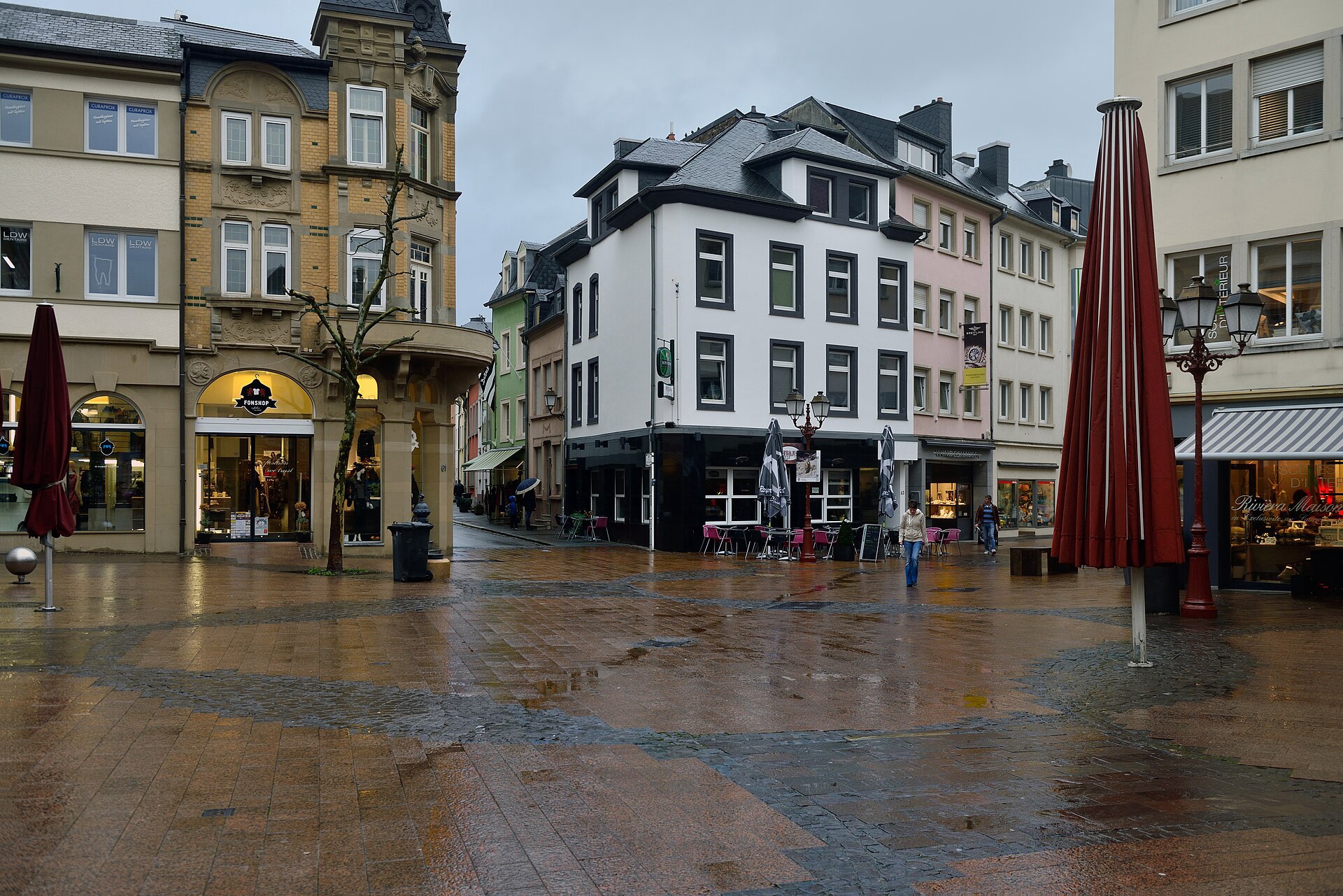

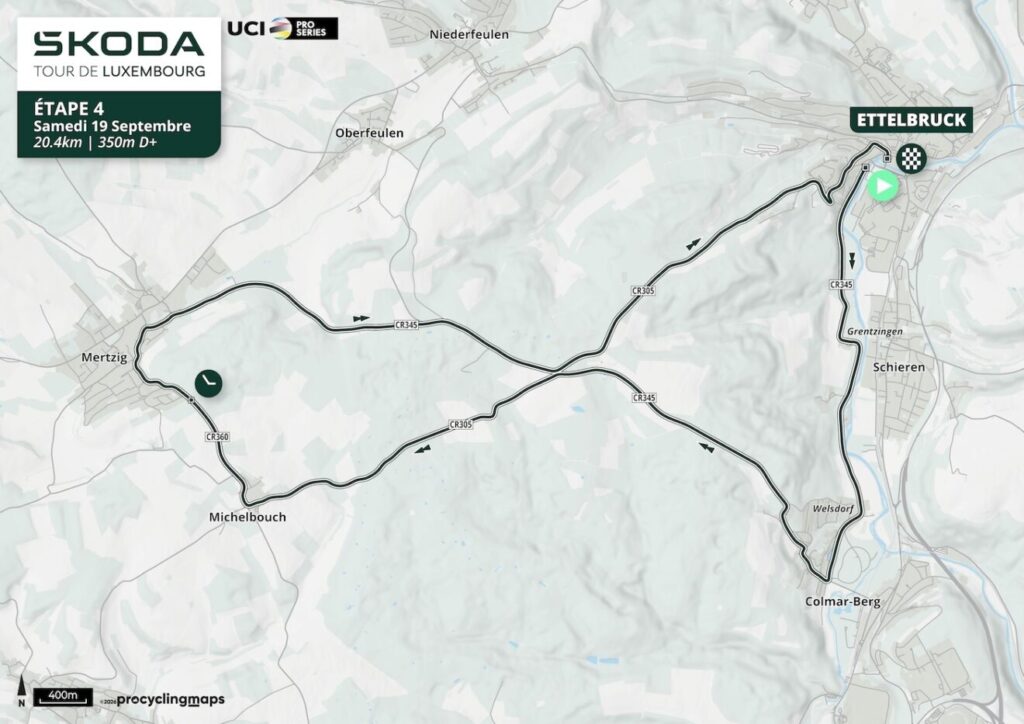
Stage 4 is only 20.4 kilometres long, but it may decide the 2026 Tour de Luxembourg. After three road stages built from castles, river valleys, industrial landscapes and repeated Ardennes climbing, the race changes character completely in Ettelbruck. Riders leave one by one from Rue Grande-Duchesse Joséphine-Charlotte, cross the low country around the Alzette and Attert, climb sharply towards Karelshaff and the wooded plateau around Michelbouch, reach the intermediate time check at Mertzig with 9.1 kilometres remaining, then descend back towards Ettelbruck for the finish on Route de Bastogne.
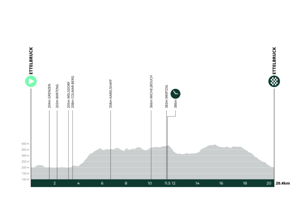
The distance is short enough to reward specialists who can hold speed, but the 350 metres of elevation gain make this very different from a flat aerodynamic exercise. The first few kilometres remain close to 200 metres above sea level. By Karelshaff, only 6.7 kilometres into the stage, the riders have climbed to 358 metres, and the route remains above 350 metres through Michelbouch and Mertzig before giving most of that height back on the return towards Ettelbruck.
For Around the Peloton, the compactness of the course produces something unusual. There are fewer places than on a normal road stage, but the route still crosses several distinct layers of Luxembourg history. Ettelbruck carries strong memories of the Battle of the Bulge and an unexpected connection between General Patton and cycling itself. Birtrange preserves an aristocratic estate with wartime traces left by American soldiers. Colmar-Berg places the race beside the official residence of Luxembourg’s head of state. Karelshaff opens onto the hunting landscape of the Grand Ducal family, while the forests beyond preserve evidence of charcoal production connected to the country’s older iron and glass economies. At Mertzig, human occupation reaches back through Roman, Celtic and prehistoric periods.
The fastest riders will cover the course in little more than twenty minutes. The road beneath them has been acquiring its present form for centuries.
START · Ettelbruck, Patton Town and an Unusual Cycling Memorial
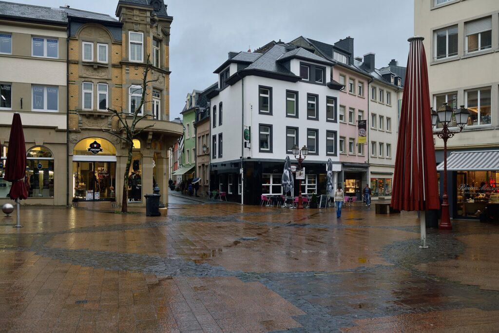
Grand-Rue in Ettelbruck, with a Stolperschwelle memorial embedded in the pavement to commemorate victims of Nazi persecution. Photo by Cayambe, licensed under CC BY-SA 3.0, via Wikimedia Commons.
The first rider leaves Ettelbruck at 16:09 from Rue Grande-Duchesse Joséphine-Charlotte. The town sits close to the meeting of the Alzette, Sûre and Wark valleys, a position that helped make it an important transport and commercial centre in northern Luxembourg.
Its modern identity is also deeply tied to the Second World War.
Ettelbruck was initially liberated by American forces in September 1944, but the German Ardennes Offensive brought war back to the region only three months later. During December, German forces re-entered the town and fighting caused extensive destruction. Ettelbruck was finally liberated again on 25 December 1944 by the 318th Infantry Regiment of the US 80th Infantry Division, operating under General George S. Patton’s Third Army.
That history is preserved particularly visibly at Patton Square, where a memorial inaugurated in 1954 stands near the Sûre bridge. Its base shows a sword driven into the ground as a symbol of the end of war, while an American eagle rises above it. A bronze statue of Patton and a Sherman tank were later added, and Ettelbruck eventually adopted the informal identity of Luxembourg’s “Patton Town.”
The most unusual part of the story is how the memorial itself originated. In 1947, only a few years after the fighting, the local Union Cycliste du Nord organised a race called the Grand Prix Général Patton. The cycling club became involved in the movement to create a permanent monument honouring Patton and the American forces connected with Luxembourg’s liberation.
Cycling therefore entered the town’s memory of the war almost immediately. The sport was not added later as a commemorative gesture. Local cyclists were already helping shape how Ettelbruck would remember liberation before the monument itself existed.
That gives the start of the time trial a connection to cycling deeper than the race route alone. From the ramp, though, the historical associations recede quickly. Each rider leaves alone, with no peloton and no tactical shelter, and the first kilometres follow the valley south.
-18.9 km · The Alzette Corridor South of Ettelbruck
Only 1.6 kilometres after the start, with 18.9 kilometres remaining, the route settles into the low country south of Ettelbruck.
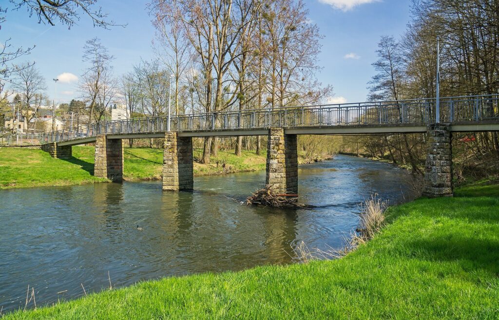
The road here follows the broad logic of the Alzette valley. Long before modern transport infrastructure, valley floors offered the easiest routes through otherwise rolling terrain, linking farms, mills, villages and estates without requiring constant movement over the surrounding uplands.
That same geography is useful to the time trial. The opening kilometres are fast because the road remains relatively low and direct, allowing riders to establish rhythm before the course begins to climb.
The first substantial historical site appears almost immediately beside that corridor.
-18.2 km · Birtrange, an Aristocratic Estate with Wartime Traces
At 2.2 kilometres raced, with 18.2 kilometres remaining, the course passes Birtrange.
Set close to the Alzette, Birtrange Castle developed very differently from the dramatic hilltop fortresses encountered on earlier stages. The surrounding landscape is lower and gentler, and the building functioned primarily as an aristocratic residence rather than a stronghold dominating a valley from above.
The estate has medieval roots, while the castle in substantially its present form dates from around the 18th century. In 1813, it came into the possession of the de Blochausen family, one of whose members, Félix de Blochausen, later became prime minister of Luxembourg.
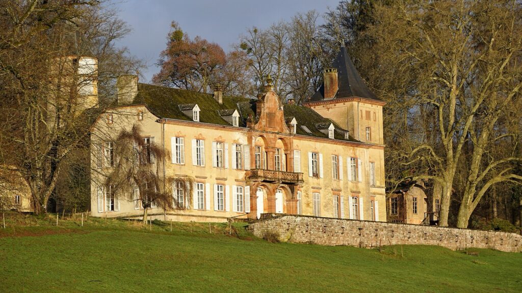
The front façade of Birtrange Castle in Luxembourg, photographed in winter. Photo by GilPe, licensed under CC BY-SA 4.0, via Wikimedia Commons.
The Second World War added a very different layer. American soldiers were quartered in the building and left inscriptions and graffiti on some of the walls. Those surviving marks are unusually direct. They are not official memorials or post-war interpretations, but traces left by individual soldiers who temporarily occupied an aristocratic house during the final months of the conflict.
Birtrange therefore carries the wartime history introduced at Ettelbruck into a much smaller setting. The memorial in town addresses armies and liberation publicly; here the evidence survives through names and marks left inside a private residence.
The road remains almost level as it continues towards Welsdorf and Colmar-Berg.
-17.3 km · Welsdorf and the Agricultural Landscape Below Berg
At 3.2 kilometres raced, the route passes Welsdorf, still within the lower agricultural country around the Alzette.
Historical records from the early modern period describe a landscape organised through fields, livestock, hay, rents and obligations to the surrounding lordship. This was the ordinary economic base beneath the estates and castles that dominate the historical record more visibly.
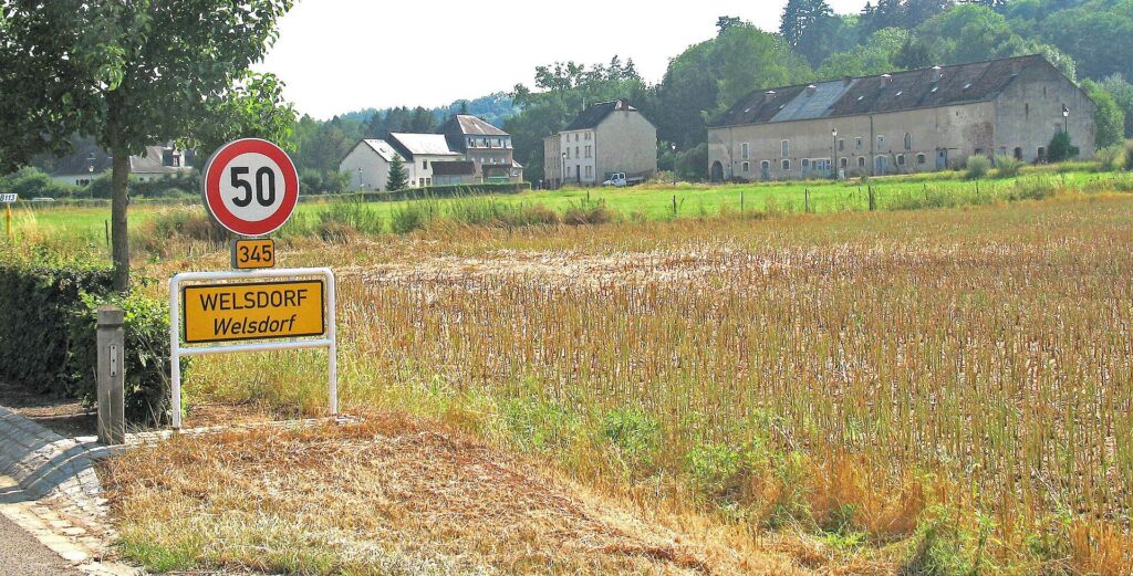
The village of Welsdorf, known as Welsdref in Luxembourgish, in the commune of Colmar-Berg, Luxembourg. Photo by Johnny Chicago, licensed under CC BY-SA 3.0, via Wikimedia Commons
The Thirty Years’ War disrupted that world severely. Farms and households in the region suffered losses, buildings were abandoned and agricultural production declined as conflict and disease affected communities far beyond the major battlefields.
Welsdorf never developed into a monumental centre, and that is precisely why it fits this section of the route. The road passes through the kind of settlement where most people actually lived, between the large estates and political institutions that shaped the wider region.
Only a short distance ahead, the landscape becomes much more closely connected with the modern Luxembourg state.
-16.9 km · Colmar-Berg and the Residence of Luxembourg’s Head of State
With 16.9 kilometres remaining, the riders pass Colmar-Berg, where the modern monarchy enters the course.
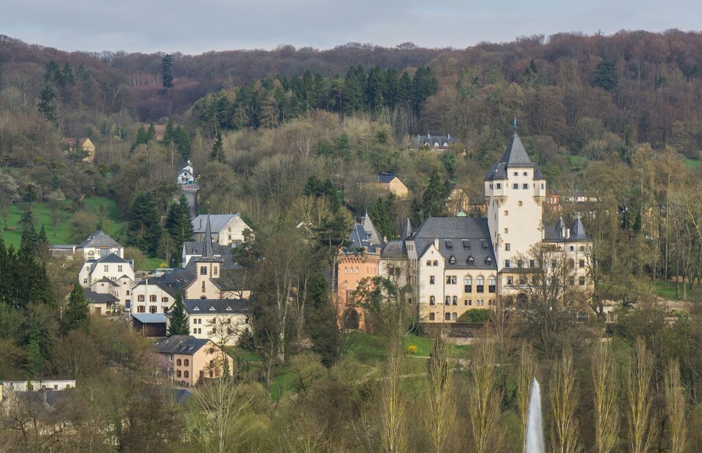
The village of Berg and Berg Castle, the official residence of Luxembourg’s Grand Duke, seen from the N7 near Colmar-Berg. Photo by MMFE, licensed under CC BY-SA 4.0, via Wikimedia Commons
The municipality lies close to the confluence of the Alzette and Attert, and the surrounding area has attracted settlement since prehistoric times. Flint tools, burial mounds and traces of Roman agricultural occupation show that the landscape was used long before the present village and castle emerged.
The modern identity of Colmar-Berg is dominated by Berg Castle.
The estate entered the possession of the Luxembourg sovereigns in 1845, when King William II of the Netherlands, who was also Grand Duke of Luxembourg, acquired it. During the reign of William III, the older residence was extensively altered in a Neo-Gothic style.
The political situation changed in 1890 when the Dutch and Luxembourg crowns separated dynastically. The Netherlands passed to Queen Wilhelmina, while Luxembourg’s succession laws brought Grand Duke Adolphe of Nassau-Weilburg to the throne. Adolphe acquired Berg Castle, and his son William IV later made it his principal residence.
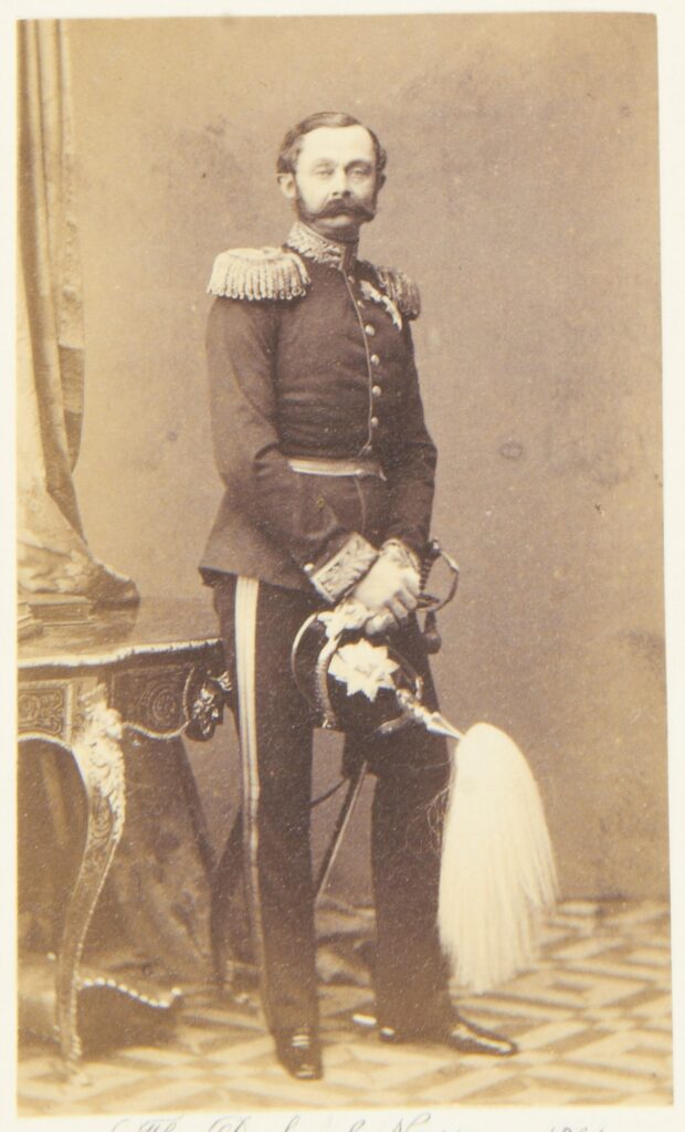
Adolphe, the first Grand Duke of Luxembourg from the House of Nassau-Weilburg. Photo by Ludwig Angerer, public domain, via Wikimedia Commons.
The present building was largely created between 1907 and 1911. The previous castle had deteriorated too far to preserve in the form originally intended, so Munich architect Max Ostenrieder and Luxembourg architect Pierre Funck-Eydt designed a new residence while incorporating surviving elements. The completed castle contained more than a hundred rooms.
Berg Castle subsequently became closely tied to constitutional history. Grand Duchess Marie-Adélaïde lived here before her abdication in 1919, while Grand Duchess Charlotte took her constitutional oath at the castle.
During the Nazi occupation, the Grand Ducal family fled the country and the property was requisitioned. Berg Castle was converted into a National Socialist educational institution for girls and was left in poor condition after the war. Restoration took years, and Grand Duke Jean returned to the residence in 1964.
The time trial remains outside the estate, but the road passes directly through a landscape associated with the country’s head of state before turning abruptly away from the valley.
-16.9 to -13.7 km · Climbing from Colmar-Berg to Karelshaff
At Colmar-Berg, the road still sits near 208 metres above sea level. By Karelshaff, only 3.2 kilometres later, it has reached roughly 358 metres.
The valley road that made the opening kilometres fast now gives way to the hardest continuous climbing of the course. Riders turn away from the Alzette and Attert and climb onto the wooded plateau to the west, where settlement becomes thinner and the character of the landscape changes quickly.
For a time triallist, the transition demands a different use of effort. The aerodynamic position that dominates the flat opening becomes less decisive as the gradient rises, and pacing becomes more important. Spend too much energy here and the second half of the course becomes expensive; climb too conservatively and the time is already lost before Mertzig.
The ascent also carries the route from the formal world of Berg Castle into the less ceremonial landscape historically attached to the Grand Ducal estate.
-13.7 km · Karelshaff and the Grand Ducal Hunting Landscape
At 6.7 kilometres raced, with 13.7 kilometres remaining, the riders reach Karelshaff.
The farm and hunting lodge was built in 1817 by Karl Daumartin, decades before Berg Castle became permanently associated with Luxembourg’s ruling family. The site combined several functions, serving as a hunting lodge while sheep grazed around the surrounding land and helped keep open ground from being reclaimed by scrub.
Its isolated position suited that use. Dense woodland and distance from larger settlements created a landscape appropriate for hunting and private retreat.
When Grand Duke Adolphe came to the Luxembourg throne at the end of the 19th century, the wider property became connected with the Grand Ducal family. William IV later continued using Karelshaff as part of the estate associated with Berg Castle.
The route therefore passes through two parts of the same social landscape in quick succession. Colmar-Berg represents the formal residence in the valley, while Karelshaff belongs to the wooded estate above it.
The forest itself carries another history, one less visible than the castle or lodge but older than both.
-10.3 km · Michelbouch and a Forest Once Used for Fuel
At 10.1 kilometres raced, with 10.3 kilometres remaining, the riders reach Michelbouch, still close to the high point of the course.
The forest around Michelbouch and neighbouring Biischtert has been shaped by human use for centuries. Burial mounds indicate early occupation in the wider landscape, while later communities repeatedly cleared, managed and exploited woodland according to agricultural and industrial needs.
Before coal and coke transformed large-scale metallurgy, charcoal was one of the essential fuels of European industry. Ironworking depended on it, as did glass production and other processes requiring high temperatures.
Charcoal burners converted wood by stacking it carefully, covering it and allowing it to burn slowly with restricted oxygen. The process removed moisture and volatile material while preserving a carbon-rich fuel capable of producing much greater heat than ordinary firewood.
Evidence of former charcoal-burning platforms survives in the forests around Michelbouch.
That makes these woods part of the economic history encountered elsewhere on the Tour. The great industrial expansion of southern Luxembourg eventually relied on mines, coke and railways, but earlier iron production depended heavily on managed woodland. Forest was not simply scenery or hunting ground. It was an energy resource.
The road continues across the plateau towards Mertzig, where the time trial reaches both its highest significant point and its only intermediate timing check.
-9.1 km · Mertzig, From Prehistoric Settlement to Roman Agriculture
At 11.4 kilometres raced, with 9.1 kilometres remaining, the riders reach Mertzig.
Archaeological evidence indicates human occupation in the area by around 1000 BC, followed by Celtic settlement and later Roman use of the surrounding agricultural landscape.
Under Roman rule, this part of Luxembourg belonged to a wider economic system connected strongly with Trier, one of the most important cities in the northwestern empire. Rural villas combined residence, farming and estate management, supplying regional markets while linking apparently remote countryside to much larger commercial and administrative networks.
Local tradition associates Mertzig with a Roman landowner called Marcius, whose name may have contributed to the later place-name. Whether or not the linguistic development can be reconstructed with certainty, Roman agricultural occupation in the wider area is well established.
The settlement appears in medieval sources from the 9th century and later became part of the patchwork of feudal and ecclesiastical structures typical of Luxembourg. The wars and crises of the 17th century affected the village severely, and recovery was gradual.
Small-scale quarrying and other economic activities developed alongside agriculture during the 18th and 19th centuries, but Mertzig never lost its rural character.
For the riders, the village has a much narrower meaning today. The official time check stands here after 11.4 kilometres, once most of the major climbing has already been completed.
From this point onward, the balance shifts increasingly back towards speed.
-9.1 km to -1.3 km · The Descent Back to Ettelbruck
Beyond Mertzig, the route begins surrendering the altitude gained after Colmar-Berg.
The course drops from around 384 metres towards Ettelbruck, losing more than one hundred metres before the final kilometre. Riders who have paced the climb and plateau well can begin converting elevation into speed, while technical efficiency becomes increasingly important.
The physical shape of the course is now clear without needing to announce a separate tactical phase. The first kilometres used the valley, the middle climbed onto the plateau, and the final part falls back towards the same low country from which the riders started.
Corners, braking points and aerodynamic position matter more again as the gradient turns downward. A rider can lose seconds not only through insufficient power but by carrying less speed through bends or misjudging the transition between descent and flatter road.
The landscape around Ettelbruck gradually reappears below.
-1.3 km · Ettelbruck and the Return to the Valley
At 19.1 kilometres raced, the riders re-enter Ettelbruck.
The difference between the outward and return roads is visible in the approach. The opening kilometres followed low ground south towards Colmar-Berg, while the finish arrives from the higher plateau, descending into the town.
The remaining distance is short enough that there is little room to recover from mistakes made earlier on the course. The climb has already tested pacing, the plateau has required sustained power and the descent has demanded speed and control.
Now the road returns to the town where every rider began alone.
FINISH · Ettelbruck, Cycling and the Memory of Liberation
Stage 4 finishes in Ettelbruck after 20.4 kilometres.
The route has travelled only a compact loop, but its history is unusually dense. Birtrange preserves the informal traces of American soldiers inside an aristocratic residence. Colmar-Berg brings the race beside the official home of Luxembourg’s head of state and through a landscape connected with the country’s modern dynastic history. Karelshaff belongs to the hunting world of that same estate, while the forests around Michelbouch preserve evidence of a much older economy in which woodland functioned as an industrial fuel source. Mertzig extends the chronology back through Roman agriculture and prehistoric settlement before the road drops once more towards the Sûre and Alzette country.
Ettelbruck gives those different layers a particularly direct connection with cycling.
The town was heavily affected during the Battle of the Bulge and liberated again on Christmas Day 1944 by American troops serving under Patton’s Third Army. Only three years later, local cyclists organised the Grand Prix Général Patton, and their commemorative initiative became part of the movement that eventually created the Patton monument beside the river.
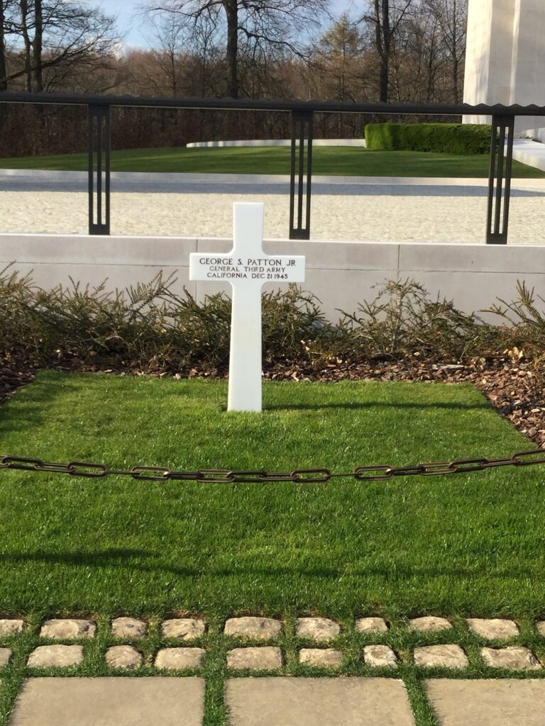
General George S. Patton’s grave at the Luxembourg American Cemetery in Hamm, Luxembourg. Photo by Gbern3, licensed under CC BY-SA 4.0, via Wikimedia Commons
That history changes the relationship between race and place. Cycling did not simply arrive decades later and use a wartime memorial as scenery. The sport had already become part of Ettelbruck’s remembrance while the events of the war were still recent.
The 2026 time trial returns to that same town under completely different circumstances. Riders leave individually, cross the valley, climb through Grand Ducal woodland and return from Mertzig with the general classification potentially changing by seconds.
The finish is beside a town where Luxembourg cycling once helped turn recent memory into a permanent monument, making Ettelbruck a particularly fitting place for the Tour to measure its riders one by one.



