

The Giro della Toscana begins and ends in Pontedera, in a part of Tuscany that sits slightly outside the version of the region most familiar to visitors. Florence and Siena are elsewhere, and the great Renaissance monuments that have come to represent Tuscany internationally do not dominate this route. Instead, the race travels through the Valdera and around Monte Pisano, crossing a landscape of smaller hill towns, olive terraces, thermal springs, river plains and villages whose histories were shaped by the long rivalry between Pisa, Lucca and Florence. It is recognisably Tuscan, but it tells a different story of the region.
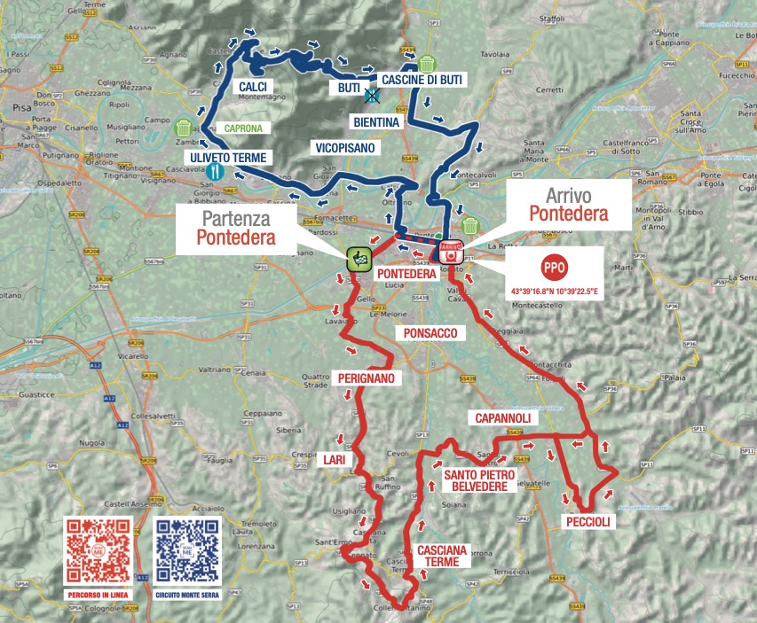
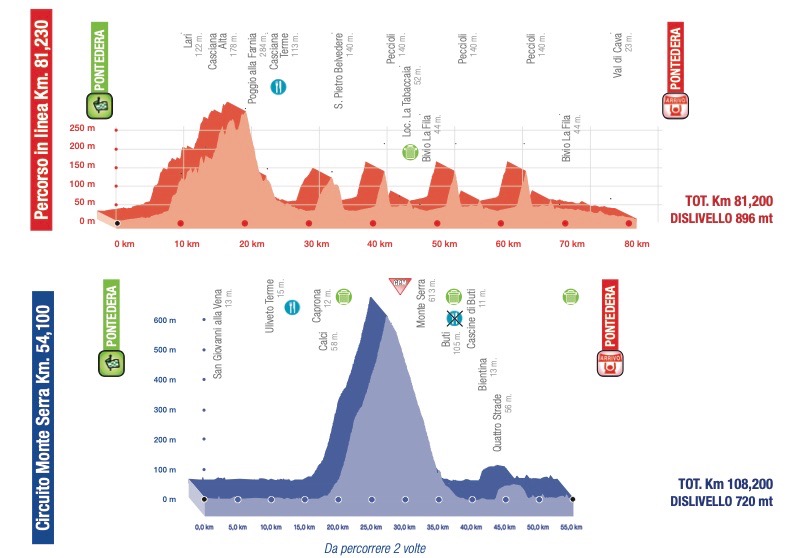
The 2026 course divides naturally into two landscapes. The opening section leaves Pontedera for the hills of the Valdera, passing through Lari and Casciana Terme before repeatedly reaching Peccioli and eventually returning to the start town after 81.2 kilometres. From there, the race enters two circuits around Monte Serra, following the Arno towards Uliveto Terme and Caprona, turning beneath the mountain at Calci and climbing for more than eight kilometres before descending through Buti and crossing the plain around Bientina. The second passage over Monte Serra comes with only 26.9 kilometres remaining and should determine which riders still have a chance of winning when the road returns to Pontedera.
What makes the route particularly suited to Around the Peloton is how often an apparently familiar Tuscan landscape turns out to contain something unexpected. One hill town has placed monumental contemporary sculptures beside a waste-treatment facility. A small village beneath Monte Pisano entered the Divine Comedy because Dante had seen its soldiers surrender. A Carthusian monastery built for solitude now contains one of Europe’s important collections of whale skeletons, while the fields crossed near Bientina occupy land that remained beneath the largest lake in Tuscany until engineers drained it during the 19th century. Even Pontedera, rather than looking backwards towards medieval or Renaissance Tuscany, built its international identity around one of the defining objects of modern Italian design.
This is a landscape that has never remained still for very long. Political borders disappeared, castles became administrative buildings, marshes became farmland, monasteries became museums and factories destroyed during war returned with entirely different products. The Giro della Toscana crosses all of those layers before returning to the same town from which it began.
START · Pontedera and the Birth of the Vespa
Pontedera is not a city of marble façades or medieval towers. Its modern identity was formed by industry, and particularly by Piaggio, whose arrival during the early 20th century transformed the town into one of the important manufacturing centres of Tuscany. The company itself was older, having been established in Genoa in 1884, and its interests ranged from railway equipment to ships and eventually aircraft. When Piaggio expanded its aeronautical production at Pontedera during the 1920s and 1930s, the town became increasingly dependent upon a factory producing some of the most advanced machinery of its period.
That specialisation also made Pontedera vulnerable during the Second World War. Piaggio manufactured military aircraft, and Allied bombing caused extensive destruction to the industrial complex. When the war ended in 1945, the company faced the same problem confronting much of Italian industry: factories had been damaged, military production no longer offered a future and the domestic population had very little money. Italy nevertheless had an enormous need for mobility. Roads and railways had suffered wartime damage, cars remained beyond the reach of most families and millions of people needed an inexpensive way to travel between home and work.
Enrico Piaggio responded by turning away from aviation and towards personal transport. For the design he eventually relied upon Corradino D’Ascanio, an aeronautical engineer who approached the motorcycle with the eyes of somebody who did not particularly like motorcycles. D’Ascanio disliked the awkward process of climbing over a conventional frame, the exposed chain that could stain clothing and the difficulty of changing a tyre. His solution used a step-through body, enclosed mechanical components, small interchangeable wheels and a front suspension influenced by aircraft landing gear. The engine sat beside the rear wheel, eliminating the conventional motorcycle chain and allowing the machine to remain compact.
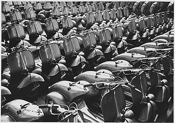
The first Vespa appeared in 1946, and its timing proved almost as important as its engineering. It offered relatively affordable transport during the reconstruction of Italy, but it was also approachable in a way that many motorcycles were not. Men and women could ride it without specialised clothing, its bodywork protected ordinary clothes from much of the machinery, and its shape was unlike almost anything else on the road. What began as an industrial response to post-war conditions gradually became part of Italian popular culture, reinforced internationally by cinema, advertising and the growing fascination with Italian design during the economic boom of the 1950s and 1960s.
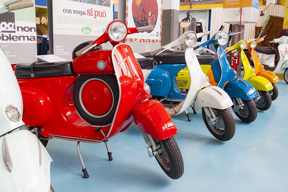
Eighty years later, the Vespa is still produced at Pontedera. The Piaggio Museum occupies part of the historic factory complex and preserves not only generations of scooters but also the earlier industrial history from which they emerged, including railway and aviation material. That continuity makes Pontedera an unusually appropriate starting point for a bicycle race. Both bicycle and scooter belong to histories of inexpensive individual mobility, and the riders leave a town whose most famous contribution to the world was created because another generation needed a better way to move.
-179 km · Lari and the Frontier Between Pisa and Florence
The first hills lead towards Lari, where the historic village gathers around a fortress occupying one of the highest points in the surrounding countryside. From the walls of the Castello dei Vicari, the view extends across the Pisan hills and towards the plain of the Arno, making immediately apparent why a castle was built here long before anybody considered the landscape picturesque.
During the Middle Ages, Tuscany was divided among competing cities whose territories shifted repeatedly through war, diplomacy and rebellion. Pisa was a maritime republic with commercial interests across the Mediterranean, Florence was expanding steadily from the interior and Lucca defended its own independence between them. Smaller settlements could consequently acquire considerable strategic importance when they occupied roads or hills close to the boundaries between those powers.
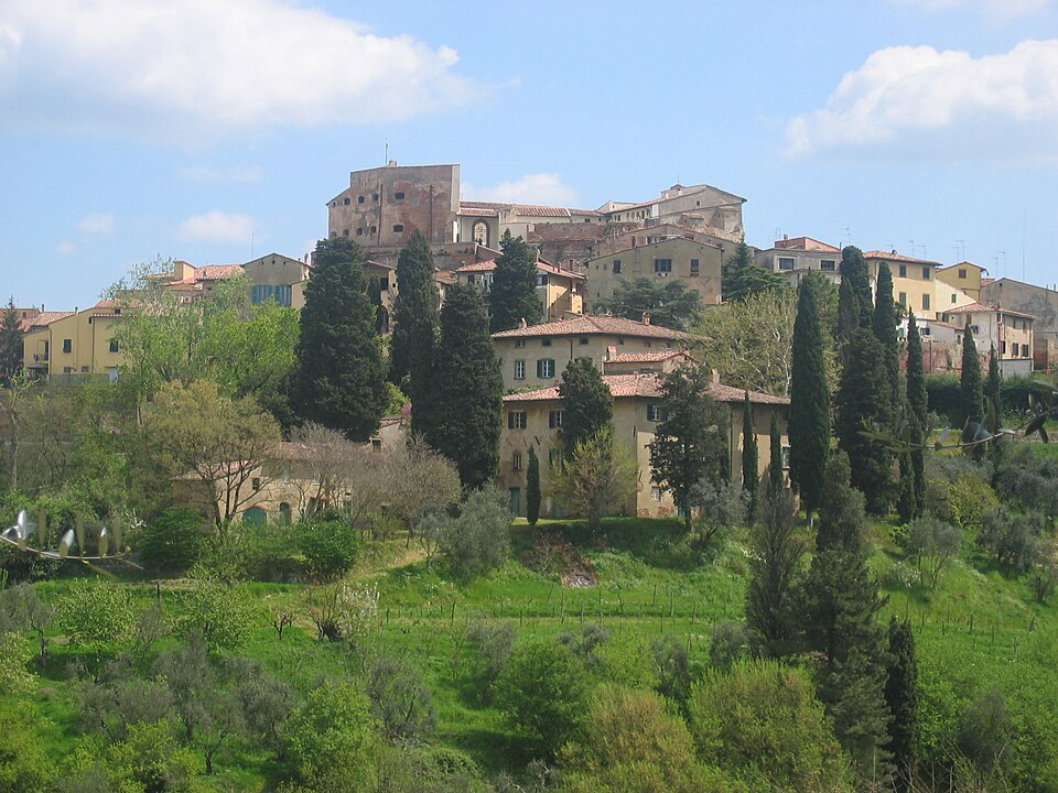
Lari became one of those places. A fortified settlement existed here by the 11th century, and during the following centuries the castle became associated with the Upezzinghi family before Pisa established firmer control over it. From the late 13th century it served as an important Pisan stronghold, guarding territory increasingly threatened by Florentine expansion. The modern road allows the peloton to move through these hills almost without noticing the old political boundaries, but during the medieval period the same geography separated communities owing allegiance to rival states.
Florence finally conquered Pisa in 1406, and the function of Lari changed with the political map. The fortress no longer needed to defend Pisan territory against Florence because it had become part of the Florentine state. Instead, it developed into the seat of a vicariate from which officials administered a large area of the former Pisan countryside. Florentine families including the Medici, Strozzi, Pitti and Albizzi supplied vicars whose coats of arms accumulated around the castle, leaving the building with a visual record of the administration that followed military conquest.
The riders pass beneath a fortress that therefore survived by changing purpose. Its commanding position first made it useful for defence and later for government, while the disappearance of the political frontier eventually transformed it into historical architecture overlooking a peaceful agricultural landscape. The view remained much the same, but the meaning of controlling it changed completely.
-165 km · Casciana Terme and the Warm Water Beneath the Hills
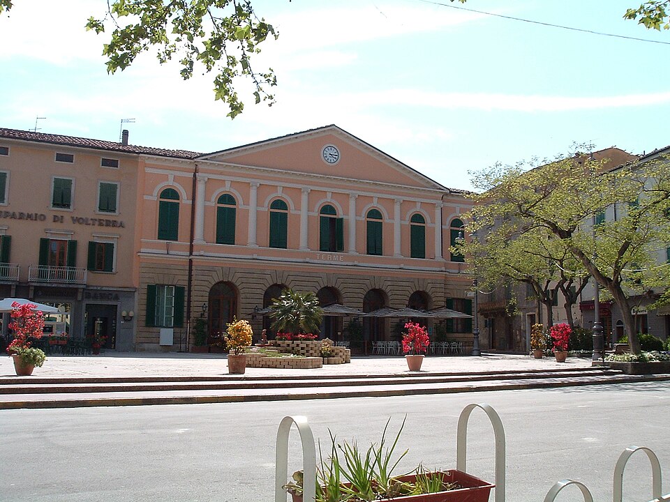
From Lari the race continues towards Casciana Terme, where the landscape has attracted visitors for a very different reason. Warm mineral water reaches the surface here at approximately 35.7°C, and over centuries the spring turned a small settlement in the Pisan hills into a destination for people seeking relief from illness and physical pain.
Local tradition places the beginning of the spa in the 11th century and connects it with Matilda of Canossa, one of the most powerful political figures of medieval Italy. The story tells of an elderly blackbird belonging to the countess that recovered its health after repeatedly bathing in the warm spring, persuading Matilda to investigate the water and establish bathing facilities. Like many foundation legends attached to European thermal towns, it is better understood as folklore than documentary history, but its survival shows how communities attempted to explain a natural phenomenon long before geology could describe what was happening beneath them.
The water itself belongs to a much older process. Rain entering the surrounding hills moves through permeable and fractured rock, descending underground before returning towards the surface after interacting with minerals and warmer geological layers. What appears in the town as a spring is therefore the visible end of a journey taking place largely out of sight. Human beings discovered the result without understanding the mechanism and built a therapeutic culture around what they could observe.
By the 19th century, when European spa tourism expanded dramatically, Casciana had become increasingly organised around visitors arriving for treatment and rest. Hotels, bathing establishments and public spaces developed around the thermal water, connecting the town with a broader culture in which travel itself could be prescribed as part of medical treatment. The surrounding countryside offered quiet and clean air, while the baths promised benefits that contemporary medicine attributed to the particular properties of mineral water.
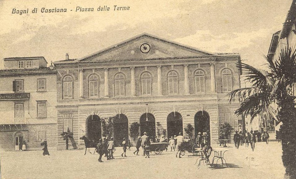
The peloton encounters Casciana Terme under almost opposite circumstances. Riders pass through while deliberately pushing their bodies towards exhaustion, yet the town developed because generations travelled here hoping that the same landscape might restore theirs. The contrast is incidental to the race but entirely characteristic of a route where geology has repeatedly determined what people came here to do.
-147 to -126 km · Peccioli, Where Contemporary Tuscany Refused to Hide Its Waste
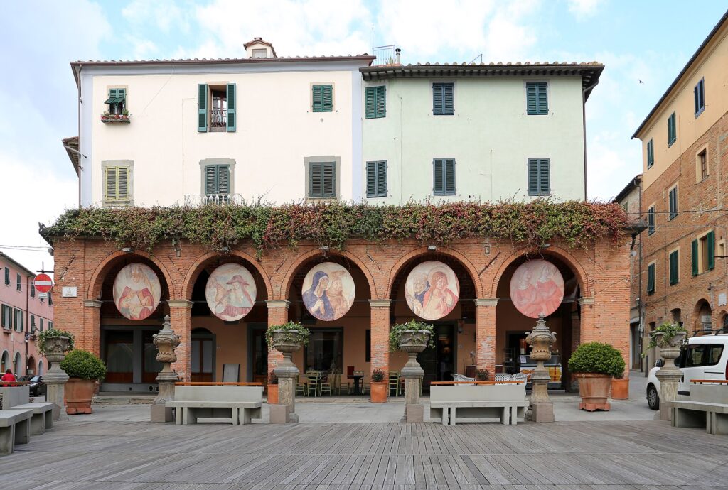
The race reaches Peccioli repeatedly during the opening section, climbing into a town whose historic centre rises above the Valdera in the familiar arrangement of stone buildings, narrow streets and agricultural hills. It would be easy to treat Peccioli as another attractive Tuscan settlement whose principal interest lies in what survived from the past, but the town has spent several decades deliberately building a different identity.
The story begins outside the historic centre at Legoli, where a landfill became a difficult environmental and political problem during the late 20th century. Rather than simply closing the site and transferring the problem elsewhere, the municipality and local institutions developed a waste-management model that modernised the facility and redirected part of the economic return towards the community. Infrastructure, social programmes and cultural projects became connected to an activity that most towns understandably prefer to keep invisible.
Peccioli then made the unusual decision not to hide the contradiction. Contemporary art began appearing throughout the municipality, including at the waste facility itself. The most immediately recognisable works are the enormous human figures known as the Presenze, created by the Naturaliter group and installed from 2011 onwards. Their brightly coloured bodies rise several metres above the landscape, appearing to emerge from the ground and look across a place normally associated with everything society wants removed from sight.
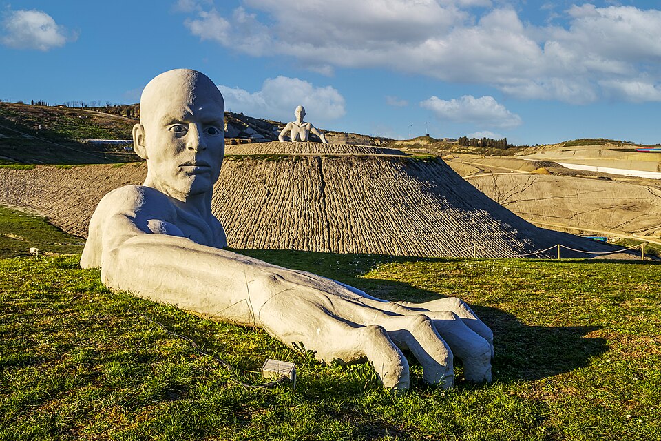
The project gradually expanded beyond the landfill. Sculptures, installations, murals and architectural interventions appeared through Peccioli and its surrounding villages, while cultural events brought audiences into spaces that would rarely feature on a conventional itinerary through rural Tuscany. The result is not simply a medieval town decorated with modern art. Peccioli has used contemporary culture to ask what a small community should do with the less picturesque parts of modern life, including waste, industrial infrastructure and the economic realities required to maintain public services.
That makes the repeated passages of the Giro della Toscana particularly revealing. Television images will naturally favour the hill town and the rolling countryside around it, reproducing the Tuscany that audiences expect to see. Peccioli itself has chosen to complicate that image, insisting that the landscape of the present deserves attention alongside the architecture inherited from the past.
-108 km · From the Valdera to the Arno
After 81.2 kilometres, the route returns to Pontedera and turns eastwards towards the Arno. The hills of the Valdera are left behind as the river begins organising the geography of the race, squeezed between the low plain to the south and the abrupt mass of Monte Pisano to the north. From this point the riders will complete the same 54.1-kilometre circuit twice, and the landscape becomes more concentrated as mountain, river and settlements repeatedly occupy the same narrow corridor.
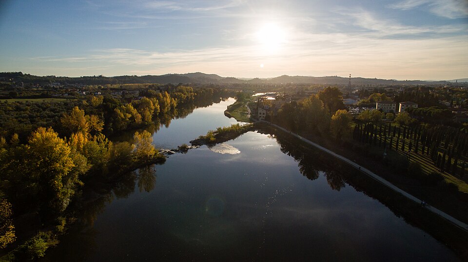
The Arno has always been more than scenery here. It connected inland Tuscany with Pisa and the sea, carried goods and people, supplied water and repeatedly flooded the communities built beside it. Settlements developed at crossings and along routes that followed its valley, while attempts to control its water became one of the great engineering problems of Tuscan history. The river will become particularly important later near Bientina, where the difficulty of draining a vast lake was ultimately solved by carrying its water beneath the Arno itself.
Before the race reaches that plain, however, it follows the river towards the foot of Monte Pisano. Here the landscape narrows sufficiently that communities could exploit several environments at once, taking resources from the mountain while remaining connected to the commercial corridor of the river.
-93 km and -39 km · Uliveto Terme, Between the Arno and Monte Pisano
At Uliveto Terme, houses occupy the narrow strip of ground between the Arno and the limestone slopes rising immediately behind them. The geography gives the settlement an unusually compressed appearance, with river, road, quarries and mountain pressed together within a space only a few hundred metres wide.
For generations, inhabitants found livelihoods in each part of that landscape. The Arno supported fishing and river transport, while the mountain provided stone. Quarrying became particularly important as limestone from Monte Pisano supplied construction across the region, leaving exposed faces on slopes otherwise covered by vegetation. The same geology also produced another resource, one that eventually carried the name of this small village throughout Italy.
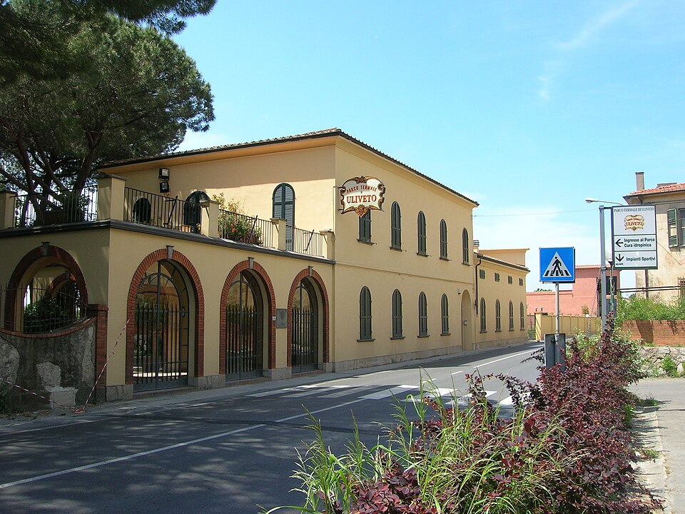
Mineral water emerges naturally around Uliveto, and historical references to the springs extend back into the medieval period. Bathing developed around the source, while later centuries brought increasing interest in the water’s supposed therapeutic properties. During the 19th century, as spa culture expanded across Europe, Uliveto attracted visitors who came specifically to drink or bathe in its mineral water.
The development of bottling changed the relationship between spring and visitor. Once production expanded industrially during the early 20th century, people no longer needed to travel to the village to consume its water. The landscape itself could effectively be packaged and transported, carrying the name Uliveto onto tables far beyond Tuscany.
The riders pass through twice, each time with Monte Pisano immediately above them. The village is a useful reminder that settlements rarely depended upon a single resource. River, stone and underground water all contributed to the economy of the same narrow piece of land, while the road now adds professional cycling to the succession of activities that have moved along the Arno.
-92 km and -38 km · Caprona, Where Dante Saw the Fear of Defeated Soldiers
Immediately beyond Uliveto, the race reaches Caprona, a village whose rocky height above the road once carried a Pisan fortress. Little of that medieval stronghold survives, but an episode that took place here in 1289 was preserved by a witness whose later writing ensured that the name Caprona would outlive the castle itself.
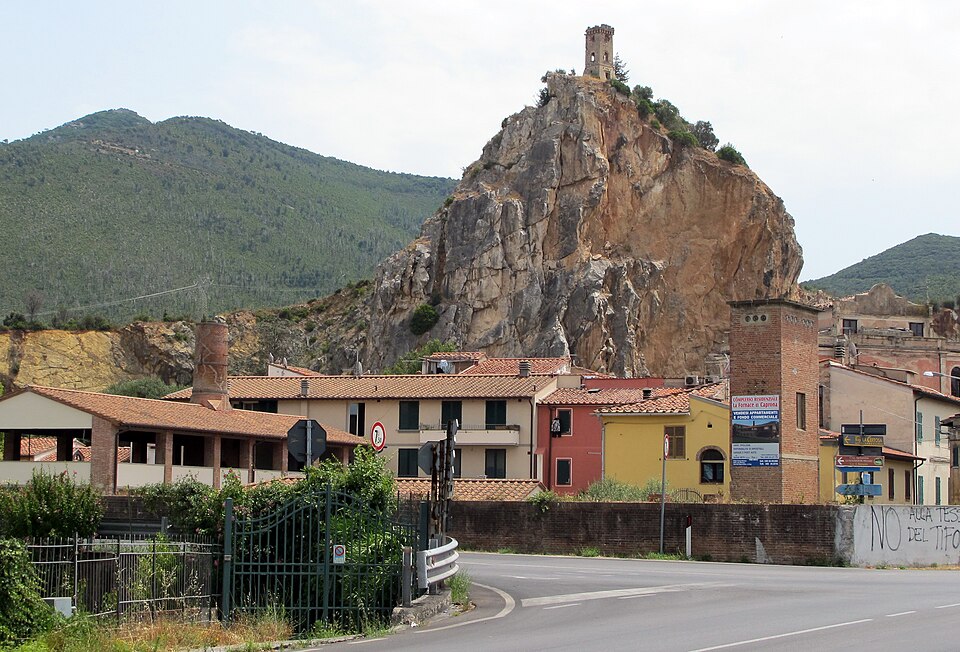
Tuscany at the end of the 13th century was divided by conflict between cities and political factions. Pisa had suffered a devastating naval defeat against Genoa at Meloria in 1284 and faced increasing pressure on land from Florence and Lucca. In the summer of 1289, Florentine and Lucchese forces moved against Pisan territory and besieged Caprona. Among the Florentine cavalry was Dante Alighieri, then a young man in his twenties, years before exile and the Divine Comedy defined the life by which he would be remembered.
The garrison eventually surrendered under terms that allowed its soldiers to leave the fortress safely. Their position nevertheless remained terrifying. They had to walk out among victorious enemies whose promise of safe conduct was the only thing separating surrender from massacre, and Dante appears to have retained a vivid memory of their expressions as they passed through the hostile army.
More than a decade later, that memory resurfaced while he was writing the Inferno. Describing the fear of the damned surrounded by demons, Dante compared it with the frightened soldiers he had seen leaving Caprona after the surrender. The reference is brief, but its specificity is what makes it remarkable. One of the foundational works of European literature suddenly contains what appears to be an autobiographical memory of a military campaign in the Pisan countryside.
The landscape visible today is not identical to the one Dante knew. The medieval fortress was later destroyed, and the tower now standing prominently above the village belongs to a subsequent period. Yet the rocky position remains enough to explain why Caprona mattered militarily. The road below passes through what was once contested ground between rival Tuscan states, and for a few lines of the Divine Comedy the fear experienced on this small hill became part of the imagined geography of Hell.
-89 km and -35 km · Calci, from Carthusian Silence to the Skeletons of Whales
The road leaves the Arno corridor and turns towards Calci, entering the Valgraziosa beneath the western slopes of Monte Pisano. Olive groves spread across the lower hills, while behind the town stands one of the most remarkable architectural complexes on the entire route: the Certosa di Calci.
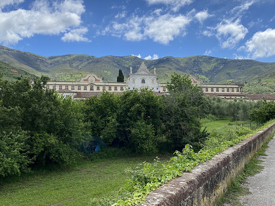
The monastery was founded in 1366 for the Carthusians, an order whose religious life combined communal worship with an unusually strong commitment to solitude. A Carthusian monastery was organised differently from the great Benedictine or Cistercian communities encountered on other Around the Peloton routes. Each choir monk lived much of his life within an individual cell, usually with a small private garden, while the great cloister arranged these separate spaces around the communal centre of the monastery.
Calci offered the isolation such a community required without being impossibly remote. The fertile valley supplied food, olive oil and other resources, while Pisa remained close enough to provide patrons and economic connections. Over the following centuries the monastery grew far beyond the austerity of its medieval beginnings. Baroque decoration transformed parts of the complex, and grand apartments were created for important visitors, producing an extraordinary contrast between the ideal of Carthusian withdrawal and the splendour accumulated around it.
Religious suppression eventually ended the monastery’s original role, and during the 20th century part of the Certosa acquired a purpose its founders could never have anticipated. The Natural History Museum of the University of Pisamoved major collections into the complex, bringing together specimens whose institutional history reaches back to the collections assembled in Pisa from the late Renaissance onwards.
Among the most striking are the cetaceans. Skeletons of whales hang within rooms connected to a monastery built for men who had deliberately reduced their contact with the outside world. The contrast is visually extraordinary but historically meaningful. The same building now preserves two very different attempts to understand existence: a religious community organised around contemplation and a scientific collection organised around observation, classification and comparison.
The riders do not enter the Certosa. They continue through Calci towards the mountain rising behind it, where the roads of the race finally begin to impose themselves upon the story.
-81 km and -27 km · Monte Serra, Between Pisa and Lucca
The climb of Monte Serra gives the Giro della Toscana its sporting shape. From Calci the road rises for more than eight kilometres through the Monte Pisano massif, gaining enough altitude to break the rhythm of a race that has otherwise moved between hills and plains. The riders cross the summit area twice, first with around 81 kilometres remaining and then, far more importantly, with only 26.9 kilometres to go.
Monte Pisano is compact compared with the Apennines, but its position makes it appear much larger than its altitude suggests. The massif rises abruptly between the plains of Pisa and Lucca, forming a natural barrier between cities separated by only a relatively short distance. For centuries, routes across and around these mountains mattered because the political communities on either side did not necessarily belong to the same state or share the same interests.
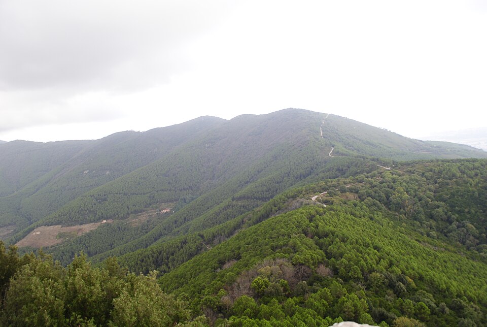
The mountain also contains several landscapes within a small area. Olive groves occupy the lower slopes, where generations constructed terraces to hold soil and make cultivation possible on difficult gradients. Woodland becomes more extensive higher up, including chestnut and pine, while exposed rock reveals the limestone structure that has supported quarrying elsewhere around the massif. Fire has repeatedly altered the vegetation, sometimes dramatically, adding another layer of human influence to a mountain that can look entirely natural from the plain below.
Cycling simplifies all of that complexity into a climb. Gradients and kilometres become the immediate language, yet the road itself follows a mountain that has spent centuries separating and connecting the territories around it. On the first passage the ascent should expose weakness. On the second, when fewer than thirty kilometres remain, it becomes the obvious place for the strongest riders to separate themselves before the descent towards Buti.
The Giro della Toscana does not finish on Monte Serra, and that is important to the character of the race. Whoever attacks here must still return through the inhabited landscape below, descending from the mountain into olive country and then onto a plain whose present appearance is the result of one of Tuscany’s most ambitious hydraulic transformations.
-73 km and -19 km · Buti and the Olive Landscape of Monte Pisano
The descent reaches Buti, where houses gather beneath the eastern slopes of Monte Pisano and olive trees spread across terraces above the town. Olive cultivation is so visually associated with Tuscany that it can easily become background scenery, yet landscapes such as this required centuries of deliberate construction.
The tree itself is well suited to Mediterranean conditions and can survive on relatively poor, stony soils, but cultivating steep ground is labour intensive. Slopes must be stabilised, terraces repaired and trees carefully managed, while harvesting historically required large amounts of seasonal work. Stone removed from the soil became walls and terrace supports, gradually turning the mountain into an agricultural structure as much as a natural one.
Evidence for olive cultivation around Buti reaches deep into the medieval period, and by later centuries the quality of local oil had developed a reputation beyond the immediate area. Chestnut woodland provided another important resource higher on the slopes, supplying food and timber to communities whose economies depended upon making use of different elevations of the same mountain.
This division of the landscape can still be read from the road. Olive trees dominate the warmer lower ground, woodland occupies higher slopes and settlements sit where access to water, roads and cultivable land made permanent occupation practical. The postcard appearance of the Tuscan countryside is therefore partly the result of an old economic system whose patterns remain visible long after agriculture ceased to employ most of the population.
The riders descend through that landscape at speed before reaching the flat country around Bientina. The transition is sudden, but until surprisingly recently the plain below would have looked completely different.
-66 km and -12 km · Bientina and the Lake That Disappeared
The roads around Bientina cross broad agricultural fields, drainage channels and low country that appears almost naturally suited to farming. Two centuries ago, much of this landscape was water.
Lake Bientina, historically also known as Lake Sesto, occupied the depression between Monte Pisano and the surrounding plains and was once the largest lake in Tuscany. Its size changed substantially with rainfall and season, spreading across a mixture of open water, marsh and wet ground that supported fishing communities and an ecosystem very different from the fields visible today.
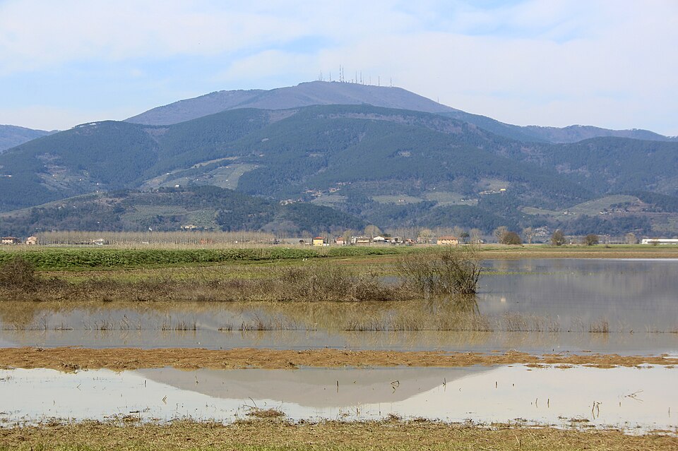
The lake provided resources, particularly fish and eels, but its unstable water level also created persistent problems. Flooding threatened settlements and farmland, while attempts to reclaim the surrounding marshes were complicated by the relationship between the basin and the Arno. The river that might logically have carried drainage water towards the sea could itself rise high enough to prevent discharge or force water back towards the lake.
Tuscan governments spent centuries trying to solve the problem. Medici and Lorraine administrators commissioned hydraulic works, channels and studies, while engineers attempted to understand a landscape in which small differences in elevation determined whether water could escape. The decisive intervention came during the 19th century under Grand Duke Leopold II, when engineer Alessandro Manetti developed a solution that sounds almost improbable even by modern standards.
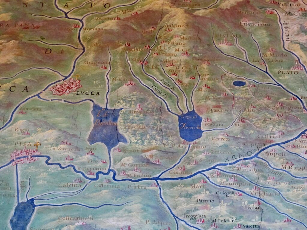
Instead of trying to make the lake drain directly into the Arno, Manetti carried its water underneath the river.
The structure known as La Botte used a subterranean conduit to take drainage from the Bientina basin beneath the bed of the Arno and into a channel continuing towards the sea. Completed during the 1850s, it made possible the large-scale reclamation of the lake bed. Water retreated, wetlands were reduced and land that had supported boats, fishermen and marsh vegetation was progressively converted to agriculture.
The social transformation was as significant as the engineering. Families whose livelihoods had depended upon fishing had to adapt to a landscape increasingly dominated by farming, while an ecosystem that had existed for centuries was dramatically reduced. Drainage canals and pumping systems became part of the permanent infrastructure required to maintain the new geography.
This makes Bientina one of the easiest places on the Giro della Toscana to misunderstand. Nothing about a bicycle race crossing flat agricultural roads suggests that the riders are travelling over the former edge of a vast lake. The mountains still stand where they did, and the Arno still flows nearby, but the space between them has been fundamentally rewritten within the last two centuries.
The peloton crosses it twice. On the second passage, with barely twelve kilometres remaining, the vanished lake becomes the final landscape between Monte Serra and Pontedera.
-27 km · The Last Passage over Monte Serra
By the time the leaders return to Monte Serra, the places encountered on the first circuit have become familiar, but the race will have changed around them. The same road rises from Calci, the same woodland closes around the slopes and the same descent waits beyond the summit, yet nearly four hours of racing have accumulated in the legs of the riders approaching it.
The summit comes with 26.9 kilometres remaining, leaving enough road after the climb to complicate the tactics. A strong climber cannot assume that reaching the top alone will be enough, because the descent through Buti and the flatter roads around Bientina still favour riders capable of organising a pursuit. Waiting is equally dangerous, since a small gap created on the steepest part of the climb can become much harder to close once tired riders begin looking at one another.
That balance explains why Monte Serra has become so useful to the modern Giro della Toscana. It is difficult enough to create separation without reducing the race to a summit finish, allowing the final kilometres to reconnect the sporting contest with the landscape through which it has developed. The riders leave the mountain, descend through the olive terraces and cross the former lake bed before the Arno leads them back towards the industrial town where the journey began.
FINISH · Pontedera, Eighty Years After the Vespa
Returning to Pontedera after 189.4 kilometres reveals how misleading the familiar idea of a timeless Tuscany can be. Almost every important landscape crossed by the race has been altered because people found a new use for it. Lari’s castle changed allegiance when Florence conquered Pisa. Thermal water turned Casciana into a place of treatment and leisure. Peccioli made waste infrastructure part of a contemporary cultural project, while the slopes of Monte Pisano were reorganised through olive cultivation, quarrying and settlement.
Around the mountain, the transformations become even more pronounced. Caprona’s military importance disappeared with the political world that had made its fortress necessary, yet Dante’s memory preserved its name. The Certosa at Calci outlived the monastic community for which it was constructed and became partly a home for scientific collections. At Bientina, engineers went much further, removing an entire lake from the modern map and replacing water with fields whose agricultural appearance now seems completely ordinary.
Pontedera belongs to the same pattern. The destruction of the Second World War could have ended the industrial story Piaggio had built here, but instead it forced the company to reconsider what its engineering knowledge was for. Aircraft gave way to a small scooter suited to a country that needed inexpensive mobility, and a practical response to post-war scarcity became one of the most recognisable products associated with Italy.
The Giro della Toscana returns to Pontedera in 2026 exactly eighty years after the first Vespa appeared. Between the start and finish, the race crosses medieval frontiers, thermal landscapes, art installations, olive terraces, a mountain separating old rivals and fields reclaimed from Tuscany’s vanished largest lake. They belong to very different periods, but together they reveal a region that has never survived by remaining unchanged. The Tuscany around the peloton is beautiful partly because generation after generation has altered it, adapted to it and left another layer for the road to cross.



