


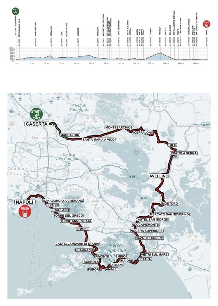
Twenty-five years after professional cycling last contested the Giro di Campania, the race returns with a route designed to cross the region rather than simply borrow one of its famous landscapes. Over 193.1 kilometres, it passes through all five provinces of Campania, beginning before the Royal Palace of Caserta, moving east through the Caudine Valley into Sannio and Irpinia, descending towards the Salerno plain, reaching the Mediterranean at Vietri sul Mare and then following the Amalfi Coast before climbing for roughly fourteen kilometres to Agerola. From the summit, with around 47 kilometres remaining, the course descends through the Monti Lattari towards Gragnano and Castellammare di Stabia, then follows the urban corridor beneath Vesuvius through Pompeii, Torre Annunziata, Torre del Greco, Ercolano and Portici before reaching Naples and the finish in Piazza del Plebiscito.
The modern comeback sits on top of a much older racing history. The Giro di Campania was born in 1911 and spent part of its early life as an occasional stage race before settling into the form of a one-day classic. Learco Guerra won it three consecutive times, while Gino Bartali, Fausto Coppi, Franco Bitossi, Giuseppe Saronni and Francesco Moser are among the major Italian champions in its palmarès. The previous edition took place in 2001, when Dmitri Konychev won at Caserta.

The 2026 course tells a broader story than the race’s name alone suggests. Campania is often represented internationally by Naples, Pompeii and the Amalfi Coast, but much of the region lies inland, where the Apennines divide valleys, old Roman roads pass through mountain corridors and wine towns look towards landscapes very different from the Bay of Naples. The first half of the race belongs mainly to that interior world. The second gradually moves towards the Mediterranean, where ancient ports, medieval maritime communities, volcanic cities and Bourbon palaces crowd the coastline.
CEREMONIAL START · Caserta and a Palace Built for a Kingdom
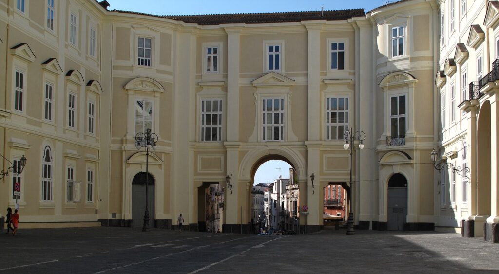
The riders assemble in Piazza Carlo di Borbone, the vast open space before the Royal Palace of Caserta, north of Naples.
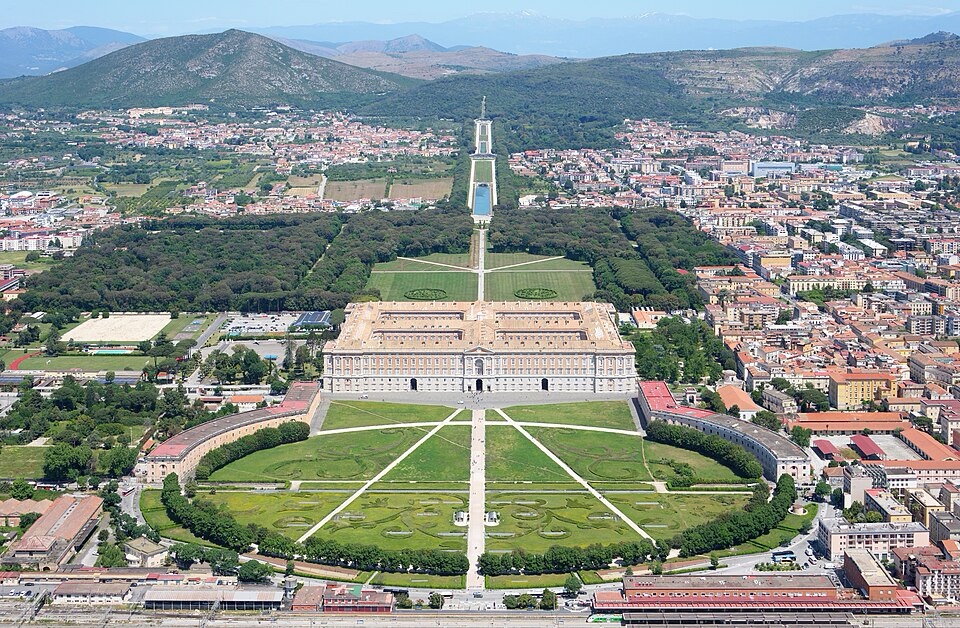
The Royal Palace of Caserta seen from the south, revealing the vast scale of the eighteenth-century Bourbon residence in Campania. Photo by Carsten Steger, licensed under CC BY-SA 4.0, via Wikimedia Commons
Caserta is the capital of the province of the same name, but its international identity is dominated by the palace behind the start line. Construction began in 1752 for Charles of Bourbon, king of Naples and Sicily, who wanted a residence capable of expressing the scale and independence of his kingdom.
The architect was Luigi Vanvitelli, one of the leading figures of 18th-century Italian architecture. His design combined an immense royal palace with formal gardens, fountains, woodland and an engineered water system extending far beyond the residence itself.
That water arrived through the Carolino Aqueduct, another Vanvitelli project. It carried water for tens of kilometres and crossed the Valle di Maddaloni on three monumental tiers of arches, turning practical hydraulic infrastructure into architecture intended to impress from a distance.
The palace, gardens, aqueduct and nearby industrial settlement of San Leucio now form a UNESCO World Heritage property.
Caserta also links directly with the recent history of the race. The Giro di Campania last took place in 2001, when the finish was held here. In 2026 the race begins in the same monumental setting before travelling under neutral conditions towards Maddaloni.
Ten kilometres later, the competition starts.
START · Maddaloni and the Road Rome Built South
The official start comes at Maddaloni, with 193.1 kilometres remaining.
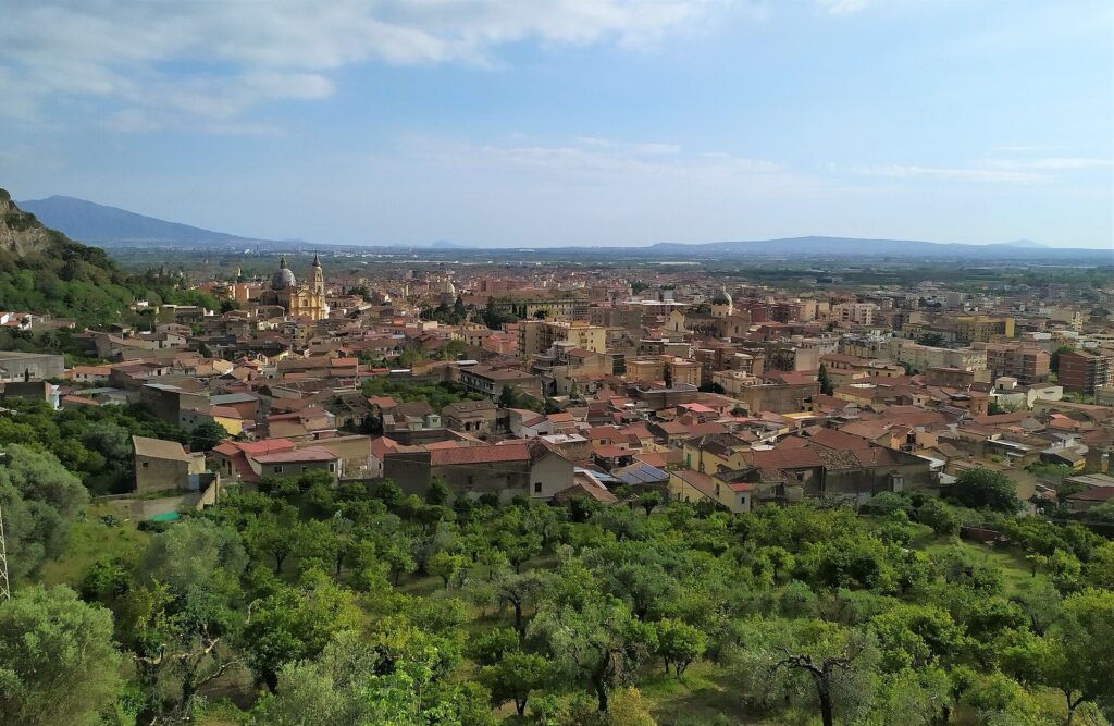
Maddaloni and the Campanian with Mount Vesuvius in the distance. Photo by VallVit, licensed under CC BY-SA 3.0, via Wikimedia Commons
Maddaloni lies immediately east of Caserta at the entrance to a natural corridor through the Campanian interior. The modern route broadly follows the geography of the Via Appia, the Appian Way, begun by Rome in 312 BC.
The road initially connected Rome with Capua and was later extended across southern Italy to Brindisi on the Adriatic. It became one of the most important arteries of the Roman world, carrying armies, merchants, officials and travellers through territories that Rome had not yet fully subdued when the first sections were constructed.
That unfinished conquest matters almost immediately. East of Maddaloni, the road enters the Caudine Valley, enclosed by mountain ranges and historically associated with one of Rome’s most humiliating defeats.
-184 km · Forchia, Arpaia and the Caudine Forks
The peloton reaches Forchia with 184 kilometres remaining, followed almost immediately by Arpaia at -182.7 km.
These are small communities in the province of Benevento, positioned near the western entrance to the Caudine Valley. The settlements themselves are modest, but the surrounding mountains gave the area enormous strategic importance in antiquity.
In 321 BC, during the Second Samnite War, a Roman army under the consuls Titus Veturius Calvinus and Spurius Postumius Albinus advanced into the region. According to the Roman historian Livy, the Samnite commander Gaius Pontius lured the army into a confined mountain corridor and blocked both exits.
The Romans were trapped. Rather than destroy the army, the Samnites forced the soldiers to surrender and pass beneath a yoke made from spears, a ritual humiliation remembered as the disaster of the Caudine Forks.
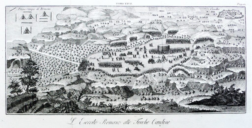
An eighteenth-century etching of the Battle of the Caudine Forks, where the Samnites trapped a Roman army in 321 BCE. Artist unknown. Public domain, via Wikimedia Commons
The exact location of every stage of the episode remains debated, but the valley around Forchia, Arpaia and Montesarchio is the landscape traditionally associated with it.
At the time, Rome was not yet the dominant Mediterranean power familiar from later centuries. It was still fighting neighbouring peoples for control of Italy, and the Samnites were capable of stopping Roman expansion through a combination of military skill and intimate knowledge of mountain terrain.
The modern race crosses the same corridor in minutes.
-175.5 km · Montesarchio and the Samnite City of Caudium
With 175.5 kilometres remaining, the riders pass Montesarchio, the principal modern town in the Caudine Valley.
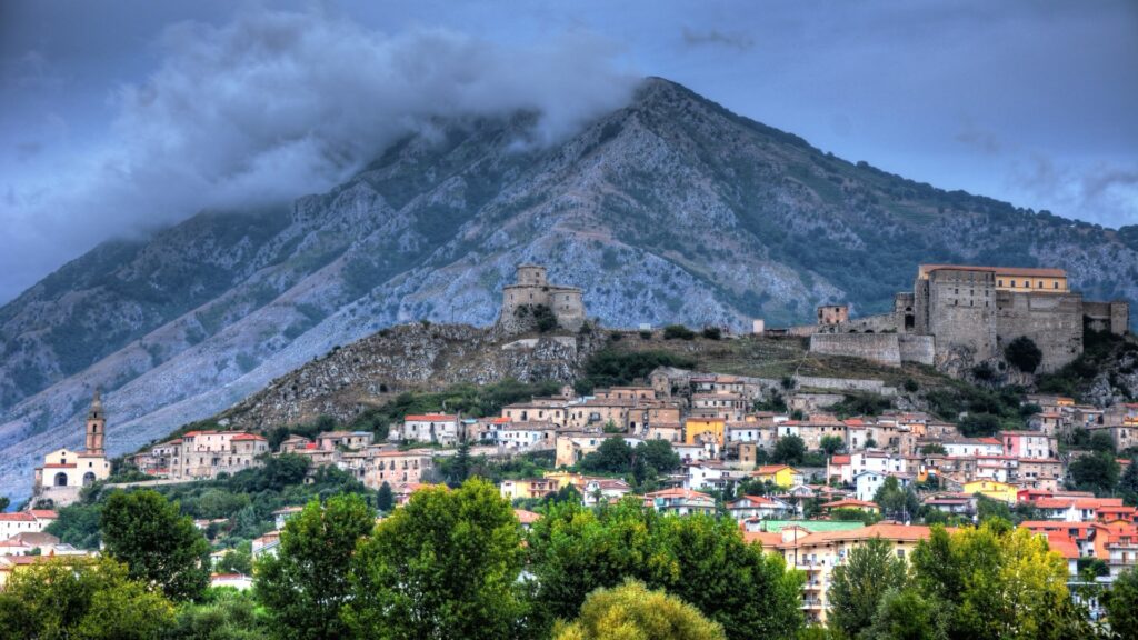
The historic centre of Montesarchio in Campania, with its castle and tower beneath Mount Taburno. Photo by Salvatore Di Maro, licensed under CC BY-SA 3.0, via Wikimedia Commons
The settlement lies beneath Monte Taburno, a limestone massif rising north of the valley, and occupies the area associated with ancient Caudium, one of the important centres of Samnite territory.
The Samnites were not organised around one dominant city in the way Rome eventually was. They were related peoples occupying the central and southern Apennines, connected through tribal and political structures capable of combining for war. Mountain geography helped protect their communities and made Roman expansion through the interior difficult.
Archaeological discoveries around Montesarchio include rich burials and objects belonging to that pre-Roman world. The medieval castle and tower on the hill above the town belong to a much later period, but they occupy a site whose strategic importance had already been established many centuries earlier.
From Montesarchio, the Appian corridor leads east towards Benevento.
-159.7 km · Benevento, From Samnite Territory to Roman and Lombard Power
At -159.7 kilometres, the race reaches Benevento, the capital of the province of the same name.
The city stands where several river valleys and transport routes meet in the Campanian interior. In antiquity, this was Samnite territory. Under Roman rule, Benevento became an important city on the Via Appia and later on the Via Traiana, an alternative imperial road towards the Adriatic.
The clearest monument to that Roman importance is the Arch of Trajan, completed in AD 114. Its sculpted panels celebrate the emperor Trajan through scenes of military victory, public works, religion and civic administration. The arch was more than a gateway. It was a visual statement of how imperial power wanted itself to be understood.
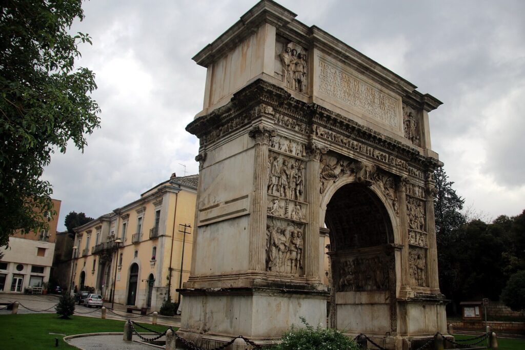
The Arch of Trajan in Benevento, built in the second century CE to honour the Roman emperor and mark the entrance to the Via Traiana. Photo by Mongolo1984, licensed under CC BY-SA 4.0, via Wikimedia Commons
Benevento remained important after the Western Roman Empire disappeared.
During the sixth century, the Lombards, a Germanic people who established kingdoms and duchies across Italy, created the Duchy of Benevento. Because the city lay far south of the main Lombard kingdom in northern Italy, the duchy developed with considerable independence and eventually became a principality controlling large parts of southern Italy.
The Church of Santa Sofia, founded in the eighth century, survives from that world and forms part of UNESCO’s group of monuments associated with Lombard power in Italy.
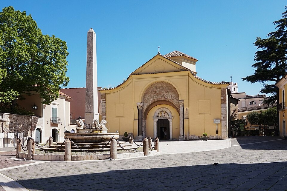
The eighth-century Church of Santa Sofia in Benevento, a landmark of the city’s Lombard past and part of a UNESCO World Heritage Site. Photo by Bernard Gagnon, released under CC0 1.0, via Wikimedia Commons
The same strategic location therefore supported three very different political landscapes: Samnite, Roman and Lombard.
From Benevento, the race turns south-west towards Irpinia.
-146.4 km · Chianche and the Beginning of Irpinia
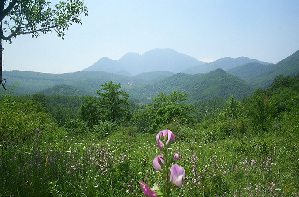
A typical Irpinia landscape near Montella in inland Campania, with Monte Acellica rising beyond the green hills. Photo by Razzairpina, released into the public domain, via Wikimedia Commons.
At -146.4 kilometres, the peloton reaches Chianche, a small hill community where the route enters the province of Avellino.
This is Irpinia, the historical name for the mountainous interior centred on Avellino. The name derives from the Hirpini, one of the Samnite peoples, whose own name is traditionally linked with the Oscan word for wolf.
Irpinia is geographically very different from the crowded coastal plain around Naples. Ridges, wooded mountains, vineyards and river valleys dominate the landscape, and settlements often occupy elevated ground above agricultural basins.
Around Chianche, vineyards become increasingly visible. The village lies within the production area of Greco di Tufo, one of Campania’s most important white wines.
A few kilometres later, the route reaches the town that gives the wine its name.
-142.9 km · Tufo, Vineyards Above a Sulfur Landscape
With approximately 142.9 kilometres remaining, the riders pass Tufo, a small town above the Sabato Valley.
Its name is internationally recognised because of Greco di Tufo DOCG, produced from the Greco grape in Tufo and surrounding municipalities.
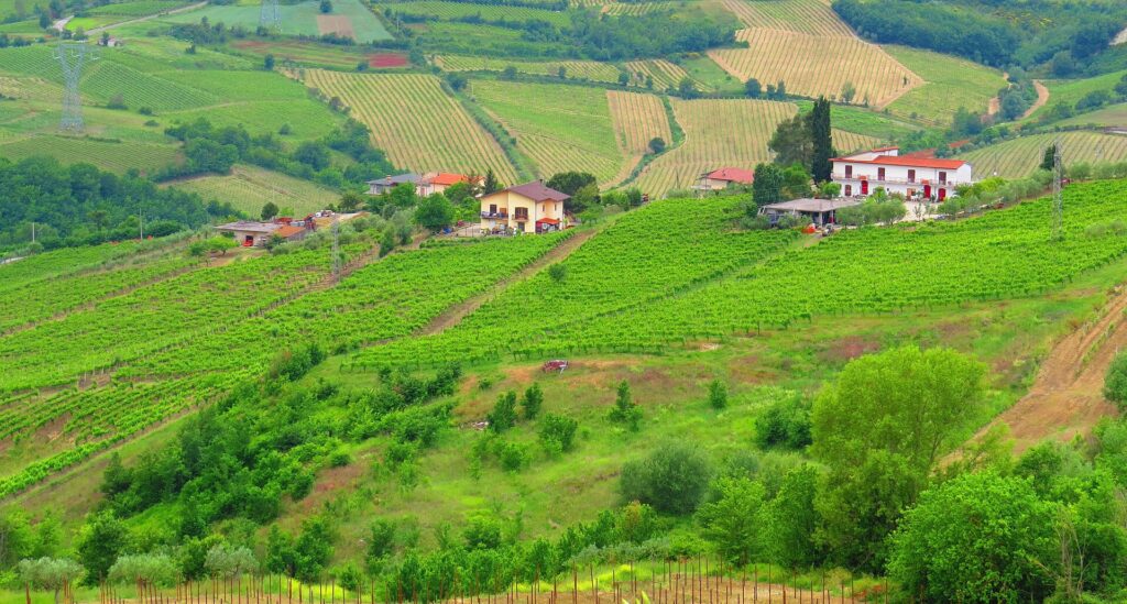
Tufo in Irpinia, surrounded by the vineyard landscape that produces Campania’s Greco di Tufo wine. Photo by Gianfranco Vitolo, licensed under CC BY-SA 2.0, via Wikimedia Commons
The vineyards grow on complex soils containing clay, limestone and mineral deposits, while another economy once developed beneath them. During the 19th and 20th centuries, sulfur mining became important around Tufo, bringing industrial labour into a region otherwise dominated by agriculture.
The contrast is unusual. Vines occupy the slopes above while the ground below preserves the history of extraction.
Greco has been cultivated in southern Italy for centuries, although the precise ancient ancestry often claimed for local varieties is difficult to prove. What is certain is that the grape is now deeply tied to this section of Irpinia, where climate, elevation and soil have produced one of southern Italy’s most distinctive white-wine landscapes.
The road follows the Sabato corridor through Prata di Principato Ultra at -135.5 km before reaching the wider urban area of Avellino.
-128.9 km · Avellino and the Landscape of the 1980 Earthquake
At roughly 129 kilometres remaining, the race enters the area around Avellino, the principal city of Irpinia.
Avellino sits inland among the mountains at around 350 metres above sea level, far removed from the coastal image most visitors associate with Campania. The region’s geology has repeatedly shaped life here, most dramatically in modern times on 23 November 1980.
That evening, a magnitude 6.9 earthquake struck Irpinia and neighbouring parts of Basilicata. Nearly 3,000 people were killed and hundreds of thousands were left temporarily homeless.
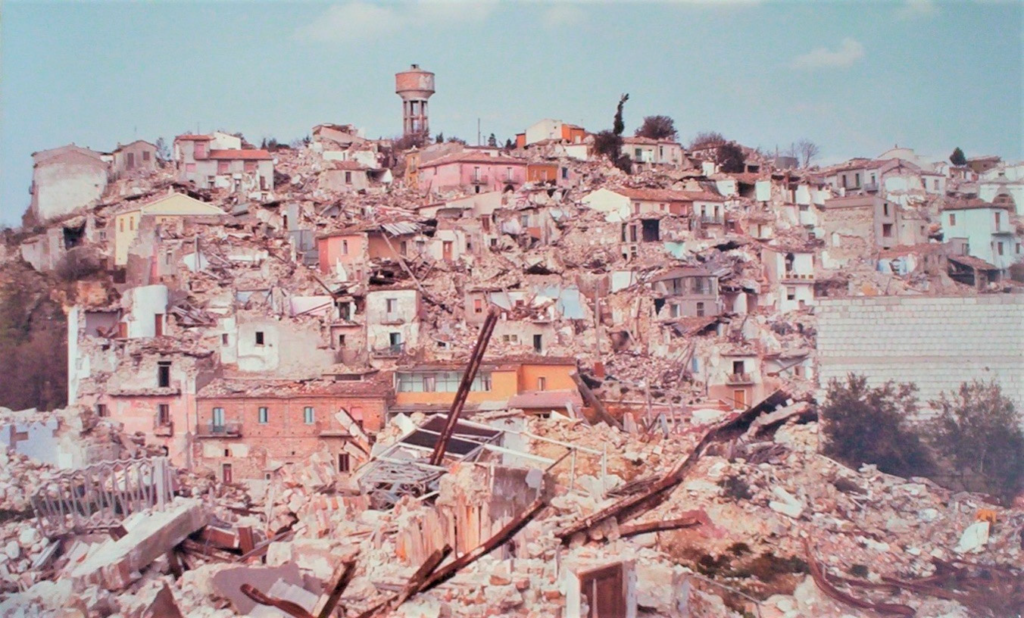
Collapsed buildings in the province of Avellino, after the devastating Irpinia earthquake of 23 November 1980. Image by Pro Loco Compsa, licensed under CC BY-SA 4.0, via Wikimedia Commons
The destruction was especially severe in smaller mountain towns, where vulnerable buildings, difficult road access and the wide area affected complicated rescue efforts. Entire communities were reconstructed in the decades that followed, and the disaster became a major turning point in the development of Italy’s modern civil protection system.
Avellino itself suffered heavily, but the story belongs to the wider mountain region rather than one city alone.
Much of the rebuilt landscape now looks ordinary. Roads, homes and public buildings reveal little of the scale of the disaster unless the history is known.
The route turns south-west through Contrada and Forino, beginning the passage from the interior towards the Salerno plain.
-116.3 km · Forino and an Ancient Aqueduct Through the Mountains
At -116.3 kilometres, the riders reach Forino, a community set inside a basin surrounded by mountains.
The geography marks a transition. Behind lies the interior of Irpinia. Ahead, the road gradually begins to descend towards the fertile lowlands behind Salerno and the Bay of Naples.
Forino also lies within the territory crossed by one of Roman Italy’s most ambitious hydraulic systems, the Aqua Augusta, sometimes called the Serino Aqueduct.
This network carried water from springs in the Serino area across a large part of Campania. Its branches supplied major settlements including Nola, Pompeii and Neapolis, as well as the enormous naval installations at Misenum.
Unlike an aqueduct serving one city, this was a regional system stretching across difficult terrain. Roman engineers had to maintain a controlled gradient through mountains and valleys for more than a hundred kilometres when the various branches are considered together.
The race follows roads through the same mountain corridor before descending towards Montoro and Mercato San Severino.
-100 km · The Agro Nocerino-Sarnese and the Fertile Plain Behind the Coast
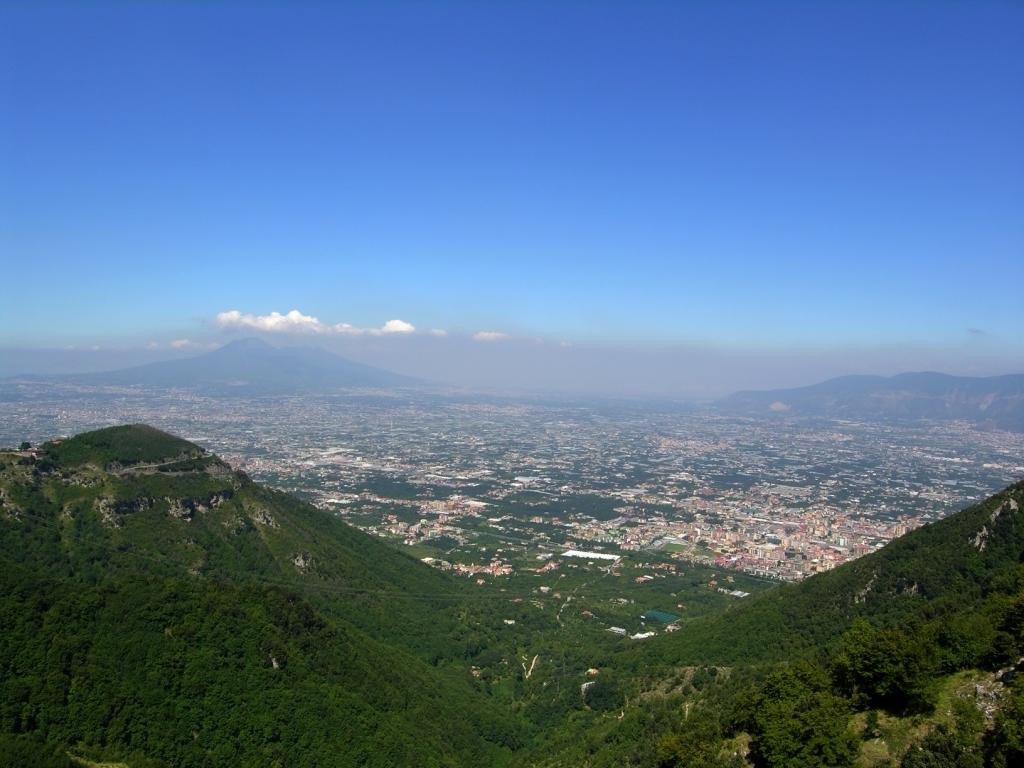
A view across the Agro Nocerino-Sarnese, the plain around Nocera and Sarno in the province of Salerno, Campania. Photo by Pagawiki, released into the public domain, via Wikimedia Commons.
At Castel San Giorgio, exactly 100 kilometres remain.
The riders have entered the northern edge of the Agro Nocerino-Sarnese, a densely populated agricultural plain between the mountains of the Salerno interior and the volcanic landscape surrounding Vesuvius.
Its fertility comes from a combination of alluvial deposits and repeated volcanic material spread across the region over long periods. The result is a rich agricultural landscape capable of supporting intensive cultivation.
This is the broader territory associated with tomatoes, vegetables and fruit, including the famous San Marzano tomato, which developed into one of the symbols of Campanian agriculture and later became closely tied to the growth of the canning industry.
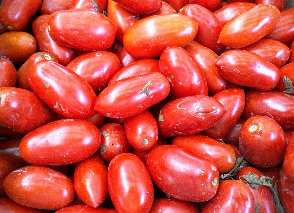
San Marzano tomatoes, the elongated variety closely associated with the food traditions of Campania. Photo by Assianir, licensed under CC BY-SA 3.0, via Wikimedia Commons
The race crosses Roccapiemonte and Nocera Superiore before the road rises gently towards Cava de’ Tirreni. The Mediterranean remains hidden behind the mountains.
With 91.6 kilometres remaining, the race reaches Cava de’ Tirreni.
-91.6 km · Cava de’ Tirreni, a Trading Town Behind the Amalfi Coast
The town lies in a valley immediately inland from the Amalfi Coast, surrounded by the Lattari and Picentini mountain systems. Its location made it a natural passage between the inland plain and the coastal settlements beyond Vietri.
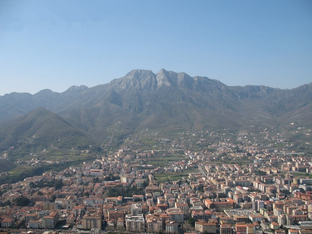
Cava de’ Tirreni seen from Monte Castello, overlooking the town and its valley in the province of Salerno. Photo credited to Gegè Avagliano, licensed under CC BY 3.0, via Wikimedia Commons
Cava developed as a commercial town rather than a cliffside maritime settlement. Its historic centre is marked by long arcaded porticoes sheltering shops and houses along the principal streets, giving it an architectural character very different from the towns the race will encounter once it reaches the sea.
The surrounding territory is also associated with the Abbey of the Holy Trinity at La Cava, founded in the early 11th century. The Benedictine monastery became an important religious, economic and cultural institution, accumulating manuscripts, land and influence across southern Italy.
The road begins to descend towards Vietri sul Mare, where the landscape changes suddenly.
-86.2 km · Vietri sul Mare and the Ceramic Gateway to the Amalfi Coast
At -86.2 kilometres, the race reaches Vietri sul Mare, the eastern gateway to the Amalfi Coast.
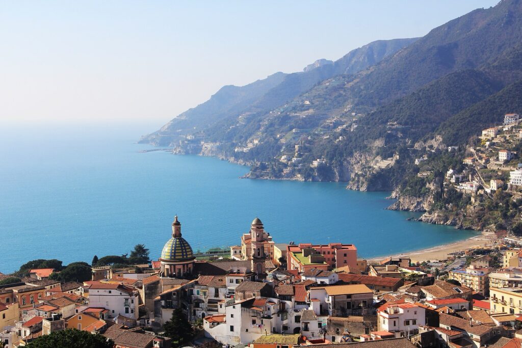
Vietri sul Mare overlooking the Tyrrhenian Sea at the eastern gateway to the Amalfi Coast. Photo by Anila amataj, licensed under CC BY-SA 4.0, via Wikimedia Commons
The town rises above the Gulf of Salerno where steep slopes meet the sea and has been associated for centuries with ceramics.
Vietri’s workshops became known for brightly decorated plates, vessels and tiles, drawing on local craft traditions as well as influences arriving through Mediterranean trade. Pottery production expanded particularly strongly from the Renaissance onward, and the town’s ceramics eventually became part of the visual identity of the coast itself.
Vietri also marks the beginning of the Costiera Amalfitana, the Amalfi Coast, a landscape where mountains descend almost directly into the Tyrrhenian Sea.
The coastal road, the SS163, had to be engineered through cliffs, tunnels and retaining walls because there is so little flat land between rock and water. Medieval communities survived here by using terraces, small valleys, fishing grounds and maritime trade.
The peloton follows that road west.
-81.1 km · Cetara, a Fishing Village Built Around Anchovies
With 81.1 kilometres remaining, the race passes Cetara, a small fishing village squeezed between the sea and the steep slopes of Monte Falerio.
Fishing has long defined the settlement.
Cetara is especially known for colatura di alici, an amber-coloured liquid made from salted anchovies. The fish are cleaned, layered with salt inside wooden containers and pressed. As they cure, liquid collects below and is later filtered and bottled.
The method belongs to the much older Mediterranean tradition of preserving fish with salt. Although it is often compared with Roman garum, modern colatura has its own distinctive production history.
On a coast where flat agricultural land is scarce, fishing provided both food and something that could be preserved, transported and traded.
The road continues towards Maiori.
-78.5 km to -64.3 km · Maiori, Minori, Atrani and Amalfi
At -78.5 kilometres, the riders reach Maiori, whose broad beachfront is unusual along a coast dominated by cliffs.
Its modern shoreline was significantly reshaped after the catastrophic 1954 flood, when extreme rainfall sent debris and water down the mountain valleys. The disaster caused heavy destruction across several coastal communities and altered the physical shape of parts of Maiori.
At -68.4 kilometres, the race passes Minori, a smaller settlement around the mouth of the Reginna Minor valley.
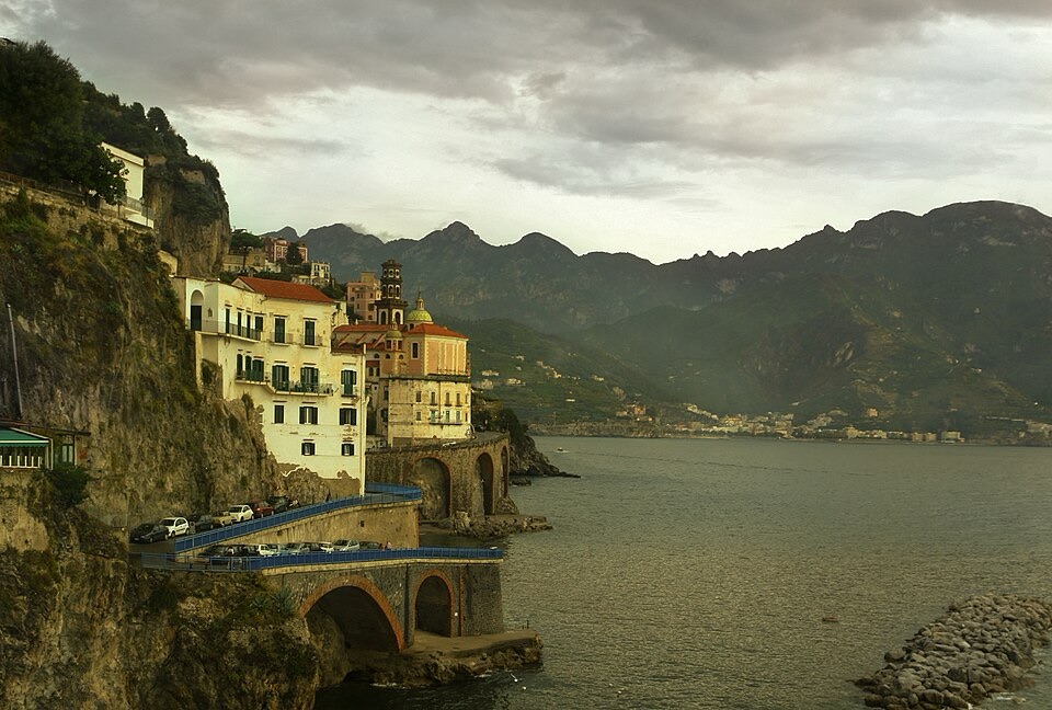
Atrani on Italy’s Amalfi Coast, tucked into a small cove beneath steep coastal cliffs. Photo by wolfgang.mller54, licensed under CC BY 2.0, via Wikimedia Commons
Roman elites were already using this coastline almost two thousand years ago. Minori preserves a substantial Roman maritime villa dating mainly from the first century AD, with rooms, gardens and bathing spaces showing that the coast functioned as a place of leisure and agricultural production long before medieval Amalfi became a trading power.
A few kilometres farther on comes Atrani at -64.7 km, one of Italy’s smallest municipalities by area. Houses rise tightly from the valley floor between steep mountains, giving the settlement an almost vertical form.
Atrani was closely integrated with medieval Amalfi, and the Church of San Salvatore de’ Birecto was traditionally associated with the investiture of Amalfi’s dukes.
Only a short distance later, with 64.3 kilometres remaining, the race enters Amalfi itself.
-64.3 km · Amalfi, a Small Town That Became a Mediterranean Power
Modern Amalfi is a compact town, but during the early Middle Ages it became one of the major commercial centres of the Mediterranean.
Between roughly the ninth and eleventh centuries, the Duchy of Amalfi maintained trading connections with Byzantine territories, Islamic North Africa and ports throughout the eastern Mediterranean.
Its prosperity depended on shipping, commerce and an ability to exploit the sea because the mountainous hinterland offered little room for expansion.
The Tavole Amalfitane, a body of maritime law traditionally associated with the town, remained influential in Mediterranean shipping long after Amalfi’s political power had declined. The town also developed an important paper-making industry, using water descending through the narrow valley behind the coast to power mills.
The geography shaped both activities. Mountains constrained the town from behind, while the Mediterranean opened routes towards distant markets.
West of Amalfi, the road begins to climb through Conca dei Marini and Furore.
-56.5 km · Furore, a Village Spread Across the Mountainside
At -56.5 kilometres, the riders enter the territory of Furore.
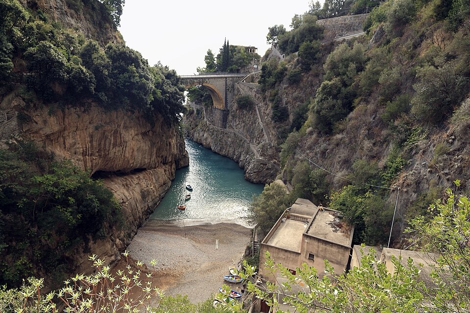
The Fiordo di Furore on the Amalfi Coast, where a narrow gorge shelters the small settlement of Marina di Furore above the sea. Photo by Falk2, licensed under CC BY-SA 4.0, via Wikimedia Commons
Unlike a compact hill town, Furore is scattered across steep slopes above the sea. Houses, churches and farms are linked by roads, stairways and old paths rather than concentrated around one central square.
Its most famous natural feature lies below the race route: the Fiordo di Furore, a narrow gorge where the Schiato stream reaches the sea between high limestone walls.
Despite the popular name, it is not a glacial fjord. It is a coastal ravine cut into limestone by running water.
A small settlement once occupied the gorge itself, using mills, fishing and the protected inlet, while higher terraces supported vines, olives and other crops.
From Furore, the route continues climbing into the Monti Lattari.
-47 km · Agerola, Mountain Pastures and the Memory of Fausto Coppi
The decisive climb of the race rises for roughly 14 kilometres at an average gradient close to 6%, with the mountain prize reached at around 47 kilometres to go.
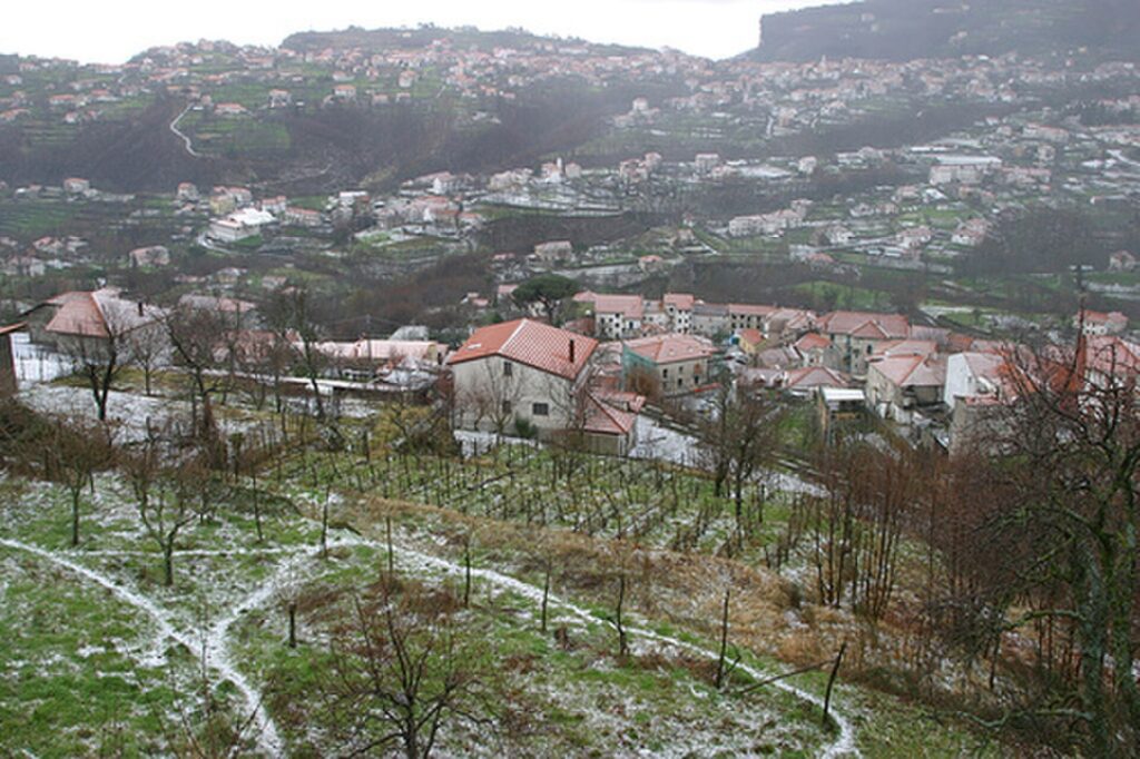
Agerola in the mountains above Italy’s Amalfi Coast, where the landscape opens onto the high ground of the Lattari Mountains. Photo by Albertistvan, licensed under CC BY-SA 3.0, via Wikimedia Commons
Agerola occupies a high basin in the Monti Lattari, the limestone mountain chain separating the Amalfi Coast from the Bay of Naples.
The name of the mountains has long been associated with milk and pastoralism. High pastures supported cattle and dairy production, traditions that survive in local cheeses including provolone del Monaco, produced in the wider Sorrentine and Lattari area.
Agerola is also the starting point of the famous Sentiero degli Dei, the Path of the Gods, a high walking route above the Amalfi Coast towards Positano. Its extraordinary views come from the abrupt way the Monti Lattari rise from the Mediterranean rather than from a broad coastal plain.
The climb also carries a genuine cycling memory.
During the 1955 Giro di Campania, Fausto Coppi attacked on the roads around Agerola. The episode became part of local sporting memory, and a monument now commemorates the connection.
By then Coppi was already one of the defining figures in cycling history, winner of the Tour de France, multiple Giri d’Italia, Milan-San Remo, Paris-Roubaix and the world championship. His greatest performances were associated with long attacks and an ability to make mountain roads decisive far from the finish.
The revived race returns to Agerola more than seventy years later.
Beyond the summit, the view changes from the Amalfi Coast towards the Bay of Naples.
-45.1 km to -38.5 km · Pimonte and Gragnano, From Mountain Country to Pasta
At -45.1 kilometres, the road passes Pimonte, a settlement on the inland side of the Monti Lattari.
Its position below the mountains explains its name, traditionally understood as referring to the foot of the mountain. Farms, orchards and livestock occupy the valleys descending towards the Bay of Naples.
The descent continues to Gragnano at -38.5 kilometres.
Gragnano is internationally known as the City of Pasta, a reputation built from the relationship between manufacturing and local climate.
For centuries, mills used water descending from the Lattari to grind grain. By the 19th century, pasta production had become increasingly industrialised, with factories concentrated along streets where airflow and sunlight helped control drying.
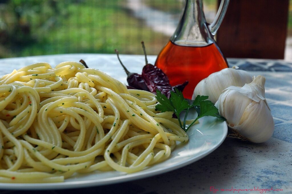
Spaghetti di Gragnano served with colatura di alici, the traditional anchovy sauce of Cetara on the Amalfi Coast. Photo by Elga Cappellari, licensed under CC BY-SA 2.0, via Wikimedia Commons
Long strands of pasta were once hung outside or placed in carefully ventilated spaces, using the combination of mountain breezes, sea air and humidity to dry slowly and evenly.
Modern production uses different technology, but Pasta di Gragnano now carries European Protected Geographical Indication status and remains tied legally as well as culturally to its place of origin.
The road drops quickly towards Castellammare di Stabia.
-33.2 km · Castellammare di Stabia and the Villas of Stabiae
With 33.2 kilometres remaining, the race reaches Castellammare di Stabia, on the southern side of the Bay of Naples beneath the Monti Lattari.
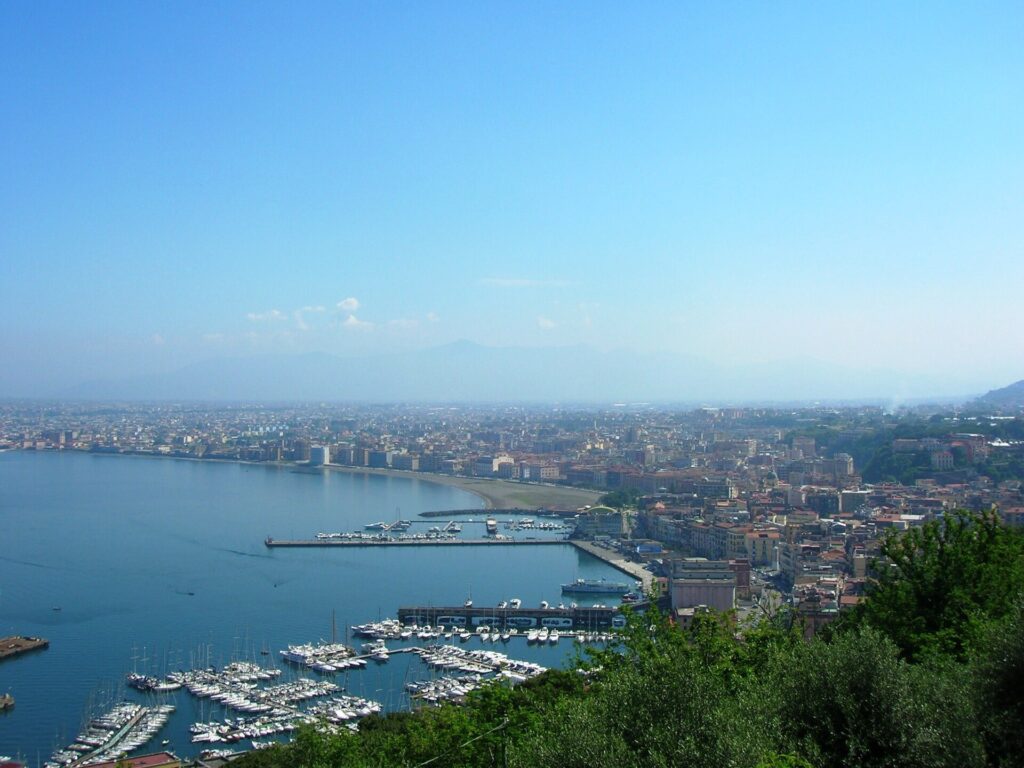
A view over Castellammare di Stabia, the coastal city at the southern edge of the Bay of Naples. Photo by Mentnafunangann, licensed under CC BY-SA 3.0, via Wikimedia Commons
The modern city occupies the territory of ancient Stabiae.
Unlike Pompeii, which was a substantial urban centre, Stabiae became particularly known for luxurious Roman villas built along the ridge above the bay. Wealthy families created large residences with gardens, elaborate frescoes, bathing areas and views across the water.
In AD 79, Mount Vesuvius erupted catastrophically.
Ash, pumice and volcanic surges buried communities around the volcano, including Pompeii, Herculaneum, Oplontis and Stabiae.
The Roman writer Pliny the Elder died at Stabiae after sailing across the bay to observe the eruption and assist people attempting to escape. His nephew, Pliny the Younger, later described the disaster in letters that remain among the most important eyewitness accounts of a volcanic eruption from the ancient world.
From Castellammare onward, the race enters an almost continuous archaeological landscape beneath Vesuvius.
-28.7 km · Pompeii, a Roman City Preserved by Disaster
At -28.7 kilometres, the peloton enters the municipality of Pompei.
Modern Pompei developed beside the archaeological remains of ancient Pompeii, buried during the eruption of Vesuvius in AD 79.
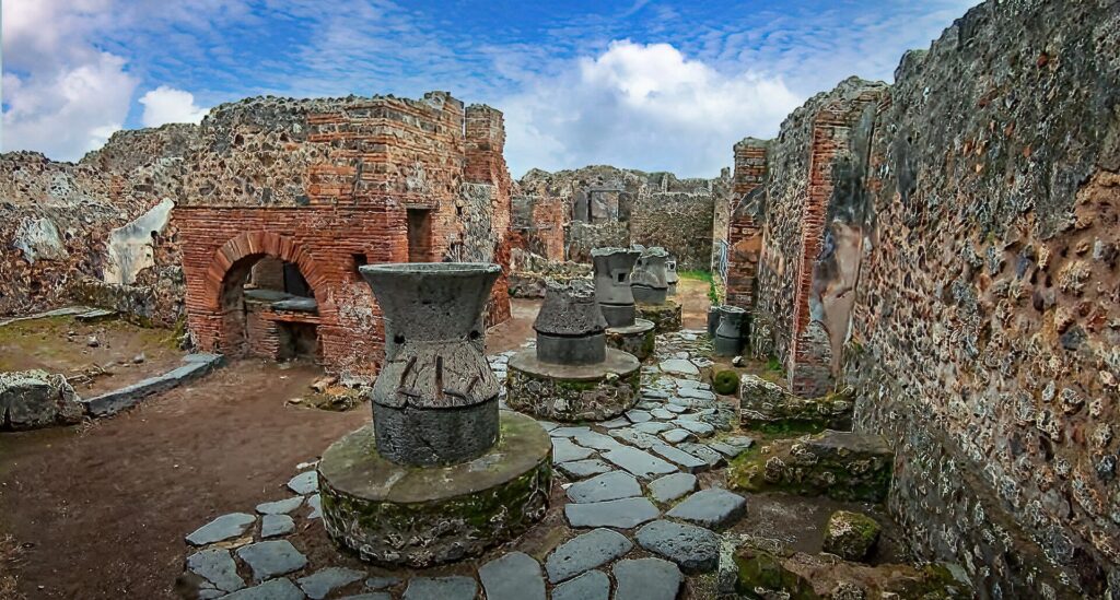
The importance of the site lies not simply in the survival of monumental buildings. Pompeii preserves streets, houses, workshops, taverns, baths, temples, bakeries, graffiti, election notices, gardens and countless objects from daily life.
Wealthy homes contain elaborate frescoes and mosaics, but ordinary shops and small workshops survive beside them, allowing archaeologists to reconstruct urban life across many social levels.
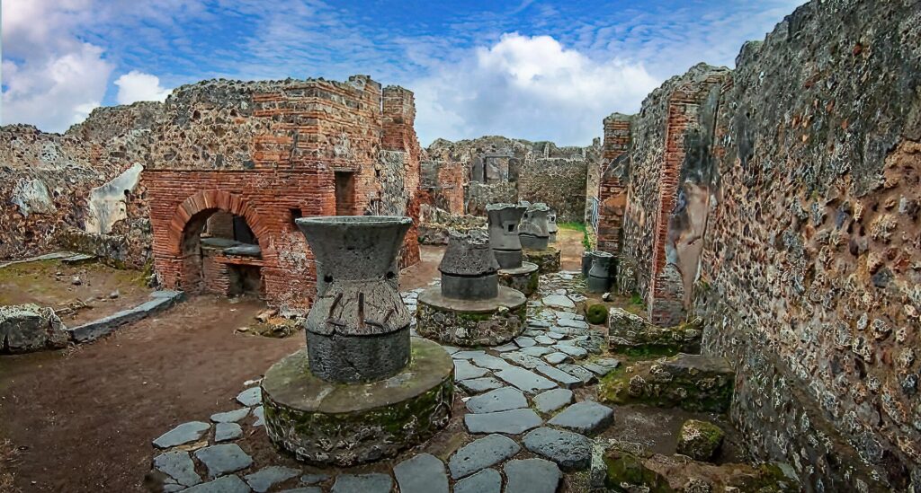
The remains of an ancient bakery at the Pompeii Archaeological Site. Image by Mary Harrsch from ProWalk Tours footage, licensed under CC BY-SA 4.0, via Wikimedia Commons
The eruption did not preserve the entire city in one simple frozen instant, and excavation history complicates the popular image. Even so, few archaeological sites reveal ordinary Roman life with comparable richness.
The race remains on the modern road system and continues towards Torre Annunziata.
-27.3 km · Torre Annunziata and the Villas of Oplontis
At -27.3 kilometres, the riders enter Torre Annunziata, a densely built coastal town between Pompeii and Vesuvius.
Torre Annunziata seen from its port on the Bay of Naples, with the city rising along the waterfront. Photo by Bboss, released into the public domain, via Wikimedia Commons.
Beneath the modern city lie remains associated with ancient Oplontis.
The most famous is the enormous Villa of Poppaea, traditionally linked with Poppaea Sabina, the second wife of Emperor Nero. The exact nature of her connection remains uncertain, but the scale and decoration leave little doubt that the owners belonged to the highest levels of Roman society.
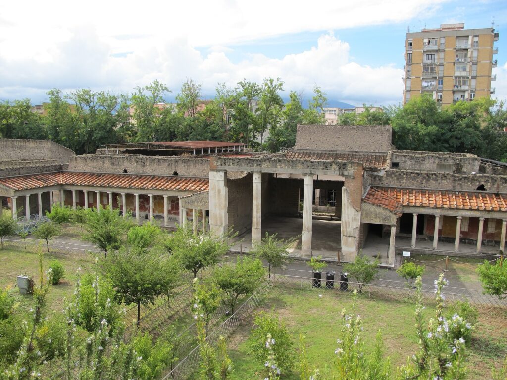
The garden of Villa Poppaea at Oplontis in Torre Annunziata, a Roman villa buried by the eruption of Mount Vesuvius in 79 CE. Photo by ho visto nina volare, licensed under CC BY-SA 2.0, via Wikimedia Commons
The villa contains extensive frescoes, gardens and rooms designed for leisure, ceremony and display.
Nearby excavations have revealed another complex containing storage spaces and the remains of people apparently caught while waiting for escape.
The contrast with Pompeii is useful. The Vesuvian landscape was not occupied by one type of settlement. Cities, villas, farms and commercial properties existed side by side around the bay.
The course continues towards Torre del Greco.
-21.9 km · Torre del Greco, Coral and Life Beneath Vesuvius
With 21.9 kilometres remaining, the race passes Torre del Greco, a city between Vesuvius and the Bay of Naples.
Its history has always involved living with the volcano.
Eruptions repeatedly damaged the town, particularly during the 17th and 18th centuries, yet residents rebuilt because the same landscape offered fertile soil and access to the sea.
Torre del Greco also became internationally important for coral and cameo work. Mediterranean coral was traded through the town, while artisans carved shell and other materials into jewellery and decorative objects for customers far beyond Campania.
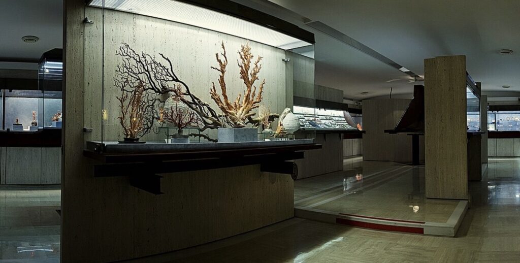
A cropped view inside the Museo Liverino in Torre del Greco, whose coral collection reflects the town’s long tradition of coral craftsmanship. Wikimedia Commons credits Peppoune21 and lists the image under CC BY-SA 4.0. Original image
The city is also linked with Giacomo Leopardi, one of Italy’s greatest poets. During the final period of his life, Leopardi stayed in the area and wrote La ginestra, “The Broom”, inspired partly by the volcanic slopes of Vesuvius.
The yellow broom plant surviving on barren lava became part of his meditation on the vulnerability of human beings before nature.
The race continues along the western side of Vesuvius.
-14.3 km · Herculaneum, Where Heat Preserved Wood
At -14.3 kilometres, the peloton enters Ercolano, the modern city built above ancient Herculaneum.
Herculaneum was smaller than Pompeii and experienced the eruption differently. Extremely hot pyroclastic surges overwhelmed the town, while later volcanic deposits buried it under many metres of material.
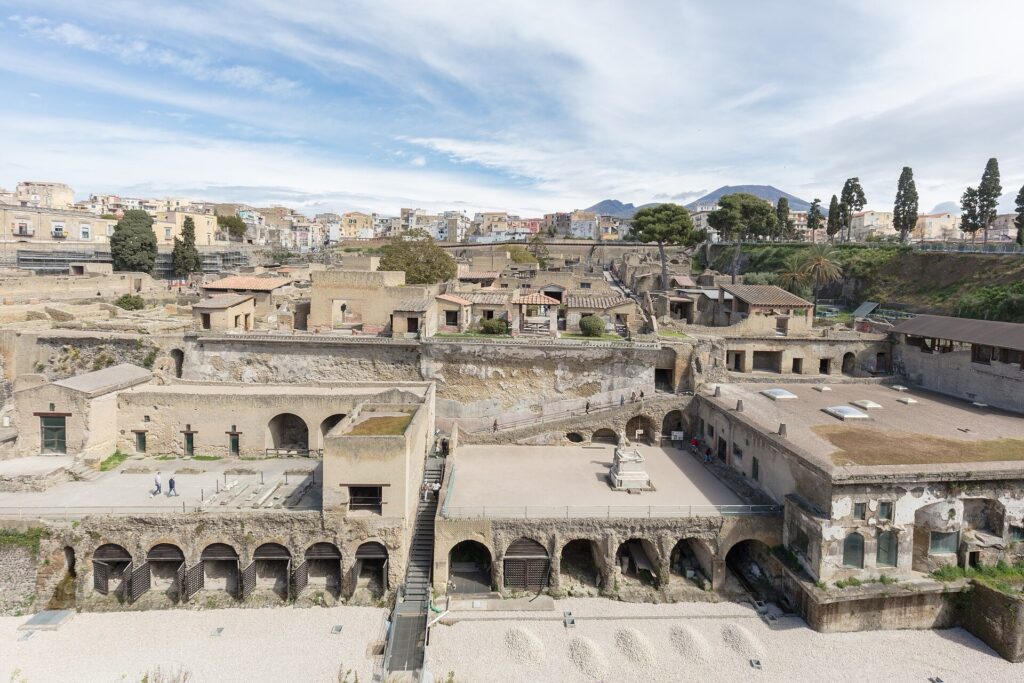
Those conditions preserved materials that rarely survive from antiquity.
Wooden doors, furniture, roof beams and even food were carbonised rather than simply disappearing. Multi-storey buildings survive unusually well, while interiors retain marble, mosaics and painted decoration.
Excavations near the ancient shoreline also revealed groups of people who had taken shelter in vaulted spaces while apparently waiting for evacuation by sea.
Herculaneum therefore complements Pompeii rather than repeating it. Pompeii preserves the scale and variety of a larger Roman city, while Herculaneum provides exceptional evidence of architecture and organic material that normally vanishes.
The modern road now enters the Bourbon landscape of the Miglio d’Oro.
-12.3 km · Portici and the Villas of the Golden Mile
At -12.3 kilometres, the riders reach Portici, where the route passes through the Royal Palace of Portici.
The palace was commissioned in 1738 by Charles of Bourbon, the same ruler who later ordered the construction of the much larger palace at Caserta.
Portici offered something Caserta could not: immediate views across the Bay of Naples with Vesuvius rising behind.
The Royal Palace of Portici, near Naples, was built in the 18th century as a residence for the Bourbon kings and later housed finds from nearby Herculaneum. Photo by Rutger van der Maar, licensed under CC BY 2.0, via Wikimedia Commons
The presence of the royal court attracted aristocratic families, who began constructing villas along the road between Naples and the Vesuvian towns. Their concentration became known as the Miglio d’Oro, the Golden Mile.
The name refers not to one exact measured mile but to the extraordinary sequence of 18th-century residences stretching through Portici, Ercolano, San Giorgio a Cremano and neighbouring communities.
These villas developed at a moment when the Bay of Naples was becoming one of Europe’s great destinations for aristocrats, artists and scholars travelling on the Grand Tour.
The archaeological discoveries at Herculaneum and Pompeii were unfolding at almost the same time. Early finds from the Vesuvian excavations were housed at Portici before later collections were transferred into institutions that eventually contributed to Naples’ archaeological museums.
The riders pass through the palace complex with little more than twelve kilometres remaining.
Caserta opened the race with Bourbon architecture on an imperial scale. Portici brings the same dynasty back into view just before Naples.
-8.7 km · Naples, a Greek City Beneath a Modern Metropolis
With 8.7 kilometres remaining, the race enters Naples, the capital of Campania and the largest city in southern Italy.
Its urban history reaches back almost three thousand years.
Greek settlers established Neapolis, meaning “new city”, beside an older settlement during the first millennium BC. The street pattern of the historic centre still preserves elements of the ancient Greek and Roman layout, especially the long east-west streets traditionally known as the decumani.
Naples later passed through Roman, Byzantine, Norman, Swabian, Angevin, Aragonese, Spanish and Bourbon rule. Each political period left architecture, institutions, language and cultural traditions behind.
In 1224, Emperor Frederick II founded the university that now bears his name, generally regarded as one of the oldest state-founded universities in the world.
The city later became one of Europe’s major centres of music, theatre, scholarship and political thought, while its enormous population made it one of the continent’s largest urban centres during parts of the early modern period.
The race does not attempt to cross all of that Naples. It approaches from the eastern side, reaches the waterfront and moves towards the monumental centre. The finish lies in Piazza del Plebiscito.
FINISH · Piazza del Plebiscito, Between Royal Naples and the Bay
The Giro di Campania finishes after 193.1 kilometres in Piazza del Plebiscito, one of the principal monumental spaces of Naples.
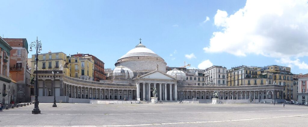
The Basilica of San Francesco di Paola overlooks Piazza del Plebiscito in the heart of Naples. Photo by Wolfgang Pehlemann, licensed under CC BY-SA 3.0 Germany, via Wikimedia Commons
The square lies beside the Royal Palace of Naples, begun in the early 17th century during Spanish rule and later used by the Bourbon kings. Across the open space, the curved colonnades of the Basilica of San Francesco di Paola frame the western side.
The church was commissioned by Ferdinand I after the Bourbon restoration following the Napoleonic period. Its enormous dome and classical portico gave the square a monumental form suited to royal Naples.
The name Piazza del Plebiscito refers to the plebiscite of 1860 associated with the incorporation of the Kingdom of the Two Sicilies into the expanding Italian state, immediately before the proclamation of the Kingdom of Italy in 1861.
That political history sits at the end of a route whose older layers have already carried the race from Samnite territory to Roman roads, Lombard Benevento, earthquake-scarred Irpinia, medieval Amalfi and the towns buried by Vesuvius.
The final kilometres also return to the architectural world in which the day began. Charles of Bourbon commissioned Portici before his larger palace at Caserta, and the revived Giro now connects those landscapes through nearly two hundred kilometres of Campania.
Between them lie mountain corridors where Roman armies once fought for control of Italy, vineyards above former sulfur mines, valleys crossed by Roman aqueducts, fishing villages dependent on salted anchovies, medieval ports forced outward towards the Mediterranean and cities that learned repeatedly to live beside an active volcano.
After twenty-five years away, the Giro di Campania returns by crossing the region from its inland historical routes to the Bay of Naples, finishing in the centre of a city whose own history contains almost every period the race has passed through on the way.



