

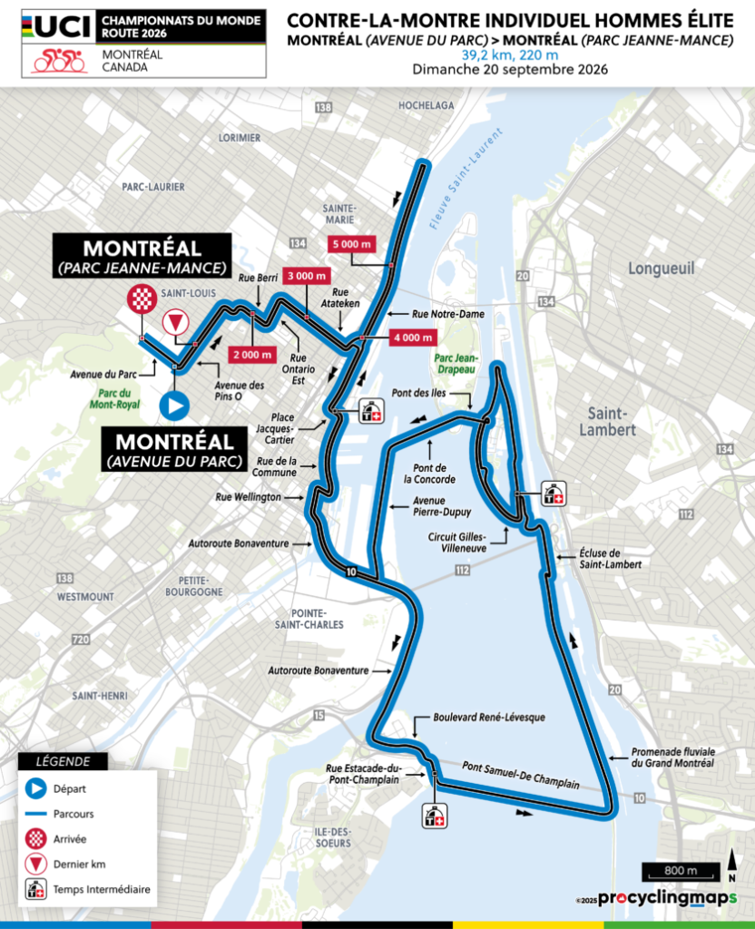
The 2026 UCI Road World Championships open in Montréal with a race against the clock, but the course is more than a technical test of pacing and aerodynamics. Over 39.2 kilometres, it traces the relationship between the city and the geography that made it possible: Mount Royal behind the start, the St Lawrence below, the industrial southwest, the great transport works of the seaway era, the artificial islands created for Expo 67, the Formula One circuit on Île Notre-Dame, the old colonial waterfront and, finally, the return towards the mountain at Parc Jeanne-Mance.
The first intermediate time comes after 10.5 kilometres, leaving 28.7 km to go. The second is taken after 21.5 kilometres, with 17.7 km remaining, near the entrance to the Circuit Gilles-Villeneuve. The third arrives at Place Jacques-Cartier after 29.5 kilometres, leaving 9.7 km for the final climb back through the city. The total elevation gain is only about 220 metres, so this is not a climbing time trial, but the profile hides an important detail: the course spends much of its first two-thirds encouraging long periods of sustained speed before asking riders to change rhythm on the return towards Mount Royal.

For Around the Peloton, that distinction matters because Montréal was already explored a week earlier during the Grand Prix Cycliste de Montréal. That race belonged to Mount Royal itself, circling repeatedly around the mountain and using the same urban slopes again and again. The World Championship time trial turns away from that familiar landscape almost immediately. Its story lies lower, beside the river, in the districts and islands Montréal reshaped in order to move goods, build industry, stage international exhibitions and connect itself to the rest of the continent.
START · Avenue du Parc and the City Below Mount Royal
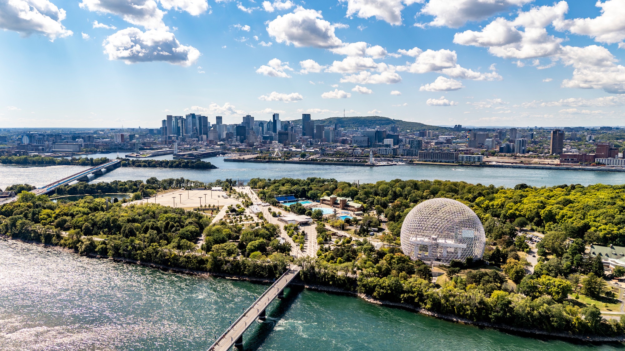
Montréal Island rises across the St. Lawrence River, seen from Île Sainte-Hélène with the Biosphere in the foreground. Photo by Hayden Soloviev, licensed under CC BY 4.0, via Wikimedia Commons
The first rider leaves Avenue du Parc, on the eastern side of Mount Royal, the low mountain that rises from the centre of Montréal Island and ultimately gave the city its name.
Long before Montréal became a colonial settlement, this landscape belonged to an Indigenous geography organised around water, portage routes and seasonal movement. The Kanien’kehá:ka, or Mohawk, name for the island is Tiohtià:ke, and the St Lawrence below the mountain formed part of a much larger network connecting communities across the northeast of North America.
French colonists established Ville-Marie in 1642 beside the river, with Mount Royal immediately behind them. The mountain remained largely wooded as the settlement expanded, but by the 19th century private development and tree cutting were beginning to threaten its slopes. Montréal eventually responded by creating Mount Royal Park, inaugurated in 1876 and designed by Frederick Law Olmsted, the American landscape architect also associated with New York’s Central Park.
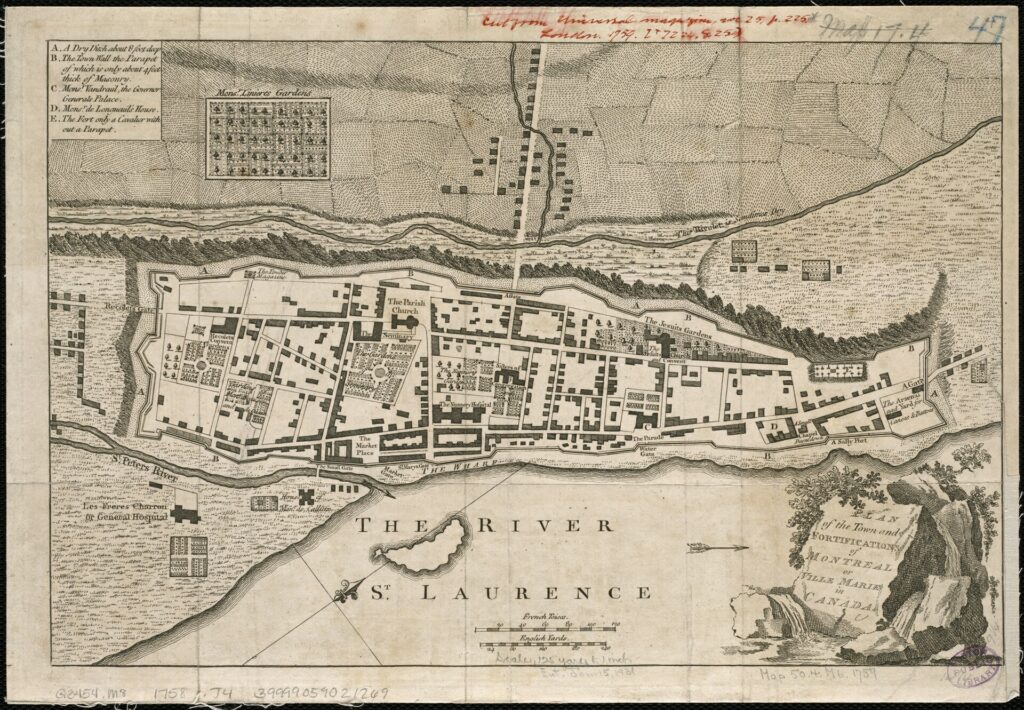
A 1758 plan by Thomas Jefferys showing Montréal, then also known as Ville-Marie, within its town fortifications. From the Boston Public Library’s map collection, licensed under CC BY 2.0, via Wikimedia Commons
The World Championship course does not climb into the park. Instead, it leaves the mountain almost at once and heads downhill, towards the city that grew between Mount Royal and the St Lawrence.
OPENING KILOMETRES · DESCENDING TOWARDS THE ST LAWRENCE
The opening kilometres move south through Montréal as the gradient eases and the road begins to favour sustained speed.
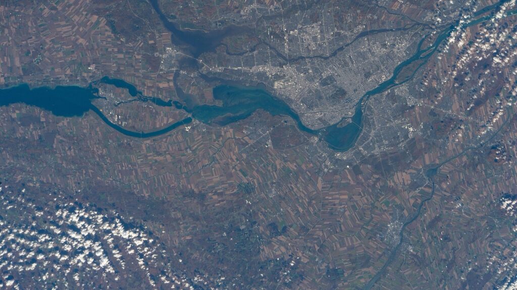
Seen from the International Space Station, Montréal Island lies between the Rivière des Prairies to the north and the St. Lawrence River to the south. NASA Johnson Space Center image, public domain, via Wikimedia Commons
The St Lawrence is the reason the city grew where it did. From the Atlantic, the river penetrates deep into the North American continent before linking, through a chain of waterways, with the Great Lakes. For thousands of years, Indigenous communities travelled and traded along this corridor. French settlement entered that existing geography rather than creating it, and Montréal gradually became one of the principal places where continental traffic met Atlantic commerce.
The location was valuable partly because movement was difficult. Upstream, the Lachine Rapids interrupted navigation and prevented large vessels from travelling freely west. Cargo had to be unloaded, carried around the rapids and transferred again, and the inconvenience itself generated trade, storage, labour and infrastructure.
As Montréal industrialised, the city increasingly tried to overcome the obstacles that had first made its location important. That process becomes visible as the route approaches the southwest.
TOWARDS POINTE-SAINT-CHARLES · THE INDUSTRIAL CITY
The riders reach the wider Pointe-Saint-Charles area southwest of downtown, a district that once stood at the centre of Montréal’s industrial expansion.
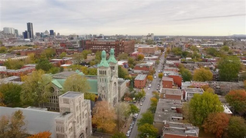
A drone view over Montréal’s Pointe-Saint-Charles neighbourhood, with Rue Centre and Saint-Charles Church below. Photo by Bellavancem, licensed under CC BY-SA 4.0, via Wikimedia Commons
The transformation began with the Lachine Canal, opened in 1825 to bypass the rapids and later enlarged as shipping increased. Factories gathered along its banks because the canal offered both transport and water power, while railways soon added another layer of movement. By the late 19th century, Pointe-Saint-Charles was crowded with workshops, warehouses, railway yards and dense working-class housing.
Irish immigration shaped the neighbourhood particularly strongly after the Great Famine of the 1840s. Labourers arriving in Montréal found work in railways, construction and industry, often under difficult conditions. Over time, churches, schools, unions and local institutions grew around those communities, giving Pointe-Saint-Charles an identity distinct from the commercial centre farther east.
Heavy industry later declined, and the canal became increasingly recreational, but the district still carries the physical imprint of the period when Montréal became one of Canada’s great industrial cities.
The time trial passes through that history at high speed before the urban fabric begins opening towards the river.
-28.7 km · FIRST TIME CHECK AND THE ENGINEERED ST LAWRENCE
The first official time check comes after 10.5 kilometres, leaving 28.7 kilometres remaining, near Rue Estacade-du-Pont-Champlain.
By now, the city around the riders has changed. Buildings give way to bridges, causeways, channels and broad water, and the course enters a landscape that looks natural from a distance but has been heavily engineered.
The largest transformation came with the St Lawrence Seaway, opened in 1959 after Canada and the United States created a system of locks, channels and navigation works capable of carrying ocean-going ships between the Atlantic and the Great Lakes. The project altered shorelines, required new bridges and dams, and changed the economic geography of inland North America by allowing deep-water shipping to penetrate much farther west.
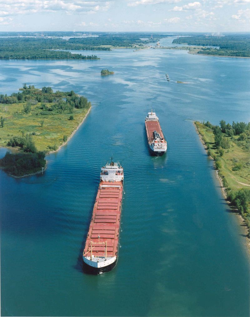
The St. Lawrence Seaway, the navigation route linking the Atlantic Ocean with the Great Lakes. Image from the U.S. Department of Transportation, public domain, via Wikimedia Commons
Near the course stands the Estacade, a long structure extending across the river system near the Champlain crossing. It was built to help control ice and protect infrastructure farther downstream, a reminder that even after the great seaway project had opened the river to large ships, the St Lawrence still had to be managed season by season.
The riders are now crossing the product of that long struggle between geography and engineering.
ÎLE DES SŒURS · FROM FARM ISLAND TO MODERN SUBURB
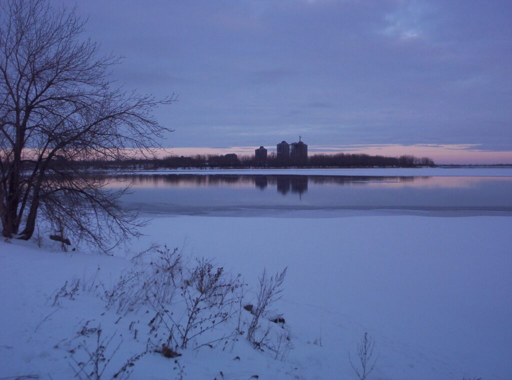
A winter view from Île des Sœurs, an island in the St. Lawrence River that forms part of Montréal’s Verdun borough. Photo by Colocho, licensed under CC BY-SA 2.5, via Wikimedia Commons
The course next passes Île des Sœurs, or Nuns’ Island, immediately southwest of Montréal Island.
The name comes from the Congrégation de Notre-Dame, a religious community that owned much of the island for centuries. For most of that time, the landscape was agricultural, with fields and farm buildings separated from the city by the river.
That isolation disappeared rapidly in the 20th century as bridges and road connections drew the island into metropolitan Montréal. Farmland gave way to apartment towers, houses and planned residential districts, turning Île des Sœurs into a modern suburb within a few decades.
The transformation also produced an unexpected architectural legacy. During the 1960s, Ludwig Mies van der Rohe, one of the defining architects of modernism, designed apartment towers and a service station on the island. Glass, steel and strict geometry brought the language of international modern architecture into what had once been agricultural land owned by a religious community.
The riders do not remain on the island for long. The route continues across the river system towards a place where Montréal’s transformation became even more radical.
THE ST LAWRENCE CROSSING · BRIDGING THE METROPOLIS
For much of Montréal’s history, the St Lawrence was both highway and barrier.
Ships could move along the river, but crossing it remained difficult. Ferries linked Montréal with the South Shore, while ice complicated travel in winter and industrial growth made permanent connections increasingly necessary.
The Victoria Bridge, opened in 1859, became the first great fixed crossing of the St Lawrence at Montréal and one of the major engineering works of Victorian North America. Railways could now move directly across the river, and later road bridges expanded the metropolitan network further.
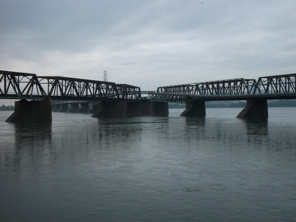
The Victoria Bridge crosses the St. Lawrence River between Montréal and the South Shore, connecting the island with Longueuil. Photo by Doug Kerr, licensed under CC BY-SA 2.0, via Wikimedia Commons
By the middle of the 20th century, Montréal was no longer simply an island city surrounded by separate communities. Bridges had begun turning the river into the centre of a much larger urban system.
The time trial now reaches the most extreme expression of that ambition: land created in the river itself.
-17.7 km · SECOND TIME CHECK AND ÎLE NOTRE-DAME
The second official intermediate time comes after 21.5 kilometres, leaving 17.7 kilometres to go, near the entrance to the Circuit Gilles-Villeneuve.
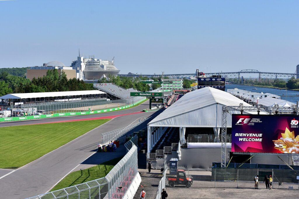
Circuit Gilles-Villeneuve on Montréal’s Île Notre-Dame during the 2017 Canadian Grand Prix. Photo by pedrik, licensed under CC BY 2.0, via Wikimedia Commons
Approaching Île Notre-Dame, nothing in the broad water and tree-lined shoreline immediately suggests that much of the ground ahead did not exist in anything like its present form until the 1960s.
Montréal manufactured the island for Expo 67, using millions of tonnes of excavated rock and earth, including material removed while the city was digging its new Metro system. The project belonged to one of the most ambitious periods in Montréal’s modern history, when the city was preparing to host the 1967 International and Universal Exposition during Canada’s centennial year.
Expo 67 spread across Île Sainte-Hélène and the newly created Île Notre-Dame, filling the St Lawrence with national pavilions, experimental architecture, transport systems and public art. Tens of millions of visits made the exhibition one of the most successful world’s fairs ever staged.
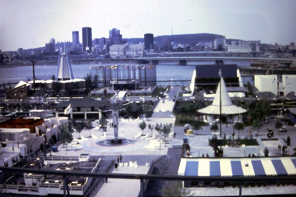
Pavilions and sculptures on Île Notre-Dame during Expo 67, the world’s fair that transformed Montréal’s river islands. Photograph by The Webhamster’s father, scanned and shared by The Webhamster, licensed under CC BY-SA 2.0, via Wikimedia Commons
When the fair ended, the islands remained, and Montréal continued to reuse them.
Less than a decade later, they became part of the landscape of the 1976 Summer Olympics.
PARC JEAN-DRAPEAU · AN ISLAND LANDSCAPE BUILT FOR GLOBAL EVENTS
Île Notre-Dame and neighbouring Île Sainte-Hélène now form Parc Jean-Drapeau, named after the mayor most closely associated with Expo 67 and the Olympic era.
Île Sainte-Hélène is partly natural, although it was enlarged for the exhibition, while Île Notre-Dame is largely a product of modern engineering. Together they preserve some of the most recognisable architecture of 20th-century Montréal.
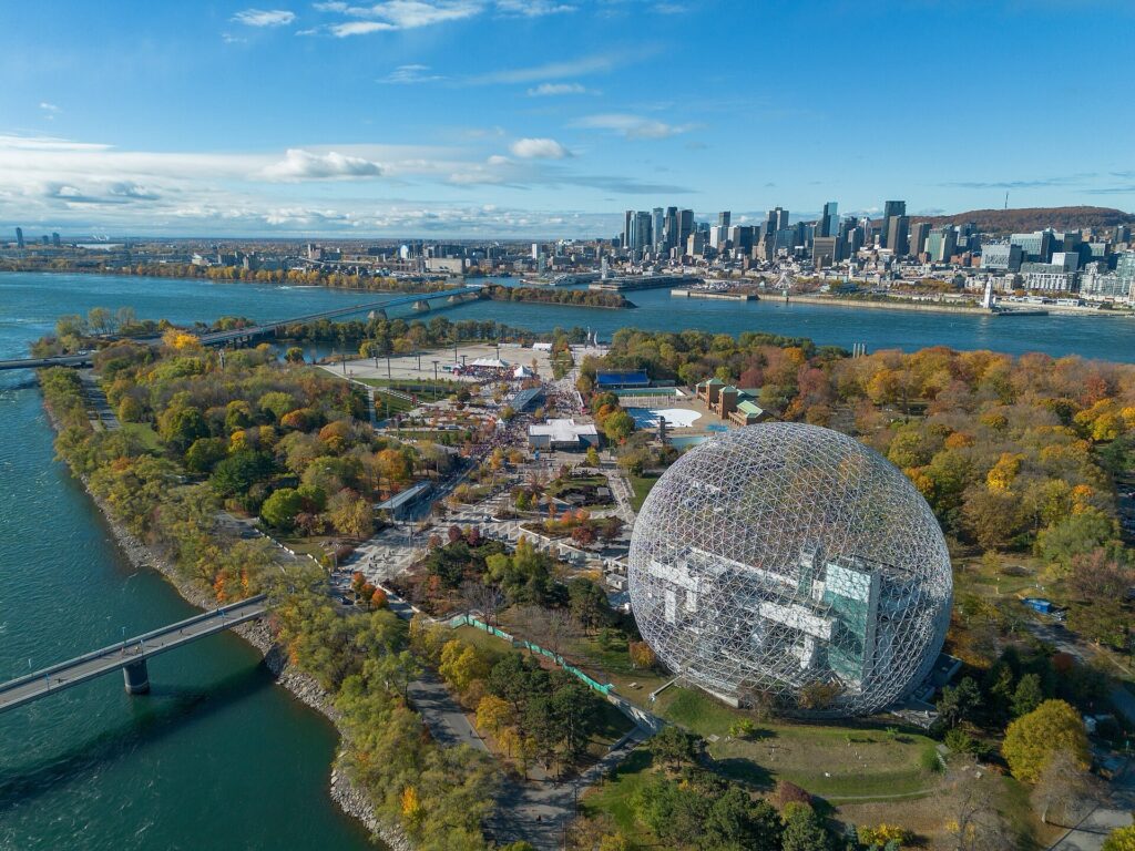
The former United States pavilion survives as the Biosphère, a geodesic dome designed by Buckminster Fuller. Its triangular steel framework enclosed an enormous exhibition space using relatively little material, and although the transparent covering was destroyed by fire in 1976, the exposed structure remained and was later adapted as an environmental museum.
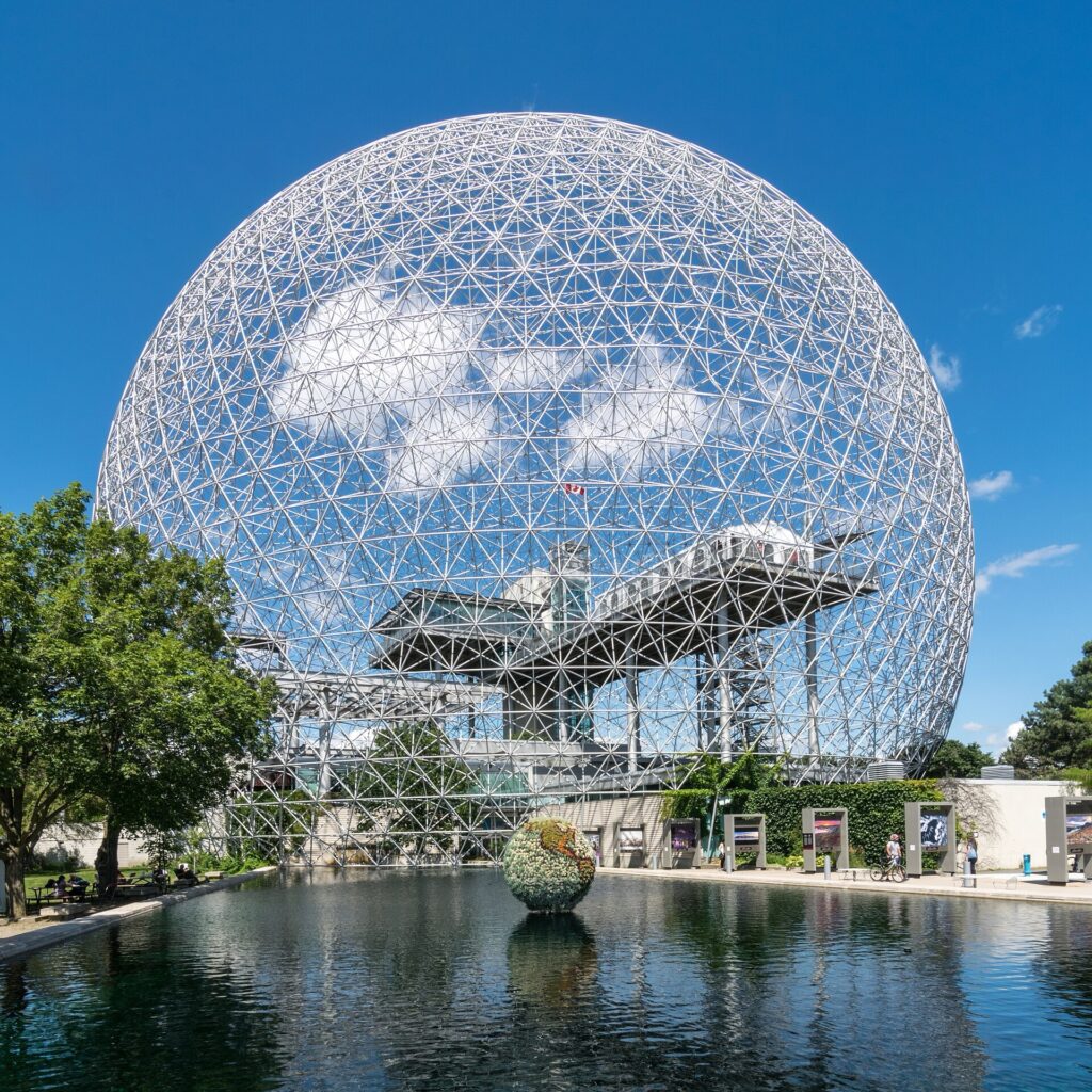
The Montréal Biosphere, the geodesic dome built for Expo 67 on Île Sainte-Hélène. I’d choose another image for your blog: this photo by Ralf Roletschek is offered under GFDL 1.2, whose license-copy requirement makes a short caption alone insufficient. Wikimedia Commons source
Nearby, on the Cité du Havre peninsula, Habitat 67 survives as another major legacy of the fair. Designed by Moshe Safdie, the housing complex stacks prefabricated concrete units into terraces and irregular volumes, an attempt to combine the density of apartment living with some of the spatial qualities of individual houses.
These structures belong to the same period as the island beneath the riders: a moment when Montréal was willing to remake its shoreline and river landscape in order to present itself as a modern international city.
The next transformation came through sport.
CIRCUIT GILLES-VILLENEUVE · FORMULA ONE ON AN ARTIFICIAL ISLAND
The World Championship enters the Circuit Gilles-Villeneuve, a permanent road circuit laid across Île Notre-Dame.
The track opened in 1978, initially under the name Circuit Île Notre-Dame. It was later renamed in honour of Gilles Villeneuve, the Québec-born Formula One driver who won the first Canadian Grand Prix held on the circuit and who died during qualifying for the Belgian Grand Prix in 1982.
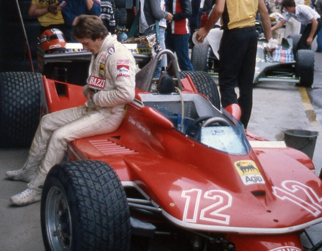
Canadian Formula One driver Gilles Villeneuve with his Ferrari 312T4 in 1979. Photo by ideogibs, licensed under CC BY-SA 2.0, via Wikimedia Commons.
Villeneuve became one of Canada’s most celebrated racing figures, admired for a driving style defined by aggression, improvisation and a willingness to push machinery close to its limits.
The circuit itself is fast, built around long straights interrupted by chicanes and heavy braking zones. Its final chicane gained particular notoriety when several Formula One world champions crashed there during the 1999 Canadian Grand Prix, giving the outside barrier its nickname, the Wall of Champions.
A bicycle time trial uses the same asphalt very differently. There is almost none of the violent braking that defines Formula One here. Instead, the width of the road and length of the straights allow riders to hold an aerodynamic position for extended periods, making this one of the purest high-speed sections of the entire course.
The contrast with the setting is striking. The riders are racing on a Formula One circuit built on an island created partly from the earth removed while Montréal was excavating its subway.
That single sequence links transport engineering, urban expansion and global sport within a few kilometres.
LEAVING THE ISLANDS · PONT DE LA CONCORDE
From Île Notre-Dame, the route crosses Pont de la Concorde and begins returning towards central Montréal.
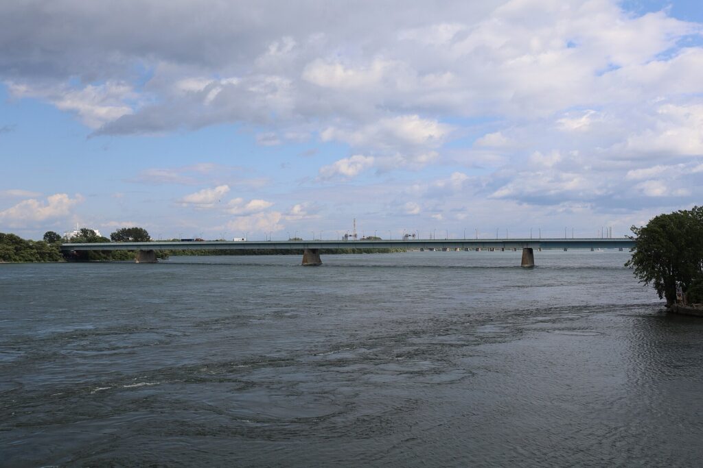
The Pont de la Concorde crosses the St. Lawrence River in Montréal, linking the city’s waterfront with Île Sainte-Hélène. Photo by Antony-22, licensed under CC BY-SA 4.0, via Wikimedia Commons
The bridge itself was another product of Expo 67, and even its name reflects the internationalist language of the exhibition. The fair imagined Montréal as a meeting place of nations, technologies and architectural ideas, and the infrastructure built for it became part of the permanent city.
Once across the bridge, the character of the course changes again. Broad open roads give way to tighter streets, buildings close around the riders and the skyline that had remained across the water begins to surround them.
The route is now approaching the oldest European part of Montréal.
OLD MONTRÉAL · FROM COLONIAL SETTLEMENT TO COMMERCIAL PORT
The riders enter Old Montréal, the historic district beside the St Lawrence where Ville-Marie developed during the 17th century.
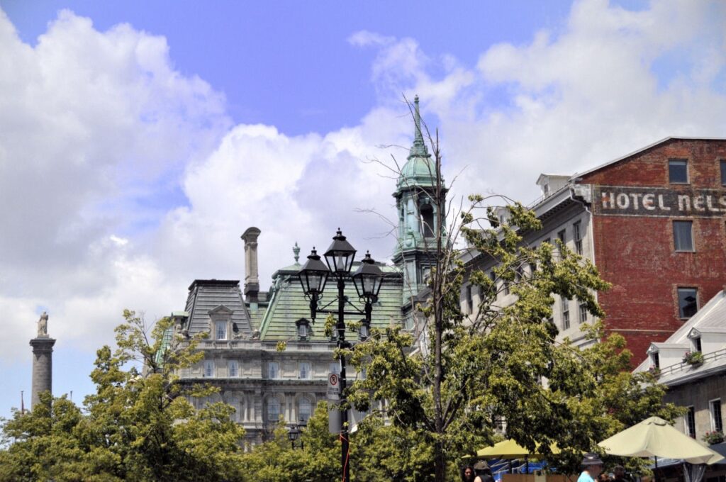
Old Montréal / Vieux-Montréal, the historic district beside the St. Lawrence River. I couldn’t verify this file’s photographer or license from its Commons page, so I can’t give you a reliable credit or confirm it’s usable yet.
The settlement began in 1642 as a French Catholic mission, but its position quickly tied it to trade. The St Lawrence connected Montréal with Québec City and the Atlantic, while waterways and portage routes stretched west towards the continental interior. Fur, goods and people moved through the settlement, gradually turning a religious colony into an increasingly important commercial centre.
By the 18th and 19th centuries, Montréal’s port had become central to the city’s economy. Warehouses, merchants, banks and insurance companies gathered near the waterfront, while ships carried goods between inland Canada and overseas markets.
The old fortified town eventually became too small for the city growing around it, and the walls were demolished in the early 19th century. The street pattern survived, however, and Old Montréal still contains architecture from French colonial, British imperial and industrial periods side by side.
What now appears picturesque was once intensely functional. These streets existed to move goods, capital and people between the port and the city.
The time trial reaches its final official time check in one of the district’s oldest civic spaces.
-9.7 km · PLACE JACQUES-CARTIER AND THE LAYERS OF MONTRÉAL
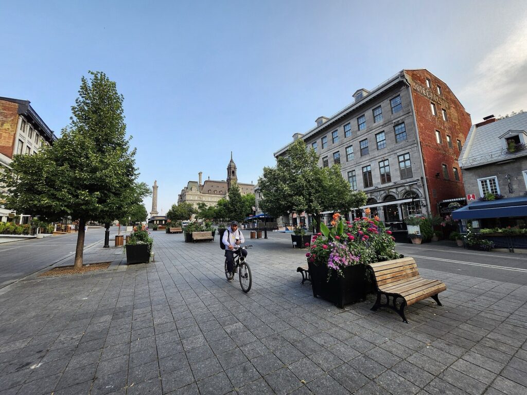
Place Jacques-Cartier in Vieux-Montréal, a historic square near the Old Port. I can’t verify the photographer or license for this specific image, so I wouldn’t use it on the blog yet.
After 29.5 kilometres, with 9.7 kilometres remaining, the riders cross Place Jacques-Cartier.
The long square slopes towards Montréal City Hall and the old port and carries the name of Jacques Cartier, the French navigator who explored the St Lawrence during the 16th century.
In 1535, nearly a century before Ville-Marie was founded, Cartier reached the Indigenous village of Hochelaga somewhere in the Montréal area and climbed the nearby mountain he called Mont Royal.
The square itself belongs to a later era. The site once contained the Château de Vaudreuil, an 18th-century residence associated with French colonial government. After the building burned in 1803, the area became a public market and civic space.
The monument standing above the square adds another historical layer. It honours Horatio Nelson, the British admiral killed at Trafalgar in 1805, and was erected only four years later. Montréal had passed from French to British rule in 1760, and by the early 19th century both traditions were physically present in the city.
The combination is revealing. A French explorer gives the square its name, a British naval hero overlooks it and the surrounding city remains predominantly French-speaking within a political history shaped by both empires.
From here, the course turns away from the river.
The final climb back towards Mount Royal begins gradually.
FINAL 9.7 KM · FROM THE RIVER BACK TOWARDS THE MOUNTAIN
The closing section reverses the geography of the opening half.
Most of the time trial has moved away from Mount Royal, down towards the St Lawrence and across the islands. After Place Jacques-Cartier, the riders begin working their way back through the city and gradually regain elevation.
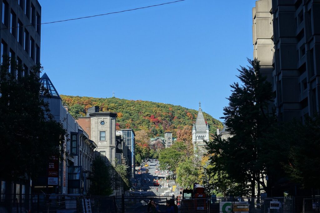
Mount Royal rises above Montréal, the city that takes its name from this wooded hill. Photo by Guilhem Vellut, licensed under CC BY 2.0, via Wikimedia Commons
The road becomes more technically broken as well. Corners, intersections and shorter straight sections interrupt the long aerodynamic rhythm established beside the river and on Île Notre-Dame. Riders who have spent most of the course holding a fixed position now have to accelerate repeatedly while already close to their physiological limit.
That is why the course’s 220 metres of total climbing can be misleading. The number is modest, but elevation arriving after thirty kilometres of World Championship effort has a different effect from elevation encountered while the rider is fresh.
The final approach towards Avenue du Parc rises only gently by normal road standards, yet the change in gradient forces riders out of the pure speed rhythm that has defined much of the previous half-hour.
The mountain from which the course began now returns to the centre of the landscape.
THE FINAL RISE · AVENUE DU PARC
The last roughly half-kilometre rises at around 4% on average, with steeper moments close to the finish.
On an ordinary ride, that would barely register as a climb. At the end of a World Championship time trial, it changes the pacing equation.
The long straights beside the river and through the Circuit Gilles-Villeneuve reward sustained aerodynamic efficiency, but the final rise reduces speed and therefore reduces the relative importance of drag. Power and fatigue become more visible.
A rider who has overextended on the flat sections may arrive with very little ability to accelerate. Another who has judged the course more carefully can still gain time precisely because the final gradient demands a different effort from the one used across the islands.
The finish sits beside Parc Jeanne-Mance, opposite the eastern slopes of Mount Royal.
FINISH · PARC JEANNE-MANCE AND ONE OF MONTRÉAL’S FOUNDERS
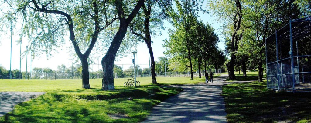
Parc Jeanne-Mance, the open green space beside Mount Royal in Montréal’s Plateau neighbourhood. Photo by Jeangagnon, licensed under CC BY-SA 3.0, via Wikimedia Commons
The World Championship ends after 39.2 kilometres beside Parc Jeanne-Mance.
The park is named for Jeanne Mance, one of the founders of Ville-Marie and one of the most important figures in the early history of French Montréal.
Born in France in 1606, Mance travelled to New France as part of the group that established Ville-Marie in 1642. She was not a peripheral figure in the settlement. She helped organise and finance the colony and founded the Hôtel-Dieu de Montréal, the city’s first hospital.
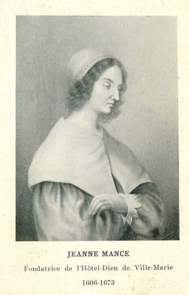
Jeanne Mance, co-founder of Montréal and founder of its Hôtel-Dieu hospital, in a 19th-century portrait by an unidentified artist. Public domain image from the Archives de la Ville de Montréal, via Wikimedia Commons.
In a small and isolated settlement vulnerable to disease and conflict, medical care was essential to survival. Mance administered the hospital and helped sustain the community through some of its most difficult early decades before her death in Montréal in 1673.
The park did not originally bear her name. For many years it was commonly known as Fletcher’s Field, after a British military figure whose precise connection with the place was uncertain. Montréal officially renamed it Parc Jeanne-Mance in 1990, placing the name of one of Ville-Marie’s founders onto one of the city’s major public green spaces.
The course finishes close to where it began, but the journey between those points has followed a different Montréal from the one seen on Mount Royal a week earlier.
The road has descended from the mountain towards the river that made the city strategically important, crossed the industrial southwest created by canals and railways, moved through infrastructure built to connect the Atlantic with the Great Lakes and reached islands that Montréal itself partly manufactured in the 20th century. It then passed through Expo 67, Formula One and the old colonial port before returning uphill towards the mountain.
What holds those places together is not one period of history but one persistent geography. Montréal has spent centuries adapting the narrow space between Mount Royal and the St Lawrence, first as an Indigenous travel corridor, then as a colonial settlement, a commercial port, an industrial city and finally a modern metropolis willing to remake its own shoreline.
The World Championship uses that same geography for 39.2 kilometres, and by the time the riders reach Parc Jeanne-Mance, the course has crossed far more than the city centre.



