
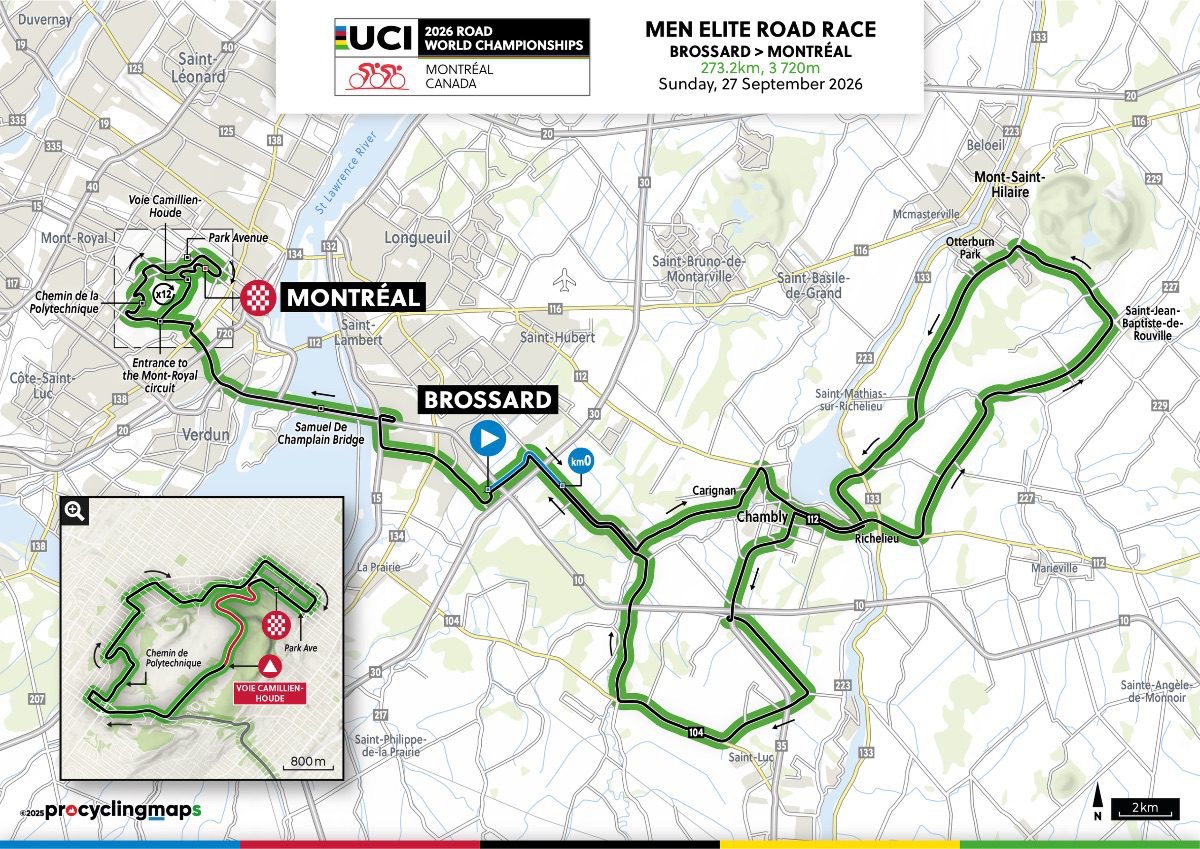

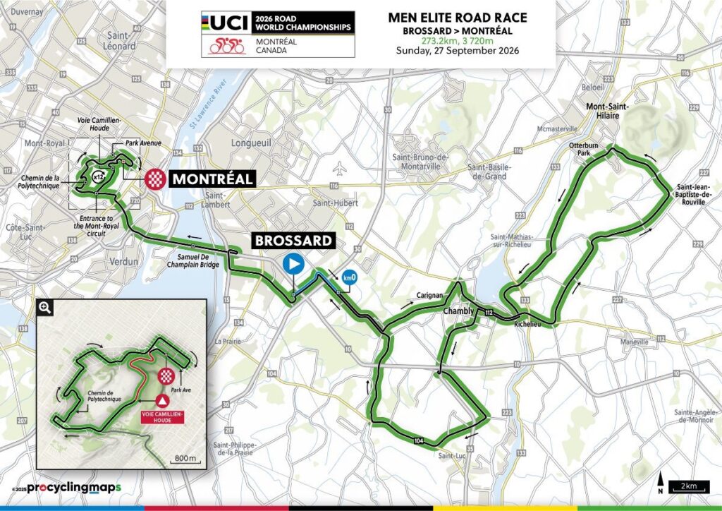
The 2026 Men Elite World Championship begins far from the circuit that will eventually decide it. Before Mount Royal, before the repeated climbs and before the familiar Montréal skyline closes around the race, the peloton spends more than one hundred kilometres crossing the open country of Montérégie, the agricultural region south and east of the city where the Richelieu River cuts through farmland, orchards and old military settlements beneath isolated wooded hills.
From Brossard, on the South Shore of the St Lawrence, the race moves through Carignan, Chambly, Mont-Saint-Hilaire, Richelieu, Saint-Jean-Baptiste, Saint-Jean-sur-Richelieu and Saint-Mathias-sur-Richelieu. The route follows landscapes shaped for thousands of years by movement along water: first Indigenous travel, then French and British military strategy, later commercial navigation and finally the suburban expansion of metropolitan Montréal. Only after roughly 113 kilometres does the peloton return to the St Lawrence and cross the Samuel-De Champlain Bridge.

On the other side waits the part of the race that viewers will recognise immediately. The riders enter a 13.4-kilometre circuit around Mount Royal and repeat it twelve times, adding more than 3,200 metres of climbing to legs already carrying the opening half of the day. The roads are familiar from the Grand Prix Cycliste de Montréal, so there is no reason to tell the same stories again. The mountain, Olmsted’s park, Polytechnique, Parc Jeanne-Mance and the modern Grand Prix have already had their place. Here, the interest lies in what repetition does to terrain that initially appears manageable.
The World Championship therefore unfolds in two movements. Montérégie provides distance, exposure and geography; Montréal takes those accumulated kilometres and compresses them into a circuit where every climb returns before the previous effort has fully disappeared. By the time the riders reach Avenue du Parc after 273.7 kilometres and 3,803 metres of climbing, the result will have been shaped by both landscapes.
START · Brossard and the South Shore of Montréal
The race begins in Brossard, a modern city on the southern bank of the St Lawrence directly opposite Montréal.
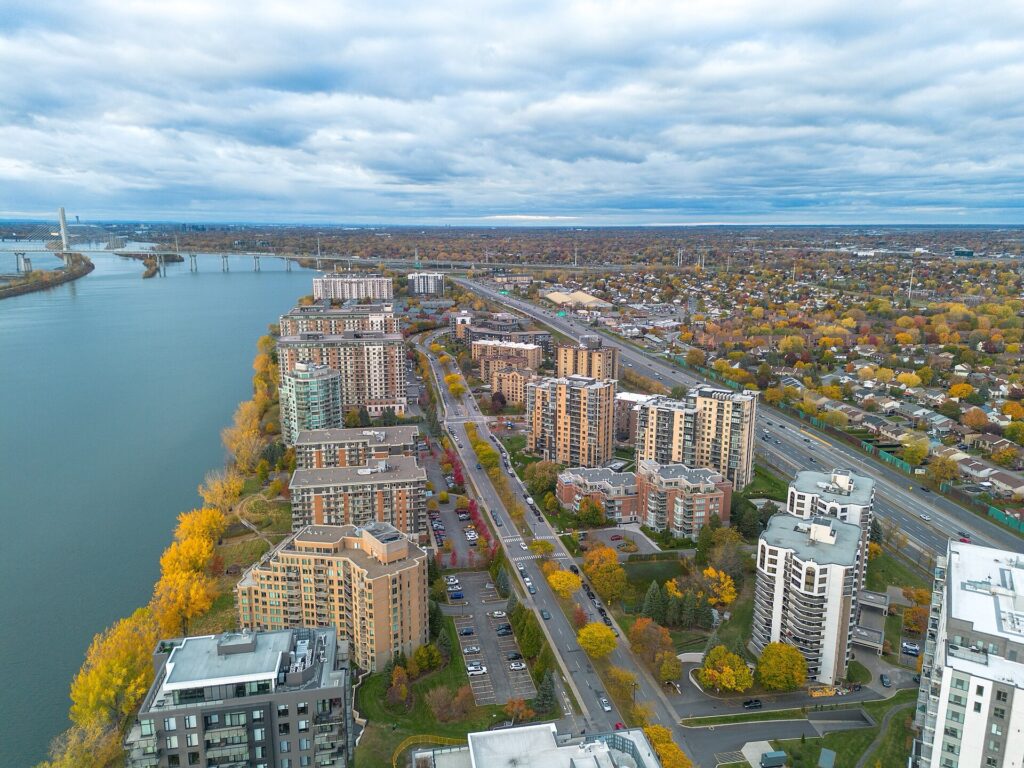
A view of Brossard, on the south shore of the St. Lawrence River across from Montréal. Photo by Hayden Soloviev, licensed under CC BY 4.0, via Wikimedia Commons
Much of Brossard’s present form is recent. Suburban growth accelerated during the second half of the 20th century as highways, bridges and later public transport tied the South Shore more closely to Montréal Island. Apartment blocks, commercial districts and residential neighbourhoods now occupy land that once belonged to a much more rural landscape.
That older landscape is part of the St Lawrence Lowlands, a broad corridor of relatively flat and fertile ground running along the river. Post-glacial seas, rivers and sediment created productive soils here, and the region became one of the principal zones of French colonial agriculture in Québec.
During the period of New France, rural land was often organised through the seigneurial system, with long narrow farms stretching back from roads and rivers. The shape allowed many households to reach water and transport routes without giving each farm a broad frontage. In parts of southern Québec, those elongated strips remain visible in the modern landscape even where suburbs have spread around them.
The race leaves Brossard quickly. Within a short distance, the urban fringe begins to loosen and water starts to organise the route.
Carignan · Where the River Divides the Landscape
Carignan lies east of Brossard, in a landscape broken apart by the Richelieu River, the Chambly Basin and a network of channels and islands.
The Richelieu is the central geographical feature of the first half of the race. It flows north from Lake Champlain, on the modern Canada-United States border, towards the St Lawrence, creating a natural corridor through southern Québec.
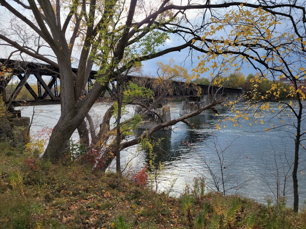
A railway bridge crosses the Richelieu River southeast of Montréal. Photo by Veillg1, licensed under CC BY-SA 4.0, via Wikimedia Commons
Long before Europeans arrived, waterways such as the Richelieu were part of an Indigenous geography of travel, trade, fishing and seasonal movement. Canoes could move efficiently along rivers that cut through otherwise heavily forested country, and the valley connected communities across what are now two countries.
European colonial powers immediately recognised the same advantage. The river was not simply water. It was a route towards Montréal.
The peloton follows it towards Chambly, where that strategic importance became visible in fortifications.
Chambly · A Fort on the Road to Montréal
Chambly stands beside the broad Chambly Basin, where the Richelieu widens before narrowing again farther south.
At the edge of the water is Fort Chambly, a compact stone fortress whose location reflects the anxieties of New France. French authorities understood that armies approaching from the south could use the Richelieu valley as one of the most direct corridors towards Montréal.
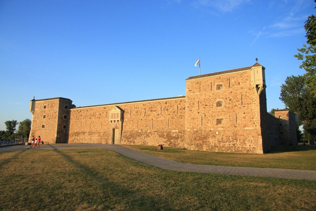
Fort Chambly, the stone fortress built by the French beside the Richelieu River in Québec. Photo by Cephas, licensed under CC BY-SA 3.0, via Wikimedia Commons
In 1665, soldiers of the Carignan-Salières Regiment built the first wooden fort here. Several timber structures occupied the site before the present stone fortification was completed in the early 18th century.
The political map changed after Britain conquered New France, but the military logic of the river remained. During the American Revolution and again during the War of 1812, the Richelieu corridor retained strategic importance because Lake Champlain and the Hudson Valley created a natural route between the United States and the St Lawrence.
Over time, however, the river’s importance shifted from defence towards commerce.
The problem was that the Richelieu was not continuously navigable.
Rapids stood in the way.
Chambly Canal · Turning a Military Corridor Into a Trade Route
Between Chambly and Saint-Jean-sur-Richelieu, rapids forced boats to stop or transfer cargo around sections of the river.
During the 19th century, engineers began cutting a bypass.
Construction of the Chambly Canal started in 1831 and was finally completed in 1843. Running for roughly twenty kilometres, the canal allowed boats to move around the rapids and created a more reliable route between the St Lawrence and Lake Champlain.
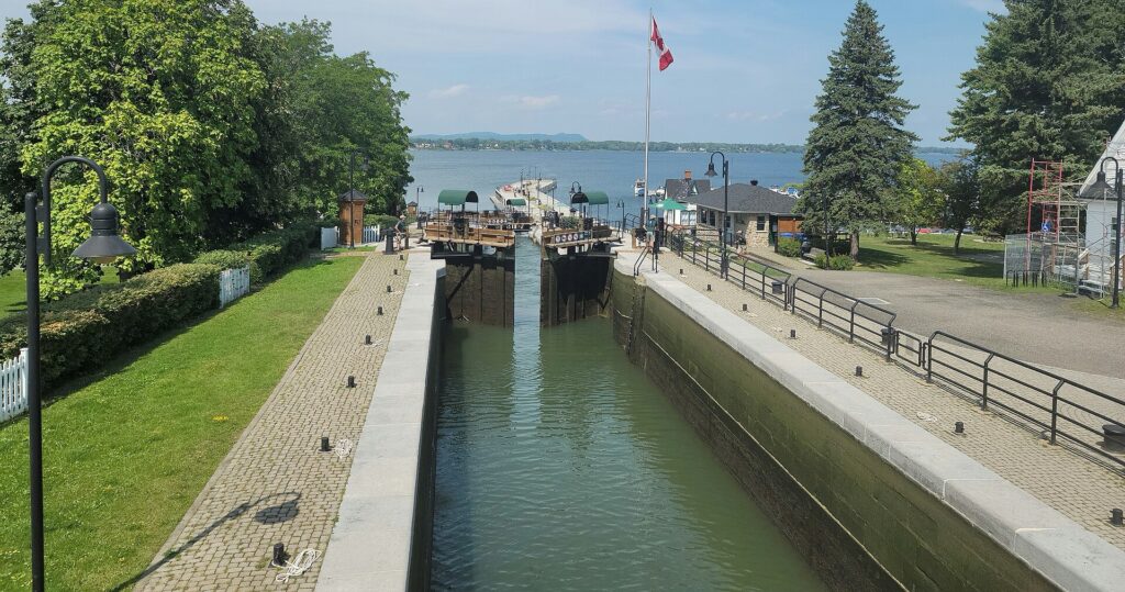
A lock opens for a boat on Québec’s Chambly Canal, with the Chambly Basin in the background. The canal links the basin to Saint-Jean-sur-Richelieu. Photo by Veillg1, licensed under CC BY-SA 4.0, via Wikimedia Commons
The commercial effect was immediate. Timber moved south towards the United States, while coal and manufactured goods travelled north. The Richelieu valley became a cross-border trading corridor, linking Montréal to the Hudson system and New York.
The canal’s role declined as railways and roads became more important, and commercial barges gradually gave way to pleasure boats. Today its towpaths and banks are also used for walking and cycling.
The race passes through a landscape where infrastructure built for freight has become part of a recreational corridor, while professional cyclists cross the same geography at a very different speed.
Beyond Chambly, the horizon changes.
A wooded mountain begins rising almost alone from the plain.
Mont-Saint-Hilaire · A Mountain That Is Not a Volcano
Mont-Saint-Hilaire is both a town and an isolated mountain standing beside the Richelieu River.
The mountain rises a little above 400 metres, which would be modest by the standards of professional cycling, but the surrounding plain is so flat that the effect is striking. From a distance, the mountain appears almost detached from the landscape around it.
It belongs to the Montérégian Hills, a chain of isolated elevations stretching across southern Québec.
Their form has encouraged a persistent misconception that they are extinct volcanoes. In reality, the geology is more unusual. Around 120 million years ago, magma intruded deep underground but cooled before reaching the surface. Over immense periods, erosion removed softer surrounding rock and gradually exposed the harder intrusive bodies.
The mountains seen today are therefore remnants of rock that once formed far below the surface.
That geological history gives Montérégie one of its most distinctive visual characteristics: broad farmland interrupted by isolated wooded hills.
Mont Saint-Hilaire is also important ecologically, preserving old-growth forest, wetlands and a remarkable range of plant and animal life close to metropolitan Montréal.
For the riders, however, the mountain first appears as a landmark. It stands above a countryside entering one of its busiest agricultural periods of the year.
Montérégie in September · Orchards at Harvest
Late September is apple season in southern Québec.
The slopes and lower country around Mont Saint-Hilaire, Mont Rougemont and neighbouring hills contain some of the province’s most important orchards. The combination of fertile soils, drainage, summer warmth and the local conditions created around the Montérégian Hills has made the region particularly suitable for apple growing.
The harvest is economic, but also cultural. Families travel from Montréal and other towns for apple picking, cider and farm markets, and orchards become part of the seasonal identity of Montérégie.
For television viewers abroad, this part of the World Championship will look very different from the densely built city circuit that comes later. The road runs through farmland, small communities and open country where church towers and wooded hills stand above long views across the fields.
The race continues through Richelieu, a small town whose name belongs to the river that has organised the day so far.
Richelieu · A River That Kept Reusing the Same Route
The town of Richelieu sits beside the river of the same name.
The modern French name ultimately refers to Cardinal Richelieu, chief minister to Louis XIII, though the waterway had Indigenous and other colonial names before the present one became established.
By the time the race reaches this section, the same geographical idea has repeated itself several times without needing to be forced.
The river first served Indigenous movement, then became a military corridor for colonial powers, and later a commercial route once engineers built around its rapids. Roads and settlements followed the same general line because the valley kept offering the easiest passage through the region.
The peloton now leaves the immediate riverbank and heads towards Saint-Jean-Baptiste, where the countryside opens beneath another isolated hill.
Saint-Jean-Baptiste and Mont Rougemont · Agriculture Between the Hills
Saint-Jean-Baptiste is a rural municipality east of the Richelieu, set between Mont Saint-Hilaire and Mont Rougemont.
Rougemont belongs to the same geological family as Mont Saint-Hilaire and rises sharply from the agricultural plain. Its slopes have become particularly associated with apple orchards and cider production.
The mountains here matter less as climbs than as organisers of the landscape. They influence drainage, exposure, agriculture and settlement, while remaining visible for kilometres because the surrounding country offers so few competing elevations.
In most professional races, mountains are reduced quickly to gradient and distance. In Montérégie, their presence is more geographical than sporting.
The World Championship turns south-west again and returns to the Richelieu at the largest city in the valley.
Saint-Jean-sur-Richelieu · The Gateway to Lake Champlain
Saint-Jean-sur-Richelieu stands on the river roughly forty kilometres south-east of Montréal.
Its position made it important almost from the beginning of French colonial settlement. A fort was established here during the 17th century as part of the same defensive system that included Chambly, protecting the route between Montréal and Lake Champlain.
After Britain took control of New France, Saint-Jean remained strategically valuable. During the American Revolution, troops from the rebelling colonies moved north through the Richelieu corridor during their attempted invasion of Québec. British authorities continued to regard the valley as a potential invasion route afterward, particularly during the War of 1812.
Commerce eventually became more important than defence.
The southern end of the Chambly Canal begins here, turning Saint-Jean into part of a continuous water connection between Montréal and Lake Champlain. Shipping, customs and later railways strengthened the town’s role as a gateway between Canada and the United States.
The river has now carried the race through almost a complete history of movement in southern Québec.
The peloton turns north again.
Saint-Mathias-sur-Richelieu · Following the River Back Towards Montréal
Saint-Mathias-sur-Richelieu lies on the eastern bank north of Saint-Jean, with farms reaching close to the water.
The settlement belongs to the old rural geography of Québec, where parish churches, rivers and roads formed the basic structure around which communities developed.
During the 19th century, local merchants and landowners supported improvements to navigation because easier movement along the Richelieu promised access to larger markets. The canal was not simply a distant engineering project imposed on the valley. Communities along the river had their own economic reasons for wanting the rapids bypassed.
As the race continues north, the landscape begins changing almost imperceptibly.
Fields remain, but suburbs grow denser. Rural roads feed into larger metropolitan arteries. The Montérégian hills begin to fall behind the peloton, and Montréal slowly returns to the horizon.
The St Lawrence is ahead.
THE SAMUEL-DE CHAMPLAIN BRIDGE · FROM MONTÉRÉGIE TO MONTRÉAL
The peloton reaches the Samuel-De Champlain Bridge, the immense modern crossing linking the South Shore with Montréal.
The present bridge opened in 2019, replacing the original Champlain Bridge that had carried traffic across the river since 1962. It now carries road traffic, a central corridor for Montréal’s automated REM light-rail network, and a separated path for cyclists and pedestrians.
For the World Championship, the bridge is a geographical hinge.
The opening hundred kilometres have belonged to the Richelieu valley, Montérégie’s agricultural plain and the South Shore. The St Lawrence now separates that landscape from the circuit that will dominate the rest of the race.
When the riders reach Montréal, 160.8 kilometres remain.
Twelve laps of Mount Royal are still ahead.
-160.8 km · MOUNT ROYAL BEGINS
The circuit measures 13.4 kilometres and contains around 269 metres of climbing per lap.
Twelve repetitions add more than 3,200 metres of vertical gain after the riders have already spent well over one hundred kilometres crossing Montérégie.
The central ascent is Voie Camillien-Houde, 1.67 kilometres at an average gradient of 7.4%, with steeper sections around 10%. Later on the circuit, the university side rises more sharply in places, with gradients above 11%, before the route bends back towards Avenue du Parc.
The roads themselves are already familiar from the Grand Prix Cycliste de Montréal. What changes here is the arithmetic.
One passage of Camillien-Houde is a climb. Twelve passages become a method of attrition.
The same applies to every descent, acceleration and position fight that follows. None is decisive on its own, but each removes a little more from the riders who will have to repeat the sequence again.
The circuit’s main climb also carries a name whose history deserves attention.
Camillien Houde · The Political Life Behind a Cycling Climb
Voie Camillien-Houde is named after one of Montréal’s most distinctive politicians of the 20th century.
Born in 1889, Camillien Houde built a career on populist appeal and an unusual ability to return after political defeat. He served several periods as mayor of Montréal between the late 1920s and 1950s and also held seats in provincial and federal politics.
His most controversial period came during the Second World War.
In 1940, Houde publicly urged Montréalers to resist compulsory national registration introduced by the Canadian government. Many French Canadians feared that registration would eventually lead to compulsory overseas military service, reviving memories of the bitter conscription crisis of the First World War.
Canadian authorities arrested Houde under wartime powers and interned him without trial for several years.
The episode divided opinion sharply. Supporters saw him as resisting federal coercion and defending French Canadian autonomy. Critics regarded his actions as irresponsible while Canada was fighting Nazi Germany.
When Houde returned to Montréal in 1944, large crowds greeted him, and he later returned again to the mayor’s office.
Today, his name survives most visibly for cycling fans on a road climbing through Mount Royal Park.
The World Championship will pass it twelve times.
THE LONG MIDDLE OF THE RACE · WHEN REPETITION BECOMES THE SUBJECT
The first laps around Mount Royal do not need drama.
National teams are still relatively intact, feeding is still manageable and the distance remaining discourages reckless commitment. Riders learn the rhythm of the circuit while trying to spend as little energy as possible.
But the circuit never really allows complete recovery.
Camillien-Houde raises the effort, the descent requires attention and position, the university side interrupts the rhythm again, and Avenue du Parc drags the race back towards another lap.
The climbs do not change.
The accumulated cost does.
After six laps, the riders have added more than 1,600 metres of climbing to the opening hours through Montérégie. After eight, the total begins to resemble the elevation of a genuinely mountainous one-day race. By ten, the same roads that felt manageable in the first hour of the circuit begin exposing differences that had been invisible earlier.
That is where Montréal’s design works best.
The circuit does not rely on one spectacular obstacle. It makes riders repeatedly answer the same physical question until fewer of them can give the same response.
THE RAINBOW JERSEY · A TITLE THAT MOVES WITH THE RIDER
At the end of the day, one rider will earn the right to wear the rainbow jersey for the following year.
The jersey’s white background carries five coloured horizontal bands and identifies the reigning World Champion in the discipline in which the title was won.
Its importance comes partly from duration.
A stage-race leader’s jersey may disappear the following afternoon. A Monument victory becomes part of a palmarès but does not alter what the winner wears in every subsequent race. The rainbow jersey follows its owner through an entire season.
The World Championship also cannot be repeated on the same roads the following year.
A rider who loses in Montréal does not return twelve months later for another chance on Mount Royal. The next championship will take place somewhere else, with different terrain and a different tactical problem.
That scarcity has always given the Worlds a slightly different emotional weight from the great annual Classics.
Montréal already occupies an important place in that history.
MONTRÉAL 1974 · WHEN THE WORLDS LEFT EUROPE
In 1974, Montréal became the first city outside Europe to host the complete UCI Road World Championships programme.
Professional road cycling at the time remained overwhelmingly European in its major races, teams and traditions. Bringing the championship across the Atlantic required the sport to operate outside its familiar centre of gravity.
The men’s road race covered 21 laps of a 12.5-kilometre circuit, totalling 262.5 kilometres. Only eighteen of the seventy starters reached the finish.
Eddy Merckx won his third world title and completed the Giro d’Italia, Tour de France and World Championship in the same season.
His victory became the lasting image of the event, but Montréal’s role was broader than one result. The city demonstrated that the World Championships did not have to remain geographically tied to Europe.
In later decades, the event travelled to the United States, Colombia, Australia, Qatar, Rwanda and other destinations, while professional cycling itself developed a much more international calendar.
By 2026, a World Championship in Canada no longer feels like an experiment.
The sport has changed enough that Montréal’s old precedent now feels normal.
-80.4 km · SIX LAPS TO GO
With 80.4 kilometres remaining, six circuits are left.
The race has already travelled more than 190 kilometres, and the central problem begins to shift from patience towards survival.
National teams start losing numbers. Riders who spent too much energy covering attacks in Montérégie or during the opening laps begin to fade. Mechanical problems become more expensive because returning through a fractured field is harder than it was earlier.
The unusual structure of World Championship teams also matters more now.
Trade squads spend an entire season establishing roles. National selections exist for only a few days, and riders who normally compete against one another may suddenly be asked to cooperate. Some countries arrive with obvious leaders and enough depth to control the race. Others need to anticipate because they cannot match the strongest teams rider for rider.
Those differences become increasingly visible as the circuit removes domestiques.
The race begins to narrow.
-53.6 km · FOUR LAPS TO GO
At 53.6 kilometres remaining, four laps are left.
The distance is still substantial, but the number of opportunities is no longer large.
Earlier in the circuit, an attack could fail and another chance would arrive soon enough. Now each move forces a more serious decision.
Camillien-Houde is hard enough to create separation but not hard enough to make that separation permanent by itself. The university side can widen a gap. Descents can reward riders willing to take risks. Avenue du Parc gives organised chasers enough room to work.
That balance is what keeps the finale open.
The circuit offers repeated opportunities without identifying one obvious place where the race must be won.
Teams have to decide how many riders they are willing to spend before the final two laps. Leaders have to decide whether waiting is patience or simply delay.
By now, the first hundred kilometres through Montérégie have become invisible but not irrelevant.
Everything spent there is still present in the legs.
-40.2 km · THREE LAPS TO GO
With 40.2 kilometres remaining, the riders begin another lap of roads they know completely.
The contrast with 1974 becomes particularly clear here.
That championship was entirely a circuit race. The modern course reaches Mount Royal only after more than one hundred kilometres through the South Shore and Richelieu country.
Even if the opening section produces no decisive breakaway, it adds distance, wind exposure, accelerations through towns and hours of energy expenditure before the circuit begins.
Mount Royal does not create all the fatigue.
It concentrates it.
A rider who entered Montréal slightly depleted may hide the difference for several laps. With three remaining, the same gradients become less forgiving.
The circuit has stopped being repetitive because each passage now carries more consequence than the last.
-26.8 km · TWO LAPS TO GO
At 26.8 kilometres remaining, the race has only two complete circuits left.
Camillien-Houde will be climbed twice more.
For riders who need to avoid a reduced sprint, the number of remaining chances has become small enough that hesitation itself carries a cost. A move postponed now may never have another opportunity.
National teams also reach the point where collective plans become individual decisions.
A rider sent to chase may be spending the last energy that could have kept him in contention. A leader waiting for support may discover another nation has already created the decisive split. Two riders from the same country can still share a jersey while wanting the same title.
World Championships compress those tensions into one afternoon because nobody can return to the same course the following season.
There is only Montréal.
FINAL LAP · -13.4 km
The bell marks 13.4 kilometres remaining.
The course needs no further explanation. Every surviving rider has already crossed these roads eleven times.
The final ascent of Camillien-Houde is the last sustained opportunity to use climbing strength. Riders who reach the summit together still have the university side, where the sharper gradients provide one more place for acceleration, before the circuit begins resolving towards Avenue du Parc.
By now, positioning and power have become inseparable. A rider can possess the strength to attack and still be trapped behind the wrong wheel. Another can enter the climb perfectly placed and discover that eleven previous laps have removed the acceleration needed to use that position.
The finish itself rises gently.
After nearly 274 kilometres, even modest gradients become meaningful because there is no recovery left to follow them.
FINISH · Avenue du Parc and the Return of the Rainbow Jersey to Montréal
The Men Elite World Championship finishes on Avenue du Parc, beside the eastern side of Mount Royal.
The road has already appeared in the Montréal Grand Prix and in the World Championship time trial, but the men’s road race reaches it through a different journey.
The riders began on the opposite side of the St Lawrence in Brossard and spent more than one hundred kilometres following a landscape whose basic geography has been reused repeatedly across history. The Richelieu carried Indigenous travellers before Europeans arrived. French and British authorities fortified it because armies recognised the same north-south corridor. Engineers later cut the Chambly Canal because merchants needed a navigable route around the rapids. Orchards spread beneath the Montérégian hills, while Montréal’s suburbs eventually pushed outward towards the same agricultural plain.
The Samuel-De Champlain Bridge then carried the race across the St Lawrence and into twelve laps around Mount Royal.
From that point onward, history receded behind repetition. The mountain did not need another story because the road itself became the subject, climbed and descended until familiarity turned into fatigue.
Montréal hosted the complete World Championships outside Europe for the first time in 1974. Fifty-two years later, the sport returns with a route that begins by showing more of southern Québec before asking the same central question of Mount Royal.
Not whether the climb is difficult once, but what remains after twelve passages.
That answer will decide who leaves Montréal in the rainbow jersey.



