

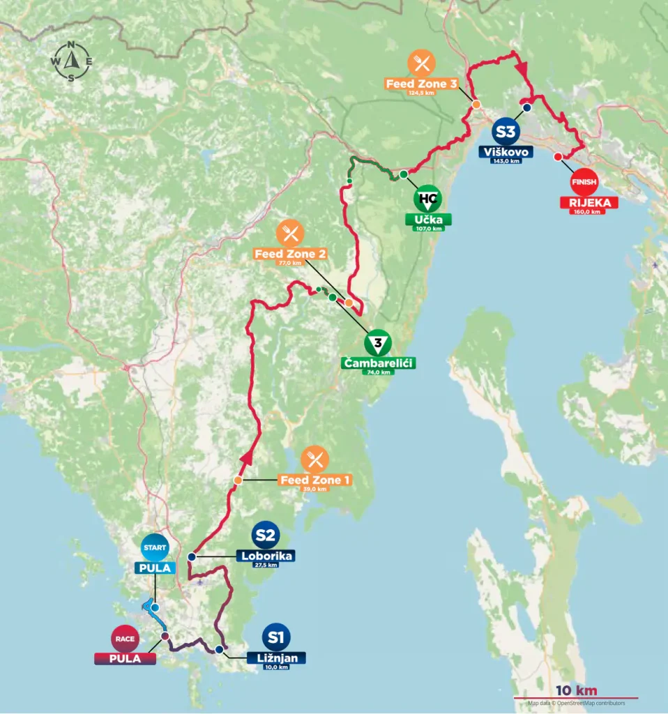
The fourth stage of the CRO Race crosses the Istrian peninsula from south to north-east, beginning beside one of the greatest surviving buildings of the Roman Adriatic and finishing in a city whose modern identity was created by ships, factories and the competition between Central European powers for access to the sea. Between Pula and Rijeka, however, the route avoids the straightforward coastal journey. It travels through the villages of southern Istria, passes close to the remains of the people who lived here before the Roman conquest, reaches a broad agricultural plain that was still a lake less than a century ago, and then climbs into Učka, the mountain barrier separating Istria from the Kvarner Gulf.
That crossing gives the stage a different shape from the previous day’s journey from Krk to Labin. Stage 3 approached Učka from the sea and followed its eastern foot through Opatija, Lovran and the old settlements overlooking Kvarner. Stage 4 begins on the other side of the mountain and eventually has to cross it, climbing through Vela Učka before descending towards the densely settled country behind Rijeka. The official itinerary then makes a long northern approach through Viškovo and the hills above the city before the race finally drops into central Rijeka and reaches the Riva beside the port.
START · Pula and the Roman Arena
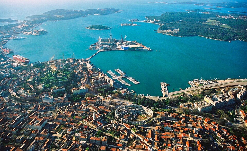
The race begins beside the Pula Arena, an amphitheatre so complete that it can obscure an important fact about the city around it: Roman Pula was not an isolated military outpost at the edge of the empire, but a substantial colonial city embedded in the economic life of the northern Adriatic.
Known to the Romans as Colonia Pietas Iulia Pola, Pula developed after Rome consolidated its control of the Istrian peninsula. The amphitheatre was built during the 1st century AD, with major construction associated with the Flavian period, when Emperor Vespasian also began the Colosseum in Rome. Its position just outside the ancient city walls was normal for a building expected to accommodate enormous crowds, and at its height the arena could hold roughly 20,000 spectators for gladiatorial combat, animal hunts and other public spectacles.
What survives is unusually revealing because much of the external wall remains standing, including the four distinctive towers projecting from it. The pale limestone came from Istria itself, linking one of the city’s most monumental Roman buildings directly to the geology of the peninsula through which the stage will travel. Beneath the arena floor, passages once accommodated gladiators, animals and equipment, while the seating above was organised according to Roman social hierarchy, turning a day of entertainment into a physical representation of status as well as spectacle.
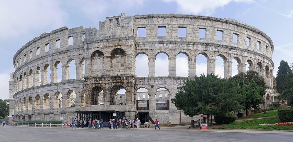
Pula continued to reuse its Roman city long after the empire disappeared. The Temple of Augustus still faces the old forum, the Arch of the Sergii remains embedded in the street plan, and fragments of Roman gates, walls and theatres survive among much later buildings. The Arena itself escaped the more complete destruction suffered by many ancient amphitheatres, although stone was removed from it over the centuries, and today it remains a functioning public space used for concerts and the Pula Film Festival.
For the riders, it is not merely scenery at the start. The official course actually circles through central Pula and returns past the Arena before leaving the city, giving the peloton a second encounter with the monument before the road turns south-east towards Medulin and Ližnjan.
Valtura · Before Roman Istria, the Histri and Nesactium
After passing through the low country around Medulin, Ližnjan and Šišan, the race reaches Valtura, a village east of Pula where one of the most important archaeological sites in Croatia lies only a short distance from the route. The ruins are called Nesactium, and understanding them requires going back beyond the Roman monuments that dominate the beginning of the stage.
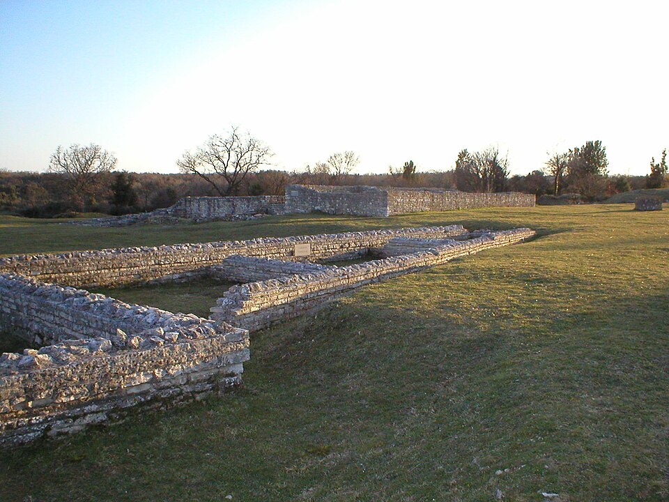
The name Istria ultimately preserves the memory of the Histri, an Iron Age people who inhabited the peninsula before Roman conquest. They lived in fortified settlements, often occupying defensible hills, and participated in the maritime and trading networks of the northern Adriatic. Nesactium, positioned on a hill above Budava Bay, became their principal political centre and is described in ancient sources as the seat of their king.
Rome’s expansion into the northern Adriatic brought the Histri into direct conflict with a much larger Mediterranean power. The decisive campaign came in 177 BC, when Roman forces attacked Nesactium during the Second Histrian War. The fall of the settlement effectively ended independent Histrian resistance and opened the way for the much deeper Romanisation of the peninsula that would eventually produce cities such as the Pula encountered at the start of today’s stage.
Nesactium did not disappear when the Histri were defeated. The Romans rebuilt and occupied the site, adding a forum, temples and other structures, while settlement continued into late antiquity. Archaeologists therefore find several Istrias occupying the same hill: the prehistoric fortified centre of the Histri, a Roman town created after conquest, and a later Christian settlement. Excavations begun in the early 20th century produced such important material that discoveries from Nesactium helped form the collections from which Pula’s archaeological museum developed.
The race passes Valtura without climbing to the ruins, but the proximity matters. Within the opening kilometres of Stage 4, the road has connected the monumental architecture of Roman Pula with the political centre of the people Rome had to defeat before that Roman landscape could exist.
Across Southern Istria · The Red Earth Behind the Coast
Beyond Valtura, the route moves through Loborika, Marčana and Manjadvorci, leaving the heavily visited coastline for an Istrian landscape that many travellers crossing the peninsula quickly by car never see. Villages are scattered among woodland, vineyards, olive groves and fields whose soil can be an intense rusty red, particularly across southern and western Istria.
The colour comes from terra rossa, the iron-rich soil that develops over limestone in Mediterranean karst regions. As limestone slowly dissolves, insoluble minerals remain behind and accumulate in depressions and pockets where agriculture becomes possible. The relationship between rock and soil helps explain the patchwork appearance of rural Istria, where exposed limestone can sit close to surprisingly fertile cultivated ground.
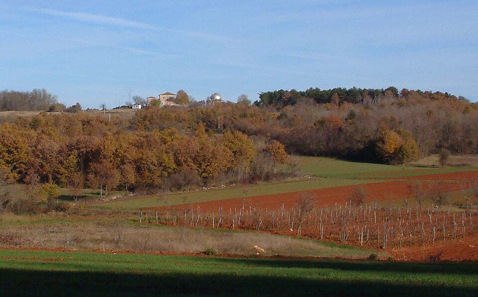
This is also the country behind Istria’s long tradition of wine and olive oil. Both existed here in antiquity, when Roman estates produced agricultural goods for markets connected by Adriatic shipping, and both survived through the political changes that followed. The peninsula later passed through Byzantine, Frankish, Venetian and Habsburg spheres, while its rural economy continued to depend on making productive use of relatively small areas of good soil among the karst.
The CRO Race spends a substantial part of Stage 4 in this interior rather than on the more familiar western coast around Rovinj or Poreč. Gradually the road turns north-east through the central-eastern peninsula, approaching Potpićan and Kršan, where the terrain begins to reveal a very different intervention in the Istrian landscape.
Čepić Field · The Farmland That Was a Lake Until 1932
Between Kršan and the foot of Učka, the race crosses Čepić Field, a broad, low and unusually flat area surrounded by hills. Nothing in the present agricultural landscape immediately suggests that until the 20th century much of this ground lay beneath water.
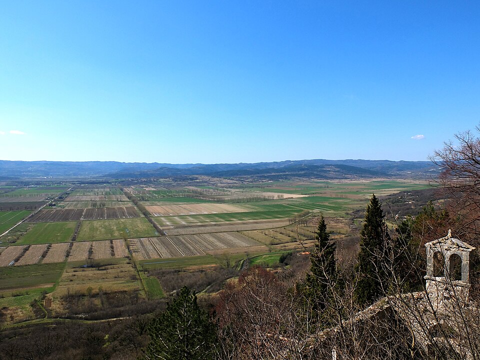
Lake Čepić was Istria’s only substantial natural lake. Its size varied with rainfall, generally covering somewhere between five and nine square kilometres, while reeds, wetlands and shallow water supported fish and bird life. The same marshy environment also provided ideal conditions for mosquitoes, and malaria was a persistent problem in this part of the peninsula.
Plans to drain the lake had circulated for years before a major engineering project finally transformed it. Workers excavated a tunnel through the rock towards Plomin Bay, creating an artificial outlet that allowed the water to escape to the Adriatic. When the drainage system was opened in 1932, the lake gradually emptied and its former bed was converted into agricultural land.
The change was profound enough that two generations could have known entirely different landscapes in the same place. Someone travelling here at the beginning of the 20th century would have encountered a shallow lake beneath Učka; the peloton crosses fields.
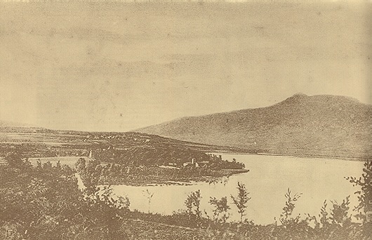
The project also belonged to a wider period of land reclamation carried out while Istria was under Italian rule between the world wars, when drainage schemes were promoted both for agriculture and for campaigns against malaria. Yet the old lake has not vanished completely from the geography. Water still has to be managed across the basin, and the extraordinary flatness of the cultivated ground continues to reveal the shape of what once occupied it.
From Čepić, the route reaches Boljunsko Polje and begins moving towards the mountain that has been visible across much of eastern Istria.
Učka · The Mountain Between Istria and Kvarner
Učka rises along the eastern edge of the Istrian peninsula, separating its interior from the Kvarner coast around Opatija and Rijeka. Its highest summit, Vojak, reaches 1,401 metres, high enough to dominate views across northern Istria and the islands of Kvarner, and the mountain’s position between maritime and continental climatic influences supports a much richer variety of vegetation than the exposed limestone landscapes encountered earlier in the race.
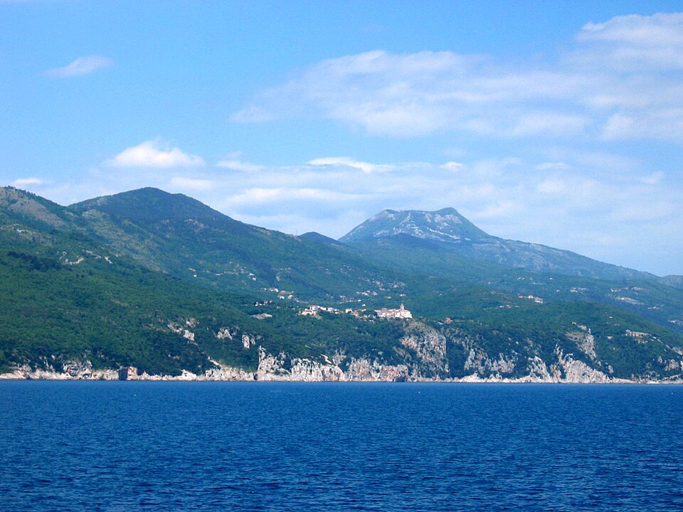
For an international reader looking at a map, Učka can appear to be simply another ridge in the Dinaric landscape running along the Adriatic. On the ground it functions as a genuine geographical wall. Roads between Istria and Rijeka have to find passes through or around it, and for centuries the mountain influenced how people, goods and pilgrims moved between the peninsula and the Kvarner Gulf.
The stage climbs through Vela Učka, entering the protected landscape of Učka Nature Park. Forest replaces much of the open agricultural country below, while the road gains height towards the central mountain zone. Nearby, the limestone has been cut into formations such as Vela Draga, a spectacular karst canyon where erosion has isolated towers and pillars of rock from the surrounding slopes. Učka also contains species with extraordinarily restricted ranges, including the Učka bellflower, Campanula tommasiniana, which grows naturally only along this mountain ridge.
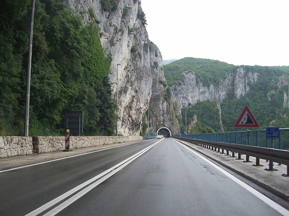
Human movement across Učka has left its own vocabulary on the landscape. The best-known crossing is Poklon Pass, at roughly 920 metres above sea level. Its Croatian name means a bow or act of reverence and is traditionally connected with pilgrims travelling from Istria towards the sanctuary of Our Lady of Trsat above Rijeka. After climbing the mountain, they could see Kvarner and the distant sanctuary and would bow towards it before continuing their journey. Long before roads and tunnels made the crossing routine, reaching this height marked the moment when Istria opened towards the sea on its eastern side.
Stage 4 uses this same mountain barrier for sporting rather than devotional reasons, climbing through Vela Učka before turning towards the Kvarner side. The significance of the ascent lies as much in what happens to the geography as in the gradient, because the summit area marks the point where the race finally leaves Istria behind.
Veprinac · The Old Town Above the Habsburg Riviera
The descent reaches Veprinac, a small historic settlement high above Opatija and the Kvarner Gulf. Stage 3 passed through Opatija itself and explored the transformation of that coastline into the fashionable Austrian Riviera of the 19th century, so there is little reason to repeat that history here. Veprinac offers the opposite perspective.
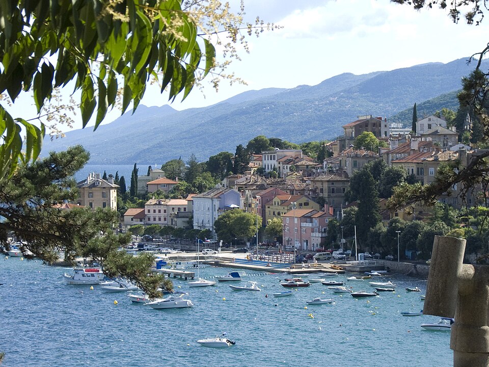
The old settlement occupies a steep position several hundred metres above the sea, and it existed long before aristocratic villas and grand hotels appeared on the shore below. Like many communities along this coast, Veprinac developed where elevation provided protection and control over routes through difficult terrain. Its compact centre, churches and surviving gate belong to the older human geography of Učka, when communities were oriented as much towards paths across the mountain and agricultural terraces as towards the waterfront.
Looking down from these slopes helps explain how unusual Opatija’s later development really was. For centuries, the secure settlements were often above the coast; during the 19th century, wealth moved downhill and began constructing villas almost at the water’s edge. The race now follows that relationship in reverse, descending from the older mountain country without returning to the resort shoreline covered on Stage 3.
Instead, the course turns north through Rukavac and Jurdani, beginning a broad arc through the hinterland of Rijeka.
Viškovo and the Kastav Country · The Croatian Hinterland Above Rijeka
The roads around Viškovo lead through a densely settled upland immediately north-west of Rijeka. For a visitor arriving at the city from the sea, these communities can easily disappear behind the much stronger visual identity of the port, yet they form part of an older Croatian-speaking hinterland whose history did not always follow the same political path as Rijeka itself.
Nearby Kastav, although the race does not pass directly through its old centre, provides the clearest example. The fortified hill town stood above the routes linking Istria, Kvarner and the interior, while Rijeka below developed under Habsburg and later Hungarian administration. The political borders of this region repeatedly shifted, and settlements only a few kilometres apart could find themselves under different administrations, languages of government and economic systems.
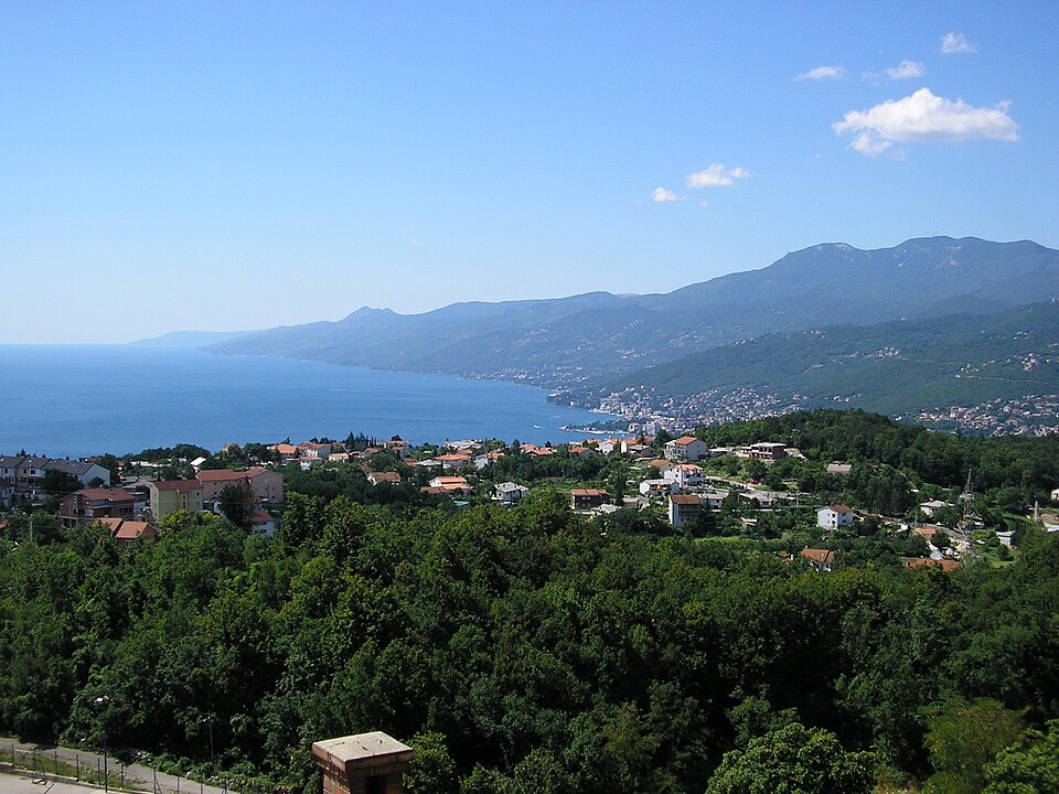
That distinction became especially sharp in the 19th and early 20th centuries, when Rijeka, widely known by its Italian name Fiume, grew into a major industrial port while the surrounding Croatian communities supplied workers, food and connections to the hinterland. The city and the country above it were therefore closely dependent on one another even when administrative boundaries attempted to separate them.
The stage approaches Rijeka through this upper landscape rather than arriving along the coast. After Viškovo, the road runs through Saršoni and begins dropping towards the valley of the Rječina, the short river from which the Croatian name Rijeka, literally “river”, derives.
At the bottom lies a city whose history is unusually complicated even by Adriatic standards.
Rijeka · The Port That Central Europe Needed
Rijeka occupies the northern end of the Kvarner Gulf, where the Adriatic penetrates deeply towards Central Europe. That position explains much of the city’s history. Mountains rise almost immediately behind the coast, but beyond them lie routes towards Zagreb, Hungary, Austria and the Danube basin. Whoever could connect those inland markets efficiently to Rijeka possessed a valuable maritime outlet.
The Habsburg emperor Charles VI declared Rijeka a free port in 1719, encouraging commerce by reducing many of the restrictions and customs burdens that constrained ordinary ports. Roads were then improved across the difficult hinterland, and during the 19th century railways finally connected the harbour directly with Central European markets. After the political reorganisation of the Habsburg lands in the second half of that century, Hungary treated Rijeka as its principal seaport and invested heavily in docks, warehouses, rail facilities and industry.
The result was not simply a larger harbour. Rijeka became an industrial city whose factories produced paper, machinery, engines and naval equipment, while shipyards and maritime companies connected it to ports far beyond the Adriatic. Its population grew increasingly diverse, with Croatian, Italian, Hungarian, German, Slovenian and other communities contributing to a city known in different languages and political contexts as Rijeka, Fiume and Sankt Veit am Flaum.
One invention made the city’s industrial reputation particularly international. In the 1860s, the Rijeka-born naval officer Giovanni Luppis, also known as Ivan Lupis, developed the idea of a remotely directed explosive craft intended for coastal defence. His concept eventually reached Robert Whitehead, an English engineer working in Rijeka’s marine engineering industry. Whitehead abandoned much of the original surface-vessel design and developed something radically different: a self-propelled weapon capable of travelling underwater towards a target while maintaining its depth.
The first successful Whitehead torpedo was presented in Rijeka in 1866. Navies quickly understood its implications, and the city’s torpedo factory became internationally important as the weapon spread through the world’s fleets. The familiar modern meaning of the word torpedo, an autonomous underwater projectile rather than a stationary mine or explosive boat, was largely established by the technology developed here.
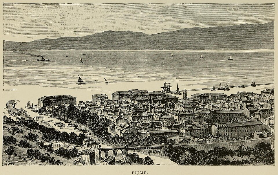
The peloton reaches Rijeka from the hills and follows the Rječina towards the old centre, where another chapter of the city’s history becomes visible. On the eastern side of the river lies Sušak, historically separated from Rijeka for periods when political frontiers ran directly through what is now a continuous urban area. After the First World War, the struggle over Rijeka became one of the strangest territorial disputes produced by the collapse of Austria-Hungary, involving Italy, the newly created South Slav state and the occupation led by the Italian nationalist poet and soldier Gabriele D’Annunzio. The city passed through several political arrangements before Rijeka and Sušak were finally reunited after the Second World War within Yugoslavia and, later, independent Croatia.
Those complications are easier to understand once the port is visible. Rijeka was repeatedly contested because it was not simply a coastal town; it was a piece of infrastructure connecting the Adriatic to a much larger continental economy.
FINISH · The Riva and the Harbour That Made Rijeka
The final streets carry the race through central Rijeka towards the Riva, the waterfront facing the harbour. The broad quays and port installations belong largely to the extraordinary expansion of the 19th and early 20th centuries, when engineers extended the shoreline, reclaimed land from the sea and constructed the docks required by a modern industrial port. What appears today as the natural edge of the city is therefore partly manufactured ground, built outward as Rijeka’s commercial ambitions grew.
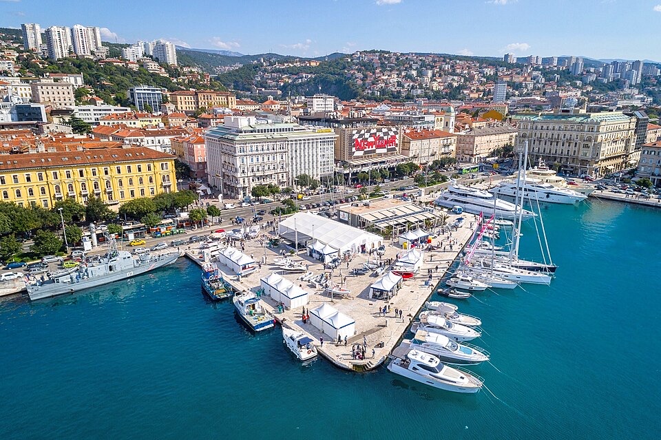
That makes the finish a fitting counterpart to the beginning in Pula. Both cities owe much of their historical importance to the Adriatic, but they represent very different moments in its history. Pula’s Arena belongs to the Roman Mediterranean, when imperial roads and sea lanes tied Istria to a political system centred on Rome. Rijeka’s waterfront belongs more strongly to the industrial age, when railways, steamships, factories and national ambitions turned the northern Adriatic into an outlet for Central Europe.
Between them, the race crosses landscapes where those larger histories are much less obvious but no less important. Near Valtura lie the remains of the Histri who occupied Istria before Rome; farther north, farmland covers the bed of a lake deliberately emptied in 1932; above it rises Učka, the mountain that for centuries complicated every journey between the peninsula and Kvarner. Once the road has crossed that barrier, the descent towards Rijeka brings the stage into a city whose harbour drew roads, railways, workers, industries and competing states towards the same narrow strip of coast.
The route therefore reaches the Riva only after crossing the geography that made such a port necessary. Istria lies behind the riders, Central Europe begins beyond the mountains, and Rijeka occupies the difficult space between them.



