

Around the Peloton: Münsterland Giro 2026
Borken → Münster · approximately 205 km · Saturday, 3 October 2026 · UCI ProSeries
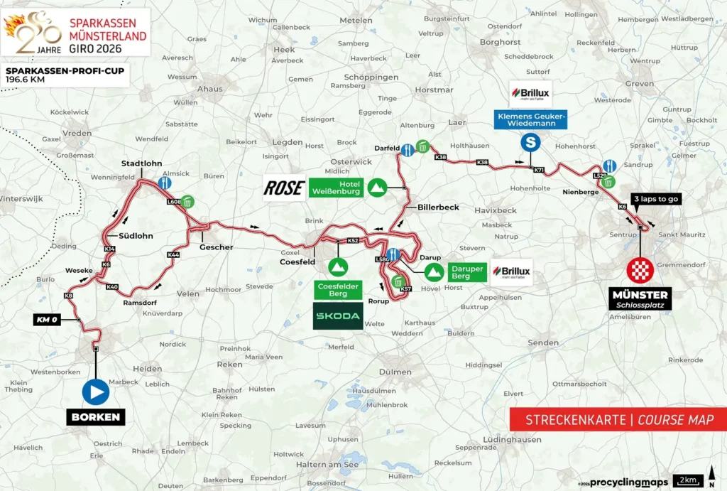
The Münsterland does not immediately suggest a landscape capable of complicating a professional bicycle race. Across much of this corner of north-western Germany, the horizon remains low, farms stand among hedges and small woods, and roads pass between fields with barely enough gradient to interrupt the view. Bicycles belong naturally here, particularly in Münster, where they are part of ordinary transport rather than simply a sporting culture. Yet the 2026 Münsterland Giro uses the region’s subtle changes in elevation to build a race whose most difficult roads arrive between two much flatter worlds.

For its 20th edition, the race starts in Borken for the first time and travels east towards Münster. The opening kilometres explore the western Münsterland close to the Dutch border, passing through a succession of old market towns whose histories were shaped by farming, textile production, Catholic institutions and trading routes across Westphalia. Around Coesfeld the ground begins to rise into the Baumberge, a compact hill country that is modest in absolute altitude but geologically and culturally distinct from the surrounding plain. Sandstone quarried there has travelled far beyond the hills, while springs on their slopes feed rivers flowing in several different directions.
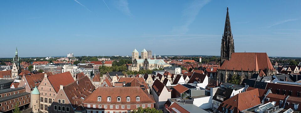
Once those hills are behind the riders, the landscape relaxes again. Billerbeck and Darfeld lead back towards the open country around Münster, where the race enters a city whose relationship with the bicycle is unusually intimate. The finish comes in front of the Schloss, the former residence of Münster’s prince-bishops, only a short distance from the streets where diplomats spent years negotiating an end to the Thirty Years’ War.
The professional race takes place on 3 October, German Unity Day, as it traditionally does. In 2026, the date brings together two more local anniversaries: Borken celebrates 800 years since receiving its town rights in 1226, while the Münsterland Giro reaches its twentieth edition.
START · Borken and Eight Centuries of a Westphalian Town
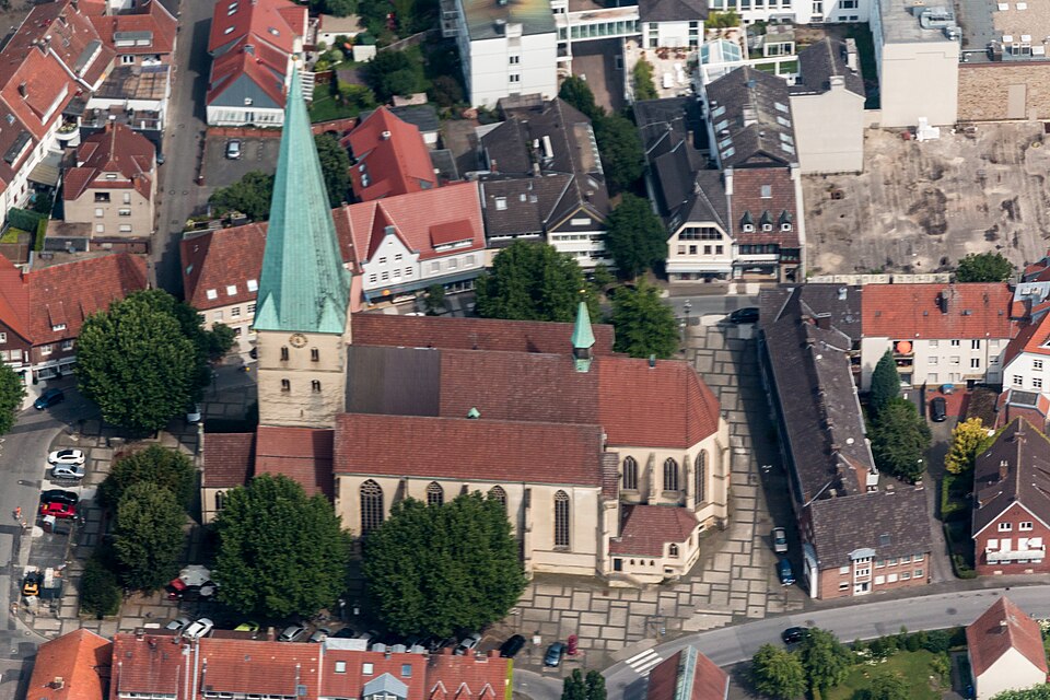
The race begins in Borken, a town in western Münsterland about ten kilometres from the modern Dutch border. That proximity helps orient the landscape from the beginning. This is not the Germany of Alpine valleys, the Rhine gorge or the industrial Ruhr. Borken belongs to the broad lowlands extending towards the Netherlands, where political borders have repeatedly divided a countryside connected by trade, language, religion and movement.
Borken received its town rights in 1226, making the 2026 start particularly appropriate during celebrations of its 800th anniversary. Medieval town rights were much more than ceremonial recognition. They could establish privileges concerning markets, local administration, taxation and legal jurisdiction, separating an urban community from the surrounding countryside and giving merchants and craftspeople a more secure environment in which to work.
The town developed within the Prince-Bishopric of Münster, one of the many territories that made up the Holy Roman Empire. A prince-bishop was both an ecclesiastical leader and a territorial ruler, combining authority over the Catholic diocese with secular government over lands that could include towns, farms, forests and castles. For centuries, much of the Münsterland was therefore governed from Münster by rulers whose position was simultaneously religious and political.
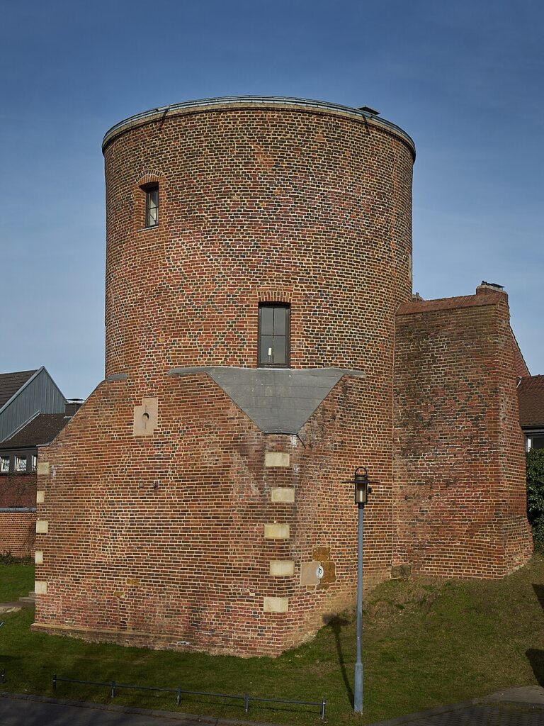
Borken was fortified with walls, gates and towers, although only fragments of that defensive system survive. Among the most recognisable remnants is the Holkensturm, a round brick tower incorporated into the medieval fortifications. Its survival gives some idea of the enclosed town that existed before modern streets expanded into the surrounding countryside.
That older Borken suffered heavily during the final months of the Second World War. Allied bombing in March 1945 destroyed much of the centre shortly before Allied forces advanced through the region. The rebuilt town consequently contains the same historical layering encountered in many German cities: medieval origins, fragments of older architecture and a large amount of reconstruction created after 1945.
The peloton leaves this compact urban centre and heads north through country that quickly becomes rural. Farms, hedges, patches of woodland and long straight roads begin to replace the streets, while the Netherlands remains only a short distance to the west.
-193 km · Weseke and the Beginning of the Western Loop
After approximately 12 kilometres, with about 193 kilometres remaining, the race reaches Weseke, where the first large loop begins.
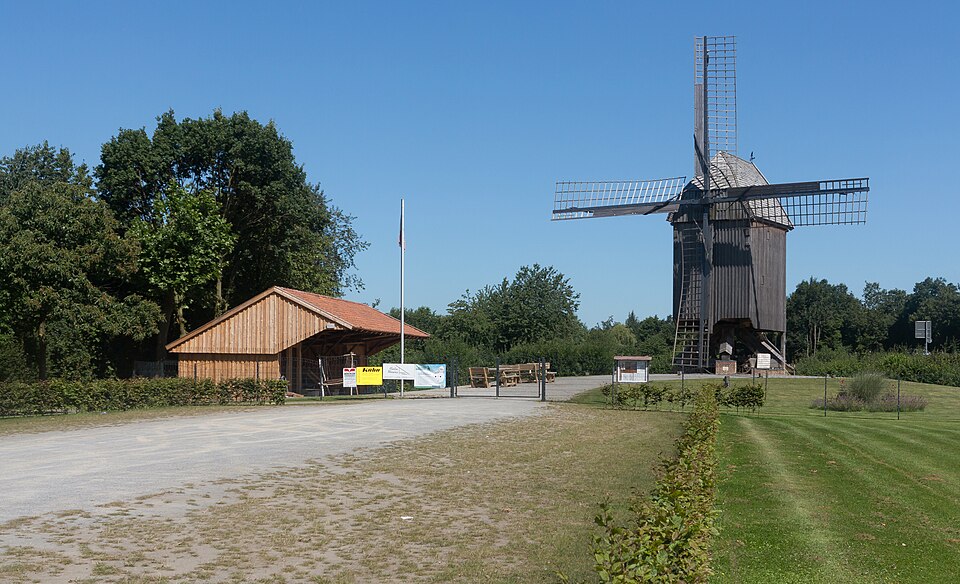
Weseke is now part of the municipality of Borken, but the settlement developed separately in an agricultural landscape characteristic of western Münsterland. The countryside here is not organised around dense villages surrounded by empty fields. Traditional settlement often included dispersed farmsteads, small hamlets and individual holdings connected by lanes, with hedges and stands of trees dividing the agricultural ground.
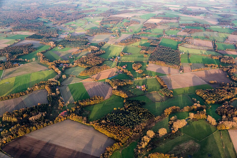
This scattered pattern contributed to what is often called the Münsterland park landscape, although the term can be misleading for an international reader. It does not describe a designed park in the manner of an aristocratic garden. Instead, fields, meadows, hedgerows, woodland, ponds and farms form a landscape whose alternation of open and enclosed spaces can resemble a vast cultivated park.
The riders encounter it repeatedly during the opening circuit. From Weseke the course runs through Südlohn, Stadtlohn, Gescher and Ramsdorf, completing roughly a 37-kilometre loop before returning towards Weseke and eventually turning east.
For the race, these are fast roads. Historically, they belong to a border country whose connections did not stop where the modern Netherlands begins.
Südlohn and the Dutch Border · A Frontier Across an Older Landscape
Südlohn lies only a few kilometres from the Netherlands, in countryside where the international boundary cuts across a landscape that looks essentially continuous on either side.
Modern national borders can make this part of Europe appear more divided historically than it often was. Communities in western Münsterland traded with towns across what is now the Dutch frontier, while dialects, family connections and commercial routes did not necessarily correspond to later state boundaries. The region stood between the German-speaking interior, the Rhine and the Low Countries, making westward connections as natural as those towards Münster.
Religion eventually made some of those differences sharper. The Dutch Republic became predominantly Protestant after the Reformation and its revolt against Habsburg Spain, while the Prince-Bishopric of Münster remained strongly Catholic. Churches, roadside crosses and pilgrimage traditions became particularly visible features of the Münsterland countryside, where Catholic identity remained deeply embedded in village life.
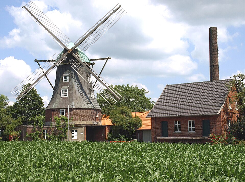
The political meaning of the border changed repeatedly as the states around it changed, while roads continued between farms and towns whose economic relationships were older than the customs posts that later separated them.
The race turns through that country towards Stadtlohn, where one of the great European conflicts of the 17th century once reached the fields of the Münsterland.
Stadtlohn · A Battle in the Thirty Years’ War
Stadtlohn looks like another small Westphalian town along the opening circuit, but nearby fields were the setting for a major battle of the Thirty Years’ War on 6 August 1623.
The Thirty Years’ War had begun in 1618 within the Holy Roman Empire, initially around disputes involving religion and political authority in Bohemia. It expanded into a much wider European conflict involving imperial forces, Protestant princes and foreign powers including Spain, Sweden and France. Armies repeatedly crossed German territories, financing themselves partly from the places through which they travelled, while civilian communities endured requisition, destruction, disease and displacement.
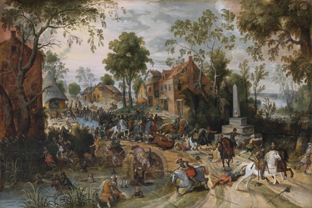
The Protestant commander Christian of Brunswick was attempting to move his army towards the Dutch Republic while being pursued by Catholic League forces commanded by Johann Tserclaes, Count of Tilly. Near Stadtlohn, Tilly caught him. The resulting battle ended in a severe defeat for Christian’s army, with thousands killed, wounded or captured and much of the force disintegrating.
The battle strengthened the Catholic position in north-western Germany during the early phase of the conflict, but it settled little permanently. The war continued for another quarter of a century, drawing in additional European powers and inflicting immense damage across parts of Central Europe.
Twenty-five years after armies fought outside Stadtlohn, diplomats in Münster and Osnabrück were completing the agreements that brought the conflict within the Holy Roman Empire to an end. The Münsterland Giro will reach Münster only after crossing much quieter versions of the same Westphalian countryside.
Gescher · Bells From the Münsterland
The circuit continues through Gescher, a small town with an unusual industrial tradition. It became one of Germany’s important centres for bell founding, a craft in which molten bronze is cast into large bells for churches, civic buildings and other institutions.
Bell founding demands a combination of metallurgy, acoustics and precision. A large church bell is not simply a bronze object that happens to ring. Its shape, thickness and alloy influence the frequencies produced when struck, while errors in casting can ruin an object weighing hundreds or thousands of kilograms. Traditional founders constructed moulds from several layers, prepared the metal and poured it at temperatures above one thousand degrees Celsius before allowing the casting to cool slowly.
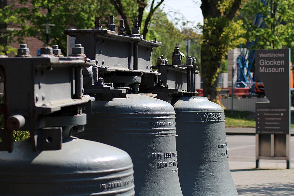
Gescher’s association with the craft became particularly important through the Petit & Gebr. Edelbrock foundry, whose history reaches back centuries. Bells made in the town have travelled far beyond Westphalia, giving a relatively small Münsterland community a connection with churches and towers across Germany and abroad.
Across the low countryside surrounding Gescher, church towers remain visible from considerable distances, sometimes identifying a settlement before the houses beneath them can be distinguished. Bells extended that presence farther still, carrying the sound of a village or town across fields where little interrupted it. From Gescher, the circuit bends towards Ramsdorf.
Ramsdorf · A Castle Above a Small Westphalian Town
Ramsdorf, today part of Velen, developed around another institution characteristic of the medieval Münsterland: a fortified residence connected to territorial rule.
The surviving Burg Ramsdorf has changed considerably over the centuries, but its origins reach into the Middle Ages. Castles across this region rarely occupy the dramatic rocky positions familiar from the Rhine or the Alps because the Münsterland offers few such heights. Defence instead relied heavily on water, earthworks and moats, making lowland castles part of the same hydraulic landscape as farms, streams and wetlands.
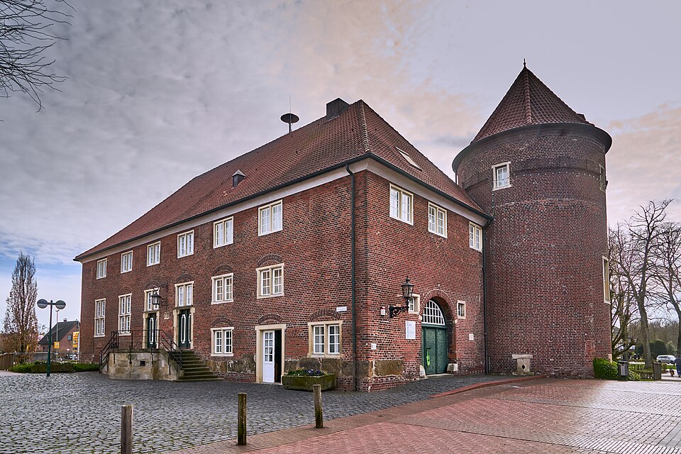
Many eventually lost their military purpose and became administrative centres, noble residences or estates. Their transformation helps explain why the Münsterland contains an unusually rich collection of Wasserburgen, water castles and moated manor houses whose architecture appears to rise directly from ponds and canals.
Moats, brick manor houses, tree-lined approaches and isolated estates recur throughout the region, remnants of a society in which land ownership, ecclesiastical government and noble privilege shaped the countryside for centuries.
After the opening loop, the course leaves the Borken district and begins moving towards Coesfeld. The terrain remains gentle, but the low ridge beyond the town will finally disturb the flat profile.
Coesfeld · A Small Hanseatic City on the Berkel
Coesfeld sits on the River Berkel, which rises in the Baumberge and eventually flows west across the Dutch border before joining the IJssel river system. The river is modest, but Coesfeld’s position on regional roads helped the town become an important commercial centre during the Middle Ages.
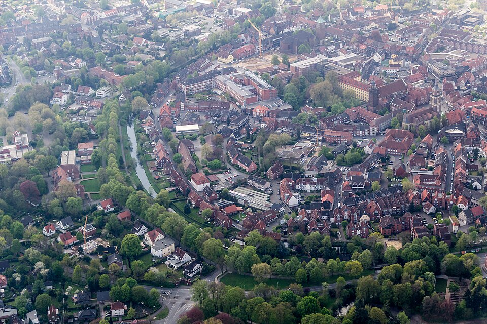
Coesfeld belonged to the wider network of the Hanseatic League, the loose association of northern European trading towns and merchants that dominated much commerce around the North Sea and Baltic between the Middle Ages and early modern period. The Hanse was not a country or a centrally governed commercial empire. It was a network in which towns and merchants cooperated to secure trading privileges, protect routes and conduct business across enormous distances.
Coesfeld merchants traded in products including flax, cloth, dairy goods, livestock and Baumberger sandstone. Their commercial connections reached towards the Rhineland, Bremen and ports with access to Scandinavia and the Baltic. By the 16th century, Coesfeld acted as an important coordinating town for smaller Hanseatic communities in western Münsterland.
The Berkel helped connect the town with the countryside, while roads extended towards Münster and the Low Countries. East of Coesfeld, the ground supplying one of those traded products begins to rise.
The Baumberge · Hills Made From an Ancient Sea
The name Baumberge can suggest something much larger than the landscape itself. These are not mountains in the Alpine sense and barely rise above 180 metres. In Münsterland, however, even that elevation is enough to alter views, drainage, vegetation and the rhythm of a bicycle race.
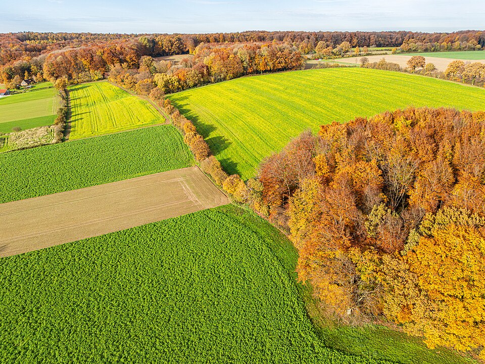
The highest ground reaches the Westerberg, around 187 metres above sea level. Beneath these modest slopes lies a geological record of a completely different landscape. During the Late Cretaceous period, tens of millions of years ago, this part of Europe lay beneath a shallow sea, where sediments accumulated and eventually hardened into the rock now associated with the region.
Baumberger sandstone, despite its traditional name, is geologically a calcareous sandstone or sandy limestone. Its warm pale colour and relative ease of carving made it valuable as both a building and sculptural material. Quarrying has taken place in the Baumberge for roughly a thousand years, and the stone appears in churches, sculptures and historic buildings across Münsterland and farther into the Netherlands.
Rock extracted from these small hills consequently became part of cities far beyond them. In Münster itself, pale Baumberger stone appears against red brick on important historic buildings, including the palace beside which the Giro will eventually finish.
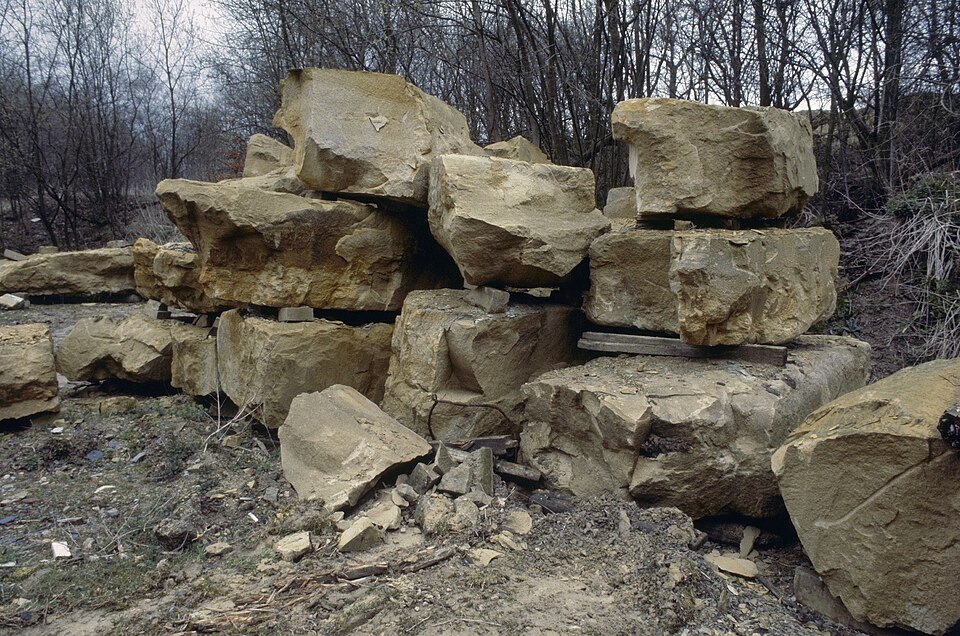
For approximately 65 kilometres, the race moves repeatedly across the Baumberge and their surrounding roads. None of the climbs resembles a major mountain ascent, but the succession through Coesfeld, Rorup and Darup repeatedly interrupts the high-speed rhythm established on the western plain.
Rorup and Darup · The Münsterland Begins to Fold
Around Rorup and Darup, the roads show how deceptive the description of Münsterland as flat can become. The Baumberge do not produce sustained climbing, but streams have cut shallow valleys into the upland, while roads repeatedly rise and fall between farms, villages and wooded ridges.
Fields climb gentle slopes, beech woods occupy patches of higher ground, and church towers remain visible across valleys shallow enough to preserve long views. For professional riders, the difficulty comes from accumulation rather than altitude. A short ramp can be crossed quickly, but repeated accelerations demand a different effort from the sustained speed of the opening circuit.
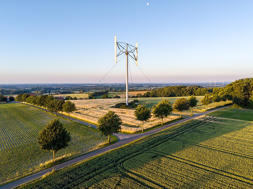
The hills also form a watershed. Several rivers have their sources in or around the Baumberge, including the Berkel, Stever, Münstersche Aa, Steinfurter Aa and Vechte. From a relatively compact upland, their waters begin travelling in different directions towards larger river systems and ultimately the North Sea.
The Berkel encountered at Coesfeld is one of them. Another, the Münstersche Aa, flows eastwards through Münster itself. The hills crossed by the race therefore send water towards both the Dutch border behind the riders and the city waiting ahead.
Billerbeck · Where Saint Ludger Died
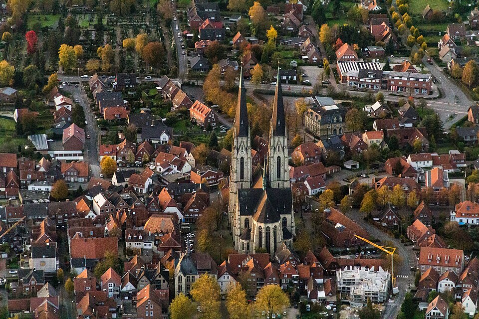
After the Baumberge, with roughly 50 kilometres remaining, the race passes towards Billerbeck, a town whose skyline is dominated by the twin towers of St Ludgerus Cathedral.
The building is much younger than the event it commemorates. Its association is with Saint Ludger, an 8th-century missionary who played an important role in the Christianisation of the Saxon lands and became the first bishop of Münster.
Ludger lived during the reign of Charlemagne, when the Frankish king was extending his authority into Saxony. Conversion and conquest were often closely connected during this period. Charlemagne’s long Saxon Wars incorporated the region into the Frankish realm, while missionaries established churches and ecclesiastical institutions among populations whose religious traditions had previously been non-Christian.
Ludger pursued missionary work across the region and was appointed bishop of the newly established diocese of Münster in 805. He died at Billerbeck in 809, after celebrating Mass there according to tradition. His body was later taken to Werden, now part of Essen, where he had founded a monastery.
The large neo-Gothic church visible today was constructed in the late 19th century over the place associated with his death. Its towers rise high above a town of modest size, carrying the memory of the early medieval bishopric into the landscape through which the race approaches Münster.
Darfeld · A Renaissance Castle Surrounded by Water
Near Darfeld stands Schloss Darfeld, one of the moated residences that give the Münsterland much of its architectural character.
The complex developed over several periods, but its most distinctive architecture reflects the Westphalian Renaissance, when local noble families adapted Renaissance forms arriving from elsewhere in Europe to regional traditions of brick, sandstone, steep roofs and water defences.
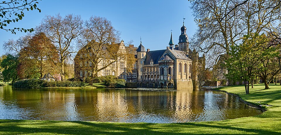
Water castles were particularly suited to this landscape. Where there were few commanding rocky hills on which to build fortresses, estates could instead be protected by broad moats supplied by local streams. As military threats diminished, those same moats became aesthetic features surrounding increasingly comfortable aristocratic residences.
The result is very different from the popular image of a German castle perched above the Rhine. Münsterland castles often sit almost level with the surrounding fields, partially hidden among woodland until towers, bridges or reflecting water appear between the trees.
Beyond Darfeld, the roads begin their final approach towards Münster, returning to the flatter country that has made the bicycle unusually practical here.
Münsterland and the Bicycle · Why the “Leeze” Belongs Here
In Münster and the surrounding region, a bicycle is often called a Leeze, a local word embedded deeply enough in regional cycling culture that the mass-participation rides held alongside the professional Giro are known as the LeezenCups.
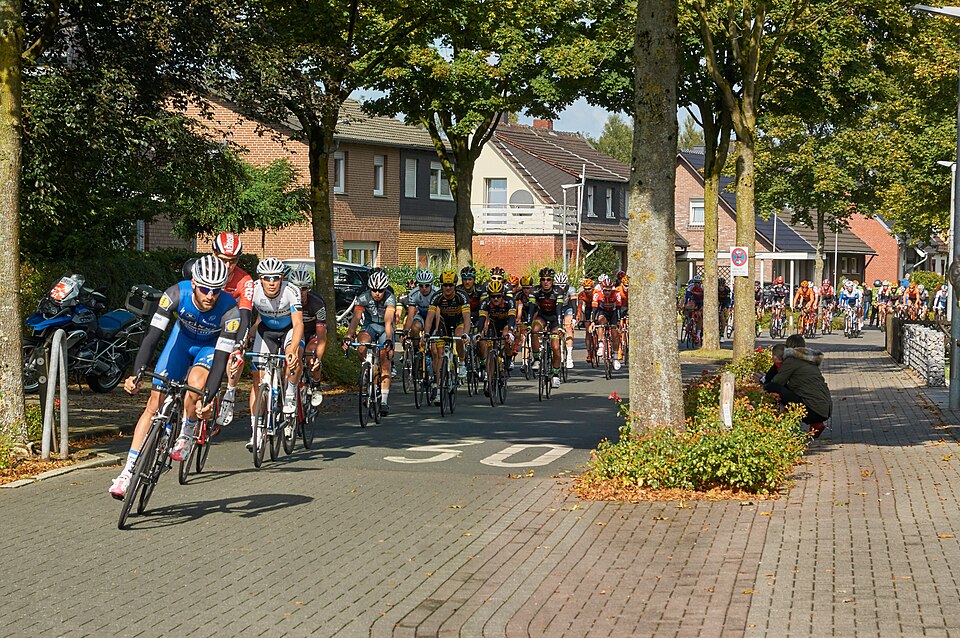
The prominence of cycling is closely related to the landscape. Münster and much of its surrounding country are flat, settlements lie at manageable distances from one another, and cycling has remained useful for ordinary journeys rather than becoming primarily a recreational activity.
Münster itself developed one of Germany’s strongest urban cycling cultures. Students ride between the university and residential neighbourhoods, commuters use bicycles for daily transport, and enormous bicycle parking areas surround the railway station. The Promenade, a green ring around the historic centre following the line of the former city fortifications, has become one of the city’s principal cycling corridors.
Münster once needed walls and bastions around its centre. After those defences became obsolete and were removed, their former line opened space for trees and paths. A belt once intended to restrict movement into a fortified city eventually became one of the easiest ways to move around it by bicycle.
The professional race enters a city already organised around the machine being raced through its streets.
Münster · From an Early Bishopric to the Anabaptist Rebellion
The name Münster derives from the Latin monasterium, reflecting the ecclesiastical origins of the settlement. In the early Middle Ages, a monastery and episcopal centre developed here, and in 805, the same year Ludger became bishop, Münster emerged as the centre of a new diocese.
Over subsequent centuries, the city developed around two overlapping worlds. The bishop and cathedral occupied an ecclesiastical precinct, while merchants and craftspeople built a commercial town beside it. Münster joined the Hanseatic trading network and became the principal urban centre of the surrounding region.
The relationship between religious authority and the population was not always peaceful. During the Reformation, Münster became the site of one of the most extraordinary episodes in 16th-century European history when radical Anabaptists took control of the city in 1534.
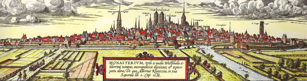
Anabaptists rejected infant baptism in favour of the baptism of believing adults, but the movement that gained control of Münster went considerably further. Under leaders including Jan van Leiden, the city was proclaimed a new Jerusalem, property arrangements were radically altered and polygamy was introduced while forces of the expelled prince-bishop maintained a prolonged siege outside the walls.
The experiment ended violently in 1535 when the besiegers retook Münster. Jan van Leiden and fellow leaders Bernd Knipperdollinck and Bernd Krechting were tortured and executed in 1536, and the iron cages in which their bodies were displayed still hang high on the tower of St Lambert’s Church.
More than a century later, another religious and political conflict brought representatives from across Europe to Münster, this time to negotiate rather than besiege the city.
The Prinzipalmarkt · Merchants, Gables and the Peace of Westphalia
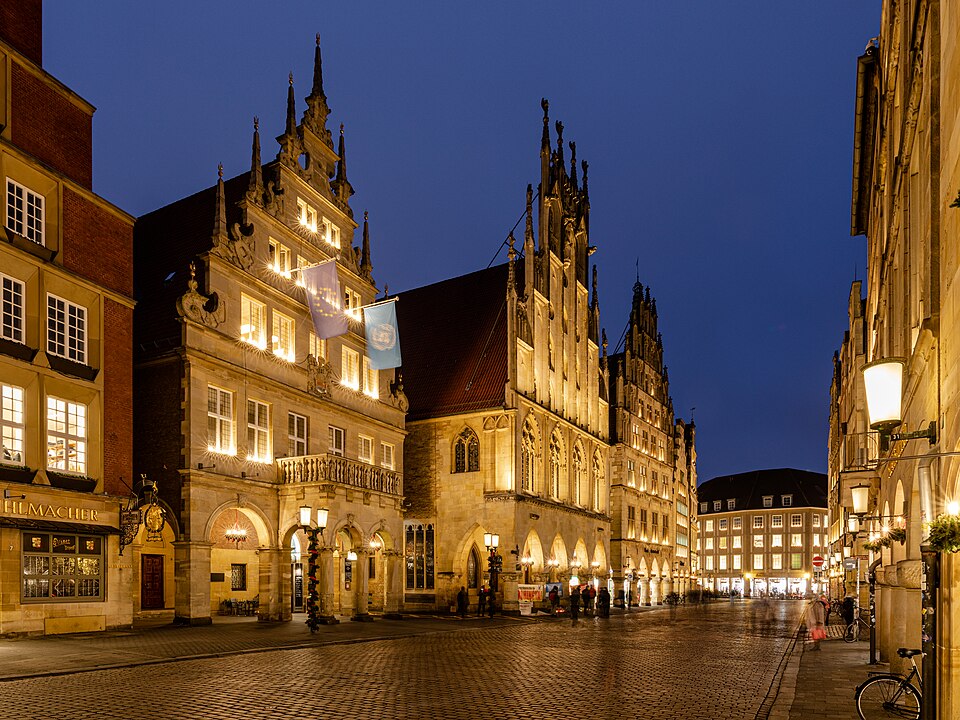
The Prinzipalmarkt is the historic commercial spine of Münster, lined by narrow gabled houses standing above continuous arcades. Its architecture reflects the merchant families whose businesses helped make Münster wealthy during the Middle Ages and early modern period.
Much of what visitors see today was reconstructed after the Second World War. Bombing destroyed large sections of central Münster, including much of the Prinzipalmarkt. Beginning in the late 1940s, the street was rebuilt on its historic plots, preserving the characteristic rhythm of gables and arcades without attempting an exact stone-by-stone reconstruction of every façade.
Among the buildings stands Münster’s historic town hall, containing the Friedenssaal, or Hall of Peace. Münster and Osnabrück became the principal centres of the long diplomatic congress that eventually produced the agreements collectively remembered as the Peace of Westphalia.
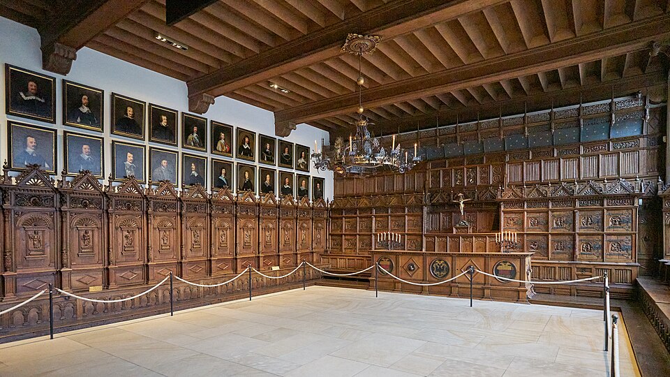
By then, the Thirty Years’ War encountered near Stadtlohn had devastated large parts of Central Europe. What began with conflict inside the Holy Roman Empire had expanded through the intervention of major European powers, while armies repeatedly consumed the resources of the territories through which they marched. Disease, hunger and displacement accompanied the fighting, and some regions suffered catastrophic population losses.
Negotiations were divided between Münster and Osnabrück, partly because Catholic and Protestant delegations could conduct diplomacy in separate cities while messengers travelled constantly between them. The process lasted for years and involved numerous states, representatives and overlapping conflicts rather than a single meeting followed by one treaty.
Münster’s Friedenssaal is particularly associated with the Spanish-Dutch peace, which was solemnly sworn there on 15 May 1648, formally recognising the independence of the Dutch Republic from Spain. The principal treaties between the Holy Roman Emperor, France, Sweden and their allies followed in October, together forming what is conventionally called the Peace of Westphalia and ending the Thirty Years’ War within the Empire.
The settlement did not suddenly invent the modern sovereign state system, as later shorthand sometimes implies, but it substantially reshaped political and confessional arrangements within Europe and became a landmark in the history of international diplomacy.
The race that passed the battlefield at Stadtlohn during its opening circuit now enters the city where negotiations helped close the war twenty-five years later.
The Schloss · From Prince-Bishop’s Residence to University
The Münsterland Giro finishes before the Schloss Münster, a large Baroque palace whose red brick and pale stone façade stretches across the western edge of the old city.
Construction began in 1767 as a residence for Münster’s prince-bishops. The architect was Johann Conrad Schlaun, one of the major figures of Westphalian Baroque architecture, who designed a building in which red brick is articulated by pale stone around windows, entrances and architectural details. Schlaun died in 1773, and Wilhelm Ferdinand Lipper continued the work, completing the residence in the 1780s.
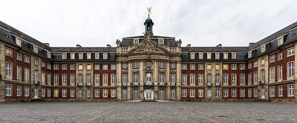
The pale stone is Baumberger sandstone, quarried in the hills the race crossed earlier. After appearing beneath the riders’ wheels as geology and around Coesfeld as a traded commodity, the same material stands here in the architecture of the regional capital.
The palace belonged to a political order that was already approaching its end. The ecclesiastical territories of the Holy Roman Empire were secularised during the transformations surrounding the Napoleonic period, and Münster eventually became part of Prussia. The Schloss later acquired new functions and today houses the administration of the University of Münster.
The building itself also had to be recreated. Allied bombing during the Second World War left the palace almost completely destroyed, and it was reconstructed after 1945. Its present role brings thousands of students into grounds originally planned around the ceremonial life of an ecclesiastical ruler.
Before the professionals reach the Schloss for the final time, they cross the finish line once and continue onto the closing circuit through Münster.
FIRST FINISH PASSAGE · Münster Becomes the Circuit
The first passage across the finish brings the professional field into the final city circuit after a day spent across western Münsterland.
There is no equivalent of the Baumberge left in the closing kilometres. Position, speed and whatever strength remains after more than two hundred kilometres become more important than sustained climbing, while the broad rural course contracts into streets lined by spectators.
The professional race shares the day with thousands of amateur cyclists competing over the different LeezenCup distances. In Münster this does not feel like an artificial attempt to create a cycling identity for race weekend. Many of the people watching from the roadside live in a city where riding to work, university, the railway station or the shops is an ordinary part of daily life. The circuit returns them to the Schlossplatz.
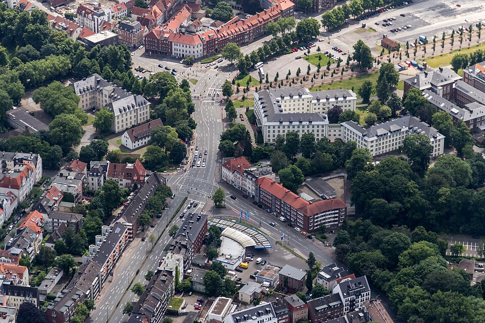
FINISH · Schlossplatz, Münster
The finishing straight lies in front of a palace built for the rulers who once governed much of the countryside crossed during the day. Its brick façade is edged with stone cut from the Baumberge, while beyond the palace a university now occupies spaces created for an ecclesiastical court.
A few kilometres away, the Prinzipalmarkt and St Lambert’s Church preserve very different chapters of Münster’s past, from merchant wealth and religious upheaval to the years of diplomacy that followed the war encountered earlier near Stadtlohn. None of them needs to be visible from the finishing straight for the race to belong to the same landscape.
What is immediately visible is the bicycle. Münster’s everyday cycling culture surrounds an event that takes the region’s most ordinary means of transport and pushes it to its fastest extreme. After the narrow roads, hedges, moated castles and modest hills of the Münsterland, the professional race ends not on a mountain or beside some isolated monument, but in the middle of a city where bicycles will still be moving through the streets long after the barriers have been removed.



