

Busto Arsizio → Varese · 196.12 km · UCI 1.Pro
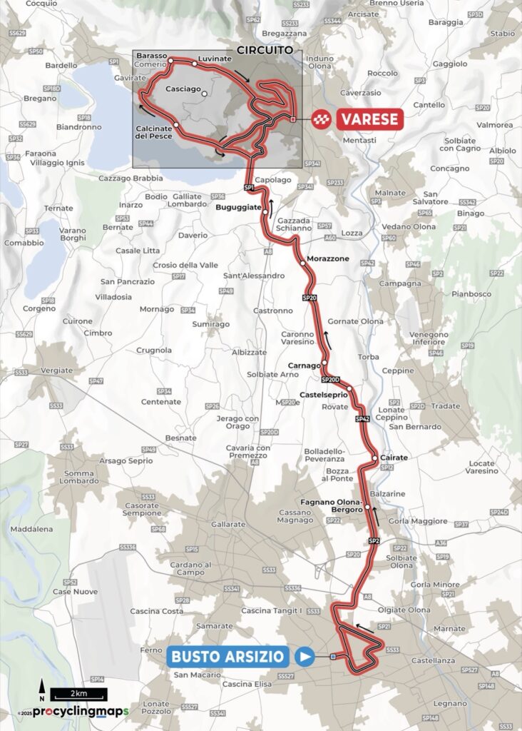
The name Tre Valli Varesine means the Three Valleys of Varese, a reminder of the race’s older geography through Valcuvia, Valganna and Valceresio, three valleys in the lake and foothill country of north-western Lombardy. The modern route no longer needs to visit all three. Instead, the 2026 edition moves from the industrial plain at Busto Arsizio towards Varese, a city built across hills between the Po Valley, Lake Varese and the first heights of the Prealps.
That landscape separates the Tre Valli from the two races preceding it in the Trittico Regione Lombardia. Coppa Agostoni belongs to Brianza, while Coppa Bernocchi follows the Olona north of Legnano. Here the road continues towards the Alps, climbing away from the plain into increasingly broken country beneath the wooded Campo dei Fiori massif.
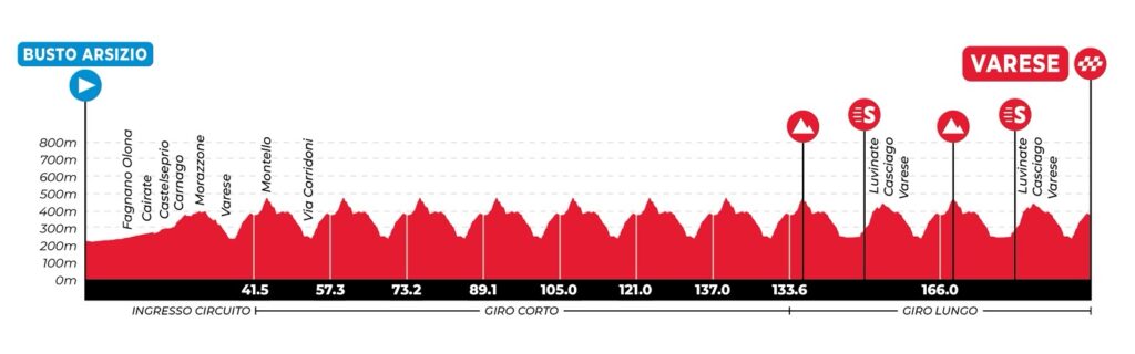
The official route covers 196.12 kilometres. After an opening section through the province of Varese, the riders enter the finishing circuit on Via Sacco with 155.26 kilometres remaining. Six complete short circuits of 15.51 kilometres keep the race close to Varese before the course expands westwards for the final phase, taking in Lake Varese, Gavirate, Cinque Piante and the lower slopes of Campo dei Fiori. The last classified passage over Montello comes at -28.56 km, followed by the final Cinque Piante sprint at -15.53 km.
First held in 1919, the Tre Valli Varesine reaches its 105th edition on roads where a surprisingly large amount of Lombard geography is compressed into less than two hundred kilometres, from the industrial upper Po Valley to glacial lake country and the first limestone foothills of the Alps.
START · Busto Arsizio and the Cotton Industry
The race begins in Busto Arsizio, near the Museo del Tessile e della Tradizione Industriale, the Museum of Textiles and Industrial Tradition. Rather than occupying a purpose-built museum, it stands inside the former spinning department of the Cotonificio Carlo Ottolini, one of the cotton mills that helped transform the city during industrialisation.
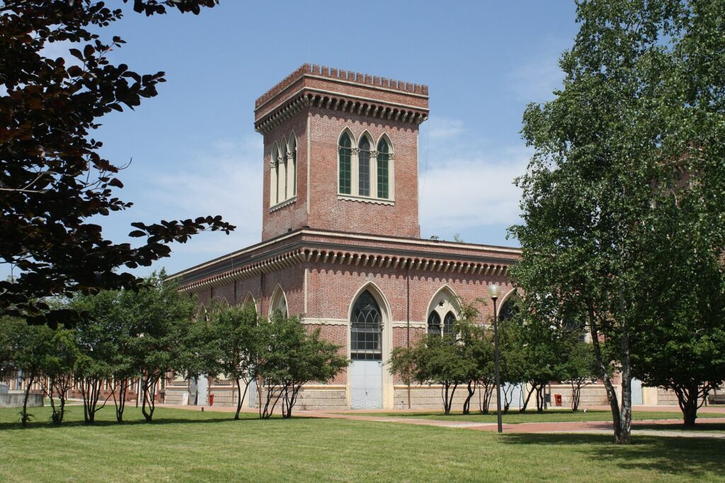
The former Cotonificio Bustese
(originally founded as Cotonificio Carlo Ottolini), now home to the Museum of Textiles and Industry in Busto Arsizio. Photo by Dario Crespi, licensed under CC BY-SA 4.0, via Wikimedia Commons
The building was constructed during the 1890s in a neo-Gothic style that gives the former factory the appearance of a brick castle. Pointed windows, towers, battlements and decorative details surround spaces once occupied by spinning machinery. After textile production left the site during the restructuring of the local industry, the municipality acquired the complex, which opened as a museum in 1997. Its collections preserve machinery, fabrics, documents and the technical knowledge of an industry that shaped Busto Arsizio for generations.
Textile production here was older than the factory. Domestic and artisanal cloth making gradually developed into a specialised economy, and mechanisation accelerated the transformation during the 19th century. Cotton mills, dye works, weaving businesses and companies supplying their machinery spread through the city. Workers arrived from surrounding communities, railways connected production with Milan and wider markets, and Busto Arsizio became one of Lombardy’s important textile centres.
The concentration of cotton manufacturing eventually brought comparisons with Manchester, the English city synonymous with industrial textile production. The Tre Valli begins among the surviving architecture of that industrial period before leaving Busto Arsizio and turning north.
From the Po Valley to the Prealps
The road towards Varese crosses an important geographical boundary without travelling very far. Busto Arsizio stands near the upper edge of the Po Valley, the enormous plain extending across northern Italy, while Varese belongs to a landscape shaped by the Alps and by the glaciers that repeatedly advanced from them during the Ice Ages.
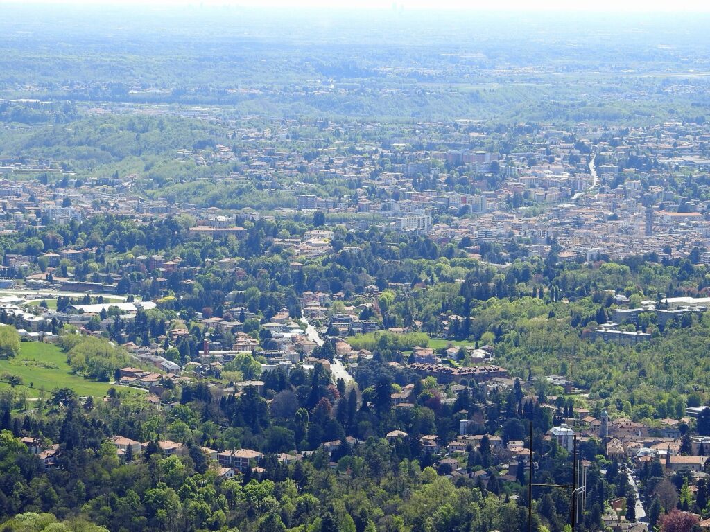
overlooking the northern edge of Lombardy’s Po Valley. Photo by Flodur63, licensed under CC BY-SA 4.0, via Wikimedia Commons
Those glaciers left ridges, basins and depressions that later filled with water, which is why the province of Varese contains so many lakes within a relatively compact area. Lake Maggiore lies farther west and Lake Lugano towards the north-east, while the smaller lakes of Varese, Monate, Comabbio and Biandronno occupy the country closer to the race. Beyond them rise the first substantial heights of the Prealps.
The transition is gradual. Roads begin to rise and fall more frequently, wooded slopes interrupt the settlements and mountains appear beyond the rooftops. After passing Solbiate Olona, Fagnano Olona, Cairate, Castelseprio, Carnago and Morazzone, the course approaches Lake Varese from the south-east. The official timetable places the race on the lakeside road at Capolago after approximately 36 kilometres, before the first climb into Varese.
-155.26 km · First Passage Through Varese
The riders reach Via Sacco at kilometre 40.86, leaving 155.26 kilometres to race. This first passage marks the beginning of the circuit phase and introduces a city whose uneven topography will determine almost everything that follows.
Varese is known as the Città Giardino, the Garden City, a name that grew from the villas, parks and private gardens created as the town became a favoured retreat for aristocratic and wealthy Milanese families. Cooler summers, wooded hills and proximity to Milan encouraged residences to spread across terrain already naturally divided by slopes and valleys.
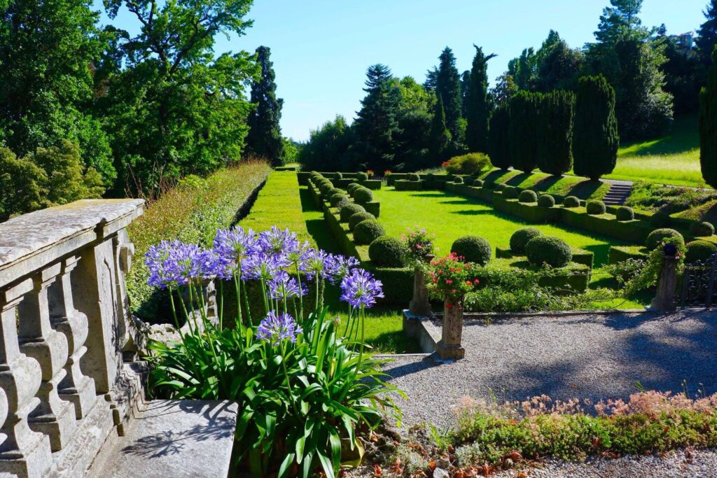
The formal Italian garden of Villa Craven di Seyssel d’Aix, part of Varese’s rich tradition of historic villas and landscaped gardens. Photo by Alessia Del Monaco, licensed under CC BY-SA 4.0, via Wikimedia Commons
The city does not sit on a single hillside. Its neighbourhoods occupy different levels between Lake Varese and the Campo dei Fiori massif, creating short climbs and descents between districts that are geographically close together. The Tre Valli uses precisely that irregular urban landscape.
SIX SHORT CIRCUITS · 15.51 km Each
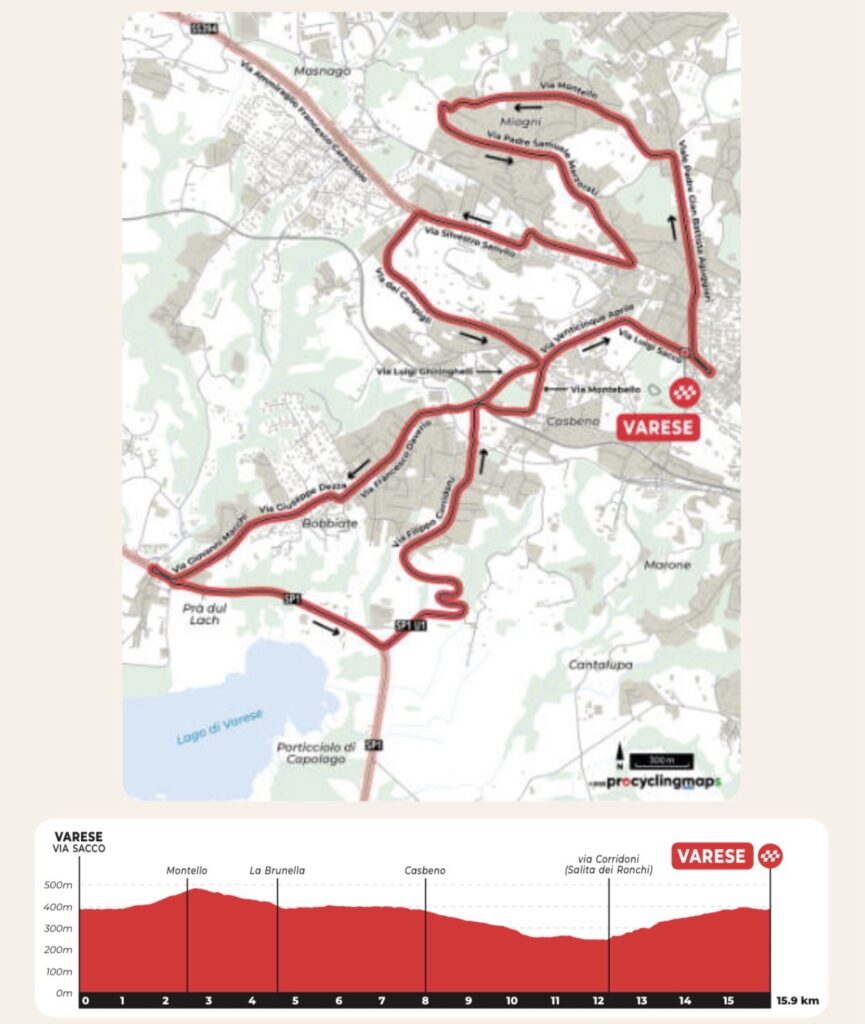
From the first Via Sacco passage, the riders complete six circuits of 15.51 kilometres. Each lap takes them through central Varese, across Montello and back towards the low ground near Lake Varese before climbing into the city again.
The repeated passages through Via Sacco come at kilometres 56.37, 71.88, 87.39, 102.90, 118.41 and 133.92. Rather than six separate episodes, they form the central rhythm of the race, repeatedly connecting Varese’s hills with the lakeside below.
Montello · The Hill Inside Varese
Montello is a residential hill on the northern side of Varese and one of the principal climbs on the circuit. It belongs to the city’s internal topography rather than to the higher mountains beyond it, but repeated passages make it one of the roads around which the Tre Valli is organised.
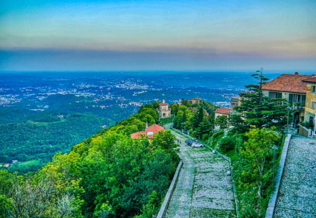
The Sacro Monte di Varese, a 17th-century pilgrimage complex of chapels and part of the UNESCO-listed Sacred Mountains of Piedmont and Lombardy. Photo by Zairon, licensed under CC BY-SA 4.0, via Wikimedia Commons
Above the neighbourhood rises Campo dei Fiori, a limestone massif reaching more than 1,200 metres and forming part of the Varese Prealps. Higher on its slopes is the Sacro Monte di Varese, a 17th-century devotional route whose fourteen chapels climb towards the sanctuary of Santa Maria del Monte. A Sacro Monte, or Sacred Mountain, is a pilgrimage route in which architecture, sculpture and landscape combine to represent episodes of Christian belief; Varese’s complex forms part of the UNESCO-listed Sacred Mountains of Piedmont and Lombardy.
The race remains far below the sanctuary, using the lower urban hills rather than climbing into the massif. Montello is short enough to encourage acceleration rather than prolonged climbing, and its descent feeds the course back towards the lower side of Varese before the road rises again.
Villa Panza · An Aristocratic Villa Filled With American Art
On the hill of Biumo Superiore, north-east of the historic centre, stands Villa Panza, an 18th-century residence surrounded by extensive gardens. It began as one of the country residences created by wealthy families attracted to Varese’s landscape, but its modern reputation comes largely from Giuseppe Panza di Biumo, a 20th-century collector who assembled an important collection of American contemporary art.
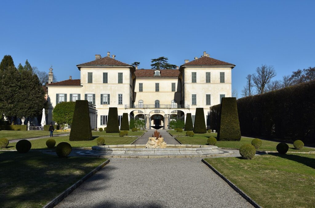
The garden and fountain of Villa Menafoglio Litta Panza in Varese, a historic villa now renowned for its contemporary art collection. Photo by Phyrexian, licensed under CC BY-SA 4.0, via Wikimedia Commons
Beginning in the 1950s, Panza collected artists exploring abstraction, light, space and minimal forms. Works by figures including Dan Flavin and James Turrell eventually occupied rooms created for an aristocratic Lombard residence, producing an unusual encounter between 18th-century architecture and post-war American art. Today the property is managed by the FAI, the Italian National Trust.
Palazzo Estense · The Making of the Garden City
Varese’s reputation as a place of aristocratic residence accelerated after Francesco III d’Este, Duke of Modena and Reggio, became lord of Varese in 1765. He enlarged an existing villa into the Palazzo Estense, surrounding it with formal gardens that remain beside the city centre today.
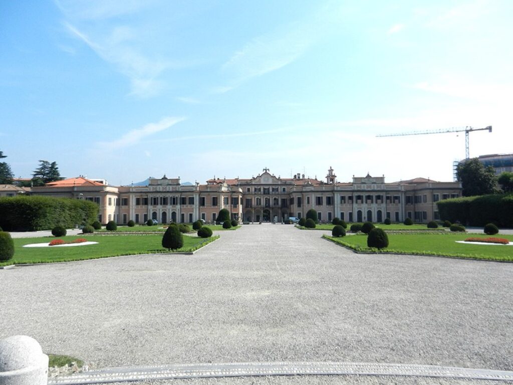
Palazzo Estense viewed from its landscaped gardens in Varese. The 18th-century ducal residence now serves as the city hall. Photo by Geobia, licensed under CC BY-SA 3.0, via Wikimedia Commons
Other wealthy families followed the same attraction to Varese’s cooler hills, and villas and gardens multiplied around the town. Industry later grew among them rather than replacing them, leaving the mixture of residences, greenery and urban development still visible around the circuit.
Schiranna and a Prehistoric Lake
The opposite side of each short circuit reaches Schiranna, Varese’s principal lakeside district. The repeated descent from the city therefore brings the race back to a landscape whose human history extends far beyond the villas and industrial towns surrounding it today.
Near the western side of Lake Varese lies Isolino Virginia, a tiny island containing remains of prehistoric pile-dwelling settlements. These communities constructed wooden buildings on raised platforms or along wet lakeshores, an adaptation found across the Alpine region from the Neolithic into the Bronze Age. Waterlogged ground sometimes preserved wood, plant remains and other organic material that would normally decay, giving archaeologists an unusually detailed record of prehistoric life.
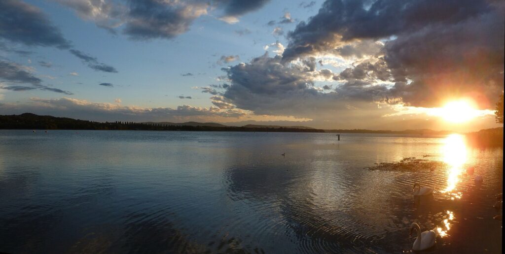
Lake Varese at sunset, framed by the wooded foothills of northern Lombardy. Photo by Docfra, licensed under CC BY-SA 3.0, via Wikimedia Commons
Isolino Virginia forms part of the UNESCO World Heritage property Prehistoric Pile Dwellings around the Alps, a collection of archaeological sites distributed across six European countries. The remains around Lake Varese document human occupation several millennia before the Roman settlements, medieval churches and aristocratic villas that later appeared among these hills.
Ronchi and the 2008 World Championships
From the low ground near the lake, the road climbs back towards central Varese through Ronchi, one of the recurring ascents in the Tre Valli circuit and a road already familiar from another major chapter of cycling history.
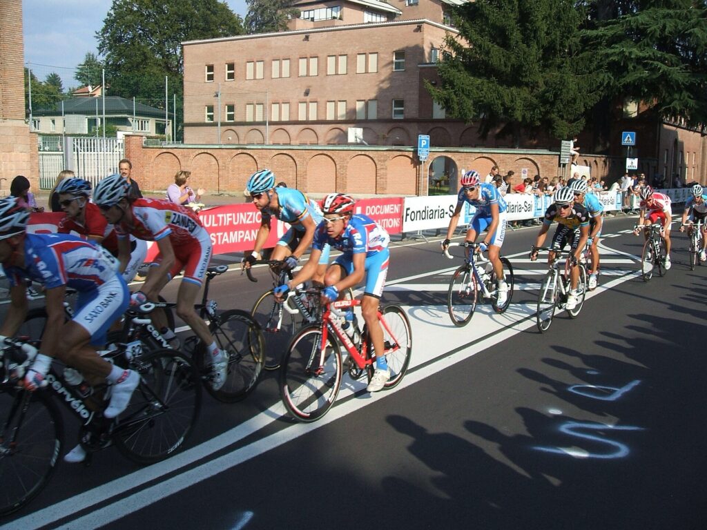
Alessandro Ballan rides in the peloton along Via Crispi during the 2008 UCI Road World Championships in Varese, where he won the men’s road race and rainbow jersey. Photo by Mpiz, licensed under CC BY-SA 2.5, via Wikimedia Commons
The 2008 UCI Road World Championships were held in Varese, using the city’s hills to create a demanding circuit without relying on a major Alpine climb. Ronchi formed part of that course, and the men’s road race ended with Alessandro Ballan attacking late and reaching the finish alone to become world champion. Damiano Cunego followed in second place, giving the home crowd an Italian one-two.
The short circuits repeatedly reproduce that fundamental movement between lake and city: down towards Schiranna, then back onto the higher streets of Varese. After the sixth complete lap, the riders cross Via Sacco at kilometre 133.92 with 62.20 kilometres remaining, and the geography of the race expands.
-62.20 km · The Long Circuits Begin
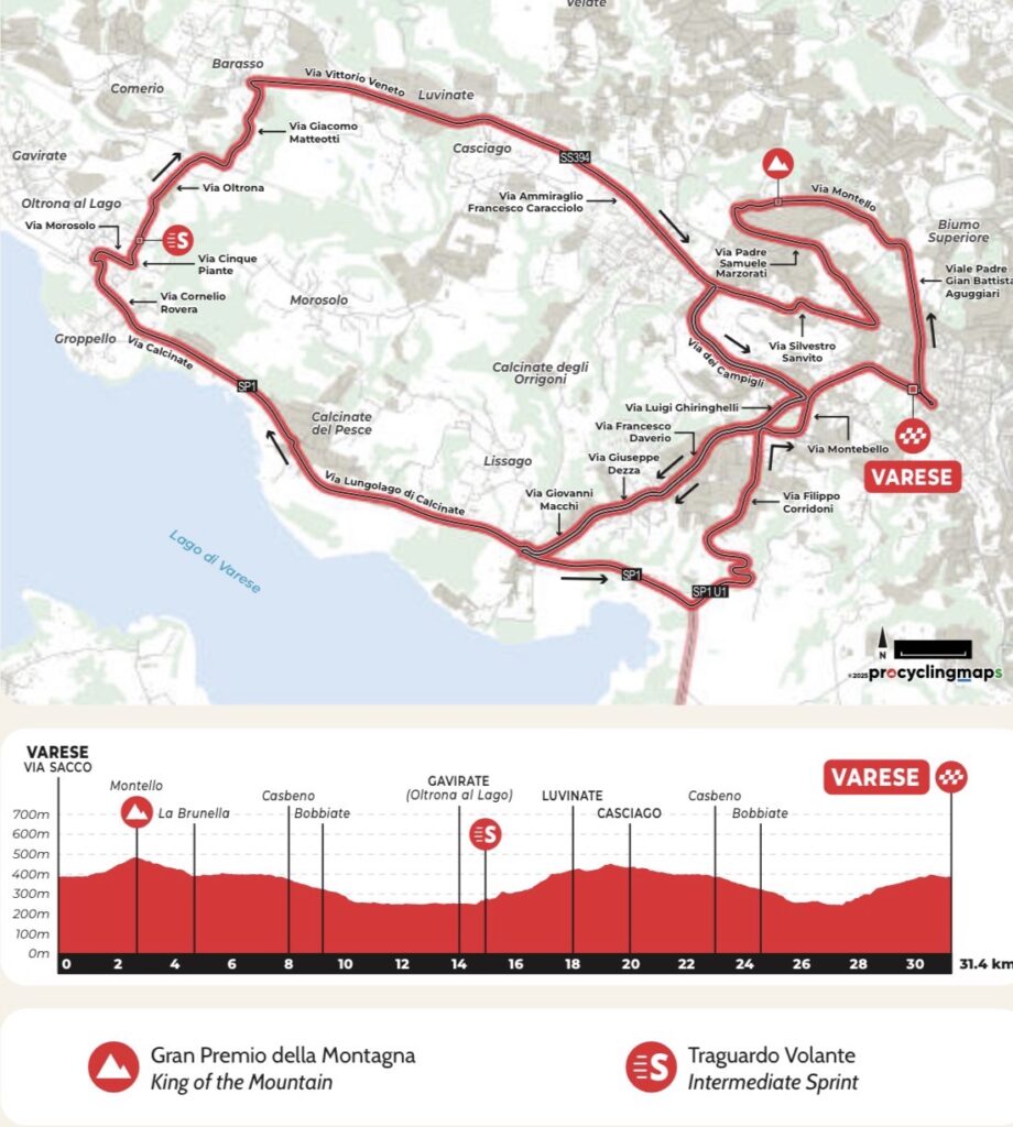
The final phase leaves the compact Varese circuit for a longer loop through the country west of the city. Montello and the lakeside remain part of the route, but the riders now continue beyond Schiranna towards Gavirate, then turn into the foothills through Cinque Piante, Barasso, Luvinate and Casciago before returning to Varese.
The change is important because the race is no longer confined to the repeated urban rhythm of the previous six laps. Lake Varese becomes a corridor towards the western foothills, while the lower slopes of Campo dei Fiori introduce a longer sequence of rolling roads before the return to the city.
-60.65 km · Montello KOM
Only 1.55 kilometres after crossing Via Sacco, the riders reach the officially classified Montello KOM at kilometre 135.47.
After six earlier passages through this part of Varese, Montello is no longer an unfamiliar climb. What changes is its position in the race. The circuit has opened, the remaining distance has fallen below sixty-one kilometres, and the riders are beginning the first of the two extended final loops.
From Montello the course descends through Varese towards Lake Varese once again.
-47.85 km · Gavirate · Between Lake and Mountain
Gavirate stands on the north-western shore of Lake Varese, between the water and the slopes rising towards Campo dei Fiori. The race reaches it at kilometre 148.27, with 47.85 kilometres remaining.
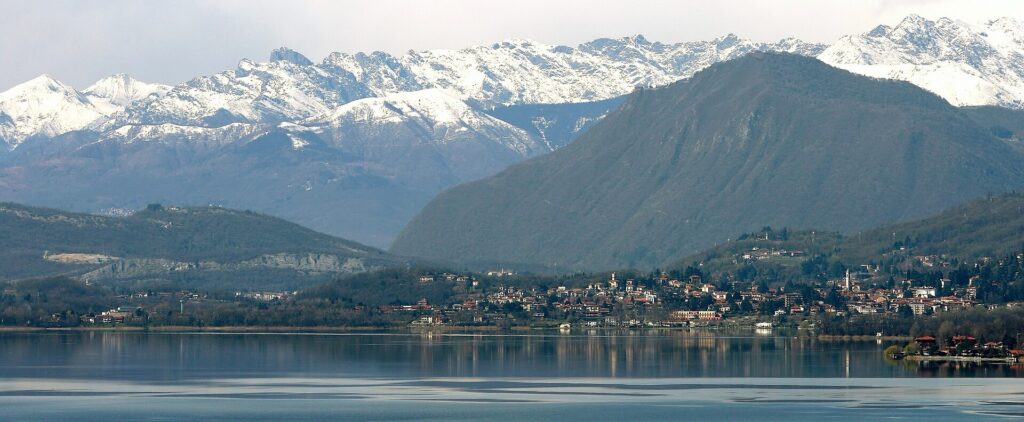
A panoramic view of Gavirate on the shore of Lake Varese, framed by the mountains of northern Lombardy. Photo by Pro Loco Gavirate, licensed under CC BY-SA 3.0, via Wikimedia Commons
Fishing, agriculture and movement around the lake supported communities here long before the shore became associated with recreation. Roads through the surrounding hills also connected the settlement with Lake Maggiore and the valleys farther north.
In the modern period, the combination of water and mountains encouraged rowing, walking and cycling around Gavirate. The Tre Valli follows the lakeside before turning inland at Oltrona, where the road begins climbing away from the water towards Cinque Piante.
-45.75 km · Cinque Piante and the Campo dei Fiori Foothills
The first passage through Cinque Piante comes at kilometre 150.37, leaving 45.75 kilometres. The roadbook designates the point as a TV sprint, adding a classified landmark to a short climb whose importance also comes from its position between Lake Varese and the foothills.
Cinque Piante, literally Five Trees, is the local name attached to the road climbing from the Gavirate side towards Barasso, a small municipality on the southern slopes of Campo dei Fiori. After the repeated urban gradients of Montello and Ronchi, the race is now moving through the lower hills beneath the massif.
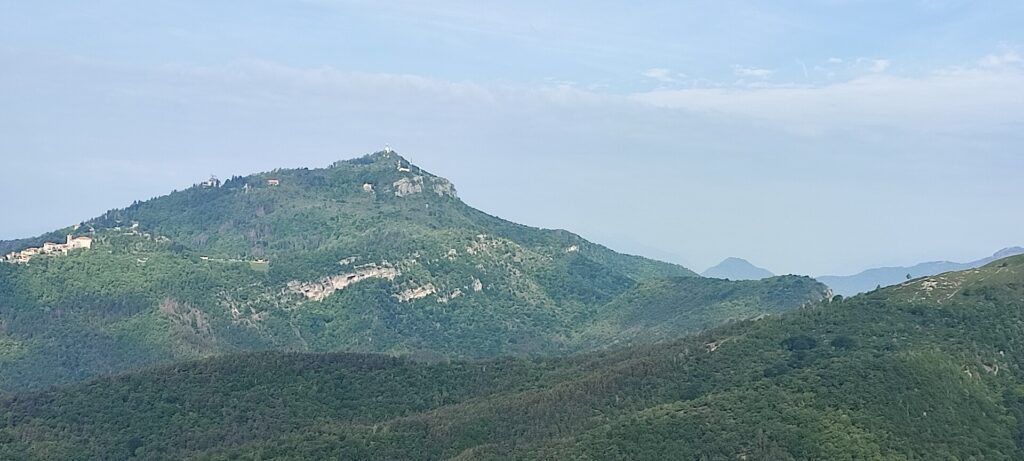
The Campo dei Fiori massif seen from Monte Monarco above Induno Olona, in the Prealps north of Varese. Photo by Marco Brusa Pasquè, dedicated to the public domain under CC0 1.0, via Wikimedia Commons
Campo dei Fiori is built largely from limestone, a rock gradually dissolved by slightly acidic rainwater. Over immense periods, that process created a karst landscape of caves, sinkholes and underground drainage. The regional park surrounding the massif protects this geology together with extensive forests on the slopes above Varese.
Barasso, Luvinate and Casciago
From Cinque Piante the course continues through Barasso, Luvinate and Casciago, neighbouring communities occupying the hillside west of Varese. Their roads follow terrain cut by streams and small valleys, repeatedly changing elevation as they connect settlements built at different levels on the lower slopes.
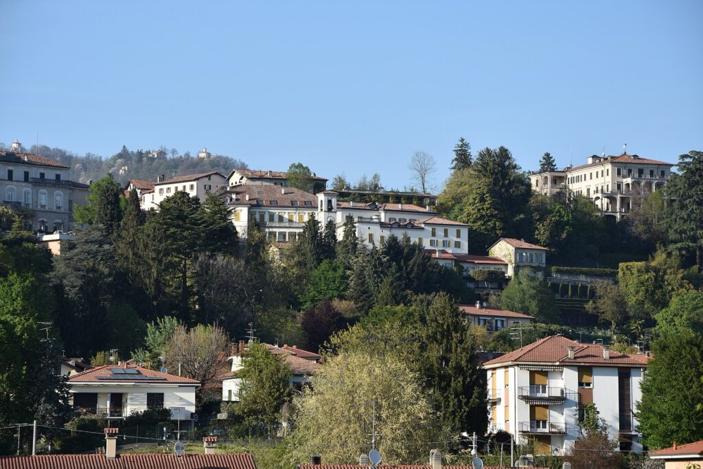
A view across Casciago, a hillside municipality just west of Varese in northern Lombardy. Photo by Phyrexian, licensed under CC BY-SA 4.0, via Wikimedia Commons
Villas and residential estates spread through the same country as transport improved during the 19th and 20th centuries, extending the residential landscape of Varese westwards. The race follows this belt back towards the city, eventually descending towards the roads already used earlier in the afternoon.
At kilometre 166.01, the riders reach Via Sacco again. Only 30.11 kilometres remain.
-30.11 km · The Final Long Circuit
The second long circuit begins on roads the riders have just completed. There is no new landscape to introduce now: the significance lies in the sequence already established between Varese, Montello, Lake Varese and the western foothills.
This final loop is therefore less a new geographical chapter than a return through familiar terrain with steadily diminishing distance. Montello arrives almost immediately.
-28.56 km · Final Montello KOM
The final classified passage over Montello comes at kilometre 167.56, with 28.56 kilometres remaining.
The hill has appeared repeatedly throughout the afternoon, first as part of the compact Varese circuits and then as the opening climb of the longer loops. On this last passage there is no further return to it. From the summit area the course turns towards the lake and the final journey through the western foothills.
Schiranna and Gavirate follow once more, but their history and landscape need no second introduction. The next decisive geographical marker is Cinque Piante.
-15.53 km · Final Cinque Piante
At kilometre 180.59, the riders reach Cinque Piante for the second and final time, with exactly 15.53 kilometres remaining according to the official timetable.
The climb leads towards Barasso before the course continues through Luvinate and Casciago. What had been an exploratory movement into the foothills on the previous circuit is now the last sequence of rising and falling roads before Varese.
From Casciago, the race turns back towards the city.
FINAL APPROACH · Varese and Garibaldi
Varese existed long before its transformation into a city of villas and gardens. During the Middle Ages it belonged to the complicated political landscape between Milan, Como and Seprio, a territorial and administrative district that once controlled much of the country immediately south of the Alps. Milan’s influence eventually became dominant, but Varese retained a distinct position in the hills between the Lombard plain and the lakes farther north.
Those hills became a battlefield on 26 May 1859, during the Second Italian War of Independence. Lombardy was then under Austrian rule, while the Kingdom of Sardinia, supported by France, was fighting Austria in a campaign that would become decisive for Italian unification. Giuseppe Garibaldi operated on the northern side of the war with the Cacciatori delle Alpi, the Hunters of the Alps, a volunteer formation that had entered Varese shortly before Austrian troops approached the town.
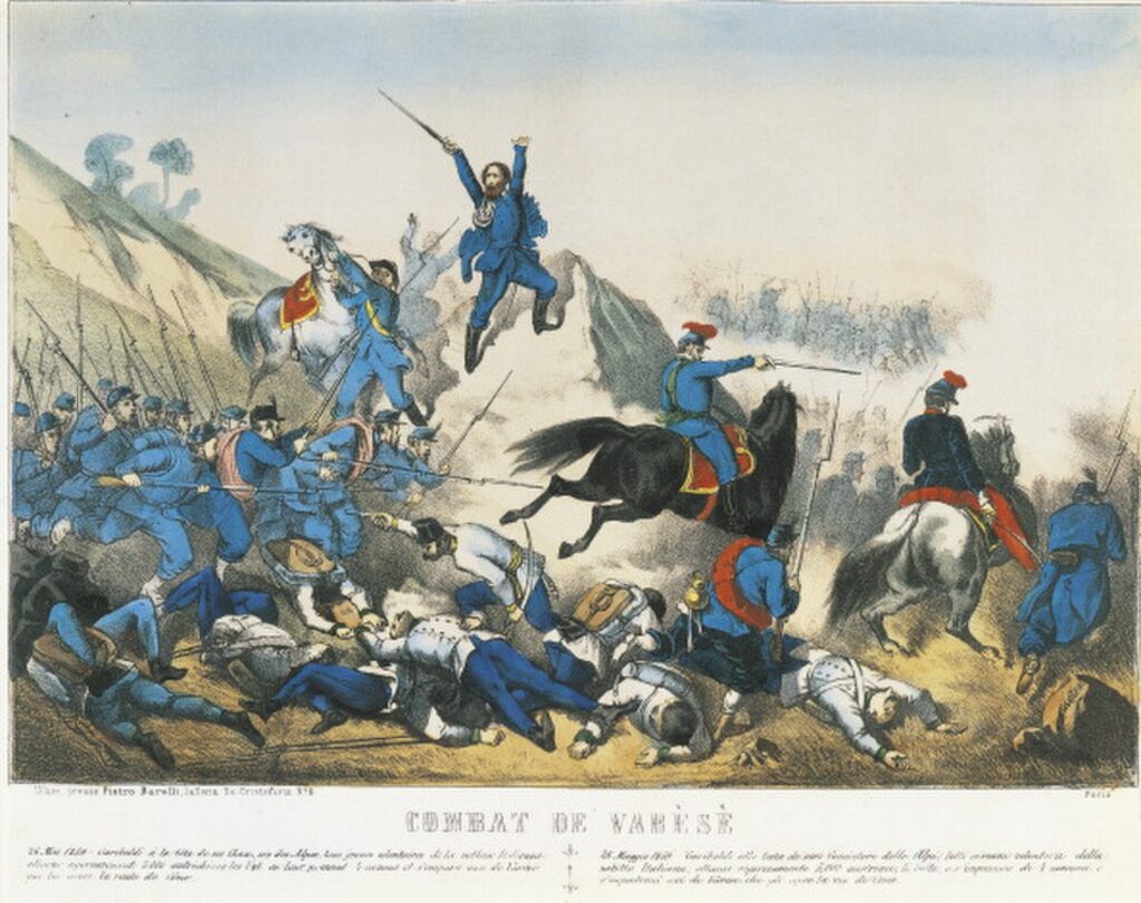
Giuseppe Garibaldi leads his volunteers during the Battle of Varese on 26 May 1859, a victory in the Second Italian War of Independence. Illustration by an unknown 19th-century artist, Public Domain
The Austrian force under General Karl von Urban attempted to retake Varese, but Garibaldi’s volunteers held their positions and forced it to retreat. The battle was small beside the much larger clashes at Magenta and Solferino that followed, yet it placed Varese directly within the military events of 1859. Garibaldi’s campaign continued towards Como, including the fighting at San Fermo della Battaglia, a landscape encountered on the final approach of Il Lombardia.
Within weeks, Austria had lost control of most of Lombardy. The region passed to the Kingdom of Sardinia and in 1861 became part of the newly proclaimed Kingdom of Italy, giving the battle fought outside Varese its place in the broader history of Italian unification.
More Than a Century of the Tre Valli
The first Circuito delle Tre Valli Varesine was held on 22 June 1919, only months after the end of the First World War. Pietro Bestetti won the inaugural race over approximately 100 kilometres.
Ten years later, the newly formed Società Ciclistica Alfredo Binda took over its organisation. The club was named after Alfredo Binda, a cyclist from the province of Varese who became one of the dominant riders of the interwar period, winning the Giro d’Italia five times and the professional road world championship three times.
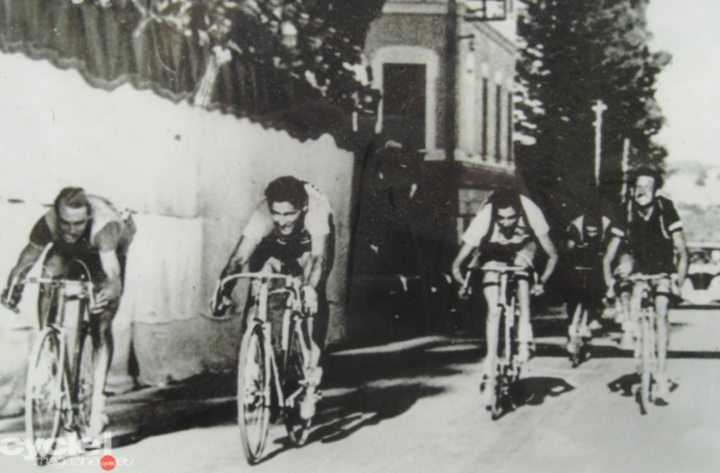
The finish of the 1940 Tre Valli Varesine on 1 September, with Fausto Coppi among the riders. Unknown photographer; public domain, via Wikimedia Commons
Its winners connect very different periods of the sport. Gino Bartali and Fausto Coppi both won during the great Italian rivalry of the mid-20th century, while Eddy Merckx added the race to his palmarès in 1968. In the modern era, Primož Roglič and Tadej Pogačar have also won here.
The course has never been fixed permanently. Starts and finishes moved, circuits changed and the three valleys preserved in the race’s name ceased to be compulsory components of every edition. The same hilly terrain has also brought the professional road world championships to Varese twice, in 1951 and 2008, demonstrating how much difficult racing can be compressed into the roads around the city without a major Alpine pass.
-1 km · The Last Kilometre
The official timetable places the beginning of the final kilometre at Piazza Libertà, after 195.12 kilometres of racing. From there the course takes Via XXV Aprile and Via Sanvito before reaching Via Sacco.
After almost two hundred kilometres, the finish is not approached through an Alpine landscape or a monumental avenue but through ordinary central Varese. That contrast fits a race whose difficulty has been accumulated across dozens of smaller changes in elevation rather than concentrated into one defining mountain.
FINISH · Via Sacco, Varese
The 2026 Tre Valli Varesine ends on Via Sacco after 196.12 kilometres.
There is nothing theatrical about the finishing road itself. After the repeated climbs, lakeside roads and foothills of the previous hours, the final metres return the race to ordinary city streets, with the civic buildings and gardens of central Varese around the barriers.
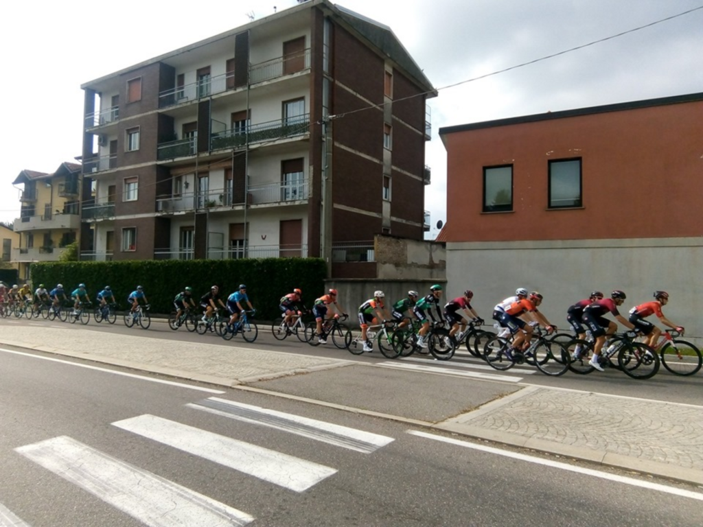
The peloton during the 2019 Tre Valli Varesine. Photo by Moxmarco, licensed under CC BY-SA 4.0, via Wikimedia Commons
That modest setting suits a race that has changed its route repeatedly since 1919 without losing its attachment to the city. Even the three valleys preserved in its name no longer need to appear in every edition.
On Via Sacco, the irregular roads of the previous hours finally give way to the finishing straight. The barriers narrow the view, the city closes around the course, and after 196.12 kilometres the Tre Valli ends in the city around which almost its entire second half has revolved.



