
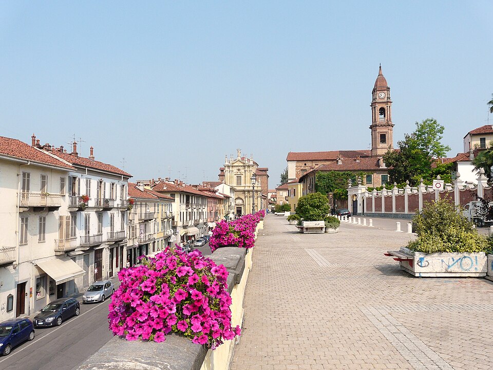

Asti → Bra · 185 km · Thursday, 8 October 2026 · UCI 1.Pro
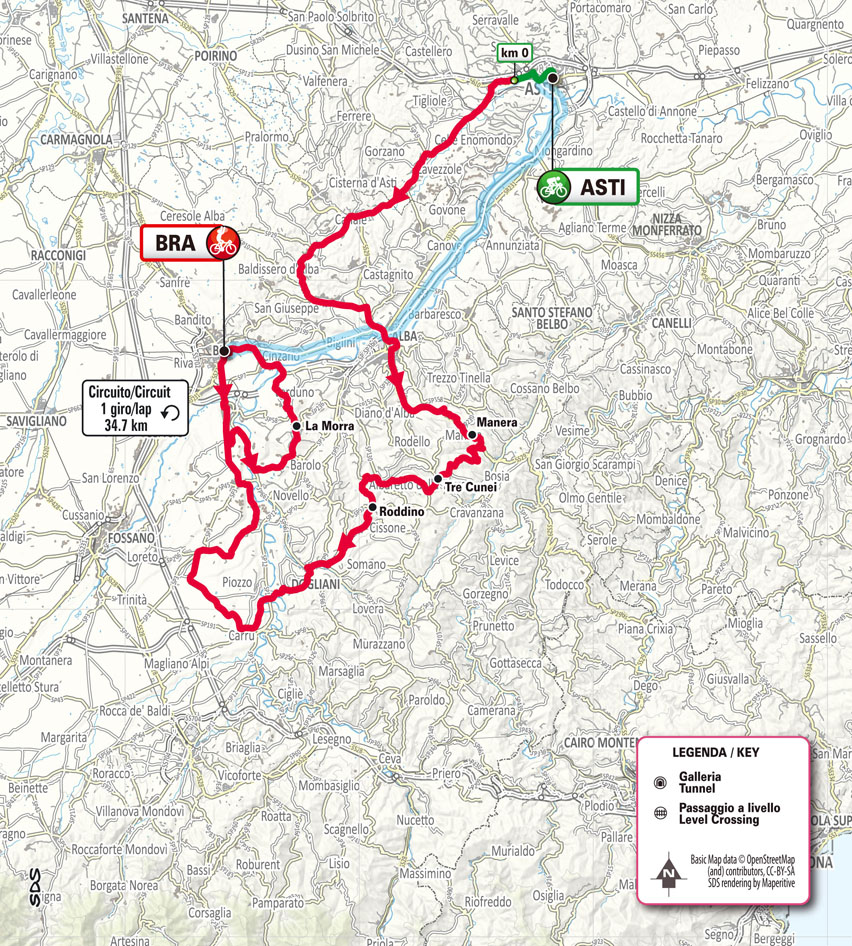
Gran Piemonte has never belonged to a single landscape. The race was created in 1906 to cross Piedmont, a region extending from the Alps to the agricultural plains of the Po and the vineyard hills of the south, and its route has consequently changed more radically than those of classics tied to one particular road or climb. The 2026 edition concentrates on southern Piedmont, travelling 185 kilometres from Asti, a medieval city surrounded by the vineyards of Monferrato, to Bra, the town internationally associated with the Slow Food movement.
Between them lies a succession of landscapes whose names have become inseparable from Italian wine. Roero is the hilly country north of Alba, while the Langhe extend south and east of the Tanaro River through vineyard ridges, hazelnut groves, woodland and small hilltop settlements. Farther west, around La Morra, the course enters the heart of the Barolo-producing country. Centuries of agriculture have reshaped these hills into rows of vines, farm tracks, villages and wine estates, part of a cultural landscape recognised by UNESCO for the long relationship between people, wine production and the terrain of southern Piedmont.
After leaving Asti, the race crosses a constantly undulating first half, with Manera, Tre Cunei and Roddino among the principal climbs before reaching Dogliani. The road becomes less severe farther west, then turns back towards the Barolo hills and La Morra. The final 55 kilometres include a single 34.7-kilometre circuit through Bra, Cherasco, La Morra, Verduno and Pollenzo before the finish.
The 2026 race is the 110th edition of a competition first held as the Giro del Piemonte in 1906. Its first winner came from the same city where this edition begins.
START · Asti and the City of a Hundred Towers
Asti, the provincial capital at the eastern edge of the route, stands between the vineyard landscapes of Monferrato and the hills leading towards Alba and the Langhe. Long before sparkling Asti wine carried its name around the world, the city had been one of medieval Piedmont’s important commercial centres.
The Romans knew the settlement as Hasta, but Asti’s greatest expansion came during the Middle Ages, when it developed into a wealthy self-governing commune. Its merchants and bankers operated far beyond Piedmont, and powerful families expressed their status through fortified houses and private towers. Medieval Italian towers were not simply observation posts. In prosperous cities they could become architectural declarations of family wealth and political power, which is why Asti once possessed so many that its skyline became one of the city’s defining features.
Only part of that skyline survives. The 13th-century Torre Troyana, the Torre De Regibus and other medieval structures still rise above streets where Roman remains, Gothic buildings and later Baroque palaces overlap. The lower portion of the Torre Rossa, or Red Tower, is considerably older, surviving from a Roman gate built during the first centuries of the city’s history.
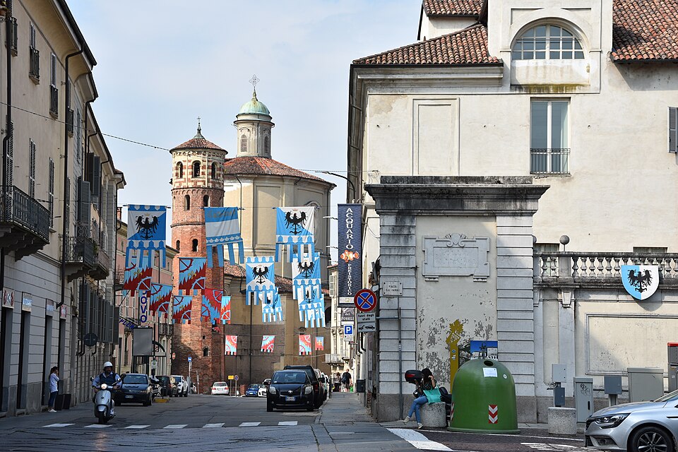
Asti’s medieval identity is also preserved by the Palio di Asti, a horse race contested by the city’s neighbourhoods and surrounding communities. Its historical roots reach deep into the Middle Ages, when the race ran through city streets rather than around the modern course in Piazza Alfieri. The event belongs to the same civic world as Asti’s towers, with neighbourhood identity, political rivalry and public ceremony expressed in the centre of the city.
Giovanni Gerbi · The Red Devil From Asti
Giovanni Gerbi, a pioneering Italian professional cyclist born in Asti in 1885, connects the start city directly with the origins of Gran Piemonte. A year after winning the inaugural Giro di Lombardia in 1905, Gerbi won the first Giro del Piemonte over 320 kilometres, then returned to win the next two editions as well
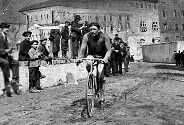
Gerbi raced in a period of enormous distances, primitive equipment and roads far removed from modern racing surfaces. His nickname, Il Diavolo Rosso, the Red Devil, became part of Italian cycling folklore. He competed in a distinctive red jersey, and the traditional story tells of a priest seeing the red-clad cyclist speeding towards or through a religious procession and warning those nearby that the devil was approaching. The details accumulated through retelling, but the nickname survived Gerbi’s racing career.
More than a century later, Gran Piemonte leaves his home city and heads towards the hills south-west of Asti.
-144.5 km · Alba and the Entrance to the Langhe
After forty kilometres, the race reaches Alba, a city on the Tanaro River and the principal urban centre of the Langhe wine country.
Alba began as the Roman Alba Pompeia, but much of its visible historical character developed during the Middle Ages. Like Asti, it became a city of towers belonging to competing noble families, although only a fraction remain at their original height. Around Piazza Risorgimento, medieval towers rise beside the Cathedral of San Lorenzo, whose present appearance incorporates centuries of reconstruction above a site used for religious buildings since antiquity.
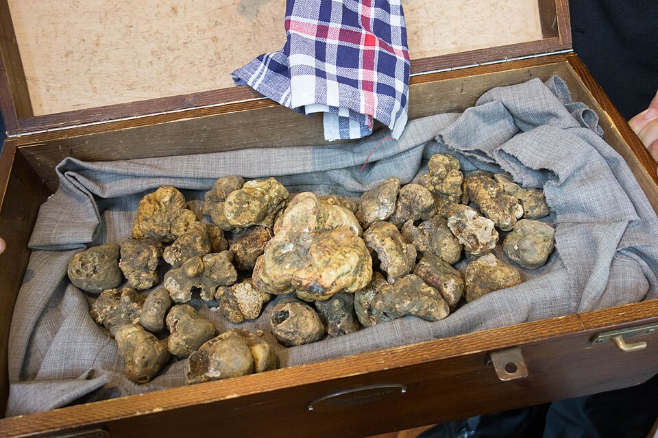
For many visitors today, Alba is associated less with towers than with something found beneath the surrounding woodland: the white truffle of Alba, the highly prized subterranean fungus that grows in symbiosis with the roots of particular trees. Its autumn season has made Alba an international centre of truffle culture and trade, while the hills surrounding the city produce some of Italy’s most celebrated wines.
Beyond Alba, the road enters the Langhe and begins climbing through a landscape that becomes progressively more rural.
-131.7 km · Manera and the High Langhe
At Manera, a locality among the higher hills south of Alba, 131.7 kilometres remain. By now the race has entered the broken terrain characteristic of the Langhe.
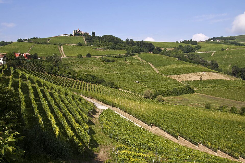
The Langhe are a landscape of long ridges separated by narrow valleys, formed from sedimentary rocks deposited when this part of northern Italy lay beneath an ancient sea. Erosion subsequently cut those sediments into the succession of hills visible today. Their slopes, elevations and exposures vary considerably over short distances, creating the physical diversity on which the region’s agriculture developed.
The famous vineyard landscape occupies only part of this territory. As the road climbs farther from Alba through Borgomale and towards Lequio Berria, vineyards share the hills with woodland, hazelnut groves and pasture. Settlements often occupy ridges rather than valley floors, historically giving villages defensible positions while leaving lower ground available for cultivation.
The course follows those natural folds, repeatedly dropping from one ridge before climbing towards another.
-118.8 km · Tre Cunei and the Langhe Ridges
Tre Cunei, one of the climbs highlighted by the race organiser, comes with 118.8 kilometres remaining. It is not a monumental summit. Its place in the route comes from the succession of elevation changes accumulating across this part of the Langhe.
From here the race continues through Albaretto della Torre, a small hill village named partly for the medieval tower that still dominates its skyline, then towards Sinio and Roddino. Villages appear along the ridges with cultivated slopes falling away beneath them, while another line of hills rises across the valley.There is rarely enough level ground for that pattern to disappear for long.
-105.4 km · Roddino and the Road to Dogliani
Roddino, a small ridge-top village in the southern Langhe, is reached with 105.4 kilometres remaining. From here the road works towards Dogliani and the end of the long sequence of climbs dominating the first half of the race.
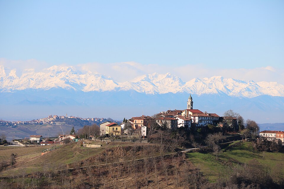
The agricultural landscape is changing as well. These hills have a particularly old association with Dolcetto, a native black grape of Piedmont. Its name can mislead an international reader because dolce means sweet in Italian, yet Dolcetto normally produces dry red wines.
A document preserved farther down the road at Dogliani shows how deeply the grape was already embedded in the local economy more than four centuries ago.
-96.3 km · Dogliani · Wine and the Architecture of Schellino
Dogliani, a wine town on the Rea stream, lies beneath a hilltop medieval district. Archaeological evidence indicates settlement here before the Romans, while the later town developed around a fortified upper settlement and a lower walled borough. That division remains visible, with the old Castello district above and the modern town spreading beneath it.
A Dogliani municipal document from 1593 specifically mentions Dolcetto while regulating the grape harvest, forbidding growers from picking before the authorised date without permission. More than simply proving the grape’s age, the regulation shows that wine production was already important enough for the community to control when harvesting could begin.
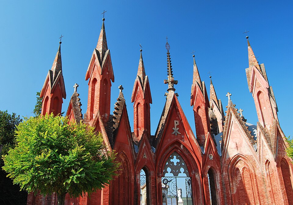
Dogliani acquired another distinctive identity during the 19th century through Giovanni Battista Schellino, a local architect born in 1818. Schellino transformed his hometown with an unusual collection of neo-Gothic, neo-Romanesque and eclectic buildings. Churches, towers, hospital buildings and cemetery architecture gave a relatively small Piedmontese town a visual vocabulary far more theatrical than its size might suggest.
From Dogliani the course becomes less relentlessly hilly and travels west through Farigliano towards the agricultural plain around Bene Vagienna.
-76.4 km · Bene Vagienna · A Roman City Beneath the Fields
Bene Vagienna is a small Piedmontese town west of the Langhe, but the more unusual discovery lies about two kilometres from its modern centre. Beneath surrounding farmland are the remains of Augusta Bagiennorum, a Roman city founded in the late 1st century BC during the age of Emperor Augustus.
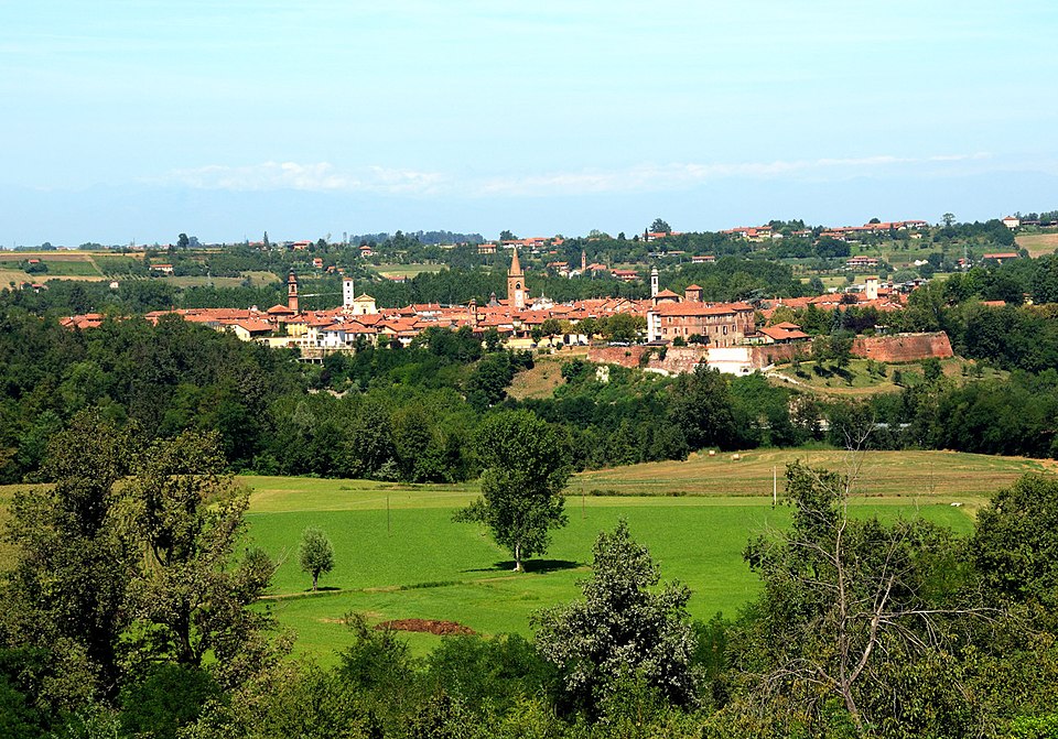
Its name preserved that of the Bagienni, a Ligurian people who inhabited this part of north-western Italy before Roman conquest. Augusta Bagiennorum occupied a useful position between routes leading across the Piedmontese countryside towards the Alpine valleys and Ligurian coast.
The city eventually disappeared as an urban centre and fields spread across much of its former site. Excavations beginning in the late 19th century revealed remains of a theatre, amphitheatre, baths and other structures, but agriculture continued around them.
That relationship is what makes the site unusual today. Augusta Bagiennorum is not a Roman quarter absorbed by a modern city. Its surviving walls and foundations emerge among cultivated fields, fragments of an ancient urban plan occupying a landscape that returned to agriculture centuries ago.
The riders continue through Lequio Tanaro and Narzole before the road bends back towards the vineyards.
-55.4 km · Entering the Barolo Hills
With 55.4 kilometres remaining, the race approaches La Morra, one of the principal villages of the Barolo wine-producing area.
Barolo is a dry red wine produced from the Nebbiolo grape within a legally defined group of municipalities in the Langhe. Its identity is unusually dependent on place because Nebbiolo responds strongly to slope, exposure, elevation and soil. Vineyards separated by relatively short distances can consequently possess different historical reputations.
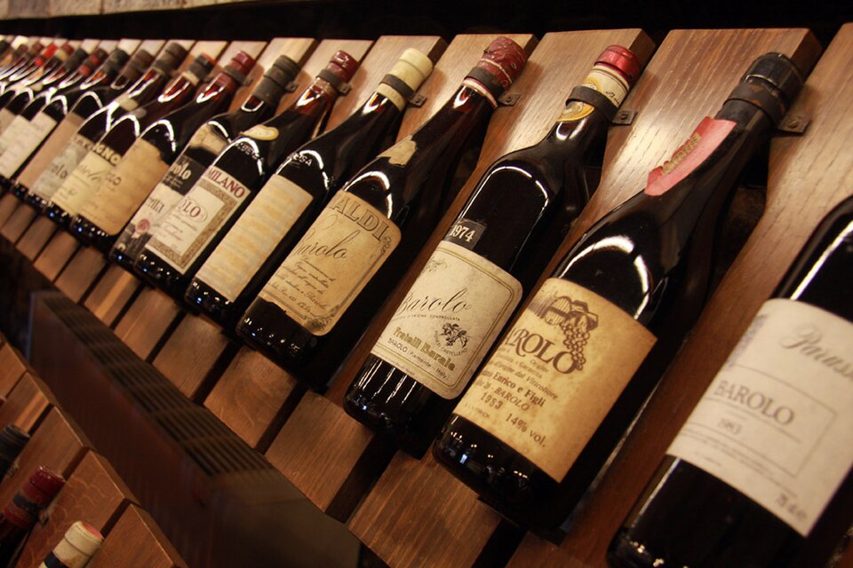
The vineyard landscapes of Langhe-Roero and Monferrato are included on the UNESCO World Heritage List for this long interaction between cultivation and terrain. The designation encompasses more than attractive vineyards. Villages, cellars, roads and cultivated slopes together preserve a landscape organised around wine over many generations.
La Morra occupies one of its highest and most recognisable ridges.
-48.3 km · La Morra · Above the Vineyards of Barolo
La Morra, a hilltop village overlooking the Barolo-producing Langhe, stands high above vineyards that spread across almost every suitable slope around it. From the Piazza del Belvedere, the ground falls into a succession of cultivated hills, with other villages occupying neighbouring ridges and the Alps visible on the distant horizon in clear weather.
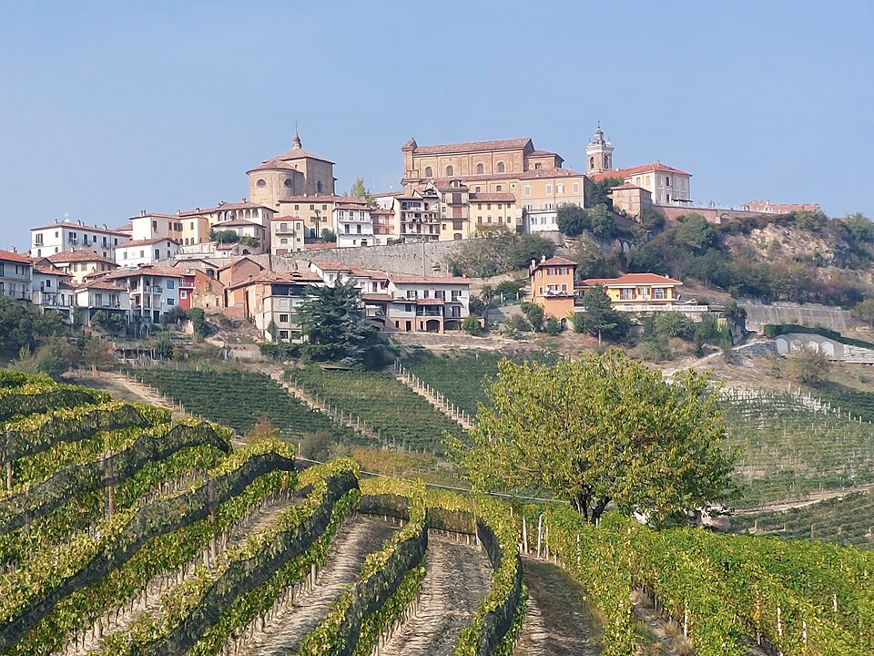
Farmhouses and cellars are scattered among slopes divided into individual vineyard sites, while narrow roads descend from the village before climbing towards the next ridge. Generations of growers have learned to distinguish these slopes according to exposure, soil and local conditions, producing a remarkably detailed agricultural geography within a small area.
The race descends through San Giacomo towards Pollenzo and Bra, passing close to the finish before beginning the only complete circuit of the day.
THE FINAL CIRCUIT · 34.7 km Through Cherasco, La Morra and Pollenzo
The final 34.7-kilometre circuit links Bra with Cherasco, a planned medieval town above the Tanaro; La Morra and its vineyard ridge; Verduno, a small wine village with connections to the House of Savoy; and Pollenzo, an ancient settlement later transformed into a royal agricultural estate.
-29.8 km · Cherasco and Napoleon’s Armistice
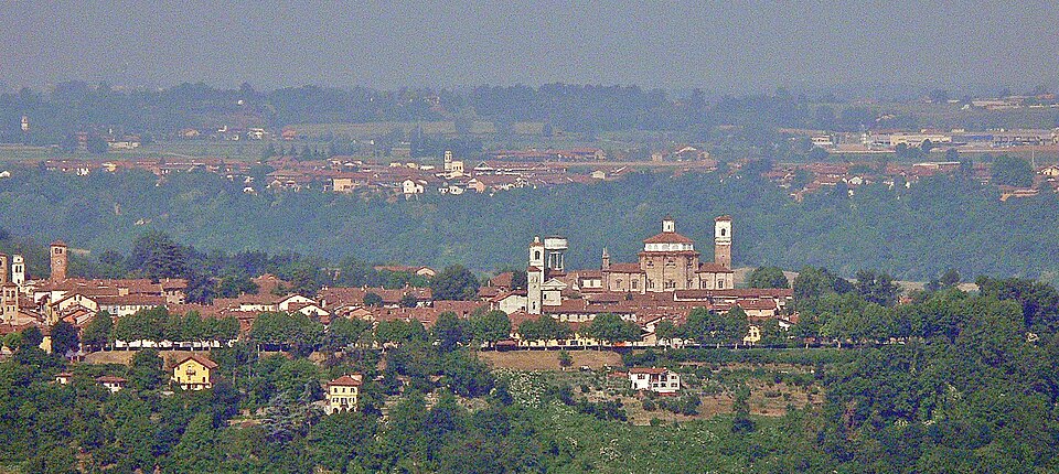
Cherasco, a medieval town standing on a plateau above the confluence of the Tanaro and Stura di Demonte rivers, was founded in the 13th century as a planned settlement. Its relatively straight streets still distinguish it from the more irregular hill villages of the Langhe.
Its position repeatedly brought larger conflicts through the town, most famously in 1796, during Napoleon Bonaparte’s first Italian campaign. Napoleon was then a young French general whose army had defeated the forces of the Kingdom of Sardinia-Piedmont and advanced rapidly across the region.
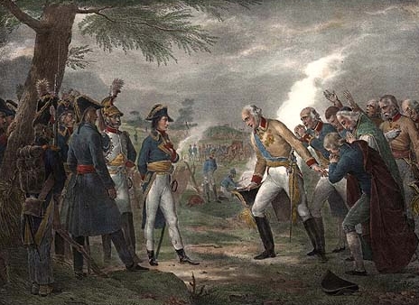
After the Piedmontese defeat at Mondovì, negotiations at Cherasco produced an armistice that forced King Victor Amadeus III to abandon the coalition against revolutionary France and surrender strategic fortresses. Piedmont was effectively removed from the campaign, allowing Napoleon to concentrate his forces against Austria in northern Italy.
Napoleon stayed at Palazzo Salmatoris, one of the noble residences reflecting the prosperity Cherasco had developed through trade and silk production. A relatively small Piedmontese town had briefly become the place where the direction of a European war changed. From Cherasco, the race leaves the plateau and returns to the Barolo hills.
Verduno · A Savoy Village Above the Tanaro
Verduno, a small village on a ridge above the Tanaro valley, developed around a castle that became associated during the 19th century with the House of Savoy, the dynasty that ruled Piedmont-Sardinia and later supplied the first kings of unified Italy.
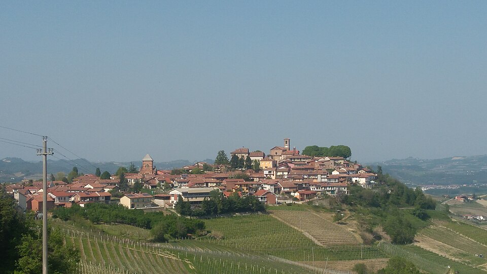
The village also preserves a much more local identity through Pelaverga Piccolo, an indigenous grape cultivated in a restricted area around Verduno. It produces the aromatic red wine Verduno Pelaverga, surviving in countryside internationally dominated by the reputation of Barolo and Nebbiolo.
Below Verduno, the vineyards begin to give way to flatter ground around the Tanaro. Pollenzo lies ahead.
-4.7 km · Pollenzo · A Royal Estate Reimagined Around Food
Pollenzo, now part of the municipality of Bra, grew on the site of ancient Pollentia, a Roman settlement established at an important junction of regional routes. The surrounding countryside later gave its name to the Battle of Pollentia in 402 AD, fought between Roman forces commanded by Stilicho and the Visigoths led by Alaric during the troubled final century of the Western Roman Empire.
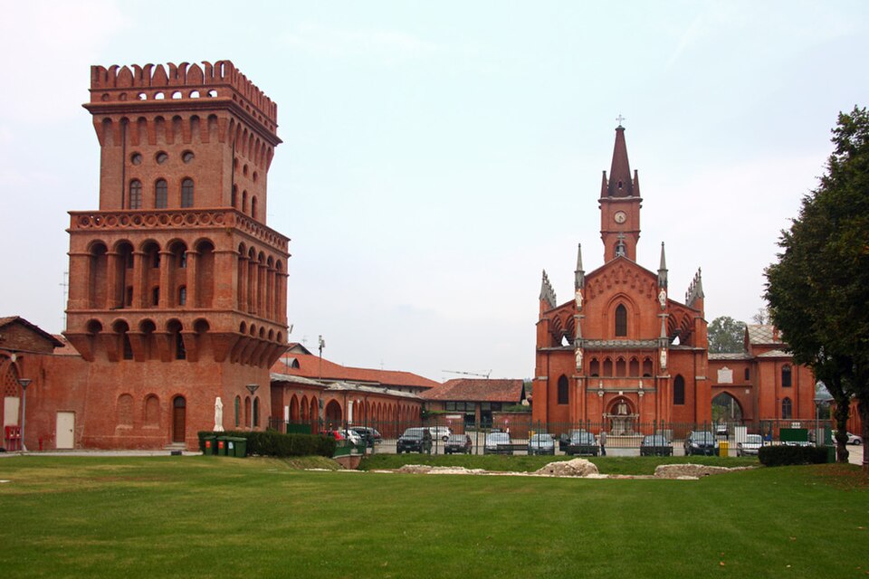
Little about the appearance of modern Pollenzo, however, is explained by Rome alone. During the 19th century King Charles Albert of Sardinia, a member of the House of Savoy, transformed the area into a royal agricultural estate. Architects reworked the village and estate in a deliberately medievalising style, creating a complex of towers, courtyards, farm buildings and royal spaces. The estate now forms part of the UNESCO-listed Residences of the Royal House of Savoy.
Agriculture remained central to Pollenzo, but its meaning changed again in the early 21st century. The former estate became home to the University of Gastronomic Sciences, founded in association with the Slow Food movement. Rather than functioning as a conventional culinary school, the university approaches food through agriculture, culture, economics, sustainability, production and the societies that create it. That modern role provides the connection with Bra, only a few kilometres away.
FINISH · Bra · The Town Behind Slow Food
Bra, a town in the province of Cuneo at the edge of the Roero hills, has acquired an international cultural influence disproportionate to its size. It is the home town of Carlo Petrini, the Piedmontese writer and food activist who became the central figure in the creation of Slow Food.
The movement emerged in Italy in 1986 amid concern about industrialised food, disappearing local traditions and the spread of fast-food culture. It subsequently developed into an international organisation advocating food that it describes as good, clean and fair, connecting quality and pleasure with biodiversity, environmental sustainability and fair conditions for producers. Bra remains one of its principal centres and has hosted Cheese, an international event devoted to cheese and dairy biodiversity, since 1997.
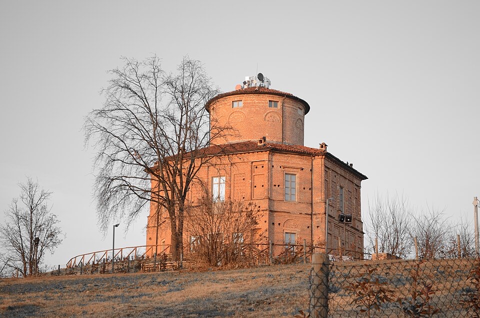
The town’s history is considerably older. Above Bra stands La Zizzola, an octagonal 19th-century villa on Monteguglielmo that has become one of the city’s visual symbols. Below it, the town developed through commerce and industries including tanning before its modern association with food culture became internationally recognised.
The final approach initially remains flat. At approximately 1.8 kilometres to go, the road begins to rise, first gently and then for around a kilometre at roughly five per cent, with a maximum gradient of about eight per cent shortly before the final kilometre. Two bends inside the final 500 metres lead onto a 250-metre finishing straight that continues slightly uphill.
Beyond the barriers, the hills around Bra are still agricultural country. Vineyards run across the Langhe to the east, farms occupy the Tanaro plain, and Pollenzo lies only a few kilometres behind the race. Slow Food grew here among those landscapes rather than in isolation from them, which makes Bra a fitting endpoint for a Gran Piemonte spent moving through places where agriculture has shaped not only what people produce, but the appearance and identity of the land itself.



