

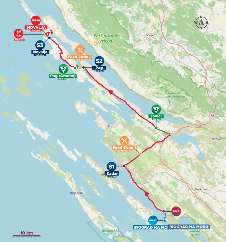
Stage 2 is short, but the landscape changes quickly enough to make the distance feel larger than it is. From Biograd na Moru, the race heads north along the coast towards Zadar, then turns towards the rougher country beneath Velebit before crossing onto Pag, where the final part of the stage unfolds across one of the most exposed islands in the Adriatic.
The profile is not mountainous. The classified climbs at Jovići and Gradac are modest, and on paper the stage looks manageable for fast riders. The more unpredictable element is the setting itself. Pag lies directly opposite the Velebit range, exposed to the bora, the cold north-easterly wind that can descend from the mountains with enough force to reshape a race as quickly as any climb.
That wind also helps explain the island.
Pag is a place of pale limestone, low vegetation, salt pans and open grazing land, a landscape where the sea and weather are never far apart. Stage 2 reaches it only after crossing several layers of Dalmatian history, from a former Croatian royal centre at Biograd to Roman and medieval Zadar, then spends the final kilometres moving through an island whose harsh appearance has produced some of Croatia’s most distinctive traditions.
START · Biograd na Moru and a Former Royal Centre
Biograd na Moru is small enough today to feel like a coastal resort rather than a former centre of political power. In the Middle Ages, it was something very different.
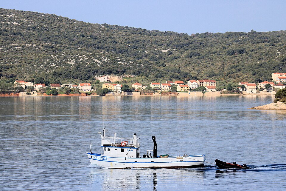
By the 11th century, Biograd had become one of the important centres associated with the Croatian monarchy and the seat of a bishopric. Petar Krešimir IV, one of the most important kings of medieval Croatia, supported monasteries here and strengthened a town already benefiting from its position on the Adriatic.
The moment most often attached to Biograd came in 1102, when the Hungarian king Coloman was crowned king of Croatia here. The event belonged to the complicated process by which the Croatian and Hungarian crowns became joined, beginning a political relationship that would endure in changing forms for centuries.
The town’s importance faded quickly afterward. Venice captured and devastated Biograd in 1125, and the political centre moved elsewhere. When crusaders attacked nearby Zadar in 1202, refugees later helped repopulate Biograd, one reason the town became known in Venetian usage as Zara Vecchia, or Old Zadar.
The stage leaves that diminished royal centre and follows the coast north. The next major city is much larger, and much older.
-92.8 km · Zadar and a City Built From Earlier Cities
The first intermediate sprint comes in Zadar after 21.7 kilometres. The race uses the modern city rather than the narrow peninsula at its historic core, but that old centre remains only a short distance from the road.
Zadar developed over an earlier Liburnian settlement and became the Roman city of Iader. Its forum formed the civic heart of the town, and fragments of that Roman centre remain visible today.
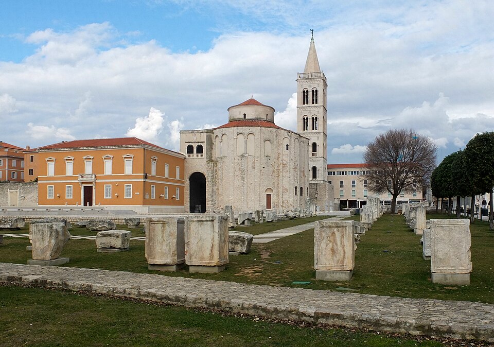
What came later was not built beside the Roman city so much as through it. The circular Church of St Donatus, begun around the 9th century, stands beside the forum and incorporates stone taken from the ancient complex. Roman columns, blocks and fragments were reused directly in the medieval building, turning pieces of one city into the structure of another.
That practice was not unusual in the medieval Adriatic, but in Zadar the layers remain especially visible. Roman streets and civic spaces survived into a city later shaped by Croatian, Byzantine and Venetian rule, while the compact peninsula continued to be rebuilt rather than abandoned.
The race does not stay long enough for that history to slow the stage, north of Zadar, the coast begins opening and the land grows harsher.
-63.8 km · Jovići and the Shadow of Velebit
The first classified climb rises towards Jovići, reaching the summit with 63.8 kilometres remaining.
The gradient is modest ad the larger presence is Velebit. The mountain chain runs along the Croatian coast like a wall between the Adriatic and the continental interior. Built largely from limestone and dolomite, it belongs to the Dinaric Alps and carries an intensely karstic landscape of sinkholes, caves, fractured ridges and underground drainage.
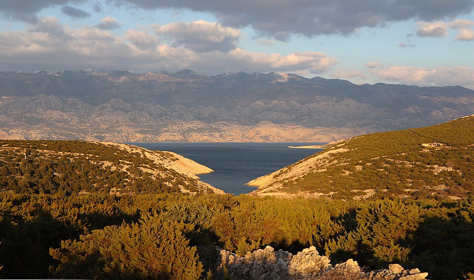
From the road, Velebit can look dry and motionless. Its most powerful influence is invisible until the air begins moving. The bora forms when cold air gathers inland and spills across the mountains towards the warmer Adriatic. As it descends through gaps and over ridges, it accelerates sharply, often reaching the coast in violent gusts.
The eastern side of Pag lies directly in its path. Approaching the island, the vegetation begins thinning. Trees become scarce, scrub hugs the ground and bare limestone starts taking over the view. Across the channel, Velebit remains present almost continuously, close enough to dominate the horizon and far enough away to make the island feel exposed between mountain and sea. The road soon reaches the bridge that carries the race onto Pag.
PAG BRIDGE · Entering the Bare Side of the Island
The Pag Bridge crosses the narrow Ljubačka Vrata channel and connects the southern tip of the island with the mainland.
Opened in 1968, it changed the practical geography of Pag. The island remained surrounded by water, but road traffic no longer depended entirely on ferries and boats.
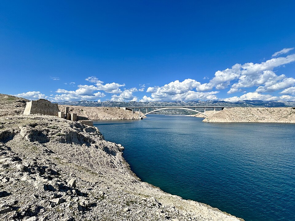
For Stage 2, the bridge also marks a much sharper change than the map suggests. On the mainland side, the road still belongs to the wider Dalmatian coast. Across the water, the eastern face of Pag appears pale and stripped back, with long stretches of exposed limestone and very little tall vegetation.
The bora is partly responsible. Wind crossing the channel carries salt spray onto the island, and repeated exposure makes life difficult for trees and larger plants. The surface that remains is white stone, low scrub and thin strips of soil protected wherever possible from the wind.
The usual comparison is lunar, and it has become a cliché because almost every description of Pag reaches for it. The landscape is better understood on its own terms. It is not empty. It is exposed.
Human settlement here has always depended on working with conditions that offer very little shelter.
Pag · Salt, Stone and a Planned Renaissance Town
With the race well inside the island, the road reaches the town of Pag.
Salt shaped this place long before tourism did.
The shallow water and strong sun around the bay allowed seawater to evaporate in managed basins, and the resulting salt became one of the island’s most valuable resources. Before refrigeration, salt was essential for preserving food, which gave places capable of producing it reliably an importance far beyond their size.
Venetian authorities understood that value and regulated production closely. The salt pans remain part of the landscape, flat geometric surfaces lying almost at sea level beneath the pale hills.
The present town dates largely from the 15th century, when the population moved from an older settlement farther south. Unlike many coastal towns that grew irregularly over centuries, Pag was laid out according to a deliberate plan around a central square, with major civic and religious buildings positioned within a more ordered street system.
The design is associated with Juraj Dalmatinac, one of the most important architects and sculptors of the eastern Adriatic Renaissance.
There is an unexpected precision to the place. Outside the walls, the island appears rough and elemental. Inside, the streets follow geometry.
The race leaves town and begins climbing again.
-24.8 km · Gradac and the Open Country Above Pag
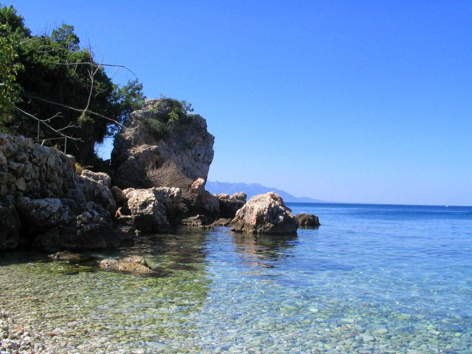
The second classified climb reaches Gradac with 24.8 kilometres remaining.
It is short enough that the road never becomes a true climbing contest, but the view opens across the part of Pag that explains the island better than any monument. Below are the salt pans and the bay. Across the channel stands Velebit. Between them lies a landscape of stone, grazing land and low vegetation that has spent centuries under wind and salt.
Moving north, the island gradually becomes less severe.
The road begins approaching Kolan, where the sparse pastures support one of Pag’s best-known products.
Kolan · Sheep in the Wind
Kolan sits in the central part of Pag, surrounded by grazing land that can look almost incapable of supporting agriculture. Sheep manage it.
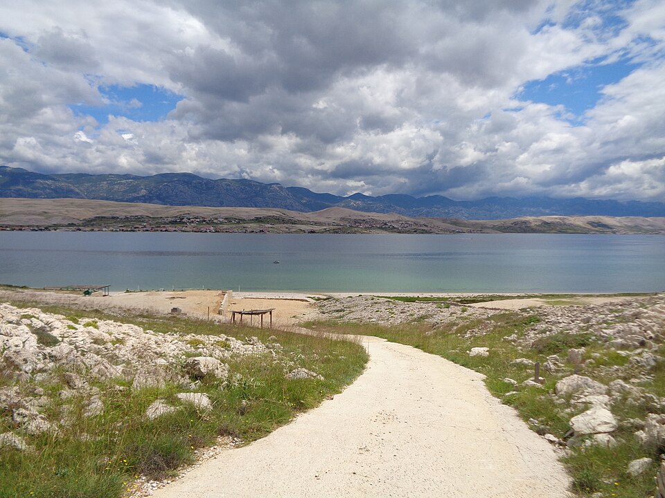
The local breed feeds on grasses, sage and other hardy plants growing between the stones. Bora winds carry salt inland from the sea, and the combination of aromatic vegetation, thin soils and salty exposure contributes to the character traditionally associated with the milk.
From that milk comes Paški sir, the hard sheep’s cheese that has become one of the island’s best-known foods.
Cheese-making offered a way to preserve and concentrate a resource produced under difficult conditions. Milk could not travel far or last long, but a hard cheese could be stored, transported and traded.
Pag’s two defining products therefore come from almost opposite processes. Salt is extracted from seawater under sun and wind. Cheese comes from animals grazing among the stones.
Both depend on the same landscape that makes the island appear so austere from the road. Novalja is now close…
FINISH · Novalja and a Roman Aqueduct Beneath the Streets
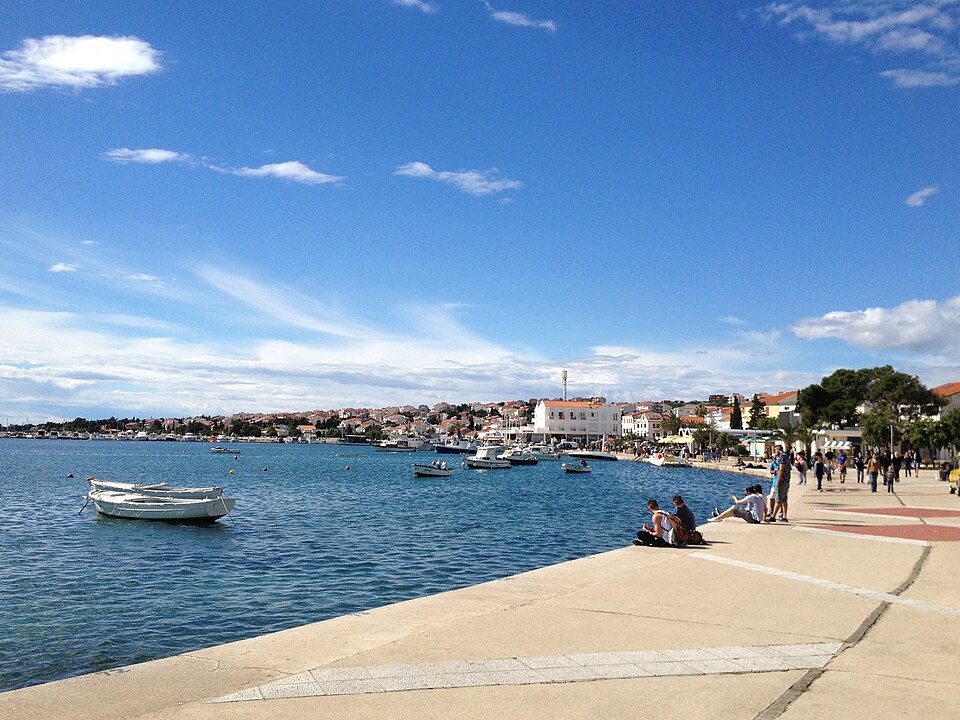
The stage finishes in Novalja, near the northern end of Pag. Modern Novalja is best known for summer tourism and the nightlife around nearby Zrće Beach, but beneath the town survives something much older and far less visible.
During the Roman period, workers carved an underground aqueduct through solid rock to bring fresh water towards the settlement.
Known locally as the Talijanova buža, the tunnel extends for more than a kilometre and is astonishingly narrow in places. Vertical shafts were cut down from the surface to help with excavation, access and ventilation, some descending dozens of metres through the rock.
The work would have been slow and difficult even with modern equipment. In the 1st century, it required sustained manual excavation through limestone.
The aqueduct suggests a Roman settlement important enough to justify major investment in water supply, probably serving both the local population and maritime activity along this stretch of the Adriatic. That hidden structure sits beneath a stage whose most obvious feature is exposure.
From Biograd, the race has passed through royal Croatia, Roman and medieval Zadar, the wind-scoured country below Velebit and the bare southern face of Pag before reaching salt pans, sheep pastures and Novalja.
Only 114.6 kilometres separate the start and finish, but the road crosses a remarkably complete change of landscape between them.



