

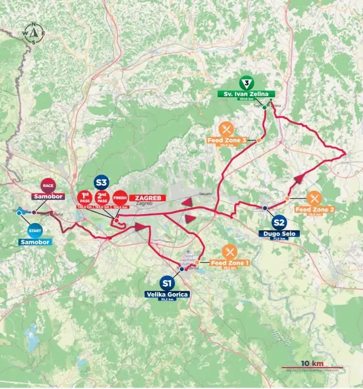
The final stage of the CRO Race begins in a town visited only a day earlier, but almost immediately takes the race into a different Croatia. Stage 5 approached Samobor through vineyards and wooded hills after a long journey from Karlovac; Stage 6 leaves its central square for the broad lowlands surrounding Zagreb, where the Sava River and its tributaries created fertile plains, forests and routes that have been used since antiquity. The road passes through Sveta Nedelja without repeating yesterday’s stories, skirts the southern edge of Zagreb, crosses Turopolje through Velika Gorica, reaches the eastern plains around Dugo Selo and Vrbovec, then turns north-west through the wine country of Sveti Ivan Zelina before finally returning to the capital.
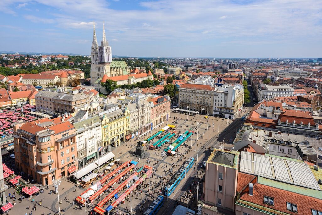
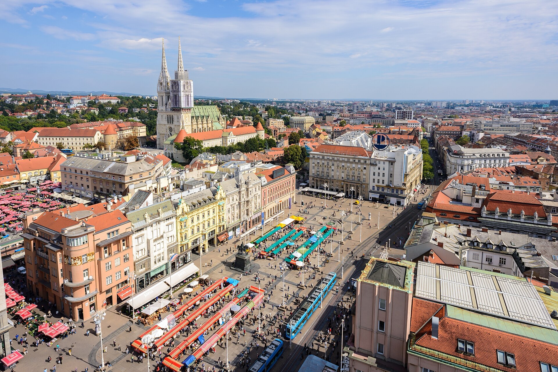
Zagreb Cathedral rising above Ban Jelačić Square in the historic heart of Croatia’s capital. Photo by Nick Savchenko, licensed under CC BY-SA 2.0, via Wikimedia Commons.
The 159.5-kilometre route contains only around 635 metres of climbing, so its interest lies less in dramatic topography than in the enormous circle it draws around Zagreb. Rather than heading directly from Samobor to the capital, a journey that could be completed in little more than twenty kilometres, the peloton spends most of the afternoon exploring the country that historically supplied, defended and connected the city. Only at the end does the race enter Zagreb for good, finishing beside Lake Jarun, where a former branch of the Sava was transformed into the sporting landscape that hosted the 1987 Summer Universiade.
START · Samobor and the Square Beneath the Hills
Stage 5 already introduced Samobor as a medieval free royal market town and followed the long struggle between its citizens and the lords occupying the castle above them, so repeating that history would add little to the final stage. The start instead offers an opportunity to look more closely at the town that eventually emerged after those medieval disputes had faded.
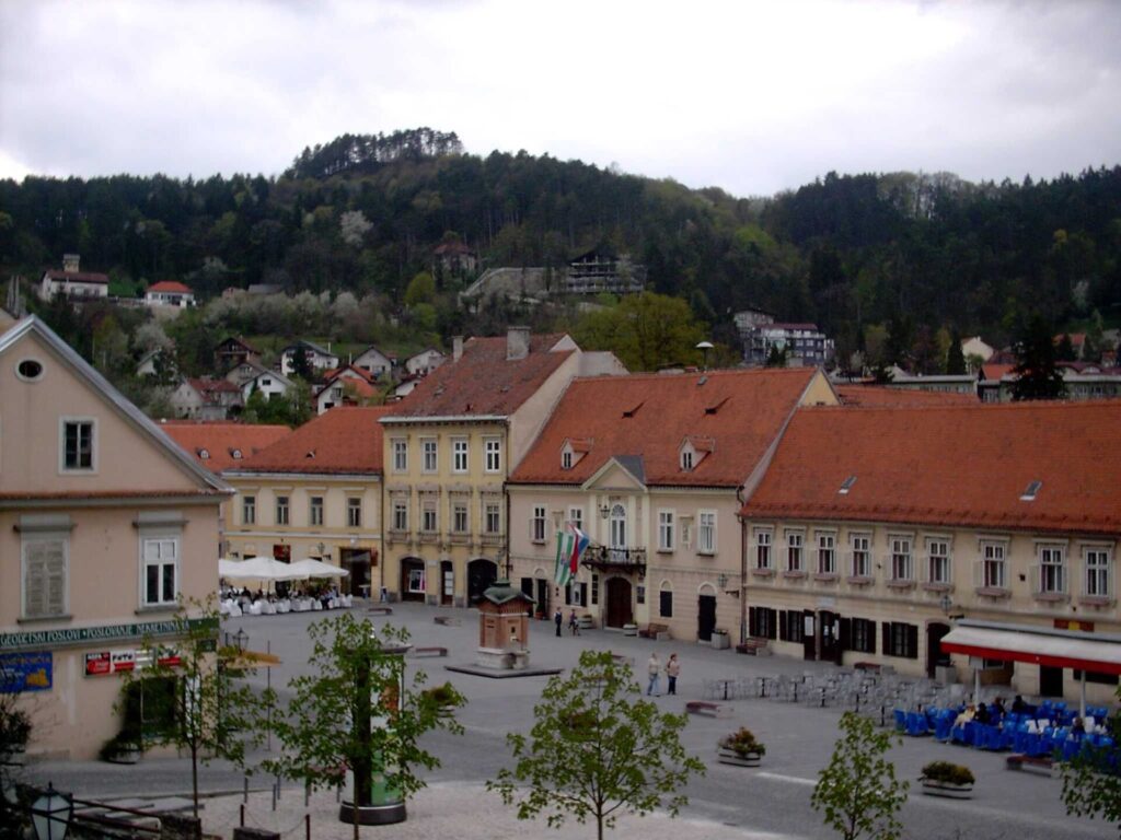
King Tomislav Square, the café-lined central marketplace at the heart of Samobor’s historic centre. Photo by Perun, licensed under CC BY-SA 3.0, via Wikimedia Commons
The riders gather in Trg kralja Tomislava, the main square at the centre of Samobor, surrounded by the low façades of a town that became increasingly attractive to visitors from Zagreb during the 19th century. The journey became considerably easier after 1901, when a narrow-gauge railway connected Zagreb with Samobor. The little train became affectionately known as the Samoborček, and for generations it carried workers in one direction and weekend excursionists in the other, helping turn the town and the surrounding hills into one of Zagreb’s favourite escapes. The railway closed in 1979, by which time buses and private cars had made its slow journey increasingly impractical, but its memory remains unusually strong because it belonged to the everyday relationship between the capital and the smaller town at the foot of the hills.
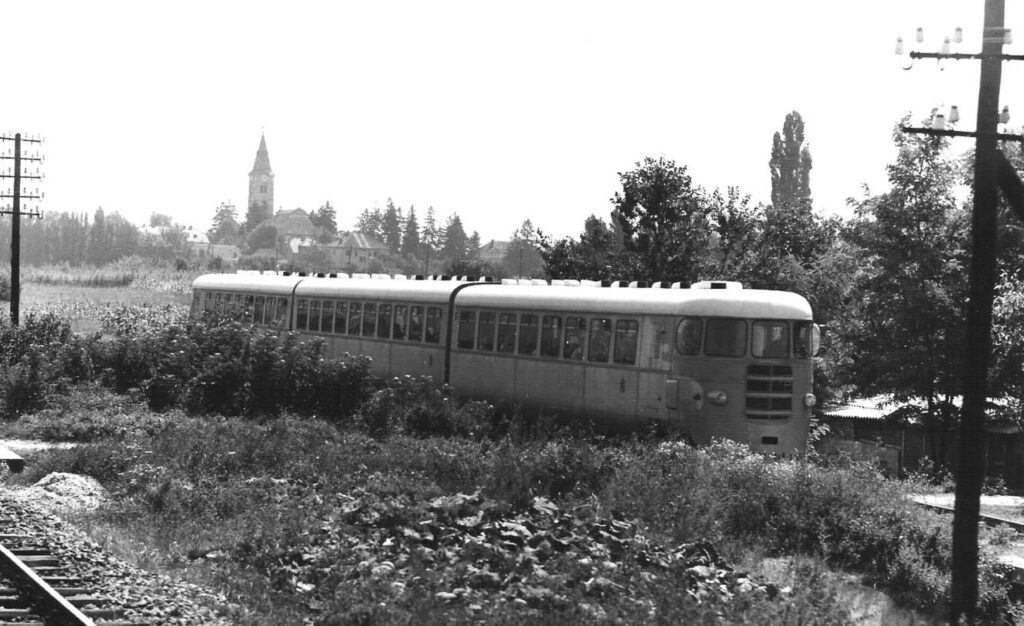
A Samoborček narrow-gauge diesel railcar operating between Zagreb and Samobor in July 1970. Photo by Dr. E. Scherer, licensed under CC BY 2.5, via Wikimedia Commons.
The same period strengthened Samobor’s reputation for crafts, inns and food, including the kremšnita mentioned on Stage 5. The pastry is worth understanding rather than simply adding to a list of regional dishes: it consists principally of warm vanilla custard held between layers of puff pastry, traditionally served in large square portions, and became so closely associated with Samobor that travelling from Zagreb to eat one became part of the excursion itself. The modern recipe associated with the town was developed in the 20th century, long after Samobor’s medieval market privileges, but it belongs to the same continuing role as a place where the city comes to spend a day away from itself.
The race makes a circuit through Samobor before returning to the square and leaving eastwards, retracing the road towards Sveta Nedelja that closed Stage 5. Yesterday the town provided the finish and a story about Kerestinec Castle, Roman movement and the peasant revolt of 1573; today it is simply part of the transition from the Samobor Hills towards the metropolitan plain. Beyond it, the route reaches Lučko and begins turning south around Zagreb rather than entering the city.
Velika Gorica and Turopolje · The Noble Peasants of the Zagreb Plain
South of the Sava, the peloton reaches Velika Gorica, the principal town of Turopolje, a low and fertile region extending between the Sava and Kupa rivers and the wooded Vukomeričke hills. Modern Velika Gorica has grown into one of Croatia’s larger urban centres and lies close to Zagreb’s international airport, yet the surrounding countryside preserves a regional identity that developed quite differently from the capital only a few kilometres to the north.
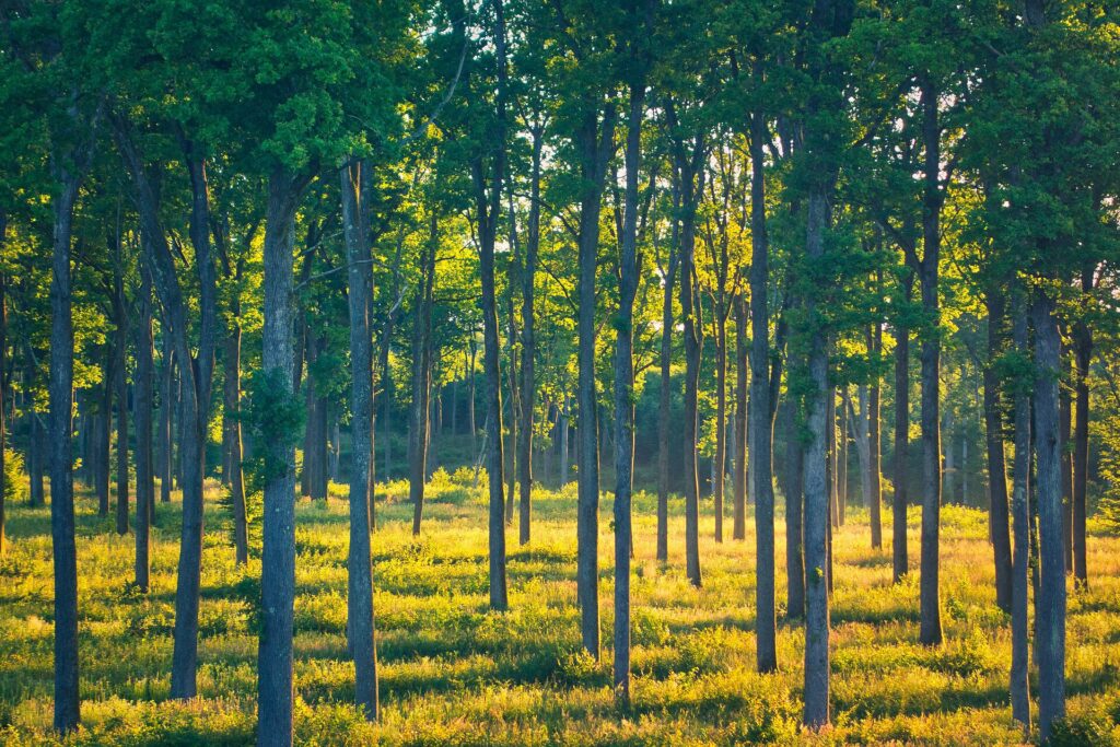
Tall oak trees near the Turopoljski Lug forest in Croatia’s lowland Turopolje region. Photo by Ivan Zilich, licensed under CC BY-SA 4.0, via Wikimedia Commons
Water and forest were fundamental to that identity. The Sava repeatedly changed its channels across the plain, leaving wetlands, meadows and fertile ground behind it, while extensive oak forests provided timber, pasture and resources that could be shared by local communities. Houses, barns and even churches were traditionally constructed from oak, and a small number of wooden chapels still survive around Turopolje. Their walls were assembled from heavy oak planks by local craftsmen, while interiors could be unexpectedly elaborate, covered with painted saints, flowers and decorative patterns. They belong to a vernacular building tradition created from the material that the surrounding forests supplied in abundance.
Turopolje also developed an unusual political institution. During the Middle Ages, local landholders who owed military service to the Zagreb fortress gradually acquired privileges that distinguished them from ordinary dependent peasants. By the late 13th century they had organised themselves into what became known as the Noble Municipality of Turopolje, a self-governing community of relatively modest landowners who possessed noble status collectively and elected their own local leader.
These were not aristocrats living in palaces comparable with the Zrinski or Frankopan families encountered earlier in the race. Many worked their own land and lived in villages, which is why the description “noble peasants” is useful even if it simplifies a complicated legal status. Their privileges included control over communal property and a significant degree of local self-government, while assemblies allowed members to choose officials and defend their customary rights against outside interference.
The institution survived in meaningful form for centuries, until the abolition of feudal privileges during the revolutionary changes of 1848 transformed the legal structure on which it depended. Its physical traces remain in Velika Gorica and the surrounding villages, where the old municipal building, oak architecture and landscape of fields and forests preserve something of a community that existed within sight of Zagreb while governing much of its local life on its own terms.
Stage 6 crosses this plain before turning towards the Domovinski Bridge, carrying the race over the Sava and into the eastern approaches to the capital.
The Sava · The River Zagreb Spent Centuries Avoiding
The Sava is the great geographical constant of Zagreb, although for most of the city’s history the urban centre kept its distance from it. Rising in Slovenia and eventually joining the Danube at Belgrade, the river crosses Croatia from west to east through a broad alluvial corridor, linking Zagreb with a much larger river system extending towards the Black Sea.
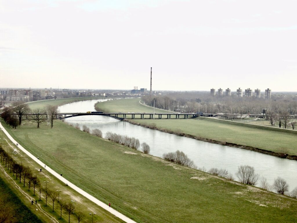
The Sava River flowing east through Zagreb, viewed from Liberty Bridge. Photo by Flammard, licensed under CC BY-SA 3.0, via Wikimedia Commons
For medieval Zagreb, however, the Sava was less an urban waterfront than an unpredictable boundary. The historic settlements from which the city developed, Gradec and Kaptol, occupied higher ground several kilometres north of the river, beneath Medvednica. That distance offered protection from flooding because the Sava could shift channels across the plain during high water, inundating low ground and making permanent construction risky.
As Zagreb expanded during the 19th and especially the 20th century, the city gradually moved south towards the river. Bridges improved connections with the villages and agricultural country beyond it, embankments attempted to control floods, and after the Second World War large residential districts were built south of the Sava as Novi Zagreb, or New Zagreb. The river that had once marked the edge of the city consequently became something much closer to its geographical centre.
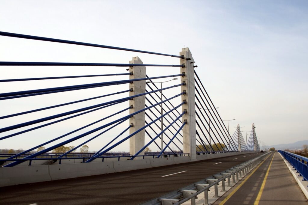
Domovinski Most, or Homeland Bridge, carrying road traffic across the Sava River in southeastern Zagreb. Photo by SpeedyGonsales, licensed under CC BY-SA 3.0, via Wikimedia Commons
Stage 6 makes that relationship particularly visible because it does not use one of Zagreb’s older central bridges. The riders cross the Sava on the Domovinski Bridge, opened in 2007 on the eastern side of the metropolitan area, and continue away from central Zagreb towards Dugo Selo. The capital is already close enough to dominate the road network, but the race postpones its arrival for another long loop through the plains to the east.
Dugo Selo · Templars, Hospitallers and the Road East from Zagreb
About twenty-three kilometres east of Zagreb lies Dugo Selo, a town whose modern importance comes largely from transport. Roads and railway lines leaving the capital divide here towards northern and eastern Croatia, making the settlement a natural junction between Zagreb and the wider Pannonian plain.
That role has much older precedents. During the early 13th century, the surrounding estate belonged to the Knights Templar, the military religious order founded in the context of the Crusades and eventually established across much of medieval Europe. The Templars were not present here because Dugo Selo lay anywhere near the Holy Land; orders such as theirs accumulated estates far across Christian Europe, whose agricultural income helped finance their institutions and military activities elsewhere.
When the Templars were suppressed in the early 14th century, much of their property passed to another military religious organisation, the Knights Hospitaller, later better known as the Knights of Malta. Their Croatian estates were administered through a network centred on Vrana in Dalmatia, and the land around Dugo Selo remained connected with the order until the 16th century.
The modern town developed much later. Its position on the road east from Zagreb became increasingly important, and railway construction strengthened the connection during the industrial age. Dugo Selo eventually became the point where major rail corridors diverged, one continuing east through the Sava basin and another turning towards Koprivnica and Hungary.
The riders follow that same general geography towards Vrbovec, although the surrounding country is now predominantly agricultural, with long stretches of open ground replacing the hills and forests of the previous stage.
Vrbovec · A Market Town in the Agricultural Country East of Zagreb
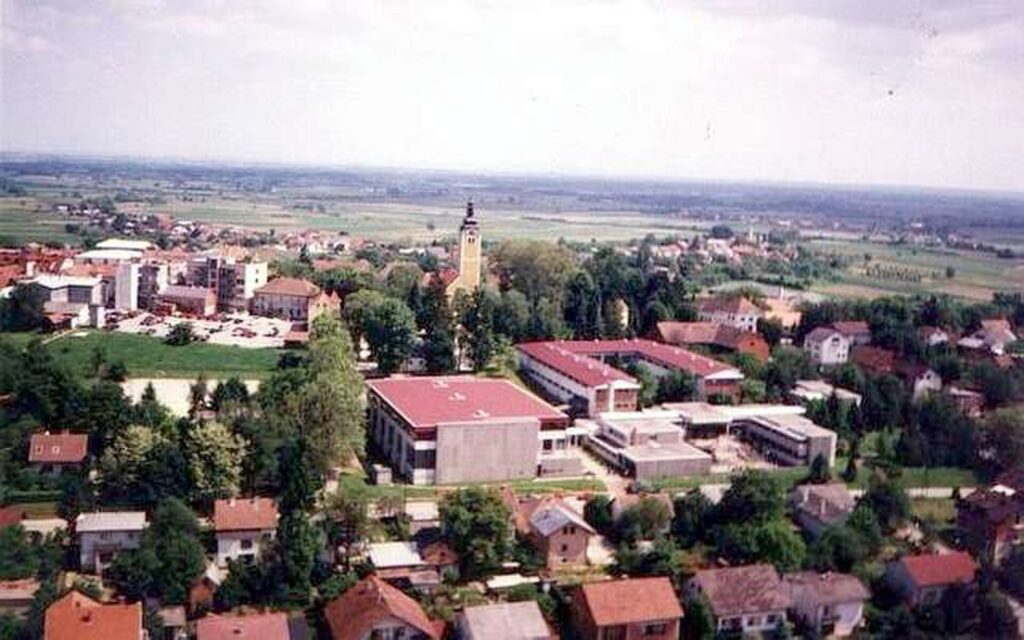
Aerial panorama of Vrbovec, a town in the rolling countryside of Zagreb County, Croatia. Photo by Euroman, released into the public domain, via Wikimedia Commons
Vrbovec lies roughly forty kilometres north-east of central Zagreb in a landscape of fields, low hills and small settlements. Unlike the Adriatic cities encountered earlier in the CRO Race, its history was never built around maritime trade or monumental stone architecture. Its importance came from the countryside surrounding it.
The town developed as a local market and administrative centre in an agricultural region producing grain, livestock and other food for Zagreb and neighbouring towns. Estates changed hands among noble families over the centuries, while the settlement itself remained closely tied to farming and the movement of produce along the roads leading towards the capital.
Vrbovec is also traditionally identified as the birthplace of Petar Zrinski, born in 1621 and already encountered on Stage 5 through the family’s castle at Ozalj. The connection gives the final stage another perspective on a figure whose life extended across a surprisingly large part of Croatia. Zrinski belonged to one of the country’s most powerful noble dynasties, became Ban of Croatia, fought against Ottoman forces and was eventually executed in 1671 with Fran Krsto Frankopan after the failed magnate conspiracy against Habsburg rule. Around Ozalj, his story belonged to aristocratic culture and politics; at Vrbovec, it begins in the quieter agricultural country east of Zagreb.
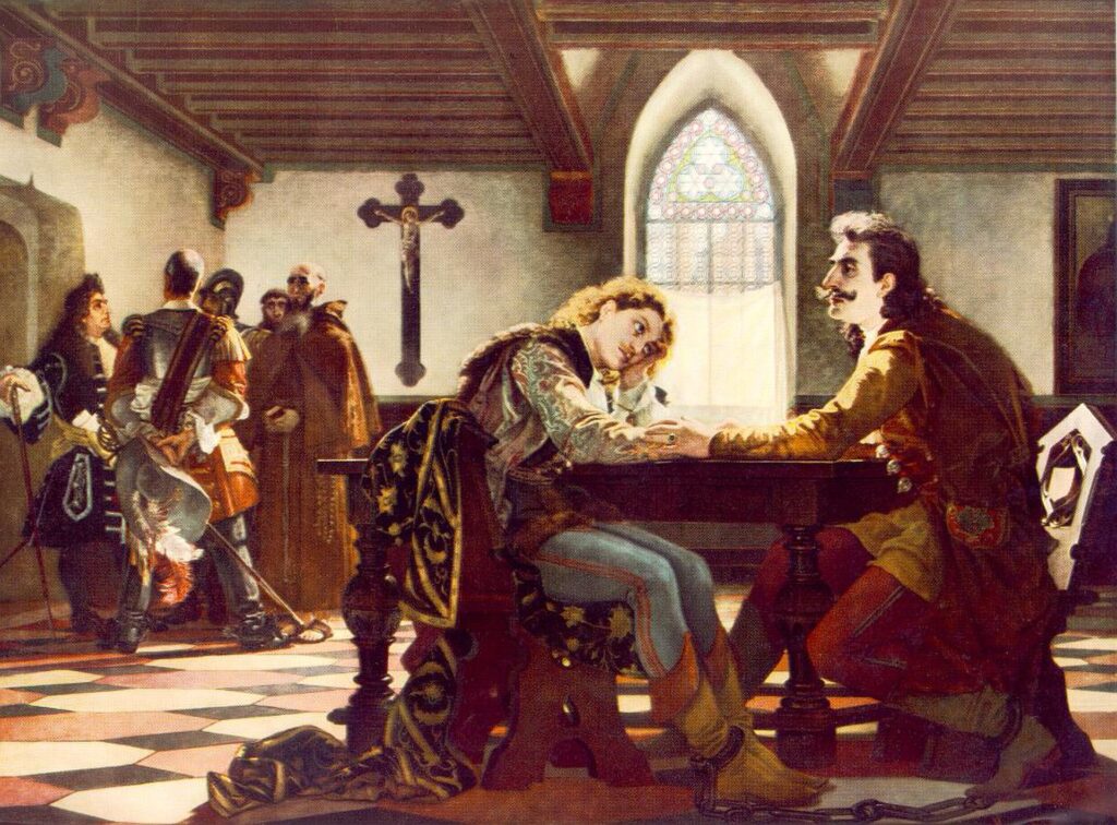
Petar Zrinski and Fran Krsto Frankopan imprisoned at Wiener Neustadt before their execution in 1671, depicted in Viktor Madarász’s 1864 painting. Public domain, via Wikimedia Commons.
The route does not continue farther into the Pannonian plain. From Vrbovec it begins turning back towards the capital, but first it reaches the low slopes north-east of Zagreb where vineyards once again appear above the road.
Sveti Ivan Zelina · Wine on the Slopes of Medvednica
Sveti Ivan Zelina stands about thirty kilometres north-east of Zagreb on the lower slopes beyond the eastern end of Medvednica, the mountain whose long forested ridge rises immediately north of the capital. The town occupies an old route between Zagreb and Varaždin, and its position between the plain and the hills helped it develop as both a market centre and a centre of wine production.
The settlement appears in medieval records by the 12th century, and in 1328 it received privileges as a free royal market town. Such privileges allowed regular markets and strengthened local commerce, drawing craftsmen and traders from the surrounding countryside. Ottoman incursions disrupted that development during the 16th century, but the town recovered as the frontier moved farther away.
Wine remained unusually persistent through those changes. Vineyards cover the hills around Zelina, where elevation and exposure create conditions different from the hotter Adriatic regions crossed during the opening stages. Records from the 15th century already document wine from villages around Zelina being sold in Gradec and Kaptol, the two neighbouring medieval settlements that eventually became Zagreb. The final stage is therefore travelling through one of the landscapes that supplied the capital long before the modern city expanded beyond its old walls.
One local grape carries that relationship particularly well. Kraljevina is a traditional white variety strongly associated with north-western Croatia and especially the Zelina area, producing generally light, fresh wines suited to the cooler continental climate. It lacks the international recognition of Chardonnay or Pinot Noir, but that relative obscurity is precisely what makes it useful for understanding the place: this is not a wine landscape created recently for visitors, but an agricultural tradition that grew alongside the markets of Zagreb.
From Zelina, the race turns south-west through Soblinec and finally commits itself to the capital. The long circuit of Zagreb’s surrounding country is almost complete.
Zagreb · Two Medieval Towns That Had to Become One
Approaching Zagreb from the east, the modern city spreads across a wide plain, and little in its scale suggests that for most of its history there was no single city called Zagreb in the modern sense. Its historic core developed from two neighbouring settlements, Kaptol and Gradec, divided by a stream and frequently divided by interests as well.
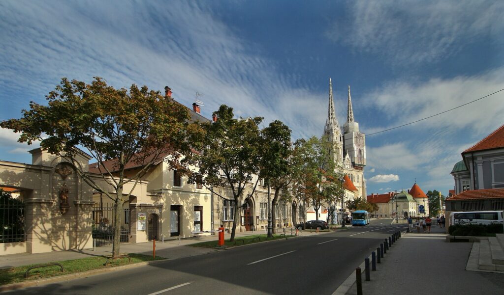
Zagreb Cathedral rising above Kaptol, the historic ecclesiastical quarter at the heart of Croatia’s capital. Photo by VitVit, licensed under CC BY-SA 4.0, via Wikimedia Commons.
Kaptol grew around the bishopric established in Zagreb in 1094, making it the ecclesiastical centre. The cathedral and the houses of canons formed a community under church authority. On the neighbouring hill, Gradec developed as a secular settlement of merchants and craftsmen and received major privileges from King Béla IV in 1242, shortly after the Mongol invasion had devastated parts of the region. Gradec became a free royal city with its own government and fortifications.
The physical distance between the two was tiny, but their rivalry could be fierce. Disputes over property, mills, taxation and trade occasionally became violent, and the stream separating them, the Medveščak, acquired a bridge whose later name, Krvavi Most, means Bloody Bridge. The waterway itself was eventually covered and converted into a street, leaving the name behind as one of the most vivid reminders that Zagreb’s old centre was once divided between competing jurisdictions.
Only in 1850 were Gradec, Kaptol and several surrounding communities formally united into the city of Zagreb. By then the medieval walls were becoming obstacles to expansion rather than essential defences, and during the later 19th century the city spread southwards across the plain towards the railway. Parks, civic buildings and broad streets transformed the lower town, while industrialisation and population growth eventually carried Zagreb much farther towards the Sava.
The CRO Race does not finish among those medieval streets. After entering the modern city from the east, it follows the great avenues across Zagreb towards a landscape created during an entirely different period of urban development.
FINISH · Jarun, From a Sava Backwater to Zagreb’s Sporting Lake
The final kilometres reach Jarun, in south-western Zagreb, where the race finishes on Aleja Matije Ljubeka beside the lake.
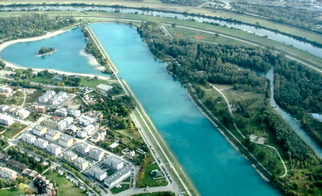
Cropped aerial view of Jarun Lake, Zagreb’s major recreational and rowing centre southwest of the city centre. Photo by Suradnik13, licensed under CC BY-SA 3.0, via Wikimedia Commons
Jarun looks deliberately constructed because much of the landscape is exactly that. The area originated as part of the shifting river environment of the Sava, with gravel pits and backwaters occupying low ground near the river. During the second half of the 20th century, Zagreb began transforming it into a recreational area, but the decisive redevelopment came in preparation for the 1987 Summer Universiade, the international university sports competition hosted by the city.
The lake was reshaped for rowing and canoeing, beaches and recreational areas were developed around it, and Jarun became one of Zagreb’s principal spaces for outdoor sport. The long road circling the water was later named after Matija Ljubek, one of Croatia’s greatest canoeists, who won four Olympic medals for Yugoslavia between 1976 and 1984, including gold in the C-1 1000 metres at Montréal in 1976 and another gold in the C-2 500 metres at Los Angeles in 1984.
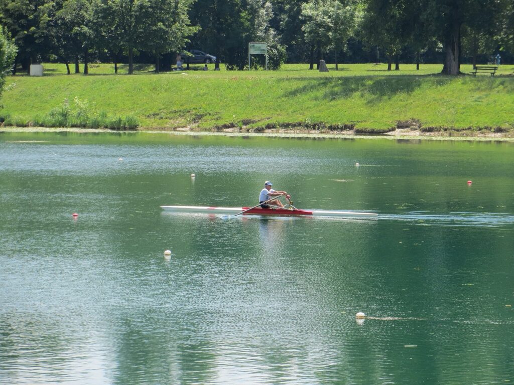
A rower training on Jarun Lake, Zagreb’s principal rowing and canoeing venue. Photo by Branko Radovanović, licensed under CC BY-SA 4.0, via Wikimedia Commons.
Ending the CRO Race here places the final sprint far from the Zagreb of cathedral towers and medieval gates. Jarun belongs instead to the city that expanded across the Sava plain during the 20th century, absorbing former fields, river channels and villages into a metropolitan landscape of housing, roads and recreational spaces. The riders have spent much of the stage travelling through the country surrounding that expansion, from the old excursion town of Samobor through the self-governing communities of Turopolje, the eastern transport corridor around Dugo Selo, the agricultural plain of Vrbovec and the vineyards of Zelina.
When the peloton finally reaches the lake, the journey that began five days earlier beside Diocletian’s Palace in Split has crossed almost the full geographical range of the race: Dalmatian coast and karst, the exposed island of Pag, Kvarner and Istria, the river country around Karlovac and, finally, the broad continental plain around Zagreb. Jarun does not need a monumental finish to complete that journey. Its water, roads and sporting grounds belong to the youngest of those Croatian landscapes, shaped not by Roman emperors, Venetian merchants or frontier nobles, but by the modern capital that grew outward until the Sava was no longer its boundary.



