

The name is new, but the race underneath it belongs to a much older Belgian cycling culture. In 2026 the former SUPER 8 Classic becomes the Flandrien 0.0 Classic, yet the route still begins in Brakel, still finishes at the gates of Brouwerij Haacht and still carries the memory of two riders from different generations of the Flemish Classics: Raymond Impanis and Peter Van Petegem. The event’s roots reach back to 1982 as a tribute to Impanis, and after interruptions and several reinventions it returned to professional racing in 2011 before becoming part of the UCI ProSeries.
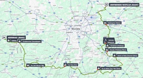
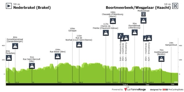
The 2026 route covers 199.4 kilometres and lists 15 climbs, beginning almost immediately with Parikeberg and Zonnebloemstraat before leaving East Flanders, crossing Hainaut and Walloon Brabant, then returning to Flemish Brabant for the decisive final seventy kilometres. Moskesstraat, Holstheide and Smeysberg are each crossed twice, Florivalstraat breaks up the two sequences, and Hulstbergstraat provides the final listed climb with 20.1 kilometres remaining.
That route makes the race broader than its Flemish name initially suggests. It starts among the short hills of the Flemish Ardennes, crosses Belgium’s language border into the agricultural country of Hainaut, passes through the territory of the Waterloo campaign, reaches Wavre and the rolling plateaus of Walloon Brabant, then returns north into the old greenhouse-grape country around Huldenberg. In the final ten kilometres, the race passes the monument to Raymond Impanis in Berg before continuing towards the brewery whose involvement has shaped several of the event’s modern identities.
There is no one climb capable of explaining the whole race and no single monument around which the route is built. The difficulty comes instead from the cumulative character of Belgian roads: short ascents, cobbles, narrow approaches, repeated changes of direction and a final hour in which positioning matters almost as much as climbing.

That is also close to the older meaning of the word attached to the race’s new name. A Flandrien was never defined by one mountain or one spectacular effort. The word belongs to riders who could continue when cold, wind, cobbles and ordinary roads had already taken away any possibility of comfort.
The 2026 route begins in the home landscape of one of the best examples.
START · Brakel and Peter Van Petegem’s Flemish Ardennes
The peloton gathers on the Marktplein in Nederbrakel, with the neutralised section looping through the town before the official start on the N493.
Brakel sits between the Scheldt and Dender within the Flemish Ardennes, a region whose name exaggerates its altitude but not its importance to cycling. The hills are low, yet streams have cut enough valleys into the terrain to create the short, irregular ascents that define so many Flemish races. Farms occupy the plateaus, villages sit in the folds between them and older roads often climb directly rather than searching for gentler gradients.
For Belgian cycling, Brakel is inseparable from Peter Van Petegem, born in Opbrakel in 1970 and known as the Zwarte van Brakel. He became one of the outstanding Classics riders of his generation, winning the Tour of Flanders twice and Omloop Het Volk three times, but his career is remembered most clearly for the spring of 2003.
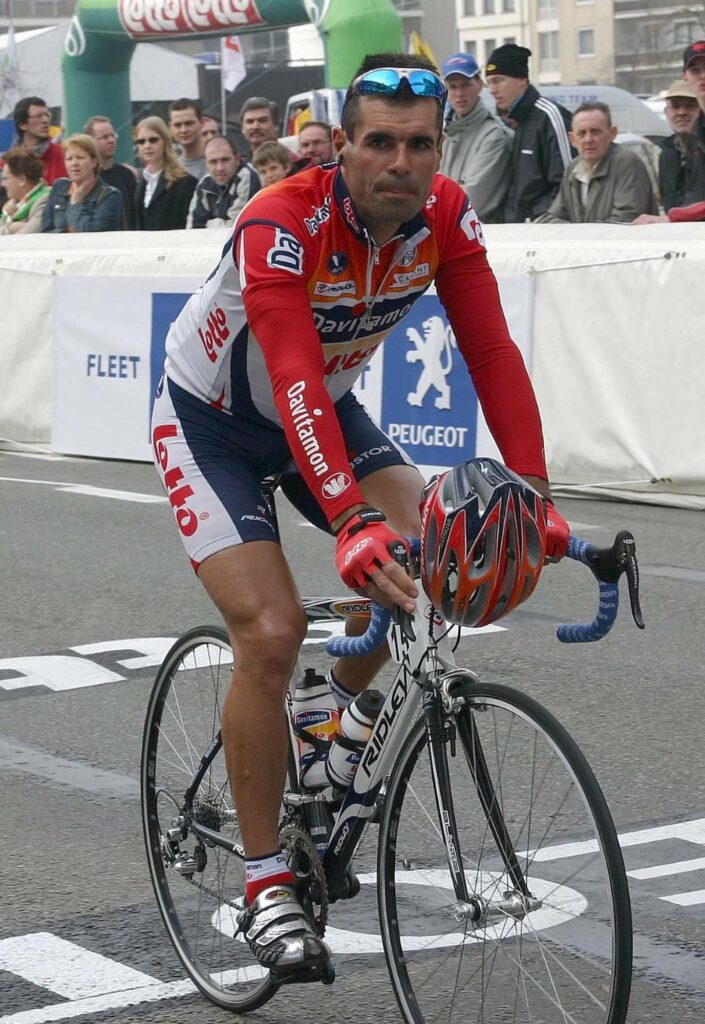
Belgian classics specialist Peter Van Petegem at the 2005 E3 Harelbeke. Photo by Filip Bossuyt, licensed under CC BY 2.0, via Wikimedia Commons
Van Petegem won the Tour of Flanders on 6 April and Paris-Roubaix seven days later. No rider had completed that same-season cobbled Monument double since Roger De Vlaeminck in 1977. One of the men before him to achieve it had been Raymond Impanis in 1954.
The connection later became part of the identity of this race. The event originated around the memory of Impanis and later incorporated Van Petegem’s name, while Van Petegem himself became involved in its organisation. The road from Brakel to Haacht therefore links the home landscape of one rider with the home village of another.
The official race begins by climbing almost immediately.
-196.9 km · Parikeberg and the Flemish Ardennes Without a Monument
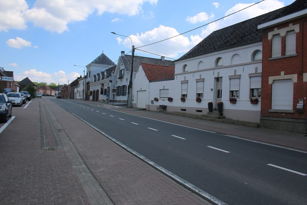
The Parikeberg, a rural climb through Parike in Brakel and the rolling Flemish Ardennes. Photo by FrDr, licensed under CC BY-SA 4.0, via Wikimedia Commons
Only 2.5 kilometres after the flag drops, the riders crest Parikeberg with 196.9 kilometres remaining.
It is an appropriate opening because Parikeberg shows how the Flemish Ardennes create difficulty without dramatic altitude. The climb belongs to the rolling terrain between Brakel and Geraardsbergen, where roads repeatedly cross small valleys cut into layers of sand, clay and other sediments.
There is no mountain horizon here. Farms, houses and church towers remain visible across fields that can look gentle until the road itself begins to rise.
The landscape helped produce a particular form of racing. Short climbs come too quickly for long periods of steady pacing, and narrow approaches often matter as much as gradient. Acceleration is repeated rather than sustained, so fatigue grows through rhythm rather than altitude.
Less than ten kilometres into the race, a second climb reinforces the same pattern.
-190 km · Zonnebloemstraat and Geraardsbergen Beyond the Muur
The Zonnebloemstraat is crossed with 190 kilometres remaining as the race moves through the wider Geraardsbergen area.
The obvious cycling story here would be the Muur van Geraardsbergen, but the Flandrien 0.0 Classic does not climb it, and the city is more interesting if it is not reduced to that one road.
Geraardsbergen developed beside the Dender, close to the historical boundary between Flanders and Hainaut. The river supported transport and industry, while the hills around the valley later gave the city the topography that cycling turned into legend.
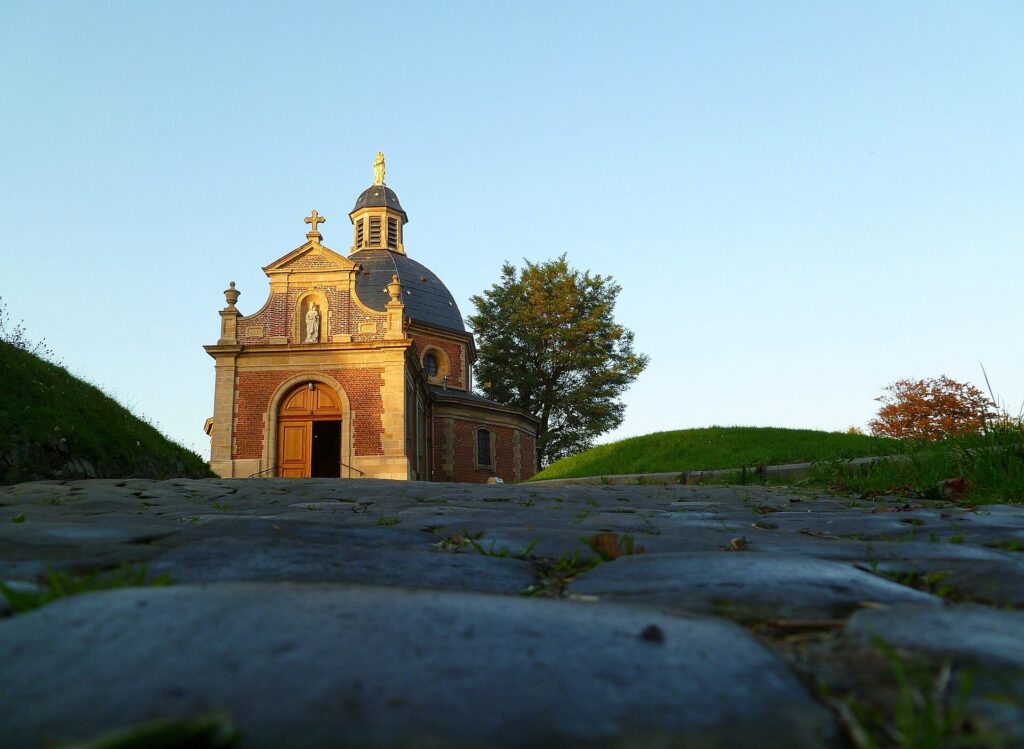
The legendary cobbles of the Muur van Geraardsbergen climbing Oudenbergstraat towards the hilltop chapel, an enduring landmark of Flemish cycling. Photo by Severien Malfait, licensed under CC BY-SA 3.0, via Wikimedia Commons
The Muur still rises nearby towards the Chapel of Our Lady of Oudenberg, but local identity extends well beyond cycling. The Geraardsbergse mattentaart, made from curdled milk, eggs and pastry, became closely associated with farms and bakers around the city and remains one of the area’s most recognisable food traditions.
The race therefore passes through a place where ordinary regional culture and cycling mythology overlap without needing to share the same road.
From here the peloton continues south-west towards Belgium’s language frontier.
-178 km · Crossing from Flanders into Hainaut
Around the first twenty kilometres, the race crosses from East Flanders into Hainaut.
The landscape does not suddenly change. Fields continue across the frontier, streams ignore it and villages on either side were connected through trade, marriage, agriculture and local roads long before modern Belgium formalised its linguistic regions.
What changes is cultural and administrative geography. Dutch street names give way to French ones, and the route moves from the Flemish Ardennes into rural Hainaut, passing through Bassilly, Silly, Hoves and the agricultural country west of Brussels.
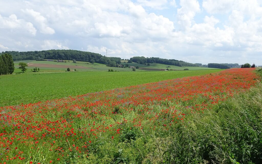
The rural landscape in Belgium’s Hainaut province. Photo by Pierre André Leclercq, licensed under CC BY-SA 4.0, via Wikimedia Commons
That crossing is important to the character of the event. Despite carrying the word Flandrien in its name, the race spends a substantial part of the day in Wallonia before returning to Flemish Brabant for the finale.
The next significant story belongs naturally to that agricultural landscape.
-172.2 km · Silly, Farm Brewing and the Origins of Saison
The third listed climb, Rue Saint-Marcoult, comes with 172.2 kilometres remaining in the wider Silly area.
Silly’s name comes from the local river, the Sille, and the municipality belongs to a part of Hainaut where large farms once combined crop production with brewing.
During the 19th century, farmers grew barley and hops and brewed beer seasonally, often with the intention of serving it to workers during the warmer months. In 1850, Marcellin Hypolite Mynbrughen began brewing at the Cense de la Tour farm in Silly, using barley from the property.
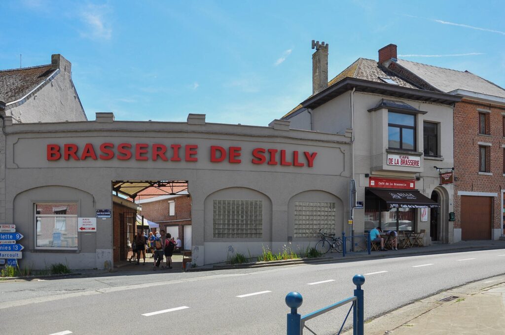
The historic Brasserie de Silly in Hainaut, a family brewery producing Belgian beer in the village of Silly since 1850. Photo by DirkVE, licensed under CC BY-SA 4.0, via Wikimedia Commons
That operation developed into the Brasserie de Silly, which remains family-owned generations later. Its early Saison belonged directly to the agricultural calendar: beer brewed in winter could be kept for labourers working through summer.
Over time, brewing became more important than farming. The company expanded, production diversified and the old farm-brewery relationship became a modern brewery business, but the origins remained tied to the fields around it.
That history sits well within the shape of the race. The Flandrien 0.0 Classic finishes at another brewery almost 170 kilometres later, but Silly preserves an older version of Belgian brewing, rooted directly in the farm economy.
The road continues east towards Walloon Brabant.
Ittre · Roads Between Hainaut and Brabant
The race moves through Braine-le-Comte, Rebecq and Ittre, crossing a part of central Belgium where roads have always mattered more than monuments.
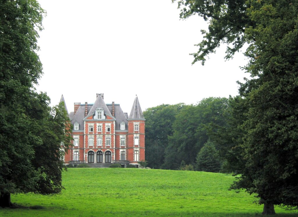
The Château d’Ittre, set among the wooded countryside of Walloon Brabant, Belgium. Photo by Jean-Pol Grandmont, licensed under CC BY 2.0, via Wikimedia Commons
Brussels lies to the north, Mons and the old Hainaut basin to the west, while Nivelles and central Brabant lie to the east. Agricultural plateaus are cut by smaller streams and shallow valleys, creating a network of routes used for centuries by farmers, merchants, officials and armies.
The fourth listed rise, Rue Basse at -140.7 kilometres, comes within this landscape. It is not a major climb, but it belongs to the same pattern that has shaped the opening third of the race: low hills that accumulate because the road is never allowed to settle completely.
From Ittre, the route turns towards Genappe, where those ordinary roads once carried an army through one of the most consequential campaigns in European history.
Genappe · On the Roads of Napoleon’s Final Campaign
The route crosses the municipality of Genappe, including Baisy-Thy, Bousval and the wider country south of Waterloo.
For several days in June 1815, these roads were filled with troops moving between battles that would determine the fate of Napoleon’s restored empire.
Napoleon had returned from exile on Elba and moved north in an attempt to defeat the allied armies before they could combine. On 16 June, his forces defeated the Prussians at Ligny, while Marshal Ney fought Wellington’s Anglo-Allied army at Quatre-Bras.
Two days later, Napoleon faced Wellington near Waterloo.
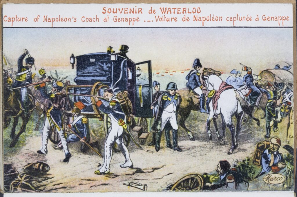
A historic postcard depicting the capture of Napoleon’s carriage at Genappe following his defeat at Waterloo in 1815. Public domain, from Ghent University Library, via Wikimedia Commons
Genappe lay directly between those battlefields and the French army’s routes of movement and retreat. After the defeat at Waterloo on 18 June, French troops fell back south through the town while pursuing forces followed along the same road network.
The Flandrien 0.0 Classic does not visit the Waterloo battlefield itself. Instead, it crosses the roads that connected the campaign, then continues east towards Wavre, where another battle was being fought almost simultaneously.
The landscape therefore carries the race from one part of Napoleon’s final campaign into another without needing an artificial historical detour.
Wavre · The Battle That Continued Beyond Waterloo
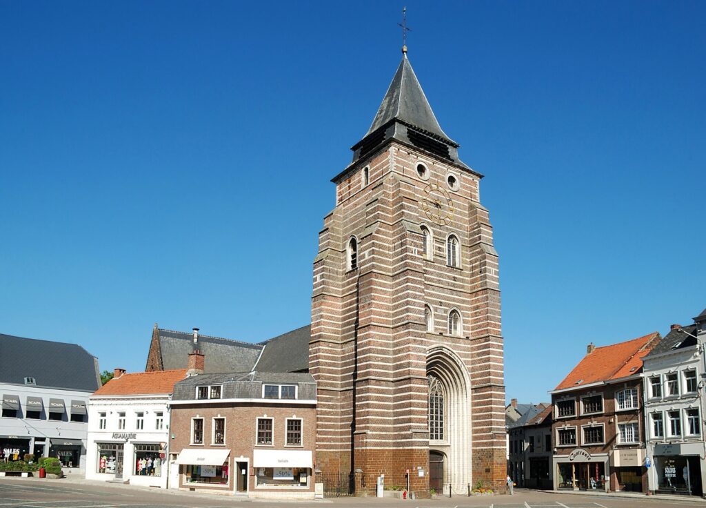
The late-Gothic Church of Saint John the Baptist in the historic centre of Wavre, capital of Walloon Brabant. Photo by EmDee, licensed under CC BY-SA 3.0, via Wikimedia Commons
The peloton reaches Wavre after crossing deeper into Walloon Brabant.
On 18 June 1815, while Napoleon fought Wellington at Waterloo, another French army under Marshal Emmanuel de Grouchy confronted Prussian forces around Wavre.
After the Prussian defeat at Ligny, Napoleon had sent Grouchy after them. The strategic problem was that the Prussians did not retreat eastward and disappear from the campaign. Large parts of their army moved north towards Wavre and remained capable of turning west to support Wellington.
Grouchy engaged the Prussian rearguard around Wavre. His troops eventually gained the local battlefield, but the larger strategic decision was already unfolding elsewhere. Blücher’s Prussian forces reached Waterloo and reinforced Wellington, while Grouchy’s substantial French army remained occupied to the east.
The fighting around Wavre continued into 19 June, after Napoleon’s main army had already been defeated.
For generations, military historians argued over orders, timing and whether Grouchy could have moved towards the sound of the battle at Waterloo. The race does not need to solve that debate. What matters is that it moves through a modern Belgian city whose bridges and roads formed part of the final military actions of the Napoleonic Wars.
From Wavre, the route begins turning gradually north, through countryside where much older traces survive beneath apparently ordinary agricultural land.
-84.6 km · Chaumont-Gistoux and Roman Brabant Beneath the Fields
The Chemin de l’Herbe is reached with 84.6 kilometres remaining in Chaumont-Gistoux.
The surrounding countryside is typical of central Brabant: broad farmland broken by shallow valleys, wooded fragments and villages spread across relatively fertile soils. This landscape attracted settlement long before Belgium existed.
Archaeological sites in the municipality include Gallo-Roman tumuli, burial mounds that still survive as raised forms within fields and woodland. Roman villas and roads were common across this part of Brabant, where productive land supported rural estates linked to larger towns and markets.
The tumuli are valuable because they show how easily history can disappear into a working landscape. A low mound beside a field can preserve the memory of an elite burial almost two thousand years old without dominating the horizon or changing the modern use of the land around it.
The peloton continues through that same agricultural country, and the road gradually begins to rise towards Ottenburg.
-76.3 km · Chaussée d’Ottenbourg and the Return Towards Flanders
The Chaussée d’Ottenbourg comes with 76.3 kilometres remaining.
The climb marks the transition towards the decisive final part of the race. Walloon Brabant begins to fall away behind the riders as they approach Ottenburg, part of Huldenberg in Flemish Brabant.
Again, the language border does not correspond to any sudden geographical break. Villages on either side occupy the same Brabant plateau, use the same valleys and share the same agricultural history.
What changes farther north is the way those slopes were used.
During the late 19th and early 20th centuries, the hills around Huldenberg, Overijse and Hoeilaart became part of one of the most extraordinary greenhouse landscapes in Europe.
Huldenberg and Ottenburg · When Brabant Grew Grapes Under Glass
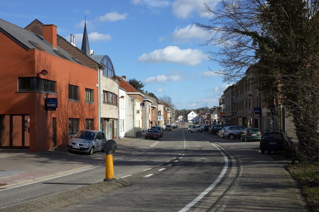
The Peuthystraat leading into the centre of Huldenberg, a village surrounded by the rolling countryside of Flemish Brabant. Photo by Wouter Hagens, public domain, via Wikimedia Commons
The country around Huldenberg, Ottenburg, Overijse and Hoeilaart became famous for growing table grapes under glass.
The story is closely associated with Felix Sohie, who worked in the 1860s as a gardener on the Huldenberg castle estate. Greenhouses could produce high-quality grapes for wealthy customers in Brussels, and Sohie recognised the commercial potential.
He later established his own greenhouse cultivation in Hoeilaart, while growers in surrounding communities followed. Overijse entered the trade during the 1870s, and improved transport helped the industry expand rapidly.
Greenhouses transformed entire villages. Hillsides and gardens filled with long glass structures heated through the colder months, allowing growers to control temperature and ripening. By the middle of the 20th century, thousands of greenhouses stood across the region. In Huldenberg alone, local accounts recall around 2,500 greenhouses during the early 1960s.
The work was demanding. Vines had to be trained and pruned, individual bunches managed carefully, glass cleaned and heating systems maintained. The crop was valuable, but the labour behind it was constant.
The industry later declined as fuel costs increased and imported fruit became cheaper. Many greenhouses disappeared, but the table grape remains part of the cultural identity of the region.
The race now enters those same hills for the sequence that will shape its final hour.
-67 km · Moskesstraat, Cobbles on the Edge of Ottenburg
At 67 kilometres remaining, the peloton reaches Moskesstraat for the first time.
The climb is short, narrow and cobbled, a combination that matters more than its headline gradient. On a broad asphalt road, riders can move through the group and choose lines relatively freely. On a narrow cobbled lane, position becomes part of the climb itself.
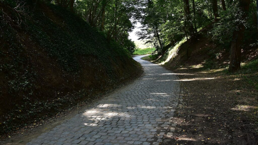
The narrow cobbled Moskesstraat climb in Terlanen, one of the distinctive cycling roads of Flemish Brabant. Photo by Paul Hermans, licensed under CC BY-SA 4.0, via Wikimedia Commons
The road existed long before professional racing had any use for it. Cobbles were practical surfaces, laid because stone gave roads durability in conditions where mud could otherwise make travel difficult.
Cycling inherited that infrastructure rather than creating it.
The great Flemish Classics eventually turned old roads into sporting monuments, but the difficulty still comes from their earlier purpose. Wheels bounce, traction changes, hands and shoulders absorb vibration and narrow lanes leave little room to recover from mistakes.
Moskesstraat is not important because it has the prestige of the Oude Kwaremont or Carrefour de l’Arbre. It matters because it arrives inside a dense sequence of roads that do not give the peloton much opportunity to settle.
Holstheide follows almost immediately.
-64.5 km · Holstheide and the Roads Above Huldenberg
The first passage of Holstheide comes with 64.5 kilometres remaining.
The climb crosses the higher ground above Huldenberg, where old agricultural roads run between villages, woodland and the remains of greenhouse country.
Its effect is cumulative rather than spectacular. Moskesstraat has already forced riders to fight for position on cobbles, and Holstheide arrives before the group can reorganise fully. The road then bends towards Huldenberg and another short climb that has become familiar through repeated use in Brabant races.
-60.8 km · Smeysberg, A Brabant Climb Made Important by Racing
The Smeysberg is crossed for the first time with 60.8 kilometres remaining.
The climb is short but steep enough to force a genuine selection when ridden hard. It rises from Huldenberg through country that once stood among the heartlands of greenhouse-grape cultivation.
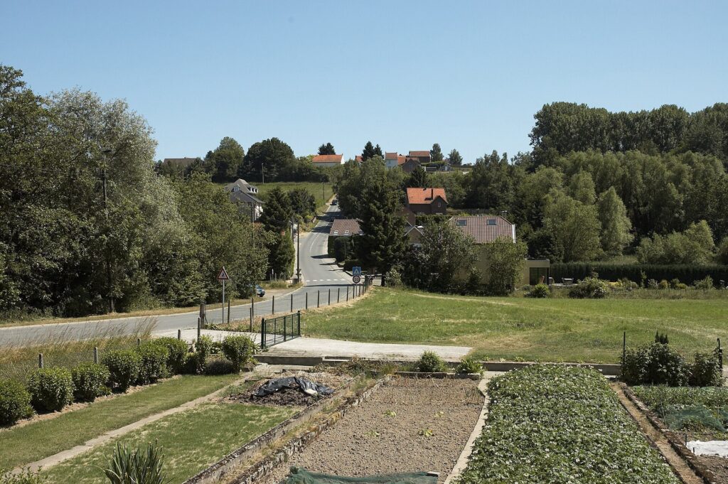
The steep Smeysberg in Huldenberg, one of Flemish Brabant’s best-known cycling climbs and a regular feature of the Brabantse Pijl. Photo by Wouter Hagens, public domain, via Wikimedia Commons
Unlike the older monuments passed earlier in the day, Smeysberg has little historical importance independent of the road itself. Its identity comes largely from cycling, where gradient, narrowness and position have turned an ordinary local climb into a recognised obstacle.
A few hundred metres of climbing would mean little on their own. After almost 140 kilometres, following cobbles and another ascent, they become part of a sequence capable of splitting a professional field.
The race then drops towards the Dijle valley, where the next climb carries the name of a religious site that largely disappeared.
-52 km · Florivalstraat and the Memory of a Lost Abbey
With 52 kilometres remaining, the race climbs Florivalstraat.
The road takes its name from Florival, associated with a medieval community of religious women established beside the Dijle in the wider Grez-Doiceau area.
The early history is uncertain, but a monastic community clearly existed here and eventually became Cistercian, accumulating farmland and woodland in the surrounding region.
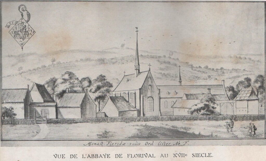
Florival Abbey in 1697, when it was home to a community of Cistercian nuns. Historical engraving published by Jacques Le Roy, public domain, via Wikimedia Commons
Like many religious houses in the Low Countries, Florival suffered repeatedly during the political and religious conflicts of the 16th and 17th centuries. Buildings were pillaged or burned, the community was displaced and reconstruction followed whenever conditions allowed.
The French Revolutionary period eventually brought monastic life to an end. The buildings later entered industrial use, including textile processing, before fire and redevelopment transformed the site again.
Very little of the medieval abbey dominates the landscape today, but its name survived in the roads and local geography.
The peloton crosses that valley and begins turning back towards Ottenburg. The first sequence of modern cycling climbs has become a historical valley, then the race returns to the same roads under much greater fatigue.
-40.4 km · Moskesstraat, Second Passage
At 40.4 kilometres remaining, Moskesstraat returns.
The road itself no longer needs introduction. The importance of the second passage lies in what has changed around it.
The first ascent came with enough distance remaining for teams to absorb a split and reorganise. Now fewer riders remain available to work, positioning mistakes are harder to repair and any separation can survive much farther towards Haacht.
The cobbles therefore become more selective without changing physically. The race has altered the meaning of the road.
Holstheide follows again.
-37.9 km · Holstheide, Second Passage
The second Holstheide summit comes with 37.9 kilometres remaining.
By now Moskesstraat, Holstheide and Smeysberg function less as individual climbs than as one continuous piece of terrain. The cobbles stretch the field, Holstheide prevents an easy regrouping and the descent towards Huldenberg immediately leads riders towards another acceleration.
The remnants of the old greenhouse landscape remain around them, but the history has already been established. On the second passage, the road itself is enough.
-34.1 km · Smeysberg, Last Passage Through the Grape Country
The final passage of Smeysberg comes with 34.1 kilometres remaining.
After the summit, the hardest repeated cluster of the route is complete, but more than thirty kilometres remain. That distance keeps the race tactically open.
A strong Classics rider can attack through the hills, but a reduced group still has enough road to organise behind. Sprinters who survive the repeated climbs remain in contention, although their teams may already have spent much of their support simply keeping them in the race.
The route heads north through Neerijse and Sint-Agatha-Rode towards Bertem.
One final listed ascent remains.
-20.1 km · Hulstbergstraat, the Last Climb
The fifteenth and final listed ascent, Hulstbergstraat, comes with 20.1 kilometres remaining.
Its importance lies almost entirely in its position. The repeated Ottenburg and Huldenberg sequence is behind the riders, and the course is beginning to trend towards the flatter country north-east of Brussels.
From here, anyone hoping to prevent a regrouping has fewer natural opportunities.
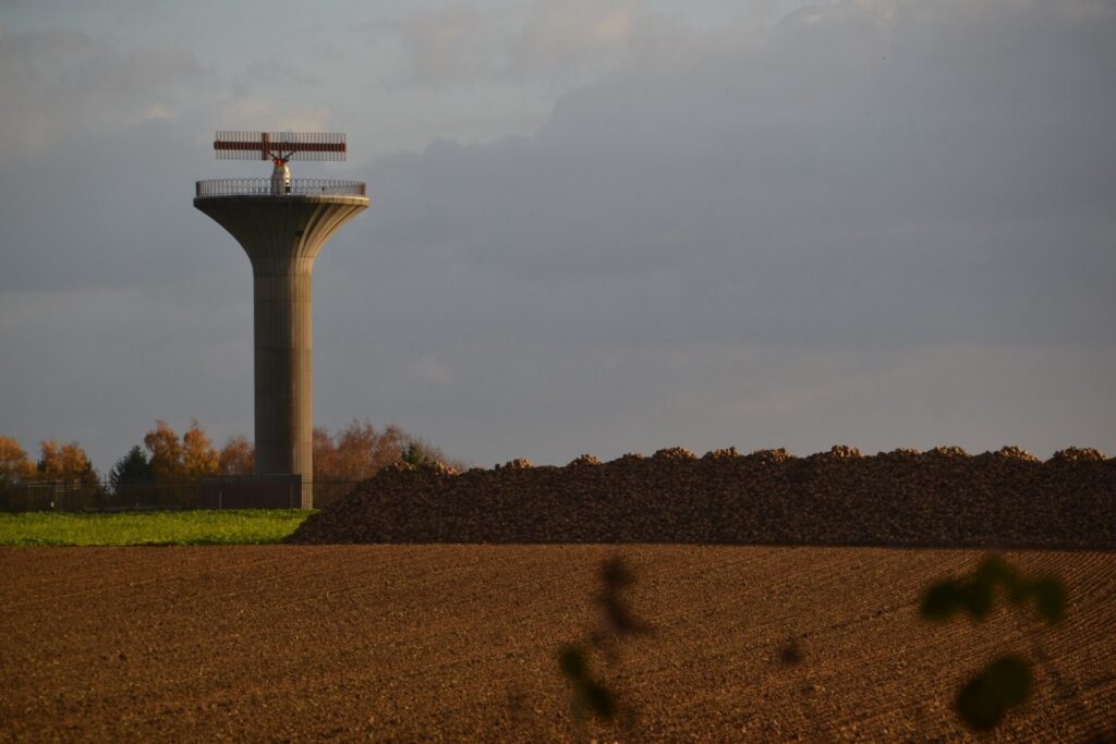
The backup radar tower at Bertem, part of Belgium’s air-traffic surveillance infrastructure in Flemish Brabant. Photo by ArjanH, licensed under CC BY-SA 4.0, via Wikimedia Commons
The race moves through Bertem, Erps-Kwerps, Nederokkerzeel and Kampenhout, across a landscape shaped by agriculture, expanding suburbs and the old political geography of Brabant.
The roads are carrying the peloton towards the home of the rider whose memory originally gave the race its identity.
Kortenberg Country · A Charter in Medieval Brabant
As the route crosses the wider Kortenberg area through Erps-Kwerps, it moves through territory associated with one of the most important political documents of medieval Brabant.
In 1312, Duke John II of Brabant signed the Charter of Kortenberg at the abbey of Kortenberg. The document established guarantees concerning taxation and justice and created a council in which representatives of major Brabant towns participated alongside nobles.
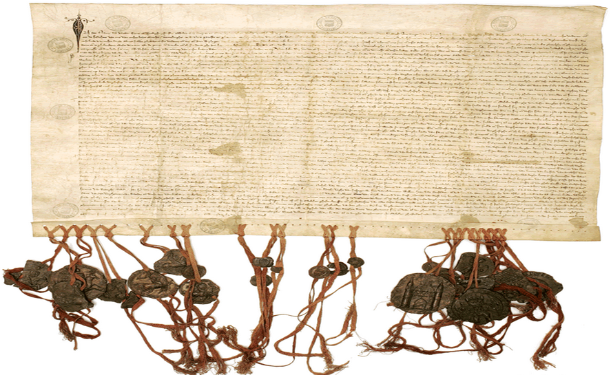
The original Charter of Kortenberg, issued in 1312 with its seals still attached, an early constitutional document that limited ducal power in Brabant. Held by the Leuven City Archives, public domain, via Wikimedia Commons
It was not democracy in the modern sense, but it placed institutional limits on ducal power and created a recurring body capable of judging whether agreed privileges were being respected.
The abbey itself is not on the race road through Erps-Kwerps, so this is a story of the wider territory rather than a roadside monument. It also provides a useful historical frame for the landscape the race has spent much of the afternoon crossing.
The old Duchy of Brabant linked communities now divided between linguistic regions and modern provinces. The route has moved repeatedly across those later boundaries while remaining inside a much older geographical world.
Ten kilometres from the finish, the race enters the home country of Raymond Impanis.
-10.4 km · Bergstraat and Raymond Impanis
At 10.4 kilometres remaining, the route passes along Bergstraat in Kampenhout, where the official itinerary marks the Monument Impanis.
Raymond Impanis was born in Berg-Kampenhout on 19 October 1925. His nickname, Bakkertje van Berg, referred to his family’s bakery background and stayed attached to a rider who eventually became one of the most versatile Belgian professionals of the post-war era.
He won Gent-Wevelgem in 1952 and 1953, the Flèche Wallonne in 1957 and Paris-Nice twice. He also won three stages of the Tour de France and consistently placed among the strongest riders in major stage races.
His defining season came in 1954.
Impanis won Paris-Nice, then the Tour of Flanders, and one week later Paris-Roubaix. The Flanders-Roubaix double placed him among the small group of riders capable of dominating both great cobbled Monuments in the same spring.
He also came remarkably close to another Monument without ever winning it. Impanis finished second at Liège-Bastogne-Liège four times, an extraordinary record of consistency and frustration.
The race that eventually evolved into the Flandrien 0.0 Classic was created in 1982 as a tribute to Impanis. Its later history became complicated, with interruptions, changes of organisation and several names, but Berg remained central to the identity of the event.
The modern route makes that connection physical.
After almost 190 kilometres, the peloton passes through the village where Impanis was born and directly past his monument before continuing towards Haacht.
At the opposite end of the race, Brakel belongs to Peter Van Petegem. Near the finish stands the memory of Raymond Impanis. Both men achieved the Flanders-Roubaix double, separated by almost half a century, and the road between their home regions now carries the race that links them.
Berg and Kampenhout · The Landscape Behind the Bakkertje van Berg
The final ten kilometres cross Berg and Kampenhout, where local memory of Impanis extends beyond a single monument.
His birthplace is marked in Bergstraat, and the municipality has developed an Impanis cycling route connecting places associated with his life and career. A bust stands near the Sint-Servaas church, while his image also appears in a mural elsewhere in Kampenhout.
That memory belongs to a wider culture in which professional cyclists often emerged from ordinary Belgian villages rather than specialised institutions. Impanis began racing in a country still recovering from the Second World War, on roads rougher than those used by the modern peloton and with equipment far heavier and less forgiving.
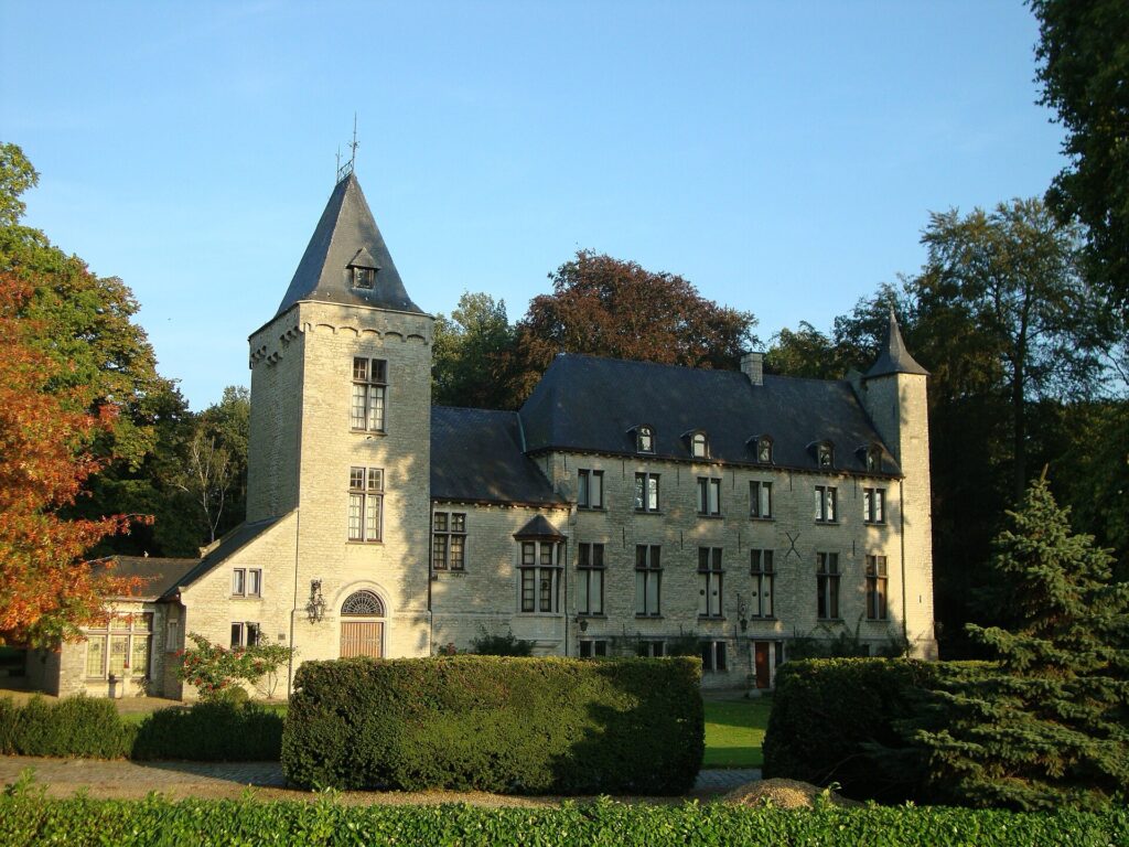
Kasteel van Opstal in Relst, Kampenhout, a historic estate remodelled in neo-medieval style around 1906. Photo by Peter Janssens, licensed under CC BY-SA 3.0, via Wikimedia Commons
The word Flandrien grew from that environment. It described riders who could absorb bad roads, cold weather and long hours of discomfort without losing the ability to race.
The event now carries that word officially, but the road into Berg gives it a much older local meaning.
From Kampenhout, the route continues towards Boortmeerbeek and the brewery gates.
FINISH · Brouwerij Haacht, From Dairy to Brewery
The Flandrien 0.0 Classic finishes after 199.4 kilometres on the Provinciesteenweg, beside the historic site of Brouwerij Haacht.
Despite the brewery’s name, the modern address lies in Boortmeerbeek, immediately beside Haacht. The business itself grew from an operation that was not originally centred on brewing.
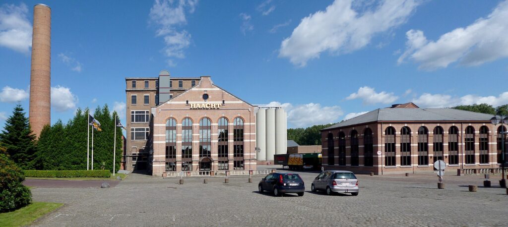
The vast Haacht Brewery complex in Boortmeerbeek, home to one of Belgium’s largest independent breweries. Photo by DirkVE, licensed under CC BY-SA 3.0, via Wikimedia Commons
In the late 19th century, Eugène De Ro, a fermentation engineer, was involved with the local Haacht dairy. On 14 June 1898, he brewed his first beer there, and the business developed into the Brouwerij en Melkerij van Haacht, the Haacht Brewery and Dairy.
The Belgian beer market was already crowded. Thousands of breweries served local communities, and surviving required a combination of technical competence, distribution and scale. De Ro shifted production towards bottom-fermented beer in 1902, at a time when lager brewing was expanding rapidly.
The decision helped the brewery grow significantly.
Transport soon mattered as much as production. Beer destined for Brussels had to travel a substantial distance, and the steam tram linking Haacht with the capital became closely associated with the movement of barrels towards cafés and customers. The line was remembered locally as a beer tram, a practical piece of infrastructure that connected a regional brewery to a much larger urban market.
The dairy operation gradually disappeared while brewing expanded. Over the following century the company developed brands including Primus and remained independently owned even as much of the European beer industry consolidated into multinational groups.
The brewery also became part of the modern identity of the race. The event was known as the Primus Classic, later the SUPER 8 Classic, and in 2026 becomes the Flandrien 0.0 Classic, each name reflecting a different moment in the relationship between the event and Haacht.
The route that reaches the brewery has crossed several different Belgians landscapes on the way. The Flemish Ardennes supplied the opening hills around Brakel and Geraardsbergen. Hainaut introduced a farming tradition in which brewing grew directly out of agriculture. Genappe and Wavre carried the race across the roads of Napoleon’s final campaign. Chaumont-Gistoux preserved traces of Roman Brabant beneath modern fields. Huldenberg recalled the decades when hillsides disappeared beneath greenhouse glass, while Moskesstraat and Smeysberg turned ordinary local roads into the decisive terrain of a professional race.
Near the end, the route passed Raymond Impanis in Berg before reaching the brewery that has helped sustain the event in its modern form. At the other end of the course stood Brakel and Peter Van Petegem, another rider who mastered the same two cobbled Monuments as Impanis almost fifty years later.
The connection between them does not need a final slogan. It is already contained in the route.
The Flandrien 0.0 Classic begins in Van Petegem’s Flemish Ardennes, passes through the country of Impanis and ends at Haacht after almost two hundred kilometres of roads shaped long before professional cycling decided to race over them.



