

The GP de Fourmies does not have the monumentality of an Alpine race, the urban intensity of Montréal or the singular emotional identity of the Memorial Marco Pantani. Its character comes from somewhere quieter. The race moves through Avesnois, a corner of northern France where fortified towns, dairy country, textile mills, glassmaking, abbey history and the Franco-Belgian border all sit inside a landscape of hedged fields, woods and short, persistent climbs.
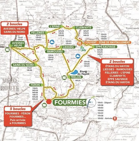
The 2026 edition covers 200.1 kilometres and follows a route that gives unusually strong definition to that landscape. The opening section takes the race through Sains-du-Nord and twice into the historic centre of Avesnes-sur-Helpe, where the peloton passes beside the Collégiale Saint-Nicolas before turning back into the bocage. The middle of the race repeatedly crosses Ramousies, Felleries, Clairfayts, Eppe-Sauvage, Liessies and the roads near the Belgian border, with several passages over the Côte du Bocquet and the Sacré-Cœur. Later comes Trélon, whose industrial history was built around glass, before the race returns to Fourmies for five final circuits of 10.6 kilometres.
Nothing on the profile resembles a great mountain. That is part of the race’s nature. The Avesnois does not overwhelm the peloton with one decisive ascent. It works by accumulation: short hills, narrow roads, repeated loops, constantly changing gradients and the fatigue of two hundred kilometres through a countryside that rarely looks severe enough to be dangerous.
The landscape surrounding those roads is richer than the race’s reputation as a sprinters’ Classic might suggest. Avesnes-sur-Helpe was shaped by the military problem of defending a frontier. The bocage records centuries of cattle farming and rural land management. Liessies preserves the memory of a Benedictine abbey whose influence once spread across the surrounding countryside. Trélon linked local forests and industrial skill with millions of glass bottles. Fourmies itself grew through textile production and became one of the most important places in the history of the European labour movement after soldiers fired on demonstrating workers on 1 May 1891.
The finish may be fast. The road leading back to it is anything but simple.
START · Fourmies, a Textile Town That Created Its Own Race
The GP de Fourmies begins outside the Hôtel de Ville in a town whose modern form was created by industry long before cycling gave it international sporting recognition.
At the beginning of the 19th century, Fourmies remained a relatively small settlement. Mechanised wool production altered that completely. Spinning mills, weaving works, workers’ housing and commercial buildings spread through the town as textile manufacturing became the foundation of the local economy. Population growth followed the factories, and Fourmies became one of the industrial centres of the Avesnois.
The surviving former Prouvost-Masurel spinning mill, now part of the Écomusée de l’Avesnois, makes that world unusually tangible. Carding, combing, spinning and weaving machines preserve the technical history of textile production, but the more important story lies around them. Industrialisation reorganised time as much as space. Factory bells, shifts, wages and production targets increasingly structured the lives of the people who worked inside these buildings, while the fortunes of entire families depended upon economic cycles they could not control.
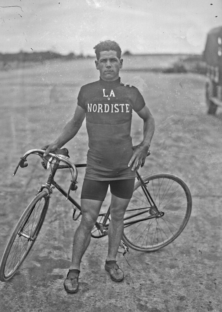
Cycling developed naturally inside that environment. Local races were already part of the social calendar when the Grand Prix de Fourmies was created in 1928 by Auguste Goutierre of the Union Vélocipédique Fourmisienne. The intention was to establish a more ambitious event capable of attracting strong competition while giving local rider Albert Barthélémy a major race on home roads.
Barthélémy won the first edition and then repeated the victory in 1929 and 1930. His three consecutive wins remain unmatched outright, and the race gradually grew from a local initiative into one of France’s enduring professional one-day events.
The list of later winners reflects how much cycling changed while Fourmies remained on the calendar. Eddy Merckx, Andrea Tafi and Philippe Gilbert appear alongside Robbie McEwen, Marcel Kittel, Nacer Bouhanni, Elia Viviani, Caleb Ewan and Tim Merlier. The race adapted repeatedly to the professional peloton around it, but its point of departure remained an industrial town close to the Belgian border.
Before returning to Fourmies, however, the route moves out through the countryside that fed, surrounded and partly sustained that industrial world.
-194.5 km · Sains-du-Nord and the Bocage of the Avesnois
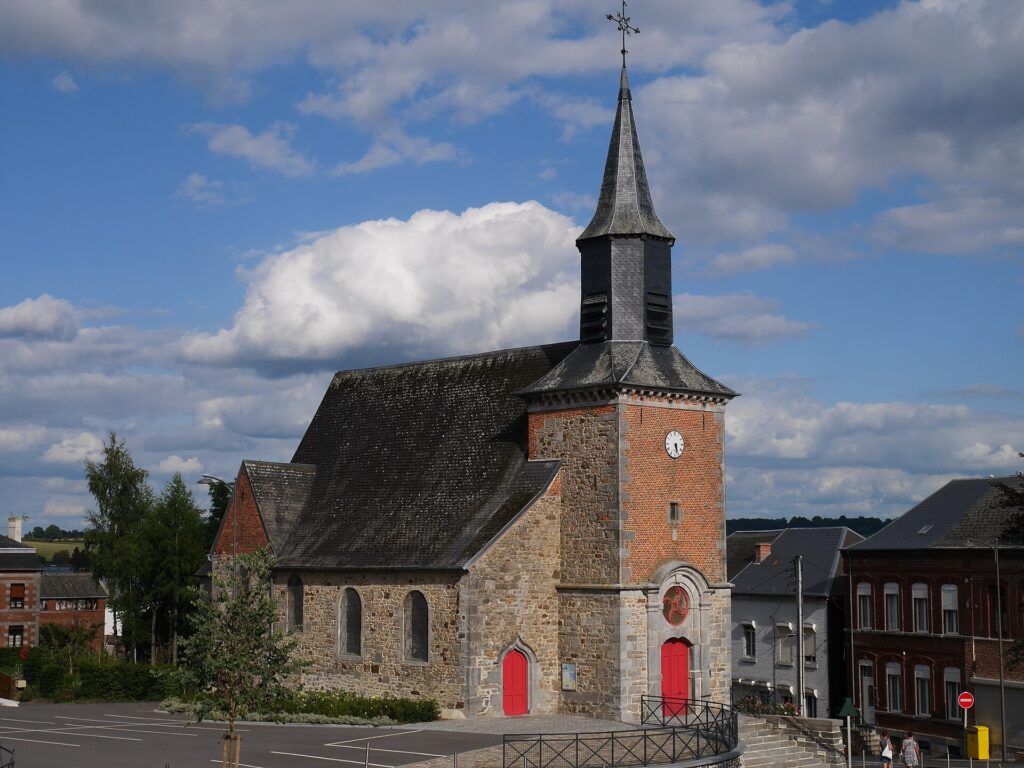
Only a few kilometres after the official start, the race reaches Sains-du-Nord, where the landscape begins to close into one of the defining features of the Avesnois.
The bocage is a countryside divided into small and medium-sized fields by hedges, trees, banks and narrow lanes. It is easy to mistake it for untouched nature because the pattern feels old and organic, but almost every element of it is the result of long-term human management. Fields were enclosed, hedges planted, livestock moved between pastures and boundaries maintained because the system suited a rural economy based heavily on cattle and dairy farming.
Those hedges had practical value far beyond marking ownership. They slowed water runoff, reduced erosion, sheltered animals from wind, provided wood and created ecological corridors between fields and woodland. Their density also gave the countryside a more enclosed character than the broad open-field systems found elsewhere in northern France.
The Avesnois retained this pattern particularly well because large-scale agricultural restructuring transformed it less completely than many neighbouring regions. Pasture remained important, and cattle farming continued to shape both land use and local food production. The wider area became closely associated with Maroilles, while the same dairy economy supported other regional cheeses and farm traditions.
Sains-du-Nord preserves that history through the Maison du Bocage, where farming tools, hedgerows, rural architecture and biodiversity are interpreted as parts of one system rather than as separate curiosities. The town itself also experienced industrial growth during the 19th century, helped by improved roads and the arrival of the railway, so agriculture and textile production existed side by side rather than belonging to completely different worlds.
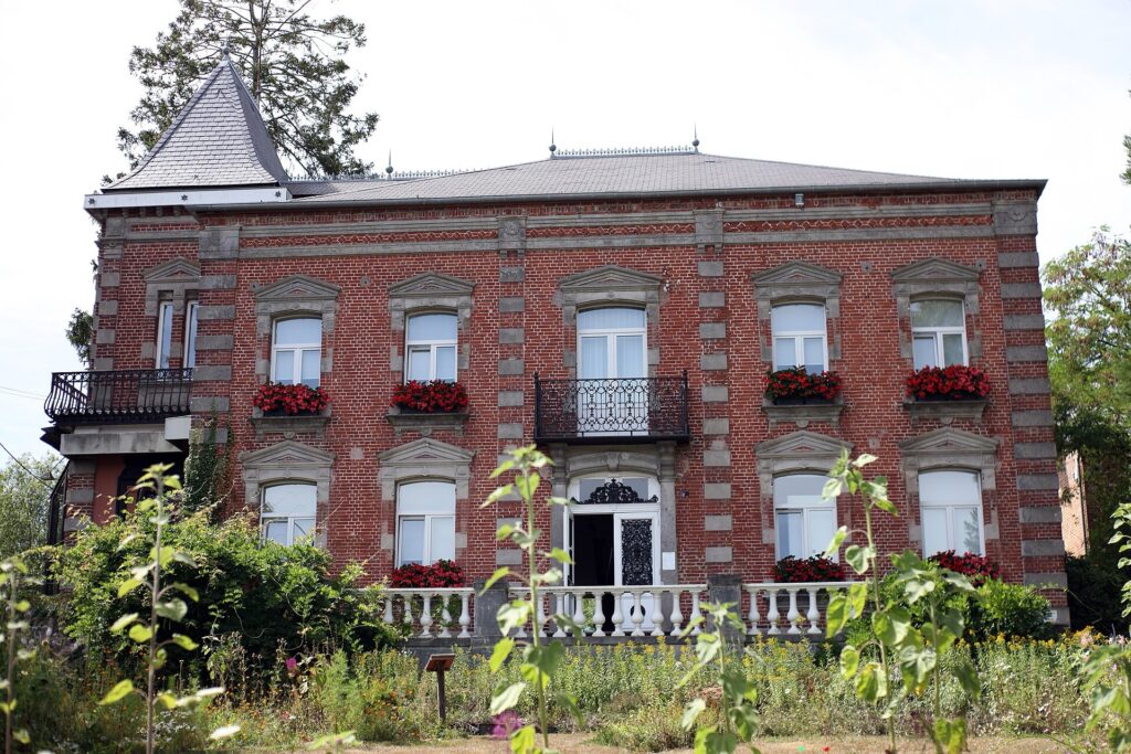
The race leaves Fourmies through precisely that mixed landscape: pasture behind hedges, industrial villages, brick houses and roads that rise and fall gently enough to hide how often the riders are working.
-186.6 km · Avesnes-sur-Helpe, a Town Built for the Frontier
At 13.5 kilometres raced, with 186.6 kilometres remaining, the peloton enters the centre of Avesnes-sur-Helpe for the first of two passages. The route reaches the Place du Général-Leclerc beside the Collégiale Saint-Nicolas, placing the race briefly inside a town whose form was dictated for centuries by the politics of borders.
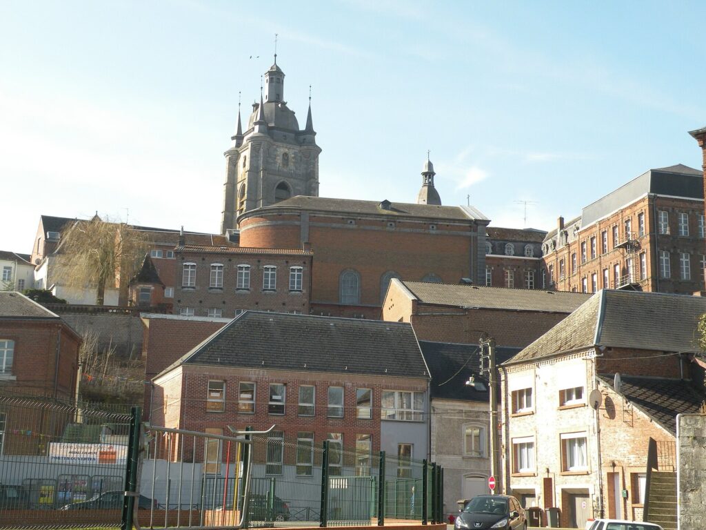
Avesnes occupied an exposed position between territories that repeatedly changed rulers. Hainaut, Burgundy, the Habsburg Netherlands, Spain and France all shaped its history, and its fortifications evolved because political control of this corner of Europe was never secure for long.
The town suffered heavily in 1477, when forces of Louis XI destroyed it during the struggles that followed the death of Charles the Bold. Reconstruction came quickly, and during the 16th century the dukes of Croÿ strengthened the defences with bastioned fortifications adapted to the age of artillery. Parts of that system survive, including the Bastion de la Reine.
The political geography shifted again in 1659, when the Treaty of the Pyrenees made Avesnes definitively French. Under Louis XIV, the town entered the kingdom’s northern defensive network. Vauban strengthened the outer works during the following decades as part of the broader system of fortresses intended to protect France’s vulnerable northeastern frontier.
Water formed part of those defences. The Helpe could be controlled through hydraulic works, and the surrounding low ground could be used to complicate the approach of an attacking army. The town’s position, streets and surviving defensive structures therefore make sense only when read against centuries of military anxiety.
The Collégiale Saint-Nicolas adds another political layer. In 1461, Louis XI passed through Avesnes during the ceremonies following the death of his father Charles VII, appearing here before continuing towards his coronation at Reims. A place that later became part of France’s defensive frontier had already been touched by the rituals through which royal authority was transferred.
The peloton spends only minutes inside Avesnes, but the roads through the centre still belong to a town built around the expectation that borders could move and armies could return.
-169.7 km · Avesnes-sur-Helpe, Back Through the Old Walls
After looping through Avesnelles, Flaumont-Waudrechies, Sémeries and Sains-du-Nord, the race returns to Avesnes with 169.7 kilometres remaining.
The second passage is useful because it makes the relationship between the fortified town and the countryside around it much clearer. Avesnes was a political and military centre, but it depended constantly on the farms, villages, markets and roads beyond the walls. Agricultural produce moved inward, while taxation, administration and military obligations moved outward.
The dairy landscape is one of the strongest surviving connections between town and countryside. Avesnes gives its name to the boulette or boule d’Avesnes, a pungent cheese associated with the same cattle-farming culture that produced Maroilles and other regional specialities. The fortified streets and the bocage are therefore not separate stories. They belonged to the same local economy.
After the second passage, the military architecture begins to recede and the race settles more fully into the working countryside of the Avesnois.
-160.1 to -89.9 km · Ramousies, Felleries and the Working Countryside
Around race kilometre 40, the peloton reaches Ramousies and begins the repeated central loops that define the middle of the race. From here the road repeatedly crosses Ramousies, Felleries, Clairfayts, Eppe-Sauvage and Liessies, with the terrain shifting between pasture, woodland and small villages.
The Côte du Bocquet appears three times, with approximately 159.1, 124.9 and 89.9 kilometres remaining. Its importance lies less in height than in the way it returns. Riders climb it once while fresh, then again after the race has accumulated another hour of effort, and once more when the middle section is beginning to wear down the peloton.
The countryside around the climb is built from local materials. Traditional farms and houses combine brick with the dark blue limestone characteristic of the Avesnois, while slate roofs and enclosed farmyards place the region architecturally between northern France, Hainaut and the Ardennes. The roads rarely separate neatly from settlement. They bend past farm walls, cross village centres and disappear again behind hedges.
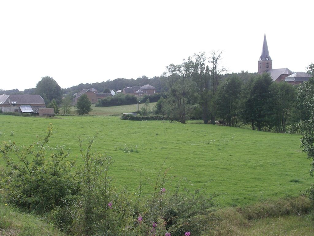
Around Felleries, woodland once supported craft economies alongside farming. Woodturning, toolmaking and other small-scale industries depended upon local forests and streams long before mechanised factories became the dominant image of northern France. Water, timber, livestock and village workshops formed an older economy that survived even as nearby Fourmies and Sains-du-Nord industrialised.
This is the landscape through which the race keeps moving, not spectacular enough to announce itself but demanding in accumulation. The riders rarely receive long, exposed straights or sustained flat roads. The route folds continuously through a countryside built at human scale.
-149.4 km · Clairfayts and a Border Almost Hidden in the Landscape
At 50.7 kilometres raced, with 149.4 kilometres remaining, the peloton passes through Clairfayts, where the Belgian border lies only a short distance away.
Today that frontier can be crossed almost without ceremony. Roads continue, villages resemble one another and the same hedged pasture extends across both sides. Historically, however, this was one of the most politically sensitive parts of Europe.
The contrast between political and cultural geography is particularly visible here. States drew lines across a region where dialects, family connections, religious traditions, agricultural practices and local markets often ignored them. Brick architecture, enclosed fields and village forms continue across the modern boundary with little regard for nationality.
Avesnes had needed walls because political frontiers shifted repeatedly. Clairfayts shows how little those frontiers necessarily corresponded to everyday landscape.
The race itself inherited something of that border character. Belgian riders and teams have always been familiar presences at Fourmies, and the event developed inside a cycling culture shared across northern France and Belgium long before professional racing became truly global.
-141.5, -106.8 and -71.8 km · Eppe-Sauvage and the Sacré-Cœur
The race reaches Eppe-Sauvage three times, with the Sacré-Cœur climb appearing at approximately 141.5, 106.8 and 71.8 kilometres remaining.
Here the bocage becomes increasingly wooded as the route approaches the Belgian frontier and the upper Helpe valley. The transition is gradual. Pasture remains visible, but forest begins closing around the road and water becomes more important in the shape of the landscape.
Nearby lies the Lac du ValJoly, an artificial reservoir created during the 20th century by damming the Helpe Majeure. It now appears fully integrated into the surrounding countryside and is associated with recreation and nature tourism, but its presence is another reminder that the Avesnois is not simply preserved countryside left untouched by modern intervention.
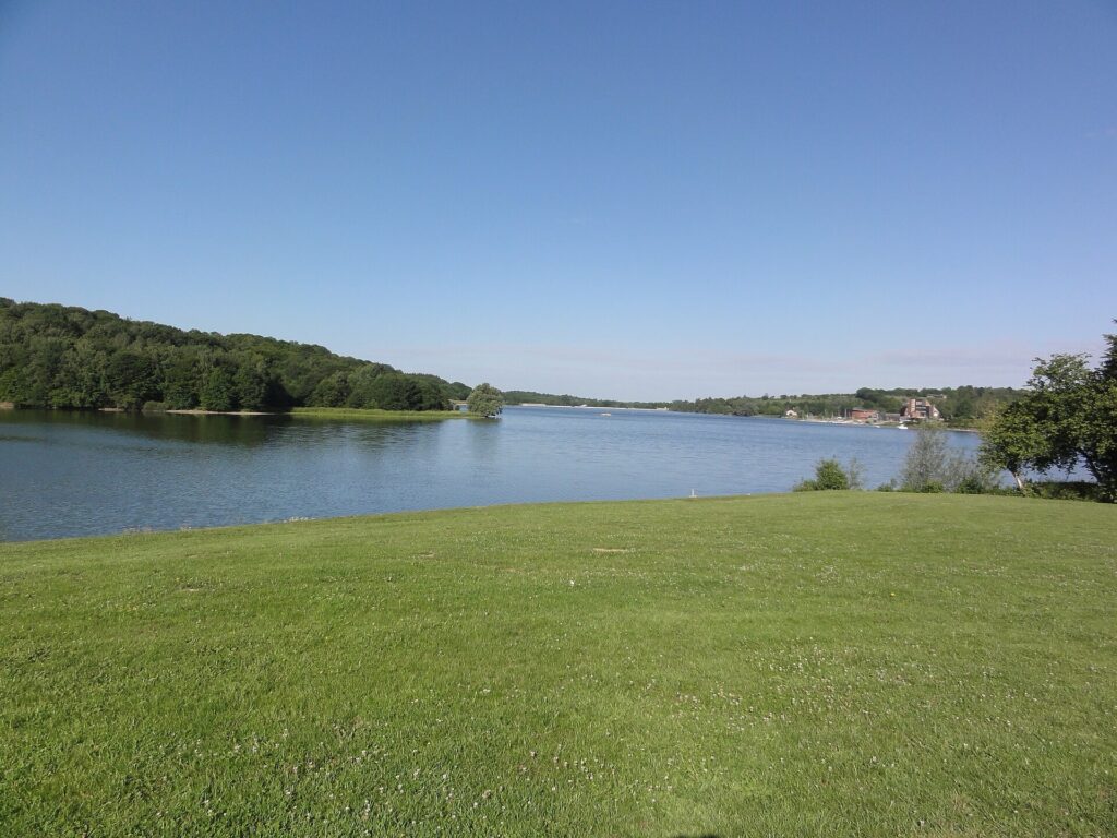
Hedges were planted and removed according to agricultural needs. Woods were worked for fuel and industry. Streams powered local activities before being regulated more intensively. Reservoirs altered valleys. The apparent naturalness of the region is largely the product of continuous human adjustment.
The Sacré-Cœur climb rises through that managed landscape. Repeated three times, it does not create one decisive moment but steadily adds cost to the race, particularly once the earlier Bocquet passages and constant changes of gradient have accumulated.
-130 km · Liessies and the Abbey That Disappeared
With approximately 130 kilometres remaining, the peloton reaches Liessies, a small village whose present scale gives little indication of the institution that once dominated it.
A Benedictine abbey existed here from the early Middle Ages, traditionally associated with an eighth-century foundation. Over centuries, the monastery acquired land and influence throughout the surrounding territory, shaping agriculture, religious life and settlement patterns well beyond the immediate village.
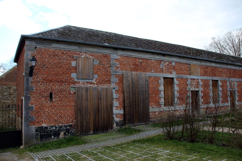
Like many monasteries in this border region, Liessies repeatedly experienced instability. Armies crossed the area, political authority changed and buildings were damaged or rebuilt. The abbey’s fortunes followed those wider disruptions until the French Revolution finally ended the institution.
Most of the great monastic complex eventually disappeared.
That absence makes Liessies more interesting than a conventional ruined abbey. There is no enormous surviving nave dominating the landscape, no single architectural spectacle announcing what once stood here. Instead, the former domain survives through fragments, parkland, traces in the village and the broader pattern of land that the monastery helped organise.
The Parc de l’Abbaye preserves part of that former landscape, while the surviving church and local topography allow the lost complex to be reconstructed only indirectly.
The peloton passes through quickly, but the village belongs to a type of history that is particularly easy to miss from a bicycle: institutions can disappear almost completely while the countryside they helped create remains in place.
-64.4 km · Trélon, Where Forest Became Glass
With 64.4 kilometres remaining, the race reaches Trélon, where the relationship between natural resources and industry becomes unusually clear.
A glassworks was established here in 1824, and the location was anything but accidental. Traditional glassmaking required huge quantities of fuel, suitable raw materials and skilled labour. The wooded Avesnois could supply fuel, while the broader region already belonged to a long glassmaking tradition stretching across northern France and Belgium.
During the 19th century, Trélon became particularly associated with bottle production. By around 1840, the factory was already producing roughly 1.2 million champagne bottles, connecting a small town near the Belgian frontier with the wine houses of Champagne. By the end of the century, production had risen to millions of bottles annually.
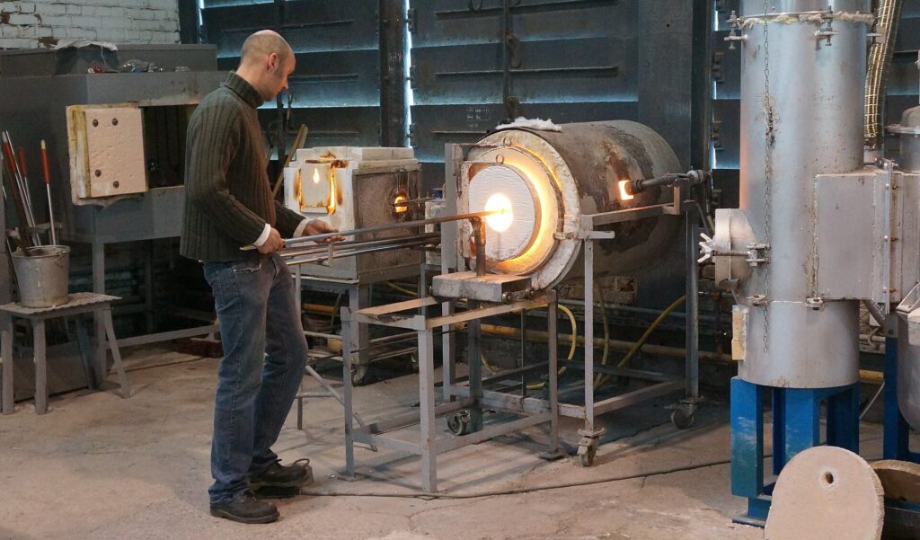
The industry did not remain static. Production was interrupted by the First World War, then reorganised under new ownership during the interwar period. White glass became increasingly important, and the factory diversified into bottles and containers for perfume and pharmaceuticals.
Mechanisation transformed production during the 20th century, but competition from plastics, changing markets and wider industrial restructuring eventually made the works unsustainable. The factory closed in 1977.
Its buildings survived as the Atelier-Musée du Verre, preserving furnaces, machinery and the techniques of glassworkers rather than allowing the industrial site to disappear entirely. In 2026 the museum itself entered another period of transformation, with major work planned to secure and reinterpret the site.
The story fits naturally into the wider Avesnois. Fourmies turned wool into textiles. Trélon turned forest resources and heat into glass. Both industries grew in places that still look overwhelmingly rural from the race.
-53.8 km · Fourmies, the First Return and the Workers of 1891
At race kilometre 146.3, with 53.8 kilometres remaining, the peloton reaches Fourmies for the first time. From here, five circuits of 10.6 kilometres remain between Fourmies and Féron.
The return to town also brings the route back to the event that gave Fourmies a place in the wider political history of France.
By the late 19th century, textile production had created a densely industrial working town. Mills offered employment, but they also imposed long hours, low wages and severe dependence on factory owners. Labour organisation was growing across Europe, and the demand for the eight-hour working day had become one of the central causes of the international workers’ movement.
On 1 May 1891, workers in Fourmies took part in May Day demonstrations. Employers had warned that participation could cost people their jobs, while authorities deployed soldiers because France had not yet developed the specialised public-order forces that would later manage demonstrations.
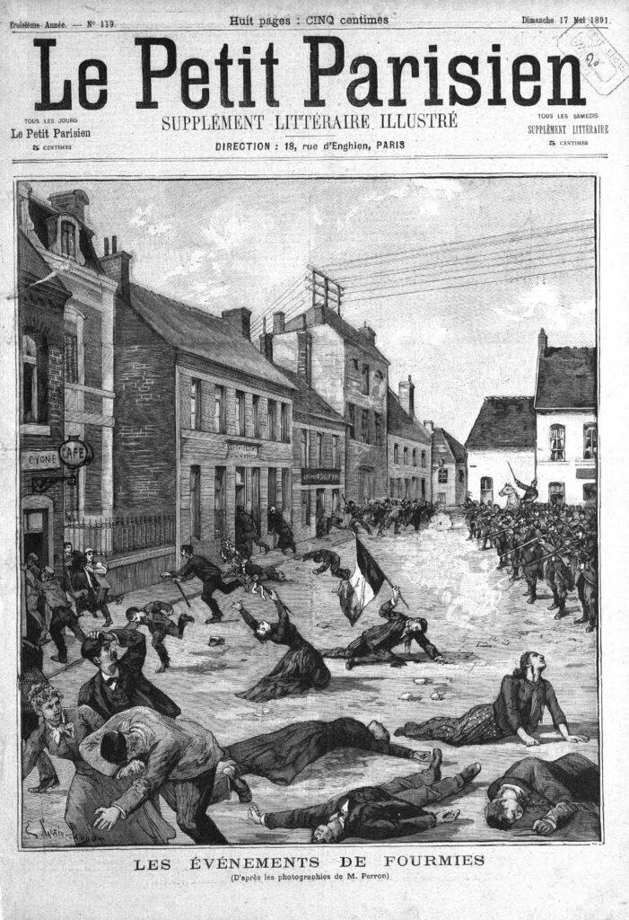
Several workers were arrested during the day. By late afternoon, a crowd had gathered near the town hall demanding their release. Soldiers opened fire.
Nine people were killed, including young workers and a child, and many more were wounded. News of the shootings spread rapidly through France and Belgium, and the dead of Fourmies became symbols within socialist and labour movements across Europe.
The event became known as the Fusillade de Fourmies, but the name can make it sound abstract. The circumstances were painfully ordinary: factory workers, a town square, young people, a demand for shorter working hours and an industrial community already strained by the power imbalance between employers and labour.
The shootings permanently altered the town’s identity. Fourmies was no longer merely one of many northern textile centres. It became a place associated with the cost of industrial conflict and with the emerging international symbolism of May Day.
The bicycle race now crosses these streets repeatedly in celebration. Spectators line the road, barriers surround the finish and the town becomes a sporting festival. Beneath that modern atmosphere remains the history of the workers whose lives were organised by the factories that once dominated Fourmies.
-53.8 to -10.6 km · Five Circuits Between Fourmies and Féron
With 53.8 kilometres remaining, the race enters its final phase. Five circuits of 10.6 kilometres carry the peloton from Fourmies through Féron and back to the finish.
The sequence is simple:
-53.8 km · first crossing of the finish line
-43.2 km · four laps remaining
-32.6 km · three laps remaining
-22 km · two laps remaining
-10.6 km · final lap
FINISH · Fourmies
After the broader journey through the Avesnois, the race contracts into a small local loop. The countryside is now familiar to the riders, the roads repeated often enough for positioning to become increasingly precise.
This is also where the reputation of Fourmies as a race for fast finishers becomes most visible. Recent decades have produced victories for Robbie McEwen, Marcel Kittel, Nacer Bouhanni, Pascal Ackermann, Elia Viviani, Caleb Ewan and Tim Merlier, riders whose careers were built around finishing speed.
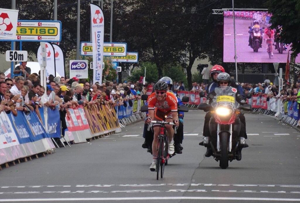
Yet the palmarès has never belonged exclusively to pure sprinters. Philippe Gilbert, Andrea Tafi, Fabio Felline and Lars Bak also won here, evidence that Fourmies is not a completely flat procession towards a bunch sprint. The earlier hills and constantly rolling roads matter, even when they do not create television drama individually.
By the time the peloton enters these final circuits, the race has already absorbed the cost of the bocage, the repeated climbs at Bocquet and Sacré-Cœur, the narrow roads around the border and nearly 150 kilometres of constant movement through the Avesnois.
Speed decides the final metres only after endurance has shaped who remains capable of using it.
-10.6 km · Final Lap, Back Through Fourmies
The bell sounds with 10.6 kilometres remaining.
The riders leave Fourmies once more, reach Féron and turn back towards the town for the final crossing of the line. Almost two hundred kilometres of landscape have now contracted to a road the peloton already knows.
That local repetition reaches back to the origins of the event. When the GP de Fourmies was created in 1928, cycling was deeply embedded in town festivals, club culture and circuits that allowed spectators to see riders more than once. Roads around a town could be controlled more easily than vast point-to-point routes, and a local champion such as Albert Barthélémy could race in front of people who already knew him.
The modern event is far larger and more international, but it still returns insistently to Fourmies. The peloton can travel through fortified towns, dairy country, woodland, abbey landscapes and former industrial sites, yet the race ultimately closes around the place that created it.
The factories that once dominated the skyline have largely disappeared or changed function. Textile machines now work inside a museum rather than a production line. The industrial economy that transformed Fourmies has contracted enormously, but the bicycle race born within that world survived.
FINISH · Fourmies, Ninety-Eight Years After Albert Barthélémy
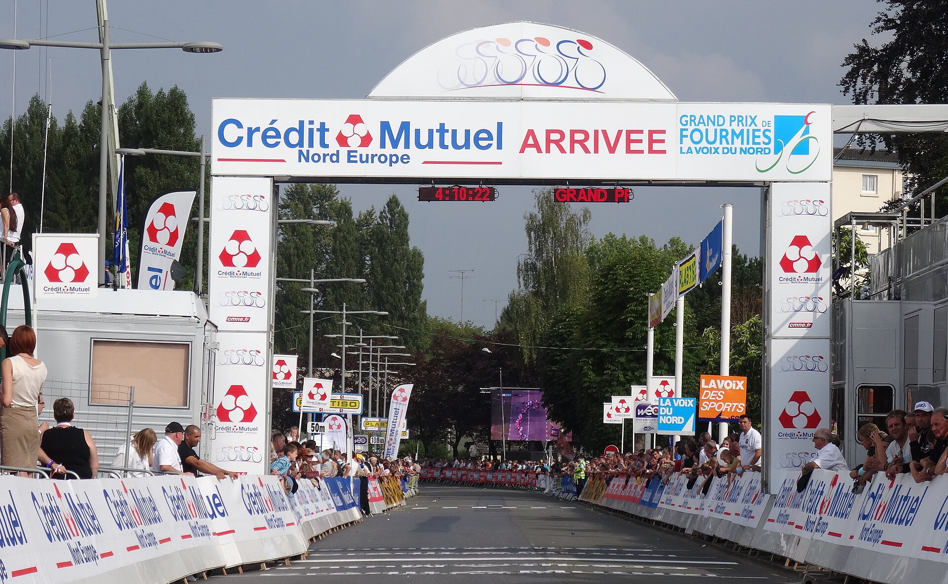
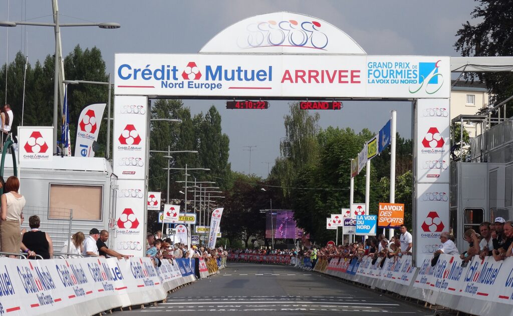
The GP de Fourmies finishes on Avenue Charles-de-Gaulle beside the Place de Verdun, 200.1 kilometres after the official start and ninety-eight years after Albert Barthélémy won the first edition.
The roads behind the riders have crossed several versions of northern France within a remarkably small territory. Avesnes-sur-Helpe preserves the architecture of a frontier once contested between states and dynasties. The bocage around Sains-du-Nord and Ramousies reflects generations of cattle farming and land management. Clairfayts sits beside a national border that looks almost invisible in the landscape. Liessies carries the traces of a monastery whose buildings largely disappeared while its influence remained embedded in the countryside. Trélon’s old glassworks connects local forests with the industrial production of millions of bottles. Fourmies itself records both the ambition of textile industrialisation and the human conflict that accompanied it.
The race belongs naturally inside that history. It was created by a local cycling club in an industrial town, first won by a rider from the region and sustained through decades in which the economic world around Fourmies changed almost beyond recognition. Factories closed, working practices disappeared and the social structure that produced the town’s first great expansion weakened, yet the Grand Prix continued to return.
When the sprint begins, all of that disappears from view for a few seconds. The road narrows to wheels, timing and speed. Behind the riders, however, remain the hedges, factory walls, fortifications, monastery traces and workers’ streets through which the race has spent the afternoon travelling.



