
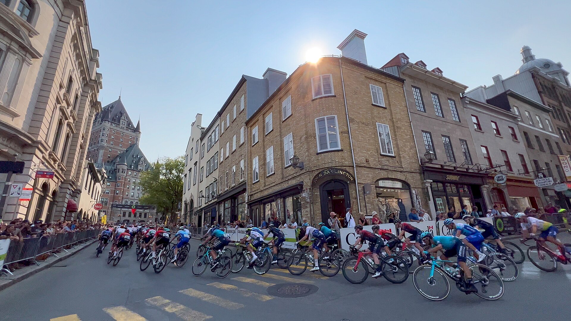

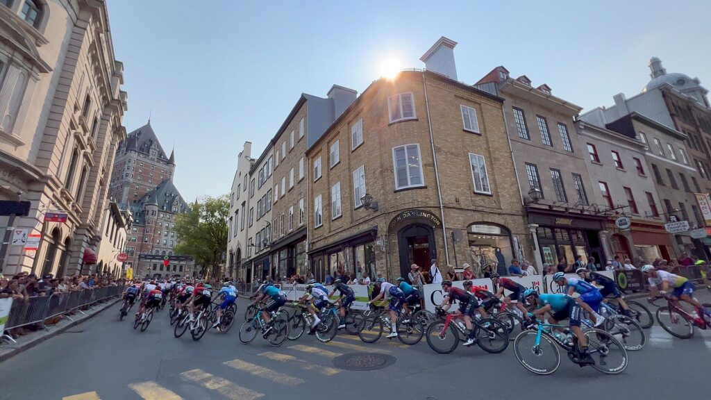
The Grand Prix Cycliste de Québec does not need to travel across a province to find history. Its circuit occupies only a small part of Québec City, yet within each lap the peloton moves between a river that opened the interior of a continent to movement and exchange, the steep streets of one of North America’s oldest colonial cities, fortifications constructed and expanded by competing empires, and a battlefield where a short engagement in 1759 helped determine the political future of Canada.
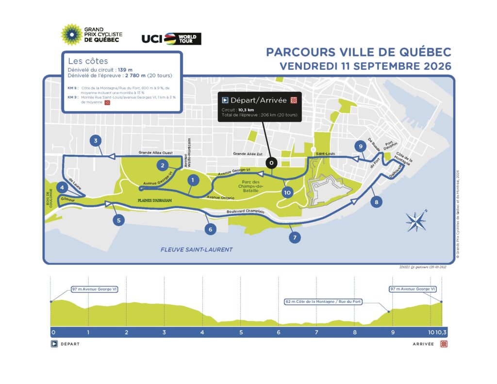
The race itself is comparatively young. First held in 2010, the Grand Prix Cycliste de Québec quickly became part of the UCI WorldTour and, together with the Grand Prix Cycliste de Montréal two days later, established an unusual September bridge between European professional cycling and French-speaking North America. Its character comes from repetition rather than geographical distance. In 2026 the peloton completes sixteen laps of a 12.6-kilometre urban circuit, accumulating close to 3,000 metres of climbing without ever leaving Québec City. Each lap descends from the heights towards the St Lawrence before forcing the riders back towards the Upper Town, turning the city’s distinctive topography into the central difficulty of the race.
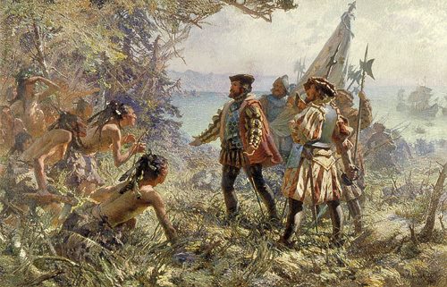
That topography is also the reason Québec developed here. The St Lawrence narrows dramatically beneath Cap Diamant, creating a natural position from which movement along the river could be observed and controlled. Long before Europeans established a permanent settlement, Indigenous peoples understood the importance of this corridor. When Jacques Cartier reached the area in 1535, he encountered Stadacona, an Iroquoian settlement close to the Saint-Charles River, within a landscape already shaped by Indigenous movement, fishing, agriculture, diplomacy and exchange. By the time Samuel de Champlain founded Québec in 1608, Stadacona had disappeared for reasons that remain uncertain, but the river and its tributaries continued to form part of Indigenous worlds extending far beyond the future boundaries of the colonial city.
The Grand Prix consequently circles a landscape whose history has always depended upon movement between water and land. Indigenous travellers, traders and communities used the river system long before European ships entered it; French merchants and missionaries subsequently followed networks they could not have understood or navigated without Indigenous knowledge; armies fought to control the same corridor; timber ships crowded its 19th-century waterfront; and a modern city eventually preserved many of the defensive structures that had been built to dominate it. The bicycle race is only the latest activity to be shaped by this geography.
START · Parc de la Francophonie and a City Built Above a River
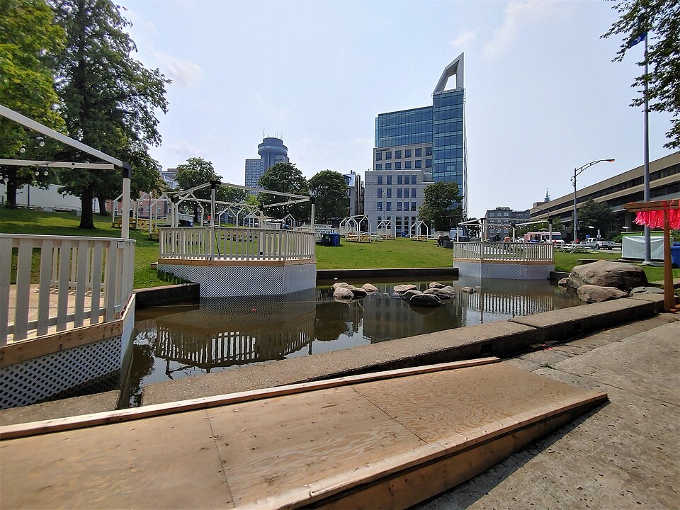
The race begins near Parc de la Francophonie, close to the Québec Parliament and the western edge of the historic Upper Town. From here the relationship between the city and its geography is immediately apparent. Québec developed on two levels, with a commercial Lower Town beside the St Lawrence and an administrative, religious and military Upper Town protected by the escarpment of Cap Diamant. Moving between those levels has been one of the fundamental problems of urban life here since the 17th century, and the Grand Prix turns that old geographical inconvenience into the defining characteristic of its course.
Samuel de Champlain established the permanent French settlement in 1608, choosing a site close to today’s Place Royale. The location offered several advantages at once. The narrowing of the St Lawrence made river traffic easier to observe, the mouth of the Saint-Charles provided access to more sheltered waters, and the cliffs above created an obvious defensive position. Champlain’s first Habitation served simultaneously as residence, warehouse, trading post and fort, reflecting the commercial purpose of the settlement as much as its colonial ambitions.
The French settlement, however, was inserted into a much older human geography. The St Lawrence Iroquoians encountered by Cartier had cultivated maize, beans and squash and occupied permanent villages along parts of the valley. Their disappearance from the area before Champlain’s arrival remains one of the major unresolved questions of the region’s early history, with warfare, migration, political realignment and epidemic disease all proposed as contributing factors. Their absence did not make the territory empty. In the early 17th century, Innu, Algonquin and Wendat peoples were deeply involved in the political and commercial networks through which the French settlement survived.
Champlain’s alliances were therefore not peripheral to the foundation of Québec. French access to the fur trade depended upon Indigenous partners whose routes extended through the St Lawrence and Great Lakes systems into the continental interior. Indigenous diplomacy also drew the French into existing conflicts, while missionaries, traders and colonial officials increasingly became participants in political relationships that had developed long before their arrival. Québec’s position at the narrowing of the river gave it strategic value, but that value could only initially be exploited through networks controlled largely by Indigenous peoples.
Champlain began developing the heights above the settlement in 1620, when Fort Saint-Louis was established near the location of today’s Château Frontenac. From that moment the distinction between Lower and Upper Town became embedded in Québec’s development. Commerce remained strongly connected with the waterfront, while government, defence and religious institutions increasingly occupied the heights. Four centuries later, the Grand Prix repeatedly joins those two levels in a matter of kilometres.
The Plains of Abraham · A Farmer’s Name on a Battlefield That Changed an Empire
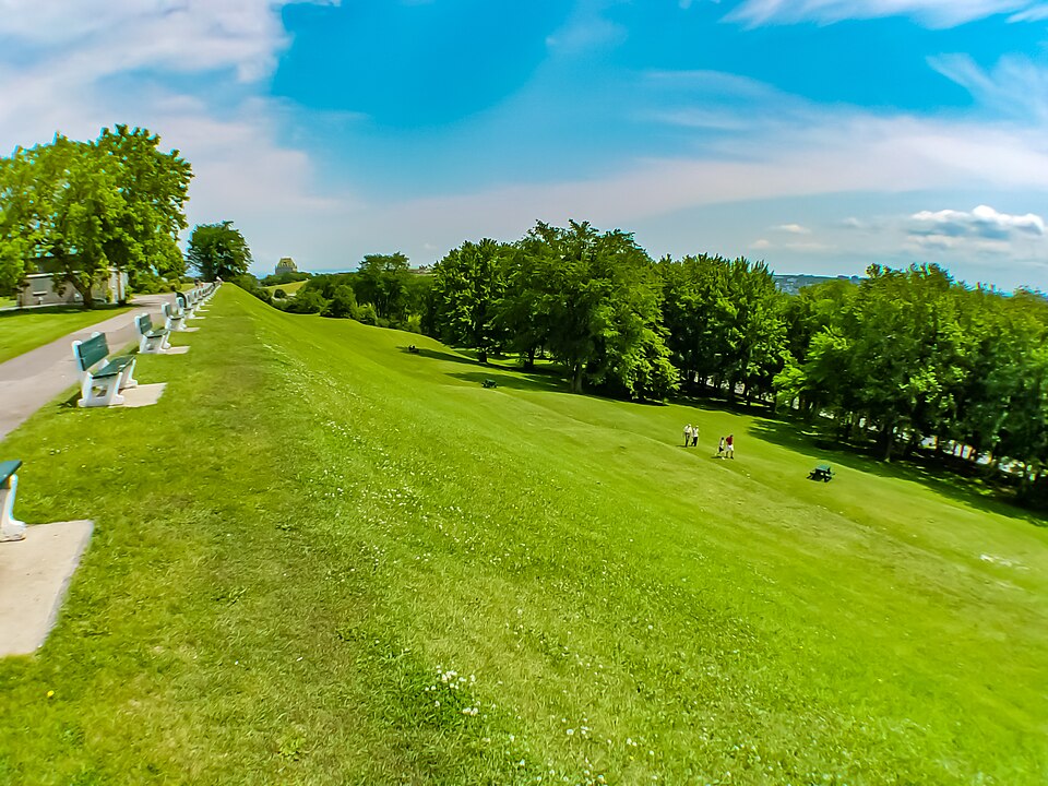
The circuit crosses the Plains of Abraham, a broad green space whose peaceful appearance conceals one of the most consequential military encounters in North American history. The name predates the battle and is generally associated with Abraham Martin, an early settler sometimes known as Abraham the Scot, who arrived in New France during the early 17th century and owned or used land in the area. The name appears on an official map from 1734, decades before British and French armies transformed it into a battlefield.
The heights west of Québec were strategically important because they protected the approach to the fortified Upper Town. The French had spent decades improving the city’s defences, particularly as rivalry with Britain intensified, yet the steep cliffs facing the St Lawrence appeared to provide their own protection. Bringing a large body of troops from the river onto the plateau seemed extraordinarily difficult, an assumption that became central to the British campaign against Québec during the Seven Years’ War.
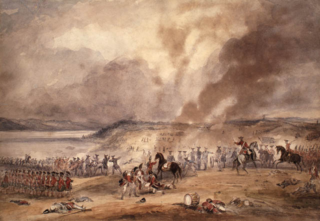
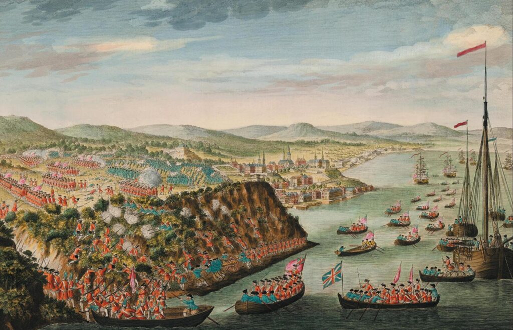
In the summer of 1759, General James Wolfe arrived with a British fleet and army while French forces under Louis-Joseph de Montcalm defended the capital of New France. British artillery bombarded Québec for weeks and caused extensive damage, but attempts to force a decisive engagement initially failed. During the night of 12 to 13 September, British troops moved upriver and landed near Anse-au-Foulon, then climbed the escarpment and reached the heights. By morning, Wolfe had deployed thousands of soldiers on the Plains of Abraham.
Montcalm chose to attack before additional British troops could consolidate their position. The battle that followed was remarkably brief for an event with such enormous consequences. British infantry held its fire until the French approached, delivered disciplined volleys at close range and forced the French line to retreat. Both Wolfe and Montcalm were mortally wounded, and Québec surrendered several days later.
The battle did not immediately end the struggle for New France. In April 1760, French forces under François de Lévis defeated the British nearby at the Battle of Sainte-Foy and attempted to recover Québec. The outcome ultimately depended upon naval power. When British ships reached the city before French reinforcements, Lévis was forced to withdraw. Montréal capitulated later that year, and the Treaty of Paris in 1763 formally transferred most French possessions in continental North America to Britain.
The consequences extended far beyond a change of flag over Québec. A large French-speaking Catholic population now lived under British rule, while Indigenous nations faced a transformed balance of power as France ceased to provide a competing imperial presence in much of the northeast. The Royal Proclamation of 1763, the Quebec Act of 1774 and the political arrangements that followed were all shaped in part by the problem of governing territories and peoples inherited through conquest. The battle remembered on the Plains therefore belongs not only to military history but to the complicated origins of modern Canada.
The battlefield itself continued to change. Military installations, grazing and other uses occupied parts of the heights, and the area might easily have disappeared beneath the expanding city. In 1908, during celebrations marking the 300th anniversary of Québec’s foundation, the federal government created the National Battlefields Commission to preserve the site. The resulting park was landscaped as a civic space rather than reconstructed as an exact representation of 1759, allowing recreation, public memory and military history to occupy the same ground.
The meaning of that history has never been politically neutral. British imperial narratives long celebrated the battle as a decisive victory, while French Canadian and Québécois memory naturally developed around a very different experience of conquest. More recent interpretations have widened the frame further by considering the Indigenous nations whose political worlds were transformed by the imperial struggle. The peloton crosses the Plains sixteen times, repeatedly passing through a landscape where the same event can be understood very differently depending upon whose history is being told.
Cap Diamant and the Citadelle · The Geography That Made Québec a Fortress
The battle of 1759 cannot be understood without Cap Diamant, the promontory rising above the St Lawrence. Its cliffs dominate the river and explain why both French and British authorities regarded Québec as a natural fortress. The city’s military history was built around the combination of water, rock and elevation long before engineers enclosed it with masonry.
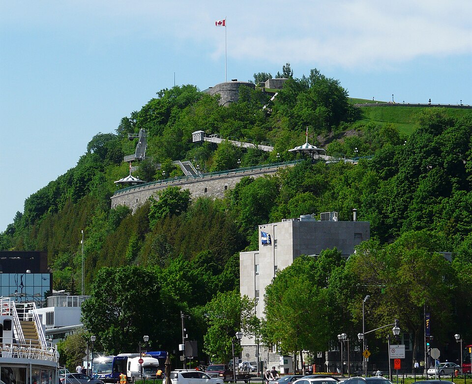
The name Cap Diamant came from crystals found in the rock that early Europeans mistakenly believed might be diamonds. They were not, but the name survived. What mattered strategically was the promontory itself. Ships travelling along the St Lawrence passed beneath a position from which the river could be observed, while the steep terrain made direct assault difficult. Champlain recognised those advantages immediately, and successive governments spent more than two centuries reinforcing them.
French fortifications developed gradually during the 17th and 18th centuries. A defensive enceinte was constructed in 1690 and subsequently replaced and strengthened as rivalry between France and Britain intensified. The western approach required particular attention because the open heights towards the Plains of Abraham lacked the natural protection provided by the cliffs elsewhere. The events of 1759 demonstrated exactly why that vulnerability mattered.
After the British conquest, the geography produced the same strategic conclusion for Québec’s new rulers. The city remained valuable, but Britain now had to defend it against possible French return and, later, against the expanding United States. The unsuccessful American assault on Québec in 1775, during the early stages of the American Revolution, reinforced the importance of the city’s defences.
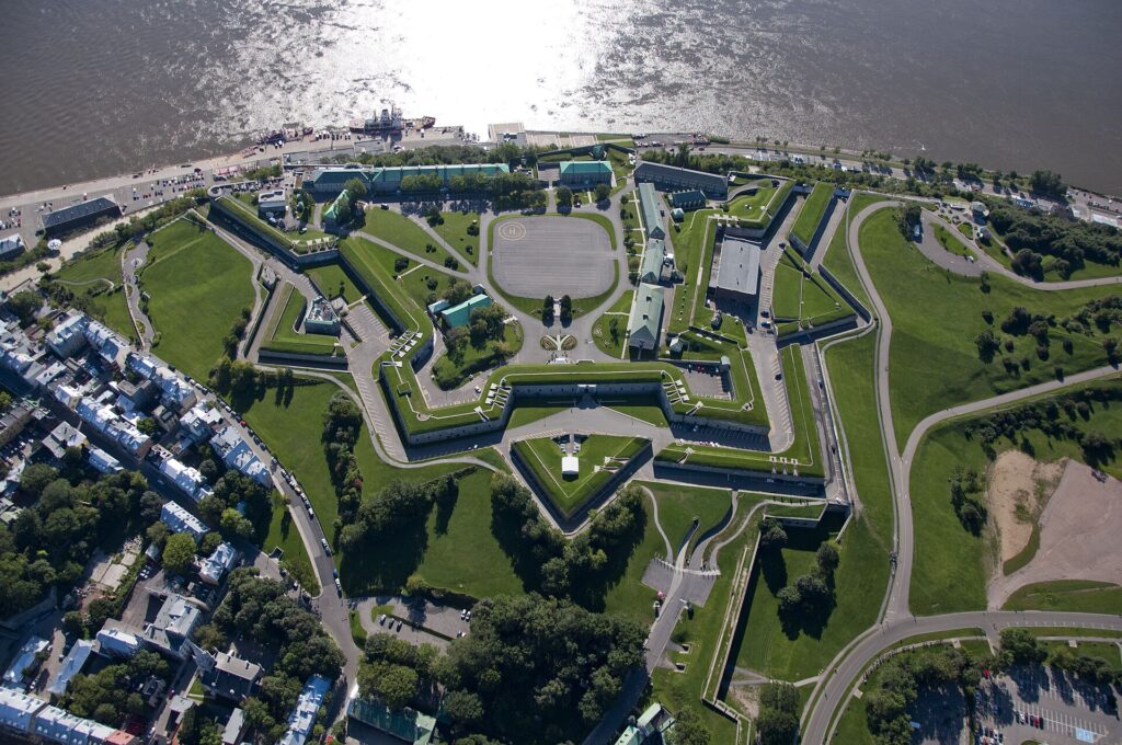
The culmination was the Citadelle of Québec, constructed largely between 1819 and 1832 on Cap Diamant. Its irregular form follows the terrain rather than imposing a perfect geometric fortress upon it, incorporating older defensive works into a larger British system. The Citadelle still occupies the heights beside the race circuit, and the same elevation that once determined whether artillery and infantry could defend Québec now contributes directly to the accumulated climbing of the Grand Prix.
The St Lawrence · The River Before the City
From the heights, the course eventually descends towards the St Lawrence River, and the character of Québec changes with it. The river is far more than scenery beneath the old city. It is the geographical reason the settlement became commercially, politically and militarily important, but its human history began thousands of years before Québec itself.
Archaeological evidence shows a long Indigenous presence throughout the St Lawrence valley. The river and its tributaries provided fish, fertile land, transportation and connections between the Atlantic, the Great Lakes and territories farther inland. Communities did not simply move along the water as though it were a natural highway without ownership or political meaning. Rivers connected territories belonging to different peoples, and movement depended upon relationships, knowledge and alliances.
When Cartier arrived in the 16th century, the St Lawrence Iroquoians occupied agricultural settlements along parts of the valley. By Champlain’s time, other Indigenous nations were using the corridor within changing political and commercial networks. Wendat traders became crucial intermediaries between the French and communities farther west, while Innu and Algonquin allies connected the new colony with territories extending north and west of the St Lawrence.
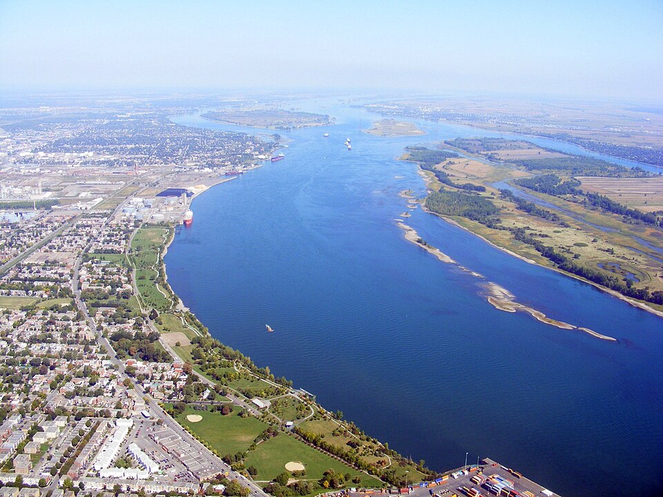
The fur trade depended upon these relationships. European demand for beaver pelts created new commercial pressures, but the networks through which furs reached Québec were not simply European creations imposed upon the continent. They developed through existing Indigenous routes and diplomacy, with French merchants positioned at one end of systems they initially understood only through their partners.
Under both French and British rule, the St Lawrence increasingly connected Québec to Atlantic commerce. Ships brought immigrants, supplies and manufactured goods while carrying colonial products towards Europe. During the 19th century, Québec became an important timber port, particularly when Britain’s demand for North American wood expanded during the Napoleonic era. Shipbuilding developed alongside the trade, and the waterfront filled with wharves, timber coves, warehouses, labourers and vessels.
The riders spend only a fraction of each circuit close to the water before beginning the return towards the heights, but every lap repeats the fundamental relationship that created the city. Québec grew where it did because the river provided movement and the cliff provided a position from which that movement could be watched and defended.
Lower Town · Where European Québec Began
Near the base of the escarpment lies Lower Town, the oldest part of European Québec. The district around Place Royale developed close to the location where Champlain constructed his Habitation in 1608, establishing a permanent French presence beside the St Lawrence.
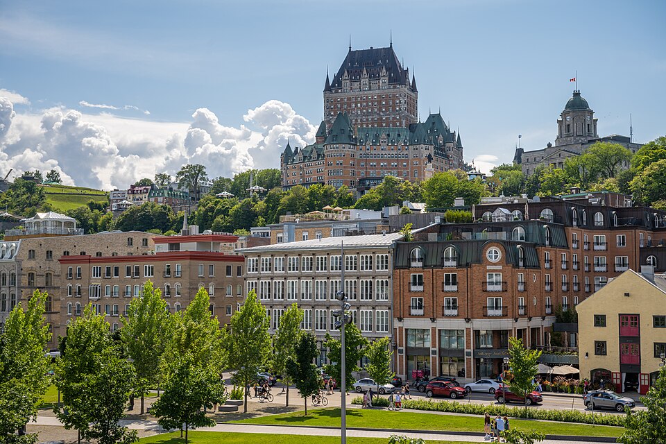
The first settlement was practical rather than monumental. Champlain’s complex contained accommodation, storage and defensive elements because the colony initially functioned largely as a trading post operating in a politically uncertain environment. As the settlement became permanent, the waterfront accumulated houses, workshops, warehouses and commercial spaces while institutions of government and defence increasingly occupied the heights above.
This physical division gradually acquired social and economic meaning. Goods arriving by ship were handled close to the river, merchants operated near the waterfront and labour associated with shipping concentrated below the cliff. Upper Town developed around government, religious institutions and military authority. Québec was therefore divided vertically as well as socially, with the escarpment influencing where different parts of colonial life took place.
Fire, bombardment and reconstruction repeatedly altered Lower Town. British artillery caused extensive destruction during the siege of 1759, while the expanding harbour of the 19th century transformed the relationship between streets and water. Later economic changes threatened older buildings as commercial activity moved and urban planners sought easier movement through the city.
The historic district visible today is consequently not a place that simply escaped change. Buildings survived because they were repaired, repurposed and eventually protected, while the value attached to the old city changed dramatically over time. Structures once regarded primarily as inconvenient remnants of an obsolete urban form became central to Québec’s identity and economy.
Côte de la Montagne · The Road Between Two Cities
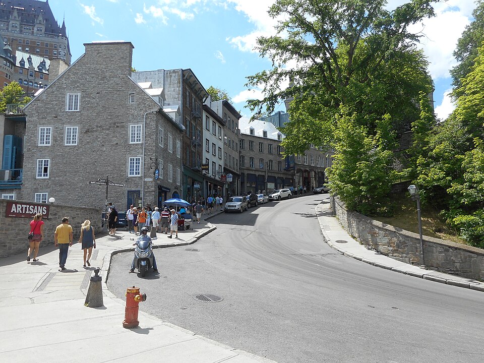
The return from the river towards the Upper Town brings the race onto Côte de la Montagne, one of its defining climbs. It is short by professional cycling standards, but the gradient reaches roughly ten percent and its position late in each circuit makes it increasingly important as sixteen passages accumulate.
Its significance predates cycling by almost four centuries. When Champlain established Fort Saint-Louis on the heights in 1620, the settlement needed a reliable route between the waterfront and the new centre of authority above. Côte de la Montagne developed along that connection and still occupies essentially the same corridor. The climb that now helps decide a WorldTour race began as part of the basic infrastructure required to make Québec function.
For early residents, the escarpment was an unavoidable part of daily movement. Merchants, officials, soldiers, clergy and labourers travelled between a waterfront where ships arrived and heights where political, military and religious institutions increasingly concentrated. Goods also had to be moved uphill, making the difference in elevation an economic problem as well as a physical one.
Pedestrians eventually created steeper shortcuts. The nearby Escalier Casse-Cou, commonly translated as the Breakneck Steps, developed from an early path connecting the two levels and became one of the oldest stair routes in the city. Its dramatic modern name was formalised much later, although English-language visitors were already describing the wooden staircase as the Breakneck Steps during the 19th century.
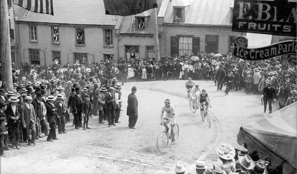
The Grand Prix turns this old urban difficulty into its principal sporting obstacle. Riders repeatedly descend towards the part of Québec created around maritime commerce and then climb back towards the part created around authority and defence. On the final lap, the same road that once connected Champlain’s settlement with Fort Saint-Louis becomes one of the places where the race can be won.
The Fortifications · The Walls Québec Nearly Lost
As the riders regain the Upper Town, they enter the landscape of the Fortifications of Québec, more than four kilometres of defensive works that make the city exceptional in North America. Québec remains the only city north of Mexico whose historic fortified enclosure survives substantially intact.
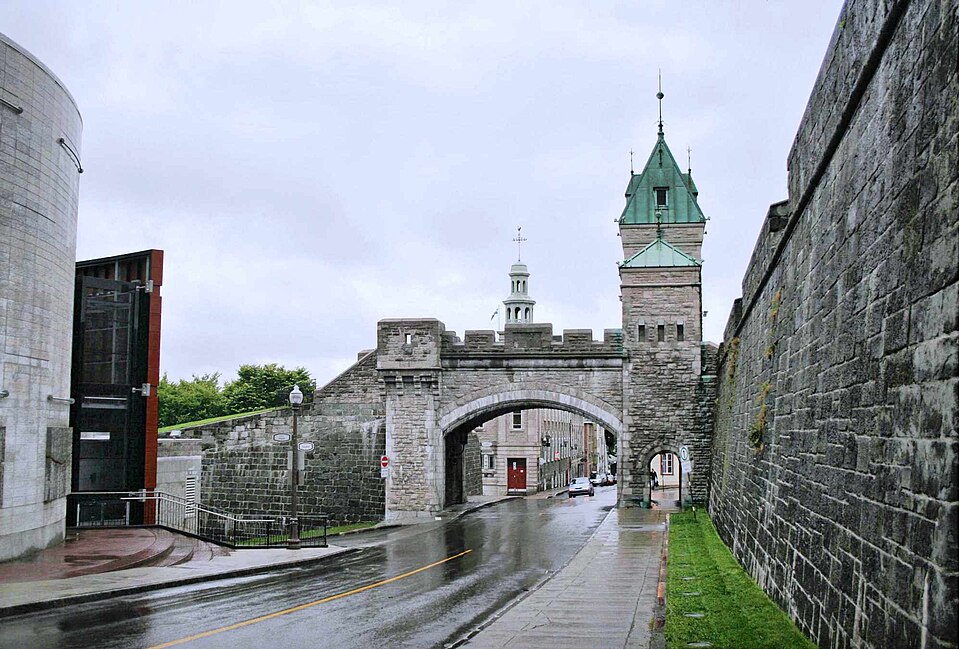
The walls originated in the military requirements of New France and were repeatedly strengthened as conflict with Britain intensified. British engineers subsequently expanded the same defensive system after the conquest, eventually incorporating the Citadelle and other works intended to protect the city from attack. What survives is therefore not a purely French fortification or a purely British one, but a military landscape constructed in stages by successive regimes responding to many of the same geographical problems.
By the 19th century, those defences had become increasingly inconvenient. Gates restricted traffic, military land constrained urban development and improvements in warfare were reducing the value of traditional fortified enclosures. After the withdrawal of the British garrison in 1871, sections of the system seemed likely to follow the walls of many other growing cities into demolition.
The decisive intervention came from Lord Dufferin, Governor General of Canada from 1872. Dufferin recognised that the walls could become an asset precisely because they were no longer essential to defence. He opposed their wholesale destruction and promoted schemes combining preservation with new gateways, promenades and improvements intended to make the old military landscape part of the modern city.
His intervention changed Québec profoundly. Had the walls been treated merely as obsolete infrastructure, much of the environment through which the Grand Prix now passes would have disappeared beneath later streets and buildings. Instead, structures created to control access became part of the city’s public identity, eventually contributing to the recognition of the Historic District of Old Québec as a UNESCO World Heritage Site in 1985.
The transformation also altered the meaning of the walls themselves. For centuries their purpose had been exclusion and defence. Once militarily obsolete, their survival depended upon people valuing them for almost the opposite reason: they became places to visit, walk beside and understand rather than barriers intended to keep outsiders away.
Château Frontenac · A Medieval Skyline Built by a Railway Company
Few buildings define the modern image of Québec more completely than the Château Frontenac, whose towers rise above the St Lawrence from the edge of the Upper Town. Its appearance suggests a building inherited from the French colonial period, and its name commemorates Louis de Buade, Comte de Frontenac, one of the most famous governors of New France. The building itself, however, belongs to a much later chapter of Canadian history.
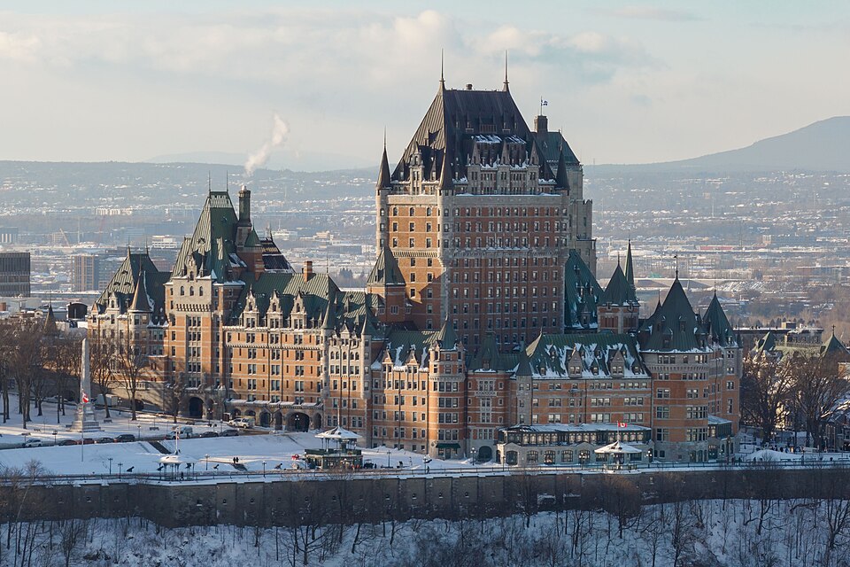
The hotel opened in 1893 during the great age of railway expansion. Canadian railway companies constructed monumental hotels along their networks to encourage wealthy travellers to cross the country, turning accommodation into part of the experience they were selling. Architect Bruce Price designed the original Château Frontenac for the Canadian Pacific Railway, drawing upon historical French architectural forms to create a building that appeared deliberately older and more aristocratic than its industrial-age origins.
The location amplified the effect. The hotel stands close to the site of the earlier Fort and Château Saint-Louis, where colonial governors had exercised authority for more than two centuries. A commercial hotel built by a railway company therefore inherited one of the most symbolically powerful positions in Québec and clothed itself in architecture intended to evoke the city’s French past.
Its construction belonged to a broader reinvention of Old Québec during the late 19th century. The fortifications were being preserved rather than dismantled, Dufferin Terrace transformed the clifftop into a public promenade, and historical architecture became increasingly important to the city’s tourist identity. Québec was preserving genuine remnants of its past while simultaneously constructing a particular visual interpretation of that past.
The distinction makes the skyline more interesting rather than less authentic. Some of its apparently ancient features are genuinely colonial, others are later reconstructions or reinterpretations, and together they show how cities actively decide which versions of their history will remain visible.
Grande Allée and Parliament · From the Road Beyond the Walls to Modern Québec
The course returns towards the start and finish area along the heights near Grande Allée, one of Québec’s major urban avenues. Its modern appearance belongs largely to the 19th and 20th centuries, but the route follows a much older corridor leading west from the fortified city towards Sillery.
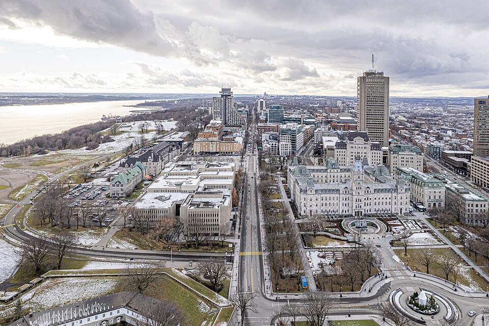
During the French period, the road crossed open ground beyond the walls. Military planners later treated the western approaches as a defensive problem, particularly because the terrain towards the Plains offered fewer natural obstacles than the cliffs facing the river. As Québec expanded and its military role declined, the same corridor became attractive for prestigious residences and public institutions.
The transformation accelerated after Canadian Confederation. Québec City became the capital of the province of Québec in 1867, creating the need for a parliamentary complex appropriate to the new provincial government. Construction of the present Hôtel du Parlement began in 1877 under architect Eugène-Étienne Taché, who designed an elaborate Second Empire building strongly influenced by contemporary French architecture.
Taché also conceived its exterior as a historical programme. Statues and architectural details commemorate figures from the history of Québec and French North America, turning the façade into an interpretation of the province’s past. Above the main entrance he placed the words Je me souviens, a phrase later adopted as Québec’s official motto and now familiar from vehicle licence plates across the province.
The Parliament therefore occupies ground where several versions of Québec meet. A road that once led beyond the fortified colonial town became an urban boulevard, land once understood partly through military geography became the centre of provincial government, and architecture inspired by France was used to express political identity within a Canadian federation. The Grand Prix finishes within this landscape, bringing the race back from the colonial history of the river and walls into the continuing political life of modern Québec.
FINAL LAP · Sixteen Climbs Through Four Centuries
By the beginning of the final circuit, the riders have crossed the same 12.6 kilometres fifteen times. The landmarks have not changed, but the sporting meaning of the roads has. The Plains of Abraham have become a question of positioning, the descent towards the river commits riders to one last passage through the lower city, and Côte de la Montagne waits between the waterfront and the decisive approach across the heights.
The accumulated climbing explains why Québec can be selective despite remaining entirely urban. No individual ascent resembles the mountains encountered elsewhere on the WorldTour, but repeated changes of elevation push the total towards 3,000 metres. The difficulty comes from the same vertical division that has shaped life in Québec since the 17th century. Commerce developed beside the river, authority occupied the heights, military engineers fortified the cliffs and generations of residents had to find ways of moving between them.
Côte de la Montagne concentrates that relationship into the final kilometres. The route established to connect the early waterfront settlement with Fort Saint-Louis survives inside a modern city because the underlying geographical problem never disappeared. The road still has to overcome the escarpment, and after almost 200 kilometres the peloton has to overcome it once more.
Once the riders regain the heights, the final approach passes through a landscape of walls, government buildings and the Plains of Abraham. At racing speed these are obstacles, corners and reference points, but the course has spent the afternoon demonstrating why they are there. Without the St Lawrence there would have been little reason for Québec to develop at this location; without Cap Diamant there would have been no natural fortress; without the division between Upper and Lower Town there would be no repeated climbing, and without the decision to preserve the city’s military and colonial landscape the Grand Prix would take place in a very different environment.
FINISH · Québec, Where Geography Became History
The Grand Prix Cycliste de Québec finishes close to where it began after sixteen circuits that have travelled only a few kilometres across the map but repeatedly crossed several centuries of North American history. The format suits Québec because the city itself developed through successive societies adapting the same geography rather than through a single moment of foundation.

Long before Champlain arrived, Indigenous peoples inhabited and travelled through the St Lawrence valley, cultivating land, fishing its waters and maintaining political and commercial networks that connected communities across enormous distances. Cartier encountered Stadacona within that world in 1535, while the French settlement established more than seventy years later depended heavily upon alliances with Innu, Algonquin and Wendat peoples. The European city that grew beside the river did not replace an empty landscape but became another participant in a much older geography of movement and exchange.
French colonists used the river for commerce and the heights for defence, creating the division between Lower and Upper Town that remains visible today. French engineers fortified the promontory, British troops captured the heights in 1759, British engineers subsequently expanded the defensive system, and 19th-century residents nearly dismantled walls that had ceased to serve their original purpose. The same structures survived because a later generation began to understand them not as military infrastructure but as heritage.
Québec then learned to reinterpret its past as well as preserve it. Lord Dufferin helped save the fortifications, the Plains of Abraham became a public park, Château Frontenac gave the skyline a deliberately historical railway hotel, and the Parliament transformed the old western approach into the political centre of modern Québec. UNESCO’s recognition of Old Québec in 1985 acknowledged a city whose unusual physical survival depended upon decisions made long after the military purposes of its walls had disappeared.
The cycling race is one of the newest uses of that inherited geography. Created only in 2010, the Grand Prix has none of the century-old sporting history of Europe’s monuments, yet its course could hardly be more closely connected to the place in which it is held. The riders descend because Québec was built on a cliff, follow the river because the city grew around the St Lawrence, climb Côte de la Montagne because Upper and Lower Town have needed to be connected since the 1620s, and cross the Plains because the open heights that once exposed Québec to attack were later preserved rather than built over.
Sixteen laps might suggest repetition, but in Québec repetition allows the landscape to be read more closely. The same circuit contains Indigenous geography beneath the colonial city, French fortifications incorporated into British defences, a battlefield transformed into a park, an obsolete military enclosure preserved as heritage and a centuries-old route from river to fortress transformed into a WorldTour climb. The peloton finishes almost exactly where it started, but the history surrounding those few kilometres reaches from the Indigenous St Lawrence to the modern capital of Québec.



