

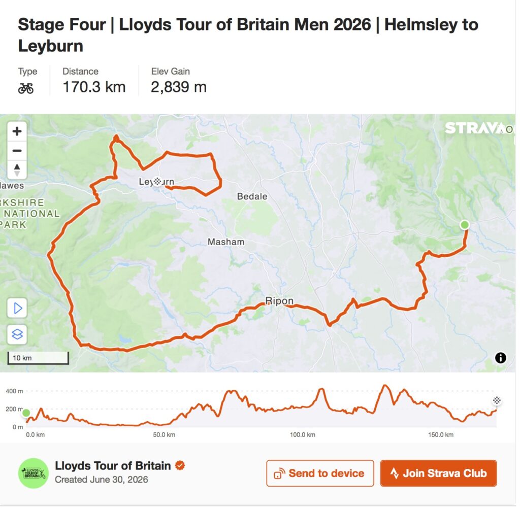
The fourth stage of the Tour of Britain begins beneath the ruins of a castle whose medieval lord was one of the barons appointed to enforce Magna Carta, then travels across a part of Yorkshire where almost every change in the landscape opens another period of history. Before reaching Leyburn, the peloton will pass prehistoric standing stones raised thousands of years before England existed, an Anglo-Saxon cathedral crypt built in the seventh century, valleys transformed by medieval monasteries, hills excavated by generations of lead miners, waterfalls painted by J. M. W. Turner and roads that entered modern cycling history when the Tour de France came to Yorkshire in 2014.
At 165.8 kilometres, Stage 4 is considerably shorter than the three days that precede it, but there is little generosity in the reduced distance. Approximately 2,699 metres of climbing are concentrated between Helmsley and Leyburn, with the character of the race changing dramatically once the peloton reaches Pateley Bridge. Greenhow Bank carries the riders out of Nidderdale, Kidstones rises beyond Buckden, and the late combination of Greets Moss and Grinton Moor creates the hardest sustained sequence of the 2026 race. This is the day on which the general classification should begin to acquire its final shape.
The difficulty of those roads is inseparable from the landscape around them. Limestone created cliffs, caves and thin upland soils. Mineral veins drew miners underground. Rivers carved the dales and later powered mills, while glaciers enlarged valleys whose contours still determine where settlements could develop and where roads can cross from one dale to another. Human communities repeatedly adapted themselves to that geology: monks accumulated sheep and pasture, miners built settlements close to lead veins, farmers divided fields with stone taken directly from the ground, and market towns developed where valleys and routes brought people together.
Professional cycling arrived very late in that story, yet it fits the landscape remarkably well. The same roads created to connect isolated communities across difficult terrain now provide some of Britain’s finest racing. Stage 4 therefore offers more than the queen stage of the Tour of Britain. It is a journey through a landscape in which geology, agriculture, religion, industry and cycling have repeatedly found different uses for the same hills.
START · Helmsley Castle and the Baron Who Defied King John
The riders leave Helmsley from Castlegate, almost beneath the walls of Helmsley Castle, a fortress whose ruins preserve two of the great political conflicts of English history.
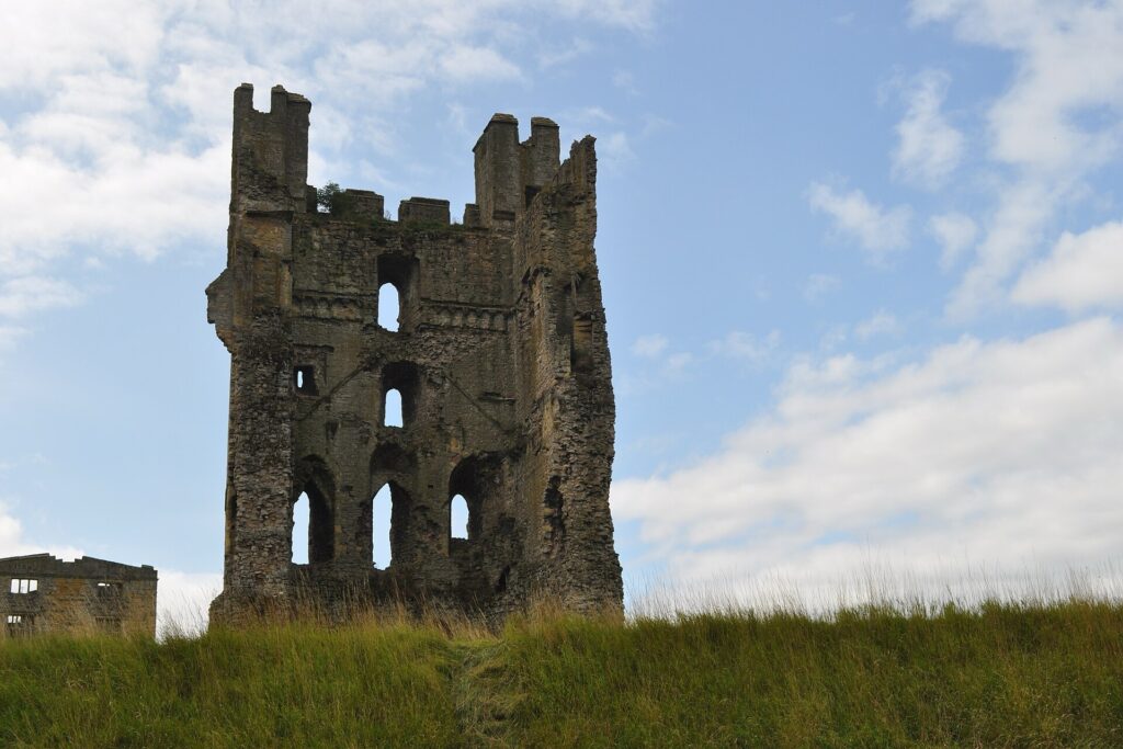
The castle began taking recognisable form during the 12th century, when the estate belonged to Walter Espec. It later passed to the de Ros family, who transformed the site with substantial stone defences and established the fortress that would dominate Helmsley for centuries. One member of that family, Robert de Ros, became directly involved in the crisis that produced Magna Carta.
In 1215, King John faced rebellion from barons angered by taxation, military failures and what they regarded as arbitrary royal government. The settlement negotiated at Runnymede produced Magna Carta, but the document contained an extraordinary mechanism for attempting to enforce its promises. Twenty-five barons were selected to ensure that the king observed the agreement, and Robert de Ros was one of them.
The settlement quickly failed. John rejected the restrictions placed upon him, the barons rebelled again and England descended into the First Barons’ War. Robert remained among the king’s opponents, while Helmsley became part of the military landscape of the conflict. Magna Carta, in other words, was not immediately the revered constitutional document it later became. In its own time it formed part of a bitter struggle between armed political factions, and men associated with castles such as Helmsley were prepared to fight over the limits of royal authority.
More than four centuries later, the castle became a battlefield again during the English Civil War. A Royalist garrison held Helmsley against Parliamentarian forces under Sir Thomas Fairfax for approximately three months in 1644 before finally surrendering. Parliament subsequently ordered the castle’s military defences to be slighted so that the fortress could not easily be used again.
The broken walls beside today’s start are therefore not simply picturesque ruins created by time. Their damaged condition is partly the consequence of a deliberate attempt to remove their military usefulness. A building created to control territory eventually survived precisely because England no longer needed it to perform the purpose for which it had been built.
START · Rievaulx Abbey and the Monks Who Changed the Countryside
Only a few kilometres from Helmsley stands Rievaulx Abbey, one of the great Cistercian monasteries of medieval England and an essential part of the landscape from which Stage 4 begins.
Walter Espec, the lord associated with early Helmsley Castle, founded Rievaulx in 1132. The monks settled in a secluded valley beside the River Rye, pursuing the Cistercian ideal of a disciplined religious life removed from the distractions of towns. Yet withdrawal from society did not mean withdrawal from the economy. Rievaulx accumulated extensive estates, organised agricultural granges and developed large-scale sheep farming, while the wool produced on monastic lands entered commercial networks extending far beyond Yorkshire.
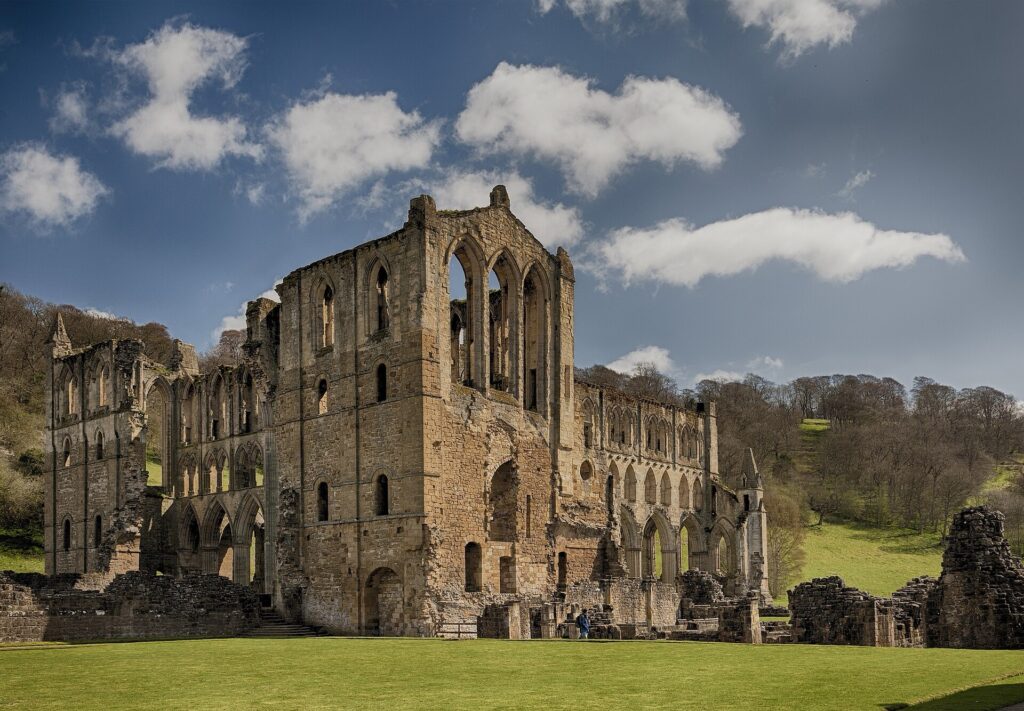
At its height, Rievaulx was one of the most important Cistercian houses in England. Hundreds of monks and lay brothers were associated with the community, and the enormous church and monastic buildings reflected an institution whose economic influence reached across the surrounding countryside. Valleys were managed, woodland exploited, farms reorganised and distant estates connected to the monastery through an administrative system that made religious houses important agents of landscape change.
That world ended abruptly during Henry VIII’s Dissolution of the Monasteries. Rievaulx was suppressed in 1538, its community dispersed and valuable materials stripped from the buildings. Over subsequent centuries the abandoned monastery acquired an entirely different meaning. Eighteenth-century landowners incorporated views of the ruins into designed landscapes, while artists and travellers increasingly admired the remains for their beauty. An institution once created for religious discipline and economic production became part of the romantic image of ruined medieval England.
The peloton does not enter Rievaulx itself, but the abbey belongs to the story of the country surrounding Helmsley. Medieval monasteries did not merely occupy picturesque valleys. They helped create the agricultural landscape through which the modern race travels.
-135 km · Easingwold and the Market Towns That Made Rural England Work
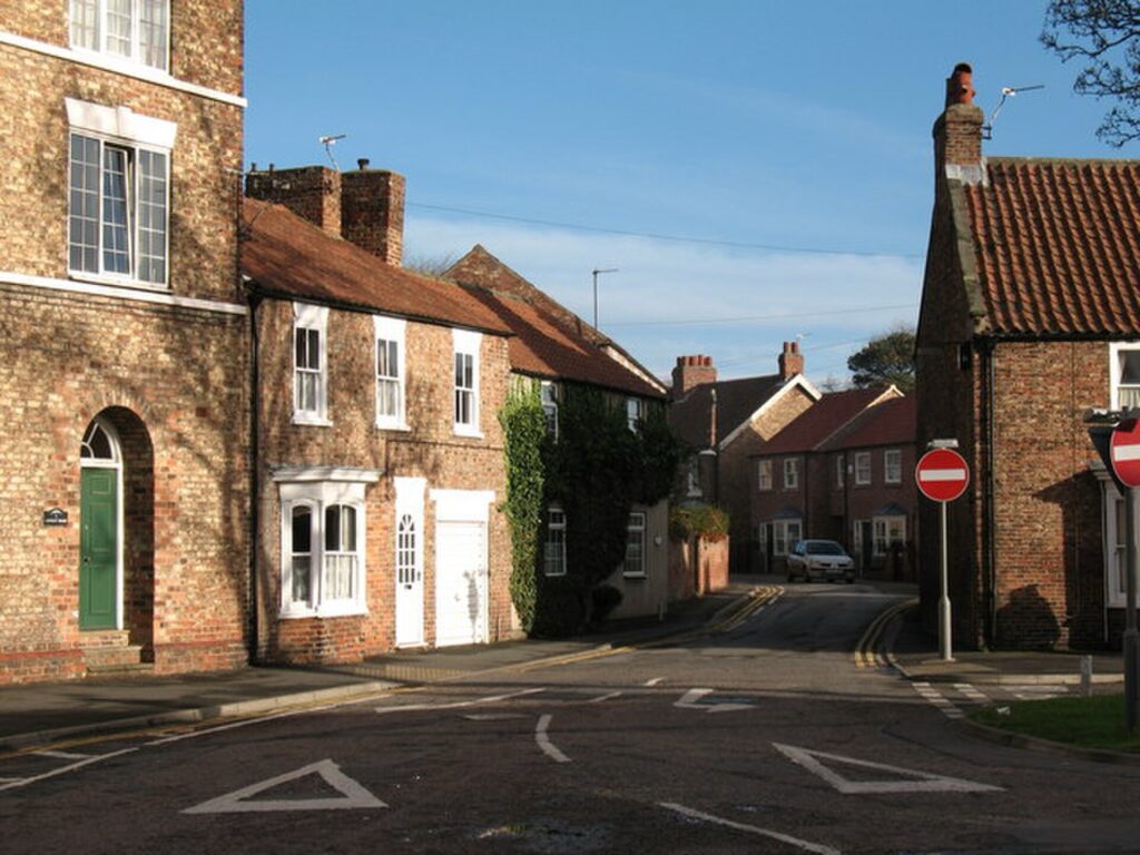
The road towards Easingwold brings the peloton into gentler country, where a broad market place recalls the network of small towns that once organised economic life across rural England.
Before railways, motor vehicles and modern distribution systems, agricultural communities needed accessible centres where livestock, grain, tools, textiles and household goods could change hands. A market charter could therefore transform the importance of a settlement. Farmers arrived from surrounding villages, craftspeople found customers, inns accommodated travellers and information moved between communities that might otherwise have relatively little regular contact.
Easingwold developed within precisely this system. Its market was not an ornamental tradition attached to an attractive Yorkshire town but part of the practical infrastructure of the countryside. The roads converging on the settlement carried people and produce towards a place where the rural economy periodically concentrated itself before dispersing again.
The race moves quickly through this flatter landscape, but the pattern becomes important for understanding much of Stage 4. Helmsley, Pateley Bridge, Grassington and Leyburn all developed in different ways because surrounding rural populations needed places where trade and services could gather. The market town is one of the recurring structures through which people learned to inhabit landscapes that otherwise encouraged isolation.
Near Boroughbridge, however, the route encounters evidence of communities who organised this country thousands of years before any of those towns existed.
-115 km · The Devil’s Arrows, Three Stones from Prehistoric Yorkshire
Outside Boroughbridge stand three enormous pillars of weathered millstone grit known as the Devil’s Arrows, a folkloric name attached long after the original meaning of the monument had been forgotten.
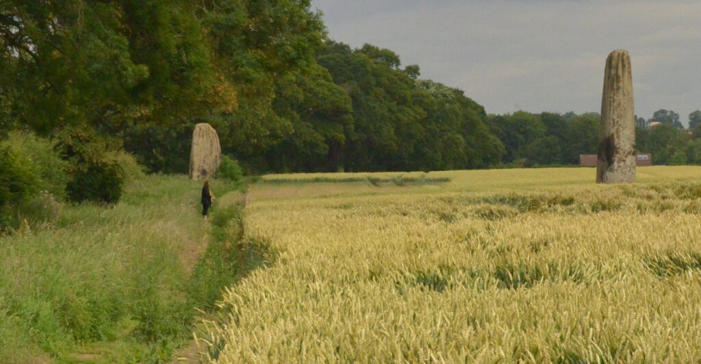
The stones were erected during later prehistory, probably in the Late Neolithic or Early Bronze Age. Three remain upright, although antiquarian descriptions indicate that a fourth once formed part of the alignment. The tallest surviving stone rises almost seven metres above the ground, with additional stone buried beneath the surface to anchor it securely.
Their construction demanded a remarkable collective effort. The millstone grit was not quarried where the stones now stand. Geological evidence points towards an origin around fifteen kilometres away, meaning prehistoric communities had to extract multi-tonne blocks, transport them across the landscape and raise them vertically without modern lifting machinery or engineered roads.
Exactly why remains uncertain. The alignment may have served ceremonial, territorial or cosmological purposes, but the people responsible left no written explanation. Archaeology can reconstruct how the stones were positioned and identify the geological source of their material, yet the ideas that justified such enormous labour remain inaccessible.
Later generations treated the monument very differently. The missing fourth stone was broken apart, with some of its material apparently reused for construction. The contrast is revealing: one society considered the stone important enough to move for kilometres and raise upright, while another regarded the same object as convenient building material.
The three survivors therefore preserve more than prehistoric engineering. They demonstrate how the meaning of a landscape can disappear even while the physical objects within it remain.
-110 km · Boroughbridge, Where Geography Trapped a Rebellion
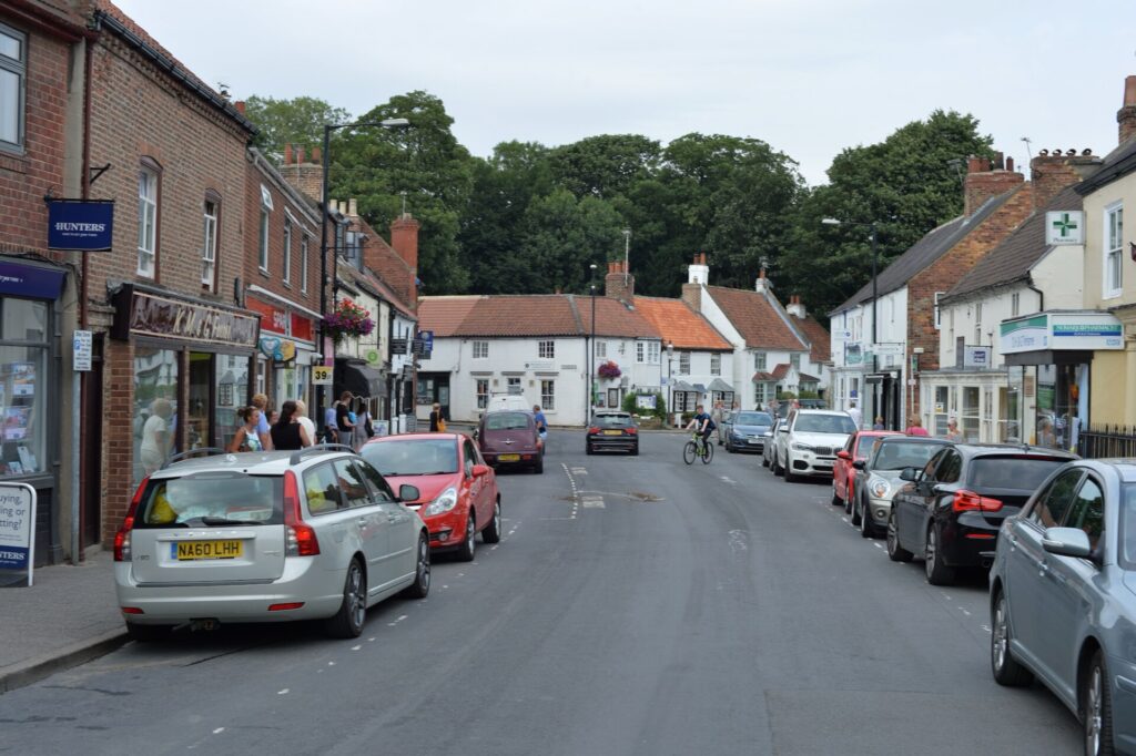
The nearby town of Boroughbridge developed around a more practical geographical feature: a crossing of the River Ure.
The importance of this corridor reaches back to Roman Britain. Nearby Aldborough became Isurium Brigantum, an important centre associated with the territory of the Brigantes, while Roman roads and military infrastructure exploited the natural routes through northern England. In later centuries Boroughbridge benefited from its position on the Great North Road, where travellers, stagecoaches, drovers and goods repeatedly converged on the river crossing.
The livestock traffic could be immense. Cattle driven south from Scotland passed through Yorkshire in large numbers, supporting inns, stables, blacksmiths and businesses whose livelihoods depended upon the movement of people and animals. The bridge was therefore not merely part of the town’s infrastructure; it was one of the principal reasons a town developed here at all.
Its strategic value became brutally clear in 1322, when forces loyal to Edward II confronted the rebellious Thomas, Earl of Lancaster. Lancaster, one of the most powerful nobles in England and a leading opponent of the king, was retreating north when royal troops blocked the crossings around Boroughbridge. Unable to move freely across the river, his forces were defeated and Lancaster was captured before being executed shortly afterwards.
The same geographical bottleneck that encouraged commerce could therefore become a trap during war. Boroughbridge prospered because travellers needed to cross the Ure, and in 1322 an army discovered the dangerous consequence of finding that crossing controlled by someone else.
-100 km · Ripon and an Anglo-Saxon Room Beneath the Cathedral
The peloton next reaches Ripon, where one of the most remarkable survivals from Anglo-Saxon England lies beneath the cathedral rather than above it.
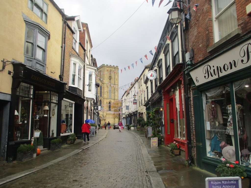
Around AD 672, the Northumbrian churchman Wilfrid constructed a stone church at Ripon. The building visible today is the product of many later centuries of rebuilding, but a tiny part of Wilfrid’s church escaped those transformations: its crypt.
Descending into the narrow underground chamber means entering a structure more than thirteen centuries old. When it was created, England did not yet exist as a unified kingdom. Northumbria, Mercia, Wessex and other Anglo-Saxon kingdoms competed for territory and influence, while the Christianisation of England was still comparatively recent and disagreements persisted over religious customs and ecclesiastical authority.
Wilfrid stood near the centre of those disputes. He had travelled extensively in continental Europe and became an energetic advocate of Roman ecclesiastical traditions in northern England. The church he built at Ripon reflected those experiences, while the crypt was probably intended to evoke the sacred underground spaces and relic shrines he had encountered abroad.
For medieval worshippers, descending into such a chamber was not simply architectural curiosity. Relics connected physical objects with holy people, and the act of entering a confined underground space could reproduce the experience of approaching a sacred tomb. The building itself helped organise religious emotion.
Almost everything surrounding Wilfrid’s crypt changed. Kingdoms disappeared, the cathedral above was reconstructed, religious practice was transformed by the Reformation and the modern city grew around the site. The underground chamber remained embedded beneath all of them, preserving a physical space from a period when the political map of Britain would be almost unrecognisable today.
-95 km · Fountains Abbey and the Economics of Medieval Monasticism
South-west of Ripon lies Fountains Abbey, another Cistercian monastery whose history helps explain the landscape through which the race is moving, even though the peloton does not pass directly through its ruins.
Founded in 1132, Fountains developed from a small religious community into one of the wealthiest monasteries in England. Like Rievaulx, it accumulated extensive estates and organised them through agricultural granges, with sheep and wool becoming particularly important to its economy. The monastery’s influence consequently extended far beyond the walls of the abbey itself.
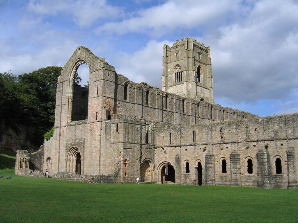
This is one of the paradoxes of Cistercian history. The order celebrated austerity, discipline and separation from worldly luxury, yet successful monasteries could become extremely powerful landowners. Their estates required sophisticated administration, labour and connections to commercial markets, and the wealth generated by those systems helped finance some of the most impressive religious architecture of medieval Britain.
After Henry VIII suppressed Fountains in 1539, the landscape changed purpose again. During the 18th century, the Aislabie family developed Studley Royal into an elaborate water garden of canals, cascades, formal vistas and ornamental buildings, eventually incorporating the medieval ruins into a carefully composed landscape. The remains of an institution created for monastic life became an aesthetic element within an aristocratic vision of nature.
The combined Fountains Abbey and Studley Royal landscape is now recognised as a UNESCO World Heritage Site. Its importance comes partly from the extraordinary coexistence of those different historical layers: medieval religion, agricultural wealth, Reformation destruction and 18th-century landscape design occupy the same valley.
Stage 4 repeatedly encounters this process. Yorkshire’s most apparently natural landscapes have often been organised, exploited, abandoned and reinvented many times.
-80 km · Pateley Bridge and a Valley Made by Ice
At Pateley Bridge, the physical character of Stage 4 changes sharply as the riders enter Nidderdale and the hills begin closing around the River Nidd.
The shape of the dale owes much to the last Ice Age. Glaciers occupied these uplands, enlarging valleys and moving enormous quantities of rock before retreating as the climate warmed. Meltwater and rivers continued to modify the terrain left behind, producing the steep slopes and narrow valley floor to which later human communities had to adapt.
Pateley Bridge developed at a crossing of the Nidd and received a market charter from Edward II in 1320. Its geography remains immediately visible in the town. The High Street climbs steeply away from the river because there is little level ground available, while roads leaving the settlement must eventually find ways out of the valley.
The market served farms and communities scattered through Nidderdale, but the surrounding hills contained another source of wealth. Mineral veins beneath the uplands had attracted human attention for centuries, and lead mining eventually became one of the defining industries of the region.
For the peloton, that history becomes physical almost immediately. The road towards Greenhow does not gently leave Pateley Bridge; it climbs directly out of the dale towards the old mining country above.
-76 km · Greenhow Bank and the Landscape of Lead
Greenhow Bank is the first major test of the stage, climbing for roughly four kilometres from Pateley Bridge at an average gradient of around seven per cent. Its difficulty comes partly from the abrupt transition between the valley floor and the exposed uplands, but the landscape at the top contains evidence of people who worked these hills under conditions considerably harsher than those faced by professional cyclists.
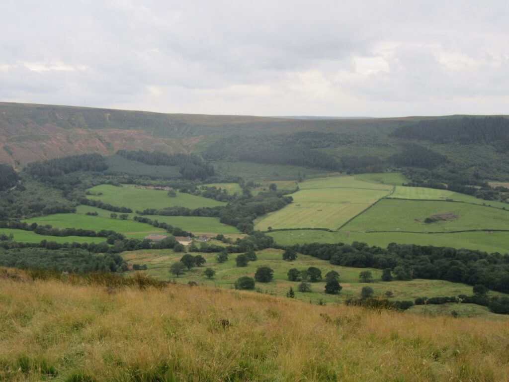
The area around Greenhow became one of Yorkshire’s important lead-mining districts. Lead-bearing veins running through the limestone had been exploited for centuries, with mining expanding significantly as demand increased. Shafts descended into the hills, tunnels followed mineral veins underground and processing sites separated valuable ore from the surrounding rock.
Mining reshaped the surface as well. Spoil heaps, abandoned shafts, ruined buildings and disturbed ground remain scattered across the uplands, although weathering and vegetation have gradually softened many of them. What can now appear to be wild moorland was once an industrial workplace filled with machinery, smoke, noise and labour.
The work was dangerous. Miners faced collapsing ground, flooding, poor ventilation and the health effects of dust and prolonged exposure to lead. Families and settlements developed around an industry whose prosperity depended upon extracting small concentrations of valuable metal from enormous quantities of rock.
The decline of mining left behind a peculiar landscape in which industrial archaeology has become part of the scenery. Grass grows over spoil heaps, ruined structures merge into drystone walls and old workings survive beneath ground crossed by walkers and livestock.
The race therefore climbs through countryside that only appears untouched if its history is ignored. Greenhow is not simply a moor through which industry once passed. Industry helped create the landscape visible today.
-65 km · Grassington and the Village That Mining Enlarged
Descending towards Wharfedale, the race reaches Grassington, one of the best-known villages in the Yorkshire Dales.
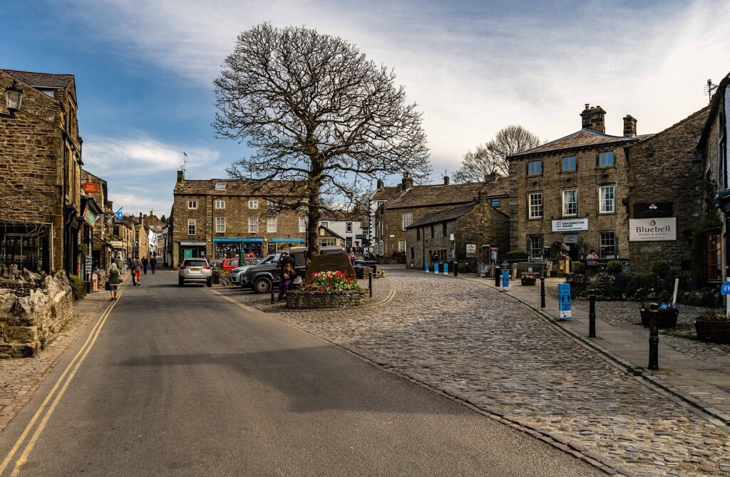
Its stone houses, narrow streets and surrounding fields now fit almost perfectly within the popular image of rural Yorkshire, but Grassington’s growth was strongly connected to industry. Lead mining expanded significantly around the village during the 18th and 19th centuries, drawing workers into the area and creating an economy that extended far beyond farming.
The nearby moors preserve extensive mining remains. Shafts, dressing floors, spoil heaps and tracks reveal the scale of an industry that once employed large numbers of people. Ore extracted underground had to be brought to the surface, broken, sorted and processed before the lead could enter commercial networks. The work altered hillsides that now appear peaceful to visitors following walking paths across them.
Grassington also demonstrates what happened when those industries declined. As mining contracted during the later 19th century, the village increasingly developed other economic roles, eventually becoming an important centre for tourism within the Yorkshire Dales. Buildings once associated with working communities became shops, accommodation and homes in a landscape valued increasingly for the appearance produced partly by earlier generations of labour.
The transformation is common throughout the Dales. Industrial landscapes gradually became heritage landscapes, and the very features created by farming, quarrying and mining helped generate the visual character later celebrated as natural beauty.
-55 to -40 km · Wharfedale, Limestone and the Architecture of the Dales
Beyond Grassington, the peloton follows the River Wharfe deeper into one of Yorkshire’s most celebrated valleys.
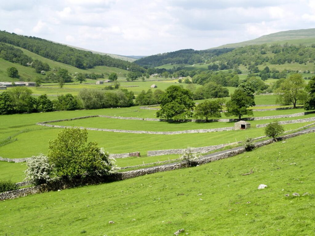
The visual language of the Dales becomes increasingly distinctive here: pale limestone, green fields divided into small irregular parcels, dry stone walls climbing hillsides and villages built from local stone. The effect can appear timeless, but almost every element reflects a relationship between geology and human labour.
The limestone began forming more than 300 million years ago beneath tropical seas. Shells and other marine material accumulated on the seabed and eventually became rock, which was later uplifted, fractured and exposed. Water dissolved the limestone along weaknesses, producing caves, underground drainage systems, cliffs and the characteristic broken pavements found elsewhere in the Dales.
Farmers subsequently turned the same geology into architecture. Stones cleared from fields were stacked without mortar to create boundaries capable of containing livestock, producing the enormous network of dry stone walls that now seems inseparable from the Yorkshire landscape. Barns and houses were constructed from similar local material, allowing settlements to acquire the same colours as the hills around them.
The resulting landscape is neither purely natural nor simply artificial. Geological processes supplied the material and determined the terrain, while centuries of farming organised it into the pattern visible from the race.
This relationship becomes particularly clear as the peloton continues through Kettlewell, Buckden and Cray, settlements occupying small areas of usable ground between river and hillside. Their positions were dictated by the valley long before modern roads connected them.
-43 km · Buckden and the Head of Wharfedale
At Buckden, the valley narrows and the surrounding hills become more imposing. The settlement stands close to the point where routes through Upper Wharfedale begin confronting the higher ground separating one dale from another.
For generations, communities here depended upon mixed upland farming, particularly sheep and cattle, while paths across the hills provided connections that could be difficult or dangerous in poor weather. Isolation was relative rather than complete: these valleys were linked through networks of tracks, markets, droving routes and later roads, but movement always had to negotiate the terrain.
The landscape also preserves a long relationship between livestock and monastic landholding. Medieval religious houses controlled extensive estates throughout the Dales, while sheep became fundamental to the regional economy. Wool connected apparently remote Yorkshire valleys to commercial systems reaching far beyond England.
Modern tourism can make places such as Buckden appear preserved outside economic history, yet their existence depended upon production and exchange. The beauty visible from the race was also a workplace, organised around animals, hay, walls, barns, seasonal rhythms and the constant problem of making a living from relatively difficult land.
Beyond Buckden, the road begins climbing towards Kidstones, where that geography enters a much more recent chapter of cycling history.
-36 km · Kidstones and the Day the Tour de France Came to Yorkshire
The ascent of Kidstones is not exceptionally long by continental standards, but it occupies a special place in British cycling because of what happened here in 2014.
That year, Yorkshire hosted the Grand Départ of the Tour de France. The opening stage ran from Leeds to Harrogate through the Yorkshire Dales, carrying the world’s largest cycling race along roads normally used by farmers, local traffic, walkers and British club cyclists.
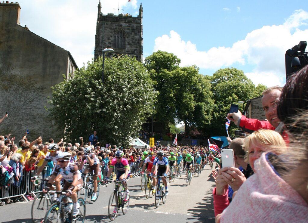
The response was extraordinary. Crowds covered climbs, villages decorated streets and fields, and spectators stood several people deep along roads in places where major international sport had rarely appeared before. Television images of the peloton moving through stone-walled valleys beneath enormous Yorkshire skies were broadcast around the world.
Kidstones formed part of that opening stage and returned to international attention during the 2019 UCI Road World Championships, when Yorkshire again hosted elite racing.
Those events changed the cultural meaning of many roads in the county. A climb does not need Alpine altitude to acquire cycling history. Repeated association with important races, memorable crowds and particular moments can transform an ordinary road into a recognised sporting landmark.
Stage 4 returns professional racing to that landscape. The gradient remains approximately what it was in 2014, the limestone beneath the road is immeasurably older and the surrounding farms continue functioning as before, but cyclists now approach Kidstones carrying an additional layer of memory.
Yorkshire has always possessed hills. International cycling taught a much larger audience their names.
-27 km · Aysgarth Falls and the River Ure
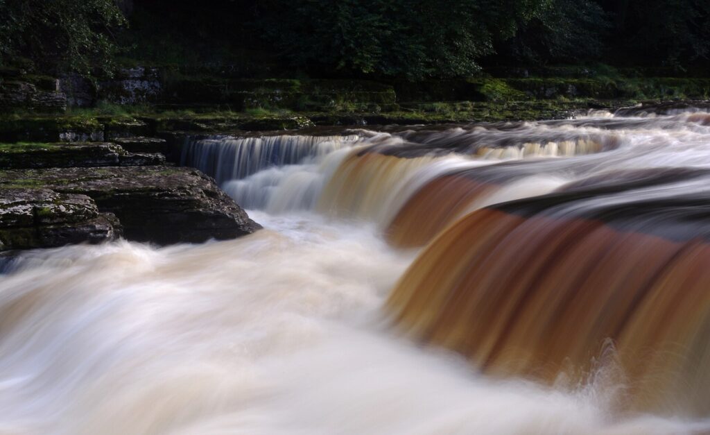
After crossing into Wensleydale, the race approaches Aysgarth Falls, where the River Ure descends through a sequence of limestone ledges.
The falls are not a single vertical drop but three principal sections spread along the river. Their form reflects the underlying geology, with harder limestone layers resisting erosion differently from softer beds and forcing the Ure into a succession of broad cascades.
Human beings have been drawn to them for centuries. The surrounding woodland and the combination of water, rock and changing light made Aysgarth particularly attractive during the development of picturesque tourism in the 18th and 19th centuries, when travellers increasingly sought landscapes that appeared dramatic, irregular and emotionally affecting.
Among those visitors was J. M. W. Turner, one of Britain’s greatest landscape artists. Turner travelled repeatedly through Yorkshire and produced studies of the Dales, including Aysgarth, as he explored how water, weather, light and terrain could be translated into painting.
His interest represents an important change in how landscapes such as these were perceived. Mountains, waterfalls and wild valleys had once been treated primarily as obstacles, resources or dangerous spaces. By Turner’s period, the same features could be destinations precisely because of their drama.
Modern tourism inherited much of that sensibility. Visitors now travel to Aysgarth because the river becomes turbulent and spectacular where earlier generations might have evaluated the same water in terms of crossings, mills or flood risk.
The Tour of Britain adds yet another way of reading the terrain. Waterfalls become television scenery, valleys become race corridors and hills become classified climbs, but the underlying geology continues determining where both river and road can go.
-20 km · Wensleydale, the Valley Named After a Village Rather Than Its River
The race is now travelling through Wensleydale, one of the major valleys of the Yorkshire Dales and an unusual exception to a regional naming pattern.
Many Yorkshire dales take their names from the rivers running through them: Wharfedale from the Wharfe, Swaledale from the Swale and Nidderdale from the Nidd. Wensleydale is different. The river flowing through it is the Ure, while the valley’s modern name derives from Wensley, a village that was historically important within the dale.
The valley was once also known as Yoredale, preserving a connection with the river, and geologists adopted the term Yoredale Series for the repeating bands of limestone, shale and sandstone characteristic of parts of the region.
For most visitors, however, Wensleydale is associated with something considerably more edible.
Cheese has been produced in the valley for centuries, with tradition connecting early cheesemaking to monastic communities. After the Dissolution of the Monasteries, knowledge and techniques continued among local farmers, eventually producing the crumbly cheese now known as Wensleydale.
Its survival was not guaranteed. Industrial consolidation and changing food production repeatedly threatened local cheesemaking, but production continued and later revived at Hawes. In modern popular culture the cheese received an unexpected additional boost through its association with Wallace and Gromit, whose creator Nick Park selected Wensleydale largely because he liked how the word sounded when spoken by Wallace.
It is a wonderfully improbable connection between an ancient agricultural valley and stop-motion animation, but it also illustrates how regional foods survive partly through stories. Cheese made because farming communities needed to preserve milk eventually became an internationally recognised symbol of Yorkshire.
The peloton will not have much time to contemplate any of this. The hardest sequence of the stage is about to begin.
-18 km · Greets Moss, Crossing Between the Dales
The climb of Greets Moss takes the riders away from Wensleydale towards the high ground separating it from Swaledale. At approximately 4.4 kilometres with an average gradient close to seven per cent, it comes late enough in the stage for accumulated fatigue to matter as much as the numbers.
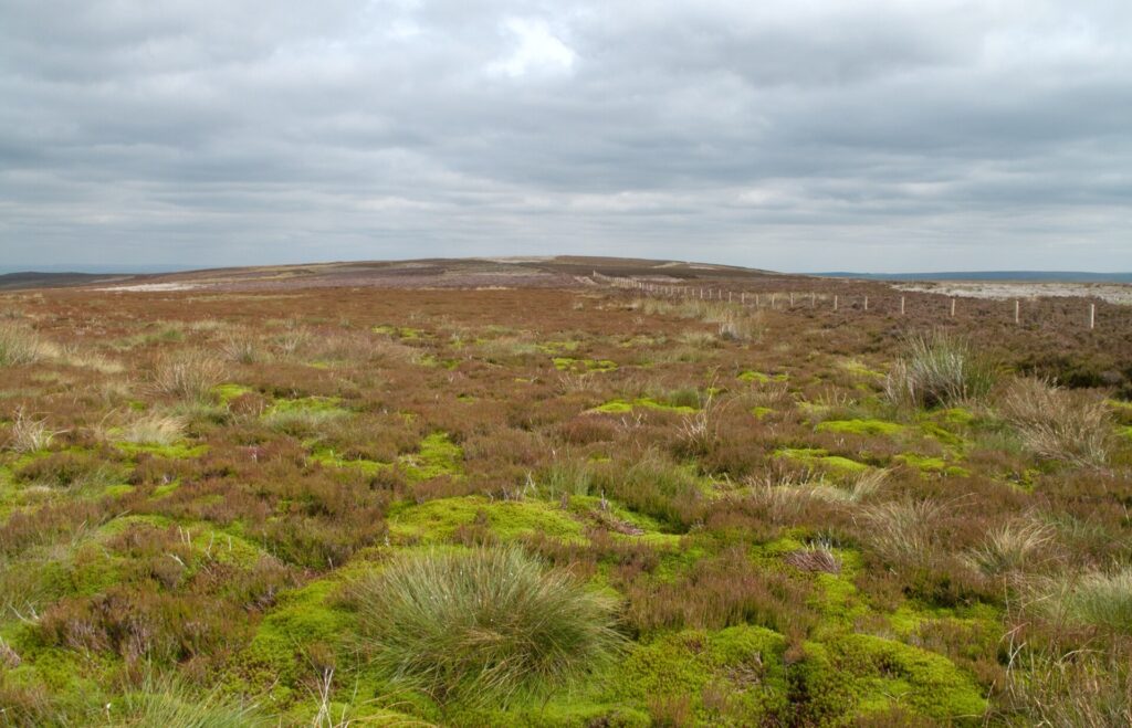
The open moorland above the valleys represents another characteristic environment of the northern Pennines. Thin soils, exposure, high rainfall and centuries of grazing have produced broad uplands dominated by grasses, heather and peat. Human activity has shaped these apparently wild spaces for generations through grazing, burning, drainage, shooting management and mineral extraction.
Peat is particularly important. Formed through the extremely slow accumulation of partially decomposed vegetation in waterlogged conditions, peatlands can store enormous quantities of carbon while regulating water movement through upland catchments. Damage through drainage, erosion or burning can therefore affect ecosystems far beyond the moor itself.
The road across Greets Moss exposes riders to a landscape with few places to hide from wind or weather. In poor conditions, the absence of trees and buildings makes the upland feel far more remote than its modest altitude might suggest.
For the race, however, there is little time for isolation. The descent leads almost immediately towards the final major climb.
-10 km · Grinton Moor, Where Industry Disappeared Back into the Landscape
The road towards Grinton Moor carries the peloton into Swaledale, another valley whose present beauty conceals an industrial past.
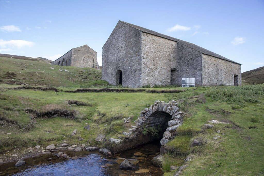
Lead mining operated extensively across this part of the northern Pennines. The veins beneath the moors attracted miners for centuries, but production expanded dramatically during the 18th and 19th centuries. Shafts, levels, smelting sites, tracks and spoil heaps spread across landscapes that today can appear remote and almost untouched.
The contradiction is only apparent. Much of what visitors perceive as wilderness has been repeatedly worked.
Mining communities developed specialised knowledge of geology long before the science was formally understood in modern terms. Miners learned where veins ran, how water moved underground and which rocks indicated promising deposits. Engineering systems drained workings, transported ore and processed material in places where the terrain made every operation difficult.
When the industry declined, machinery disappeared and buildings collapsed. Vegetation returned across disturbed ground, while walls and ruins gradually acquired the same weathered colours as the surrounding stone.
Grinton Moor therefore offers one of the central lessons of Stage 4. Landscapes can forget industries remarkably quickly. Within a few generations, a place filled with labour, smoke and mechanical noise can be reclassified as tranquil countryside even though the physical evidence remains everywhere for anyone who knows how to read it.
The cyclists climbing towards the summit are using the same fundamental advantage that miners once exploited: the road exists because people needed to cross and work these hills long before professional racing arrived.
-7 km · Swaledale and the Walls That Climb the Hills
From the high ground around Grinton, Swaledale opens below.
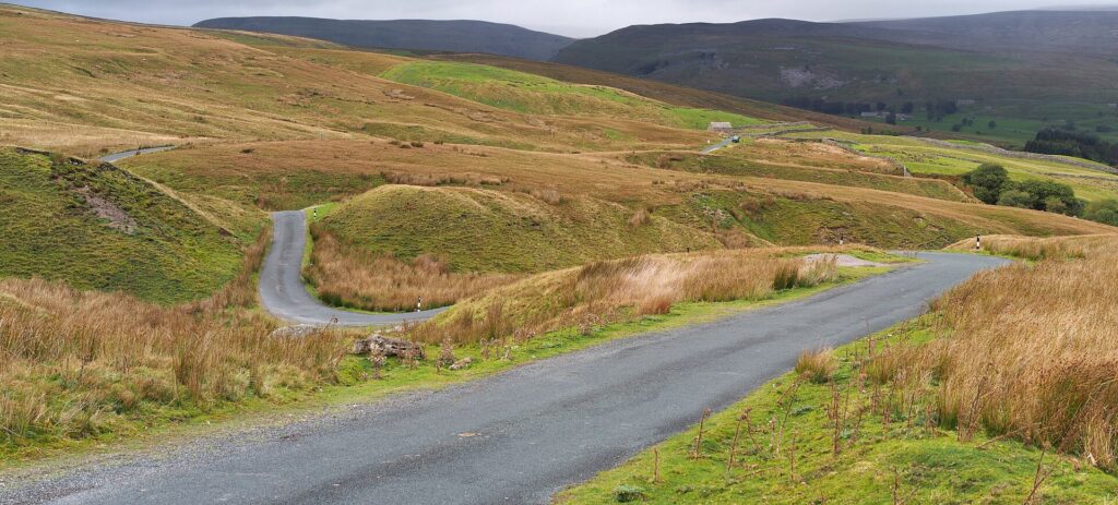
The valley is among the most visually distinctive landscapes in the Yorkshire Dales. Stone barns stand isolated among small green fields, while dry stone walls climb improbably steep slopes and divide the countryside into an intricate pattern.
Those walls represent an enormous investment of human labour.
Many were constructed or reorganised during periods of agricultural enclosure, when previously shared or less formally divided land was separated into individually controlled fields. Builders used stone available locally, selecting and balancing pieces without mortar so that the structure could flex, drain and survive severe weather.
A well-built dry stone wall can remain standing for generations, but only through maintenance. Stones move, livestock cause damage and frost gradually destabilises sections, meaning the apparently ancient pattern across the hills depends upon continuing human attention.
The famous Swaledale sheep, adapted to the exposed uplands, complete the landscape. Their hardiness made them particularly suitable for northern hill farming, where weather, thin soils and steep terrain limit what agriculture can achieve.
This is countryside created through negotiation rather than conquest. Farmers cannot flatten the hills or change the climate, so agriculture has adapted itself to the conditions available. Walls follow contours, barns occupy useful positions and livestock breeds reflect the demands of the environment.
The race now leaves the highest ground behind. Leyburn is close.
FINISH · Leyburn and the Shawl Above Wensleydale
The final kilometres bring the Tour of Britain into Leyburn, a market town standing above Wensleydale near the River Ure.
Like many settlements encountered throughout the stage, Leyburn developed because it served the countryside around it. Markets connected farms and villages, while the arrival of the railway during the 19th century improved access to wider commercial networks. The town became a practical centre for an agricultural region whose communities were distributed across valleys and uplands.
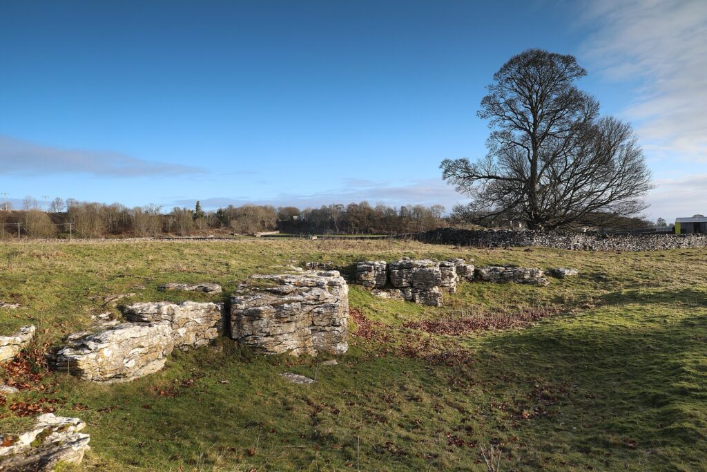
Above Leyburn runs a limestone escarpment known as the Shawl, providing extensive views across Wensleydale towards Penhill and the higher country beyond. Local tradition associates the name with Mary, Queen of Scots, claiming that she dropped or lost a shawl while attempting to escape from nearby Bolton Castle, where she was imprisoned in 1568.
The story is almost certainly folklore rather than secure history, but the real episode behind it is dramatic enough. After being forced to abdicate the Scottish throne, Mary fled into England seeking assistance from her cousin Elizabeth I. Instead, she entered a long period of English captivity. Bolton Castle became one of the first places in which she was held.
Her presence there connects this quiet landscape with one of the great dynastic crises of 16th-century Europe. Mary possessed a claim to the English throne, was a Catholic figurehead in a Protestant kingdom and became the focus of repeated plots against Elizabeth. She remained a prisoner for almost nineteen years before her execution in 1587.
The Shawl legend shows how landscapes absorb historical figures. A queen’s documented imprisonment becomes attached to a path, an object and an escape story until folklore and geography become difficult to separate.
FINISH · Leyburn, After 165 Kilometres of Yorkshire History
When the winner crosses the line in Leyburn, the hardest stage of the 2026 Tour of Britain will have carried the peloton through a landscape whose history repeatedly disappears beneath its beauty.
At Helmsley, a ruined castle recalls the political violence surrounding Magna Carta and the English Civil War, while nearby Rievaulx demonstrates how medieval monasteries reorganised enormous areas of countryside through farming and trade. Around Boroughbridge, prehistoric communities left the Devil’s Arrows without leaving any explanation of why they raised them, and a river crossing later became the geographical trap that ended a medieval rebellion. Beneath Ripon Cathedral, Wilfrid’s seventh-century crypt survived while kingdoms, buildings and forms of worship changed above it.
Once the race entered the Dales, geology increasingly dictated the story. Lead veins transformed Greenhow and Grassington into industrial landscapes before vegetation softened their remains. Carboniferous limestone supplied the stone from which farmers built walls, barns and villages, while glaciers created the valleys through which the modern roads now run. Aysgarth’s geology turned the River Ure into waterfalls admired by Turner, and the agricultural traditions of Wensleydale produced a cheese whose name eventually travelled far beyond Yorkshire.
Cycling belongs to only the most recent layer. Kidstones became internationally recognisable because the Tour de France crossed it in 2014, demonstrating how quickly sport can give an old road a new identity. The road itself existed because communities had already spent centuries solving the problem of moving through these hills.
That is what makes Stage 4 particularly suited to Around the Peloton. The Yorkshire Dales are often presented as an escape from human history, a landscape of empty moors, stone walls, waterfalls and green valleys whose attraction lies in appearing timeless. Look more closely and almost everything tells the opposite story. Monks managed these valleys, miners excavated the hills, farmers built thousands of kilometres of walls, rivers powered economies, roads connected isolated settlements and artists helped teach later generations to regard the resulting landscape as beautiful.
The peloton will cross it in an afternoon, climbing from one dale into another until the road finally releases the riders towards Leyburn. The mountains of Yorkshire may be modest beside the Alps or Pyrenees, but their scale is not what makes this stage remarkable. What matters is the extraordinary amount of human history contained within them, much of it written directly into the stone beneath the riders’ wheels.



