
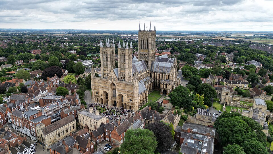

There are few better places in Britain to begin a bicycle race than the square between Lincoln Castle and Lincoln Cathedral. On one side stands a fortress ordered by William the Conqueror after the Norman invasion; on the other rises one of the great Gothic buildings of medieval Europe, a cathedral whose lost spire once carried it higher than any other structure on Earth. Somewhere within this same historical landscape, an original copy of Magna Carta has remained in Lincoln’s possession since 1215. Beneath it all lies something older still: the remains of the Roman city of Lindum Colonia, whose streets and walls established the importance of this hill almost a thousand years before the Normans arrived.
The opening stage of the 2026 Tour of Britain begins among those layers of history before leaving Lincoln for the quieter country to the north-east. Over 182.5 kilometres, the peloton crosses the Lincolnshire Wolds, passing through Market Rasen and a succession of small villages before reaching the Roman hill town of Caistor. From there the race turns west across agricultural Lincolnshire and eventually returns to the cathedral city, where five laps of the famous Lincoln Grand Prix circuit transform the final hour into something quite different. Michaelgate, a short cobbled street rising violently towards the medieval city, must be climbed five times before the finish on Newport.
On paper, this is not a stage of spectacular geography. There are no mountains, no wild coastline and none of the enormous natural landmarks that defined the road to Aitana. Yet that apparent modesty is deceptive. The Wolds are the remains of an ancient seabed, their chalk hills sculpted by ice and water; prehistoric communities buried their dead on their ridges; Romans built roads and fortifications across them; medieval settlements flourished and sometimes disappeared; and generations of farmers transformed the grasslands into one of England’s great agricultural landscapes.
Then the race returns to Lincoln, where almost two thousand years of English history have been compressed onto a single hill.
START · Lincoln Castle and Cathedral, Two Powers Facing Each Other
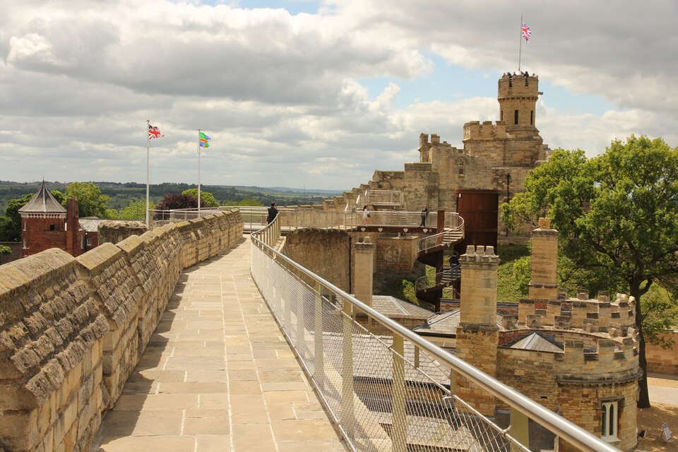
The riders begin in Castle Square, and before the race has travelled a kilometre they are already surrounded by one of the most remarkable historical ensembles in England. Lincoln Castle and Lincoln Cathedral stand almost opposite one another, monuments to two institutions that dominated medieval society: secular authority and the Church. Both owe their monumental form to the Norman conquest.
William the Conqueror defeated Harold Godwinson at Hastings in 1066, but winning a battle did not mean that England immediately accepted Norman rule. Resistance remained particularly serious in the north, and William responded by establishing castles at strategically important locations from which his new aristocracy could control the country. Lincoln was an obvious choice. Its hill dominated the surrounding plain and had already been recognised as strategically important by the Romans centuries earlier.
In 1068, William ordered a castle to be constructed within part of the old Roman city. Houses were displaced and the existing urban landscape was reorganised around a new symbol of conquest. The original defences were largely of timber and earth, but stone gradually replaced them, creating the walled fortress whose unusual layout survives today.
The cathedral followed. The seat of the enormous medieval Diocese of Lincoln was transferred here in the 1070s, and construction began under Bishop Remigius de Fécamp. Fire, earthquake, collapse and rebuilding repeatedly altered the structure over the following centuries, eventually producing the vast Gothic cathedral that dominates Lincoln today.
Its most extraordinary chapter came with the construction of a great central spire. Traditionally estimated to have raised the cathedral to around 160 metres, it made Lincoln Cathedral taller than the Great Pyramid of Giza, which had stood as humanity’s tallest structure for thousands of years. For more than two centuries, Lincoln may therefore have possessed the tallest building on Earth.
The achievement did not last forever. In 1549, a storm brought the great spire down.
Even without it, the cathedral remains enormous, and its position exaggerates its scale. Lincolnshire is largely low country, so the cathedral’s towers can appear from great distances across the surrounding plain. For medieval travellers approaching on foot or horseback, the effect must have been even more powerful. Long before reaching the city gates, they could see the church rising above the horizon.
The Tour of Britain begins directly between that cathedral and the castle built to secure Norman power. It is difficult to imagine a starting line surrounded by a denser concentration of English history.
START · Lincoln’s Magna Carta and a Rebellion Against a King
Another story beginning beside the riders reaches far beyond Lincoln. In 1215, King John faced rebellion from a group of English barons angered by royal taxation, military failures and what they regarded as arbitrary government. Their confrontation produced the agreement made at Runnymede that became known as Magna Carta, the Great Charter.
The original document was not a modern declaration of democracy. Much of it dealt with specific grievances of medieval elites, feudal rights and the relationship between king, barons and Church. Yet buried within those provisions was a principle with consequences far greater than the immediate political crisis: royal power was not entirely above the law.
Copies of the charter were produced and distributed across the kingdom. One came to Lincoln, whose bishop, Hugh of Wells, had been present at Runnymede. The document remained in the custody of Lincoln Cathedral and is one of only four surviving original exemplifications from 1215.
Lincoln’s connection became even more remarkable two years later. Following King John’s death, Magna Carta was reissued, while a related document known as the Charter of the Forest addressed rights involving royal forests and access to resources upon which ordinary people depended. Lincoln possesses an original 1217 Charter of the Forest as well.
Today the two documents are displayed together at Lincoln Castle, making Lincoln the only place where an original 1215 Magna Carta and an original 1217 Charter of the Forest can be seen side by side.
The bicycle race will leave Castle Square almost immediately. The piece of parchment preserved only metres away has spent more than eight centuries travelling through a very different kind of history, influencing later arguments about government, law, liberty and the limits of political authority far beyond England.
-160 km · Market Rasen and the Market Towns of Rural England
Once Lincoln disappears behind the race, the landscape changes quickly. The cathedral city gives way to fields, hedges and small settlements before the riders reach Market Rasen, a town whose name tells much of its original purpose.
Market towns were essential pieces of the medieval and early modern English countryside. Rural populations were dispersed across farms and villages, but goods, animals, information and people needed places in which to meet. A market charter could transform a settlement into the economic centre of its surrounding district, and over generations the rhythm of weekly markets and seasonal fairs shaped towns throughout England.
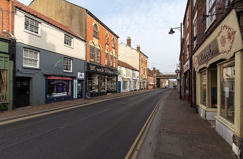
Market Rasen developed within that world. Agricultural trade remained fundamental to its prosperity, while coaching traffic and later the railway connected the town more closely with Lincoln, Grimsby and the wider region. Much of its surviving character belongs to the 18th and 19th centuries, when shops, inns, civic buildings and houses reflected the prosperity generated by the countryside surrounding it.
The name also distinguishes it from nearby Middle Rasen and West Rasen, reminders of a landscape in which settlements could grow only a short distance apart yet acquire different functions and identities.
Today Market Rasen is best known nationally for another form of rural gathering: horse racing. Its racecourse maintains a sporting tradition that feels entirely at home in a county where horses, livestock and agricultural fairs were once central to economic life.
The peloton passes through quickly, but Market Rasen introduces the world that will dominate much of the next hundred kilometres. This is not empty countryside between important places. It is a landscape historically organised around farms, villages and small market centres whose relationships made rural society function.
-150 to -115 km · Lincolnshire Wolds, an Ancient Sea Beneath the Peloton
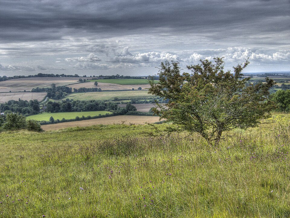
Beyond Market Rasen, the road begins to rise into the Lincolnshire Wolds, and one of the most understated landscapes in English cycling starts to reveal itself. From a distance the hills appear gentle, particularly compared with the mountains professional riders encounter elsewhere in Europe. Their geological history, however, reaches back tens of millions of years to a world in which none of this land existed.
During the Cretaceous period, much of what is now eastern England lay beneath warm seas. Countless microscopic marine organisms lived and died in those waters, their calcium-rich remains gradually accumulating on the seabed. Over immense periods of time those sediments compressed into chalk.
The sea eventually disappeared, the land rose, and later ice ages reshaped the exposed rock. Glaciers and meltwater carved valleys through the chalk plateau, leaving the rolling uplands, steep-sided dry valleys and western escarpment that characterise the Wolds today. The apparently soft countryside surrounding the riders is therefore the product of marine life, geological uplift, ice and erosion operating across almost unimaginable spans of time.
Chalk also changes the living landscape above it. Thin, lime-rich soils support distinctive grassland communities, and surviving chalk grasslands and abandoned quarries can contain an exceptional variety of wildflowers and insects. Where intensive agriculture has not replaced them, these fragments preserve habitats once far more widespread across the Wolds.
The race enters this country around North Willingham before climbing Willingham Hill towards Ludford. From there it passes through Binbrook, Swinhope, Thorganby, Thoresway and Rothwell, repeatedly dropping into valleys before climbing onto another section of upland.
Nothing here resembles a conventional mountain stage, yet the road is rarely truly settled. That rolling rhythm comes directly from the geology beneath it.
-145 to -115 km · Barrows, Lost Villages and the Human Landscape of the Wolds
Humans have been modifying these hills for thousands of years, long before Roman armies reached Britain, prehistoric communities were already using the higher ground of the Wolds for settlement, movement and burial. Long barrows and round barrows remain among the most important archaeological features of the landscape, monuments raised for the dead by societies that left no written accounts of themselves.
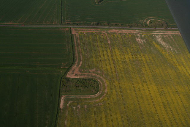
Their position matters. Burial monuments placed on ridges could be visible across considerable distances, transforming natural high points into places of ancestry and memory. A traveller moving through the prehistoric Wolds would therefore have encountered a landscape that was already culturally organised, with paths, territories and monuments linking communities to generations that had come before them.
Later societies added their own layers. Roman roads crossed the region, Anglo-Saxon cemeteries appeared, Scandinavian settlement left its mark in place-names, and by the medieval period the Wolds contained a dense network of manors, farms and villages.
Not all of those villages survived. Across the Lincolnshire Wolds are traces of deserted and shrunken medieval settlements, sometimes visible today only as earthworks, hollow ways and irregular patterns in fields. Their disappearance rarely had a single cause. Economic change, disease, changing agricultural practices and the conversion of arable land to pasture could all reduce communities until buildings vanished and fields absorbed the places where houses had once stood.
This is one of the peculiar pleasures of looking carefully at an English rural landscape. A field may appear almost empty while preserving the shape of a vanished settlement beneath its grass.
The peloton crosses the Wolds in little more than an hour. Human beings have been repeatedly writing and erasing communities here for several thousand years.
-120 km · Caistor, the Roman Fort Hidden Inside an English Market Town
At the northern extreme of the stage stands Caistor, a small town climbing a hillside on the edge of the Wolds. Its name immediately reveals something about its past.
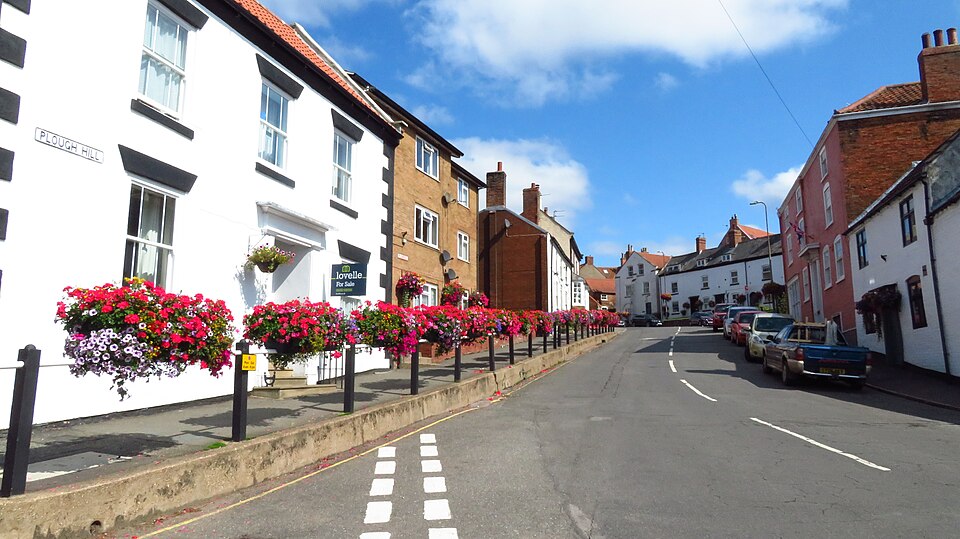
English place-names containing caster, chester or cester frequently preserve the Latin word castra, associated with a military camp or fortification. Caistor belongs to that family. Long before its Georgian houses and market square appeared, this hill was occupied by the Romans.
The location was strategically attractive. From the higher ground, movement across the surrounding country could be observed, while springs provided reliable water. A substantial Roman walled enclosure developed here, and fragments of those defences still survive around the town. Even parts of Caistor’s later street pattern appear to reflect the shape imposed by the ancient fortified settlement.
The Roman story did not simply vanish when imperial administration collapsed in Britain during the early fifth century. The site continued to matter. Caistor later became an important Anglo-Saxon centre and possessed a royal mint around the end of the first millennium, while medieval markets confirmed its role as a local trading centre.
Then, in 1681, disaster transformed the town again, a major fire destroyed much of Caistor and left dozens of families homeless. The rebuilding that followed gradually produced much of the brick-built Georgian and later streetscape visible today. The market area became surrounded by buildings associated with the agricultural prosperity of the 18th and 19th centuries, when Caistor developed into an important centre for livestock trading.
The scale of that trade could be remarkable. In 1858, Caistor’s sheep fair was described as the largest in England, with tens of thousands of animals changing hands. It is difficult now to imagine the quiet market town overwhelmed by sheep, dealers, farmers, horses, carts and the noise of one of the great livestock gatherings of Victorian rural England.
Yet beneath that Georgian market town remain Roman walls, and beneath the Roman story lie earlier springs and prehistoric occupation. Caistor is another example of something this stage repeatedly reveals: in Lincolnshire, modest places can contain surprisingly deep histories.
-105 to -70 km · The Agricultural Plain and the Landscape Made by Farming
After Caistor, the riders turn west through North Kelsey Moor, Moortown, South Kelsey and Waddingham. The Wolds begin to recede behind them and the landscape opens into the broad agricultural country for which Lincolnshire is famous.
It can be tempting to describe such country as natural simply because it is green. Almost nothing about its modern appearance, however, is accidental.
For centuries, farming has reorganised Lincolnshire on an enormous scale. Fields have been enclosed and combined, wetlands drained, hedges planted and removed, crops changed, livestock economies expanded and contracted, and settlements adapted to successive agricultural revolutions. The countryside visible from the race is therefore not untouched nature but a working landscape produced through generations of decisions about land.
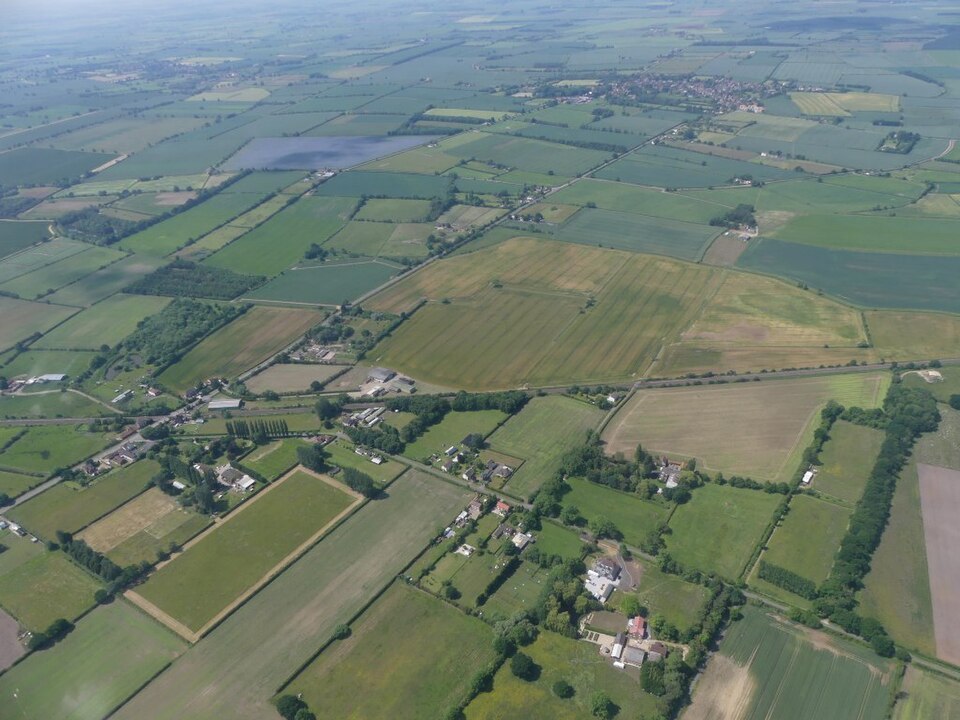
The Wolds themselves illustrate the transformation particularly well. Sheep farming once dominated large areas, with chalk grassland supporting flocks that contributed to the wealth of regional markets. From the 18th and especially 19th centuries, agricultural improvement increasingly converted land towards more intensive cultivation. Today broad arable fields of wheat, barley, oilseed and other crops have become characteristic of Lincolnshire.
That productivity came with ecological consequences. Ancient grasslands contracted dramatically, hedgerows were lost in some areas and habitats became fragmented. The surviving chalk grasslands, woodland, roadside verges and old quarries consequently matter far beyond their size, providing refuges for plants and insects that once occupied a much larger portion of the countryside.
Professional cycling is particularly good at revealing landscapes like this because the camera moves slowly enough to show their structure. Fields are not simply a green background. Their size, boundaries, crops, roads and villages contain the history of how people have organised the land.
-75 km · Stow and One of England’s Great Village Churches
As the race turns south towards Lincoln, it passes Stow, a village whose population gives little indication of the scale of the church standing within it.
The Minster Church of St Mary at Stow is one of the most important early medieval churches in Lincolnshire. Its enormous crossing arches and surviving Anglo-Saxon and Norman fabric suggest a place of considerably greater ecclesiastical importance than the modern village surrounding it might imply.
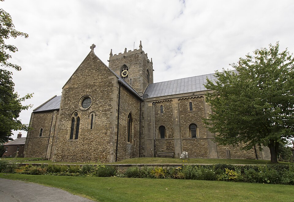
Tradition has associated a church at Stow with very early Christianity in Lindsey, while the surviving building reflects major reconstruction during the 11th century, around the turbulent decades in which England passed from Anglo-Saxon to Norman rule. Architectural details consequently preserve a period when the political world was changing dramatically but builders continued to work with traditions inherited from both sides of the conquest.
Stow demonstrates a recurring feature of the English countryside: historical importance does not always correspond to modern population. Roads shifted, economic centres moved and settlements grew or declined, but enormous medieval churches remained where they had been built.
The peloton will see the tower for only a moment. It has been standing above this landscape for roughly a thousand years.
-63 km · Lincoln Returns, and the Race Changes Character
After almost 120 kilometres in the countryside, Lincoln Cathedral reappears on the horizon.
For much of the day it has been absent behind the riders, but the city’s position on the Lincoln Edge allows its towers to announce the return long before the peloton reaches the centre. What follows is effectively a second race.
The riders enter Lincoln and begin five circuits derived from the course of the Lincoln Grand Prix, one of the most established events in British road racing. The broad roads and rolling countryside disappear. Instead, positioning becomes critical as the peloton repeatedly descends through the city before being funnelled towards the narrow streets beneath the cathedral quarter.
At the centre of each lap waits Michaelgate. It is only a few hundred metres long. In another context it might simply be an inconvenient old street connecting lower Lincoln with the historic city above. In bicycle racing, it has become something else entirely.
-60 to -5 km · Michaelgate, Five Journeys Up the Same Medieval Hill
To understand Michaelgate, it helps first to understand Lincoln itself, the city is divided by geology. Lower Lincoln developed around the River Witham and Brayford Pool, while the cathedral and castle occupy the high ground above. Between them rises a steep limestone escarpment known locally simply as the Hill. Anyone walking from the modern city centre towards the cathedral encounters it immediately through street names such as Steep Hill, and for centuries this slope has dictated how Lincoln functions.
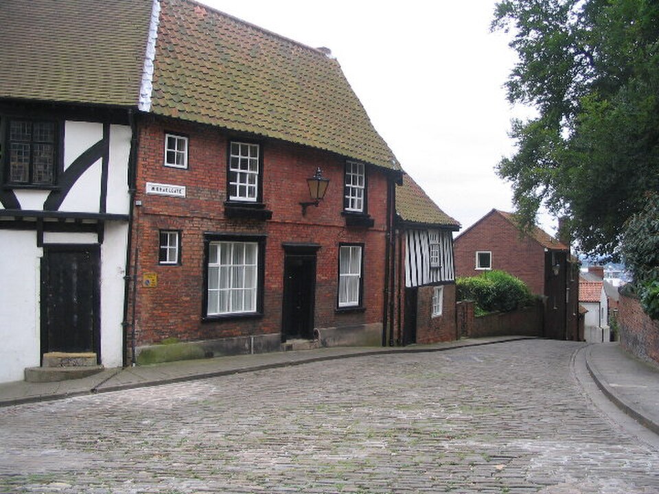
Michaelgate climbs the same escarpment by a less famous but no less severe route. Its old surface, narrow dimensions and sudden gradient make it a natural obstacle for a bicycle race. The 2026 Tour of Britain sends the peloton over it five times.
On the first passage, the climb may still feel manageable. By the third, riders will have learned exactly where the surface bites and where the gradient changes. By the fifth, familiarity offers little comfort because fatigue has transformed the same stones into a different climb.
This is what repeated circuits do particularly well. The physical landscape does not change, but the riders do.
Michaelgate also places professional cycling inside the historical structure of the city rather than merely beside it. The riders are not climbing towards a modern summit finish constructed for sport. They are following streets whose steepness exists because medieval Lincoln grew across a dramatic natural escarpment. The difficulty of the race is therefore inherited from the geography that shaped the city itself.
Above them wait the cathedral and castle, appearing and disappearing between buildings as the peloton fights its way uphill.
FINAL CIRCUITS · Lindum Colonia, the Roman City Beneath Lincoln
Every lap through Lincoln also crosses the remains of a much older city. The Roman army established a legionary fortress here in the first century AD, probably during the campaigns that followed the invasion of Britain begun under Emperor Claudius in AD 43. The site commanded the meeting point between the limestone ridge and the River Witham, giving the Romans both a defensible position and access to important routes.
When the legion moved elsewhere, the fortress did not simply disappear. A civilian settlement developed and eventually became Lindum Colonia, a colony associated with retired soldiers and one of the more important Roman towns of eastern Britain.
Its influence survives in Lincoln’s very name. The earlier Celtic name associated with the pool or lake around the Witham became Lindum under the Romans, while colonia marked the settlement’s status. Through centuries of linguistic change, Lindum Colonia eventually became Lincoln.
Physical remains are still incorporated into the modern city. The most spectacular is Newport Arch, the surviving northern gateway of the Roman upper city. Remarkably, traffic continued to pass beneath part of the Roman structure into the modern era, making it one of Britain’s most tangible examples of ancient infrastructure remaining embedded within an inhabited city.
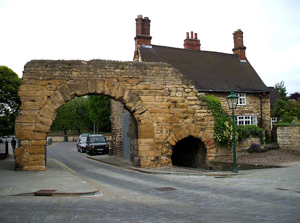
Elsewhere, fragments of Roman walls survive beneath or beside later buildings. The Norman castle itself reused the strategic logic of the Roman hilltop, while the medieval street plan grew across terrain already shaped by centuries of occupation.
The Tour of Britain finishing circuit is therefore not merely looping around historic Lincoln. It is moving repeatedly through a city whose present form cannot be understood without the Roman settlement underneath it.
FINAL CIRCUITS · Lincoln Castle and Nicola de la Haye, the Woman Who Defended It
As the race circles the castle, another figure deserves to emerge from its walls. Nicola de la Haye inherited the position of constable of Lincoln Castle in a medieval world in which such military authority was overwhelmingly associated with men. She nevertheless became one of the castle’s most formidable defenders.
Her greatest test came during the political chaos surrounding King John. After the king’s refusal to abide by Magna Carta helped plunge England into civil war, rebellious barons invited Prince Louis of France to take the English crown. Much of the country fell under rebel or French influence, but Lincoln Castle remained loyal to John and, after his death in 1216, to the young Henry III.
In 1217, forces supporting Louis besieged Lincoln. Nicola, by then an elderly woman by medieval standards, held the castle while a royalist relief army approached under William Marshal, one of the most celebrated knights of the age.
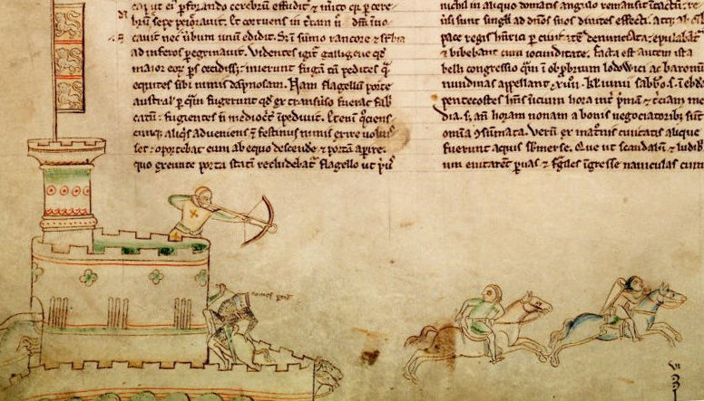
The resulting Battle of Lincoln became one of the decisive engagements of the war. Royalist forces broke into the city, defeated the rebel army and relieved the castle. Louis’s attempt to take the English throne subsequently collapsed, and the settlement that followed helped secure Henry III’s monarchy.
The same castle had already witnessed another extraordinary royal reversal in 1141, when King Stephen was captured during an earlier Battle of Lincoln amid the civil war known as the Anarchy.
Few buildings beside a professional cycling circuit have experienced quite so many changes of fortune. Kings have fought for it, prisoners have been confined within it, executions have taken place upon its walls, courts have operated there for centuries, and Magna Carta is now preserved inside. On 2 September, its grounds become the Tour of Britain race village.
FINAL CIRCUITS · Lincoln Cathedral and the Imp
Across Castle Square from the fortress stands the cathedral, and hidden high within its stonework is a much smaller figure that has become one of Lincoln’s most recognisable symbols.
The Lincoln Imp is a small carved creature perched inside the cathedral’s Angel Choir. Its exact origins are less romantic than the legends subsequently created around it, but folklore transformed the sculpture into the survivor of a supernatural disturbance.
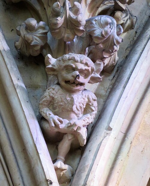
In the best-known version, two mischievous imps were sent by the Devil to cause trouble in northern England. After creating havoc elsewhere, they entered Lincoln Cathedral, where they smashed furniture, tripped a priest and challenged an angel. One escaped, while the other was turned to stone and condemned to remain inside the cathedral.
The little carving became so closely associated with Lincoln that the imp escaped the cathedral in another sense entirely. Its image appeared on jewellery, souvenirs, civic emblems and sporting identities, eventually becoming a symbol of the city itself.
There is something fitting about such a tiny creature occupying a building of almost overwhelming scale. Lincoln Cathedral contains soaring vaults, elaborate Gothic stonework and the accumulated craftsmanship of centuries, yet visitors often remember the small imp hiding among it all.
Around the Peloton is built on much the same principle. Sometimes the smallest story beside the road is the one worth noticing.
FINISH · Newport, Beneath a City Built Layer Upon Layer
The final climb of Michaelgate ends the repetition. From the medieval streets around the cathedral, the riders race towards Newport, where the first leader of the 2026 Tour of Britain will be decided.
By then they will have crossed a landscape whose apparent quietness concealed an extraordinary depth of time. The chalk beneath the Lincolnshire Wolds began as sediment in a prehistoric sea. Ice and meltwater shaped it into hills and valleys. Prehistoric communities raised burial monuments on the high ground, Romans built roads and forts across it, Anglo-Saxons and Scandinavians left settlements and names, medieval farmers created villages that sometimes disappeared again, and generations of agricultural workers transformed the countryside into the broad cultivated landscape visible today.
Caistor compressed much of that story into a single small town, where Roman walls survive beneath a market centre later rebuilt after fire and enriched by the livestock economy of Victorian England. Stow preserved another fragment of the past in a church whose scale recalls an importance its modern village no longer possesses.
Then the race returned to Lincoln and the chronology became almost overwhelming. Roman Lindum survives beneath the streets. William the Conqueror’s castle occupies the hill chosen by the Roman army before him. Nicola de la Haye defended that fortress during the war that followed Magna Carta. One of the original copies of the charter remains here. Across the square, a Norman cathedral became a Gothic giant whose vanished spire once rose higher than any other building on Earth, while somewhere inside a tiny stone imp acquired a fame entirely disproportionate to its size.
The riders will experience this history differently. They will remember corners, positioning, cobbles and five increasingly painful ascents of Michaelgate. The cathedral towers may become reference points telling them how close they are to another climb, while Castle Square will be measured less in centuries than in seconds.
That is the peculiar beauty of this opening stage. For most of the day, the Tour of Britain crosses a landscape where history must be searched for in hills, fields, village churches and fragments of old walls. In Lincoln, there is no need to search at all, the peloton is racing directly through it.



