


Some races belong to cities. Milan-Sanremo begins in one and ends in another, Paris-Roubaix carries the names of two, and Liège-Bastogne-Liège describes its journey before the riders have even started. The Bretagne Classic belongs instead to a small Breton town whose relationship with cycling has become almost disproportionate to its size. Plouay has only a few thousand inhabitants, yet for generations professional riders have returned here at the end of August, until the names of its lanes and hills have acquired a familiarity in cycling far beyond anything their geography alone would suggest.
The 2026 race leaves Plouay for 228.3 kilometres through the interior of Brittany, accumulating roughly 3,663 metres of climbing without encountering anything resembling an Alpine pass. That is the particular cruelty of these roads: the landscape rarely rises very high, but it rarely remains flat either. The peloton travels through the wooded country of the Argoat, across valleys shaped by the Scorff and Blavet, through villages of granite and slate, before returning to Plouay for three circuits in which the same short hills arrive again and again with increasingly tired legs.
Around that race lies a Brittany whose history is often written on a smaller scale than the cathedrals and imperial monuments found elsewhere in France. Here it survives in painted village churches, farmhouses built from local stone, ruined abbeys, canals, lock houses, forests, drowned valleys and roads that seem to have grown organically out of the land rather than being imposed upon it. It is exactly the kind of landscape that rewards looking away from the race for a moment.
START · Plouay, the Breton Village That Became a Capital of Cycling
Plouay’s importance in cycling cannot be explained by population, economic power or geography. Its rise came instead from a particularly Breton combination of local enthusiasm, volunteer organisation and stubborn ambition. Cycling races were already part of local festivities in the early 20th century, and in 1931 the event became an international Grand Prix under Dr. René Berthy, a physician associated with the Tour de France who used his connections to attract professional riders to a village that had no obvious reason to belong on the international cycling calendar.
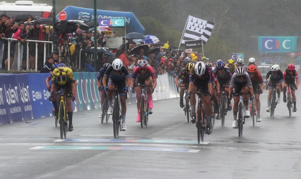
Over the decades the race survived war, changing sponsors and shifting professional structures until Plouay became one of the permanent addresses of French cycling. There were difficult years, including a low point in 1975 when only seventeen riders started, yet the event rebuilt itself and by the 1990s enormous crowds were gathering around its circuit. A village of only a few thousand people could suddenly receive tens of thousands of spectators because one weekend of the year had become part sporting event, part local ritual.
That success encouraged an even more improbable ambition: Plouay wanted the World Championships. In October 2000, the centenary year of the UCI, it got them. The world’s best road cyclists came to Morbihan, and hundreds of thousands of spectators descended upon the area during the championships. Latvia’s Romans Vainsteins won the elite men’s road race, while Belarusian Zinaida Stahurskaia took the women’s title. A new finishing avenue constructed for the event received the wonderfully literal name Boulevard des Championnats du Monde, while the local organiser Jean-Yves Perron, who had driven the campaign before dying only months before the event, would later give his name to the circuit itself.
That boulevard is where the Bretagne Classic begins and where it will end several hours later. In most races the start town simply provides a setting for the competition; in Plouay, cycling itself has become part of the town’s heritage.
-219 km · Notre-Dame de Kernascléden and the Medieval Dance of Death
Only around nine kilometres have passed when the peloton reaches Kernascléden, a tiny village whose church contains one of the most extraordinary works encountered anywhere on this route. Construction of Notre-Dame began in the early 15th century with the support of the powerful Rohan family and the Duke of Brittany, and by the middle of that century its interior had been covered with an ambitious painted cycle depicting the life of the Virgin, the Passion of Christ, heaven, hell and, most memorably, a Danse Macabre.
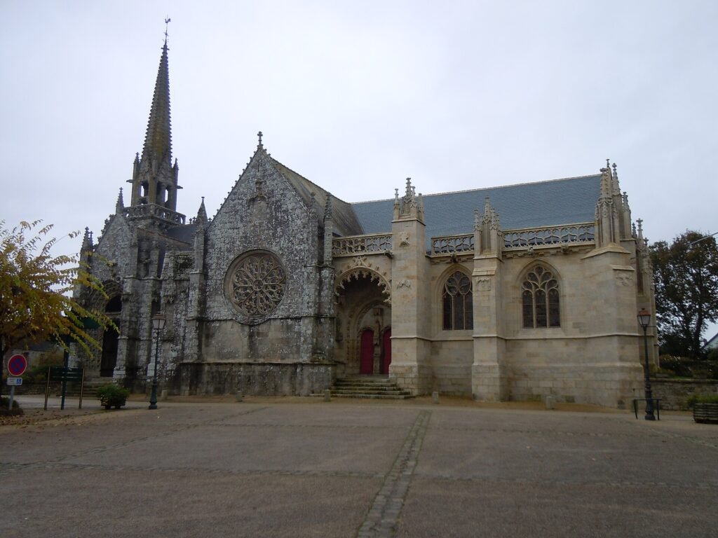
The Dance of Death was one of medieval Europe’s most unsettling artistic ideas. Skeletons take the hands of the living and lead them onwards without respecting rank, profession or wealth, reducing pope, emperor, knight, merchant and peasant to the same unavoidable destination. The theme became particularly powerful in a Europe repeatedly confronted by plague, famine and war, and its message was difficult to misunderstand: status might organise the living world, but death ignored it completely.
Kernascléden’s surviving painting dates from around the middle of the 15th century and is one of the very few medieval dances of death still preserved in Brittany. Its figures have watched generations come and go while the village around them changed almost beyond recognition.
There is, however, another story living directly above the paintings. The church attic has become an important summer roost for greater horseshoe bats, with hundreds of animals using the building before leaving at dusk to hunt across the surrounding countryside. Nearby waterways also support other species, including Daubenton’s bats that skim low over the surface in search of insects.
The accidental symbolism is almost too perfect. Beneath the roof, painted skeletons lead the living into death; above them, nocturnal animals spend each day sleeping in darkness before pouring out into the Breton evening. The peloton will pass through Kernascléden in minutes, but inside the church two very different histories of life and mortality continue to occupy the same building.
-212 km · Ploërdut and the Granite Country of Central Brittany
A few kilometres later the race enters Ploërdut, where the material from which much of rural Brittany seems to have been built becomes a story in its own right. Granite lies everywhere in this country, emerging from fields as natural outcrops before reappearing in walls, wells, crosses, chapels and houses. Near Ploërdut, stone was already being quarried during the Gallo-Roman period, and over centuries it became not merely a building material but one of the visual languages through which the Breton interior expressed itself.
Granite shaped architecture because it demanded patience and rewarded permanence. Farmhouses built from heavy blocks could survive generations of agricultural change, chapels standing among fields could outlast the communities that first paid for them, and roadside crosses could remain fixed in the landscape long after the circumstances that created them had been forgotten. The Romanesque church of Saint-Pierre and the traditional buildings scattered through the surrounding countryside belong to this continuity, in which geology became architecture and architecture became memory.
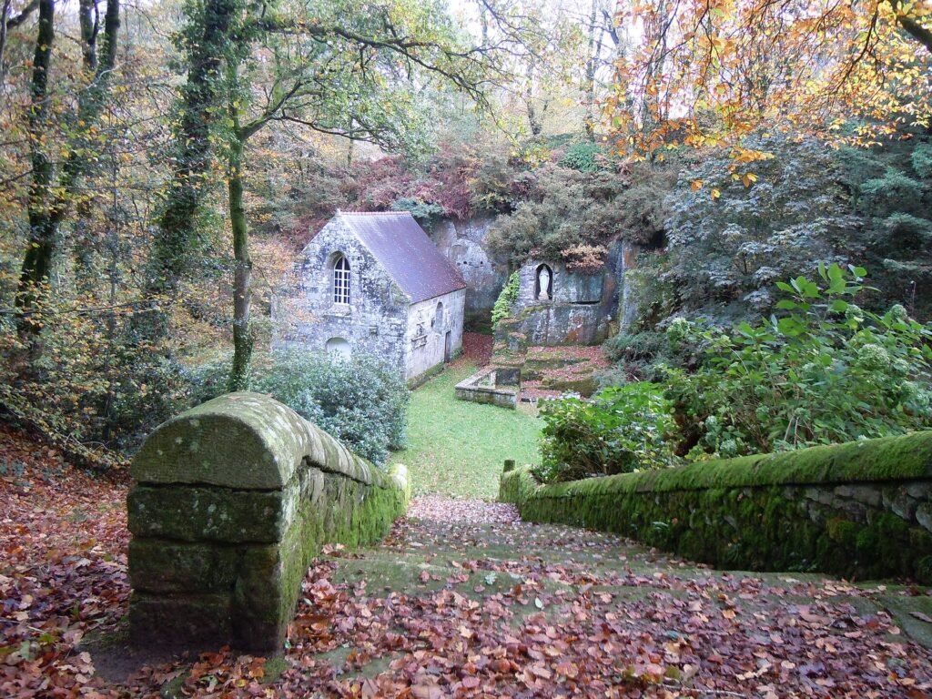
The land itself reinforces the effect. Central Brittany is rarely monumental in the conventional sense; its character comes instead from accumulated details, from stone walls enclosing fields, slate roofs darkened by rain, hedges narrowing the roads and isolated religious buildings appearing unexpectedly between farms. The race passes through a landscape whose beauty is not concentrated in one object but dispersed across hundreds of small structures created from the same material beneath the riders’ wheels.
It also helps explain the nature of Breton racing. These roads were not laid out to create smooth modern lines across the countryside. They bend around old field boundaries, rise over ridges, fall sharply into valleys and squeeze between hedges, producing a rhythm of constant interruption that can become exhausting without ever announcing itself as a major climb.
-184 km · Bon-Repos Abbey and the Rohans
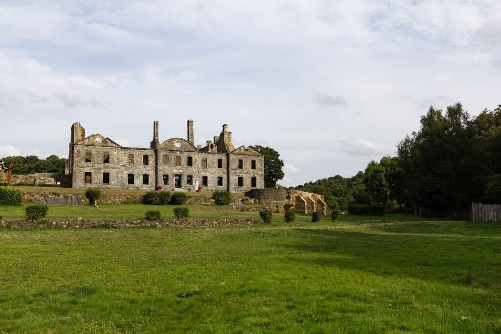
Around forty-five kilometres into the race, the peloton reaches Bon-Repos-sur-Blavet, where a severe stone façade appears beside the water and forest. The Abbaye de Bon-Repos was founded in 1184 by Alain III, Viscount of Rohan, and his wife Constance, establishing a Cistercian community at the confluence of the Blavet and Daoulas.
According to tradition, Alain had fallen asleep here after an exhausting hunt and dreamed that the Virgin instructed him to build the place in which he would eventually rest, giving the monastery its name, Notre-Dame de Bon-Repos. Whatever the truth of the story, the site was exceptionally well chosen. Water, woodland and agricultural land surrounded the abbey, giving the monks access to precisely the resources upon which Cistercian communities built their remarkable economic power.
The Cistercians were never simply men who withdrew from society to pray. Their monasteries became highly organised systems of production, exploiting rivers, forests, pasture and farmland with a discipline that was both spiritual and practical. At Bon-Repos, twelve monks and an abbot initially took possession of the site, while the wealth of the abbey strengthened its relationship with the Rohan dynasty, one of the great noble families of Brittany.
The monastery endured centuries of political and economic change before the French Revolution broke the continuity of religious life there. Buildings were abandoned, altered and allowed to decline, leaving a ruin that would only begin to be seriously restored in the late 20th century. What survives today is therefore not a perfectly preserved medieval monastery but something more evocative: the visible remains of an institution that once organised an entire landscape around prayer, labour and control of natural resources.
-178 km · Lac de Guerlédan and the Valley Beneath the Water
The Côte de Bon Repos carries the riders into the country surrounding the Lac de Guerlédan, a body of water that appears so naturally enclosed by forested hills that it is easy to imagine it has always occupied the valley. In reality, Guerlédan is entirely artificial, created in the early 20th century by the construction of a hydroelectric dam across the Blavet.
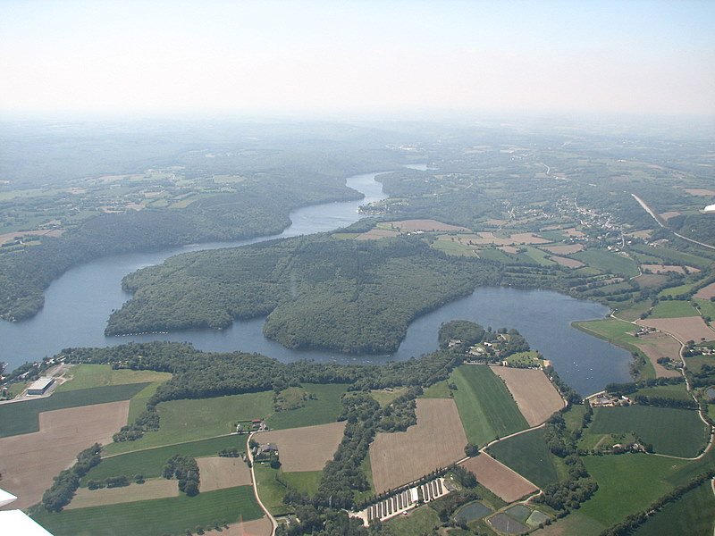
Before the water rose, the valley formed part of the Nantes-Brest Canal, one of the most ambitious engineering projects undertaken in Brittany. The idea of linking the Breton interior by navigable waterways had existed for generations, but the strategic importance of such a system increased dramatically during the Napoleonic wars, when British naval power made coastal communication vulnerable. An inland waterway could move goods, supplies and military resources without depending entirely on the sea, and over time the project developed into hundreds of kilometres of canals, canalised rivers and locks.
A century later, Brittany faced a different problem. Electricity had become the new symbol of modernisation, yet large parts of the region remained poorly supplied. The Guerlédan dam offered a solution, but progress came at a price. As the reservoir filled, seventeen locks, lock houses, quarries and sections of the old canal disappeared beneath the water, transforming working infrastructure into a drowned landscape.
During rare complete drainings of the reservoir, particularly the dramatic emptying of 2015, that lost world emerged again. Old lock chambers appeared from beneath decades of water, sections of towpath returned to daylight and visitors could walk through a valley that usually exists only beneath the surface of the lake.
Guerlédan is therefore much more than a picturesque reservoir beside a bicycle race. It is a landscape in which different eras of technological ambition literally lie on top of one another. Nineteenth-century engineers reshaped rivers to create transport; 20th-century engineers submerged part of that achievement to create power. The still surface visible from the road conceals the remains of an older idea of modernity.
-153 km · Pontivy, the Town Napoleon Renamed After Himself
At roughly seventy-five kilometres raced, the Bretagne Classic reaches Pontivy, a town whose centre appears almost divided between two competing visions of political power. On one side are narrow streets, timber-framed houses and the imposing Château des Rohan, constructed from the late 15th century when Pontivy served as one of the principal centres of the family’s influence. With its round towers, defensive walls and moat, the castle belongs unmistakably to the political world of late medieval Brittany.
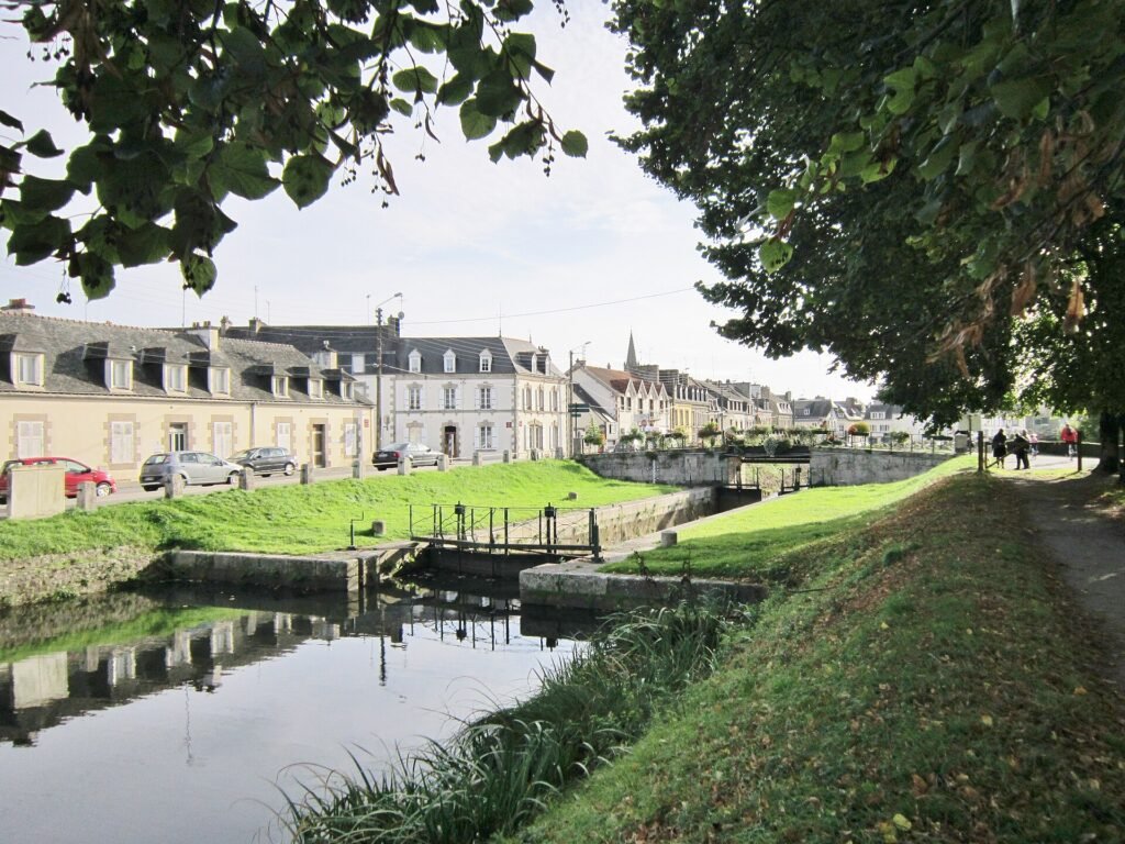
Walk only a short distance, however, and the urban language changes. Streets become wider and straighter, façades more disciplined and public buildings more formal. This second Pontivy was the product of Napoleon Bonaparte, who selected the town in 1802 for an ambitious programme of military, administrative and urban development.
The choice was strategic. Western France had recently experienced years of royalist rebellion and civil conflict, and Napoleon wanted a stronger state presence in the Breton interior. Pontivy was to become a centre from which authority could be projected through barracks, institutions, roads and waterways. The old medieval town would remain, but beside it grew a new quarter designed according to the rational order favoured by the imperial state.
Napoleon’s confidence in the project can be measured by what happened next: Pontivy became Napoléonville. Few acts of power are more explicit than renaming a town after oneself. For a time, the emperor did not merely reorganise this corner of Brittany but attempted to place his own identity upon it.
The old name eventually returned, but the urban contrast survived. Pontivy still contains the fortified authority of a Breton noble dynasty and the disciplined geometry of Napoleonic France within the same town. One represents a world of inherited lordship, the other a centralised state seeking to reorganise territory through administration, military power and infrastructure.
-138 to -107 km · The Blavet Valley and Saint-Nicolas-des-Eaux
South of Pontivy, the race enters the Blavet Valley, where the river narrows, bends and disappears repeatedly between wooded slopes. Unlike the more open agricultural country crossed earlier, this part of the route feels enclosed, with the river acting as the organising feature around which roads, villages and older industries developed.
At Saint-Nicolas-des-Eaux, the relationship between people and river remains particularly visible. The village sits beside a lock and chapel in a section where the Blavet was transformed into a navigable corridor, allowing boats to move through a landscape that would otherwise have been difficult to cross efficiently. Lock houses still mark the waterway, reminders of a period when entire families lived beside the river and organised their lives around the arrival of boats, the movement of gates and the changing level of water.
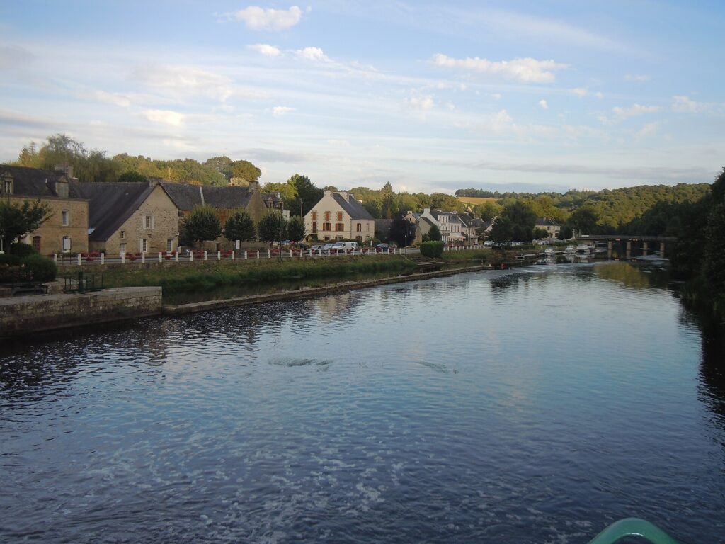
The modern quiet of the valley can obscure how active this corridor once was. Barges carried timber, agricultural produce and other goods, while towpaths were working spaces rather than recreational trails. Before railways and modern roads diminished their importance, canals and canalised rivers offered some of the most dependable ways to move heavy cargo across the Breton interior.
Yet the Blavet’s character is not entirely engineered. Beyond the locks and towpaths, steep wooded slopes descend towards the water, creating habitats for kingfishers, otters and a range of river species, while rocky outcrops and forest give some stretches an unexpectedly wild appearance. The result is a landscape in which infrastructure has never completely erased nature, but has instead been absorbed into it over time.
The peloton follows this valley at speed, but the shape of the road still reflects the same constraint that governed everyone who came before: in central Brittany, water often offered the easiest route through country that resisted straight lines.
-107 km · Quistinic and the Preserved Breton Village of Poul-Fétan
Around 121 kilometres into the race, the peloton passes Quistinic, whose surrounding countryside contains one of the most evocative reconstructions of ordinary rural life in Brittany. At Poul-Fétan, a small settlement of stone-and-thatch houses has been restored to evoke a Breton farming village of the 19th century.
Its importance comes precisely from the absence of kings, generals and monumental architecture. Poul-Fétan preserves the kind of world inhabited by people who rarely appear by name in conventional histories but whose labour shaped almost every kilometre of countryside the race crosses. Thick stone walls protected families against rain and winter cold, thatched roofs used materials available from the fields, while the household economy depended upon constant physical work in which farming, food preparation, craft and domestic survival were inseparable.
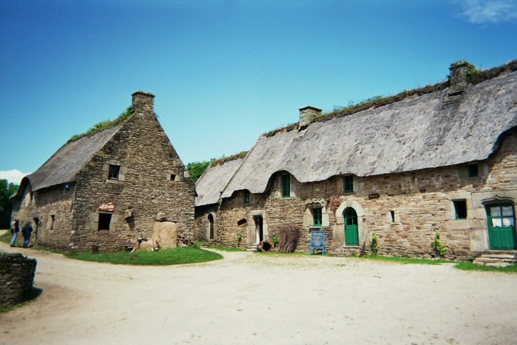
Butter had to be churned, bread baked, rope twisted, animals tended, clothes repaired and fields worked by hand. Nothing about this life was picturesque to the people living it; the beauty we now perceive in stone cottages and thatched roofs emerged from necessity, scarcity and adaptation to a demanding environment.
Poul-Fétan therefore serves as a useful correction to the histories encountered earlier in the race. Bon-Repos tells us how monks and nobles shaped the land; Pontivy records the ambitions of the Rohans and Napoleon. Here the scale returns to the farmers, craftsmen and families who transformed rough ground into fields, maintained hedges, repaired walls and passed practical knowledge from one generation to another.
The Breton landscape visible from the race is not an untouched inheritance. Much of what appears timeless is the accumulated result of ordinary people repeatedly working the same land.
-84 km · Plouay and the Roads That Became Cycling History
When the race returns to Plouay with roughly eighty-four kilometres remaining, the character of the stories around the peloton begins to change. Until now, the route has crossed places whose importance was established long before professional cycling existed. From this point onward, the roads themselves increasingly carry meanings created by the sport.
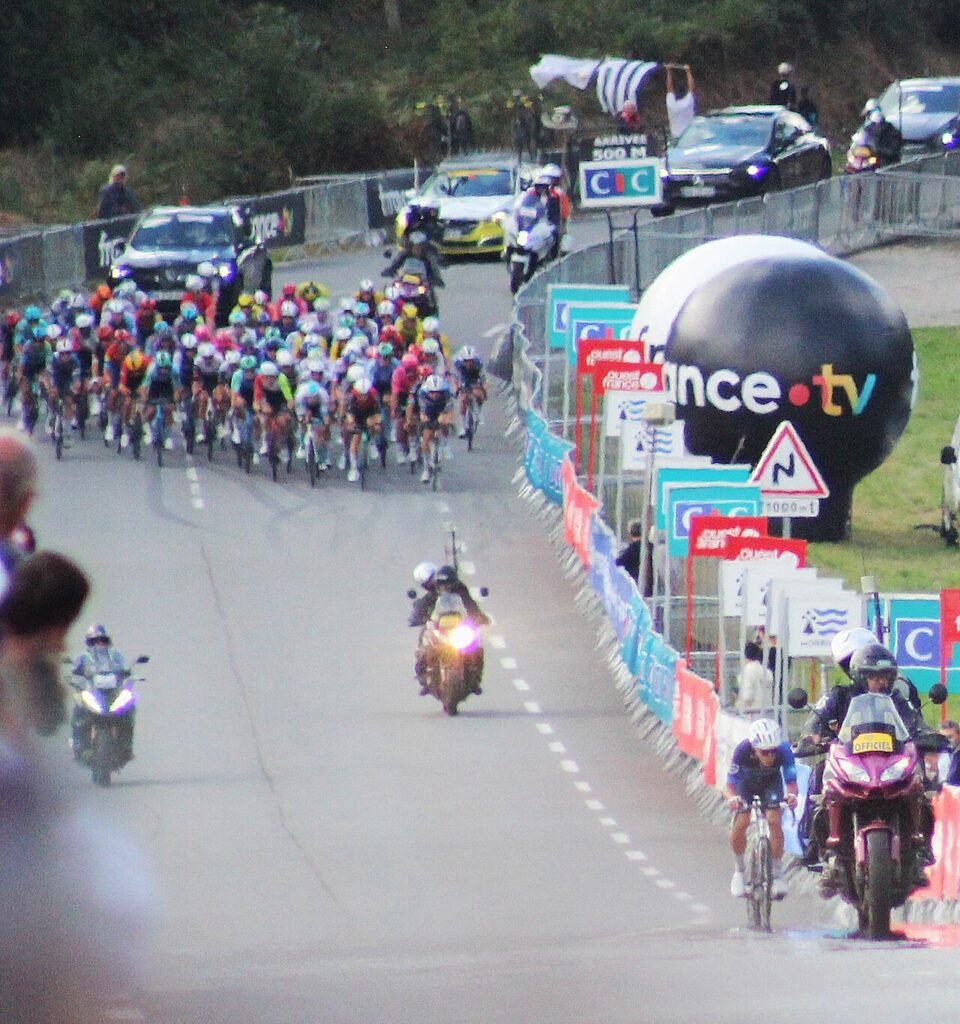
Names such as Lezot and Ty Marrec would mean little outside the region if cycling had not spent decades returning to them. There is no monumental summit, ruined fortress or ancient pilgrimage route attached to either climb. Their significance comes from repetition, from the accumulation of races, attacks, spectators and memories until ordinary local roads became landmarks within the culture of professional cycling.
This is how sporting landscapes are created. A hill does not need to be high to become important; it needs history. Riders return, spectators remember where attacks happened, commentators repeat the name and eventually a piece of road enters the shared vocabulary of the sport.
The 2026 course deliberately restores some of that traditional character. After the long northern loop, the riders face repeated passages over the Côte de Lezot and Côte de Ty Marrec, with the latter returning after several years away from the Bretagne Classic route. Neither ascent looks exceptional on paper, but paper cannot account for narrow roads, constant positioning battles, accumulated fatigue or the damage caused when the same short hill arrives for the third time after more than two hundred kilometres.
-37 km to FINISH · Côte de Ty Marrec
During the final circuits, Ty Marrec begins to acquire the significance that only repetition can create. The climb is not long and its average gradient is moderate, yet it arrives in a race where the riders have already absorbed more than three thousand metres of ascent and spent hours fighting over narrow Breton roads. What matters now is less the mountain itself than the condition in which the peloton reaches it.
Historically, Ty Marrec became one of the defining names of the Plouay circuit because the climb and its surrounding roads repeatedly fractured races. Its position close to the finish encouraged attacks, while technical descents and narrow approaches punished hesitation. The road became famous not because nature made it extraordinary, but because racing did.
That makes it an unusually fitting final discovery. Around the Peloton usually looks beyond cycling to uncover stories that existed before the riders arrived. Here the process is reversed. Cycling has been returning for long enough that the sport itself has become part of local history.
The same is true of Lezot, the Boulevard des Championnats du Monde and the surrounding circuit. Their names now connect village roads with French championships, World Championships, international professional racing and generations of spectators who learned exactly where to stand because experience told them where the race would break apart.
FINISH · Boulevard des Championnats du Monde, Plouay
When the riders finally return to the Boulevard des Championnats du Monde, they will have completed 228.3 kilometres without ever encountering the kind of landmark that normally dominates a major European race. There has been no enormous mountain, no famous coastline and no grand metropolitan finish. Instead the route has crossed small communities, wooded valleys, farmland and a network of roads whose difficulty emerges from accumulation rather than spectacle.
Yet within that compact landscape the peloton has travelled through an extraordinary range of stories. At Kernascléden, medieval painters imagined Death taking every rank of society by the hand while bats now sleep above their work. At Bon-Repos, Cistercian monks transformed forest and water into a disciplined monastic economy under the patronage of the Rohans. Near Guerlédan, a 20th-century reservoir covers part of the canal network once imagined as a strategic answer to British naval power. Pontivy still contains both the fortress of its medieval lords and the avenues of the emperor who renamed the town after himself, while Poul-Fétan preserves the harder and less celebrated history of the rural families who built much of the landscape through which the race has passed.
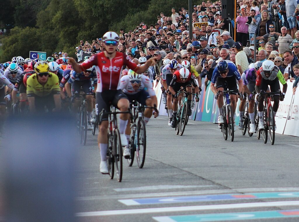
The final historical layer belongs to cycling itself. Plouay took roads that might otherwise have remained known only to the people living beside them and spent almost a century filling them with riders, crowds and memories until a small Breton town became one of the permanent addresses of professional racing.
When the winner crosses the line, another name will be added to that history. In Plouay, more than almost anywhere else on the route, the race is no longer merely passing through the landscape.
It has become part of it.



