

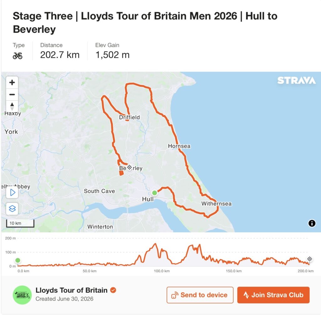
Stage 3 begins beside a river that made a city and soon reaches a sea that is slowly destroying a coastline.
From Hull, the Tour of Britain travels east across Holderness until the land ends at the North Sea. The peloton reaches Withernsea, turns north through Hornsea and Skipsea, then finally abandons the coast for the Yorkshire Wolds. Burton Agnes introduces an Elizabethan house standing beside its Norman predecessor; the rolling country around Driffield carries thousands of years of agricultural history; and at Wetwang the riders pass through one of Britain’s most remarkable concentrations of Iron Age chariot burials. The final kilometres belong to Beverley, where four circuits repeatedly return the race to a town that grew around the tomb of an Anglo-Saxon saint and became one of medieval England’s great places of pilgrimage and sanctuary.
The statistics suggest a transitional stage: 194.1 kilometres and 1,612 metres of climbing, considerably harder than the opening two days but without the severity awaiting the riders in the Yorkshire Dales tomorrow. The landscape tells a less orderly story. Holderness contains some of the fastest-eroding coastline in north-western Europe, where farms, roads and the sites of entire medieval settlements have disappeared into the North Sea. Inland, the Wolds preserve another kind of disappearance, with prehistoric cemeteries, ancient earthworks and burials revealing societies that left almost no written record of themselves.
This is a stage about what landscapes keep and what they lose. Hull remembers ships that crossed oceans. Holderness watches the sea consume its edge. The Wolds conceal their dead beneath fields. Beverley still possesses the bones of the saint around whom the town first grew.
For almost two hundred kilometres, the peloton will race between them.
START · Hull, the City Created by a River and the Sea
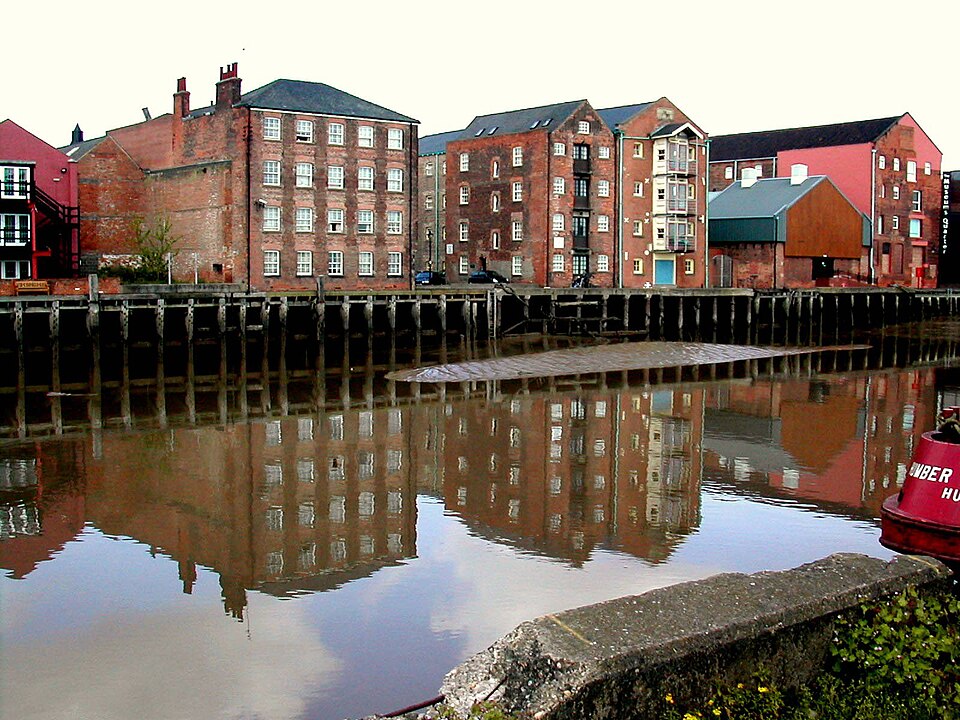
The Tour of Britain begins in East Park, but understanding Hull requires looking west towards the water.
The city’s full name, Kingston upon Hull, contains the story of its origins. During the late 12th century, Cistercian monks from Meaux Abbey needed somewhere from which to export wool produced on their estates. They established a quay near the meeting of the River Hull and the Humber and called the settlement Wyke upon Hull.
Its position was exceptional. The Humber opened directly onto the North Sea, while rivers and roads connected the port with the agricultural and increasingly industrial regions of Yorkshire behind it. Ships could sail from here towards the Low Countries, Scandinavia and the Baltic, turning what had begun as a monastic trading point into something far more important.
King Edward I recognised its strategic value. He acquired the settlement in the late 13th century and in 1299 it became Kingston upon Hull, the King’s Town upon Hull. Royal ownership encouraged expansion, while merchants increasingly connected the town with ports across northern Europe.
Those maritime connections eventually reached much farther. Hull developed major trades in whaling, fishing and merchant shipping. Its whalers pushed into Arctic waters; trawlers later sailed towards Iceland and the White Sea; merchant vessels connected Yorkshire industry with international markets. By the age of steam, docks expanded along the Humber and cargoes arrived from around the world.
The human cost could be severe. Deep-sea fishing became embedded in Hull’s identity, but trawling in northern waters was one of Britain’s most dangerous occupations. Storms, freezing conditions, ice and mechanical failures repeatedly killed crews, leaving communities in which the departure of a vessel always contained the possibility that it would never return.
The landscape of Hull consequently developed around absence as much as arrival. Ships left, families waited and the port depended upon people prepared to work in an environment that could turn lethal without warning.
Professional cyclists leaving East Park face nothing comparable. Yet their road towards the North Sea begins in a city whose existence has always depended upon people being willing to travel beyond the horizon.
START · William Wilberforce and the Struggle Against the Slave Trade
Hull’s relationship with the wider world also produced one of the city’s most important historical figures.
William Wilberforce was born in Hull in 1759, into a prosperous merchant family. He entered Parliament while still a young man, initially representing Hull before becoming MP for Yorkshire, and gradually made the campaign against Britain’s participation in the transatlantic slave trade central to his political life.
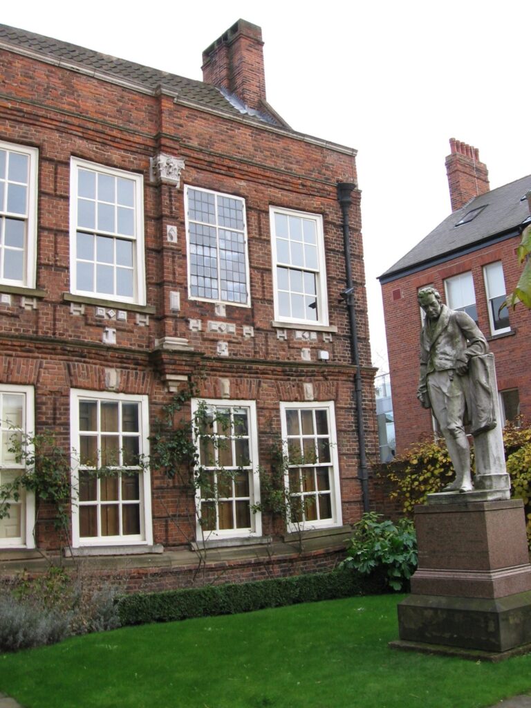
“Wilberforce House, Hull” — Photo: Paul Harrop / Wikimedia Commons, CC BY-SA 3.0
The system he opposed was enormous. European merchants transported manufactured goods to Africa, enslaved people were forced across the Atlantic under appalling conditions, and plantation commodities produced through enslaved labour flowed back towards European markets. British ships and capital played a major role in this economy, while fortunes, industries and consumer habits throughout the country were connected to it.
Wilberforce became the most prominent parliamentary voice of a much broader abolitionist movement. That distinction matters. Abolition was not the achievement of one benevolent politician. Black abolitionists, formerly enslaved people, religious campaigners, writers, organisers and countless petitioners provided testimony, political pressure and moral arguments against the trade, while resistance by enslaved people themselves was fundamental to the destruction of slavery throughout the Atlantic world.
After years of failed parliamentary attempts, the Slave Trade Act of 1807 prohibited British participation in the transatlantic trade. Slavery itself continued within much of the British Empire for decades longer. Parliament passed the Slavery Abolition Act in 1833, only days before Wilberforce died.
His birthplace survives in Hull’s Old Town and now houses a museum devoted not simply to Wilberforce but to the history and continuing legacies of slavery.
It is an uncomfortable but necessary part of the city’s maritime story. The same sea that created opportunities for merchants and sailors also connected Britain with systems of exploitation extending across continents. Looking around the peloton sometimes means finding histories that are not picturesque, but are too important to leave outside the frame.
START · Hull Blitz, When Geography Made the Port a Target
Hull’s importance as a port brought another consequence during the Second World War.
Its docks, railway connections and industries made the city strategically valuable, while its position near the North Sea placed it directly within the flight paths of German bombers. Beginning in June 1940, Hull endured repeated air raids. By the end of the war, the city had been attacked dozens of times.
The most destructive period came during the Hull Blitz of May 1941, when sustained raids devastated streets, businesses, docks and homes. Fires illuminated the city as rescue workers searched damaged buildings and civilians took shelter from explosives falling across neighbourhoods that had grown around the maritime industries making Hull a target in the first place.
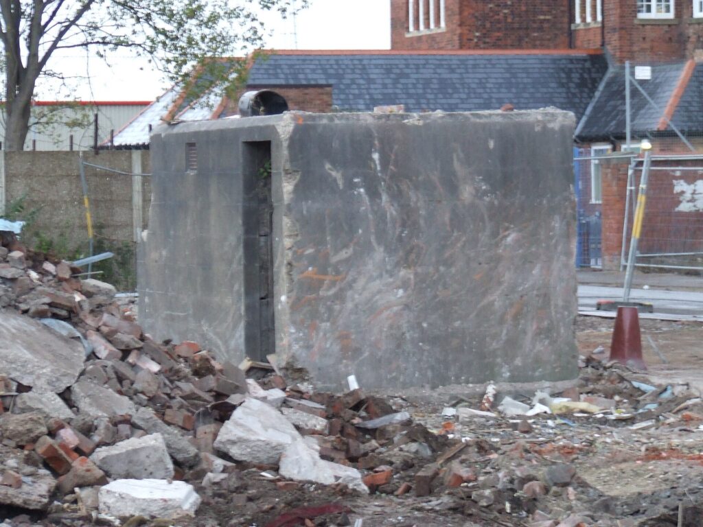
“Air raid shelter, Ringrose Street, Hull” — Photo: Peter Church / Wikimedia Commons, CC BY-SA 2.0
The physical destruction was immense, and post-war reconstruction changed the city’s appearance permanently. Buildings vanished, communities were displaced and new roads and developments later occupied areas where older streets had stood.
This creates a contrast with many of the places encountered elsewhere in Around the Peloton. In Lincoln, medieval and Roman structures survive because generations preserved, reused or built around them. Hull’s history includes large areas where the absence of old buildings is itself historical evidence. Sometimes a city’s past survives not in what remains, but in understanding why so much disappeared.
The riders leave Hull towards Holderness. Ahead waits another landscape defined by disappearance, although there the destructive force is not war, it is the sea.
-170 km · Holderness, a Coastline Being Erased
East of Hull, the peloton crosses the broad plain of Holderness towards Withernsea. At first there is little to suggest that this is one of Britain’s most unstable landscapes. Fields stretch towards the horizon, villages sit among hedges and the land appears securely attached to England.At the coast, that illusion ends…
Much of Holderness is composed not of resistant rock but of glacial till, a mixture of clay, sand, gravel and stones deposited by ice during the last glacial period. When North Sea waves strike these soft cliffs, they can remove material with extraordinary speed. Recent monitoring has recorded average retreat in vulnerable sections reaching several metres per year, while individual events can remove far more.
The process has been operating for thousands of years. Settlements recorded in medieval documents now lie beneath the North Sea, their churches, houses, fields and roads erased as the coastline migrated westwards. Names survive on maps and in historical records for places whose physical geography no longer exists.
This makes Holderness one of the clearest examples in Britain of landscape as something temporary rather than fixed. A property may stand safely inland during one generation and become dangerously close to the cliff during another. Roads must sometimes be abandoned or rerouted. Farmers can watch the edge of fields disappear.
Attempts to defend towns complicate the process further. Sea walls and other structures can protect particular communities, but the sediment that would otherwise have been released from those sections no longer moves naturally along the coast, potentially affecting erosion elsewhere. Protecting one place can therefore alter what happens farther downshore.
For the peloton, the map is absolute: a road exists and must be followed. For the people living along Holderness, the map has an expiry date.
-155 km · Withernsea Lighthouse, Built Inland to Save Ships at Sea
The race reaches Withernsea, where a lighthouse rises unexpectedly among houses rather than beside the beach.
The location looks wrong until its history is understood.
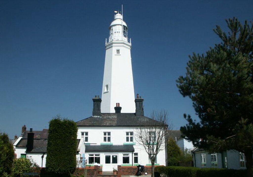
“Withernsea Lighthouse Museum” — Photo: David Wright / Wikimedia Commons, CC BY-SA 2.0
During the 19th century, the Holderness coast remained dangerous for shipping. Vessels travelling along the North Sea could find themselves between the lights at Spurn and Flamborough with insufficient guidance, and shipwrecks around Withernsea demonstrated the need for another navigational marker.
Construction of Withernsea Lighthouse began in 1892. The completed tower rises approximately 39 metres and contains a spiral staircase of 144 steps leading towards the lantern.
Yet it was deliberately built roughly a quarter of a mile from the sea.
At the time, sand dunes and a mere occupied the ground between lighthouse and shoreline. The town subsequently expanded around it as the promenade developed and houses appeared on land that had once separated the tower from the inhabited settlement.
Its original light was produced by paraffin, while an enormous revolving optical system concentrated the beam out across the North Sea. The mechanism had to be wound by hand. Electrification arrived in 1936, greatly increasing the power of the light, which continued operating until 1976.
Today the lighthouse remains standing while the coastline around Withernsea continues to change.
There is something particularly appropriate about finding it here. Holderness is a landscape in which the boundary between safe land and dangerous sea continually moves, while the lighthouse was constructed precisely to help sailors understand where they were in relation to that boundary.
The peloton passes a tower built to make a shifting coast legible.
-140 km · Hornsea Mere, Fresh Water Beside the North Sea
North of Withernsea, the race reaches Hornsea, where the coast produces another geographical surprise.
Less than a mile from the North Sea lies Hornsea Mere, the largest freshwater lake in Yorkshire. Covering hundreds of acres, the mere occupies a depression created by the same glacial processes that shaped much of Holderness.
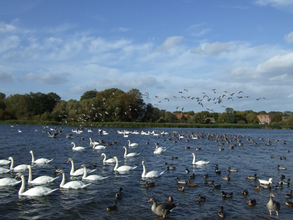
“Hornsea Mere” — Photo: Peter Church / Wikimedia Commons, CC BY-SA 2.0
This juxtaposition of fresh and salt water within such a short distance creates a distinctive ecological landscape. Reed beds, open water and surrounding vegetation provide habitat for waterbirds, while the mere has long supported fishing and recreation. Historical estate records preserve accounts of people fishing its waters centuries ago, revealing a resource that was economically useful long before it became primarily associated with leisure.
The lake is also a reminder that Holderness is fundamentally a glacial landscape. The ice sheets that deposited the unstable material now being consumed by the North Sea also left depressions, drainage patterns and subtle variations in relief across what can otherwise appear to be an almost featureless plain.
Hornsea therefore sits between two bodies of water produced by completely different processes. To the east lies the immense North Sea steadily removing the coast. Immediately inland lies a freshwater lake left behind by vanished ice.
Between them, the town occupies a remarkably narrow strip of geological time.
-125 km · Skipsea Castle, Where the Normans Built on an Iron Age Monument
At Skipsea, the peloton passes one of the most deceptive archaeological sites on the entire Tour of Britain.
A large earth mound rises from the surrounding landscape. For generations it was interpreted straightforwardly as the motte of Skipsea Castle, constructed after the Norman conquest. The story seemed obvious: William the Conqueror created the vast Lordship of Holderness and granted it to his follower Drogo de la Beuvrière, who established a castle here around 1086 to control the newly conquered territory and coastline. That interpretation was only partly correct.
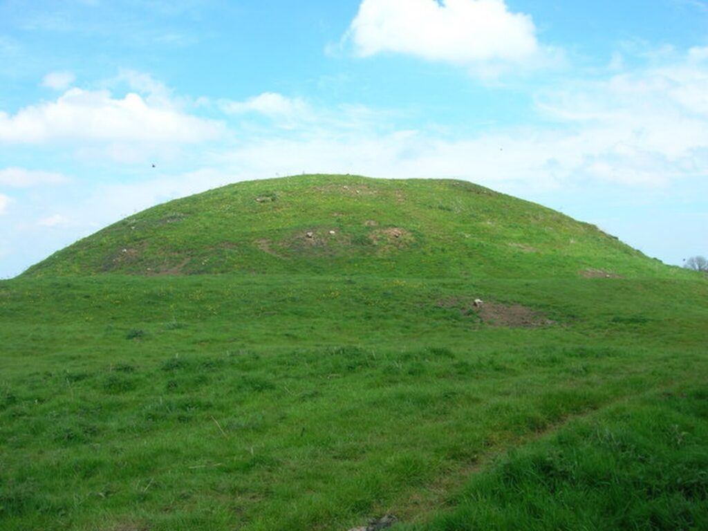
“Skipsea Castle” — Photo: JThomas / Wikimedia Commons, CC BY-SA 2.0
Modern archaeological investigation revealed that the great mound was already ancient when the Normans arrived. Its earliest phases belong to the Iron Age, probably beginning as a monumental burial mound. Nearly a thousand years later, Norman builders appropriated the existing earthwork and incorporated it into their castle.
The choice was practical, but it was also symbolically powerful. Conquest often works by occupying places that already matter. A Norman lord establishing his administrative centre on a prehistoric monument effectively placed a new political order on top of a much older landscape.
The castle itself was unusually positioned within wetlands associated with Skipsea Mere, a lake that survived until it was drained in the 18th century. The fortress controlled an inland harbour as well as the surrounding lordship, connecting aristocratic power with movement through a watery landscape very different from the drained farmland visible today.
Little monumental masonry survives. What remains is earth.
Yet that earth contains at least two entirely different ideas of power: an Iron Age community raising a monument for reasons we can only partially reconstruct, and Norman conquerors using the same mound to administer territory taken by force.
The riders see one hill.
Archaeology sees societies separated by a millennium.
-112 km · Burton Agnes, Two Houses and Eight Centuries of Continuity
After leaving the coast, the race reaches Burton Agnes, where two houses stand remarkably close together and allow the architecture of English power to be compared across more than four hundred years.
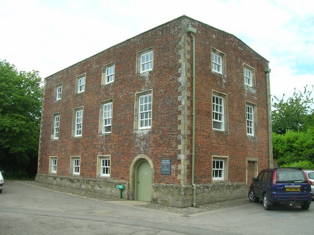
“Norman Manor House, Burton Agnes Hall” — Photo: JThomas / Wikimedia Commons, CC BY-SA 2.0
The older is the Burton Agnes Manor House, constructed between about 1170 and 1180 by Roger de Stuteville. Parts of the building survive from the Norman period, including a rare vaulted undercroft. The village itself probably took its name from one of Roger’s daughters, Agnes.
Beside it stands something completely different.
Between 1601 and 1610, Sir Henry Griffith constructed Burton Agnes Hall, an elaborate Elizabethan house designed for a society in which the aristocratic residence was becoming less fortress and more theatre. Large windows, decorative façades and carefully organised interiors displayed wealth, education and social confidence rather than preparing primarily for military defence.
The contrast between the two buildings is almost a lesson in English social history. The Norman manor emerged from the feudal world created after conquest, when aristocratic authority was closely connected with landholding and military power. The Elizabethan hall belongs to a later elite culture in which architecture increasingly demonstrated refinement, lineage and status.
More remarkable still is the continuity of ownership. The estate has passed through inheritance and marriage rather than ordinary sale for more than eight centuries.
Many historical landscapes survive because governments or preservation organisations eventually rescue them. Burton Agnes is different. Its continuity comes from a family relationship with the same place stretching back towards the Middle Ages.
The peloton passes two houses standing almost side by side.
Between them lie four centuries of change.
-95 to -70 km · Yorkshire Wolds, A Chalk Landscape Reappears
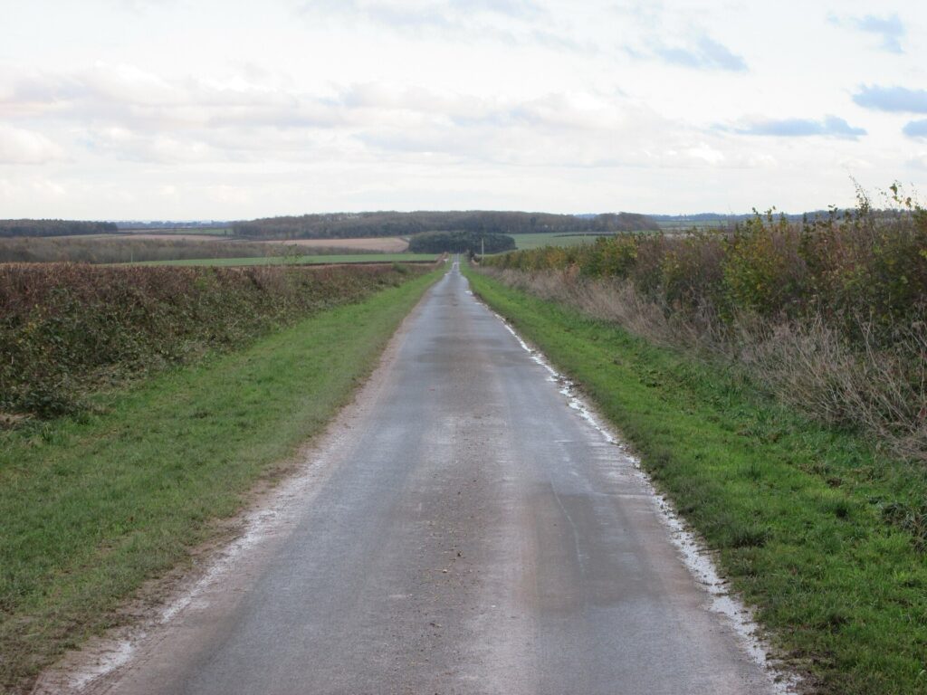
“Lane on the Yorkshire Wolds” — Photo: JThomas / Wikimedia Commons, CC BY-SA 2.0
Beyond Burton Agnes, the stage begins climbing into the Yorkshire Wolds, a broad crescent of chalk upland extending across East Yorkshire.
Like the Lincolnshire Wolds encountered during the opening stages, these hills originated beneath a prehistoric sea. Chalk formed from microscopic marine organisms accumulating on the seabed during the Cretaceous period before geological uplift exposed the sediments and erosion carved the rolling landscape visible today.
Yet the Yorkshire Wolds possess their own character. Dry valleys cut deeply into the chalk, broad ridges open towards enormous skies and intensive agriculture covers much of the plateau. Woodland survives in sheltered areas, while chalk grassland fragments support plants adapted to thin, lime-rich soils.
For cyclists, the Wolds create difficulty through accumulation. None of the climbs on Stage 3 resembles a mountain, but the route repeatedly rises and falls as it crosses valleys and ridges. Burton Road, Tire Ewe Hill and Keepers Hill provide the day’s categorised ascents, contributing to a total elevation gain of more than 1,600 metres.
For archaeologists, however, these hills are important for a different reason.
The chalk landscape has preserved evidence of human occupation stretching deep into prehistory. Burial mounds, linear earthworks, settlements and cemeteries reveal communities repeatedly choosing the Wolds as places to live, farm, travel and bury their dead.
One village ahead contains one of the most remarkable examples.
-70 km · Driffield, the Agricultural Capital of the Wolds
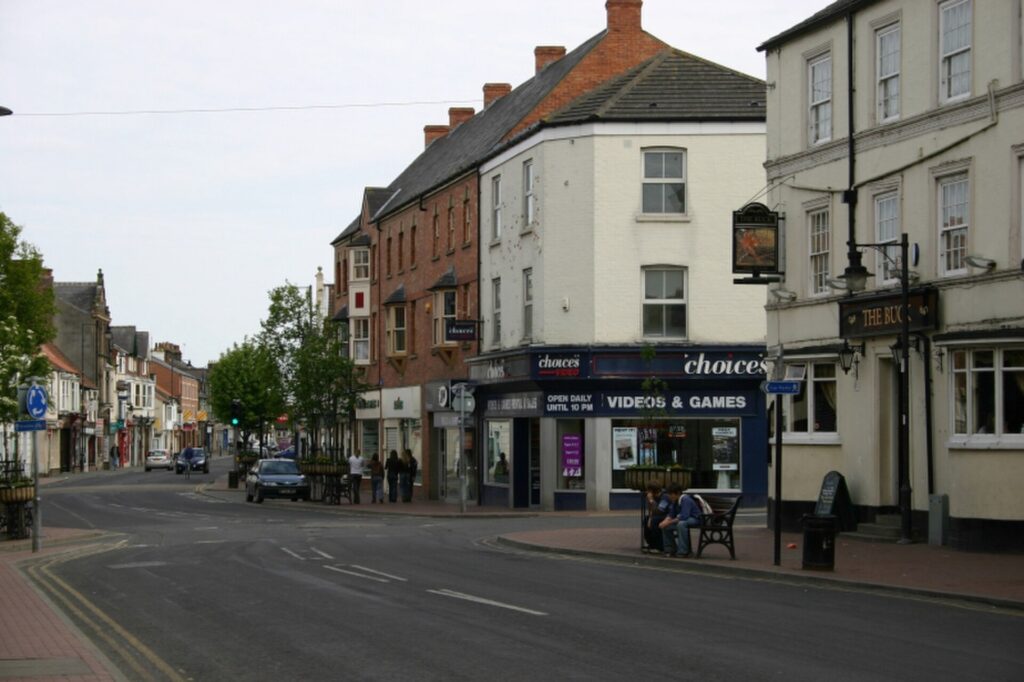
“Driffield” — Photo: Paul Glazzard / Wikimedia Commons, CC BY-SA 2.0
The race approaches Driffield, traditionally described as the Capital of the Wolds, at the centre of one of England’s great agricultural districts.
Its importance comes less from monumental architecture than from function. For generations Driffield has served the farms and villages surrounding it, providing markets, businesses and services to a landscape where agriculture remains economically and culturally dominant.
The arrival of the Driffield Navigation in the 18th century changed the town’s possibilities. Connecting inland waterways towards the Humber made it easier to move agricultural produce and heavy goods, while the railway’s arrival in the 19th century integrated Driffield even more closely into regional markets. Agriculture also became spectacle.
The Driffield Show, first held in the 19th century, developed into one of Britain’s major one-day agricultural shows. Livestock, machinery, crops, horses and competitions transform the town’s relationship with the countryside into a public gathering where farming is not simply an economic activity but part of regional identity.
This matters when watching a bicycle race cross the Wolds. The enormous fields surrounding the peloton are not empty space separating historical monuments. They are working landscapes tied to towns like Driffield through markets, transport, machinery and generations of specialised knowledge.
The Tour passes through for an afternoon.
Agriculture has organised these hills for centuries.
-55 km · Wetwang and the Woman Buried with a Chariot
The name Wetwang is memorable enough to attract attention on a road sign. What lies beneath the surrounding fields is considerably more remarkable.
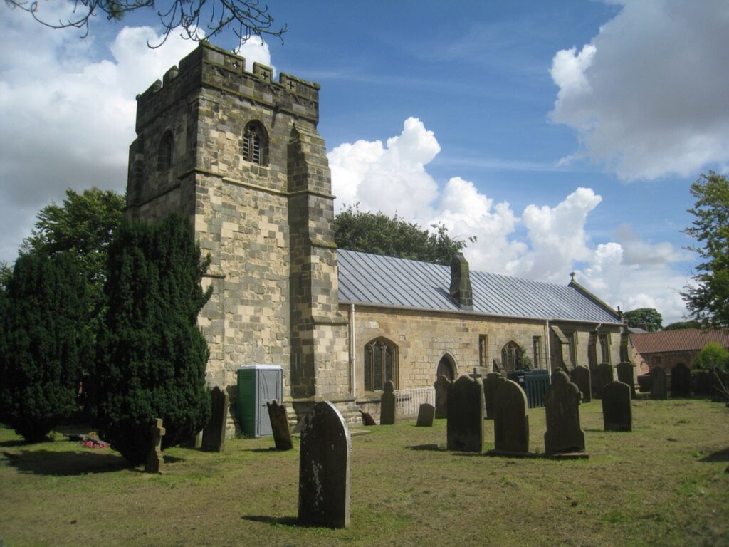
East Yorkshire contains one of Britain’s most distinctive Iron Age archaeological traditions. Communities living here during the final centuries before the Roman conquest buried some of their dead beneath square barrows, and a small number of particularly elaborate graves contained two-wheeled vehicles usually described as carts or chariots.
Several have been discovered around Wetwang.
One burial excavated near the village belonged to a woman approximately 35 to 45 years old, who died around the first half of the second century BC. Her body was placed within a square barrow, accompanied by a dismantled two-wheeled vehicle.
The details transform archaeology into something unexpectedly personal.
Parts of the vehicle’s iron tyres survived. Horse equipment, including decorated bridle fittings, was placed in the grave. Pig remains probably represented food offerings. Beside the woman was an iron mirror, apparently placed within a fur-lined bag.
The grave immediately complicates assumptions about power in Iron Age Britain. Chariot burials are commonly interpreted as high-status funerary practices, and the elaborate treatment of this woman suggests that she occupied a significant position within her community. Exactly what that position was remains unknown because the people who buried her left no written explanation.
That silence is what makes archaeology here so powerful.
We know that mourners gathered on this ridge more than two thousand years ago. We know that they dug a grave large enough to contain a vehicle. We know they placed a woman inside it with objects chosen deliberately, then covered the burial and raised a monument above her. We do not know what they called her.
The fields eventually returned to agriculture. The barrow became part of a landscape through which later generations travelled without necessarily understanding what lay beneath them.
On Stage 3, the peloton passes Wetwang in minutes. Beneath the surrounding Wolds lies the memory of a woman whose name disappeared while her chariot survived.
-35 km · Beverley, the Town That Grew Around a Saint
The final part of the stage brings the riders to Beverley, and here the relationship between a person and a place becomes unusually direct.
In the early eighth century, John, Bishop of York, established a religious community at a place then known as Inderawuda, the wood of the people of Deira. After retiring from his bishopric, John returned to the monastery and died there in 721.
His grave began attracting pilgrims, stories of healing and miracles gathered around his memory, and John was eventually recognised as Saint John of Beverley. The religious community surrounding his tomb grew in importance, and the settlement developing around it gradually became Beverley.
In other words, one of Yorkshire’s most important medieval towns grew partly because people wanted to visit the grave of one man.
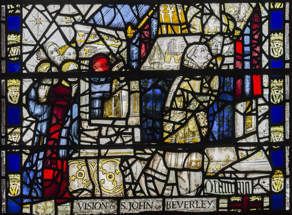
Royal patronage magnified the effect. Tradition records that King Athelstan visited John’s tomb before campaigning in the north during the 10th century and later granted important privileges to the church. Medieval kings continued to honour the saint, and his banner was carried with English armies.
The connection reached one of the most famous battles in English history. Henry V’s victory at Agincourt in 1415 occurred on 25 October, a feast associated with the translation of St John’s relics. The coincidence strengthened royal devotion, and Henry later visited Beverley to give thanks.
Pilgrimage brought people. People required accommodation, food, markets and services. Religious prestige generated economic importance.
By the later Middle Ages, Beverley had become one of the larger towns in England.
The modern peloton arrives for completely different reasons, yet it enters a town whose growth was itself created by centuries of human movement towards a destination.
-30 km · Beverley Minster, a Gothic Giant Without Cathedral Status
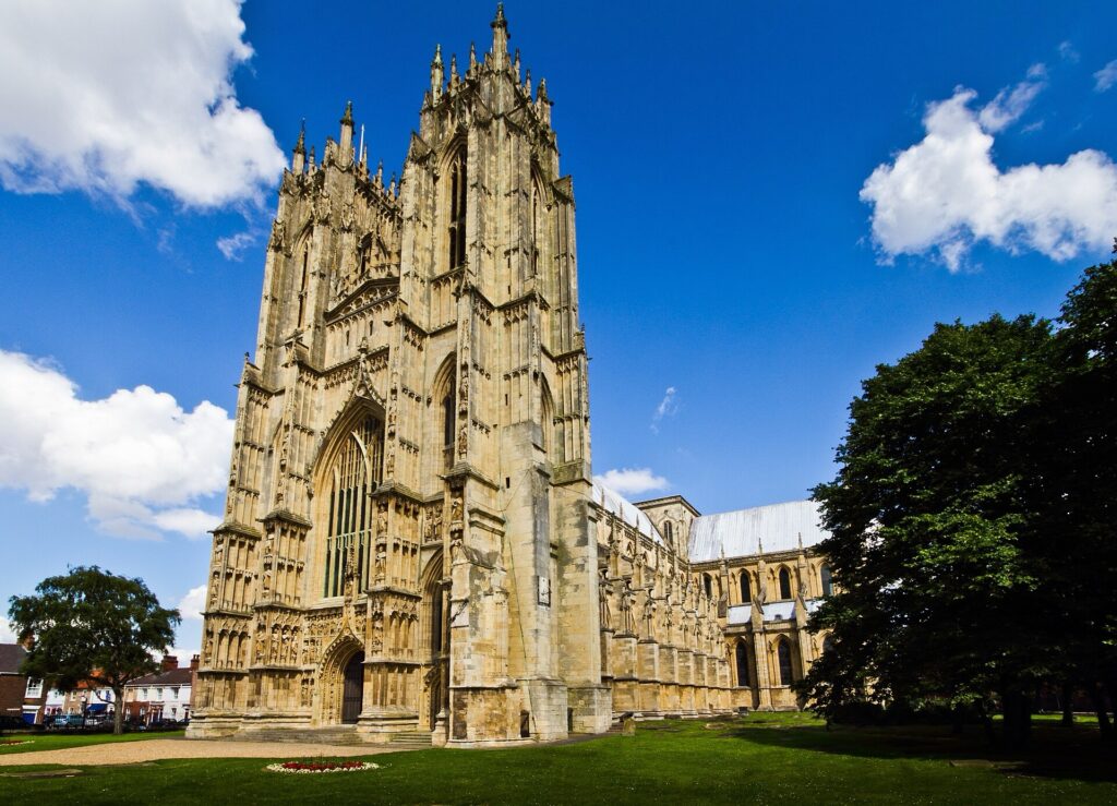
Above the town rises Beverley Minster, one of the great Gothic churches of England.
Its scale often leads visitors to assume that it must be a cathedral. It is not.
The building standing today developed largely between the late 12th and early 15th centuries, replacing earlier churches associated with the community founded by John of Beverley. Its architecture records the evolution of English Gothic across several centuries, from the soaring Early English eastern sections through later Decorated and Perpendicular work.
The proportions are extraordinary for a parish church. Twin western towers rise above an elaborate façade, while the interior extends through a long nave towards the choir and the site associated with St John’s shrine.
Medieval pilgrims would have encountered something considerably more colourful than the pale stone familiar today. Churches contained painted surfaces, textiles, candles, decorated screens, sculpture and precious metalwork. At the centre of Beverley’s devotional world stood the shrine of St John, drawing visitors from across England.
The Reformation dismantled that world. In the 16th century, the collegiate institution was suppressed, the saint’s shrine destroyed and much of the wealth associated with medieval worship removed. The building itself came dangerously close to destruction. Local townspeople eventually purchased the Minster and secured its survival, although maintenance became an enormous burden and sections deteriorated badly.
Its preservation was therefore never inevitable.
The church survived because successive generations decided that a building created for a religious system that had been radically transformed was still worth keeping.
Today it dominates Beverley much as the cathedral dominated Lincoln two days earlier.
But the stories are different. Lincoln’s cathedral grew beside royal and episcopal power. Beverley’s enormous church grew above the grave of a saint whom people refused to stop visiting.
-25 km · Beverley Sanctuary, Where the Law Could Not Immediately Follow
Medieval Beverley offered pilgrims something spiritual. To fugitives, it offered something considerably more practical, for centuries the town possessed an unusually extensive right of sanctuary associated with St John. According to tradition, King Athelstan granted protection extending around the saint’s church. Within this sacred jurisdiction, people accused of crimes could seek refuge from immediate arrest.
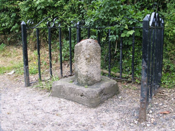
Sanctuary did not mean that a person simply escaped justice forever. Medieval sanctuary operated according to rules that changed across time and place, and fugitives might eventually face exile or other legal consequences. Yet reaching a protected church could provide a crucial barrier between an accused person and those pursuing them.
Beverley’s surviving Sanctuary Book, recording fugitives between the late 15th century and the Reformation, makes this history unusually vivid. Hundreds of people appear in its pages, associated with offences ranging from theft to homicide.
These were not abstract legal cases. They were frightened people physically travelling towards Beverley because geography could change their legal position.
Markers around the town defined the sanctuary area. Cross one boundary and the relationship between individual and authority changed.
Inside the Minster survives an even older symbol of protection, the Frith Stool, or chair of peace, associated with the sanctuary tradition and one of only a very small number of such objects surviving in England.
The Tour of Britain finishing circuit repeatedly crosses a landscape once understood through invisible legal boundaries.
For the riders, crossing a line changes race position.
For a medieval fugitive reaching Beverley, crossing the right line could change the course of a life.
FINAL CIRCUITS · Beverley, Four Passages Through a Medieval Town
Once the race reaches Beverley, it does not immediately finish.
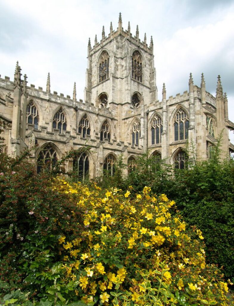
The riders enter a 16-kilometre circuit ridden four times, transforming the final part of Stage 3 into a repeated journey through and around the town. Each passage brings the peloton back towards the uphill drag to Beverley Racecourse, gradually revealing the landscape in a way a single crossing could not.
Repetition changes perception. On the first lap, the Minster is simply a landmark. By the second, riders know where roads narrow and where positioning matters. By the third, teams begin calculating whether the race will remain together. On the final passage, familiar streets become tactical territory.
This is also an appropriate way to experience Beverley because the town itself was created through repetition. Pilgrims came repeatedly to St John’s shrine. Markets repeatedly filled its streets. Fugitives repeatedly travelled towards sanctuary. Generations of builders repeatedly returned to the Minster, extending and altering a church whose construction lasted for centuries.
The modern race adds another rhythm.
Four passages, four approaches, four opportunities for the town to watch the peloton before the final climb towards the racecourse.
FINISH · Beverley Racecourse and the Westwood
The stage finishes beside Beverley Racecourse, on the open land of the Westwood overlooking the town.
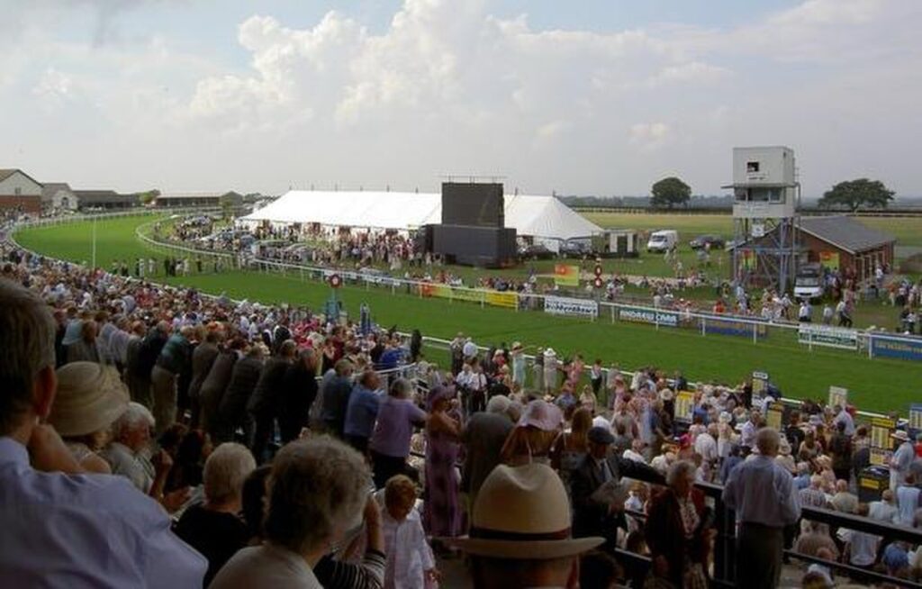
The setting creates a final contrast with the coast encountered earlier. Holderness is a landscape where boundaries retreat as the sea consumes the land. The Westwood represents a different kind of continuity, an open common landscape preserved beside a growing town.
Beverley has long maintained common grazing traditions on the Westwood, and cattle can still be seen on parts of the pasture during the grazing season. The open grassland gives the racecourse its unusual setting, with the towers of Beverley Minster visible beyond the town below.
Horse racing has taken place in Beverley for centuries, eventually developing into the formal racecourse that occupies the Westwood today. Stage 3 consequently ends at another sporting landscape much older than professional cycling.
The final kilometre rises towards it.
After almost two hundred kilometres, that modest gradient may be enough to disrupt the conventional sprint expected from flatter terrain. Riders who survived the Wolds and the repeated Beverley circuits must still judge effort carefully as the road climbs towards the line.
Around them, the entire stage has been a study in what survives.
Hull survived war but lost much of its old urban fabric. The Holderness coast loses pieces of itself every year. Withernsea’s lighthouse remains after its beam went dark. At Skipsea, Norman conquerors built upon an Iron Age monument whose original meaning had already been forgotten. Burton Agnes preserves two aristocratic houses separated by four centuries. At Wetwang, an unnamed woman’s bones and chariot survived while almost everything about her identity disappeared. Beverley offers the opposite possibility.
A bishop died here in 721. People remembered him. They visited his grave, told stories about him, built churches above him and created a town around the movement of pilgrims towards his shrine. Kings adopted his cult, fugitives sought protection beneath his authority and craftsmen spent generations constructing one of England’s greatest Gothic buildings around his memory.
More than thirteen centuries later, his bones remain in the Minster and his name remains attached to the town’s history.
The peloton will reach Beverley because a race organiser drew a route towards it.
Beverley exists as it does because, for centuries, countless other travellers did much the same thing.



