

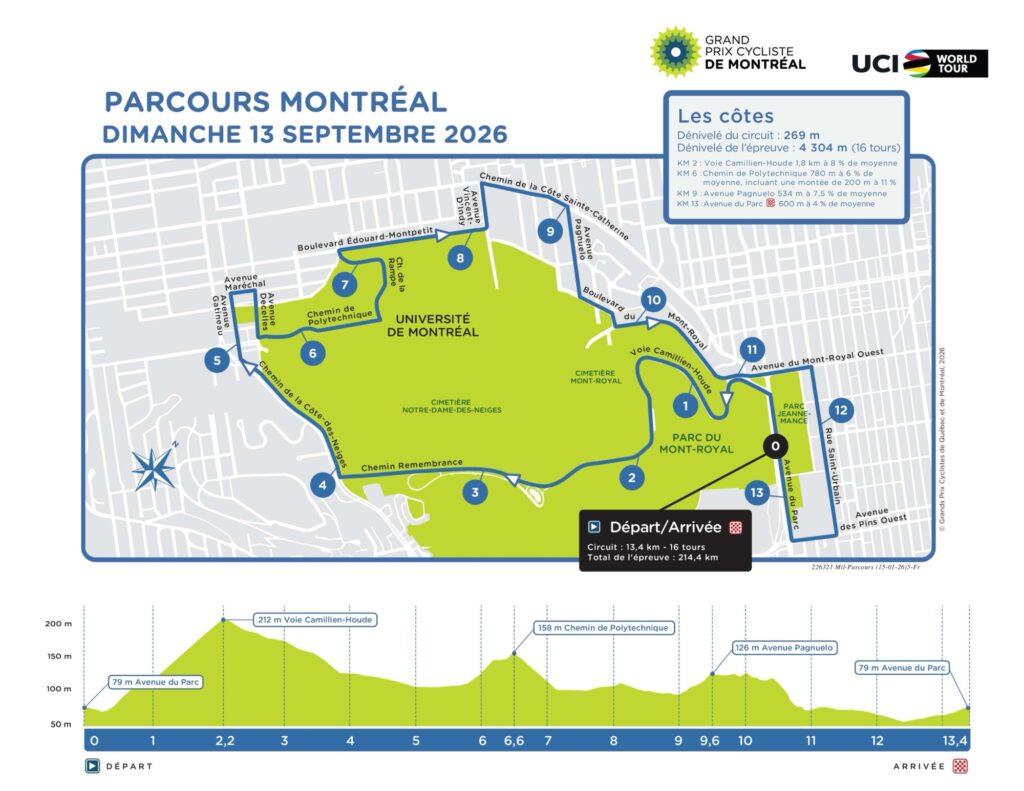
Two days after the peloton races through the fortified heights of Québec City, the WorldTour reaches Montréal and encounters a very different relationship between cycling and place. The GP Cycliste de Montréal does not travel across a province or use a succession of towns to carry its story forward. In 2026, the riders remain attached to Mont Royal for almost the entire afternoon, completing 16 laps of a 13.4-kilometre circuit, 214.4 kilometres in total. Each lap contributes roughly 269 metres of climbing, so a mountain that rises only modestly above the city accumulates more than 4,300 metres of ascent before the race is finished.
That repetition is fundamental to understanding both the race and Montréal. The peloton will climb the same slopes, pass the same institutions and return to the same streets sixteen times, but Mont Royal contains enough history for the circuit never to be as simple as it appears on a map. Long before the modern city existed, Indigenous peoples inhabited and travelled through the St Lawrence landscape around the mountain. Jacques Cartier came here after visiting the Iroquoian settlement of Hochelaga in 1535 and gave the mountain the name from which Montréal would eventually derive. Cemeteries, universities, hospitals and wealthy neighbourhoods later spread around its slopes, while part of the mountain was protected as a public park designed by Frederick Law Olmsted.
Cycling eventually became another layer of that history. Mont Royal hosted the 1974 UCI Road World Championships, where Eddy Merckx won the rainbow jersey, and the Olympic road race two years later. International professional racing returned in later decades, and since 2010 the modern Grand Prix has made the mountain one of the defining urban circuits of the WorldTour. In 2026 the relationship becomes even tighter because the same 13.4-kilometre circuit forms the decisive final loop of the UCI Road World Championships, which return to Montréal later in September.
The race therefore covers relatively little geographical territory despite its length. Over sixteen laps it keeps returning to one mountain, but each passage crosses another layer of Montréal: Indigenous history, colonial settlement, geology, public landscape, immigration, education, memory and more than half a century of international cycling.
START · Parc Jeanne-Mance and the Mountain Above Montréal
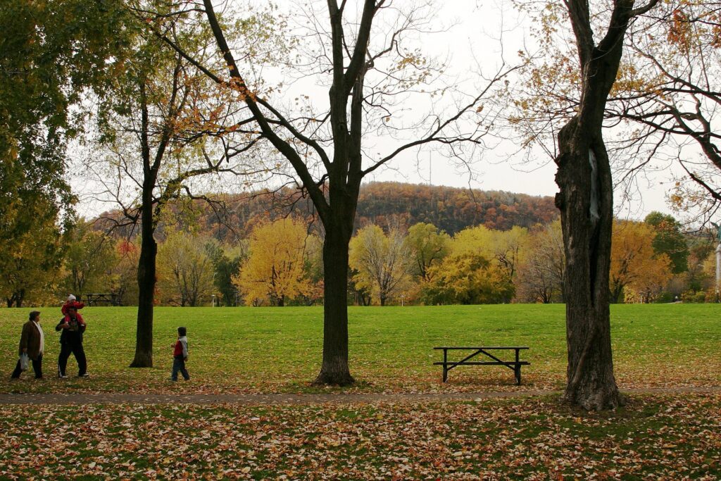
The race begins on Avenue du Parc, beside the large green space now known as Parc Jeanne-Mance, with Mont Royal rising immediately behind it. The park appears inseparable from the mountain today, but its present identity emerged gradually as Montréal expanded around a landscape that had already accumulated centuries of meaning.
For much of its history the open ground was commonly known in English as Fletcher’s Field, although the origin of the name remains uncertain. It developed as a recreational space beside Mount Royal Park and gradually accumulated playing fields, paths and public facilities as the surrounding neighbourhoods became denser. French-speaking Montrealers increasingly used the name Parc Jeanne-Mance during the 20th century, connecting the space with one of the central figures in the colonial foundation of the city.
Jeanne Mance arrived with Paul de Chomedey de Maisonneuve in 1642 as part of the group that established Ville-Marie, the French settlement from which Montréal developed. She founded the Hôtel-Dieu hospital and became one of the most important figures in the early history of the colony. Yet the story of the land around the mountain begins long before Ville-Marie.
Archaeological evidence shows Indigenous presence on and around Mont Royal extending back thousands of years. When Jacques Cartier arrived in 1535, he encountered the large St Lawrence Iroquoian settlement of Hochelaga, an organised agricultural community surrounded by cultivated fields. Cartier climbed the mountain after visiting the settlement and named it mont Royal. When Samuel de Champlain returned to the Montréal area decades later, Hochelaga was no longer there, for reasons that remain uncertain, but Indigenous occupation and use of the St Lawrence landscape continued.
The modern race therefore begins beneath a mountain whose name was inherited by the city, while the city itself was built within a much older Indigenous geography.
Camillien-Houde · A Road Through Olmsted’s Mountain
Almost immediately, the riders confront the defining climb of the circuit, Voie Camillien-Houde, rising through the eastern side of Mont Royal. It is not a great mountain road in the Alpine sense, but repeated sixteen times it becomes the central physical problem of the race.
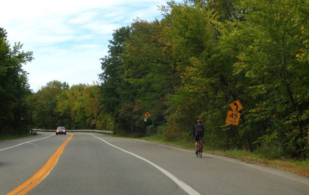
The road belongs to a much newer period in the mountain’s history. Camillien-Houde and the connecting Remembrance Road were opened in 1958, bringing motor traffic across a landscape that Frederick Law Olmsted had conceived according to very different principles.
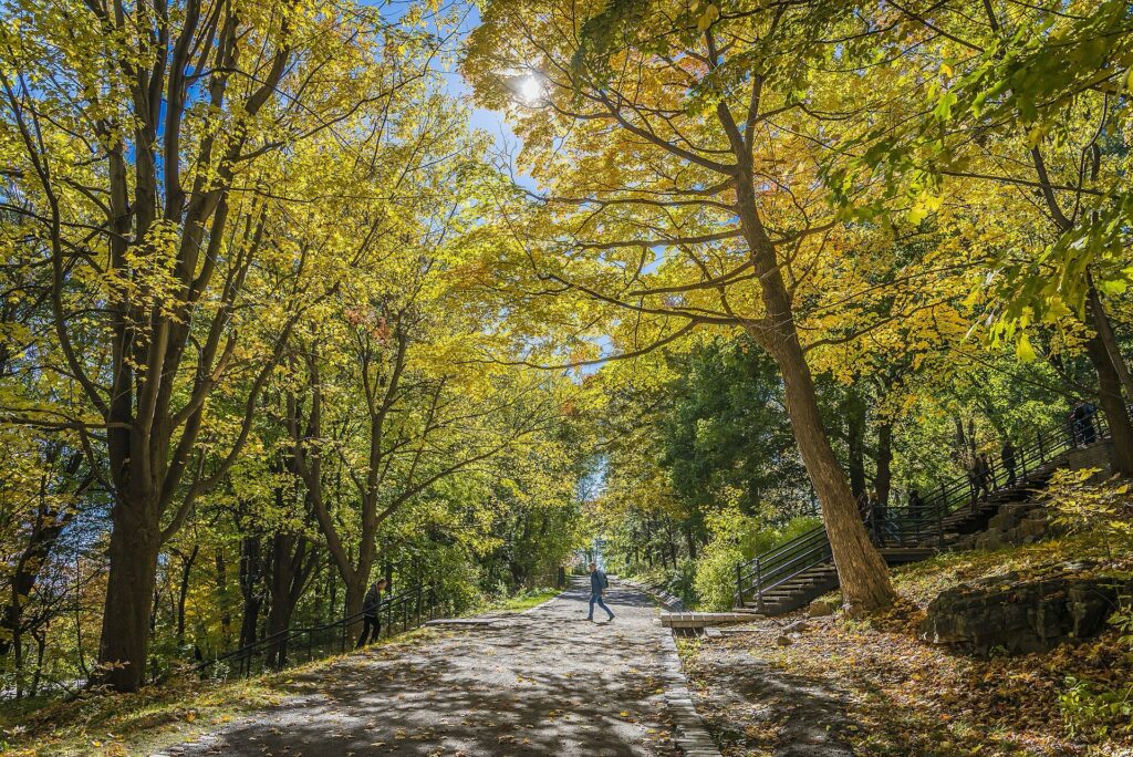
Montréal hired Frederick Law Olmsted in 1874 after acquiring large parts of the mountain for a public park. Olmsted had already helped create Central Park in New York and was becoming the most influential landscape designer in North America. His plan for Mont Royal was not to impose a formal ornamental garden on the mountain but to intensify the experience of moving gradually through its natural landscape.
He imagined ascent as a sequence rather than a direct climb. Paths would curve across the slopes so that vegetation, rock, openings and views changed slowly as visitors gained height. The mountain was supposed to be experienced rather than conquered, and the park became a deliberate counterpoint to the speed, density and industrial expansion of the city below.
Mount Royal Park opened in 1876, although Olmsted’s full vision was never implemented. Later generations added roads, recreational facilities, Beaver Lake and other interventions that changed the mountain considerably. Even so, the basic idea of the mountain as protected public landscape survived.
Professional cycling now uses that landscape in almost the opposite way. The riders accelerate through the park, reducing gradients to seconds and watts, and then return to do it again. The road built across Olmsted’s landscape becomes the main instrument through which the race gradually fragments.
Mont Royal · A Mountain Formed Underground
Mont Royal’s shape has encouraged one of Montréal’s most persistent geological myths: that it is an extinct volcano. The mountain is volcanic in origin only in a very broad sense.
It belongs to the Monteregian Hills, a chain of isolated elevations extending across southern Québec. Roughly 125 million years ago, magma intruded into older rocks deep below the Earth’s surface. It did not erupt here as a conventional surface volcano. Over enormous spans of time, erosion removed softer surrounding formations and gradually exposed the more resistant intrusive rock.
The mountain visible today is therefore the remnant of material that solidified underground.
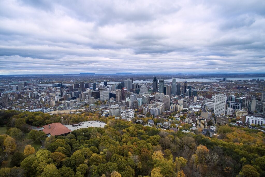
Its modest height becomes more impressive because the surrounding terrain lies so much lower. The highest point reaches only a little above 230 metres, yet Mont Royal dominates central Montréal visually and topographically. The city grew around it rather than over it.
For the race, the same geology creates an unusual kind of climbing contest. There is no pass to cross and no summit finish to reach. The mountain simply returns every 13.4 kilometres. By repeating those modest gradients sixteen times, the riders accumulate more than four thousand metres of ascent without ever leaving the city.
Remembrance Road · Cemeteries on the Mountain
As the circuit crosses Mont Royal, it passes a landscape occupied by two of Canada’s most significant cemeteries: Mount Royal Cemetery and Notre-Dame-des-Neiges Cemetery.
Their presence reflects the rapid growth of Montréal during the 19th century. As the population expanded, crowded urban burial grounds became increasingly problematic. Public-health concerns, epidemics and changing attitudes towards death encouraged cities across Europe and North America to establish large cemeteries beyond the densest districts.
Mont Royal provided space, elevation and countryside within reach of the city.
The Protestant Mount Royal Cemetery received its first burial in 1852. Its design followed the rural-cemetery movement then developing in Britain and the United States, placing graves within landscaped surroundings of winding roads, trees and carefully composed views. Burial space was transformed into a park-like environment intended not only for the dead but also for the contemplation of the living.
The Catholic Notre-Dame-des-Neiges Cemetery followed nearby in the 1850s. It expanded across more than 130 hectares and eventually became the largest cemetery in Canada, containing the graves of hundreds of thousands of people. Jewish cemeteries were also established on Mont Royal, turning the mountain into a funerary landscape reflecting several of the communities that shaped Montréal.
The riders pass quickly, often with little visible indication of what lies behind the walls and trees. Yet much of the city’s social history is gathered here: politicians, industrialists, artists, religious figures, immigrants, workers and generations of families who lived in Montréal long before the Grand Prix existed.
Côte-des-Neiges · A District Built by Successive Arrivals
The western side of the mountain falls towards Côte-des-Neiges, a name that preserves older rural geography beneath one of Montréal’s most diverse modern districts.
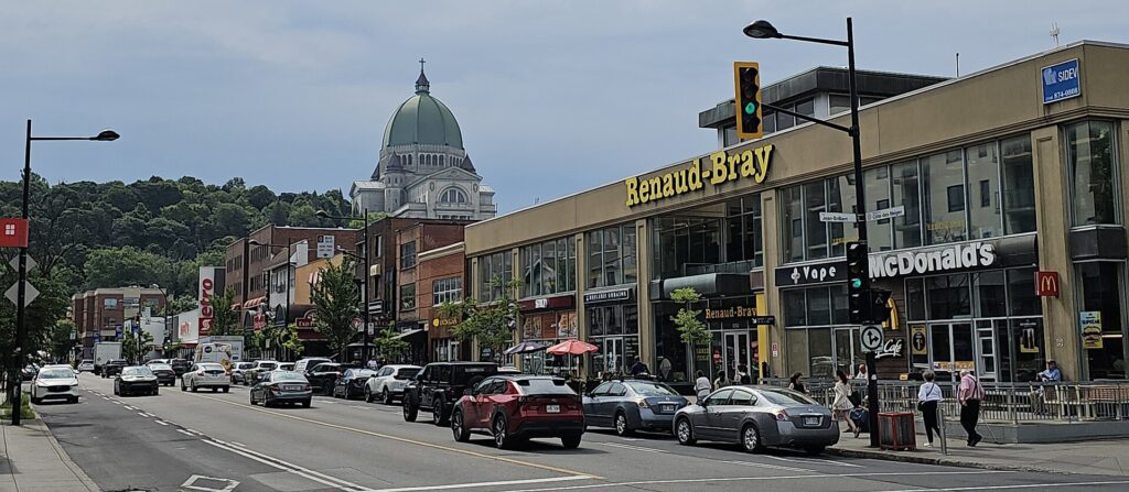
The area began as agricultural land beyond the colonial city. During the late 17th century, the Sulpicians opened territory for farming, and a village slowly developed beneath the mountain. Urban expansion, institutional development and transport eventually absorbed the area into Montréal.
During the 20th century, Côte-des-Neiges became increasingly shaped by immigration. Communities arrived from Europe, the Caribbean, Asia, Africa and the Middle East, while the presence of the Université de Montréal and major hospitals added students, researchers and medical workers from across Canada and abroad.
The neighbourhood consequently became one of the clearest expressions of Montréal’s linguistic and cultural complexity. French and English coexist with dozens of other languages, while restaurants, shops, community organisations and places of worship reveal the successive migrations that reshaped the district.
The race touches only a narrow strip of that world. The barriers and television cameras occupy the road, but within a few streets the city becomes far denser and more varied than the course itself can show.
Polytechnique and the University on the Mountain
The course climbs through the territory of the Université de Montréal and Polytechnique Montréal, part of a much larger movement that brought institutions onto Mont Royal during the 19th and early 20th centuries.
Hospitals, seminaries, schools and universities sought sites on or around the mountain where land remained available and the air seemed cleaner than in the industrial districts below. The Université de Montréal eventually established a major campus on the northern slope, dominated by the monumental main building designed by Ernest Cormier.
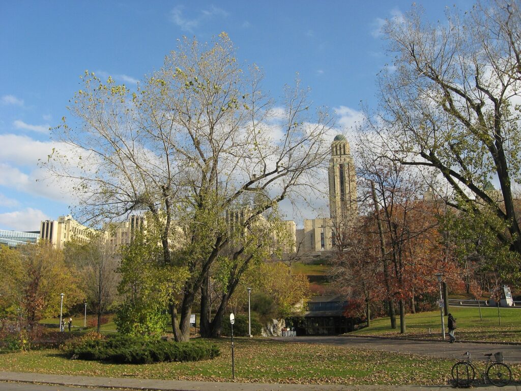
Its long horizontal wings and central tower became one of the most recognisable architectural forms on Mont Royal. Beside it developed Polytechnique Montréal, founded in 1873 and now one of Canada’s major engineering schools.
On the 2026 race course, Chemin de la Polytechnique is also one of the most difficult sections. Its steep ramps arrive after Camillien-Houde and contribute to the cumulative nature of the circuit, ensuring that the race is never defined by one climb alone.
The institution beside the road, however, carries a history that reaches far beyond education or cycling.
Polytechnique · Fourteen Women Remembered
On 6 December 1989, an armed man entered École Polytechnique and murdered fourteen women, most of them engineering students, while deliberately targeting women. Others were wounded before the attacker killed himself.
The killings became one of the defining acts of violence in modern Canadian history. Every year on 6 December, the women are remembered nationally, while the event contributed to long-running campaigns around violence against women and gun control.
Camillien-Houde will return four more times. Polytechnique will return four more times. The riders will again pass the cemeteries, the university, Outremont, Parc Jeanne-Mance and the same long approach towards Avenue du Parc.
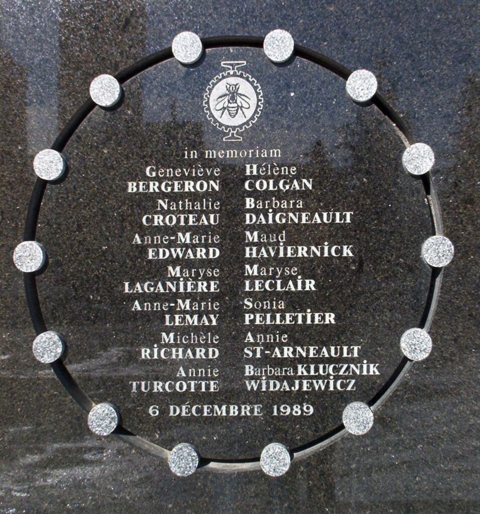
At Polytechnique, their memory remains embedded within the institution. A plaque carries their names, and nearby Place du 6-Décembre-1989 contains the memorial artwork Nef pour quatorze reines, whose fourteen elements commemorate the victims.
The race passes the university sixteen times during the afternoon. The road name appears on route maps because it is a steep climb. Beyond the barriers, the same name belongs to an institution where loss remains part of collective memory.
Outremont · When Montréal Climbed Around the Mountain
From the university sector, the circuit continues through the northern slopes towards Outremont, historically one of the municipalities that grew around Mont Royal as Montréal expanded beyond its original core.
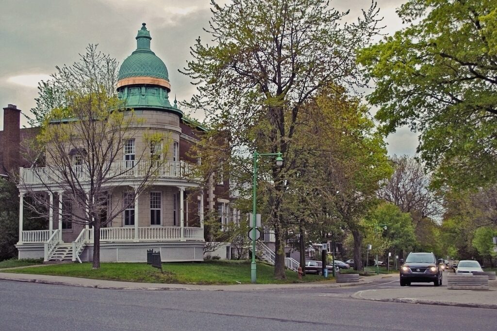
The name itself reflects geography: a district on the other side of the mountain. Farms and country estates gradually gave way to suburban streets, religious institutions and increasingly prestigious residences during the 19th and early 20th centuries.
Outremont became associated particularly with Montréal’s francophone professional and cultural elites. Large houses, duplexes and tree-lined streets climbed across terrain that had once belonged to agricultural estates, while neighbouring districts developed identities shaped by different linguistic and immigrant communities.
The growth of these neighbourhoods repeatedly raised a central question for Montréal: how much development could be permitted around Mont Royal before the mountain itself disappeared behind buildings?
Concerns were already visible during the 19th century. Clear-cutting on part of the mountain during the winter of 1859–60 produced a strong public reaction because the damage was visible from the city below. That episode helped strengthen pressure for conservation and contributed to the eventual establishment of Mount Royal Park.
Later planning rules introduced height restrictions and heritage protections intended to preserve the mountain’s dominance over the skyline. The city continued to climb around Mont Royal, but generations of Montrealers repeatedly decided that the mountain itself should remain visible above it.
Parc Jeanne-Mance and the City Below the Mountain
The course eventually turns back towards Parc Jeanne-Mance, where the relationship between protected mountain and dense city becomes especially clear.
To one side rises the wooded park. To the other, streets extend towards the Plateau Mont-Royal and Mile End, districts shaped by working-class settlement, migration, cultural change and later waves of gentrification. Terraced houses, exterior staircases, cafés, religious buildings, converted factories and neighbourhood shops fill the urban space almost immediately beyond the park.
At the northern edge stands the enormous monument to George-Étienne Cartier, one of the major political figures in the creation of Canadian Confederation. Inaugurated in 1919, the monument places a winged figure of Renown above allegorical representations connected with Canada and its provinces.
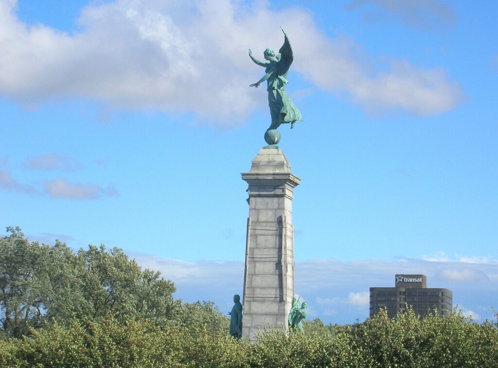
The scale of the monument is monumental in the literal sense, yet daily life has absorbed it. People run past it, sit beneath it, meet friends nearby and gather in the park. The surrounding space is used so continuously that the political symbolism of the monument becomes part of ordinary urban scenery.
The Grand Prix adds another temporary layer. For one afternoon every September, the same park becomes part of a WorldTour arena without ever ceasing to be a public space.
Avenue du Parc · Montréal Between Languages and Migrations
The finishing road, Avenue du Parc, runs beside Mont Royal and continues north through neighbourhoods that reveal much of Montréal’s demographic history.
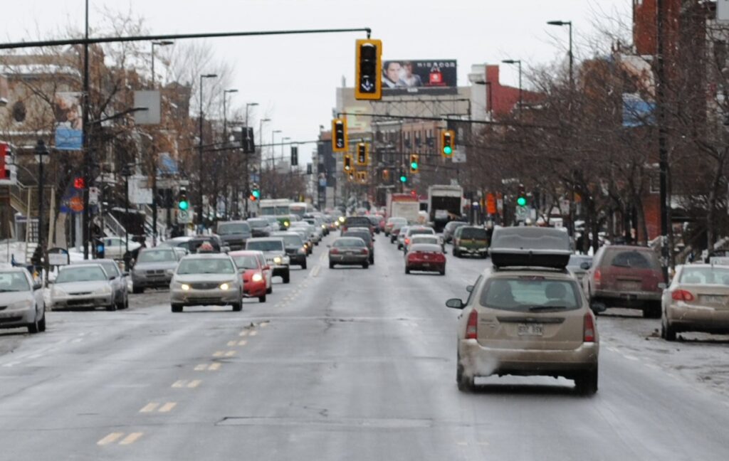
During the 20th century, Park Avenue became strongly associated with successive immigrant communities, including Jewish, Greek and Portuguese populations. Restaurants, shops, religious institutions and social clubs turned the street into one of the places where immigration was visible at neighbourhood scale.
The avenue also sits inside Montréal’s long negotiation between French and English. The city developed for generations with a powerful anglophone commercial elite while retaining a large francophone population that increasingly reasserted political and cultural control, particularly during Québec’s Quiet Revolution.
Park Avenue became part of that linguistic landscape. Its English name remains widely recognised even though French dominates public language, while the communities along the street brought still more languages into everyday use.
The finish of an international bicycle race therefore occupies a road that has been international in another sense for much longer.
Mont Royal and Cycling · Merckx, Montréal and the 1974 Worlds
Mont Royal was already international cycling territory decades before the modern Grand Prix existed.
In 1974, Montréal hosted the UCI Road World Championships, the first Road Worlds ever held outside Europe. For a sport whose professional centre remained overwhelmingly European, bringing the championship to Canada represented a major geographical break.
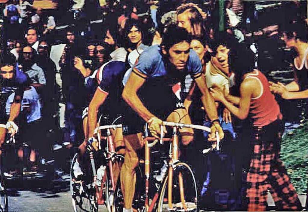
The men’s professional road race produced an appropriate winner: Eddy Merckx.
Merckx arrived in Montréal during one of the most extraordinary seasons of his career. He had already won the Giro d’Italia and Tour de France. On Mont Royal he defeated Raymond Poulidor and Mariano Martínez to claim his third professional world road title, completing the Giro, Tour and World Championship combination in the same season.
The circuit suited him because it demanded accumulation rather than one decisive mountain. Repeated climbing gradually reduced the field, and the same mountain that dominates today’s Grand Prix became the terrain on which one of cycling’s greatest riders completed one of his greatest seasons.
That race established Mont Royal as something more than a convenient urban course. It proved that Montréal could host road racing at the highest international level.
1976 · Olympic Gold on the Same Mountain
Only two years later, cycling returned to Mont Royal for the 1976 Summer Olympics.
The Olympic road race belonged to a very different era. Professional riders were still excluded, so the field did not contain the stars who dominated the Tour, Giro or spring Classics. The race instead featured riders competing under the amateur system that shaped Olympic cycling throughout much of the 20th century.
The men’s event used repeated laps around Mont Royal, once again allowing the mountain to produce difficulty through accumulation rather than altitude. The winner was Bernt Johansson of Sweden, who attacked late and reached the finish alone. Giuseppe Martinelli took silver and Mieczysław Nowicki bronze.
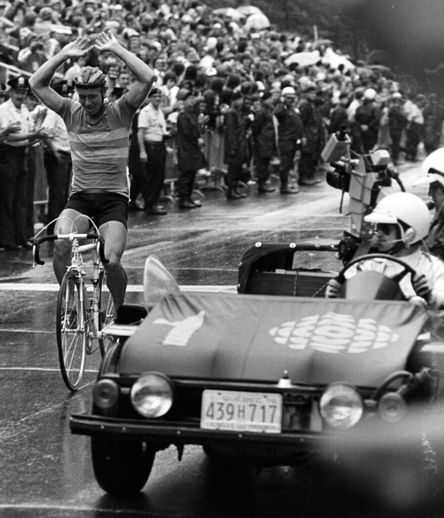
Johansson later turned professional and became a strong stage racer, including a podium finish at the Giro d’Italia. His Montréal victory therefore sits at the junction between two cycling systems: the amateur Olympic world and the professional European peloton.
Within only two years, Mont Royal had hosted both Merckx in rainbow bands and an Olympic champion. Few roads outside Europe could claim comparable cycling significance at the time.
From Steve Bauer to the Modern Grand Prix
The international history of cycling on Mont Royal did not end with the Olympics.
During the late 1980s, professional racing returned to Montréal as part of the emerging international one-day calendar. In 1988, Canadian star Steve Bauer won on Mont Royal, giving the race a local champion during the most successful period of his career.
Bauer had already established himself among the best professionals in Europe, winning an Olympic silver medal in 1984 and later finishing fourth in the Tour de France. His victory on Mont Royal helped reconnect Canadian cycling with a circuit whose global reputation had been built by the 1974 Worlds and 1976 Olympics.
The race did not survive permanently, but the idea of elite cycling on Mont Royal never disappeared. When the modern Grand Prix Cycliste de Montréal was established in 2010 alongside the Québec race, organisers were reviving an existing tradition rather than creating one from nothing.
Robert Gesink won the inaugural edition, and subsequent champions have included riders such as Peter Sagan, Greg Van Avermaet, Michael Matthews and Tadej Pogačar. Their victories added a modern WorldTour layer to a mountain already associated with Merckx, Johansson and Bauer.
The continuity matters. Montréal is not merely a North American city that happens to host a WorldTour race. Mont Royal has been a recurring international cycling stage for more than half a century.
2026 · A Grand Prix Before the World Championships
That history gives the 2026 edition additional significance. The Grand Prix is raced over 16 laps of the 13.4-kilometre Mont Royal circuit, and the same core circuit will return only days later as the decisive part of the 2026 UCI Road World Championships.
Camillien-Houde, Chemin de la Polytechnique and the rise towards Avenue du Parc will therefore be studied twice by the world’s best riders within the space of a few weeks.
For the Grand Prix, the repetition produces 214.4 kilometres and more than 4,300 metres of accumulated climbing. For the World Championships, riders will reach Mont Royal after a different opening phase before entering repeated laps of the same urban terrain.
The relationship between the two races is unusually close. Every acceleration at the Grand Prix reveals something about the roads on which the rainbow jerseys will soon be decided. Teams can observe where groups split, how quickly gaps disappear on the descents and how difficult Camillien-Houde becomes after repeated efforts.
The historical symmetry is difficult to miss. Montréal’s first World Championships in 1974 helped establish Mont Royal as international cycling terrain. Fifty-two years later, the Grand Prix serves as the final major rehearsal before the Worlds return to the mountain.
FOUR LAPS TO GO · 53.6 km
With four laps remaining, 53.6 kilometres still have to be raced. On a point-to-point course that would represent a substantial final journey. Here every road ahead has already been ridden twelve times.
The early laps reward familiarity. Riders learn where they can conserve energy and where positioning matters. Late in the race, familiarity becomes less comforting because everyone knows precisely where the next difficulty is waiting.
By now the circuit has accumulated thousands of metres of climbing without ever leaving the city, and the same urban geography begins producing a much smaller peloton than the one that started.
THREE LAPS TO GO · 40.2 km
At 40.2 kilometres remaining, three circuits are left.
The repeated climbs begin to expose the difference between surviving a course and controlling it. A rider can cross Camillien-Houde comfortably once, perhaps several times, but the accumulated effort changes how the same gradient feels after more than 170 kilometres.
Breakaways that carried minutes earlier in the afternoon can collapse within a single lap. Riders who appeared secure on the early climbs begin losing contact, and attacks become more difficult to retrieve because fewer teammates remain.
This is the same basic principle that made the 1974 World Championship and 1976 Olympic course effective. Mont Royal is not difficult because it is high. It is difficult because the race keeps returning to it.
TWO LAPS TO GO · 26.8 km
At 26.8 kilometres to go, only two laps remain.
Spectators have now watched the peloton pass fourteen times. The crowd on Camillien-Houde begins to understand the race through repetition almost as well as the riders do. The same bend, gradient and approach can be compared from lap to lap while the field gradually changes.
This is where Mont Royal works particularly well as a cycling venue. The mountain was protected during the 19th century partly so that the city’s residents could share access to it, and the Grand Prix turns that public landscape into an enormous temporary arena without enclosing it inside a stadium.
Spectators spread along the park roads and neighbourhood streets, while the race continues circling through a landscape that remains part of everyday Montréal even on its biggest sporting day.
FINAL LAP · 13.4 km Around Mont Royal
The bell leaves 13.4 kilometres.
For the final time, the riders turn towards Camillien-Houde and climb through a park created in the 1870s on rock that solidified deep underground more than a hundred million years ago. They cross a mountain whose surrounding landscape was used by Indigenous communities long before Europeans named it and whose name eventually became the name of Montréal itself.
The circuit passes burial grounds created as the 19th-century city expanded, a university landscape established as major institutions moved onto the mountain, and neighbourhoods shaped by immigration, language and urban growth. Chemin de la Polytechnique rises for the last time before the course returns towards Parc Jeanne-Mance and Avenue du Parc.
By this point, the city is no longer background. The race has spent the entire afternoon moving repeatedly through the same pieces of Montréal, and each lap has exposed another way in which the mountain has shaped the city around it.
One final rise remains before the finish.
FINISH · Avenue du Parc, Fifty-Two Years After Merckx
The GP Cycliste de Montréal finishes on Avenue du Parc after sixteen laps and more than four thousand metres of climbing.
On a map, the route appears almost stubbornly repetitive. The peloton has spent more than two hundred kilometres travelling around the same 13.4-kilometre circuit. Yet the mountain it circles carries an unusual concentration of history.
The landscape preserves evidence of Indigenous occupation and the memory of Hochelaga. Its name became Montréal. Its slopes were divided among farms, cemeteries, universities, hospitals and neighbourhoods before citizens protected part of the mountain as public space. Frederick Law Olmsted tried to shape how a growing industrial city would experience nature here, while later generations built roads through the same park and turned its gradients into one of the most demanding urban circuits in professional cycling.
The sporting history alone now spans more than half a century. Eddy Merckx became world champion on Mont Royal in 1974. Bernt Johansson won Olympic gold here two years later. Steve Bauer carried Canadian professional cycling back onto the mountain in the late 1980s. Since 2010 the modern Grand Prix has brought the WorldTour back every September.
In 2026 that history becomes unusually concentrated. The Grand Prix finishes on 13 September, and within days the world’s best riders will return to Montréal for another World Championship. Once again, Camillien-Houde, Polytechnique and Avenue du Parc will help decide who leaves the mountain wearing rainbow bands.
The Grand Prix therefore ends without really closing Montréal’s cycling story for the year. The WorldTour race is finished, but the mountain is only between championships.



