

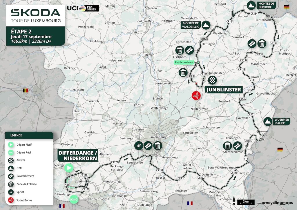
Stage 2 crosses Luxembourg almost from one economic history to another. It begins in Niederkorn and Differdange, inside the Minett, the southern region whose red iron ore transformed Luxembourg from a largely agricultural country into one of Europe’s great steel producers. From there, the race moves east through the centre of the Grand Duchy, reaches the vineyards of the Moselle, climbs away from the river, crosses the old town of Echternach and enters the sandstone valleys of the Mëllerdall, before finishing on a circuit around Junglinster.
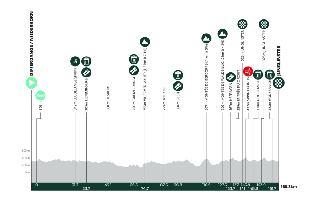
At 166.8 kilometres and 2,326 metres of climbing, the stage is still one of the clearest opportunities of the week for faster riders, but Luxembourg rarely provides completely uncomplicated terrain. The official profile contains three categorised ascents: the Wuermer Mauer above Wormeldange with 92.1 kilometres remaining, the climb to Berdorf at -50 km, and Waldbillig at -39.6 km. The final 25.8 kilometres consist of two laps around Junglinster, Gonderange, Bourglinster, Altlinster and Godbrange, giving the finale repeated changes of gradient rather than a flat approach.
The geographical progression is unusually clear. At the start, hills were cut open for iron ore and threaded with mining railways. Along the Moselle, slopes were reorganised into vineyards. Echternach introduces one of the oldest religious and intellectual centres in the country, while the Mëllerdall replaces cultivated hillsides with sandstone cliffs and narrow ravines created from sediment laid down in ancient seas. Near the finish, the scale changes again. Bourglinster preserves a medieval lordship only a few kilometres from the radio installations that once allowed Luxembourg to reach listeners across much of Europe.
Stage 1 explored the country through castles and river valleys. Stage 2 begins with extraction, moves through cultivation and scholarship, then follows geology into a landscape where Luxembourg’s small physical size once became almost irrelevant.
START · Niederkorn and the Land of the Red Rocks
The neutralised start takes place on Avenue de la Liberté in Niederkorn, part of the municipality of Differdange. After 2.7 kilometres of neutral riding, the race proper begins in Differdange before completing an opening circuit through Soleuvre, Sanem, Niederkorn, Differdange and Oberkorn.
This is the Minett, or Land of the Red Rocks, and the name refers directly to the iron-bearing rock beneath southern Luxembourg. The ore formed part of a much larger deposit extending into neighbouring Lorraine, and its reddish colour came from iron oxides. It was not the richest iron ore in Europe, but it existed in enormous quantities, and once new industrial processes made it economically viable, it changed the country.
Before large-scale industrialisation, Luxembourg remained overwhelmingly rural. During the second half of the 19th century that balance shifted rapidly. Mines opened across the south, railway lines were laid to move ore and coal, furnaces rose beside expanding towns and labour arrived from elsewhere in Luxembourg and increasingly from abroad.
Niederkorn stood inside that industrial system. Just beyond the immediate route lies Fond-de-Gras, once one of the major mining landscapes of the region. Ore extracted from the surrounding hills travelled by industrial railway towards steelworks, while miners entered galleries cut beneath the same ground now crossed by roads, woodland and former industrial tracks.
Mining declined during the 20th century, and the railway serving Fond-de-Gras was severed by a landslide in 1964. The end of extraction did not erase the infrastructure. Historic trains now operate along part of the old network, while a miners’ railway carries visitors into former workings and the surrounding landscape has become a mixture of industrial heritage and recovering nature.
That recovery is now part of the identity of the Minett. Former extraction zones where vegetation was repeatedly stripped away developed into grassland, woodland and ecologically valuable open habitats, and the wider region was designated a UNESCO Biosphere Reserve in 2020.
The stage therefore begins in a landscape changed twice by iron: first when people opened it for extraction, and later when abandoned industrial ground became a new environment of its own.
-157 km · Differdange and the Steel Economy
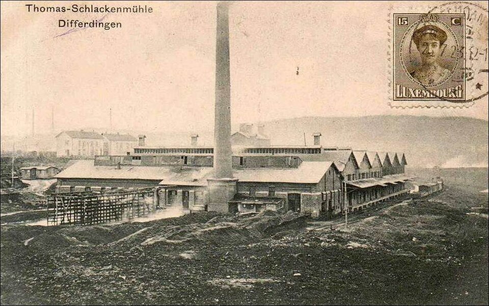
The opening circuit returns through Differdange, one of the towns most closely associated with Luxembourg’s steel industry.
Industrialisation altered more than the local economy. It changed the scale and social structure of the town. Mines supplied ore, railways linked pits to furnaces, and steel production required far more labour than the surrounding population could provide. Workers arrived from across Europe, particularly from neighbouring countries and later from farther south, helping turn the Minett into one of the most culturally mixed regions in Luxembourg.
Differdange became especially associated with heavy structural steel. Large sections rolled here were exported far beyond the Grand Duchy, entering bridges, industrial buildings and major construction projects in other countries.
That international reach is easy to underestimate when standing in such a compact region. The hills around Differdange are geographically modest, yet the material extracted and processed here became part of infrastructure on a continental scale.
Modern Luxembourg no longer depends on mining in the way it once did, but the industrial century remains visible in the arrangement of towns, railways, former pits and surviving works. The race leaves that landscape gradually, moving northeast through Sanem and Limpach towards more open country.
The red ore disappears from view, but Stage 2 will continue to show how often Luxembourg’s landscapes have been reorganised around the resources beneath or upon them.
-135.1 km · Leudelange and the Expanding Capital
At 135.1 kilometres remaining, the RUSH point near Leudelange comes as the race crosses the belt surrounding Luxembourg City.
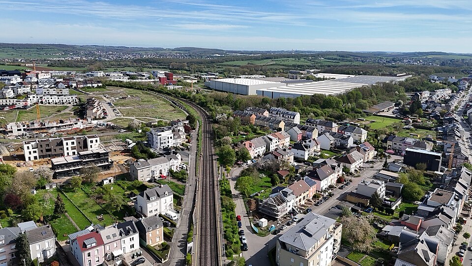
The contrast with the Minett is immediate. Heavy industry recedes, while fields, modern roads, offices and residential development begin sharing the same landscape. Luxembourg City’s growth as a financial and administrative centre has pushed the urban influence of the capital outward into villages that were much more clearly rural only a few generations ago.
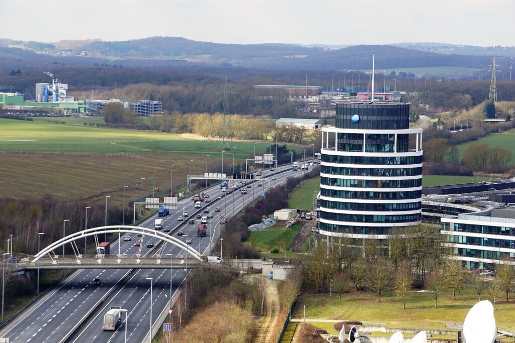
Leudelange reflects that change particularly well. Agricultural land remains close to business parks and major transport routes, while the historic centre of Luxembourg City lies only a short distance to the northeast.
The Tour does not enter the old capital today. Instead, it brushes its southern fringe around Kockelscheuer and continues through Roeser and Weiler-la-Tour, where the landscape gradually becomes more open again.
The road is already beginning to turn towards another part of Luxembourg whose economy has also been shaped by geology, although here the resource was cultivated rather than extracted.
-105.5 km · Stadtbredimus and the Luxembourg Moselle
With 105.5 kilometres remaining, the stage reaches Stadtbredimus beside the Moselle.
The river forms part of Luxembourg’s eastern border with Germany and has supported viticulture for centuries. The vineyards are not simply decorative slopes above the water. They represent a long agricultural adaptation to geology, exposure and river climate.
The character of the valley changes as it runs north. In the southern part of the Luxembourg Moselle, soils tend to contain more clay and slopes are gentler. Farther north, towards Wormeldange and Grevenmacher, limestone and dolomitic formations become more important and the hills rise more abruptly from the river.
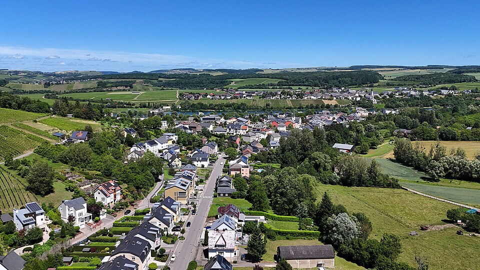
Stadtbredimus occupies one of the calmer stretches of that landscape. The château, wine cooperative and lock belong to different periods of a village shaped by both river transport and viticulture.
The village also has a place in Luxembourg’s literary history. Edmond de la Fontaine, known as Dicks, lived here and became one of the most important early figures in Luxembourgish-language literature and theatre during the 19th century. His work belongs to a period when Luxembourgish was increasingly developing a written cultural identity alongside French and German.
The peloton now leaves the immediate riverbank but remains inside wine country, climbing gradually through villages whose fields have been organised around vines for generations.
-101.6 km · Greiveldange and the Hills Above the Moselle
At 101.6 kilometres remaining, the riders pass Greiveldange, set back from the river in a valley surrounded by vineyard country.
Viticulture here is not limited to the steep slopes visible directly from the Moselle. Villages slightly inland developed around the same agricultural economy, with vines occupying favourable exposures while houses and farms gathered in the lower folds of the landscape.
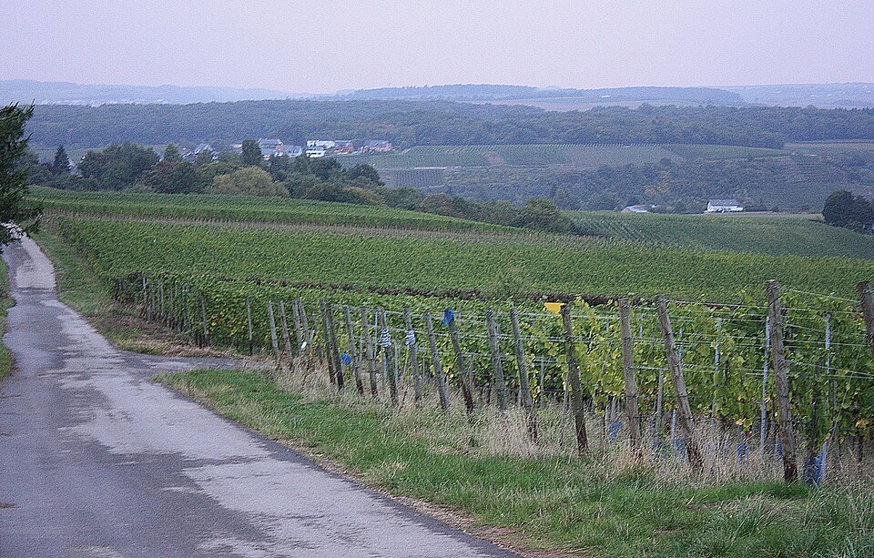
The modern reputation of Luxembourg wine owes much to changes during the 20th century. Earlier production often prioritised volume, and wines were frequently sold outside Luxembourg for blending. Cooperative organisation, improved viticulture and increasingly strict quality systems gradually shifted emphasis towards individual sites, grape varieties and more distinctive local production.
That evolution is visible in the landscape itself. Vineyard rows are highly managed environments, requiring continual pruning, drainage, soil work and seasonal labour. Unlike the scars of mining left behind in the Minett, these slopes are maintained through repeated cultivation.
From Greiveldange, the race continues through Lenningen and returns towards the Moselle at Ehnen and Wormeldange. As the road approaches the river again, the slopes become steeper and the vineyards more dramatic.
-95 km · Wormeldange and the Steep Side of Luxembourg Wine
At roughly 95 kilometres remaining, the peloton reaches Wormeldange, one of the most important wine villages in the Grand Duchy.
Here the Moselle is tightly bordered by vineyard slopes rising above the river. Limestone-rich soils and favourable exposure have helped make the area particularly associated with Riesling, while the river itself moderates local temperatures and reflects light back towards the vines.
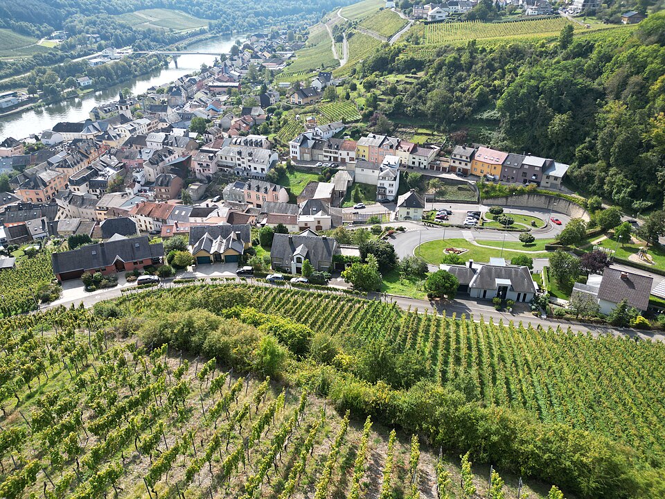
The advantages come with difficulty. Steeper slopes are harder to cultivate and often require more labour than flatter vineyard sites, but the same incline can improve drainage and exposure.
The road uses that geometry directly. After travelling close to the river, it turns sharply uphill through the vineyards and begins the first categorised ascent of the stage.
-92.1 km · Wuermer Mauer, Climbing Out of the Moselle
The Wuermer Mauer reaches its summit with 92.1 kilometres remaining. The road climbs from near river level towards Dreiborn through the steep terrain behind Wormeldange. The Moselle lies at roughly 140 metres above sea level, while the summit is around 255 metres. The altitude is modest, but the road has to gain it quickly.
What makes the climb interesting is not simply the gradient but the landscape it crosses. In the Minett, people cut into hills to remove rock. Here they have carefully organised the slope itself into productive land. Terraces, vineyard rows and access roads follow the same terrain the peloton now climbs.
Once the summit is crossed, the ordered structure of wine country gradually loosens. The route continues through Dreiborn, Flaxweiler, Berg and Biwer, moving away from the Moselle towards a part of Luxembourg whose historical importance came from religion, manuscripts and pilgrimage rather than agriculture.
-65.8 km · Herborn and the Approach to Echternach
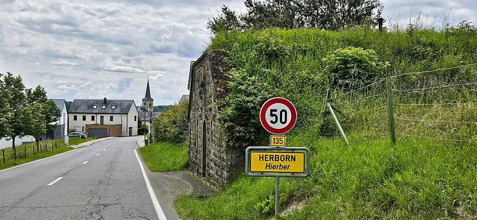
At 65.8 kilometres remaining, the race passes Herborn and begins descending towards the basin of Echternach.
The landscape is already changing beneath the road. Agricultural plateaus remain prominent, but the geology of eastern Luxembourg is beginning to assert itself. Sandstone formations lie ahead, and streams have cut increasingly irregular valleys into the country around Echternach and the Mëllerdall.
The town below developed according to a very different historical logic from the castles and industrial settlements encountered earlier. Its importance grew around an abbey rather than a fortress or mine.
The stage is about to move from one of Luxembourg’s most cultivated landscapes into one of its oldest cultural centres.
-57.5 km · Echternach, Luxembourg’s Oldest Town
With 57.5 kilometres remaining, the peloton enters Echternach, generally regarded as the oldest town in Luxembourg.
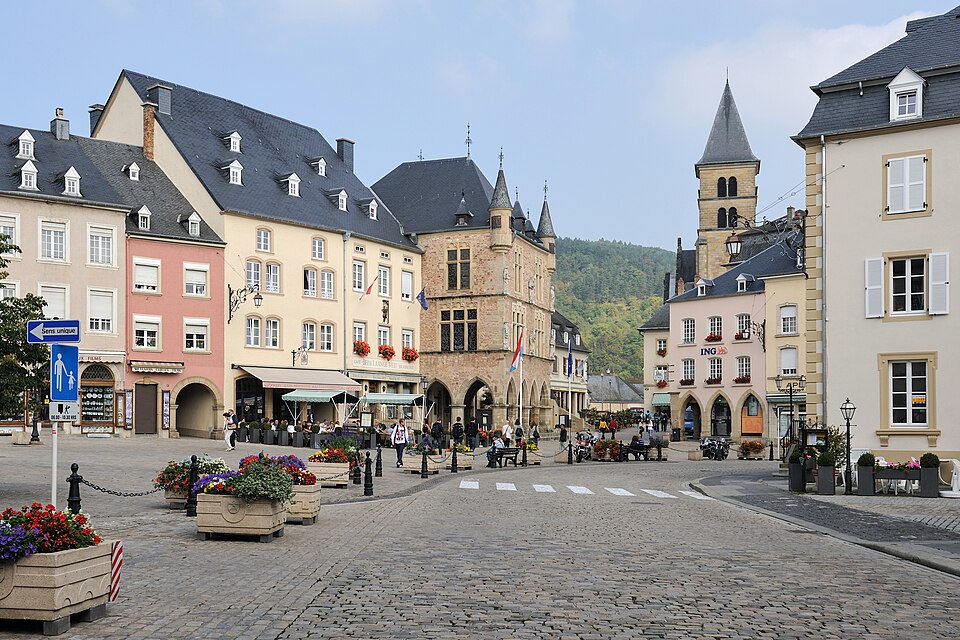
Its history is inseparable from Willibrord, an Anglo-Saxon missionary born in Northumbria during the 7th century. After training in Ireland, Willibrord travelled to the continent as part of the missionary movement into Frisia and the lands around the lower Rhine. In 698, he founded a Benedictine abbey at Echternach.
The site already possessed a much older history. Roman settlement existed in the area, and the remains of a large Roman villa outside the medieval centre show that wealthy landowners had occupied this landscape centuries before the monastery appeared.
Under Willibrord and his successors, the abbey became one of the important religious and intellectual centres of early medieval northwestern Europe. Landholdings and political connections gave it economic power, while its scriptorium became famous for producing illuminated manuscripts.
Books in the early Middle Ages were expensive objects. Parchment had to be prepared from animal skins, pigments produced from specialist materials and every line copied by hand. An illuminated manuscript therefore represented not only religious devotion but wealth, scholarship and access to skilled labour.
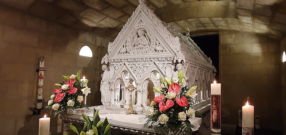
Willibrord died in 739 and was buried at Echternach. His tomb helped turn the town into a pilgrimage centre, and that tradition survives in the Dancing Procession of Echternach, held around Pentecost. Participants move through the streets in coordinated steps towards the basilica, preserving one of Europe’s most unusual religious traditions.
The town itself carries several periods at once. Sections of medieval walls and towers survive. The Church of Saints Peter and Paul incorporates architectural layers on a site with much older origins. The abbey church was reconstructed repeatedly and had to be rebuilt again after severe damage during the Second World War.
The race passes through all of this in only a few minutes before climbing away from Echternach towards a landscape whose history begins hundreds of millions of years earlier.
-50 km · Berdorf and the Sandstone of the Mëllerdall
The second categorised climb reaches Berdorf at -50 kilometres, carrying the race from the low country around Echternach to approximately 377 metres.
This is the entrance to the Mëllerdall, or Mullerthal, a region famous for wooded ravines, cliffs and narrow passages cut through sandstone. Its nickname, Luxembourg’s Little Switzerland, describes the scenery more than the geology. Nothing here is Alpine.
The defining rock was laid down roughly 200 million years ago, when changing seas and coastal environments covered parts of this region. Sand and other sediments accumulated and eventually hardened into sandstone, limestone, dolomite and marl.
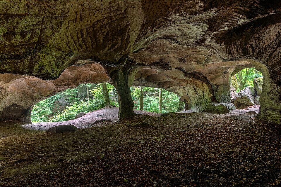
Later uplift exposed those layers. Water entered natural fractures, frost widened them, streams cut downward and gravity pulled weakened blocks apart. Over immense spans of time, the sandstone developed the towers, crevices, overhangs and narrow corridors now associated with the Mullerthal.
Berdorf stands within one of the richest parts of that landscape. Close to the village lies Huel Lee, or Hohllay, whose cavernous form is partly natural and partly the result of quarrying. Stone was extracted there for centuries, particularly for millstones, and circular cutting marks remain visible on the walls.
The detail fits the larger story of the stage. At Niederkorn, geology was mined for iron. At Wormeldange, rock and soil helped determine where vines could grow. Around Berdorf, sandstone became both scenery and raw material.
From the plateau above the village, the road now falls sharply into the valleys beneath the cliffs.
-45.6 km · Vugelsmillen, Down Into the Sandstone Valleys
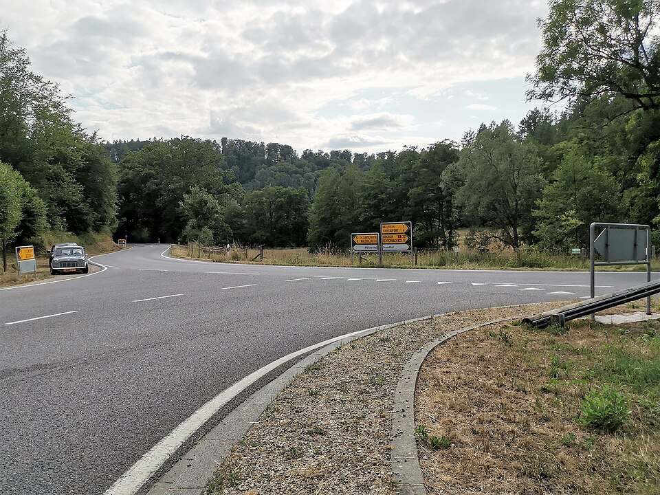
At 45.6 kilometres remaining, the race reaches Vugelsmillen after dropping almost 180 metres from Berdorf.
The descent gives the best sense of how abruptly the Mullerthal changes between plateau and valley. Agricultural land above gives way to enclosed woodland, while sandstone walls approach the road and streams occupy the narrowest ground.
These valleys are modest in absolute scale but unusually dramatic within Luxembourg. Rock faces rise almost directly from the forest, and the available space for roads, paths and water becomes extremely limited.
People adapted to those corridors rather than reshaping them completely. Mills used the streams, quarrying exploited exposed stone and tracks followed the same narrow routes now occupied by modern roads.
The stage is no longer moving from one isolated geological curiosity to another. Berdorf, Vugelsmillen and the Mëllerdall below are all parts of the same eroded sandstone system, seen from different levels.
-41.7 km · Mëllerdall and the Landscape Left by an Ancient Sea
With 41.7 kilometres remaining, the peloton reaches the heart of Mëllerdall. What appears from the road as a forested maze of cliffs and ravines is the result of an exceptionally long geological process. Sediments deposited in ancient seas became rock, later uplift exposed them, and erosion gradually opened fractures into valleys and narrow corridors.
The differences between rock layers mattered. Harder sandstone could remain as walls and isolated blocks while softer material beneath or beside it eroded more quickly. Water then deepened the contrast, cutting channels and destabilising slopes until the landscape acquired the fragmented character seen today.
Forest intensified the visual effect rather than creating it. Trees occupy the ravines and plateaus, but the structure beneath them is geological.
The Mullerthal therefore provides an interesting contrast with the Minett at the start of the stage. Both regions were shaped by sedimentary rock, but people interacted with them in very different ways. In the south, industrial extraction removed enormous quantities of material. Here, human activity tended to occupy the spaces erosion had already created, using valleys for mills, exposed stone for quarrying and plateaus for agriculture.
The road soon has to leave the enclosed valley again. Waldbillig sits above, and the final categorised climb begins almost immediately.
-39.6 km · Waldbillig, Back to the Plateau
The third and final categorised climb reaches Waldbillig with 39.6 kilometres remaining.
The ascent lifts the riders out of the Mullerthal valleys and back towards more open agricultural ground. It is not especially long, but by now the stage has accumulated more than two thousand metres of climbing through repeated transitions between river, plateau and valley.
Waldbillig belongs to the same wider landscape even if it feels less dramatic than Berdorf below. The commune contains both open farmland and some of the enclosed forested country associated with the Mëllerdall, demonstrating how quickly the terrain can change within a few kilometres.
After the summit, the road passes Christnach and Heffingen, and the sandstone scenery gradually recedes behind the race.
The final part of Stage 2 introduces a different kind of history altogether.
-30.2 km · Godbrange and the Approach to Junglinster
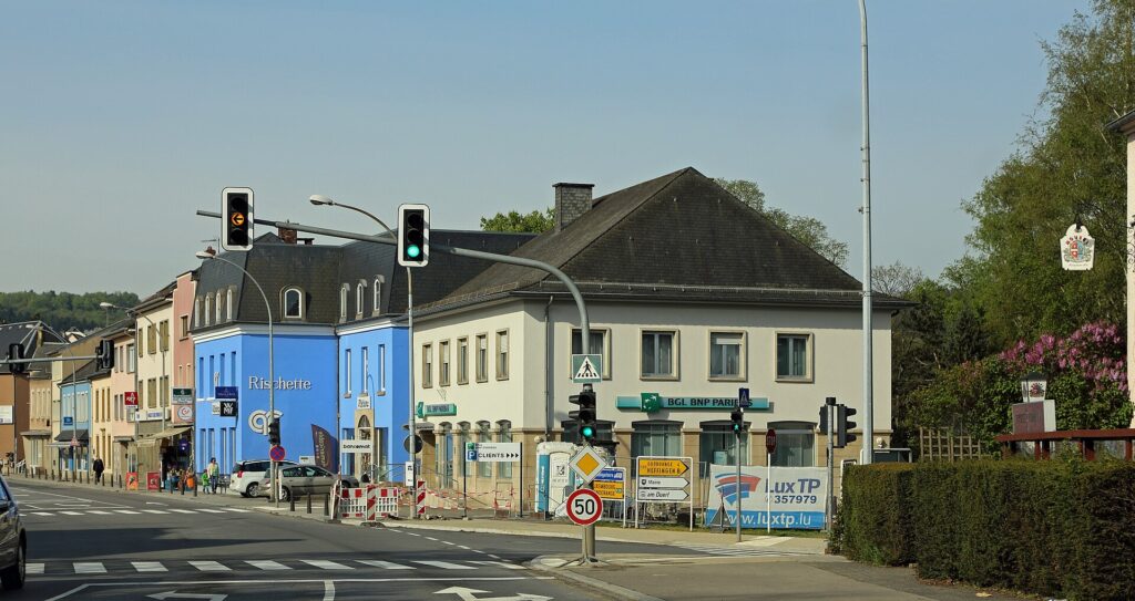
At 30.2 kilometres remaining, the riders pass Godbrange and enter the municipality of Junglinster.
The landscape is now more open, with villages and fields replacing the enclosed ravines of the previous twenty kilometres. At -29.9 km, the race joins the finishing circuit and begins the sequence that will carry it twice through Junglinster, Gonderange, Bourglinster, Altlinster and Godbrange.
The terrain appears almost ordinary after the geological drama of the Mullerthal, but the skyline around Junglinster contains structures connected with one of Luxembourg’s most unusual international stories.
For much of the 20th century, radio transmitters here allowed programmes produced in a very small country to reach audiences across national borders.
TWO LAPS TO GO · -25.8 km · Junglinster and Radio Luxembourg
The riders cross the finish line in Junglinster with 25.8 kilometres remaining, beginning two laps of the 12.9-kilometre circuit.
Commercial broadcasting in Luxembourg developed during the 1920s, when François Anen and his brother Marcel experimented with radio transmissions from Luxembourg City. Their work eventually fed into a more ambitious project backed by investors who understood the unusual advantages of broadcasting from the Grand Duchy.
Construction of a powerful transmitter at Junglinster began in 1931, and regular Radio Luxembourg services followed during the early 1930s. The location was important because radio waves did not respect the same borders as newspapers or national broadcasting licences.
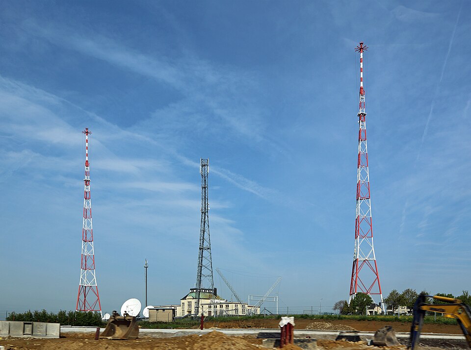
Many European countries maintained strict state control over radio. Broadcasting commercially from Luxembourg created a way around those systems, allowing programmes produced in one jurisdiction to reach listeners in another.
Radio Luxembourg eventually transmitted in several languages and became especially significant in Britain. Radio Luxembourg 208 offered popular music and commercial programming at times when the BBC provided much less of it, making the station part of the cultural memory of generations of listeners.
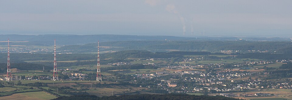
The technology evolved. Medium-wave broadcasting aimed at Britain later moved to Marnach, while new long-wave facilities at nearby Beidweiler assumed the principal role for other services. Junglinster nevertheless remained part of the network, and its masts still rise over countryside that gives little indication of how far their signals once travelled.
The race leaves the finish line towards Gonderange and Bourglinster, where the scale of power becomes much smaller again.
-22.1 km · Bourglinster, Eight Centuries of Reuse
With 22.1 kilometres remaining, the first lap reaches Bourglinster, where a castle stands above the village on a rocky site.
The origins of Bourglinster Castle go back to the 12th century, when it served as the centre of the lordship of Linster. The oldest surviving parts include remains of a Romanesque keep and early domestic structures, while Gothic and later Baroque additions record the way the complex continued to evolve.
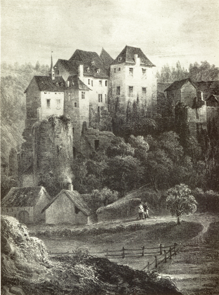
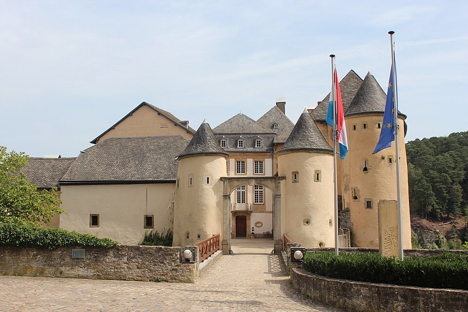
“Bourglinster Castle, past and present” — Left: historical illustration by Nicolas Liez / Wikimedia Commons, Public Domain. Right: Photo: Cayambe / Wikimedia Commons, CC BY-SA 3.0. Composite modified.
The castle suffered during the conflicts of the 16th and 17th centuries and gradually lost its military importance. What followed is almost more interesting than the period of defence.
From the mid-19th century until 1968, substantial parts of the castle were used as a farm. Defensive architecture, aristocratic rooms and service buildings were adapted to agricultural life, preserving the site through use rather than through formal conservation.
When the Luxembourg state acquired the complex, restoration continued for around two decades. The work did not attempt to return everything to a single medieval moment. Instead, different periods remained visible while the castle received new public functions.
Today Bourglinster hosts cultural events, conferences and restaurants, while former service spaces have been adapted for contemporary uses.
Its history contrasts sharply with the radio infrastructure only a few kilometres away. Medieval authority here was intensely local, concerned with land and villages immediately surrounding the castle. The transmitters at Junglinster were designed to ignore that scale completely and send information far beyond anything visible from the tower of a lordship.
The race drops through Altlinster, passes Godbrange and returns to the finish.
FINAL LAP · -12.9 km · Junglinster, Bourglinster and the Last Circuit
At 12.9 kilometres remaining, the riders cross the line in Junglinster for the second time and begin the final lap.
The circuit is short enough that its historical contrasts sit almost beside one another. Junglinster belongs to the technological optimism of 20th-century broadcasting. Bourglinster belongs to a political world organised through local lordships, estates and fortified residences. Between them lie Gonderange, Altlinster and Godbrange, villages surrounded by farmland despite being less than twenty kilometres from the capital.
The sporting situation is likely to tighten on this final passage. Stage 2 offers the sprinters one of their better opportunities, but the finishing circuit never becomes completely flat. The road rises through Gonderange and towards Bourglinster before descending through Altlinster, making control more demanding than the final distance alone suggests.
Bourglinster appears for the second time with 9.2 kilometres remaining. The road then leaves the medieval castle behind and begins turning back towards the modern finish at Junglinster.
-4.8 km · Godbrange and the Last Run to the Line
At 4.8 kilometres remaining, the race reaches Godbrange for the final time. The repeated climbs are now behind the riders, and the circuit begins to favour speed and organisation. Teams with a sprinter move forward, gaps become more difficult to maintain and the road funnels the race back towards Junglinster.
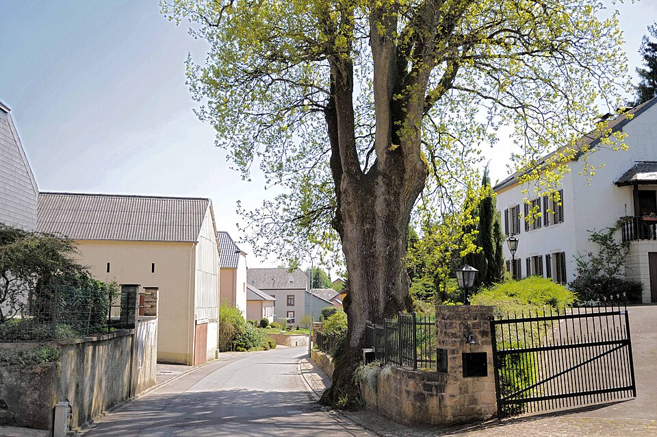
The visual markers of the finish are unlike those encountered earlier in the stage. There are no mine headframes, vineyard terraces, monastery towers or sandstone walls. Instead, the long vertical lines above the countryside belong to radio infrastructure.
The contrast does not need to be forced. It has been built by the route itself. Luxembourg’s industrial south relied on material taken from the earth. Junglinster became known for something that travelled without roads, rails or rivers.
FINISH · Junglinster, From Iron Ore to Radio Waves
Stage 2 finishes on the Route de Luxembourg in Junglinster after 166.8 kilometres and a journey through several radically different uses of the Luxembourg landscape.
The race began in the Minett, where red iron ore reshaped the country’s economy and society. Mines, industrial railways and steelworks turned southern Luxembourg into one of Europe’s important metallurgical regions and brought workers from across the continent. When extraction ended, the pits, rail alignments and spoil heaps remained as evidence of a period when prosperity depended on what could be removed from beneath the ground.
The Moselle presented almost the opposite relationship with geology. Around Stadtbredimus, Greiveldange and Wormeldange, rock and soil remained in place but determined how hillsides were cultivated. Generations of winegrowers organised slopes into vineyards, and the Wuermer Mauer carried the peloton directly through that agricultural landscape.
At Echternach, the route entered another network entirely. Willibrord’s abbey connected a small settlement beside the Sûre with the religious and intellectual world of early medieval Europe. Manuscripts created there travelled through networks of monasteries and courts long before Luxembourg existed as a modern state, while the Dancing Procession still preserves the town’s role as a place of pilgrimage.
Beyond Echternach, human history became subordinate to a much older one. Sand deposited in ancient seas hardened into sandstone, and erosion opened that rock into the cliffs, ravines and passages of the Mëllerdall. Berdorf, Vugelsmillen and Waldbillig are not separate curiosities but different parts of the same geological system, seen from plateau, valley and climb.
The final circuit then brings the scale of history back towards people. Bourglinster preserves a medieval lordship that survived partly because its buildings continued to be used, even as a farm. A few kilometres away, Junglinster belongs to a completely different understanding of distance.
From the radio installations here, programmes once crossed borders and entered millions of homes. Luxembourg’s territory remained tiny, but its signal did not.
That makes Junglinster an unusually appropriate finish. Stage 2 begins with Luxembourg digging into the earth for the resource that built its industrial economy and ends where Luxembourg once transmitted its voice across a continent.



