
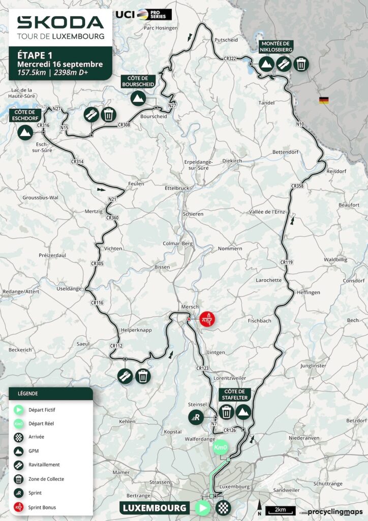
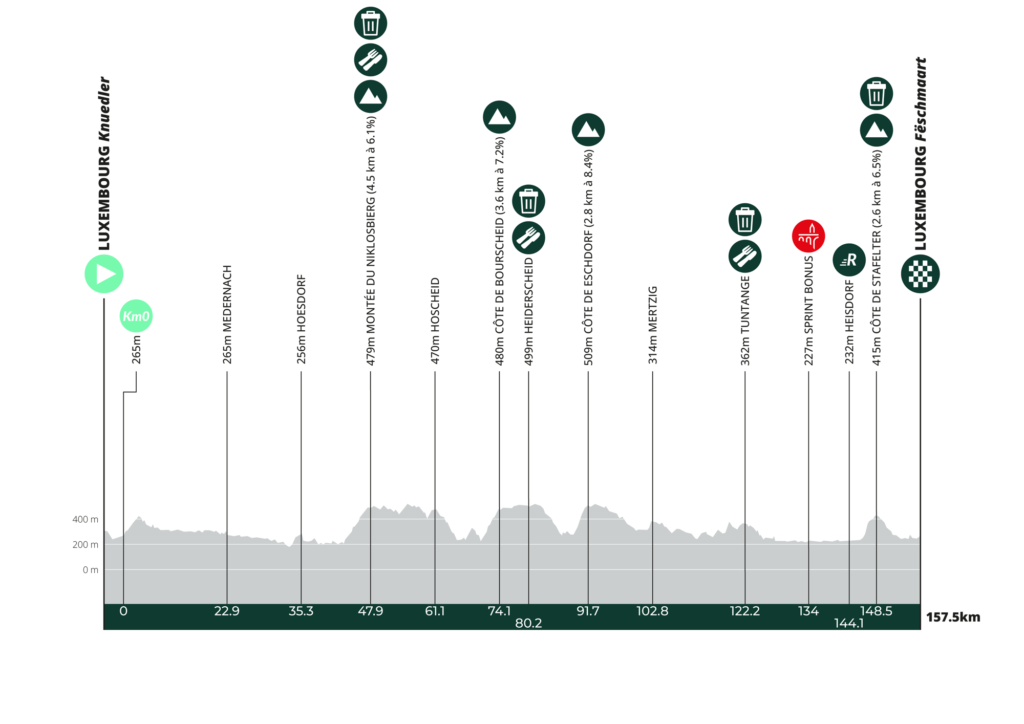
The Tour de Luxembourg begins and ends in the capital, but Stage 1 is anything but a city loop. After the neutral start at Knuedler, the race leaves Luxembourg City and spends 157.5 kilometres crossing a remarkably dense concentration of landscapes and medieval strongholds before returning to the old centre at Fëschmaart. The official route climbs almost 2,400 metres and includes four categorised ascents: Niklosbierg, Bourscheid, Eschdorf and, with only 9.1 kilometres remaining, Stafelter.
For a country covering barely 2,600 square kilometres, Luxembourg contains a surprising amount of geographical variety. The north, known as the Éislek or Oesling, belongs to the Ardennes and is characterised by wooded plateaus cut by narrow river valleys. Farther south, the country becomes more open and agricultural, but rivers such as the Sûre, Alzette and their tributaries continue to organise settlement. Castles appear so frequently along the route because this small territory spent much of its history divided among noble families and positioned between larger political powers. Strongholds controlled valleys, roads and river crossings, while Luxembourg City itself eventually developed into one of the greatest fortress cities in Europe.
Stage 1 traces that history almost from beginning to end. Larochette rises above the White Ernz. Vianden occupies one of the great medieval sites of the country. Bourscheid stands 150 metres above a bend of the Sûre. Esch-sur-Sûre compresses an entire fortified settlement into an extraordinary loop of river and rock. Useldange and Hollenfels carry the story of lesser lordships farther south, before the final kilometres return through the Alzette valley towards the fortress from which the country itself took its name.
The peloton leaves Luxembourg City in search of castles and valleys, then comes back to the place where the story of Luxembourg began.
START · Knuedler and the City That Gave a Country Its Name
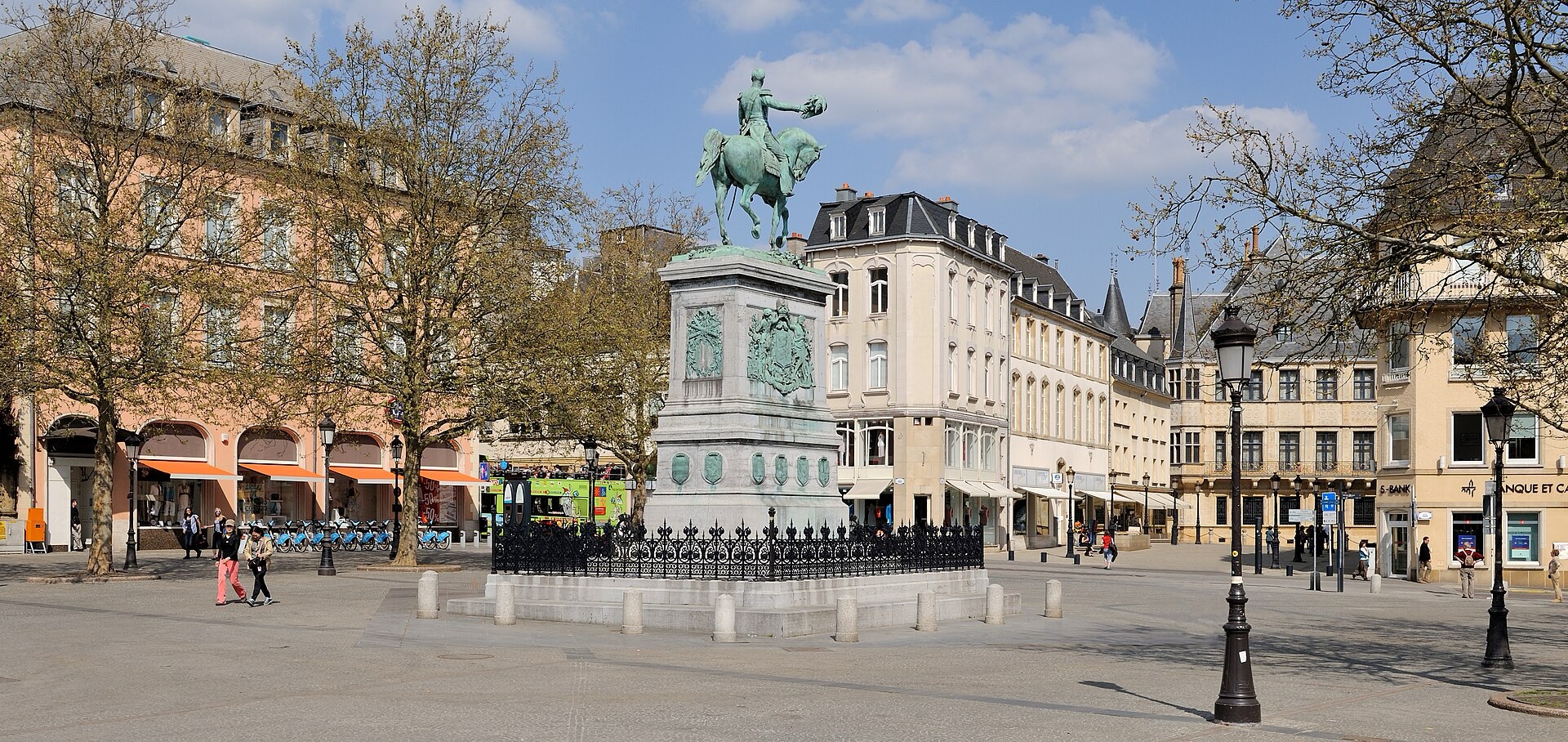
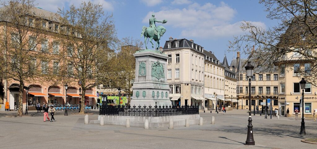
The neutral start takes place at Knuedler, the Luxembourgish name for Place Guillaume II, in the administrative heart of the capital. Today the square is associated with the city hall, markets and civic events, but the landscape around it belongs to a city whose origins are inseparable from defensive geography.
Luxembourg’s foundation is traditionally traced to 963, when Count Siegfried acquired a rocky promontory above the Alzette through an exchange with the Abbey of Saint-Maximin in Trier. A small stronghold called Lucilinburhuc already existed in the area, and Siegfried established his castle on the Bock, a steep rock protected naturally by the valleys around it. From that fortification grew a settlement, then a city, then a county and duchy, and eventually the modern state whose name preserves the memory of the original castle.
The terrain explains why the site mattered. The Alzette and Pétrusse had cut deep valleys around the upper plateau, leaving only the western side relatively exposed. Medieval walls strengthened those natural defences, and successive rulers expanded them as the city grew. By the 12th century a second enclosure had been constructed, while further fortification during the 14th century brought parts of the lower settlements within the defensive system.
Luxembourg’s political position made those walls increasingly important. Burgundians captured the city in 1443. The Habsburgs inherited it. French forces under Louis XIV took it in 1684, after which Vauban transformed the defences. The city later returned to Habsburg control, became a French fortress again after the Revolutionary Wars, and after 1815 housed a Prussian garrison as part of the German Confederation.
By the 18th century Luxembourg had acquired the nickname “Gibraltar of the North.” Its fortifications spread far beyond the medieval walls, with bastions, forts and underground casemates adapting the dramatic natural landscape to the age of artillery.
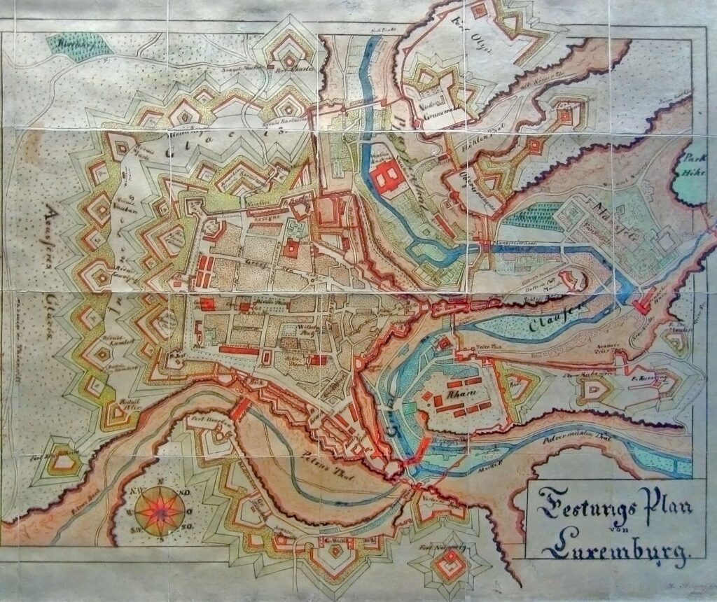
The neutralised peloton leaves this fortress plateau through the same geography. From Knuedler it descends towards Eich and Dommeldange, dropping out of the upper city before the official race begins at the Alvisse Parc Hotel. The first kilometres therefore reverse Luxembourg City’s historical logic: instead of climbing towards the safety of the fortress, the riders leave it behind.
-137.7 km · Larochette and a Castle Above the White Ernz
At race kilometre 19.8, with 137.7 kilometres remaining, the route reaches Larochette, where the ruins of a medieval castle stand about fifty metres above the valley of the White Ernz.
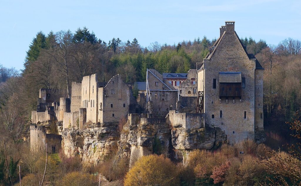
The location is characteristic of Luxembourg’s feudal landscape. The castle occupies a promontory of Luxembourg sandstone overlooking both the village and the river corridor below. The earliest structures date from the 11th century, and the complex developed not as a single compact residence but as a fortified site containing several noble houses.
The rock beneath the castle is as important as the walls above it. Luxembourg sandstone forms some of the country’s most distinctive cliffs and wooded ridges, particularly around the Mullerthal region. Erosion cut valleys through that relatively resistant stone, leaving elevated promontories such as the one above Larochette. Medieval lords required no geological terminology to understand the advantage. A castle built here commanded the road and valley naturally.
Larochette’s castle expanded as several noble families established their own residences within the fortified enclosure. The surviving ruins include the houses of Hombourg and Créhange, reminders that castles were not always the homes of a single lord and household but could contain several branches of aristocratic power behind the same walls.
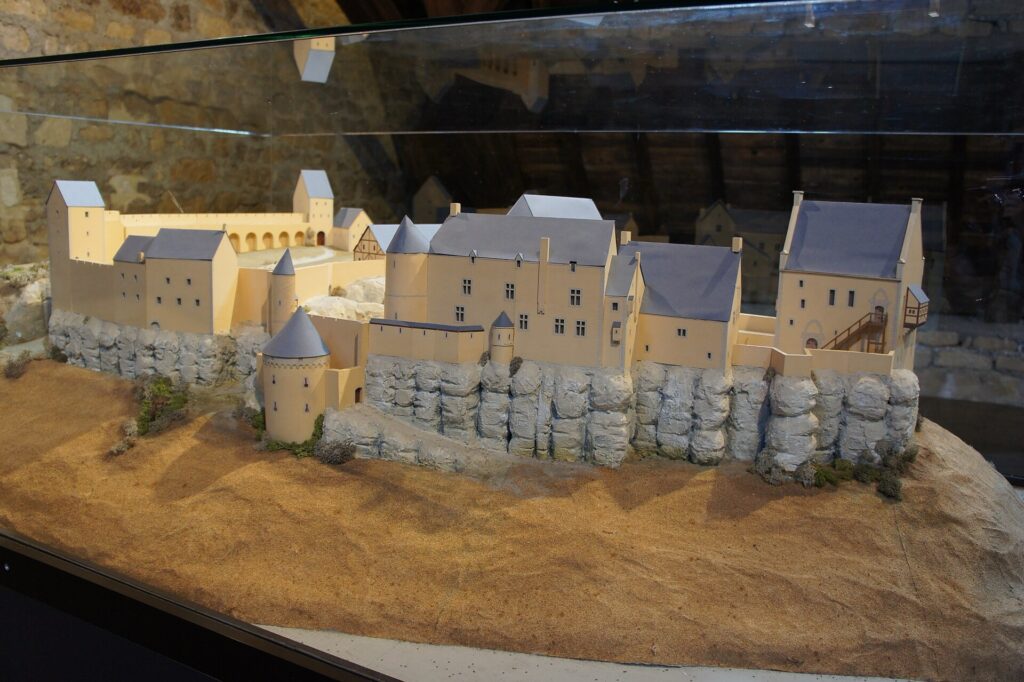
A major fire in 1565 devastated the complex. The site was never fully restored to its earlier form, and much of what remains today is ruin, although the Créhange house was substantially reconstructed during the 20th century.
The race passes beneath a fortress whose military usefulness came directly from the shape of the valley, and the same relationship between water and elevation will continue to organise much of the northern half of the stage.
-125.4 km · Reisdorf and the Sûre, Gateway to the Éislek
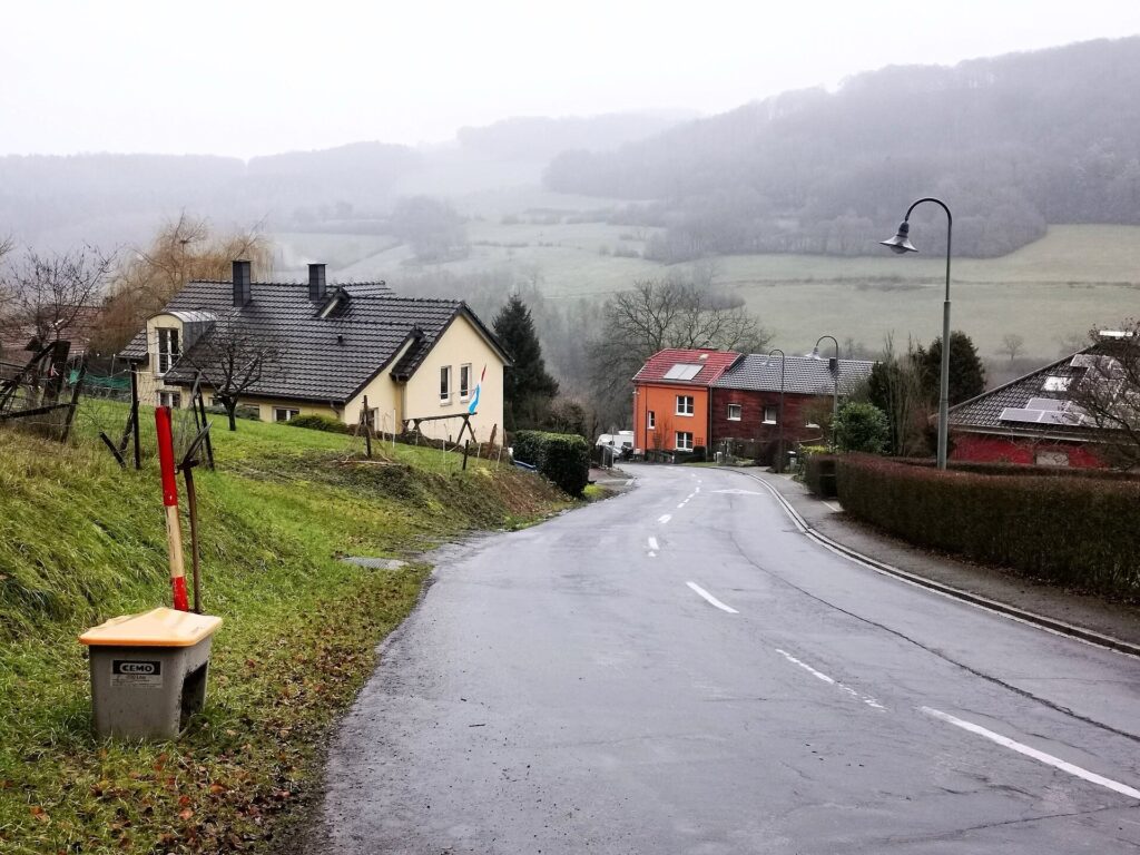
By Reisdorf, with 125.4 kilometres to go, the route reaches the Sûre, one of the principal rivers of Luxembourg and the first clear threshold into the more deeply cut landscapes of the north.
The Sûre rises in Belgium and crosses the Grand Duchy before joining the Moselle. Through northern Luxembourg, it and its tributaries have carved into the Ardennes plateau, creating a landscape of narrow valleys, wooded slopes and settlements constrained by the limited flat ground beside the water. Roads often follow the rivers because the alternatives involve climbing abruptly onto the plateau above.
Reisdorf sits where that river geography becomes increasingly important. From here, the race begins moving through a landscape in which the easiest route is rarely the shortest one, because valleys dictate direction and every escape from them costs elevation.
The distinction matters visually as well. The open country closer to the capital gradually gives way to the Éislek, where forest thickens on steeper slopes and settlements become more closely tied to river corridors. The stage is not entering high mountains, but it is entering a region where altitude differences accumulate quickly because water has cut so deeply into the plateau.
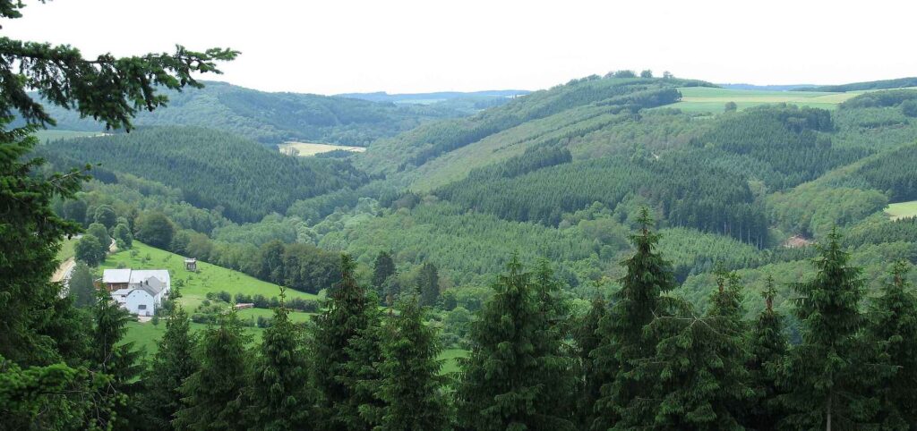
“Landscape of the Éislek near Pont-Misère, Luxembourg” — Photo: Johnny Chicago / Wikimedia Commons, CC BY-SA 3.0
Vianden lies ahead on the Our, another river valley shaped by the same northern geography. The road begins to feel more enclosed, and the castles become more dramatic because the landscape itself is doing more of the defensive work.
-115.3 km · Vianden, a Feudal Residence Above the Our
With 115.3 kilometres remaining, the peloton enters Vianden, one of the most historically important towns on the entire Tour.
The castle above the town dominates the valley so completely that it appears almost inseparable from the rock beneath it. The present complex developed between the 11th and 14th centuries, built over earlier Roman and Carolingian remains, and became one of the largest Romanesque and Gothic feudal residences in Europe.
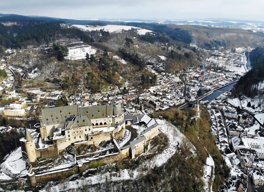
The Counts of Vianden were not minor local lords living at the margins of European politics. Their family maintained connections with both the French royal world and the imperial aristocracy of the Holy Roman Empire. The castle consequently developed beyond the requirements of a simple defensive stronghold, incorporating large ceremonial and residential spaces reflecting the status of its owners.
Its position above the Our valley remained fundamentally strategic. Rivers provided routes through otherwise difficult terrain, and controlling an elevated site above such a corridor brought both defensive and economic advantages.
Vianden’s later history is almost as striking as its medieval development. During the 19th century the castle was allowed to deteriorate, and in 1820 it was sold in a way that resulted in parts of the complex being dismantled and its materials dispersed. A monument that now appears almost impossibly complete became, for much of the century, a spectacular ruin.
The Grand Ducal family eventually regained ownership, but large-scale restoration came much later. In 1977, the castle passed to the Luxembourg state, after which reconstruction transformed the site again. The building visible above the race today is therefore both medieval monument and modern reconstruction, an attempt to recover the architectural coherence of a castle that had nearly been lost.
The peloton leaves Vianden and immediately confronts the first categorised ascent of the Tour.
-109.6 km · Niklosbierg and the Climb Above Vianden
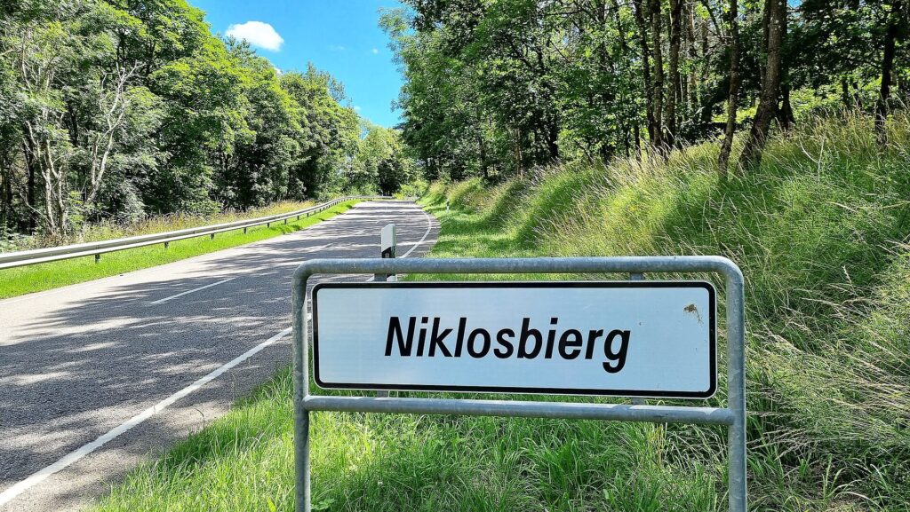
The summit of Niklosbierg comes with 109.6 kilometres remaining, after the road climbs sharply away from Vianden and the Our valley.
The sporting difficulty is obvious from the profile, but the landscape explains why the climb arrives so abruptly. Vianden sits low in the valley, enclosed by steep ground. Once the road leaves the river, it has little choice but to gain elevation quickly in order to reach the plateau above.
This is one of the defining patterns of the Éislek. The terrain is not high by Alpine standards, yet the valleys are incised deeply enough that a rider can move from river level to exposed plateau in only a few kilometres. The result is a stage whose climbing total is built through repeated transitions between valley floor and upland rather than through one monumental ascent.
Niklosbierg is the first place where that northern geography becomes fully visible in the race itself. The road rises, the valley falls away behind, and the Tour begins accumulating altitude almost as soon as it leaves one of the country’s most important medieval towns.
-83.6 km · Bourscheid and Luxembourg’s Great Castle Above the Sûre
At 73.9 kilometres raced, with 83.6 kilometres remaining, the peloton reaches Bourscheid. The categorised Côte de Bourscheid follows almost immediately, but below the road stands one of the most imposing medieval fortifications in Luxembourg.
Bourscheid Castle occupies a slate promontory approximately 150 metres above the Sûre, with steep slopes protecting most approaches naturally. The site had strategic value long before the surviving walls were constructed. Archaeological investigation has identified traces from Roman, Merovingian, Carolingian and Ottonian periods, suggesting repeated occupation or use of the height.
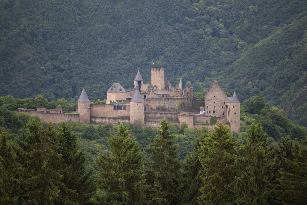
A more recognisable castle emerged around the year 1000, and the first lord associated with the name Bourscheid appears in documents in 1095. Over subsequent centuries the fortress expanded substantially. An outer curtain wall completed during the 14th century enclosed a large irregular complex reinforced by towers, while residential buildings developed within.
The finished castle covered roughly 12,000 square metres, an extraordinary scale for a country of Luxembourg’s size. Eleven towers and multiple defensive walls exploited the geometry of the rocky spur, leaving only one comparatively accessible side to defend strongly.
The Sûre loops below the fortress, and from the heights the logic is obvious. Movement through the valley could be watched and controlled from above. The same relationship between river and rock already encountered at Larochette and Vianden appears here in even more dramatic form.
The race then climbs to the plateau, crossing the Côte de Bourscheid with 83.4 kilometres remaining. By now the reader no longer needs to be told why so many castles stand above rivers in northern Luxembourg. The stage itself has made the pattern clear.
-69 km · Esch-sur-Sûre, a Village Trapped Inside a River Bend
With 69 kilometres remaining, the route reaches Esch-sur-Sûre, perhaps the most visually remarkable settlement of the stage.
The village occupies a narrow loop of the Sûre, almost enclosed by the river beneath a rocky height carrying the ruins of the castle. The geography is so compressed that streets, houses, water and rock seem to occupy the same limited space.
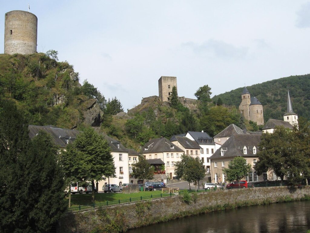
The place appears in written sources as early as the 8th century, while the castle is documented from 927, making it one of the oldest fortified sites in Luxembourg. The Lords of Esch developed the fortress above the river, and between roughly 1050 and 1292 it became an important noble residence.
Again, the position did much of the defensive work. The Sûre wraps around the settlement while the castle stands above on rock, allowing the valley to be watched and reducing the directions from which an enemy could approach easily.
After the death of Gottfried IV of Esch in 1292, the estate was divided between several families and gradually lost political importance. The castle deteriorated and eventually became a source of building material for the village itself, stones from a feudal stronghold literally descending into later houses.
Esch-sur-Sûre also records another economic history. Cloth production developed beside the river, and a former textile factory survives today as part of the regional nature-park centre. The transition from castle to cloth links the medieval valley with the small-scale industry that later developed in many European river settlements.
The road leaves the village almost as dramatically as it entered, climbing away from the river towards Eschdorf.
-65.8 km · Côte d’Eschdorf and the Plateau Above the Sûre
The Côte d’Eschdorf reaches its summit with 65.8 kilometres remaining, lifting the race from the tightly enclosed Sûre valley back onto higher ground.
The contrast is immediate. Esch-sur-Sûre sits around 280 metres above sea level, while Eschdorf rises above 500 metres. The distance between them is short enough that the climb feels less like a gradual ascent and more like an escape from the river corridor.
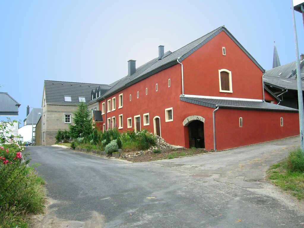
This is what gives northern Luxembourg its distinctive rhythm. The stage is not defined by altitude in the absolute sense, but by repeated vertical changes forced by deeply cut valleys. Every time the race leaves water behind, it has to recover the plateau above it.
By Eschdorf, that pattern has accumulated into much of the day’s climbing total. The road now begins to open gradually towards central Luxembourg, and the medieval fortress landscape starts giving way to a broader agricultural one.
-49.4 km · Vichten and a Roman Mosaic Beneath the Fields
With 49.4 kilometres remaining, the race passes Vichten, where one of Luxembourg’s most important Roman archaeological discoveries was made beneath an apparently ordinary agricultural landscape.
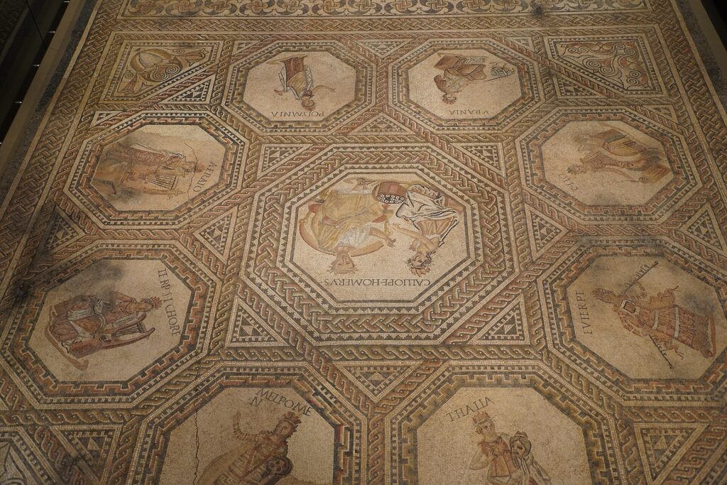
In 1994, construction work uncovered the remains of a Roman villa and an exceptional mosaic floor. The mosaic, dating from around the third century AD, depicts the Nine Muses, the classical figures associated with poetry, history, music, astronomy and the arts.
The quality of the work indicates considerable wealth and cultural ambition. Rural Luxembourg during the Roman period was not isolated from the intellectual imagery of the wider empire. An owner living here could decorate a residence with a sophisticated mythological programme recognisable from other parts of Roman Europe.
The villa belonged to the agricultural landscape supplying the Roman economy. Estates such as this combined farming with elite residence, and roads connected them to larger settlements and trading systems extending through Gaul and the Rhine frontier.
The discovery is especially effective because so little of that world is visible from the modern road. The peloton passes fields and houses rather than standing Roman monuments, while beneath the ground lies evidence of a wealthy estate connected culturally with the Mediterranean world almost eighteen centuries ago.
After a long sequence of medieval castles, Vichten changes the scale of time without changing the landscape very much at all.
-44.7 km · Useldange, a Castle Rebuilt by an Emigrant Returning from America
At 44.7 kilometres to go, the riders pass Useldange, where the ruins of another medieval castle contain an unusually modern chapter.
The lordship of Useldange emerged around 1100, with Theobald of Useldange among its earliest recorded lords. Over the following centuries the castle passed between families as inheritance, marriage and political conflict repeatedly altered control.
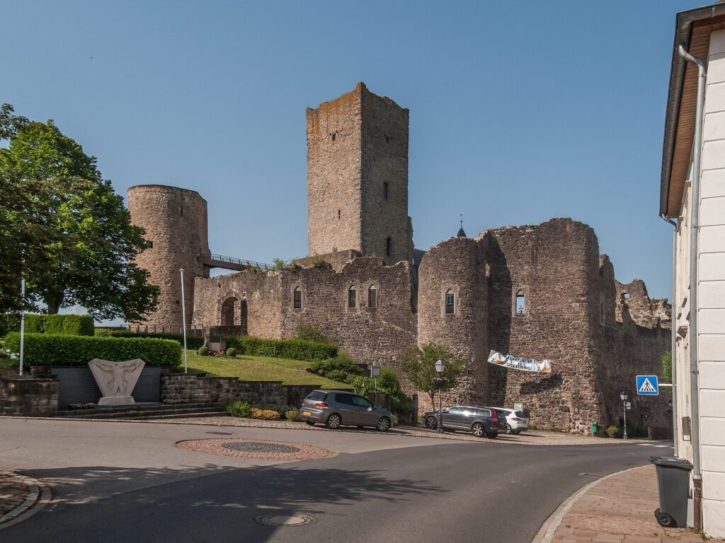
The wars between France and Burgundy during the late Middle Ages affected the fortress particularly severely. In 1479, Maximilian I confiscated Useldange and transferred it to Christopher of Baden, while the castle itself suffered damage during the political turbulence of the period.
Its importance eventually declined. By the 17th century ownership had changed again, and as feudal structures weakened the castle deteriorated until parts of the ruins were used as a quarry.
The story might have ended there if not for Mrs Kuhn-Wolff, a woman born in Useldange who had emigrated to the United States at nineteen. In 1924, she bought the ruins and returned to her native village, beginning work intended to stabilise and revive the site.
The restoration did not follow the preservation standards expected today. Parts of the medieval complex were altered substantially, and by the 1930s a modern villa had replaced sections of the old palace and gateway. That villa now serves as the town hall.
Useldange therefore contains two different ideas of heritage within the same walls: the remains of medieval lordship and a 20th-century emigrant’s attempt to recover a piece of the village she had left behind.
The castle has since acquired another distinctive role through a cultural trail designed for visually impaired visitors, using tactile models, Braille and sensory interpretation to make a medieval site accessible in ways its original builders could never have imagined.
-33.7 km · Hollenfels and the Valley of the Seven Castles
With 33.7 kilometres remaining, the route reaches Hollenfels, one of the castles of the Eisch valley, often known as the Valley of the Seven Castles.
The fortress stands on a rocky spur above the narrow valley, at roughly 315 metres altitude. Its most striking feature is the keep, rising almost forty metres above the site, accompanied by a curtain wall, residential buildings and defensive works approached across a bridge spanning the former ditch.
The concentration of castles in the Eisch valley reflects the political fragmentation of medieval Luxembourg. Noble families did not need enormous territories to justify fortified residences. Local control of land, villages, crossings and agricultural revenues was enough to produce a landscape dotted with lordships only short distances apart.
The valley eventually accumulated castles at Mersch, Schoenfels, Hollenfels, Ansembourg, Septfontaines and other nearby sites, creating an extraordinary density of aristocratic architecture within a relatively small area.
Hollenfels also illustrates how the purpose of such buildings can change. The castle became associated in modern times with youth and environmental education rather than feudal defence, giving a fortress built to separate lord from landscape a role based on opening that landscape to students and visitors.
From here the race continues towards Mersch and the Alzette valley, where the terrain becomes broader and the return towards the capital begins to feel inevitable.
-25 km · Mersch and the Centre of Luxembourg
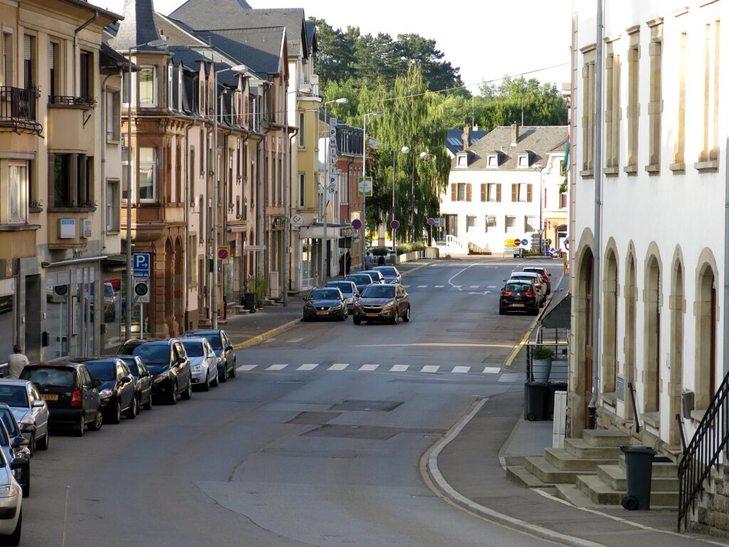
At 25 kilometres remaining, the riders enter Mersch, close to the geographical centre of the Grand Duchy.
The town developed where several transport routes and river valleys meet, including the Alzette, which will now guide the race south towards Luxembourg City. The importance of that corridor is older than the modern roads beside it. The river connects central Luxembourg with the capital and ultimately forms part of a wider system leading north towards the Sûre.
Mersch has its own castle, although its present appearance owes much to rebuilding and later civic use rather than the dramatic military architecture seen earlier in the stage. That change in scale matches the landscape. The tightly enclosed valleys and rocky strongholds of the Éislek are behind the race, and the country around Mersch is more open.
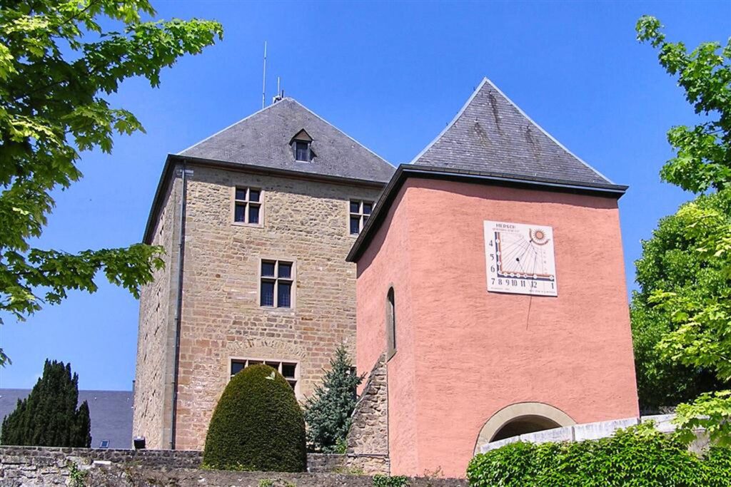
A bonus sprint comes with 23.5 kilometres remaining, but the more significant shift is geographical. The broad northern loop is finished. From here the route follows the Alzette south, and every kilometre brings the peloton closer to the capital.
-13.4 km · Heisdorf and the Alzette Corridor
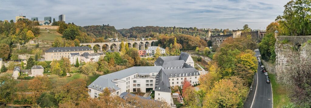
At 13.4 kilometres remaining, the race passes the RUSH point near Heisdorf, with the Alzette valley carrying the peloton almost directly towards Luxembourg City.
The road is easier to read here than it was in the Éislek. River, railway and major road all share the same north-south corridor because the valley already provides the most convenient route through the surrounding terrain.
That convenience encouraged modern settlement to stretch along the Alzette. Villages gradually became part of the capital’s suburban and commuter landscape, creating a continuous relationship between Luxembourg City and communities that once felt much more separate.
The route is nearly home, but the organisers have kept one final climb between the riders and the old city.
-9.1 km · Côte de Stafelter, the Last Climb Before the Fortress
The final categorised ascent, the Côte de Stafelter, reaches its summit with only 9.1 kilometres remaining.
Its position changes the finish completely. The peloton has already covered almost 150 kilometres and accumulated most of the day’s 2,399 metres of climbing when the road rises away from the Alzette corridor one final time.
The ascent is followed by a rapid return towards Dommeldange and Eich, where the riders descend once more into the lower ground beneath Luxembourg’s historic plateau. The sequence recalls what the stage has done all afternoon, though now compressed into its final kilometres: leave a river, climb, cross higher ground and then return to a valley before confronting the next change in elevation.
The finish is close in distance, but not yet in height.
-4.8 km · Dommeldange and the Return to Luxembourg City
At 4.8 kilometres remaining, the race reaches Dommeldange, effectively returning to the capital through the northern approaches used for the neutral start several hours earlier.
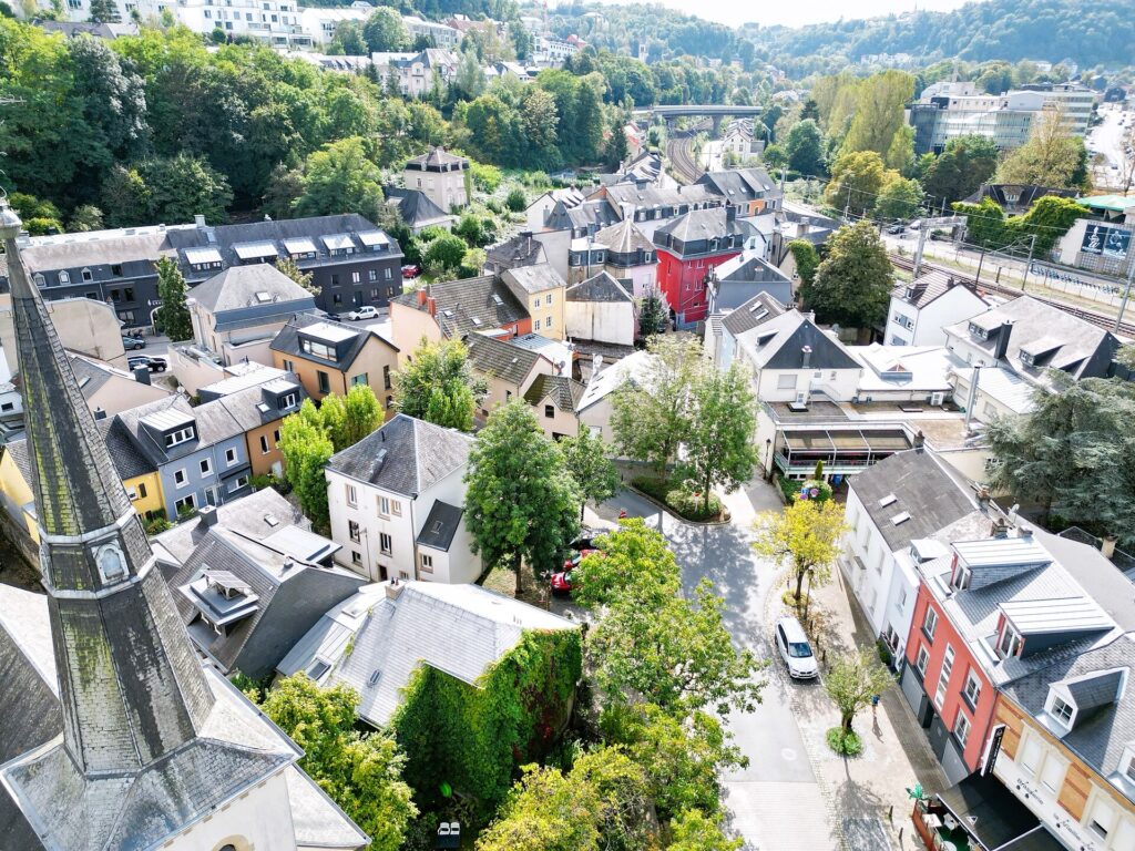
The broad loop through the Grand Duchy is complete, but the final approach is not simply a reversal of the opening kilometres. Instead of heading directly towards the upper city, the course remains low through Eich and enters the Alzette valley.
That choice brings the riders beneath the historic fortifications before they climb to the finish.
Luxembourg City is one of the rare European capitals where vertical geography still determines how neighbourhoods relate to one another. Upper streets occupy the fortress plateau while Pfaffenthal, Clausen and Grund lie in the valleys below, sometimes separated by only a few hundred metres horizontally but by steep slopes and walls vertically.
The peloton now enters those lower quarters.
-3.1 km · Pfaffenthal, Life Beneath the Fortress
With 3.1 kilometres remaining, the race reaches Pfaffenthal, one of Luxembourg City’s historic lower districts.
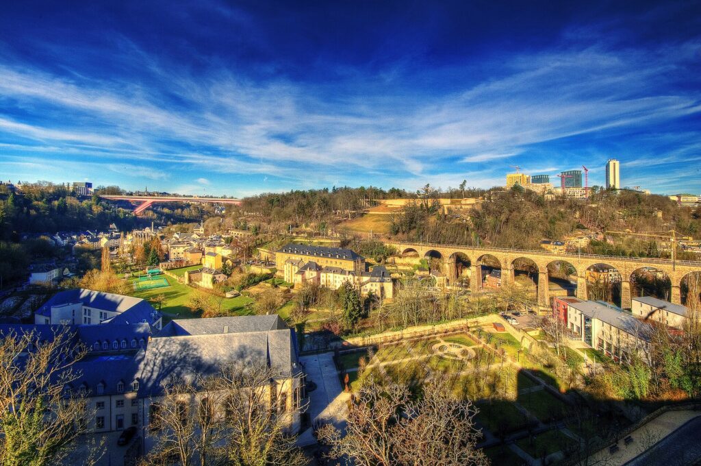
The neighbourhood developed along the Alzette, beneath the defensive heights of the upper city. Water supported mills and crafts, while the river corridor provided space for settlement in a landscape otherwise constrained by steep slopes.
As Luxembourg’s fortifications expanded, Pfaffenthal became increasingly integrated into the defensive system above. Walls and military works crossed the valley, bringing the lower settlement within a fortress complex controlled from the plateau.
That vertical relationship remains visible even after most of the military infrastructure disappeared. Modern lifts and transport systems make movement easier, but the upper and lower city still feel like distinct spaces despite their proximity.
The race follows the river briefly before moving towards Clausen, where the final ascent begins.
-1.7 km · Clausen and the Road Back Into the Old Fortress
At 1.7 kilometres to go, the riders reach Clausen, another historic settlement squeezed between the Alzette and the steep rock of Luxembourg’s upper town.
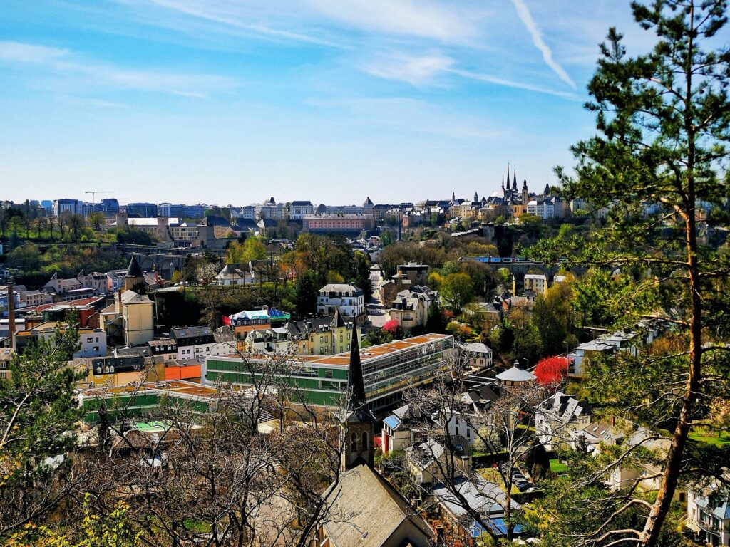
Clausen developed outside the earliest medieval centre but eventually became closely integrated with it. Mills, breweries, workshops and later industry occupied the valley, while fortifications dominated the heights above.
The contrast between the two levels becomes particularly clear in the race. In straight-line distance the finish is almost beside the peloton, but the road still has to solve the elevation difference between the valley and the old fortress plateau.
The route turns onto the Montée de Clausen and begins climbing back towards the old city. What was once defensive geography becomes the final sporting obstacle: the riders must regain the height that made Luxembourg difficult to attack for centuries.
FINISH · Fëschmaart, Where Luxembourg Began
The first stage finishes at the Fëschmaart, the Fish Market, on Rue Sigefroi in the heart of the old city.
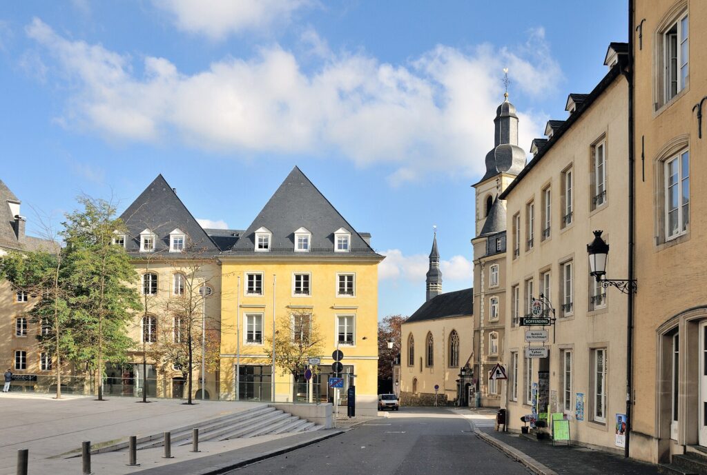
It is difficult to choose a more appropriate place for the first leader’s jersey of the Tour de Luxembourg. Long before the modern capital existed, two Roman roads crossed near this site. A fortified tower stood nearby, and the earliest markets of the medieval settlement developed in the narrow streets beside the castle of the counts.
The square was not always specifically a fish market. It was also known as the old market or cheese market, reflecting its role as one of the earliest centres of economic and social life in the growing town.
Only a short distance away lies the Bock, where Count Siegfried established the castle associated with the name Lucilinburhuc in 963. From that rocky promontory developed the city, and from the city came the name of the country.
The stage has spent the afternoon travelling through that country’s layered geography. Larochette placed a castle above the White Ernz. Vianden turned the Our valley into one of Europe’s great feudal sites. Bourscheid occupied a slate promontory high above the Sûre, while Esch-sur-Sûre compressed village, castle and river into one of the most dramatic landscapes of the Grand Duchy. Farther south, Vichten exposed a Roman world beneath the fields, Useldange introduced a 20th-century emigrant into a medieval ruin, and Hollenfels showed how densely lordships once occupied the Eisch valley.
Then the route returned through the Alzette corridor and entered Luxembourg City from below, passing Pfaffenthal and Clausen before climbing back onto the old fortress plateau.
Most of the great military complex was dismantled after the Treaty of London in 1867, when Luxembourg’s neutrality was guaranteed and the fortress that had dominated the city for centuries was ordered to be reduced. Only fragments survive, but enough remains for the old quarters and fortifications to be recognised today as a UNESCO World Heritage site.
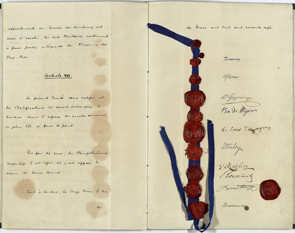
The finish at Fëschmaart sits inside that surviving landscape, beside the roads and rocks from which Luxembourg grew.
Stage 1 ends where the country’s name began.