
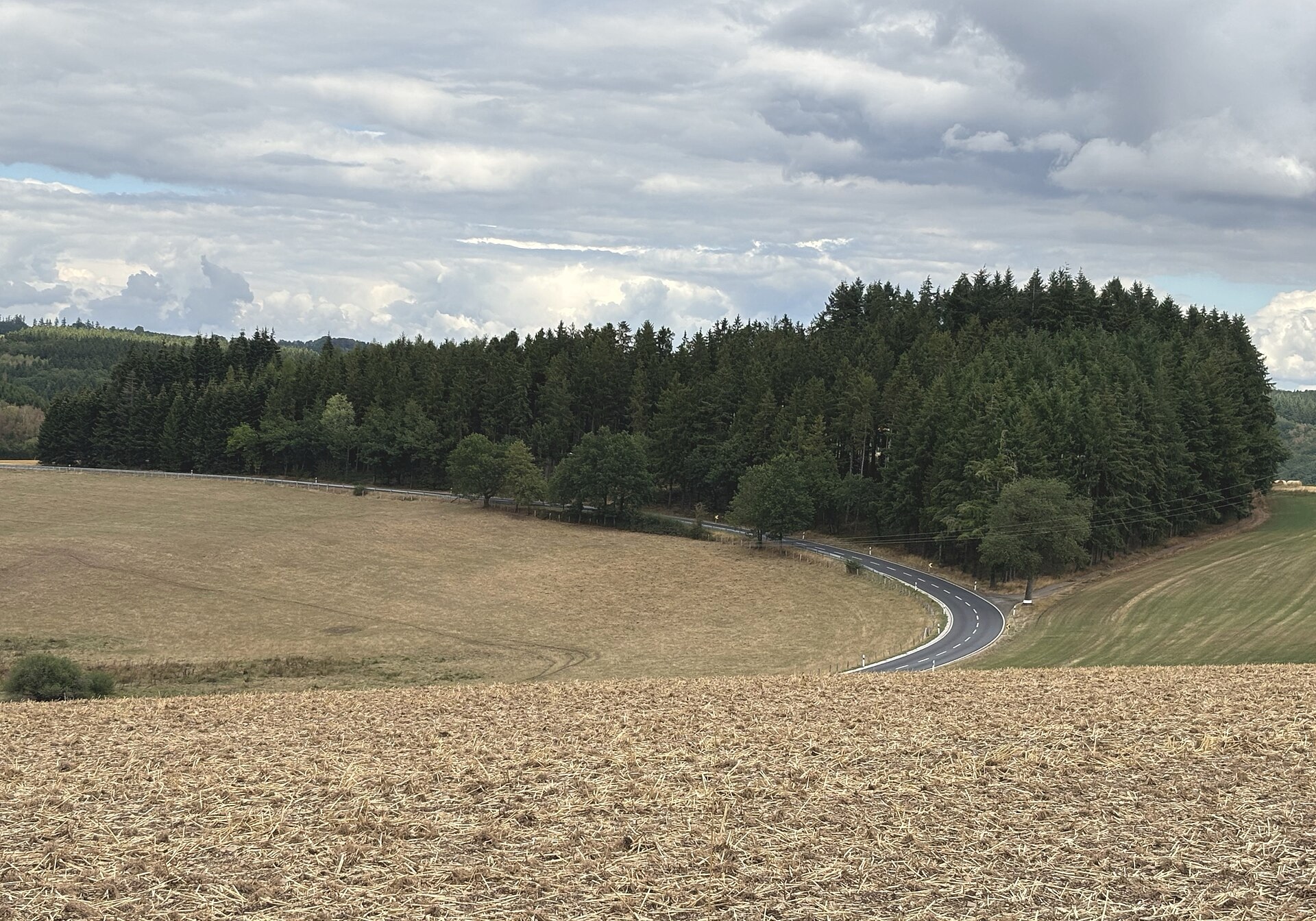

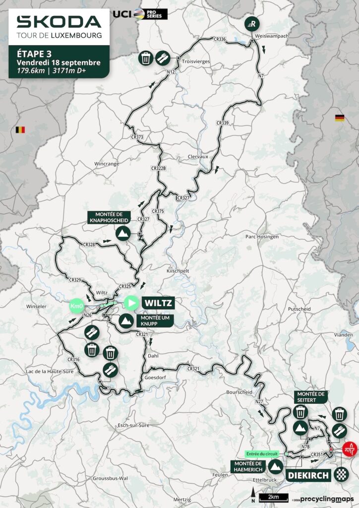
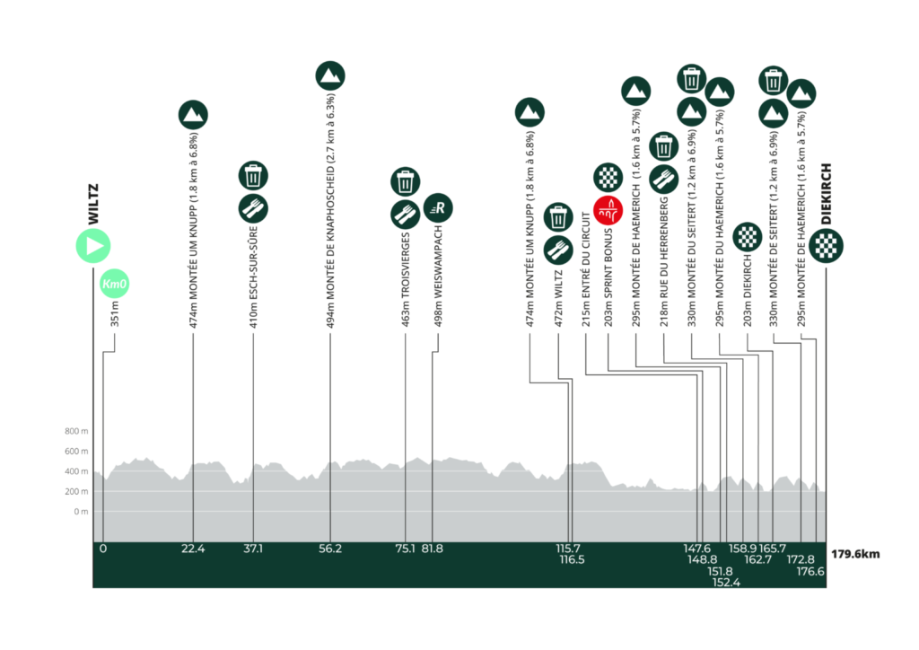
Stage 3 is the queen stage of the 2026 Tour de Luxembourg, but its difficulty is not concentrated in one great summit. Instead, 179.6 kilometres and 3,171 metres of climbing are built from the geography of the Éislek, the Luxembourgish Ardennes, where rivers have cut deeply into an elevated plateau and roads are forced to climb repeatedly whenever they leave one valley for another.
The route begins at Wiltz, heads south through Esch-sur-Sûre, then turns north across the high ground towards Troisvierges and Weiswampach before bending back through Clervaux and returning to Wiltz. From there it follows the Sûre valley east towards Diekirch, where a final circuit repeatedly climbs Haemerich and Seitert before the finish on Rue de Stavelot. Eight classified ascents are distributed across the stage, including three passages of Haemerich in the final 31 kilometres.
The physical demands alone would make this the hardest road stage of the Tour, but the northern Ardennes add a much heavier historical layer. Wiltz became a centre of resistance to German occupation before being devastated during the Battle of the Bulge. At Schumannseck, thousands of American and German soldiers fought for weeks around a road junction that now lies quietly beneath forest. Clervaux Castle was damaged in the same offensive, while Diekirch now preserves the military history of those battles in the country’s principal museum devoted to the conflict.
The stage also reaches farther back. Castles occupy the valleys at Wiltz, Clervaux and above the Sûre near Bourscheid. Troisvierges owes much of its modern development to the railway and became one of the first places where Luxembourg’s neutrality was violated in August 1914. Diekirch itself developed on Roman foundations beside another important river corridor.
Stage 3 therefore moves through a landscape whose roads have repeatedly mattered for movement, defence and survival. The race reads them as gradients and positioning. The history beneath them is much older and, in places, much darker.
START · Wiltz, Castle Above a Town of Resistance
The neutral start leaves Grand-Rue beside Wiltz Castle, almost 382 metres above sea level. Few starting points on the Tour contain such a dense combination of feudal, industrial and wartime history.
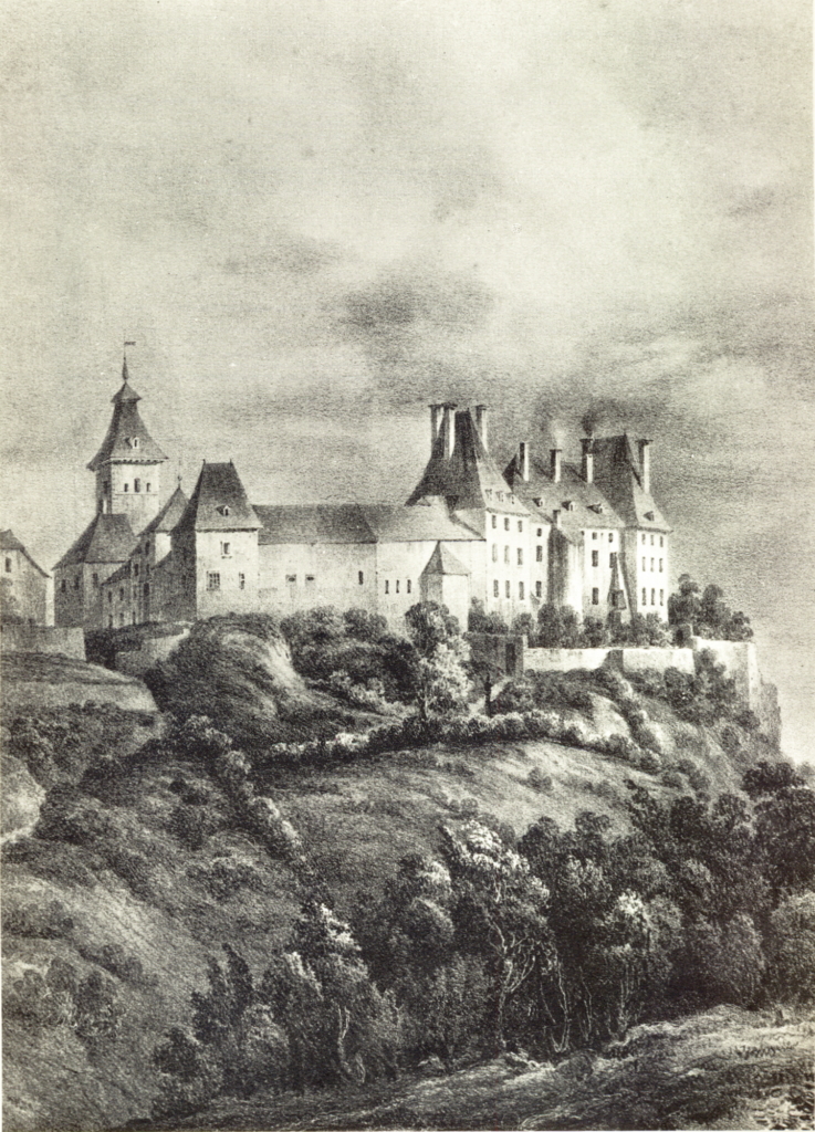
Wiltz developed in a basin in the heart of the Éislek, with settlement documented for well over a thousand years. During the 13th century, the Lords of Wiltz abandoned an older and more vulnerable fortification in the valley and established their castle on a rocky spur above it. The move followed a familiar medieval logic: higher ground offered control over the approaches and reduced the number of directions from which the residence could be attacked.
The surviving castle belongs largely to a much later rebuilding. Under Jean VI of Wiltz, construction of the present complex began in 1631, but the Thirty Years’ War, epidemics and famine delayed the work so severely that the central building was not completed until around 1720. The chapel followed in 1722 and the monumental exterior staircase in 1727. By then, the site had evolved from a defensive stronghold into a more comfortable aristocratic residence, while still preserving traces of its earlier military function.
The 20th century gave Wiltz a very different place in Luxembourg’s history. Nazi Germany invaded the country in May 1940, and in August 1942 the occupation authorities introduced compulsory military service, forcing young Luxembourgers into the German armed forces.
Resistance intensified immediately. On 31 August 1942, workers and local officials in Wiltz began a strike against conscription. The protest spread rapidly to other parts of Luxembourg, involving factories, schools, public services and workers in several towns.
The German response was severe. Martial law was imposed, arrests followed and twenty-one Luxembourgers were executed. The strike became one of the defining episodes of resistance to occupation.
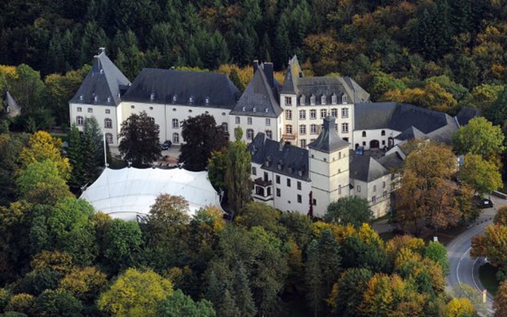
“Wiltz Castle today, the former seat of the Lords and Counts of Wiltz, Luxembourg” — Photo: Ipigott / Wikimedia Commons, CC BY-SA 3.0
A national strike monument now stands close to the castle, built from Wiltz slate and inaugurated in 1956. Its presence gives the start a particular weight because the stage will later cross places where the political repression of occupation was followed by direct military destruction.
The riders descend from the castle through Wiltz before the flag drops. Within only a few kilometres, the race is already climbing again.
-157.3 km · Um Knupp and the First Rise Above Wiltz
The first classified ascent, Um Knupp, reaches its summit with 157.3 kilometres remaining, after the opening loop through Noertrange, Derenbach and Eschweiler.
The climb introduces the physical structure of the stage immediately. Wiltz sits in a basin around 320 to 380 metres above sea level, while the surrounding plateau often rises towards 500 metres. Roads leaving town therefore gain height quickly, cross higher ground and then fall again into another valley.
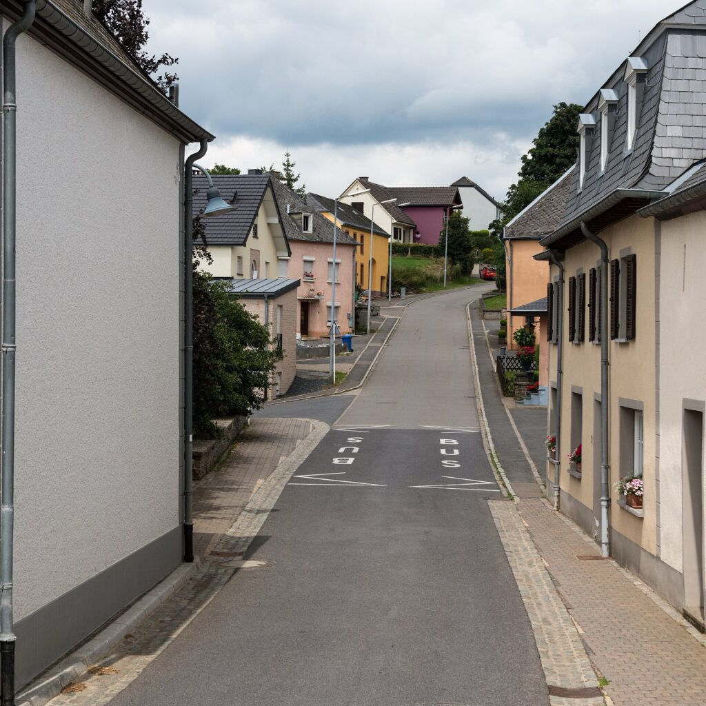
“Um Knupp in Goesdorf (Géisdref), Canton of Wiltz, Luxembourg” — Photo: GilPe / Wikimedia Commons, CC BY-SA 4.0
That is the central difficulty of the Éislek. The region is not high in absolute terms, but it is deeply dissected. A profile can look modest until the constant sequence of descents and short climbs begins to accumulate.
Um Knupp is also the first of several passages around Wiltz. The route will return much later after travelling almost to the Belgian border, making the town both the starting point and one of the geographical anchors of the day.
From the summit, the road moves through Goesdorf and begins dropping towards the Sûre.
-145.3 km · Esch-sur-Sûre and the Village Inside the River Bend
With 145.3 kilometres remaining, the race reaches once again Esch-sur-Sûre, where the Sûre almost wraps completely around the old settlement.
The village occupies a tight meander beneath the ruins of a castle established on the rocky height above it. Houses are compressed between water and rock, and the topography gives the settlement a natural enclosure that medieval builders reinforced rather than created.
The castle is documented from 927, making it one of the oldest fortified sites in Luxembourg. The Lords of Esch developed the stronghold through the Middle Ages and became important regional nobles, but the family’s political influence declined after the late 13th century.
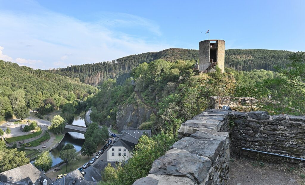
As the fortress lost importance, parts of it were quarried for building stone. Material that had once belonged to the castle gradually entered the fabric of the village below.
The Sûre supported more than defence. Mills and later textile production used the water, giving Esch-sur-Sûre a small industrial history of its own, very different from the steel economy encountered in the Minett.
Today the river also carries a much more modern national role.
-143.7 km · The Esch-sur-Sûre Dam and the Upper Sûre
Only a short distance beyond the village, at 143.7 kilometres remaining, the route passes the Barrage d’Esch-sur-Sûre.
The dam created the Upper Sûre Lake, Luxembourg’s largest reservoir and one of the country’s most important sources of drinking water. The project altered the valley fundamentally, flooding land that had previously carried farms, paths and smaller watercourses.
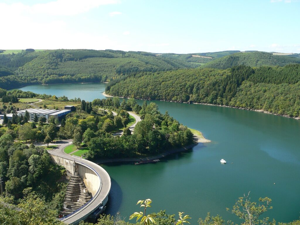
The contrast with medieval Esch-sur-Sûre is striking. The same river that once determined the position of a castle later became part of national water infrastructure.
That continuity appears repeatedly across Luxembourg. Rivers supported fortifications, mills, industry and transport before being regulated for modern utilities. The Sûre carries all of those histories at once.
The peloton leaves the reservoir and climbs through Kaundorf and Nothum. The forest ahead looks peaceful, but the next crossroads is one of the most heavily scarred places on the route.
-136.7 km · Schumannseck, the Bloodiest Battlefield in Luxembourg
At 43 kilometres raced, with 136.7 kilometres remaining, the Tour passes Schumannseck, a road junction near Nothum surrounded today by woodland.
During the winter of 1944 and 1945, this was one of the most violently contested places in Luxembourg.
The German Ardennes Offensive began on 16 December 1944, an attempt to break through Allied lines, cross the Meuse and split British and American forces. Northern Luxembourg lay directly inside the offensive zone. Towns that had celebrated liberation only a few months earlier suddenly found themselves close to the front again.
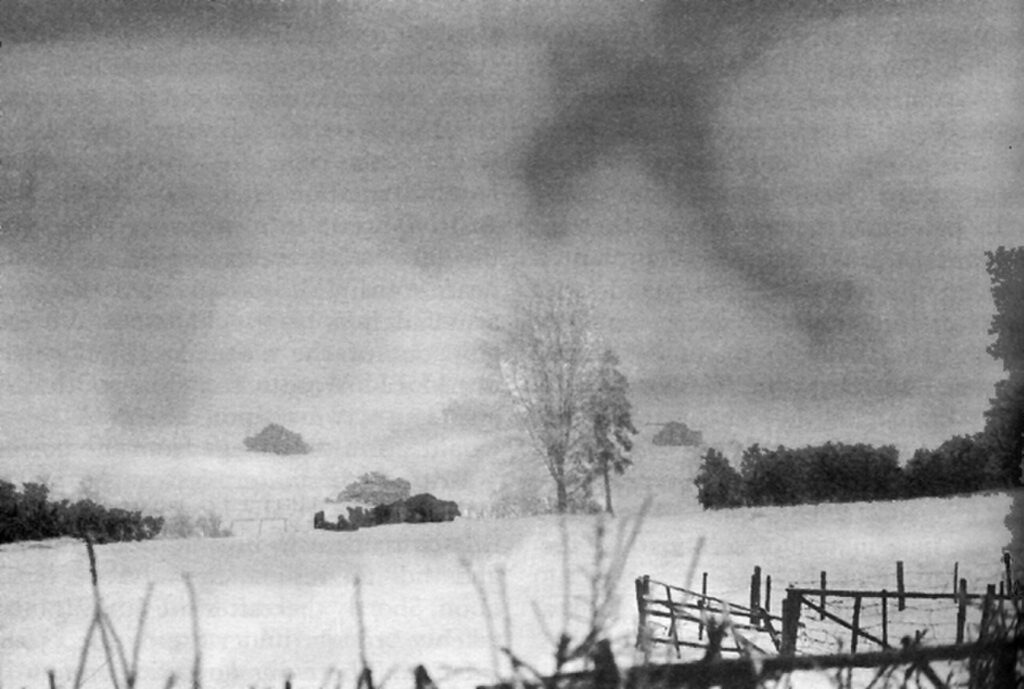
Schumannseck mattered because several roads converged there between Wiltz, Bastogne and the northern plateau. In peacetime it was an ordinary junction. During the offensive it became a strategic point because control of the roads determined the movement of troops, vehicles and supplies across difficult winter terrain.
American forces pushing north encountered entrenched German positions around the crossroads. By late December, the 26th US Infantry Division, part of General George Patton’s Third Army, was fighting through the area while trying to secure the flank of the advance towards Bastogne and beyond.
The fighting became a slow war of attrition through forest, villages and frozen ground. Artillery struck the same positions repeatedly, patrols fought at close range and front lines moved only gradually. Soldiers lived in foxholes through severe winter conditions while villages nearby suffered bombardment and destruction.
Thousands of soldiers were killed, wounded or reported missing during the fighting around Schumannseck, making it the deadliest battlefield on Luxembourg soil.
The forest still contains physical traces. Foxholes, trenches and shell craters remain visible, and the memorial trail through the area deliberately preserves parts of the landscape rather than confining the history to a single monument.
The race crosses the junction quickly. The road surface is smooth, the forest quiet, and the violence that once made every metre of this ground difficult to cross is now almost entirely hidden beneath the trees.
-123.4 km · Knaphoscheid and the High Ardennes Plateau
The second classified ascent reaches Knaphoscheid with 123.4 kilometres remaining.
After dropping back towards the Wiltz basin, the road climbs again towards almost 500 metres, returning the race to the exposed high ground of the Éislek.
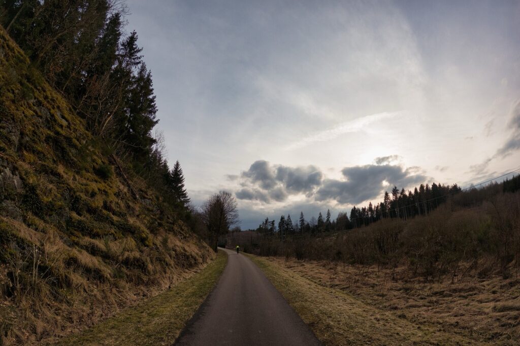
The Vennbahn cycle path near Troisvierges, winding through the wooded Ardennes landscape of northern Luxembourg. Photo by Tristan Schmurr, CC BY 2.0, via Wikimedia Commons.
This part of Luxembourg belongs geologically to the wider Ardennes massif, an ancient upland worn down over immense spans of time and then deeply cut by streams and rivers. The result is not a landscape of sharp summits but of broad plateaus interrupted by deep valleys.
From above, the country can look relatively gentle. The difficulty appears only when the road repeatedly crosses those valleys rather than following them.
The stage now stays higher through Weicherdange and Stockem, with pasture and farmland opening between wooded sections. The character of the road changes again as the route approaches one of the northernmost railway towns in the Grand Duchy.
-106.6 km · Troisvierges, Railway Town and the First Breach of Neutrality
At 106.6 kilometres remaining, the peloton passes Troisvierges, whose modern development was shaped decisively by the railway.
The northern Ardennes offered difficult conditions for older overland transport. Rail changed that relationship during the 19th century, connecting remote communities much more directly with Luxembourg City, Belgium and Germany. Troisvierges became an important railway settlement because of its position close to the northern frontier.
That infrastructure acquired international significance in August 1914.
Luxembourg had been internationally recognised as neutral under the Treaty of London of 1867, but German military planning depended heavily on railway networks for the rapid movement of troops westward.
On 1 August 1914, German soldiers used railway installations at Troisvierges without Luxembourg’s consent. The incident became one of the first violations of the country’s neutrality, even before the full German occupation began the following day.
Luxembourg had little ability to resist militarily. The state was small, lightly defended and surrounded by powers mobilising for war. German forces soon occupied railway lines and strategic points throughout the country while allowing the government and Grand Duchess Marie-Adélaïde to remain formally in place.
The episode shows how transport geography repeatedly pulled northern Luxembourg into wider European conflicts. The railway existed to overcome isolation, but in wartime the same connectivity made it strategically valuable.
The race now continues north onto the highest broad plateau of the stage.
-97.9 km · Weiswampach, Near the Northern Edge of Luxembourg

The hamlet of Kéisfuert in the rural commune of Weiswampach, northern Luxembourg. Photo by GilPe, licensed under Creative Commons Attribution ShareAlike 4.0 International, via Wikimedia Commons.
At 97.9 kilometres remaining, the RUSH sprint takes place at Weiswampach, close to Luxembourg’s northern extremity.
The commune lies between roughly 450 and 520 metres above sea level, making this one of the highest inhabited areas in the country. The landscape is more open than the narrow valleys farther south, with pasture, fields, orchards and woodland spread across the plateau.
Belgium lies only a few kilometres away, while Germany is close to the east. Modern borders divide a landscape whose roads, dialects, family connections and economic relationships have always extended beyond one national territory.
The altitude also shaped farming. Cooler conditions and a shorter growing season historically favoured pasture and hardy crops rather than the vineyards seen beside the Moselle on Stage 2.
Around Weiswampach, the route reaches its northernmost point and begins turning south. The transition is subtle because there is no dramatic summit, only high rolling ground slowly giving way to another deeply cut valley.
That valley contains one of the richest historical sites of the stage.
-83.8 km · Clervaux, Castle, Abbey and The Family of Man
With 83.8 kilometres remaining, the peloton enters Clervaux, descending from the plateau into the valley of the Clerve.
Above the town stands Clervaux Castle, occupying a rocky spur surrounded on three sides by the river. Its oldest surviving parts date principally from the 12th century, when the Lords of Clervaux developed a fortified residence tied politically to the wider network of noble families in the northern Ardennes.
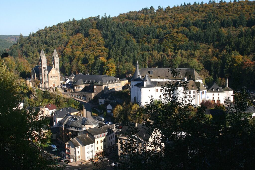
Clervaux, with its medieval castle dating from the twelfth century and the Church of Saints Cosmas and Damian, rising above the town in the Luxembourg Ardennes. Photo by Jean Pol Grandmont, licensed under Creative Commons Attribution 3.0 Unported, via Wikimedia Commons.
The castle expanded over subsequent centuries as its owners changed. Defensive towers, residential wings and ceremonial spaces transformed it into a larger aristocratic complex, but the medieval position remained the key to its survival.
That survival nearly ended in December 1944.
During the Battle of the Bulge, American troops attempted to defend Clervaux against advancing German forces. Fighting reached the castle itself, and much of the complex was damaged by fire and combat. The Luxembourg state later acquired the ruins and restored them.
The post-war use of the castle created one of the most remarkable historical juxtapositions on the Tour.
Inside is The Family of Man, the photographic exhibition assembled by Luxembourg-born American photographer and curator Edward Steichen for the Museum of Modern Art in New York.
Steichen selected 503 photographs by 273 photographers from 68 countries, arranging them around themes of birth, work, love, family, conflict, suffering and death. The exhibition opened in New York in 1955 and then travelled internationally, eventually reaching millions of visitors.
The collection was later given to Luxembourg and installed permanently at Clervaux Castle.
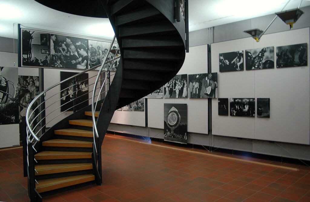
The Family of Man, Edward Steichen’s landmark photographic exhibition, permanently displayed at Clervaux Castle. Photo by Jean Pol Grandmont, licensed under Creative Commons Attribution ShareAlike 4.0 International, via Wikimedia Commons
The setting gives the exhibition an additional weight. A building damaged in one of the final major battles of the Second World War now houses a project intended to emphasise the shared experiences of people across national, political and cultural divisions.
Above the opposite side of the valley stands the Abbey of Saint-Maurice and Saint-Maur, founded by Benedictine monks in the early 20th century. Its Romanesque Revival buildings overlook a town in which medieval lordship, monastic life, wartime destruction and modern photography occupy the same narrow landscape.
The route climbs out of Clervaux and turns back towards Wiltz.
-67 km · Wiltz Revisited
With 67 kilometres remaining, the stage returns to Wiltz.
More than 110 kilometres have passed since the official start, yet geographically the race has almost closed a large northern loop. The road has reached the Belgian borderlands, crossed Troisvierges and Weiswampach, descended through Clervaux and now returns to the basin from which it began.
The historical context has changed the meaning of the second passage. The strike monument at Wiltz introduced resistance to occupation. Schumannseck showed the physical violence that reached the region two years later. Clervaux carried that same offensive into a castle that has since been rebuilt around a very different message.
The riders leave Wiltz for the final time by climbing Um Knupp again, reaching the summit at -64 kilometres. After that second passage, the route turns east and begins a long transition towards the Sûre.
The stage is no longer travelling towards the northern frontier. It is beginning to funnel itself towards Diekirch.
-49.2 km · Goebelsmühle and the Sûre Valley
At 49.2 kilometres remaining, the race reaches Goebelsmühle, deep in the Sûre valley.
Here the geography temporarily becomes kinder. Steep wooded slopes enclose the river, but road and railway are able to follow the same narrow corridor, avoiding the constant need to climb back onto the plateau.
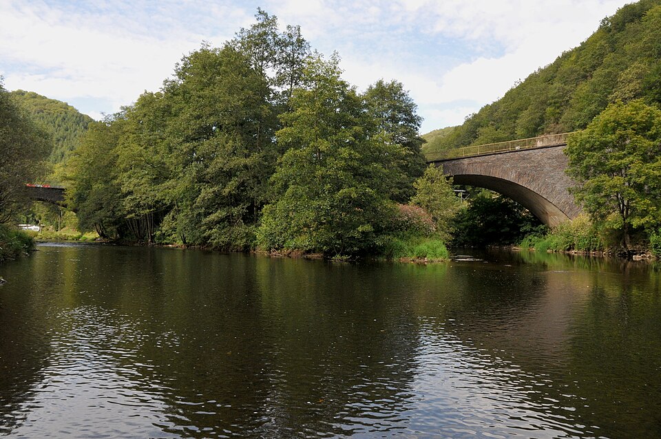
The railway through northern Luxembourg was forced to adapt to exactly this kind of terrain, using river valleys wherever possible rather than taking direct lines across the uplands. Roads evolved according to similar logic.
After the exposed country around Weiswampach, the landscape now feels enclosed. Forest descends almost to the water, tracks and road run close together, and villages occupy the limited flatter ground beside the river.
The stage has entered a corridor that will carry it east towards Diekirch.
Before reaching the finish circuit, the riders pass beneath one of the country’s greatest medieval fortresses.
-40.3 km · Michelau and Bourscheid Castle Above the Sûre
At 40.3 kilometres remaining, the peloton passes Michelau beside the Sûre.
High above the road, Bourscheid Castle occupies a slate promontory roughly 150 metres above the river. Stage 1 approached the castle from higher ground; today the race sees it from below, where the strategic logic is even easier to understand.
Construction of the medieval fortress began around the year 1000 on a site where archaeological evidence indicates earlier occupation. The lords of Bourscheid appear in documents from the late 11th century, and over the following centuries the complex expanded into one of the largest castles in Luxembourg.
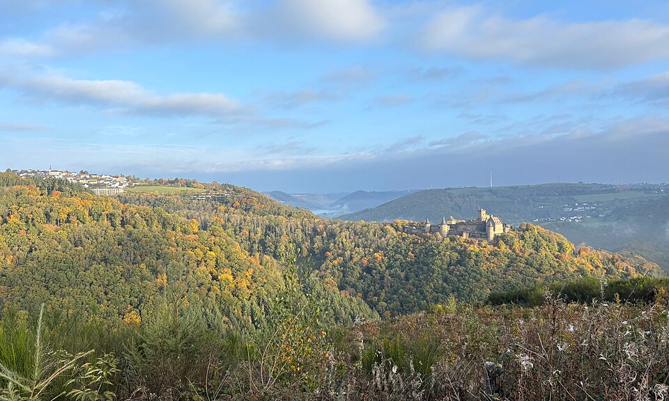
Its walls eventually enclosed roughly 12,000 square metres, reinforced by numerous towers and protected naturally by steep slopes on most sides.
The castle overlooked an old movement corridor through the Sûre valley. Routes crossing the river connected wider networks of roads, while the river itself linked settlements farther east and west.
The modern peloton uses that corridor without needing to climb towards the fortress. The road follows the water through Michelau and on towards Erpeldange-sur-Sûre. The relative calm of the valley ends there.
-32.1 km · Erpeldange-sur-Sûre and the Final Circuit
With 32.1 kilometres remaining, the race reaches Erpeldange-sur-Sûre and enters the finishing circuit.
The valley floor sits at roughly 215 metres above sea level. Only 1.3 kilometres later, the summit of Haemerich stands near 296 metres.
The final circuit therefore condenses the broader geography of the stage into a much smaller area. Diekirch and Erpeldange sit low beside the river. Seitert and Haemerich rise onto higher ground. The race repeatedly climbs out of the valley, drops back to the Sûre and then does it again.
By this point the riders have already accumulated most of the day’s climbing. The repeated circuits do not introduce a new landscape so much as intensify the one they have been crossing all afternoon.
-30.8 km · Haemerich, First Passage
The first ascent of Haemerich reaches its summit with 30.8 kilometres remaining.
The road climbs rapidly from Erpeldange, gaining roughly eighty metres in little more than a kilometre before descending towards Diekirch.
In isolation, that is not an extraordinary climb. After almost 150 kilometres of the Éislek, its meaning is entirely different. The legs reaching Haemerich have already climbed out of valleys around Wiltz, Esch-sur-Sûre, Clervaux and the northern plateau.
The finish line is crossed for the first time at -27.8 kilometres, where bonus seconds are available. The race then immediately leaves Diekirch again towards Fridhaff.
The circuit has now revealed itself completely.
-20.7 km · Seitert, First Passage
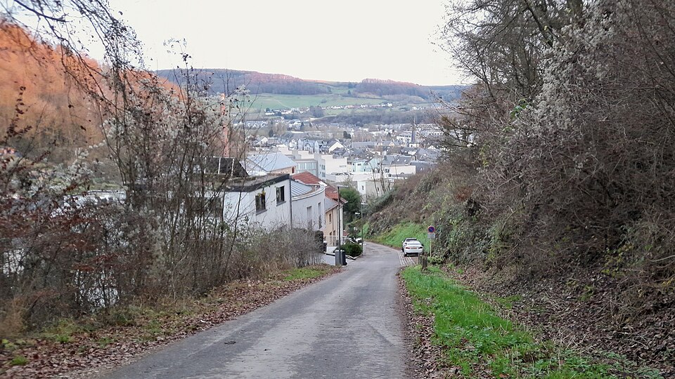
The Montée de Seitert reaches its summit with 20.7 kilometres remaining.
The climb lifts the race from Diekirch towards the higher ground around Fridhaff before the road falls back towards Erpeldange.
The relationship between the two climbs becomes clear on this first complete circuit. Seitert takes the riders from town to plateau. The descent returns them towards the river. Haemerich then climbs abruptly away from the Sûre before dropping back into Diekirch.
Instead of a single decisive mountain, the finale asks the riders to absorb repeated short efforts while constantly changing rhythm.
The second Haemerich passage follows soon afterward.
-16.9 km · Haemerich, Second Passage
At 16.9 kilometres remaining, the race reaches Haemerich for the second time.
The road has not changed, but the tactical possibilities have. Teams have already seen the approach, the gradient, the descent and the distance from the summit to Diekirch. Any attack can now be measured against knowledge gained on the first lap.
The second finish-line passage comes at -13.9 kilometres, leaving one full circuit.
The decisive phase of the queen stage therefore begins on roads the riders already know. After a day spent discovering new valleys, towns and climbs, the final thirteen kilometres are about repeating familiar terrain under much greater fatigue.
FINAL LAP · -13.9 km · Diekirch and One Last Circuit
At the second passage through Diekirch, the bell leaves 13.9 kilometres.
The race heads towards Fridhaff and reaches the final summit of Seitert at -6.8 kilometres. From there, the road drops once more towards Erpeldange-sur-Sûre.
The Sûre returns beneath the riders near the final four kilometres. All afternoon, rivers have provided the easiest routes through the Ardennes while every departure from them has demanded another climb.
The same logic now governs the finish.
The peloton reaches Erpeldange and turns uphill for the final passage of Haemerich.
-3 km · Haemerich, the Last Climb
The final classified summit of Stage 3 comes at Haemerich with exactly 3 kilometres remaining.
The riders have already climbed it twice, so there is no uncertainty about the road. What remains uncertain is who still has the strength to use it.
The ascent rises quickly from the valley floor and comes close enough to the finish that hesitation can be costly. A small gap over the summit may be enough to survive the descent, while anyone distanced has very little road left to recover.
Once over the top, the route drops back towards Diekirch. At roughly 1.8 kilometres remaining, the race re-enters the town and the road begins to flatten.
The finish lies ahead on Rue de Stavelot.
FINISH · Diekirch, From Roman Settlement to the Battle of the Bulge
Stage 3 ends in Diekirch after 179.6 kilometres and 3,171 metres of climbing.
The town stands beside the Sûre in a place where settlement long predates the modern state. Under Roman rule, the wider region formed part of Gallia Belgica, and a substantial Roman villa occupied the area from around the first century AD.
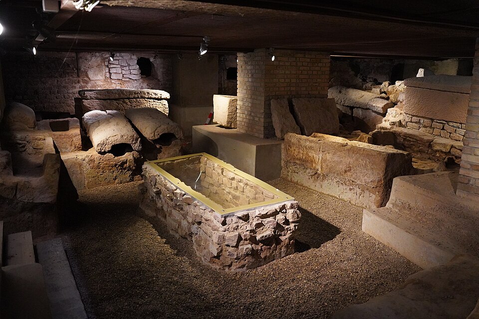
Centuries later, part of that Roman complex became the foundation for a Christian church. The Old Saint Lawrence Church developed from a building established around the sixth or seventh century on the remains of the villa, and later rebuilding added Romanesque, Gothic and subsequent architectural layers.
The town therefore carries nearly two thousand years of continuous occupation into the modern street plan.
Its more recent identity is inseparable from the Second World War. Diekirch lay directly within the Battle of the Bulge and the subsequent Allied counter-offensive. German forces returned to parts of northern Luxembourg during December 1944, while American troops fought to regain control of the Sûre valley in the weeks that followed.
Today the National Museum of Military History preserves that experience through vehicles, equipment, photographs, personal objects and large-scale reconstructions. Its importance lies partly in the breadth of perspective: American and German soldiers are both represented, along with civilians who lived through occupation, evacuation, bombardment and the return of combat to their towns.

That civilian dimension connects Diekirch with the rest of the stage more naturally than any single battlefield could.
The race began in Wiltz, where resistance to forced conscription triggered the strike of 1942. It crossed Schumannseck, where the forest still carries the physical traces of weeks of combat, and passed through Clervaux, where a castle damaged during the same offensive now contains photographs devoted to the common experiences of human life. Troisvierges added an earlier wartime memory through the railway and the first breach of Luxembourg’s neutrality in 1914.
Between those historical sites, the route crossed the northern Ardennes themselves: the high plateau around Weiswampach, the valleys of Wiltz and the Sûre, and the repeated transitions between river floor and higher ground that accumulated more than three thousand metres of climbing without producing a single monumental summit.
The final circuit around Diekirch compresses that geography into a few kilometres. The riders leave the river, climb towards the plateau, descend again and repeat the movement until Haemerich for the final time.
There is no need for the queen stage to end on a famous mountain. The difficulty has been spread across the entire landscape since Wiltz.
Diekirch receives the race beside the same Sûre that has guided so much of the afternoon, at the end of a stage where geography and history have both accumulated gradually rather than arriving in one dramatic moment.



