

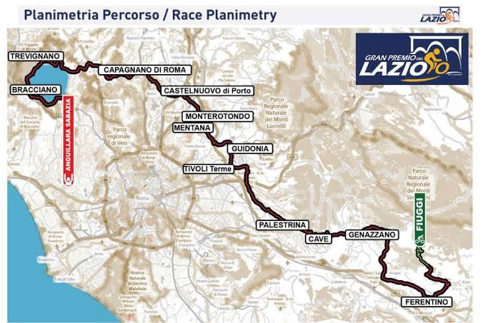
The Gran Premio del Lazio is new in its present form, but the landscape it crosses is anything but new. Over 182.35 kilometres, the race travels from Fiuggi in the hills south-east of Rome to Anguillara Sabazia on Lake Bracciano, passing through a chain of places that reveal several different versions of Lazio: papal hill towns, Roman sanctuaries, Renaissance estates, battlefield country, Etruscan territory and, finally, a volcanic lake beside one of the oldest known farming settlements in central Italy.
The event belongs to the UCI 1.1 calendar and is presented as a modern successor to the old Giro del Lazio, a race first held in 1933 and won over the decades by riders including Gino Bartali, Fiorenzo Magni, Felice Gimondi, Francesco Moser, Roger De Vlaeminck, Gianni Bugno, Michele Bartoli, Paolo Bettini and Alejandro Valverde. The 2026 course is designed to favour resistant sprinters, but it is far from flat. It crosses 28 municipalities across the provinces of Frosinone, Rome and Viterbo, with repeated hills through central Lazio before the road reaches the broader, faster terrain around Lake Bracciano.

The stage begins in Ciociaria, the historical hill country centred on Frosinone, south and south-east of Rome. Ciociaria is not an official administrative region, but a cultural landscape of limestone ridges, valleys, fortified towns, vineyards and villages whose history was shaped by their position between Rome, the Papal States and the kingdoms of southern Italy. From there, the race moves west and north towards ancient Latium, then into the territory beyond Rome where Etruscan, medieval and Renaissance histories overlap.
By the final thirty kilometres, the road enters a completely different environment. The hills open around Lake Bracciano, one of the largest lakes in central Italy, formed within the volcanic landscape of the Sabatini district. The finish at Anguillara Sabazia sits beside a shoreline that preserves traces of human settlement far older than Rome itself.
START · Fiuggi, a Spa Town Built Around Water
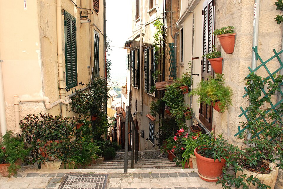
A picturesque glimpse of Fiuggi, the historic spa town in Italy’s Lazio region. Photo by Camelia Boban, licensed under CC BY-SA 4.0, via Wikimedia Commons
The race begins in Fiuggi, a spa town in the province of Frosinone, around seventy kilometres east-southeast of Rome.
Fiuggi is divided naturally between two levels. The older settlement, Fiuggi Città, occupies higher ground, while the lower spa district developed around springs whose water became famous across Italy and beyond. The water filters through volcanic and sedimentary terrain and is notably low in mineral content, characteristics that helped build its long reputation as a treatment for kidney stones and urinary problems.
The connection between Fiuggi and healing water is centuries old. Pope Boniface VIII, who reigned from 1294 to 1303, is traditionally associated with drinking it, while Michelangelo later referred to a spring near Rome whose water he believed helped break up kidney stones. The two principal spa areas became known through the Bonifacio VIII and Anticolana springs.
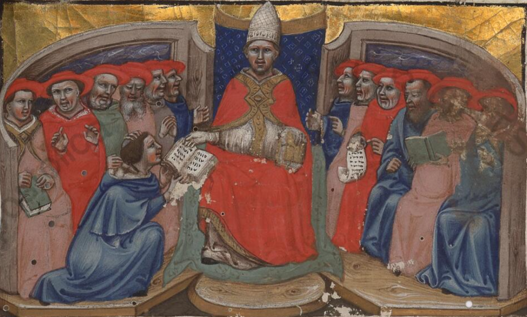
Pope Boniface VIII, who led the Catholic Church from 1294 to 1303, depicted in a medieval manuscript illumination. Unknown artist, public domain, via Wikimedia Commons
The geography explains the town’s unusual development. The upper settlement belongs to the defensive logic of medieval Lazio, where communities often occupied ridges or hillsides, while the lower town grew because people came for water. Hotels, treatment facilities and spa buildings expanded around the springs, turning a rural settlement into one of central Italy’s most recognised health resorts.
The neutralised section leaves Fiuggi before the official race begins at Ferentino, another old hill town in the province of Frosinone whose walls preserve ancient polygonal masonry and later Roman construction.
From there, the route moves quickly into one of the richest medieval landscapes south of Rome.
Anagni · The City of Popes and the Crisis of Medieval Papal Power
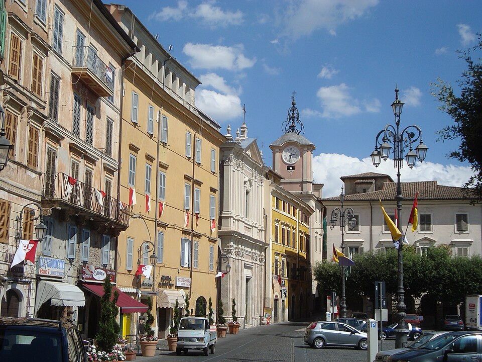
Piazza Cavour in Anagni, the historic hilltop town in Lazio known as the “City of the Popes.” Photo by LPLT, licensed under CC BY-SA 3.0, via Wikimedia Commons
The peloton reaches Anagni, a ridge-top town overlooking the Sacco Valley and one of the great papal centres of medieval Italy.
Anagni is known as the City of Popes because four popes were born there: Innocent III, Gregory IX, Alexander IV and Boniface VIII. During the Middle Ages, the papacy was less permanently tied to Rome than modern visitors might imagine. Popes frequently governed from other towns, and Anagni became one of the most important places from which they received ambassadors, managed church affairs and negotiated with European rulers.
The town’s most famous episode came in 1303, during the conflict between Pope Boniface VIII and King Philip IV of France. Their dispute concerned taxation, royal authority and the extent to which secular rulers were subject to papal power.
Philip’s agents, together with members of the Colonna family, entered Anagni and seized the pope. Later tradition turned the event into the Schiaffo di Anagni, the “Slap of Anagni”, although historians continue to debate whether Boniface was physically struck.
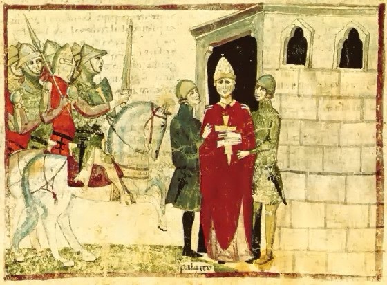
The capture of Pope Boniface VIII by Guillaume de Nogaret and Sciarra Colonna during the Outrage of Anagni in 1303. Illustration attributed to Giovanni Villani, public domain, via Wikimedia Commons
What is certain is that he was humiliated and held under coercion before local supporters freed him. He returned to Rome but died only weeks later. The episode became a symbol of a broader shift in medieval Europe, as monarchies became stronger and the political authority of the papacy began to weaken.
The town still preserves the architecture of that world. The Cathedral of Santa Maria, built mainly between the late 11th and early 12th centuries, contains a crypt covered in extensive 13th-century frescoes, while the papal palace associated with Boniface VIII stands nearby.
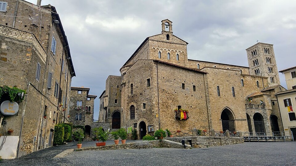
Anagni Cathedral, the Romanesque heart of the medieval “City of the Popes” in Lazio. Photo by Camelia Boban, licensed under CC BY-SA 4.0, via Wikimedia Commons
The route leaves Anagni and continues towards another fortified hill town, but the papal story does not end there.
Fumone · A Fortress Above Ciociaria and the Prison of Celestine V
Fumone is a compact medieval village built around a fortress at roughly 800 metres above sea level.
Its position explains its history. From the high ground, observers could monitor routes across the surrounding countryside, and tradition records the use of smoke signals to warn Rome of danger. The old saying Quando Fumone fuma, tutta la Campagna trema, roughly “When Fumone smokes, all the countryside trembles”, preserves that reputation.
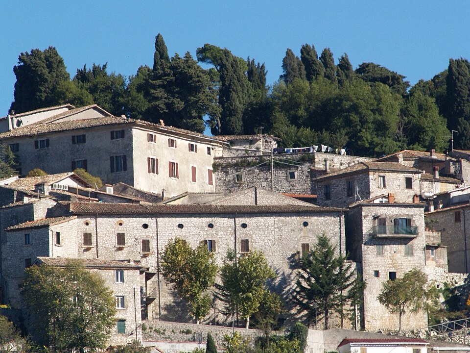
The medieval hilltop village of Fumone in Lazio, crowned by the fortress where Pope Celestine V was imprisoned. Photo by Pietro Scerrato, licensed under CC BY 3.0, via Wikimedia Commons
The castle became famous for the imprisonment of Pope Celestine V, born Pietro da Morrone.
Celestine had spent much of his life as a hermit before being elected pope in 1294. He was elderly, deeply religious and poorly suited to the political demands of the office. After only a few months, he abdicated, one of the most extraordinary decisions in papal history.
His successor was Boniface VIII, the same pope linked with Fiuggi and Anagni.
Boniface feared that Celestine might become a focus for political opposition or schism, so the former pope was eventually detained at Fumone. He died there in 1296.
Within a relatively short stretch of road, the race therefore crosses the territory of two men who represented opposite responses to papal power. Celestine renounced it. Boniface defended it aggressively and became one of the most politically ambitious popes of the Middle Ages.
The route then continues through the wine country around Piglio.
Piglio · Cesanese and a Wine Landscape Native to Lazio
Piglio is a hill town in the province of Frosinone, rising above the Sacco Valley with the Ernici Mountains behind it.
Its strongest identity is agricultural. The surrounding slopes form the heartland of Cesanese del Piglio, the only wine from Lazio recognised at Italy’s highest DOCG classification.
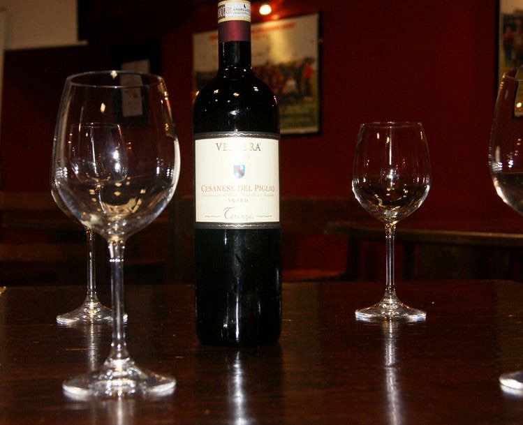
Cesanese del Piglio, Lazio’s only DOCG wine, produced from the native Cesanese grape in the hills around Piglio. Photo by Al Co, licensed under CC BY-NC-SA 2.0, via Flick
Cesanese is a red grape strongly associated with central Lazio. Unlike globally familiar varieties such as Cabernet Sauvignon or Merlot, it belongs specifically to this part of Italy and developed through long adaptation to local soils and climate.
The vineyards occupy slopes where elevation helps moderate summer heat, while limestone and volcanic influences contribute to the character of the terrain. For centuries, wine here was part of a mixed rural economy. Families cultivated vines alongside olives, grain and livestock, and towns such as Piglio served as market and administrative centres for the surrounding countryside.
The race now begins moving west through Serrone, Paliano and Genazzano, a chain of smaller towns set across ridges and valleys between Ciociaria and the hills east of Rome.
Ahead lies one of the most important ancient centres of Lazio.
Palestrina · Ancient Praeneste and a Sanctuary Built Into the Hillside
Palestrina lies around thirty-five kilometres east of Rome.
The modern town occupies the site of ancient Praeneste, one of the most important cities of pre-Roman and Republican-era Latium. Before Rome became dominant, Praeneste controlled a strong elevated position overlooking routes between the Apennine interior and the plains leading towards the capital.
Its greatest monument is the Sanctuary of Fortuna Primigenia, constructed in monumental form during the late Roman Republic.
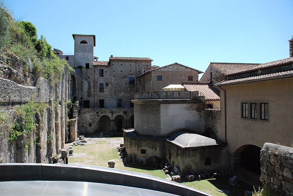
The ancient apsidal hall of Palestrina, part of the monumental Sanctuary of Fortuna Primigenia at Roman Praeneste. Photo by Camelia Boban, licensed under CC BY-SA 3.0, via Wikimedia Commons
The sanctuary climbed the hillside in a sequence of terraces, ramps, stairways and porticoes. Rather than placing a temple on a flat platform, its builders used the slope itself as part of the architecture. Visitors moved progressively upward through increasingly elevated levels, while the entire complex remained visible from the valley below.
That design combined religion with political display. Praeneste did not merely possess a sanctuary. It transformed the mountain into one.
At the top of the ancient complex now stands the Renaissance Palazzo Barberini, which houses the National Archaeological Museum. Among its most important objects is the Nile Mosaic, a large Hellenistic work depicting the Egyptian landscape during the Nile flood, complete with animals, boats, buildings and people.
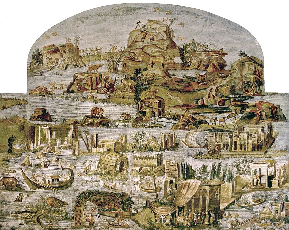
The Nile Mosaic of Palestrina, a late second-century BCE masterpiece depicting life and wildlife along the Nile during its annual flood. Unknown ancient artist, public domain, via Wikimedia Commons
Palestrina is an important reminder that Lazio’s history did not begin with Rome. Powerful communities already existed throughout the region, and places such as Praeneste retained strong identities even as Roman power expanded.
The race now turns towards Tivoli, where the scale of architecture becomes even larger.
Tivoli · Hadrian’s Empire and the Gardens of the Renaissance
Tivoli lies east of Rome where the Aniene River descends from the Apennine foothills towards the Roman plain.
The town has attracted wealthy residents for more than two thousand years because of the same combination of water, elevation and cooler air. Ancient Romans built villas in the area, and the emperor Hadrian, who ruled from AD 117 to 138, created one of the most extraordinary residential complexes of the ancient world.
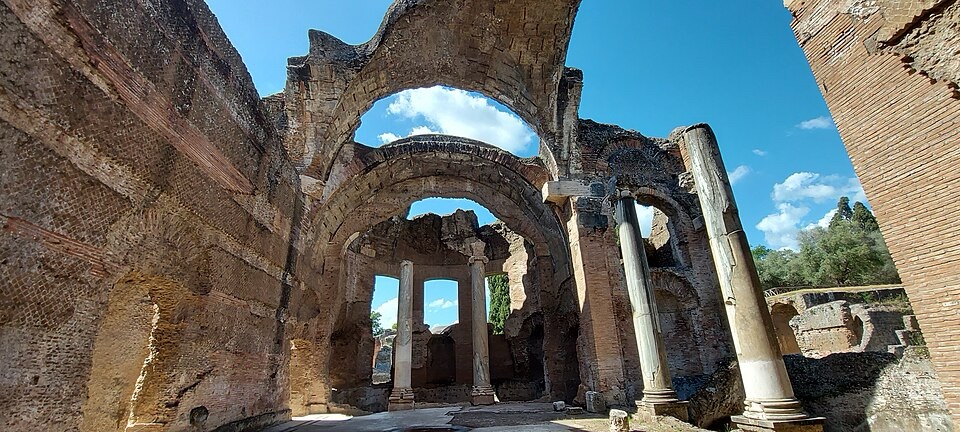
The remains of the thermal baths at Hadrian’s Villa, Emperor Hadrian’s vast second-century imperial retreat near Tivoli. Photo by Anna Eden 86, licensed under CC BY-SA 4.0, via Wikimedia Commons
Villa Adriana, Hadrian’s Villa, spreads across a vast area outside the modern town. It was far more than a house. The complex contained palaces, baths, libraries, gardens, pools, dining spaces and architectural references to different parts of the empire.
Hadrian travelled widely during his reign. His empire stretched from Britain and Iberia to North Africa and the Near East, and the villa appears to have reflected that geographical imagination. Greek, Egyptian and Roman influences were combined into an artificial landscape that functioned almost as a private map of the Mediterranean world he ruled.
More than fourteen centuries later, Tivoli acquired another monument of international importance.
In the 16th century, Cardinal Ippolito II d’Este commissioned Villa d’Este, whose gardens became famous for their use of water. Fountains, cascades, pools and hydraulic effects were arranged across the steep hillside using gravity rather than modern pumps.
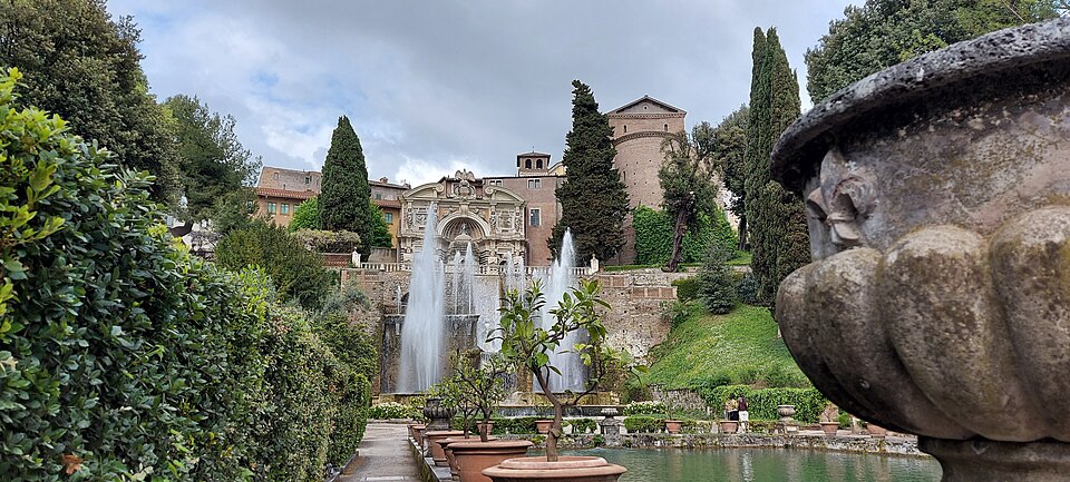
Villa d’Este in Tivoli, a UNESCO-listed Renaissance villa celebrated for its spectacular terraced gardens and water-powered fountains, including the Fountain of the Organ pictured here. Photo by Anna Eden 86, licensed under CC BY-SA 4.0, via Wikimedia Commons
The gardens became one of the great models for European Renaissance and Baroque landscape design.
Tivoli therefore preserves two very different expressions of elite power. Hadrian used architecture to recreate an empire. Ippolito d’Este used water and engineering to transform a hillside into spectacle.
The race leaves Tivoli and moves north-west towards the outer edge of Rome’s metropolitan area.
Mentana · Garibaldi’s Failed Attempt to Take Rome
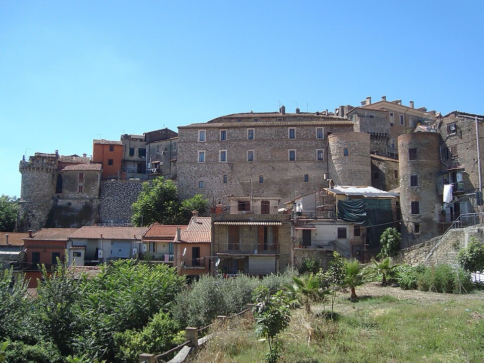
A panoramic view of Mentana, the Lazio town remembered for the 1867 battle between Garibaldi’s volunteers and Papal and French forces. Photo by LPLT, licensed under CC BY-SA 3.0, via Wikimedia Commons
The route reaches Mentana, a town around twenty kilometres from central Rome.
Mentana became nationally important because of a battle fought here on 3 November 1867, during the final stages of the Risorgimento, the long political and military process that created modern Italy.
By 1867, most of the Italian peninsula had been incorporated into the Kingdom of Italy, but Rome remained outside it. The city was still governed by Pope Pius IX as the centre of the Papal States and was protected by French military support.
The revolutionary nationalist Giuseppe Garibaldi, one of the central figures of Italian unification, organised volunteers and attempted to capture Rome.
His forces were intercepted near Mentana by Papal troops reinforced by a French expeditionary corps.
Garibaldi was defeated. The French troops carried the new Chassepot rifle, a breech-loading weapon with greater effective range and rate of fire than many of the guns used by Garibaldi’s volunteers, giving them a significant tactical advantage.
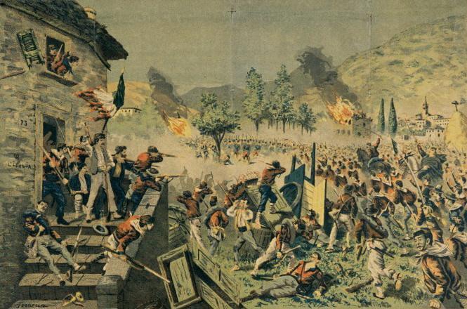
The Battle of Mentana on 3 November 1867, where Papal and French forces defeated Giuseppe Garibaldi’s volunteers during their attempt to capture Rome. Watercoloured lithograph by T. Rodella, public domain, via Wikimedia Commons.
The defeat delayed the capture of Rome, but only briefly in historical terms. Three years later, in 1870, the Franco-Prussian War forced France to withdraw its troops. Italian forces then entered Rome through the breach at Porta Pia, ending the temporal rule of the popes and completing the incorporation of the city into the Kingdom of Italy.
The roads around Mentana therefore belong to one of the final chapters in the creation of the Italian state.
From here, the race turns north through Monterotondo, Capena and the countryside leading towards the old routes of northern Lazio.
Castelnuovo di Porto · On the Corridor of the Via Flaminia
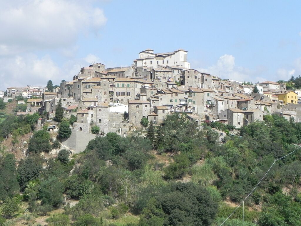
A panoramic view of Castelnuovo di Porto, a medieval hilltop town north of Rome, seen from the Church of San Sebastiano. Photo by Nubifer, licensed under CC BY-SA 3.0, via Wikimedia Commons
Castelnuovo di Porto lies north of Rome, close to the historic corridor of the Via Flaminia.
The Via Flaminia was one of the great consular roads of ancient Rome, begun in the late third century BC to connect the capital with central and northern Italy. From Rome it crossed the Tiber and ran north through the territories of the Falisci and Umbrians before eventually reaching the Adriatic coast at Ariminum, modern Rimini.
For Rome, such roads were instruments of power. They moved armies, officials, messages, taxes and goods across an expanding state and helped turn distant territories into parts of one administrative system.
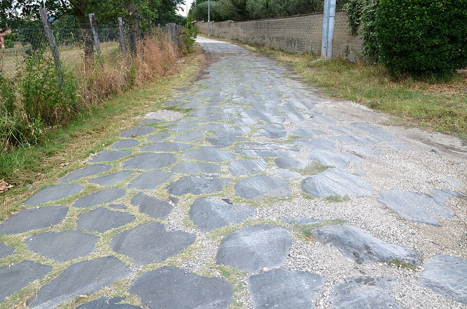
The Via Flaminia, the ancient Roman road built in 220 BCE to connect Rome with the Apennines and Italy’s Adriatic coast. Photo by Carole Raddato, licensed under CC BY-SA 2.0, via Wikimedia Commons
The towns north of Rome developed repeatedly around this same north-south problem. Rivers, tuff ridges and volcanic terrain made movement difficult in places, so routes had to follow natural corridors and avoid the deepest ravines.
The modern road around Castelnuovo di Porto does not reproduce every ancient alignment, but it occupies the same broad geography of movement.
From here, the race continues into Tuscia, the name commonly used for northern Lazio and neighbouring areas once associated with the Etruscan world.
The geology becomes more visible at Nepi.
Nepi · A Town Between Tuff Gorges
Nepi is a small town in the province of Viterbo, around forty kilometres north of Rome.
It stands on a plateau of tuff, a compact volcanic rock formed from ancient eruptions across central Italy. Streams have cut deep ravines into that softer volcanic material on either side of the settlement, creating natural defences that made the site attractive for human occupation.
Water is central to Nepi’s identity. The town’s name is traditionally linked with an ancient word associated with water, and the Cavaterra waterfall drops into a gorge immediately below the historic centre.
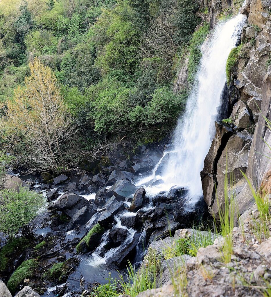
The Cavaterra waterfall plunging through the volcanic tuff gorge beneath the historic town of Nepi in northern Lazio. Photo by Livioandronico2013, licensed under CC BY-SA 4.0, via Wikimedia Common
The same geology shaped the town’s military architecture. The Rocca dei Borgia occupies the edge of the plateau and incorporates earlier defensive structures. It became particularly associated with the Borgia family during the late 15th century, when Pope Alexander VI strengthened the fortress.
His daughter Lucrezia Borgia spent time at Nepi around 1500 after the murder of her second husband, Alfonso of Aragon.
Later, under the Farnese family, the fortifications were incorporated into a broader defensive system associated with Antonio da Sangallo the Younger, one of the leading architects of Renaissance military architecture.
An 18th-century aqueduct later crossed the ravine on monumental arches, adding another architectural layer to the same landscape.
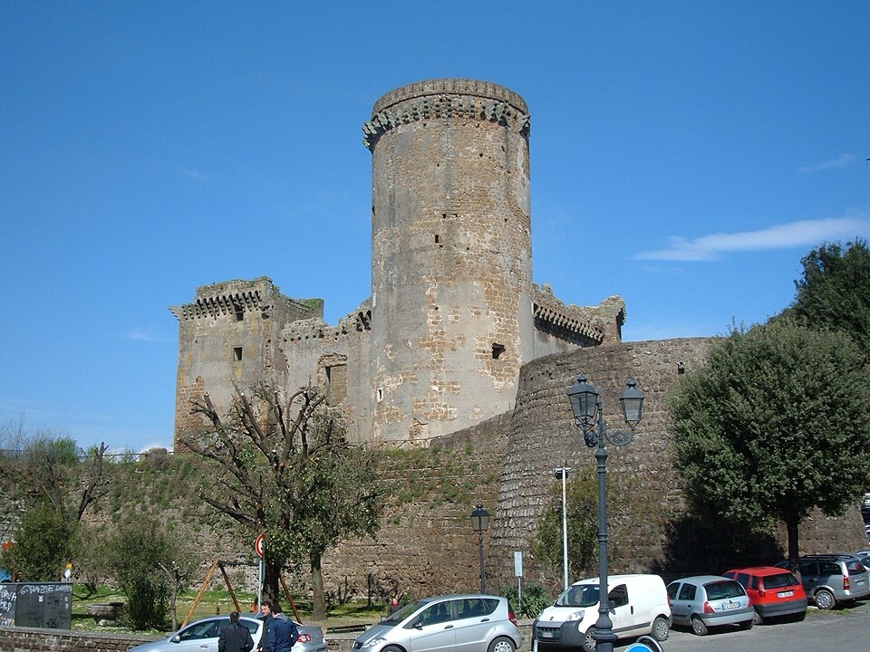
The imposing Rocca dei Borgia, a medieval fortress guarding the historic town of Nepi in northern Lazio. Photo by Croberto68, licensed under CC BY-SA 3.0, via Wikimedia Commons.
Nepi’s history is therefore tied directly to its physical setting. Volcanic rock created the plateau, water cut the gorges, fortifications occupied the edges and engineers eventually had to bridge the terrain to bring water into the town.
The route now continues through Sacrofano and Campagnano di Roma, moving closer to the ancient Etruscan world.
Campagnano di Roma · Between Rome and Etruria
Campagnano di Roma lies roughly thirty kilometres north of the capital in rolling country between the Tiber valley and Lake Bracciano.
The town occupies a strategic position between Rome and the territories that once belonged to the Etruscans, the civilisation that dominated much of central Italy before Roman expansion.
Nearby lay Veii, one of the most powerful Etruscan cities. Rome fought Veii repeatedly and, according to Roman tradition, finally captured it in 396 BC after a long siege. The conquest marked a major stage in Rome’s expansion beyond the immediate territory around the Tiber.
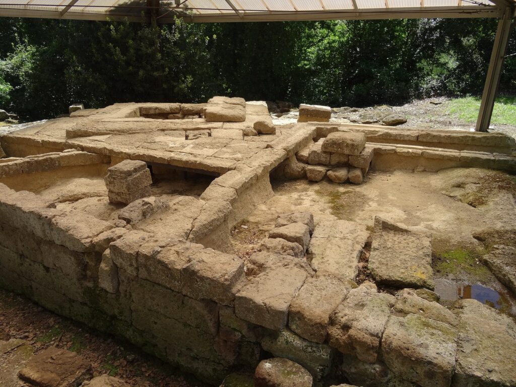
The ruins of the Portonaccio Sanctuary at Veii, once one of the most important religious centres of the ancient Etruscan city north of Rome. Photo by Livioandronico2013, licensed under CC BY-SA 3.0, via Wikimedia Commons
Centuries later, the same broad landscape became part of the Via Francigena, the medieval pilgrimage route used by travellers journeying from northern Europe towards Rome.
That creates a long continuity of movement through the region. Etruscan paths, Roman roads, medieval pilgrim routes and modern roads all had to negotiate the same hills between the Tiber basin and the volcanic country to the west.
The race now turns towards Lake Bracciano.
Trevignano Romano · Etruscan Country on the Shore of a Volcanic Lake
Trevignano Romano is one of the three principal historic towns on the shores of Lake Bracciano, together with Bracciano and Anguillara Sabazia.
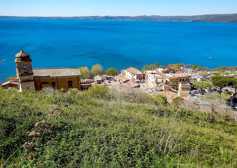
Trevignano Romano and Lake Bracciano viewed from the ruins of the medieval Rocca Orsini. Photo by Albarubescens, licensed under CC BY-SA 4.0, via Wikimedia Commons.
The town occupies the northern shore, where wooded volcanic hills descend towards the water. Before Rome dominated central Italy, this region belonged to the cultural world of the Etruscans.
The Etruscans developed wealthy city-states across much of Tuscany, northern Lazio and parts of Umbria during the first millennium BC. They traded widely across the Mediterranean, produced sophisticated metalwork and funerary art, and developed religious and political traditions that later influenced Rome.
Archaeological finds around Trevignano include tombs and objects linked to the Etruscan settlement traditionally identified with ancient Sabate.
The road now follows the lake shore, and the landscape itself becomes one of the most important subjects of the race.
Lake Bracciano · A Volcanic Landscape Filled With Water
The final thirty kilometres unfold around Lake Bracciano, approximately thirty kilometres north-west of Rome.
The lake belongs to the Sabatini volcanic district, a region shaped by repeated volcanic and tectonic activity over hundreds of thousands of years.
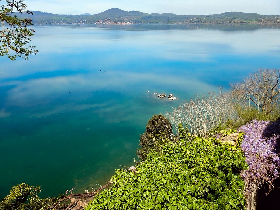
Lake Bracciano viewed from Anguillara Sabazia, with Trevignano Romano and Monte Rocca Romana visible on the distant shore. Photo by Albarubescens, licensed under CC BY-SA 4.0, via Wikimedia Commons
Lake Bracciano is often described simply as a crater lake, but its origin is more complex. It occupies a broad volcano-tectonic depression formed by faulting and collapse within a much larger volcanic system. Nearby Lake Martignano occupies a more recognisable volcanic crater.
Most of Lake Bracciano’s water comes from underground springs rather than large rivers flowing into it. Its only natural outlet is the Arrone, which eventually reaches the Tyrrhenian Sea near Fiumicino.
The lake has long been important to Rome because its water has been incorporated into the capital’s supply system. That practical role also helped encourage strict environmental protection, and motorised boating remains heavily restricted.
The result is a landscape that feels surprisingly remote given its proximity to the capital. Wooded volcanic hills surround a broad body of relatively clean water, and three old towns occupy prominent positions around the shore.
The first major one reached by the race is Bracciano.
Bracciano · The Orsini-Odescalchi Castle Above the Lake
Bracciano rises above the western shore beneath the massive Castello Orsini-Odescalchi.
An earlier stronghold already occupied the hill, but the present castle developed primarily under the Orsini family during the 15th century.
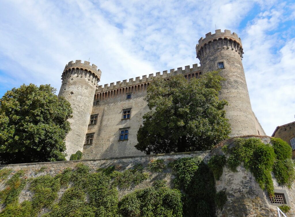
The imposing fifteenth-century Orsini-Odescalchi Castle rising above Piazza Mazzini in the historic centre of Bracciano. Photo by Albarubescens, licensed under CC BY-SA 4.0, via Wikimedia Commons.
The Orsini were one of the most powerful aristocratic families of medieval and Renaissance Rome. They produced cardinals, military leaders and popes and controlled estates across central Italy.
The castle at Bracciano reflects the changing nature of noble power during the Renaissance. It is both fortress and palace. Thick walls and towers provided defence, while decorated rooms and ceremonial spaces displayed wealth and status.
The building was also caught up in conflicts between aristocratic families and the papacy. Pope Alexander VI Borgia attempted to weaken Orsini power during the late 15th century, and papal forces unsuccessfully besieged Bracciano.
In 1696, the estate passed to Livio Odescalchi, nephew of Pope Innocent XI. The Odescalchi family still owns the castle.
From the towers, the lake dominates the view. By this point in the race, the road itself has changed character as well. The hardest inland hills are behind the peloton, and the final kilometres increasingly favour speed as the route follows the shore towards Anguillara Sabazia.
FINISH · Anguillara Sabazia and an 8,000-Year-Old Village Beneath the Lake
The Gran Premio del Lazio finishes in Anguillara Sabazia, a lakeside town around forty kilometres north-west of central Rome.
The historic centre occupies a promontory where the shoreline forms a sharp angle, a feature traditionally linked to the ancient name Angularia. The medieval town later became associated with the Anguillara family, who controlled the area until the late 15th century.
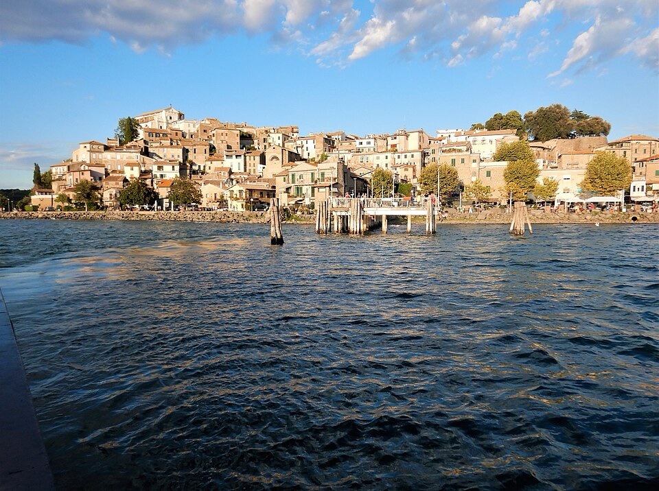
The medieval lakeside village of Anguillara Sabazia rising from the shore of Lake Bracciano. Photo by Albarubescens, licensed under CC BY-SA 4.0, via Wikimedia Commons.
Narrow streets climb from the water towards the upper part of the old town, but the most extraordinary history of Anguillara lies not above the lake.
It lies beneath it.
At La Marmotta, close to Anguillara, underwater archaeology uncovered a submerged Neolithic village dating back roughly 8,000 years.
The site preserves exceptional evidence of some of the earliest farming communities in central Italy. These people lived during the long transition from hunting and gathering towards permanent agriculture and settled life.
They cultivated crops, kept domestic animals, produced sophisticated pottery and built wooden structures close to the water.
Among the discoveries were dugout canoes, some of the oldest known examples of advanced watercraft from Neolithic Europe.
La Marmotta changes the scale of the entire route. The race has already passed medieval popes, Renaissance dynasties, Roman sanctuaries and Etruscan settlements, yet the final town preserves evidence of people who lived beside the lake thousands of years before any of those worlds existed.
The route began in Fiuggi, where water created the identity of a modern spa town. It crossed Anagni and Fumone, where two very different popes became part of the political history of medieval Europe. Piglio introduced a wine landscape native to Lazio, Palestrina revealed one of the great sanctuaries of ancient Latium and Tivoli brought the race into the architectural worlds of Hadrian and the Este family.
Farther north, Mentana carried the road into the unfinished struggle for Italian unification, while Nepi showed how volcanic geology shaped settlement, defence and engineering. Campagnano marked the transition towards old Etruscan territory, and Trevignano opened the final approach to the volcanic basin of Lake Bracciano.
At Anguillara, the chronology reaches much deeper.
The race ends beside a lake where humans were already building houses, farming land and travelling by canoe around eight millennia ago.



