

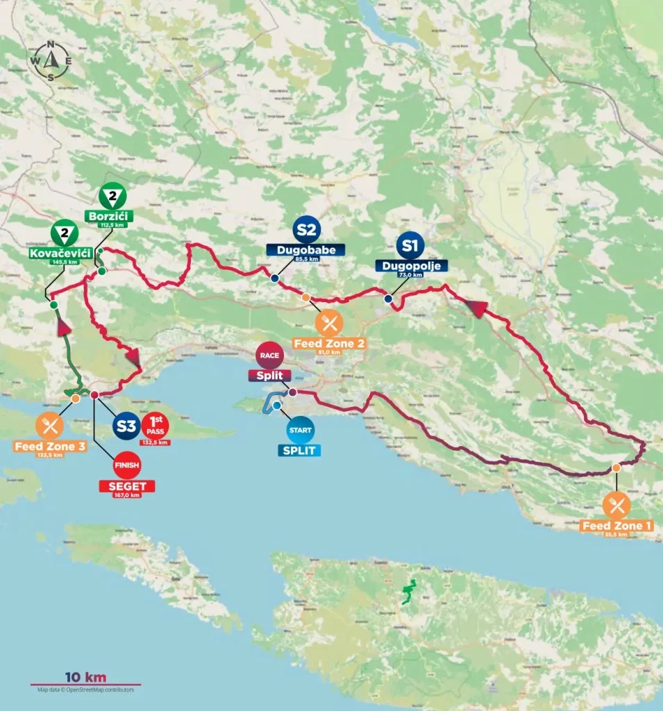
The CRO Race opens on the Dalmatian coast, but Stage 1 does not stay there for long. From Split, the route turns inland through Stobreč and the country east of the city, crosses the old territory of Poljica, reaches the Cetina valley, then bends back west through the limestone interior before dropping towards Trogir and Seget Donji. Even the finish is deceptive: the riders see Seget once with 34.5 kilometres remaining, head back into the hills, and only then return to the coast for the stage finish.
Across 167 kilometres and 2,320 metres of climbing, the road moves repeatedly between the Adriatic and the harsher country behind it. That makes the opening stage a useful introduction to central Dalmatia, because the famous coast is only one part of the region. Behind Split and Trogir lie narrow valleys, karst plateaus, old frontier villages and communities whose histories were shaped as much by mountains and rivers as by the sea.
START · Split and the Palace That Never Became a Ruin
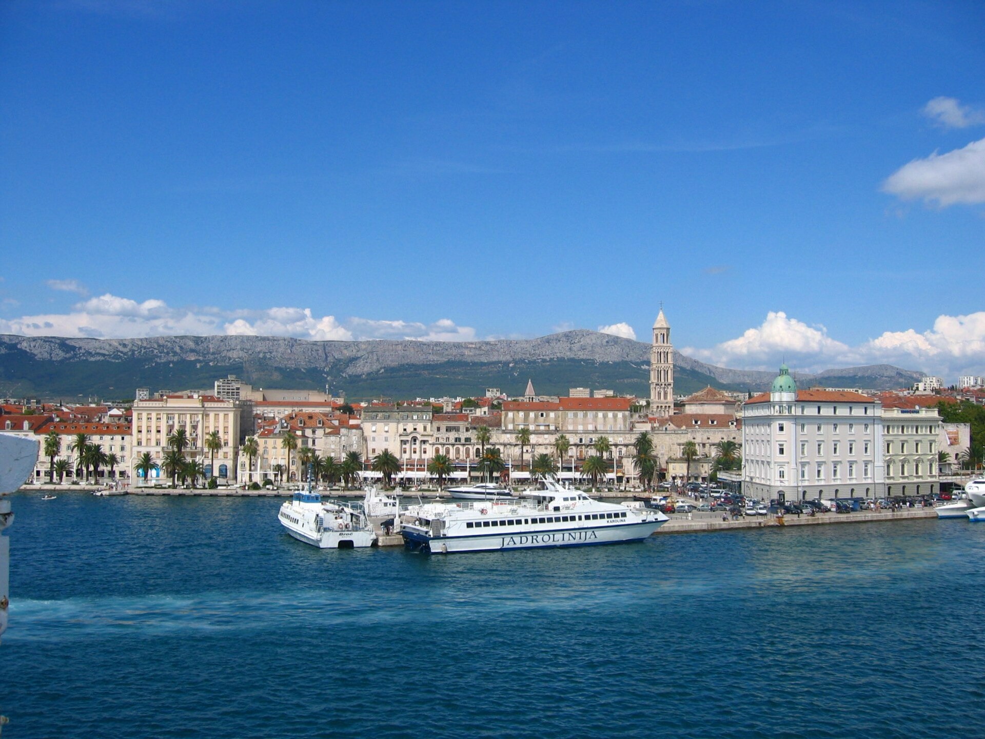
Split’s rises above the Adriatic waterfront, seen from a ferry approaching the Croatian city. Photo by Minestrone, licensed under CC BY-SA 4.0, via Wikimedia Commons
Split begins with Rome. At the beginning of the 4th century, Emperor Diocletian built an enormous fortified residence beside the Adriatic, close to Salona, then one of the principal Roman cities of the eastern Adriatic. The complex was part palace, part military enclosure, part retirement residence, with monumental gates, towers, ceremonial spaces and private quarters arranged inside heavy walls.
What happened later is what makes Split unusual. The palace survived the empire that created it. When the surrounding political order weakened and Salona declined, people moved into the complex rather than abandoning it. Rooms became houses, passageways became streets, churches appeared inside Roman structures and new buildings were inserted wherever space allowed. Diocletian’s mausoleum became the Cathedral of Saint Domnius, while centuries of medieval, Renaissance and Baroque construction accumulated around Roman columns and walls.
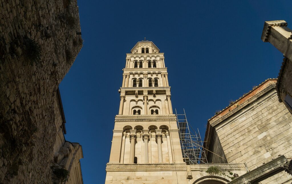
The medieval bell tower of Saint Domnius Cathedral rises above Diocletian’s Palace in the historic centre of Split, Croatia. Photo by Sumitsurai, licensed under CC BY-SA 4.0, via Wikimedia Commons.
That is still how central Split works. The palace is not separated from the city behind fences or treated as an archaeological island. People live, eat and work within its fabric, and the old imperial structure survives because it was repeatedly reused.
The race leaves that dense historical centre quickly. Only a few kilometres east, another settlement pushes the story back several centuries.
-160 km · Stobreč and the Greek Coast Before Roman Split
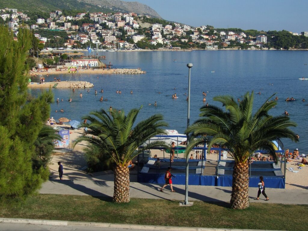
A beach on the Adriatic coast at Stobreč, a seaside neighbourhood east of Split, Croatia. Photo by Marcin Szala, licensed under CC BY-SA 3.0, via Wikimedia Commons.
Modern Stobreč sits within the wider Split urban area, close enough to the city to feel almost suburban, but its ancient predecessor was already here long before Diocletian chose the coast for his palace.
Greek settlers from Issa, modern Vis, founded Epetion here around the 3rd century BC. Issa had become one of the important Greek centres of the Adriatic and established settlements along the mainland coast, among them Epetion and Tragurion, the future Trogir.
The remains are not monumental in the way Split’s palace is, but sections of Hellenistic fortification survive, alongside Roman and early Christian layers that show how the settlement continued after Greek rule disappeared. Archaeology has also uncovered evidence of habitation predating Epetion itself.
Stage 1 will meet this Greek world twice. Stobreč appears near the start, while Trogir waits in the final hour.
Between the two, the road leaves the sea behind.
-147.5 km · Tugare and the Old Community of Poljica
At Tugare, the race moves into Poljica, the historic country lying between Mosor, the Cetina River and the coast around Omiš.
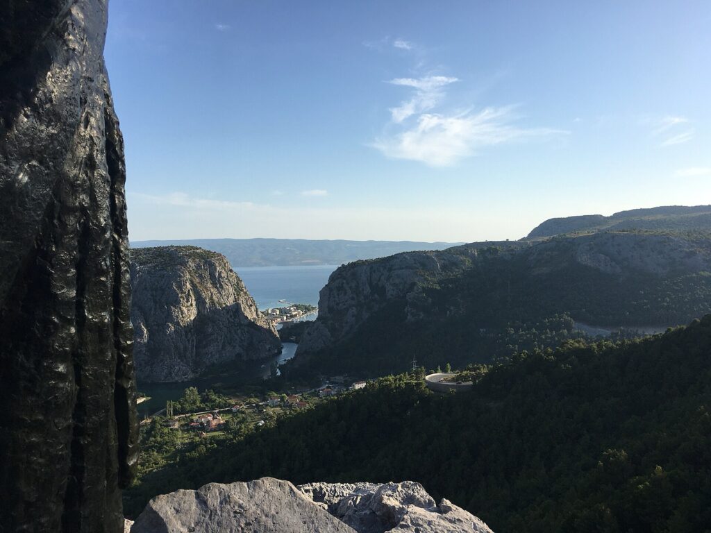
The hills of historic Poljica above Omiš, Croatia. Photo by UdrugaKačić, licensed under CC BY-SA 4.0, via Wikimedia Commons
It is difficult terrain: limestone hills, narrow valleys, limited agricultural ground and villages separated by ridges that make short distances feel longer than they appear on a map. For centuries, that geography helped sustain an unusually strong tradition of local government.
Poljica is often described as a republic, although its institutions were closer to an autonomous principality or self-governing community. From the later Middle Ages, local villages operated through assemblies, elected officials and customary law. The Poljica Statute preserved rules governing property, inheritance, obligations and local authority, while representatives of the communities gathered to choose the great prince who stood at the head of the system.
Nearby Gata was one of the important places in that political landscape.
Poljica existed beside much larger powers and survived by negotiating with them, resisting them and sometimes accepting nominal authority while keeping much of its internal structure. Venetian and Ottoman influence reached the region from opposite directions, and the autonomy endured until 1807, when Napoleonic French forces suppressed a local revolt and dismantled what remained of the old system.
The peloton continues east through country where political boundaries once shifted constantly but the mountains did not.
-126.5 km · Blato na Cetini and the River Behind the Mountains
At Blato na Cetini, the race reaches the valley of the Cetina, one of the great rivers of central Dalmatia.
This is a different world from Split’s waterfront. The village lies inland, beyond the coastal mountains, in country where limestone dominates the geology and surface water becomes unusually important because rain often drains underground through fractured rock.
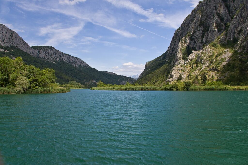
The Cetina River flows past Omiš before reaching the Adriatic Sea on Croatia’s Dalmatian coast. Photo by Nikolaj Potanin, licensed under CC BY 2.0, via Wikimedia Commons.
The Cetina does the opposite. It remains visible. Its valley supported settlement, agriculture and movement through terrain where reliable water could never be taken for granted. The river also became a natural line between communities and political zones, and the wider area around Blato passed through the influence of medieval Croatian and Bosnian rulers, Ottoman expansion and later Venetian control.
Nothing here is far from the Adriatic in absolute distance, yet the mountains make the separation feel substantial. The sea disappears from view, the climate becomes less maritime and villages sit in valleys shaped more by river access than by harbours.
The road now begins turning west again, but it still has a long way to travel before the coast returns.
Dugopolje · The Open Country North of Mosor
The stage reaches Dugopolje in the middle part of the race.
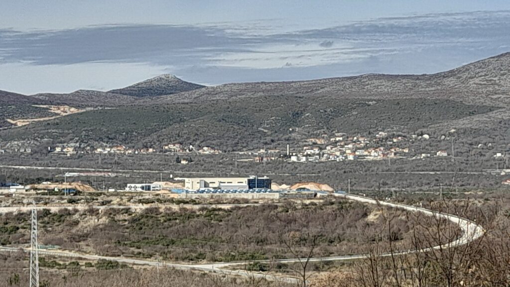
Koprivno, a village in the Dugopolje area of Dalmatia, inland from Split. Photo by Argo Navis, licensed under CC BY-SA 4.0, via Wikimedia Commons
Its name refers to the long field around which the settlement developed, one of the broader pieces of usable ground north of Mosor. Today the motorway linking Split with inland Croatia passes close by, but the importance of the corridor is much older than modern transport.
The mountains behind Split funnel movement through a limited number of passages. Nearby Klis, with its fortress controlling one of the principal approaches between coast and interior, is the most dramatic expression of that geography, but Dugopolje belongs to the same transition zone.
By now, the race has been away from the Adriatic long enough for the opening kilometres to feel remote. The road runs through dry fields and stony uplands rather than the dense coastal strip, and the next part of the stage becomes rougher still.
-54.5 km · Borzići and the Limestone Interior
The second-category climb at Borzići comes with 54.5 kilometres remaining.
The surroundings are typical of the Dalmatian karst, where water dissolves limestone over immense periods and produces a landscape of exposed rock, depressions, fissures and underground drainage. Rainfall can vanish rapidly into the ground, leaving surprisingly little surface water despite a climate that is not truly arid.
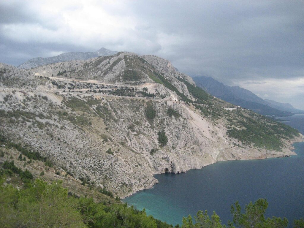
The Dalmatian karst reaches the Adriatic coast. Photo by Modzzak, public domain, via Wikimedia Commons.
Human settlement adapted to those conditions slowly.
Farmers cleared stones from small patches of workable soil and reused them for dry walls, terraces and boundaries. Much of the apparently empty ground seen from above is therefore not untouched wilderness but a landscape worked patiently over generations, often for very modest agricultural returns.
The road at Borzići is not long or steep enough to decide the stage alone, but its position is useful. The peloton has already crossed more than one hundred kilometres of irregular terrain, and from here the route finally begins descending towards the Adriatic.
The sea returns around Trogir.
-36 km · Trogir and Two Thousand Years of Streets
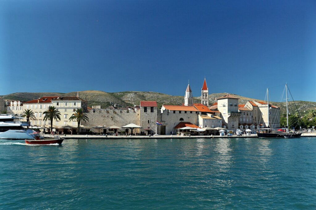
Trogir’s historic centre sits on a small island along Croatia’s Dalmatian coast, linked by bridges to the mainland and Čiovo. Photo by VitVit, licensed under CC BY-SA 4.0, via Wikimedia Commons
Trogir appears with around 36 kilometres remaining and then again close to the finish.
The historic centre occupies a small island between the mainland and Čiovo, and the amount of history compressed into that small space is remarkable.
Greek settlers from Issa founded Tragurion here in the 3rd century BC, around the same period as Epetion at Stobreč. The town was laid out according to a regular Hellenistic plan, and traces of that organisation still survive in the modern street network.
That continuity is more interesting than any single monument.
Roman rule followed the Greeks. Medieval Croatian and Venetian centuries added churches, palaces, towers and fortifications, while the basic urban structure remained recognisable underneath. The Cathedral of St Lawrence belongs to the medieval city, Kamerlengo Castle to the long Venetian presence, and Renaissance and Baroque buildings fill the streets between them.
Trogir did not preserve one historical period by freezing it. It kept building on top of what was already there.
For the race, that continuity also closes a circle begun near Split. Stobreč and Trogir were both founded from the same Greek Adriatic network, separated on the route by more than a hundred kilometres of inland Dalmatia.
The peloton now reaches Seget Donji for the first time.
-34.5 km · Seget Appears, Then Disappears Again
The riders cross the finish line in Seget Donji with 34.5 kilometres still remaining.
Instead of staying beside the sea, the route turns uphill again through Seget Gornji and the country towards Prgomet. The classified climb at Kovačevići, with 21.5 kilometres to go, is the last significant obstacle of the stage.
The design makes the finale more awkward than a conventional coastal sprint. Fast riders reach the finishing straight once, leave it behind, climb back into the karst interior and then have to descend towards Trogir a second time.
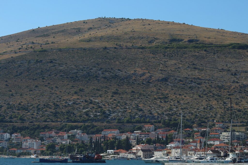
Seget Donji on Croatia’s Dalmatian coast, with Vlaška hill rising behind the village near Trogir. Photo by VitVit, licensed under CC BY-SA 4.0, via Wikimedia Commons
By the time the road returns to the old town, there is little distance left for anyone dropped on the climb to repair the damage.
Trogir passes once more through the race, and Seget Donji finally becomes the finish rather than an intermediate point.
FINISH · Seget Donji and the Fortified Edge of Venetian Dalmatia
The historic core of Seget Donji belongs to a much later period than Split, Stobreč or Trogir.
In 1564, Trogir nobleman Jakov Rotondo received permission to build a defensive tower here. A small fortified settlement developed around it, enclosed within walls and corner towers at a time when the inland frontier between Venetian-controlled Dalmatia and the Ottoman world remained unstable.
The form was practical rather than ceremonial. Coastal communities close to the frontier had to think about defence as part of ordinary settlement, and Seget grew accordingly.
That is enough to give the final kilometres their own historical identity without turning the finish into another inventory of empires. Stage 1 has already crossed Roman Split, Greek Stobreč, the autonomous country of Poljica and the Cetina hinterland before returning to the Adriatic through Trogir.
What remains most striking is the distance between those worlds.
The coast is never far away, yet within a few kilometres the road can leave Roman palaces and island towns behind and enter dry limestone country where rivers, passes and small areas of cultivable ground shaped life for centuries. Stage 1 spends much of its 167 kilometres moving back and forth across that divide.



