

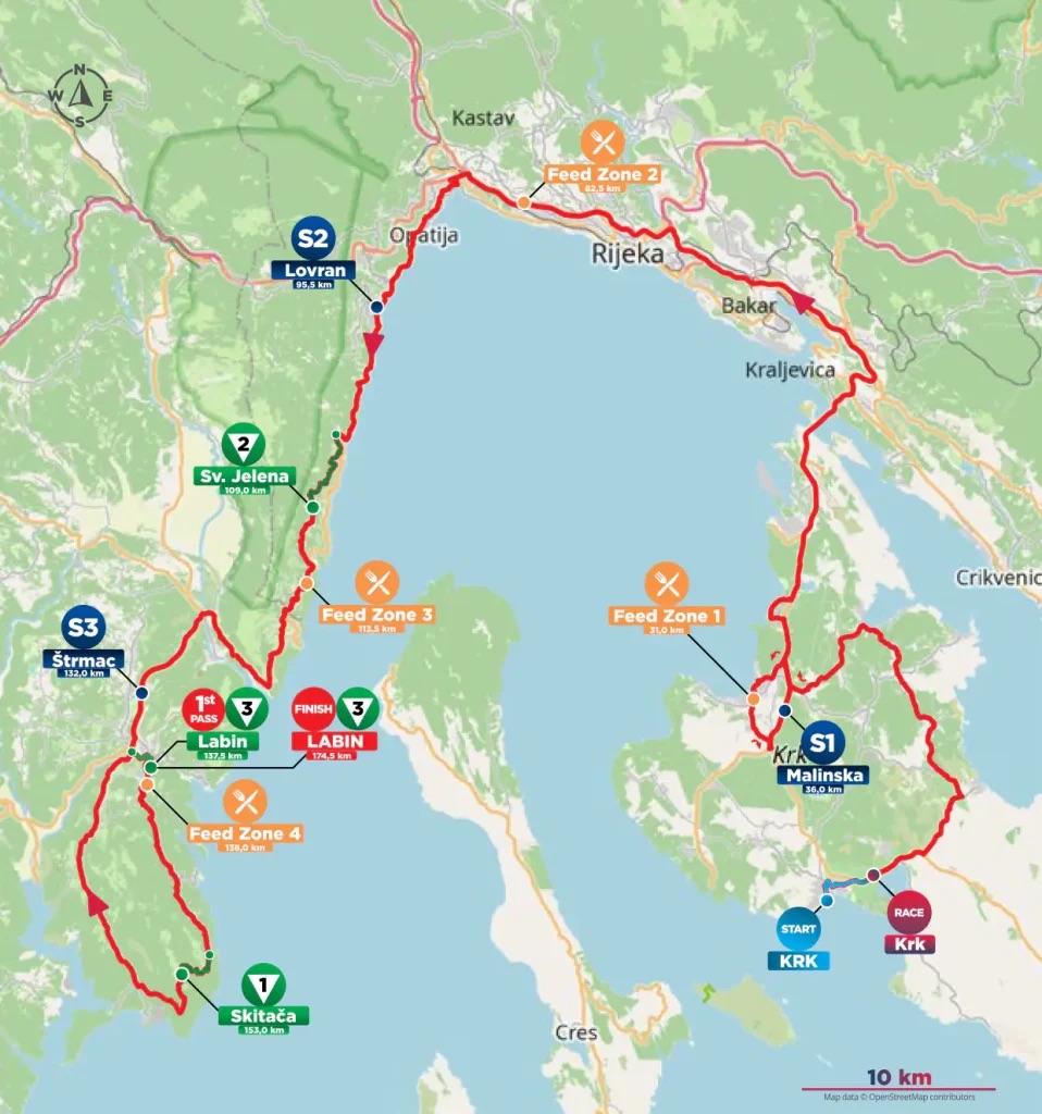
Stage 3 begins on an island and ends on a hilltop, but between those two points the CRO Race crosses a much larger geographical boundary. The opening kilometres wander through the interior of Krk, where villages, dry-stone fields and sheltered bays preserve traces of a Croatian culture that developed beside older Roman settlements and centuries of Venetian influence. After crossing the Krk Bridge, the race reaches the mainland and turns west around the head of the Kvarner Gulf, passing through Opatija and Lovran before following the increasingly dramatic coast beneath the mountains. Beyond Mošćenička Draga and Brseč, the road finally enters Istria, where the Adriatic is joined by another landscape of medieval hill towns, Venetian architecture and a mining history that transformed the country around Labin.
The official route measures 174.5 kilometres, making it longer and more demanding than the short journey across Pag on Stage 2. More important for this series, however, is the change in setting. The race moves from a Kvarner island to the old resort coast around Opatija, follows a road squeezed between mountain and sea, then reaches an Istrian interior where settlements often withdrew from the shoreline and occupied defensible heights. The finish at Labin belongs to that world, standing more than 300 metres above the Adriatic even though the sea at Rabac is only a few kilometres away.
START · Krk, Where Latin and Croatian Lived Side by Side
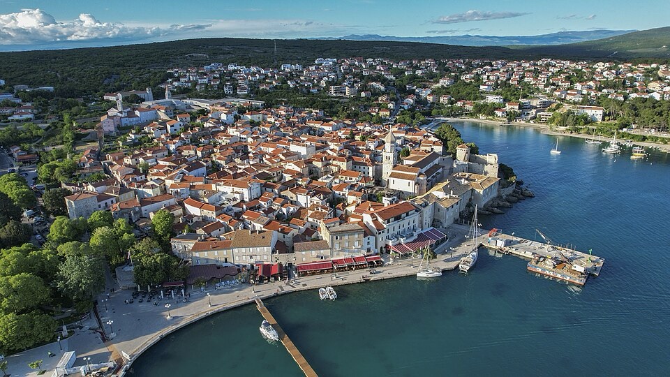
An aerial view of the town and coastline of Krk on Croatia’s island of the same name. Photo by Arne Müseler, licensed under CC BY-SA 3.0 Germany, via Wikimedia Commons
The stage begins on the waterfront of Krk, the principal town of the island that shares its name, with the old city enclosed behind walls whose history reaches back well before the Middle Ages. The Romans knew the settlement as Curicum, but they were not its founders; archaeological evidence points to an earlier fortified community, and sections of the surviving defensive line preserve a history that began before Roman control of the northern Adriatic. Later centuries added towers, gates, churches and houses without completely erasing what came before, leaving a compact town in which ancient, medieval and Venetian layers occupy much the same ground.
Krk becomes more interesting when the story moves beyond architecture, because for centuries the town stood at a linguistic and cultural boundary within the island itself. Latin remained important in the old urban centre and its church, while Croatian-speaking communities became established around the island after the early medieval Slavic migrations. In those communities, religious and written culture developed through Glagolitic, the early Slavic alphabet whose angular Croatian form survived particularly strongly in the northern Adriatic. Krk became one of its great centres, and inscriptions in the script still survive across the island. The famous Baška Tablet, carved around 1100 and discovered at Jurandvor on the other side of the island, is among the foundational monuments of written Croatian, recording a donation by the Croatian king Zvonimir in a text whose language and script belong to this remarkable local tradition.
From the 12th century, another name became inseparable from Krk. The Dukes of Krk, later known as the Frankopans, began as local rulers under Venetian influence but gradually built power far beyond the island, acquiring territories on the mainland and becoming one of the great noble families of medieval Croatia. Their castle still stands beside Krk’s old centre, where the square courtroom tower was completed in 1191. By the time Venice finally took direct control of the island in 1480, the family had already spent more than three centuries turning an island lordship into a political network stretching deep into the Croatian lands.
The peloton leaves those walls behind and begins crossing the island rather than immediately heading for the bridge.
Across Krk · Stone Fields, Villages and an Island Written in Walls
The road passes through Risika, Soline, Rasopasno, Malinska and Njivice, tracing an irregular line through Krk before finally reaching its northern edge. The island changes character repeatedly along the way, from exposed limestone country to more sheltered areas where woodland, vineyards, olive trees and grazing land soften the surface. Much of what looks natural from the road has nevertheless been worked for generations, and one of the most persistent signs of that labour is stone.
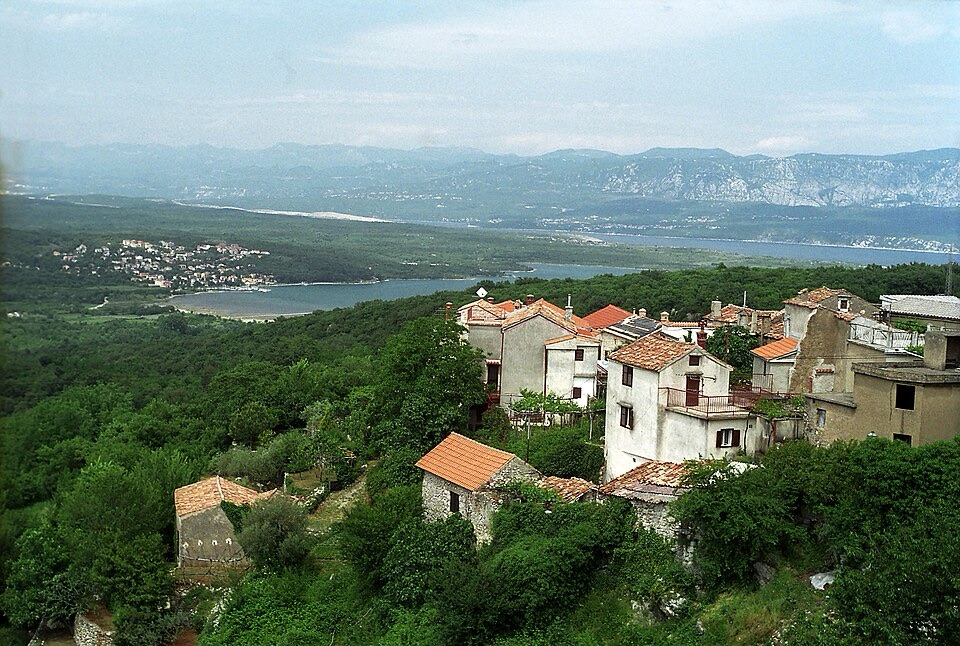
Soline Bay cutting into the northeastern coast of Croatia’s island of Krk, with Dobrinj visible on the right. Photo by Falk2, licensed under CC BY-SA 4.0, via Wikimedia Commons
Krk belongs to the great dry-stone landscape of the Adriatic, where farmers cleared limestone from shallow soils and then used what they had removed to divide fields, contain livestock and protect cultivated ground. Walls accumulated without mortar, their stability depending on the careful placement of irregular stones, until entire sections of countryside became patterned by them. The technique is common along the Croatian coast because the geology made stone abundant and workable soil precious; clearing a field and building its boundary were often parts of the same job.
Among those enclosed patches, island life traditionally combined agriculture with sheep breeding, fishing and seafaring rather than relying on any single resource. Villages developed around small pockets of cultivable ground, while the coast connected Krk with the rest of the Kvarner Gulf. The result is a landscape whose apparent simplicity conceals a dense human geography, particularly away from the modern resorts where old tracks, walls and settlement patterns remain easier to read.
Near Soline, the route also approaches one of Krk’s shallowest bays, an enclosed stretch of water known for mud deposits and a shoreline very different from the exposed western coast. Farther north, Malinska and Njivice belong to the greener side of the island, where woodland reaches much closer to the sea. By the time the peloton leaves Njivice, Krk has already shown considerably more variety than its outline on a map might suggest.
Ahead, the island narrows towards one of the largest engineering structures in the northern Adriatic.
Krk Bridge · The Island Becomes Part of the Mainland Road Network
The Krk Bridge carries the race across the channels separating the island from the Croatian mainland, a crossing whose scale is immediately different from the Pag Bridge encountered on Stage 2. When it opened in 1980, the structure was known as the Tito Bridge and its larger concrete arch, spanning the channel between the mainland and the islet of Sveti Marko, was an exceptional engineering achievement for its time. A second arch completes the crossing from Sveti Marko to Krk.
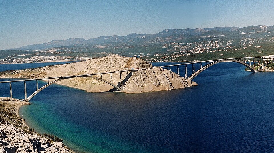
Before the bridge, the island’s relationship with the mainland depended much more heavily on ferries, even though Krk had always participated in the maritime world of Kvarner. The permanent road connection changed daily life as well as tourism, making Rijeka and the mainland road network directly accessible without a boat crossing. The bridge therefore altered the practical meaning of being an island while leaving the older maritime geography visible below.
For the riders, it is also the moment when Stage 3 changes direction. Krk falls behind, the industrial and urban surroundings of Rijeka approach, and the route swings west towards Liburnia, the narrow coastal strip beneath Mount Učka. The race does not enter central Rijeka, saving that city for Stage 4, but instead moves through Matulji towards a coastline that became fashionable across Europe long before mass tourism transformed the Adriatic.
Opatija and Lovran · The Adriatic Riviera of the Habsburg Empire
The road reaches Opatija at the head of the Kvarner Gulf, where grand hotels, villas and landscaped gardens seem at first to belong to a different Croatia from the stone villages crossed earlier on Krk. That difference has a historical explanation, because Opatija was deliberately transformed during the 19th century into one of the fashionable resorts of the Austro-Hungarian Empire.
The town’s older name and identity grew around the Benedictine abbey of St James, but the decisive change came after wealthy visitors began recognising the advantages of its sheltered position beneath Učka. The mountain protects this section of coast from some of the harsher weather reaching other parts of Kvarner, while evergreen vegetation and comparatively mild winters gave the area a climate that physicians and promoters considered suitable for long stays. Villas appeared first, followed by increasingly ambitious hotels, and the arrival of the railway at nearby Matulji made the coast accessible to wealthy travellers from Vienna, Budapest and other cities of the empire.
The Hotel Kvarner, opened in 1884, became one of the symbols of the new resort, while Opatija’s promenades and elaborate villas attracted aristocrats, politicians, artists and members of the imperial court. Tourism here therefore developed before the beach holiday became the dominant Mediterranean model; visitors came for climate, society, winter seasons and extended residence, turning a small coastal settlement into what was sometimes described as the Austrian Riviera.
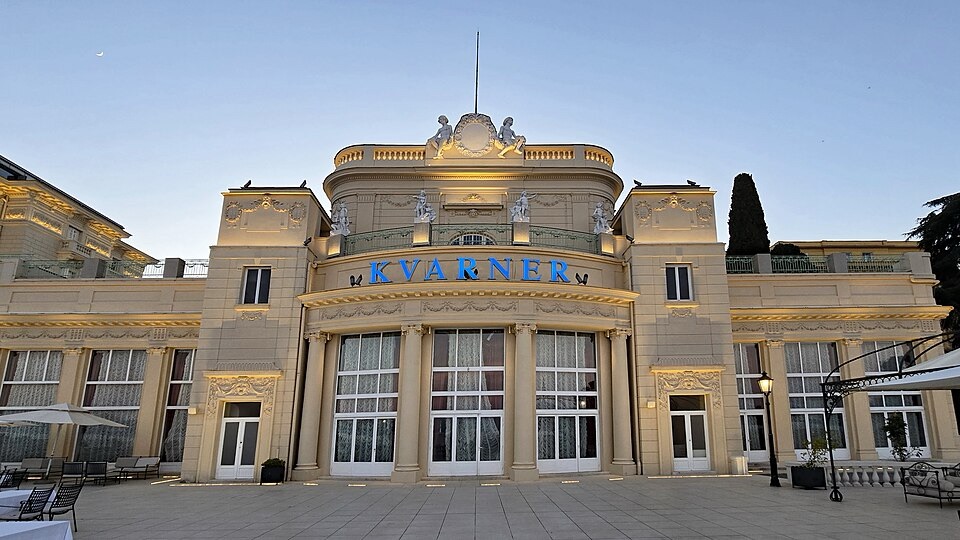
The historic Hotel Kvarner in Opatija, overlooking Croatia’s Kvarner Gulf. Photo by Rigorius, licensed under CC BY-SA 4.0, via Wikimedia Commons
The race follows that resort landscape south through Lovran, another old coastal town whose history predates the Habsburg hotels surrounding it. Lovran takes its name from the laurel that grows abundantly in the area, and its compact medieval core developed behind defensive walls while the slopes above supported agriculture. During the resort boom, villas spread along the coast between Lovran and Opatija, gradually linking the older settlements through an almost continuous strip of gardens and grand residences.
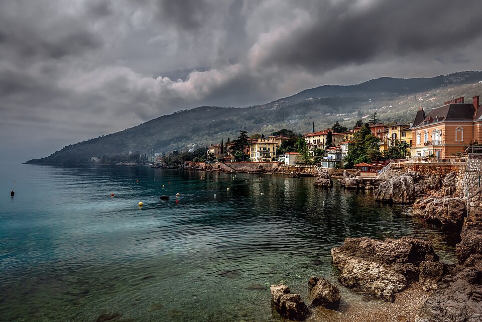
Lovran’s historic waterfront on the western shore of Croatia’s Kvarner Bay. Photo by Bernd Thaller, licensed under CC BY 2.0, via Wikimedia Commons
Beyond Lovran, however, the space between mountain and sea begins to tighten.
Mošćenička Draga and Mošćenice · A Village Below and Its Older Town Above
At Mošćenička Draga, the coastline curves around a long pebble beach beneath the eastern slopes of Učka. The modern settlement occupies the shore, but the older centre of this community is not beside the water at all. Mošćenice stands high above it, perched on a ridge more than a hundred metres above the Adriatic, and the relationship between the two settlements preserves an older pattern of life along the Istrian and Kvarner coast.
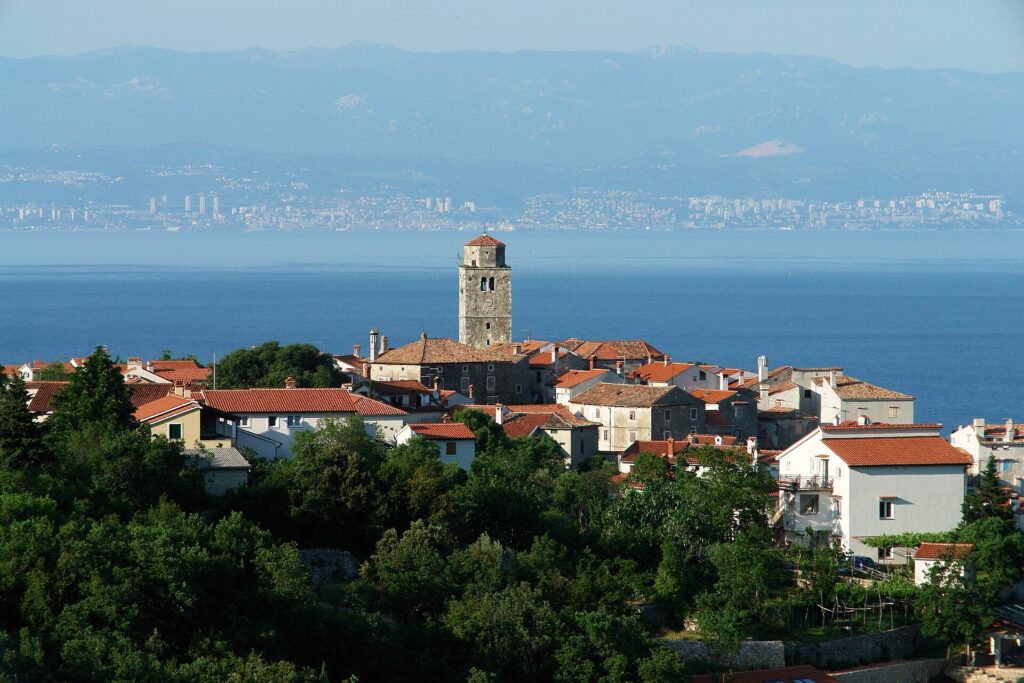
The medieval hilltop village of Mošćenice above Croatia’s Kvarner coast. Photo by Thaler Tamas, licensed under CC BY-SA 4.0, via Wikimedia Commons.
Before tourism made immediate access to the sea desirable, a hilltop could offer considerable advantages. It was easier to defend, less exposed to attacks arriving from the water and provided a broad view across the surrounding country. Mošćenice developed within walls on the height, its stone lanes compressed around a fortified centre, while the small fishing community below eventually grew into Mošćenička Draga. The coastal settlement expanded particularly as tourism arrived, reversing the older hierarchy until the village at the water became the better-known name.
The race climbs through this relationship rather than simply observing it from below, leaving the resort shoreline and rising towards Mošćenice before returning to the main coastal road. Houses cling to the slopes above the sea, terraces occupy whatever ground can be made level, and Učka rises immediately inland. There is very little flat country here, which is precisely why settlements on the heights became such persistent features of the landscape.
South of Mošćenice, the road continues towards Brseč, where the mountains come still closer to the water.
Brseč · A Medieval Town Above the Adriatic
Brseč occupies a rocky height roughly 150 metres above the sea, its old houses gathered close together above cliffs dropping towards the Kvarner Gulf. From the road, the town can seem almost improbably elevated for a settlement historically connected to fishing and coastal trade, yet that separation from the shoreline was part of its protection.
Its medieval core still preserves narrow passages, stone houses and traces of fortification, while several buildings retain Glagolitic inscriptions, extending the written tradition encountered earlier on Krk onto the mainland coast. The script was never confined to one island; it survived particularly strongly through Kvarner and Istria, supported by clergy who continued using Church Slavonic in the liturgy long after Latin had become dominant elsewhere in the western Catholic world.
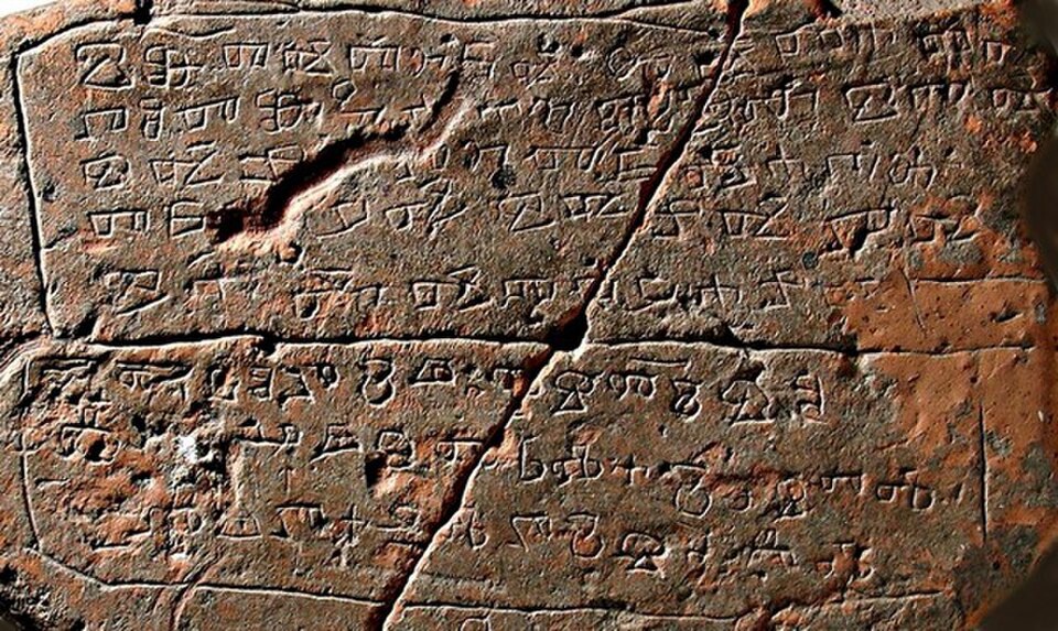
Brseč also preserves the quieter machinery of a pre-industrial Mediterranean community. Its old olive mill, known locally as a toš, recalls the importance of olive cultivation on terraces where usable land had to be created carefully from the slope. Water was equally precious, and the communal cistern in the town square collected a resource that limestone terrain could not always provide reliably at the surface.
South of the town, the road remains suspended between Učka and the Adriatic until the coast opens towards Plomin. By then the race is entering Istria, and the character of the final part of the stage begins to emerge.
Plomin · From the Roman Flanona to the Istrian Coal Country
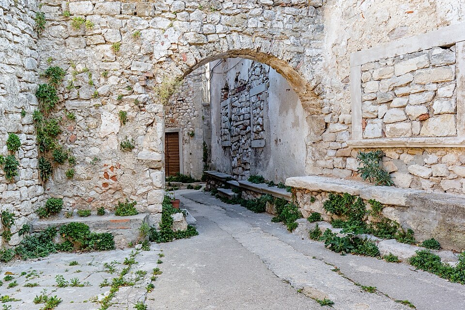
A stone-lined street in the historic hilltop village of Plomin, in Croatia’s Istria County. Photo by Michal Klajban, licensed under CC BY-SA 4.0, via Wikimedia Commons.
The old settlement of Plomin stands above Plomin Bay, occupying another defensive height rather than the shoreline below. Its position has been used since antiquity, when the Roman settlement of Flanona occupied this part of the eastern Istrian coast, but one small stone relief preserved here connects the place to an even older religious world.
The Plomin Tablet, generally dated to the early medieval period, carries an image that is usually interpreted as the ancient god Silvanus, associated in the Roman world with woods, fields and pastoral life. Beside the figure appears a Glagolitic inscription added centuries later. Pagan imagery and medieval Slavic writing therefore occupy the same piece of stone, an accidental compression of two cultural worlds that met in Istria long after Roman political authority had disappeared.
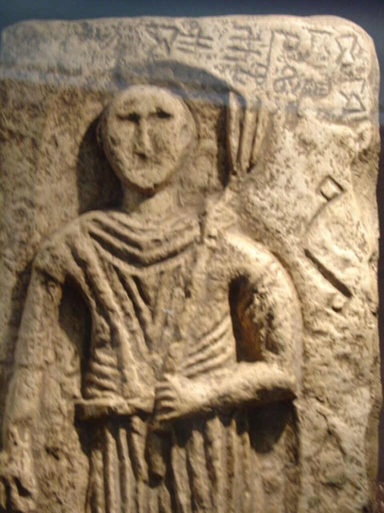
The Plomin Tablet, an 11th-century Croatian stone monument bearing a Glagolitic inscription. Author unknown, public domain, via Wikimedia Commons.
From Plomin the road moves through Vozilići towards Labin, and another landscape begins to appear beneath the surface. Eastern Istria contained important coal deposits, and mining eventually transformed communities around Labin far more dramatically than the older agriculture of the hill towns had done. Shafts, industrial settlements and transport infrastructure spread through a region whose medieval centres still stood on the heights above them.
The finish town became the centre of that mining world.
Labin · A Venetian Hill Town Above a Mining Landscape
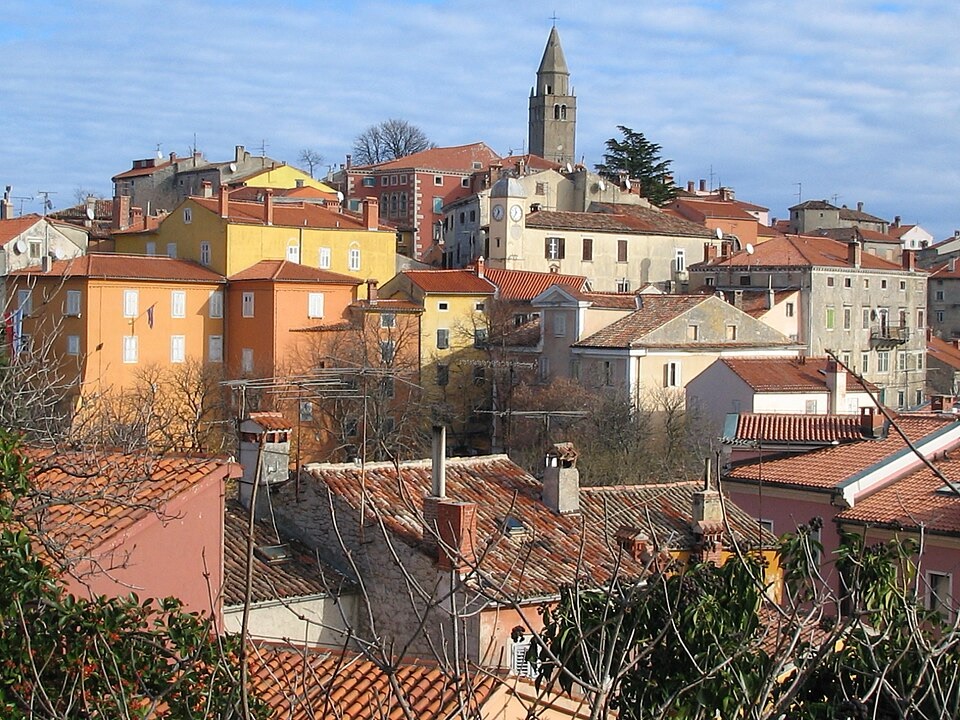
The historic old town of Labin, a hilltop settlement on Croatia’s Istrian peninsula. Photo by A. Rehazek, released into the public domain, via Wikimedia Commons.
Labin rises roughly 320 metres above sea level, only a few kilometres inland from the resort of Rabac. From the coast it appears as one of the classic Istrian hill towns, its old centre gathered on a ridge with views reaching across the Kvarner Gulf towards Cres and the mountains beyond.
The town was known in antiquity as Albona, but much of the architecture encountered today belongs to the centuries when Labin formed part of the Venetian Republic. Stone houses and palaces line steep lanes inside the old centre, while the 16th-century Gate of St Flora and the Venetian lion above it preserve the political identity that once connected this small Istrian town with a maritime state stretching along the eastern Adriatic.
Labin also produced Matthias Flacius Illyricus, born here in 1520 and later one of the important intellectual figures of the Protestant Reformation. After leaving Istria, Flacius became a theologian and controversialist within the Lutheran world, working in German-speaking Europe and participating in some of the fierce doctrinal disputes that followed Martin Luther’s death. His life carried the name of a small Adriatic town into debates taking place at the heart of Reformation Europe.
Yet the history that most thoroughly changed Labin itself came from underground. Coal had been known in the region for centuries, but industrial exploitation expanded dramatically during the 19th and 20th centuries, drawing workers into shafts around Labin and nearby Raša and reshaping the social character of eastern Istria. The old Venetian town remained on its hill while a second landscape of mines, machinery and workers’ settlements developed below it.
In 1921, that mining community became the setting for one of the most unusual episodes in modern Istrian history. After violence against union organisers amid the political turmoil following the First World War, miners occupied the pits, organised their own administration and continued production under the slogan “Kova je nasa”, meaning “The mine is ours.” The short-lived Labin Republic survived only a few weeks before Italian authorities suppressed it, but it remained an important symbol of organised labour and anti-fascist resistance in the region.
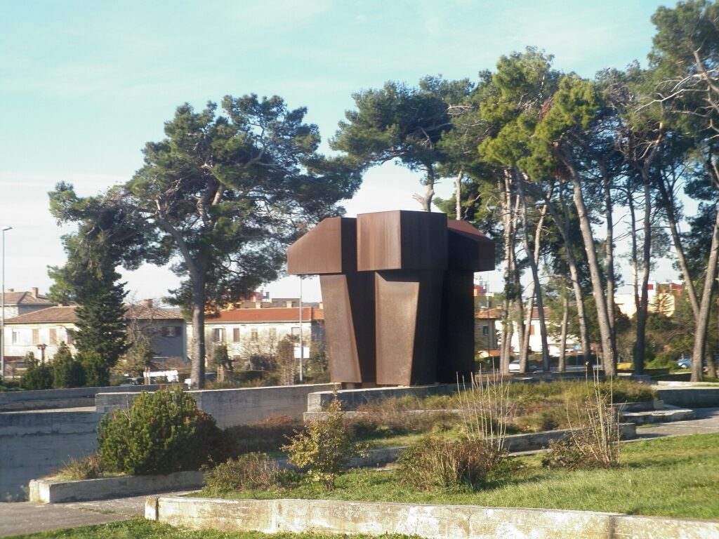
The monument in Labin commemorating fallen Yugoslav Partisans, victims of fascism from 1941 to 1945, and the 1921 Labin Republic. Photo by Flammard, licensed under CC BY-SA 3.0, via Wikimedia Commons.
Stage 3 does not finish immediately after first reaching Labin. The route continues south-east through Ravni, Skitača and Brovinje, carrying the peloton back into the exposed countryside above the eastern Istrian coast before turning once more towards town. Those final kilometres are particularly appropriate here, because they prevent Labin from appearing merely as a destination placed at the end of the course; the riders first encounter its urban edge, leave it for the limestone uplands and villages beyond, and then have to climb back towards the old town.
FINISH · Titov trg, Labin
The finish comes at Titov trg, inside the historic centre of Labin, after a stage that has spent much of the day moving between settlements built at very different relationships to the sea.
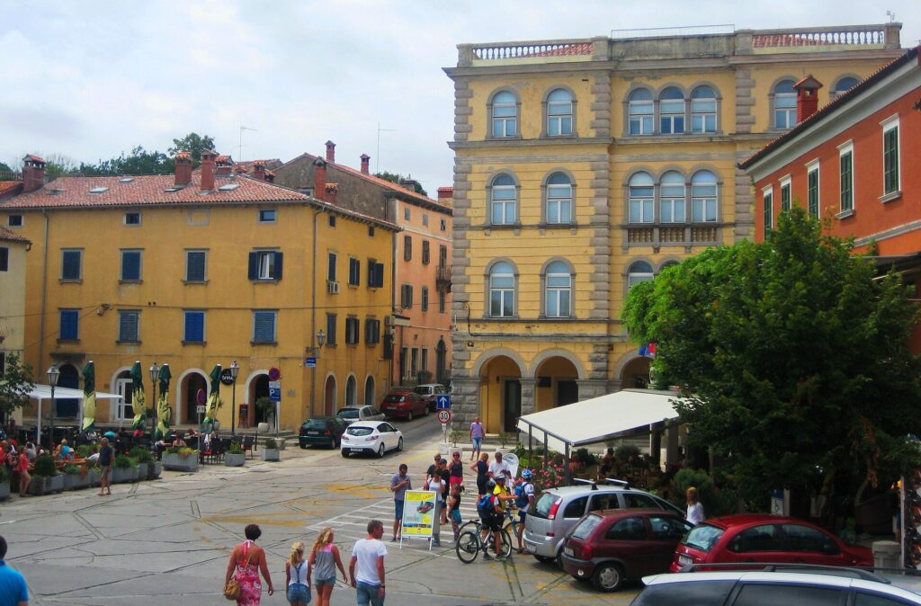
A street in Labin’s historic centre. Photo by Elmie, licensed under CC BY-SA 4.0, via Wikimedia Commons
Krk began behind walls beside the water, on an island where Latin and Croatian, Roman inheritance and Glagolitic culture existed alongside one another for centuries. Opatija later turned the shoreline itself into an attraction for the wealthy society of the Habsburg Empire, while Mošćenice and Brseč preserved an older instinct to live above the coast rather than directly upon it. Plomin carried the race into Istria, where Roman remains, medieval Slavic writing and Venetian rule overlap within the same hill country, before Labin introduced the industrial world of coal mines and organised labour beneath its old stone streets.
For much of the 174.5 kilometres, the Adriatic remains somewhere beside or below the riders, yet the communities along it were never shaped by the sea in quite the same way. On Krk it connected an island society to the wider Kvarner world; at Opatija it became the setting for an imperial resort; beneath Mošćenice and Brseč it was something to watch from defensible heights; around Labin it shared the landscape with an economy whose most valuable resource lay underground. The stage ends above that coast rather than beside it, among the steep streets of a town whose history has always extended in both directions, towards the Adriatic below and into the Istrian earth beneath it.



