

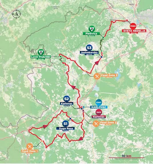
After four stages dominated by the Adriatic, Stage 5 moves inland and introduces a Croatia built around rivers, forests, castles, vineyards and the old approaches to Zagreb. The change is immediate. There are no islands, no Venetian ports and no limestone coast; instead, the race begins in Karlovac, a Renaissance fortress founded where several rivers converge, spends much of the day among the wooded hills and valleys of central Croatia, and eventually reaches the vineyard country of Plešivica before passing through Samobor and finishing at Sveta Nedelja, on the western edge of the Zagreb metropolitan area.
The official route measures 164.5 kilometres with approximately 2,345 metres of climbing, including the classified ascents of Lović Prekriški and Plešivica. Its shape is unusually complicated. The riders first travel south-west from Karlovac through Barilović and the Dobra valley towards Bosiljevo, turn back through Duga Resa and Karlovac, then head north towards Krašić, Jastrebarsko and the hills separating the Kupa basin from the Zagreb plain. The repeated encounter with Karlovac is appropriate for a city created precisely because roads, rivers and military routes met here, while the second half of the stage gradually replaces the defensive geography of the frontier with vineyards and old market towns.
START · Karlovac, a Renaissance City Drawn as a Six-Pointed Star
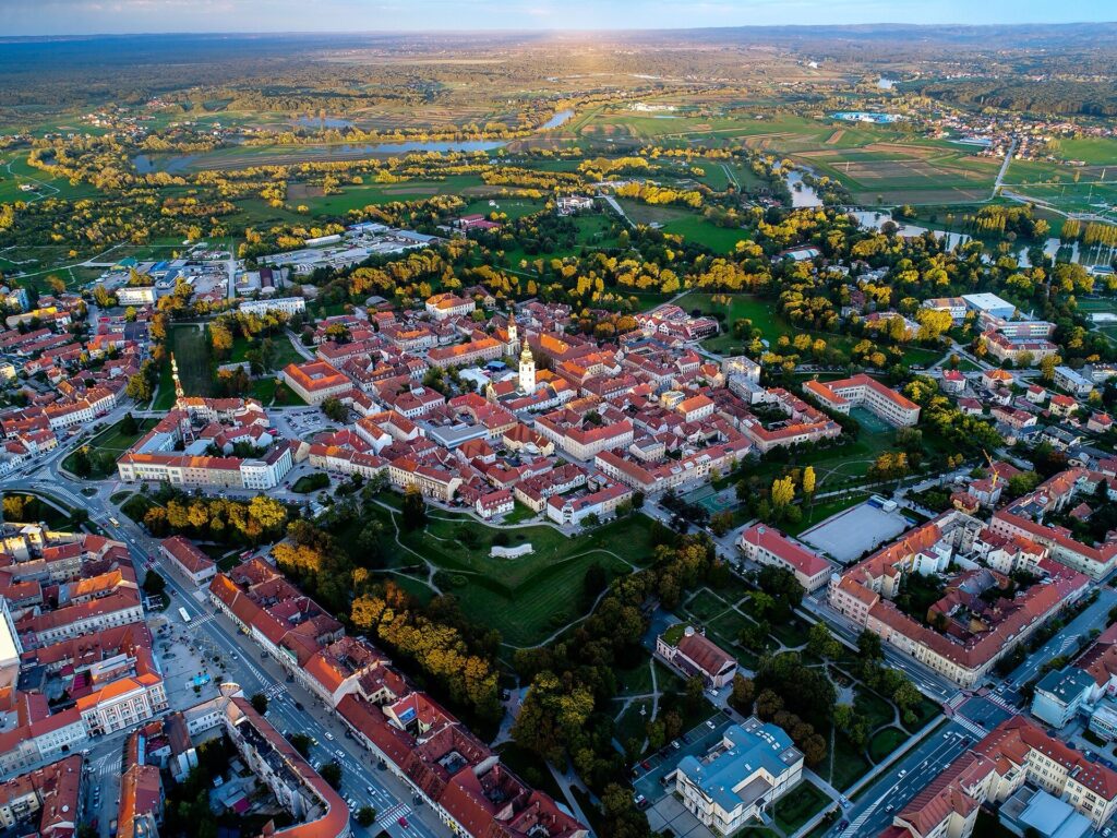
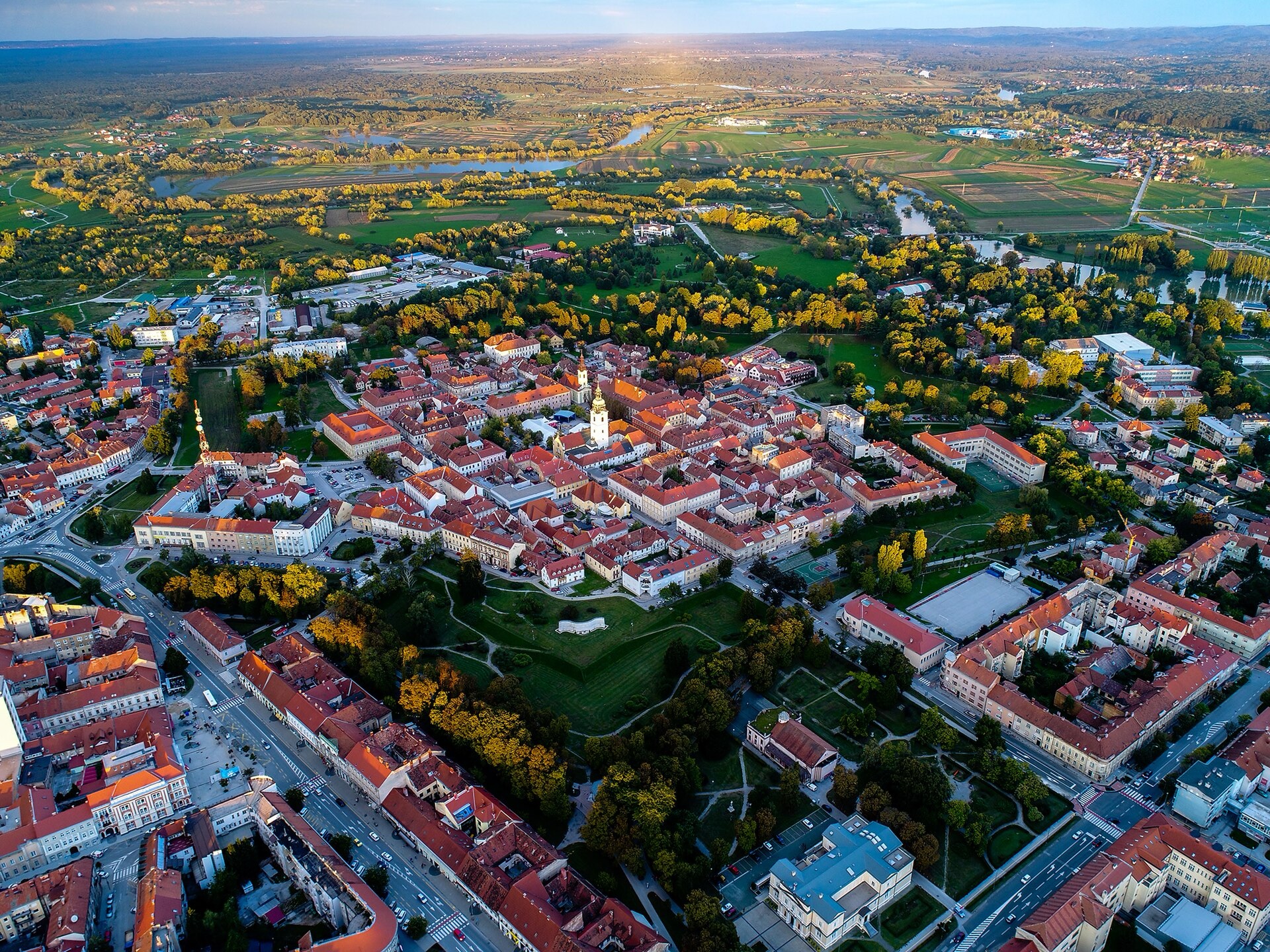
Aerial view of Karlovac’s historic Zvijezda, the star-shaped old town laid out within the former Renaissance fortress. Photo by Bukovacka, licensed under CC BY-SA 4.0, via Wikimedia Commons.
Unlike most European cities, Karlovac has an exact birthday: 13 July 1579. It was not a medieval settlement that slowly expanded into a city, but a planned fortress created by the Habsburg monarchy at a dangerous moment in the long conflict with the Ottoman Empire.
During the 16th century, Ottoman expansion had pushed deep into south-eastern Europe and brought the frontier close to the Habsburg lands of Croatia. The monarchy responded by strengthening the Military Frontier, a broad defensive zone of fortresses, garrisons and militarised communities intended to protect the routes towards Austria and the interior. Karlovac was one of the most ambitious products of that system, positioned near the confluence of several rivers and named after Archduke Charles II of Inner Austria, who oversaw the frontier’s defence.
Its original centre was designed according to Renaissance ideas about the ideal fortified city. Six bastions projected from a regular hexagonal plan, creating the star-shaped defensive outline still visible in Karlovac’s street pattern and parks. Inside, streets crossed in an orderly grid around military, administrative and religious buildings, while the earthworks surrounding them were intended to resist the artillery warfare that had made older medieval walls increasingly vulnerable.
The fortress never remained only a military installation. Its position between inland Croatia, the Adriatic approaches and the rivers of the Kupa basin encouraged merchants and craftsmen to settle around it, and Karlovac gradually developed into a commercial town. Older settlements had already existed nearby, including Dubovac, whose medieval castle stands above the Kupa and predates Karlovac by centuries, but the new fortress eventually became the dominant urban centre.
Water remained central to its identity. Karlovac is commonly called the city on four rivers, referring to the Kupa, Korana, Mrežnica and Dobra, all of which flow through or near the surrounding area. These are not four branches of the same river but separate waterways belonging to the Kupa system, and historically they provided transport, water power, fishing grounds and natural corridors through a region where roads could be difficult.
Stage 5 begins in the planned city and quickly enters that river country, where the geometry of Karlovac gives way to forests, villages and valleys that once formed part of the same defensive landscape.
Barilović and the Kupa Frontier · Where Castles Watched the Ottoman Border
South of Karlovac, the race passes Barilović, a small settlement beside the Korana whose ruined castle recalls the period that led to Karlovac’s foundation. Medieval strongholds were scattered throughout this region long before the great star fortress was built, but during the wars with the Ottoman Empire they became pieces of a much larger defensive system.
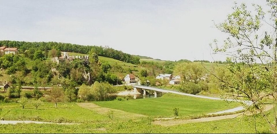
Panoramic view across the village of Barilović and its surrounding fields in Karlovac County, central Croatia. Photo by Eranyo, licensed under CC BY 3.0, via Wikimedia Commons.
The distinction between the Habsburg and Ottoman worlds was not a clean line drawn permanently across the map. During the 16th and 17th centuries, raids, counter-raids, migration and military settlement repeatedly changed life on both sides of the frontier. Villages could be abandoned and later resettled, while castles that had once protected the estates of noble families acquired a wider military purpose. The population itself became more diverse as people displaced by warfare moved into safer territory and the Habsburg authorities settled soldiers along the border.
Barilović Castle stands above the Korana, one of the rivers that helped organise movement through this difficult country. Its position illustrates why the region became so heavily fortified: valleys offered routes through otherwise broken terrain, which made controlling bridges, crossings and river corridors particularly important.
The peloton continues towards Donji Zvečaj and Generalski Stol, following country shaped by the Dobra and Mrežnica rivers. Modern roads make the journey appear straightforward, but the density of castles, old military settlements and later transport routes reflects centuries spent trying to move efficiently through precisely this landscape.
Bosiljevo · The Frankopans and a Castle That Survived the Frontier
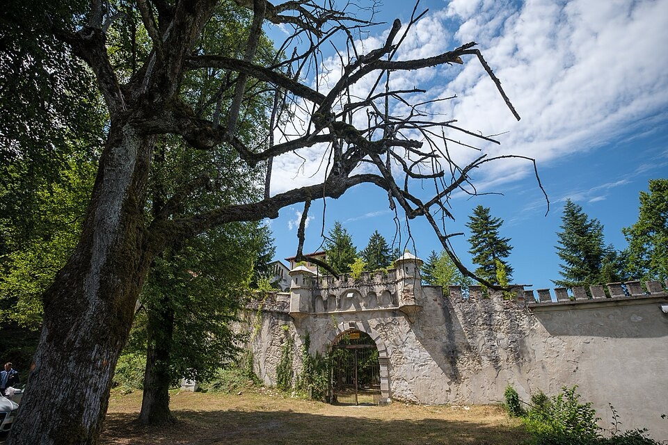
Bosiljevo Castle, a 15th-century fortified residence and protected cultural monument in Karlovac County. Photo by rom@nski photo, licensed under CC BY 2.0, via Wikimedia Commons.
The route reaches Bosiljevo, a small village whose present population gives little indication of the political importance once attached to the castle hidden among the surrounding woods. The fortress stands on a rocky height above a spring and was associated for more than two centuries with the Frankopans, one of the great noble families of medieval and early modern Croatia.
The Frankopans have already appeared earlier in this CRO Race, particularly on Krk, where the family first established its power. Their presence here shows how far that power eventually extended. From their island origins, different branches accumulated estates across mainland Croatia, controlling castles, towns, trade routes and agricultural land from the Adriatic towards the interior. By the 15th century they held Bosiljevo, where an older fortified site developed into a substantial noble residence capable of protecting both the family and the surrounding territory during periods of Ottoman pressure.
The castle was never conquered by the Ottomans, although the surrounding country suffered repeated incursions. Its most destructive political moment instead came from within the Habsburg world. In 1671, Fran Krsto Frankopan and Petar Zrinski were executed at Wiener Neustadt after participating in a conspiracy against Habsburg rule. Their estates were confiscated, and Bosiljevo was systematically stripped of property. Contemporary inventories reveal the wealth accumulated there: weapons, hundreds of books, expensive furniture, silver, ivory objects, imported goods and carriages disappeared from a residence that had been both fortress and aristocratic household.
Later owners altered the complex repeatedly, particularly during the 19th century, leaving the mixture of medieval fortification and Romantic reconstruction visible today. The building is now in poor condition, but its secluded position still makes sense of the original choice of site. Bosiljevo was not intended to dominate a city below it; it belonged to a network of noble strongholds embedded in the forests and river valleys between the coast and continental Croatia.
From here the race turns north again, beginning its return towards Karlovac.
Duga Resa and the Mrežnica · A River Town Created by Industry
Before returning to Karlovac, Stage 5 passes through Duga Resa, where the Mrežnica provides a different chapter in the history of the region. Unlike Karlovac, Duga Resa was not created as a Renaissance fortress, and unlike Bosiljevo it did not grow around a noble castle. Its transformation came much later, when the river became part of an industrial landscape.
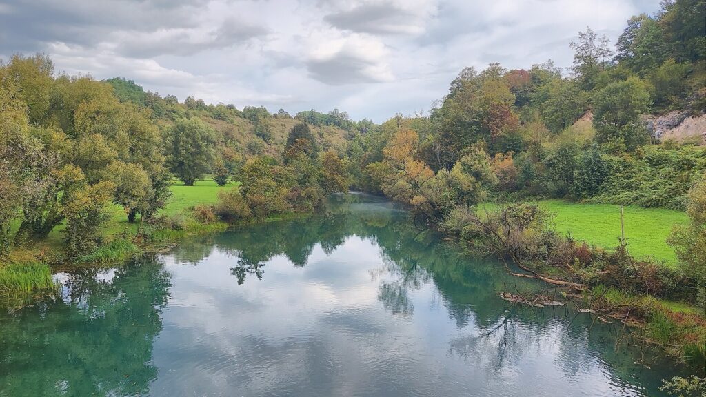
The Mrežnica River, Duga Resa, Croatia. Photo by Harald Hetzner, released under CC0 1.0, via Wikimedia Commons.
The Mrežnica is one of Croatia’s most distinctive karst rivers, known for its exceptionally clear water and a long succession of natural barriers and waterfalls formed by deposits of tufa, a porous limestone created when calcium carbonate precipitates from flowing water. Over time, vegetation and mineral deposition build low dams across the channel, dividing the river into pools and cascades. The result is a watercourse that often appears gentle between falls even though its elevation is being lost through dozens of small steps.
For centuries, rivers such as the Mrežnica powered mills and supported local agriculture, but Duga Resa changed dramatically in the late 19th century when a large textile industry developed beside the water. A settlement that had previously been modest expanded around factory buildings and workers’ housing, with the river providing the conditions for industrial production and the railway connecting the town to wider markets.
That industrial identity distinguished Duga Resa from the older administrative and military centre at Karlovac only a few kilometres away. One city had been planned for frontier warfare in the 16th century, while the other expanded through factories during the industrial age, yet both depended on the same river-rich geography.
The peloton returns through Karlovac without ending its relationship with water. The next part of the route turns north towards the Kupa, entering country associated with another of Croatia’s great noble families and with one of its most distinctive artists.
Ozalj and the Kupa · The Zrinski-Frankopan World
North of Karlovac, the road follows the Kupa towards Ozalj, where a large castle rises directly above the river. The position is dramatic, but it was also practical. Whoever controlled the height could watch movement along the Kupa valley, while the river connected the surrounding estates with Karlovac and the wider interior.
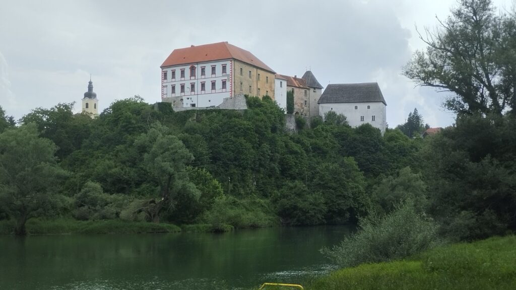
Ozalj Castle rising above the Kupa River, viewed from the opposite bank. Photo by Franjo Tahy, released under CC0 1.0, via Wikimedia Commons.
Ozalj belonged successively to several important Croatian noble families, but its most famous period came under the Zrinski and Frankopan families during the 16th and 17th centuries. By then the two dynasties were connected through marriage as well as politics, and their estates formed a powerful network across Croatia. Petar Zrinski, Ban of Croatia, used Ozalj as one of his principal residences, while his wife Katarina Zrinska and her brother Fran Krsto Frankopan were prominent figures in a remarkable literary circle associated with the castle.
The so-called Ozalj literary circle attempted to create a Croatian literary language drawing upon several major dialects rather than privileging only one regional form. The experiment was interrupted by the political catastrophe of 1671, when Petar Zrinski and Fran Krsto Frankopan were executed after their failed challenge to Habsburg authority. Their properties were confiscated and plundered, weakening both the families and the cultural world that had developed around their courts.
More than two centuries later, Ozalj produced a very different figure in Croatian culture. Slava Raškaj, born here in 1877, became one of Croatia’s most admired watercolour painters. Deaf from childhood, she studied in Zagreb and developed an unusually delicate treatment of landscapes, flowers and water, frequently painting the countryside around Ozalj and the Kupa. Her work is particularly associated with the changing light and vegetation of the river environment, turning the same landscape once dominated by castles and noble politics into something intimate and observational.
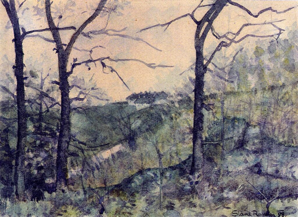
View of Ozalj, an 1898 watercolour by Slava Raškaj, the celebrated Croatian artist born in the town. Artwork by Slava Raškaj, marked as public domain, via Wikimedia Commons
The river below the castle acquired another role in the early 20th century when a hydroelectric plant was built at Ozalj, adding electricity generation to a landscape already shaped by transport, defence and agriculture. Stage 5 does not linger beside the Kupa for long, however, because the route soon turns into the hills towards Krašić and Plešivica, where vineyards increasingly replace the broad river valleys.
Krašić · A Village Between the Vineyards and Modern Croatian History
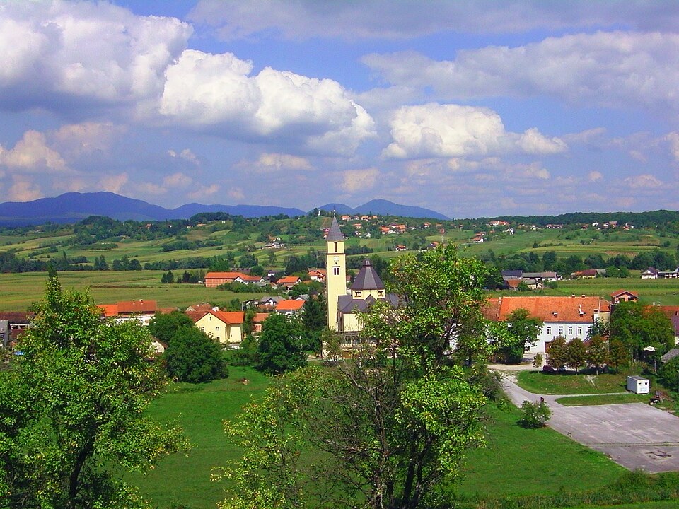
View across the village of Krašić and its surrounding countryside in Zagreb County, Croatia. Photo by Bern Bartsch, licensed under CC BY-SA 3.0, via Wikimedia Commons
Krašić lies in a green valley between Karlovac and Zagreb, surrounded by hills whose slopes have long supported vineyards and orchards. It is a small place, but within Croatia its name is closely associated with Alojzije Stepinac, the Catholic archbishop of Zagreb during one of the most difficult periods of the country’s 20th-century history.
Stepinac was born in nearby Brezarić in 1898 and became archbishop of Zagreb in 1937. His position during the Second World War, when the Axis-backed Independent State of Croatia ruled much of the country, has remained the subject of extensive historical study and controversy. Stepinac publicly criticised racial persecution and assisted some people threatened by the regime, while historians have continued to debate aspects of his relationship with the Ustaše state and the limits of his opposition to it.
After the communist Partisans established Yugoslavia under Josip Broz Tito, relations between the new state and the Catholic Church deteriorated sharply. Stepinac was arrested in 1946 and convicted of collaboration with the wartime regime in a trial that the Vatican and many outside observers regarded as politically motivated. After imprisonment at Lepoglava, he was transferred in 1951 to confinement in his home parish of Krašić, where he remained until his death in 1960.
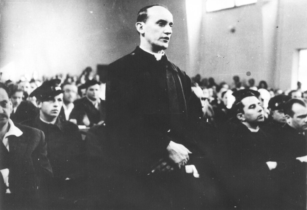
Archbishop Alojzije Stepinac before the court during his 1946 trial in communist Yugoslavia. Unknown photographer, public domain under former Yugoslav copyright law, via Wikimedia Commons
Pope John Paul II beatified him in 1998, while the questions surrounding his wartime record and later prosecution have continued to make him a complex figure in the historical memory of Croatia and neighbouring Serbia. For Krašić, however, his presence is tangible rather than abstract: the parish church, his birthplace nearby and the house where he spent his final years have made the village a place of Catholic pilgrimage.
The race passes through this history while entering one of the most important wine landscapes around Zagreb. The hills begin to tighten around the road, and the final third of the stage is considerably more demanding than the river country left behind.
Jastrebarsko and Plešivica · The Vineyards Above the Zagreb Plain
Jastrebarsko, often shortened locally to Jaska, sits between the lowlands of the Kupa basin and the hills of Plešivica, about thirty kilometres south-west of Zagreb. The town historically served the surrounding agricultural country as a market centre, but the hills above it provide the more distinctive landscape encountered by the race.
Plešivica rises to around 779 metres and forms part of the Žumberak-Samoborsko gorje uplands along Croatia’s border region with Slovenia. Its lower, sunnier slopes are covered with vineyards, many planted on steep ground where rows follow the contours of hills overlooking villages and forest. The combination of elevation, drainage and cooler conditions distinguishes the area from the hotter wine regions encountered earlier in the CRO Race along the Adriatic.
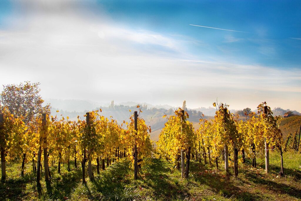
Misty vineyards across the rolling hills of Plešivica, one of Croatia’s best-known wine-growing areas near Jastrebarsko. Photo by Zrilezrno, licensed under CC BY-SA 4.0, via Wikimedia Commons
Viticulture here has deep roots, but Plešivica has developed a particularly strong modern reputation for sparkling wine. The relatively cool climate allows grapes to retain acidity, an important quality for traditional-method sparkling production, while varieties including Chardonnay and Pinot Noir are grown beside regional grapes such as Portugizac and Plavec Žuti. Small family wineries dominate much of the landscape, and cellars are scattered among the slopes rather than concentrated in a single industrial wine district.
The road through the vineyards also explains why Plešivica matters to Stage 5 as more than a scenic backdrop. The terrain rises and falls continuously, with narrow roads connecting villages at different elevations, and the classified climb comes late enough to make the vineyard country part of the sporting decision as well as the cultural landscape.
From the heights, the geography of the final kilometres begins to become clearer. The mountains are lower than Učka and the great limestone ranges crossed earlier in the week, but they form a green barrier between the Kupa basin and the increasingly urban country around Zagreb. On the other side lies Samobor, the last major historic town before the finish.
Samobor · A Free Market Town Beneath Its Castle
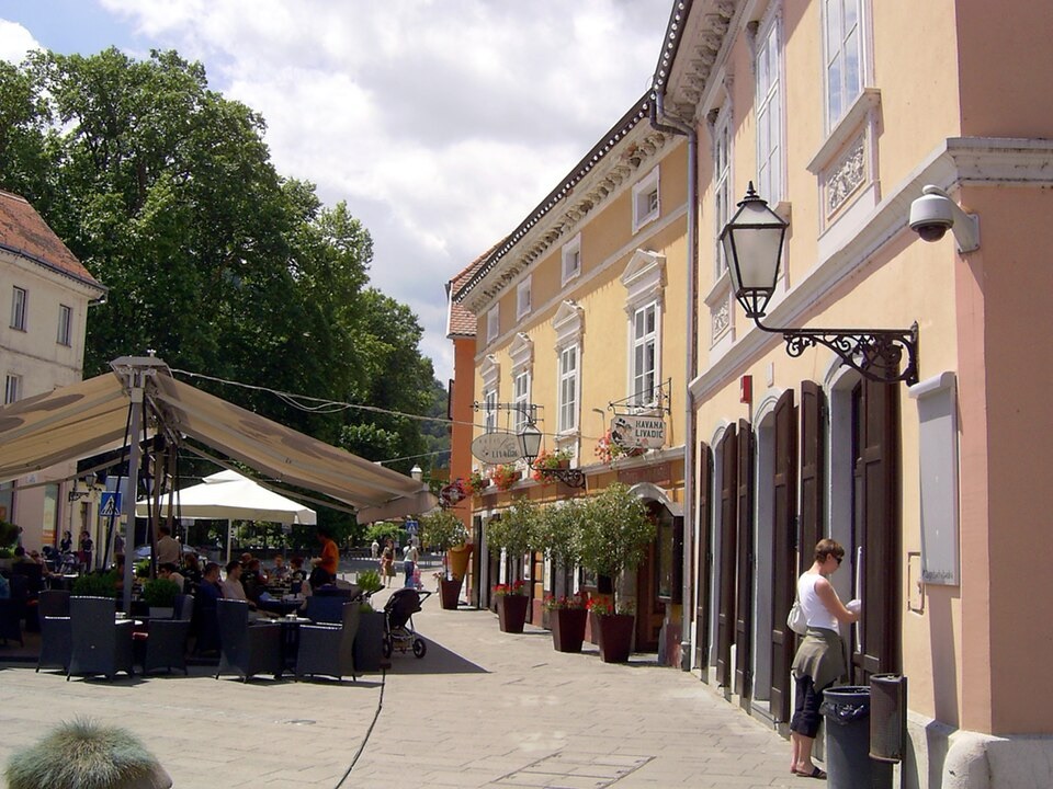
Historic architecture and pavement cafés around King Tomislav Square in the centre of Samobor. Photo by Robert Majetic, licensed under CC BY-SA 2.0, via Wikimedia Commons
The race approaches Samobor through the hills rather than from the Zagreb plain, descending towards a town that has spent much of its history occupying the borderland between major political and economic regions. Slovenia lies only a short distance to the west, Zagreb is roughly twenty kilometres to the east, and the wooded Samobor Hills rise immediately behind the town.
Samobor received the status of a free royal market town in 1242 from King Béla IV. For a medieval community, that was far more significant than the modern phrase may suggest. It granted privileges over local administration, property and trade and gave the townspeople a degree of independence from surrounding feudal lords, making the settlement an important commercial centre for the countryside around it.
The castle above the town tells the other side of that relationship. Samobor Castle was built in the 13th century, traditionally associated with the Czech king Ottokar II, and over the following centuries passed through the hands of numerous noble families. Its owners repeatedly attempted to assert authority over the market town below, producing disputes that continued for generations. A legal struggle between the townspeople and the castle’s lords stretched from the late 15th century until 1769, an unusually long contest over rights that had first been granted more than five hundred years earlier.
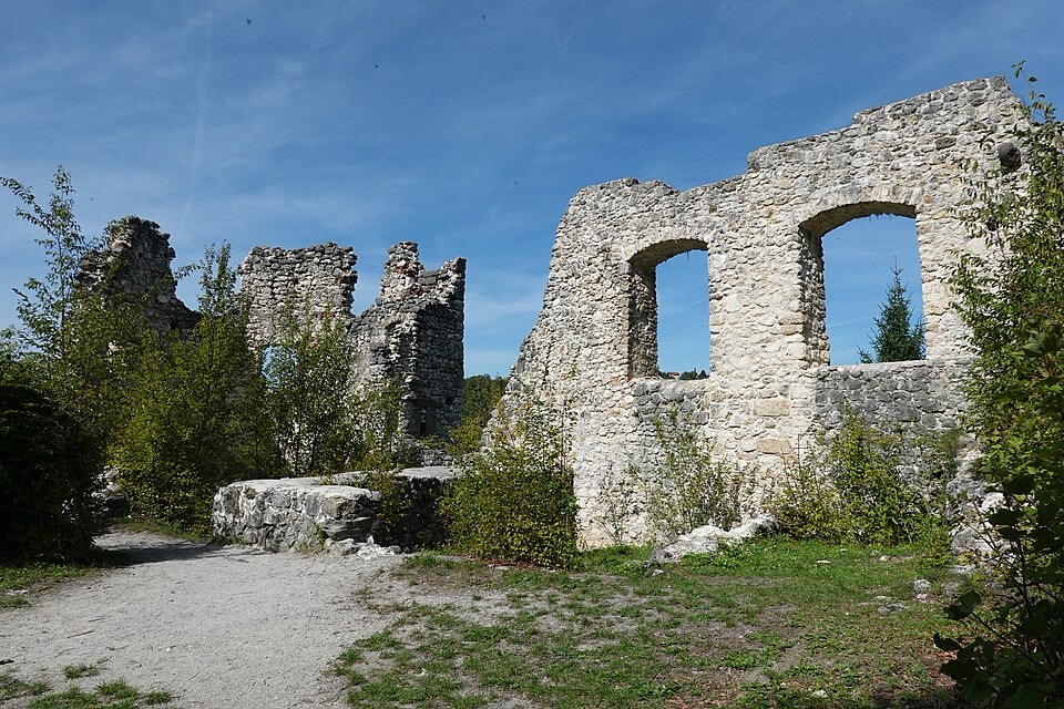
The ruins of Samobor Castle, a 13th-century fortress and protected cultural monument overlooking the town. Photo by Janezdrilc, released under CC0 1.0, via Wikimedia Commons
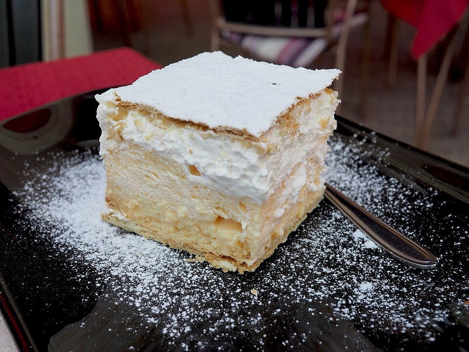
By the 19th century, the castle was declining while Samobor itself was developing a different identity. Its proximity to Zagreb, wooded surroundings and compact centre made it an early excursion destination for city residents, and inns, crafts and local food became part of a tourism culture that remains visible today. The town is particularly associated with kremšnita, a custard and cream pastry that has become one of Samobor’s culinary symbols, although the recipe now considered characteristic of the town belongs to the 20th century rather than its medieval past.
Stage 5 does not finish here. The road continues east through Mirnovec, leaving the enclosed valley of Samobor and entering the much flatter western outskirts of Zagreb.
FINISH · Sveta Nedelja, Where the Hills Meet the Zagreb Plain
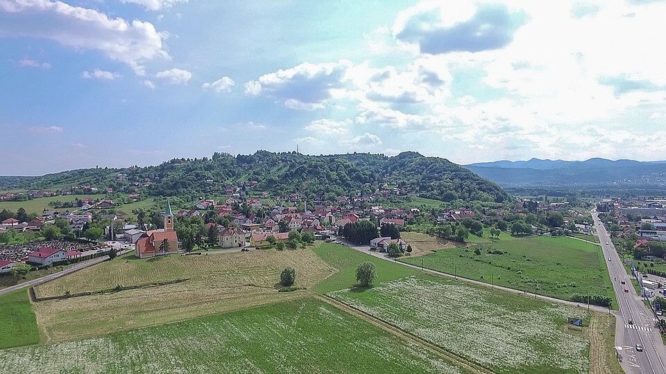
Aerial view across the fields surrounding Sveta Nedelja in Zagreb County, Croatia. Photo by rom@nski photo, licensed under CC BY 2.0, via Wikimedia Commons
Sveta Nedelja lies between Samobor and Zagreb, occupying the transition between the foothills and the broad lowland associated with the Sava River. It is now closely integrated into the Zagreb metropolitan economy, with residential districts, industry and modern transport routes making it appear very different from the castles and vineyard villages crossed during the previous hours. The area, however, has been a corridor for movement for far longer than the modern city suggests.
During the Roman period, an important road crossed this country between Emona, present-day Ljubljana, and Siscia, present-day Sisak, connecting settlements across the Roman province of Pannonia. Archaeological discoveries around Sveta Nedelja, including burials, coins, building material and a substantial 3rd-century stone monument at Kerestinec, show that people were living and travelling through the area long before Zagreb emerged as the dominant city of the region.
The most conspicuous later monument is Kerestinec Castle, built by the powerful Erdődy family during the 16th century as a lowland fortified residence surrounded by a moat. Unlike the hilltop castles encountered earlier around Bosiljevo, Ozalj and Samobor, Kerestinec reflects a period when aristocratic residences could combine defensive architecture with increasingly comfortable domestic spaces. Its square plan, corner towers and internal courtyard belong to the transition from medieval fortress to Renaissance noble residence.
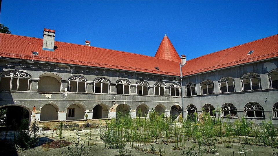
Kerestinec Castle, a historic quadrangular castle and protected cultural monument in Zagreb County, Croatia. Photo by Miroslav.vajdic, licensed under CC BY-SA 4.0, via Wikimedia Commons
The surrounding fields also became part of the Croatian-Slovenian Peasant Revolt of 1573, an uprising driven by the burdens imposed on rural communities by feudal landlords. Rebel forces gathered support around Kerestinec before being defeated nearby by a noble army, leaving hundreds dead. The revolt itself spread across a much larger area north of Zagreb and into present-day Slovenia, but Kerestinec formed one of its southern centres.
Those layers are easy to overlook at the end of a stage that arrives among the modern roads of metropolitan Zagreb. Stage 5 began in another planned landscape, the six-pointed military fortress of Karlovac, before travelling through the river valleys and castles of the old frontier, returning to the world of the Zrinski and Frankopan families at Ozalj, and then climbing into a vineyard country whose towns historically depended on markets rather than ports.
By the time the race reaches Sveta Nedelja, the geography has changed once again. The rivers and forests around Karlovac have given way to the open approaches to Zagreb, while the castles that once controlled isolated valleys have been replaced by roads linking an expanding metropolitan region. The route has travelled only 164.5 kilometres, but in doing so it has crossed the country that historically connected Croatia’s old military frontier with its modern capital.



