
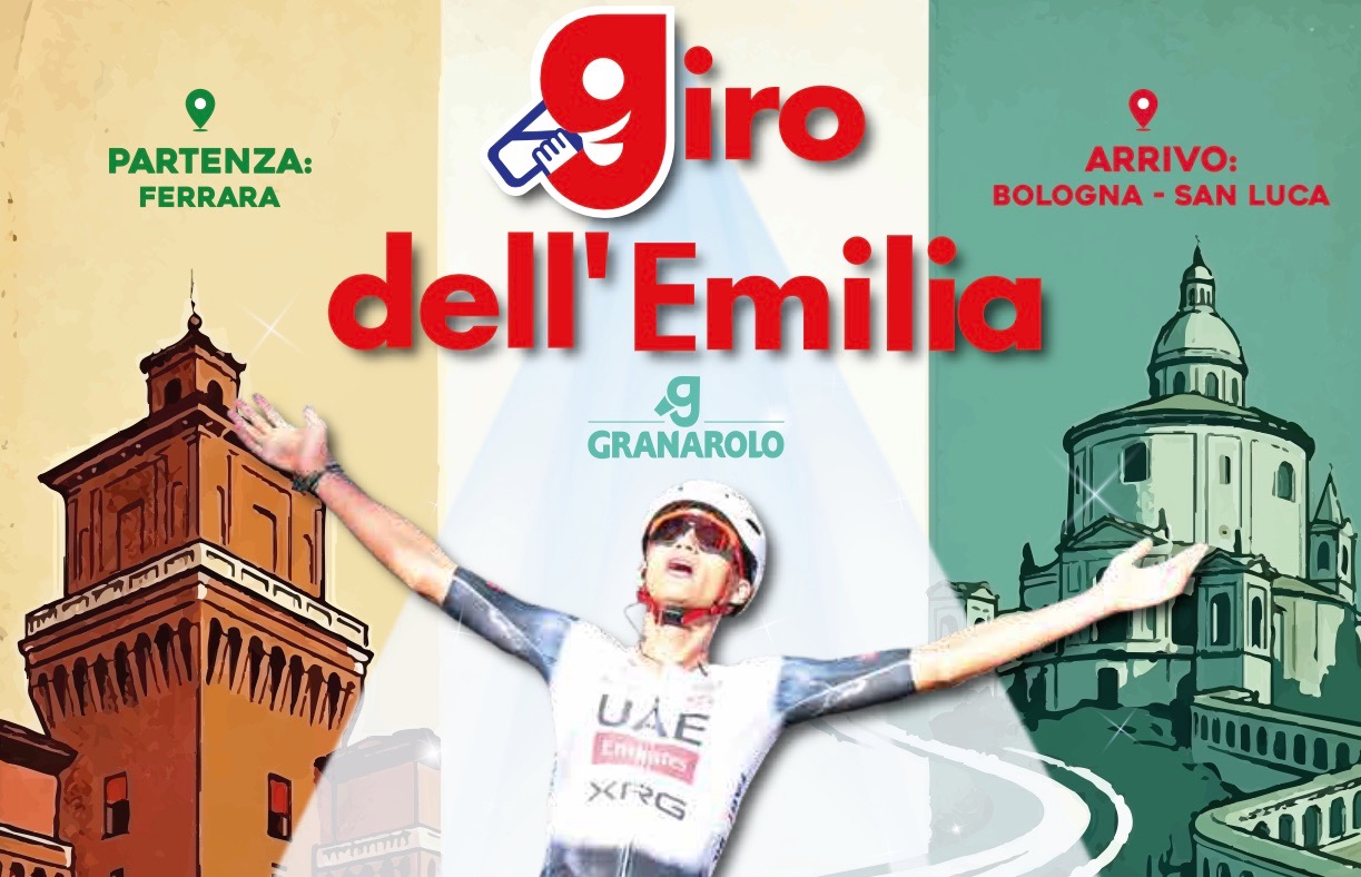

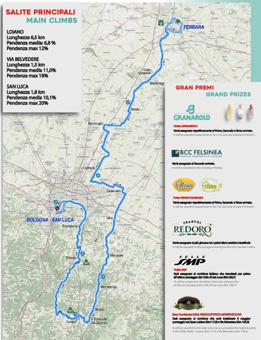
For the first time, the Giro dell’Emilia begins in Ferrara, nearly fifty kilometres north-east of Bologna and deep inside the immense plain created by the River Po and its tributaries. The riders begin on land so flat that water has determined its history for centuries, then gradually approach the dark line of the Apennines, climb into those mountains around Loiano and Pianoro, and finally return to Bologna for the five ascents of San Luca that have become the race’s defining ritual.
Ferrara developed in a low landscape of rivers, marshes and reclaimed agricultural land, while Bologna stands near the southern edge of the Po Valley, where the first Apennine hills rise abruptly behind the city. Movement between northern Italy and Tuscany has had to negotiate those mountains since antiquity, helping Bologna develop as a road junction, commercial centre and, much later, railway hub. The Giro dell’Emilia travels through the same transition, leaving the open plain for roads governed by ridges and valleys before descending towards a city whose history has always been tied both to northern Italy and to the passes across the mountains.
After Loiano and the new climb of Via Belvedere at Pianoro, the peloton descends through Rastignano and enters Bologna. At the Arco del Meloncello, with 39 kilometres remaining, the riders turn onto the road to the Sanctuary of the Madonna di San Luca for the first time. Four complete circuits of 9.2 kilometres follow that opening ascent, meaning the race climbs San Luca five times before finally ending beside the sanctuary.
The road rises beside a covered pilgrimage route containing hundreds of arches, built to protect worshippers walking from Bologna to an image of the Virgin venerated on the summit. Long before riders began attacking beneath those arches, generations of Bolognese were making the same journey on foot.
START · Ferrara and the Fortress of the Este
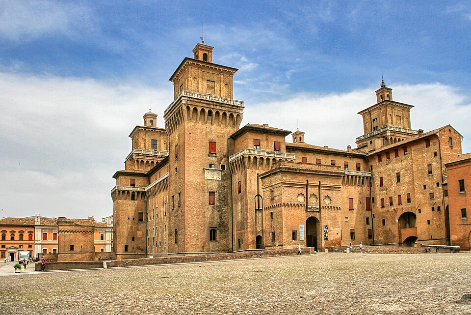
The riders begin beside Castello Estense, the enormous brick castle surrounded by water in the centre of Ferrara. Its towers and moat can make it appear like the surviving military core of a medieval city, although its origins are more specific. It was constructed after a crisis that showed the rulers of Ferrara how vulnerable they could be within their own capital.
Ferrara had been controlled by the Este family since the Middle Ages. The Este were one of the great dynasties of northern Italy, comparable in their regional importance to families such as the Gonzaga in Mantua or the Medici in Florence, and they gradually transformed Ferrara into the capital of their own state. Their position was powerful but not always secure. In 1385, a popular uprising erupted after years of taxation and economic hardship, and the crowd demanded the surrender of a senior official blamed for the situation. The Este survived the crisis, but Marquis Niccolò II responded by commissioning a fortress beside the family’s existing palace.
Architect Bartolino da Novara designed a castle with four massive towers, thick walls, drawbridges and a moat, creating a defensible refuge directly inside the city. Over the following centuries, as the Este court became more secure and increasingly sophisticated, the fortress was gradually transformed into a princely residence. Defensive spaces gave way to decorated apartments and reception rooms, while Ferrara became an important Renaissance court attracting painters, musicians, scholars and writers.
Among those writers was Ludovico Ariosto, author of Orlando Furioso, the sprawling 16th-century epic of knights, love, war, magic and journeys across an imagined medieval world. Another was Torquato Tasso, author of Jerusalem Delivered, whose troubled relationship with Duke Alfonso II ended with years of confinement in Ferrara. Their presence belonged to a court that wanted to be recognised not merely for political power but as a centre of European culture.
The Este ambition eventually extended to the shape of Ferrara itself. During the late 15th century, Duke Ercole I d’Estecommissioned the architect Biagio Rossetti to enlarge the city northwards. Rather than allowing new neighbourhoods to grow irregularly outside the medieval centre, Rossetti created a planned extension of broad streets, carefully organised intersections and aristocratic residences known as the Addizione Erculea, or Herculean Addition.
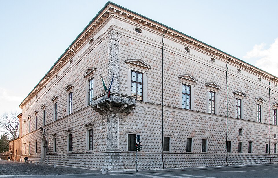
Its most famous building is Palazzo dei Diamanti, whose exterior is covered by thousands of pyramid-shaped blocks of pale marble. Their angled surfaces catch light differently throughout the day, making the façade appear to change as the sun moves. More important historically was the scale of the urban project around it. Ferrara became one of the clearest surviving examples of Renaissance attempts to think about an entire city as something that could be deliberately designed rather than merely inherited.
The Giro dell’Emilia spends its opening kilometres inside this landscape instead of leaving immediately for Bologna. Two complete circuits of 11.3 kilometres carry the peloton through Ferrara before the race finally turns south.
-174 km · Leaving Ferrara Through a City Still Surrounded by Walls
After 23.9 kilometres, with approximately 174 kilometres remaining, the race leaves Ferrara.
Much of the historic centre is still enclosed by roughly nine kilometres of walls, allowing the dimensions of the Renaissance city to be understood unusually well. Their present appearance is the result of several periods of construction, because fortifications had to change as gunpowder artillery transformed European warfare. High medieval walls that could resist ladders and siege engines were increasingly vulnerable to cannon, so engineers developed lower and thicker defences, reinforced by earth and protected by projecting bastions from which defenders could fire along the approaches.
Ferrara’s surviving walls contain elements of that transition. Today their embankments are green corridors used for walking and cycling, but their scale reveals how completely the Este court thought about the city in military as well as architectural terms. The castle, planned streets, gates and outer defences belonged to the same political landscape.
Beyond the fortifications, hills disappear and even modest embankments can stand prominently above the fields. For much of the next part of the race, the peloton crosses ground whose apparent simplicity is the result of centuries spent controlling water.
The Emilian Plain · Land Made From Rivers, Silt and Drainage
Ferrara lies within the Po Valley, the enormous lowland stretching across northern Italy between the Alps to the north and the Apennines to the south. The Po, Italy’s longest river, crosses this basin from west to east before reaching the Adriatic, while countless tributaries descend from the surrounding mountains carrying sediment into the plain.
Over geological time, those rivers deposited gravel, sand, silt and clay across the basin. In the lower country around Ferrara, the gradients became so slight that rivers repeatedly shifted course, overflowed their banks and created wetlands, marshes and shallow lakes. Human settlement therefore required a continuous negotiation with water.
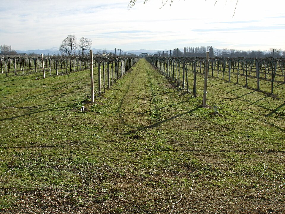
Drainage began long before the modern period. Medieval monasteries, landowners and city governments dug channels and constructed embankments, while the Este rulers organised increasingly ambitious reclamation projects to turn wet ground into productive farmland. Later centuries brought mechanical pumps capable of lifting water from land lying too low to drain naturally, allowing large areas to be cultivated permanently.
The straight canals, drainage ditches and immense rectangular fields visible from the race belong to that history. Much of this land became reliably agricultural only because generations of engineers and farmers continually controlled where water was allowed to flow.
The result helped create one of Europe’s richest food-producing regions. Emilia-Romagna is internationally associated with products such as Parmigiano Reggiano, prosciutto, mortadella and fresh pasta, although those traditions belong to different parts of a large and varied region. Across much of the plain, deep alluvial soils, irrigation and close connections between rural production and wealthy cities supported an agricultural economy of exceptional productivity.
One of the surviving monuments to the relationship between those cities and their countryside appears among the fields north of Bologna.
Bentivoglio · The Family That Ruled Bologna Without Becoming Its Dukes
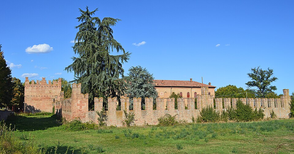
The Castello di Bentivoglio belonged to a family whose authority in Renaissance Bologna was powerful but never as formally secure as that of the Este in Ferrara.
Bologna formed part of the Papal States, the collection of central Italian territories over which the pope exercised political as well as religious authority. Papal control, however, was not always direct or stable. Bologna possessed strong traditions of communal government, powerful guilds and competing aristocratic families, and periods of papal rule alternated with struggles for local control.
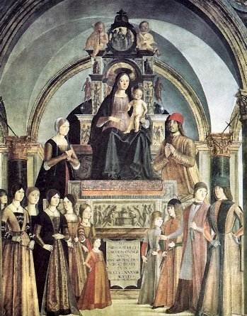
During much of the 15th century, the Bentivoglio family became the dominant political force in the city. They never acquired the secure hereditary title enjoyed by the Este dukes of Ferrara, so their authority depended upon alliances, wealth, patronage and control of Bologna’s institutions. Under Giovanni II Bentivoglio, who dominated Bolognese politics during the later 1400s, the family increasingly behaved like a princely dynasty despite the ambiguity of its legal position.
Their castle in the plain developed as a country residence where the family could administer estates, hunt and receive guests away from Bologna. The surrounding agricultural holdings supplied rents and income as well as produce for a large urban population, binding political power in the city to ownership of the countryside around it.
That arrangement collapsed in 1506, when Pope Julius II moved against the Bentivoglio and personally entered Bologna. Giovanni fled, and enemies of the family subsequently destroyed their magnificent palace inside the city so thoroughly that little remains of it today. The country residence survived, leaving a substantial monument to a dynasty whose principal expression of power inside Bologna disappeared.
-129.4 km · Granarolo and the Agricultural Country North of Bologna
At 68.5 kilometres raced, approximately 129.4 kilometres remain, and the peloton passes the Granarolo production site north of Bologna. The surrounding plain has long combined arable farming with livestock and dairy production, its farms connected economically to the expanding city to the south.
Bologna’s relationship with this countryside also depended heavily on water. The same hydraulic knowledge used to irrigate fields and drain low ground was developed into a network that carried water into the city, where it powered machinery and supported industries that would become important far beyond Emilia.
Bologna’s Hidden Canals · How Water Powered the Medieval City
Bologna is not built beside a great navigable river. The Reno passes to the west and the Savena to the east, neither providing the kind of urban waterway represented by the Arno in Florence or the Tiber in Rome. Medieval Bologna nevertheless became a city of canals because its inhabitants redirected water towards themselves.
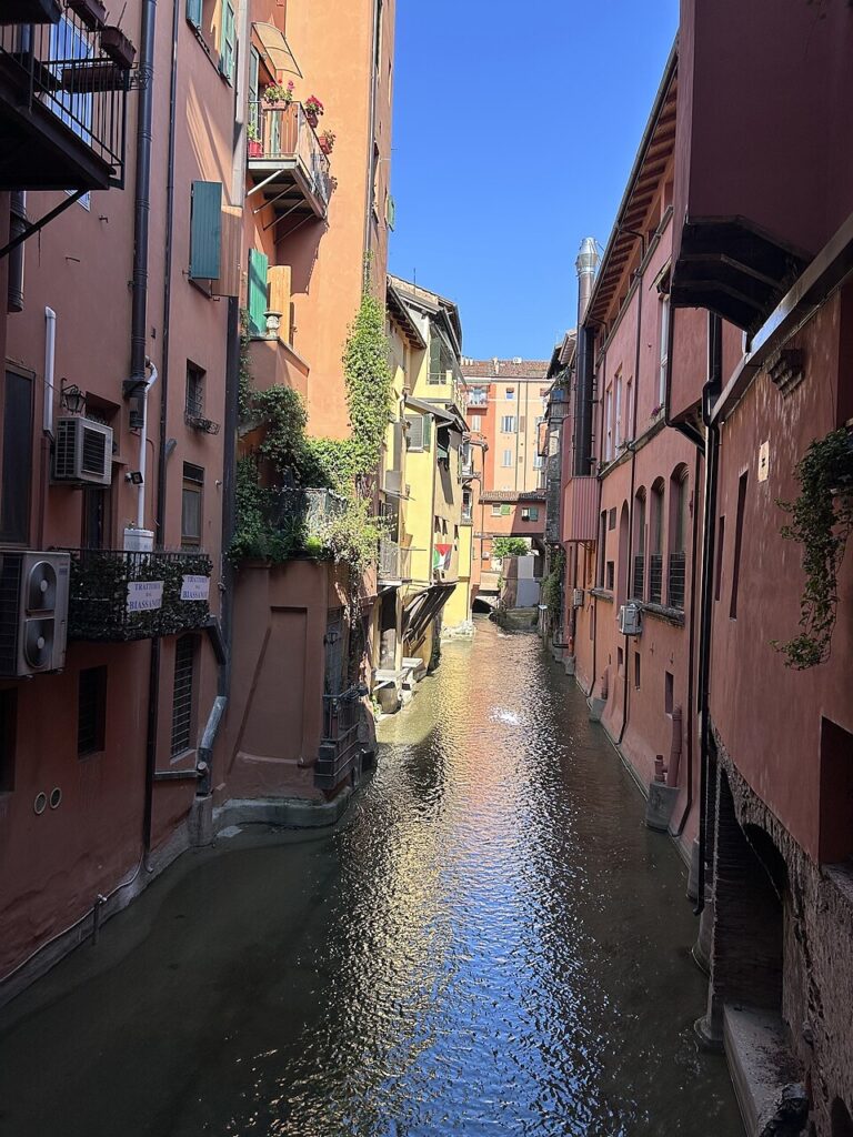
Beginning in the Middle Ages, engineers diverted portions of the Reno and Savena into artificial channels that entered Bologna. Smaller canals distributed the water through the city, where it powered mills, supplied workshops, carried waste and eventually contributed to a navigable connection with the Po river system and the Adriatic.
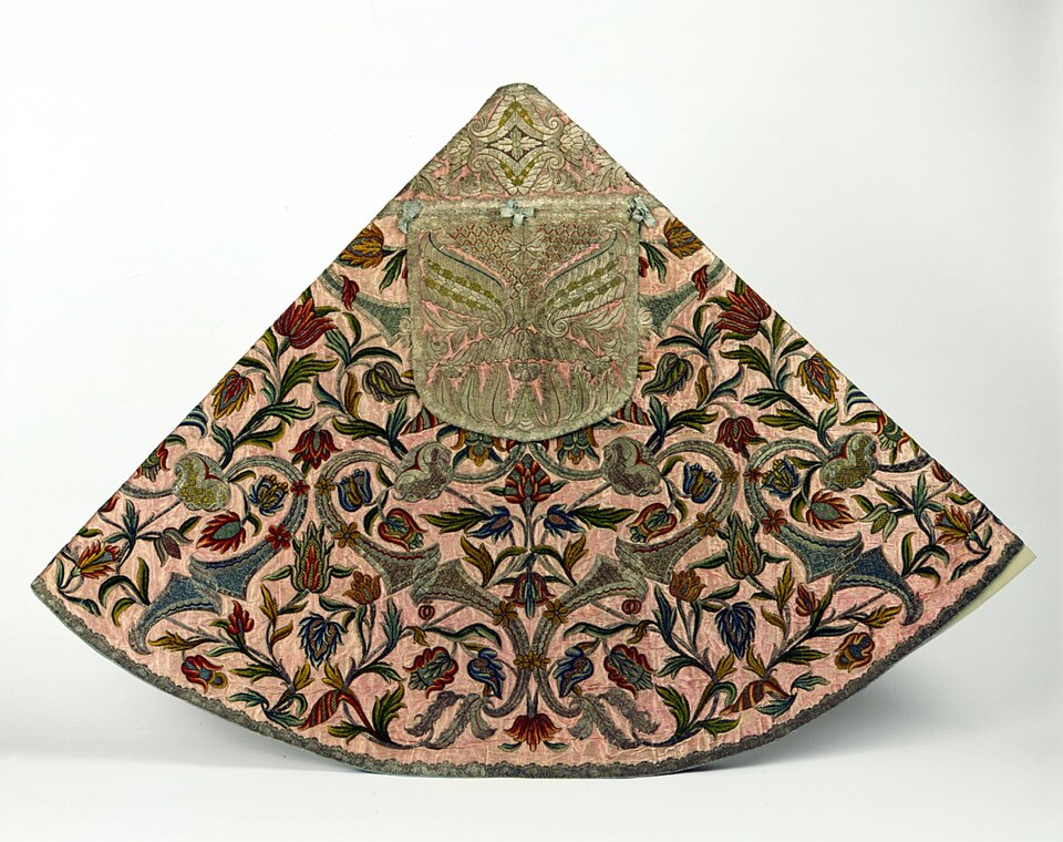
One of the industries transformed by this water was silk. Bologna became an important European centre for silk production, particularly after specialised water-powered machinery was developed to twist silk thread. These complex mills allowed processes that elsewhere required considerable manual labour to be mechanised, helping the city build an industry that employed thousands of people directly and indirectly.
The canals gradually disappeared from everyday view as industrial technology changed and Bologna modernised. Many were covered by roads and buildings, although water continues to flow through parts of the old system underground. A few exposed stretches, particularly around Via Piella, now appear almost surprising within the dense historic centre because the modern city gives little indication of how extensively water once moved through it.
The race remains outside central Bologna and begins turning south, towards the line of hills that has been growing across the horizon.
Loiano · Crossing Into the Apennines
The climb towards Loiano carries the Giro dell’Emilia out of the Po Valley and into the Apennines, the mountain chain running for roughly 1,200 kilometres along the length of the Italian peninsula.
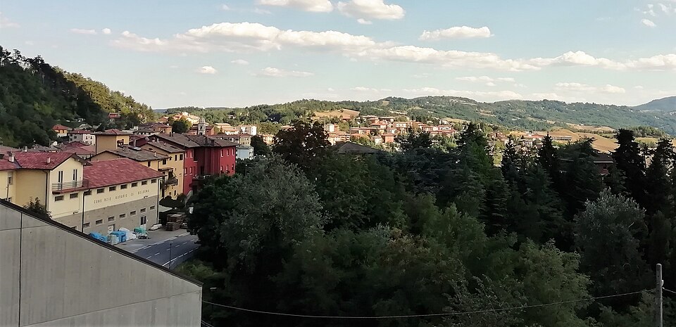
Around Bologna, the Apennines rise directly from the southern edge of the plain. They are lower than the Alps and lack their enormous glaciated peaks, but historically they presented a serious obstacle to movement between northern Italy and Tuscany. Bologna sits on their northern side; Florence lies beyond them to the south. Before modern tunnels and motorways, travelling between those cities meant following valleys and crossing passes that could become difficult in winter and vulnerable to landslides or military control.
Loiano developed along one of those approaches. The road continues south towards the Futa Pass, one of the traditional crossings between Bologna and Florence, and for centuries this corridor carried merchants, officials, soldiers, pilgrims and ordinary travellers between the Po Valley and Tuscany.
Italy’s long mountain spine repeatedly forced movement towards particular valleys and passes, giving settlements along those corridors an importance disproportionate to their size. Bologna’s prosperity was connected partly to its position at one of the principal northern entrances to this system.
Loiano is the highest point of the 2026 race. The immense horizons around Ferrara have disappeared into ridges, wooded slopes and valleys, while roads follow the shape of the terrain instead of the straight geometry of reclaimed fields.
On the return towards Bologna, the route reaches Pianoro, where the mountains carry a much more recent history.
Pianoro · A Town Rebuilt After the Italian Campaign
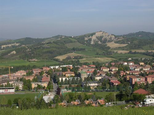
The old settlement of Pianoro was largely destroyed during the final stages of the Second World War in Italy, when the northern Apennines became one of the principal barriers between Allied armies and the Po Valley.
In 1943, after the fall of Benito Mussolini’s Fascist government, Italy signed an armistice with the Allies. German forces rapidly occupied much of the country, rescued Mussolini and established defensive positions intended to slow the Allied armies advancing north from southern Italy. The peninsula’s mountains and narrow valleys allowed German commanders to construct successive defensive systems across routes that the Allies had little choice but to approach directly.
One of the strongest was the Gothic Line, built across the northern Apennines. Allied forces attacked it during 1944, but fighting continued through the winter, and the final advance into the Po Valley did not come until the spring of 1945.
Pianoro stood on the southern approach to Bologna along an important road through the mountains. Bombing, artillery and ground fighting devastated the old settlement so thoroughly that post-war reconstruction created a new town in the valley rather than simply restoring everything where it had stood before. The modern buildings visible from the race consequently belong to a landscape that was substantially remade after the war.
The 2026 route adds a different difficulty nearby. Via Belvedere climbs for approximately 1.5 kilometres at an average gradient of 11 percent, with the first 300 metres exceeding 15 percent. Its length is modest compared with the major passes of the Alps, but the steep opening arrives late enough in the race to disturb a group before the repeated ascents of San Luca.
After Via Belvedere, the riders descend through Rastignano. The enclosed mountain landscape begins opening again and Bologna spreads ahead at the foot of the hills.
Bologna · A City Built at the Meeting of Plain and Mountain
The Po Valley opens northwards from Bologna towards Ferrara, Modena, Milan, Venice and the approaches to the Alps, while immediately south of the city the Apennines rise towards Tuscany. That position attracted settlement long before Bologna acquired its present name.
The Etruscans, whose civilisation flourished across parts of central and northern Italy before Roman expansion, established an important settlement here known as Felsina. During the 4th century BC, Celtic peoples known as the Boii occupied the region, before Rome defeated them and founded the colony of Bononia in 189 BC. The Roman city became part of the road network of northern Italy, particularly through the Via Aemilia, the great route constructed across the region that ultimately gave Emilia its name.
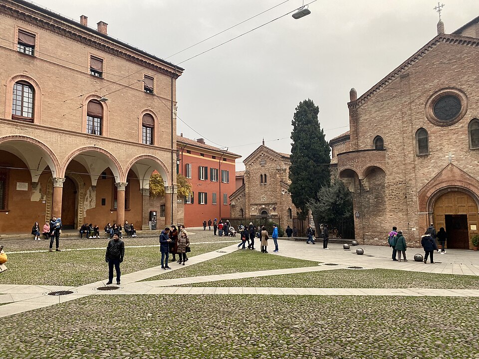
Medieval Bologna became one of Europe’s largest cities, enriched by trade, manufacturing and its position on routes crossing the peninsula. Its most influential institution developed around education. The University of Bologna, conventionally dated to 1088, is generally regarded as the oldest university in continuous operation in the Western world. Its early reputation was built particularly on the study of Roman and canon law, drawing students from different parts of Europe and helping establish models of academic organisation that influenced universities elsewhere.
Competition among Bologna’s wealthy medieval families also changed its skyline. They built tall residential towers that served as defensive structures, status symbols and visible declarations of power, and dozens once rose above the city. The most famous survivors are the Asinelli and Garisenda towers, begun during the 12th century. Garisenda’s pronounced lean became famous enough for Dante Alighieri to use it as a comparison in the Divine Comedy.
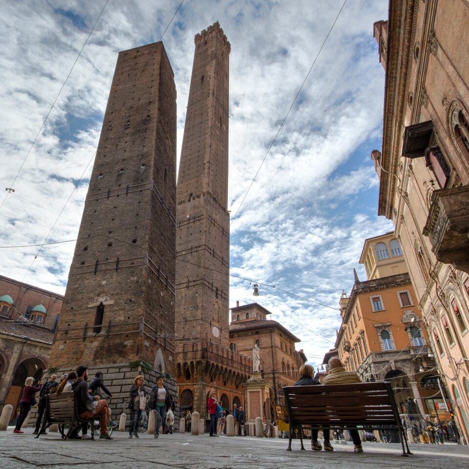
At street level, the pressure created by a large medieval population produced another architectural form that would eventually become more characteristic of Bologna than the towers themselves.
The Porticoes · How Bologna Expanded Over Its Own Streets
Bologna contains tens of kilometres of porticoes, covered pedestrian passages formed by the upper floors of buildings projecting above columns or pillars. Their origins were practical rather than monumental.
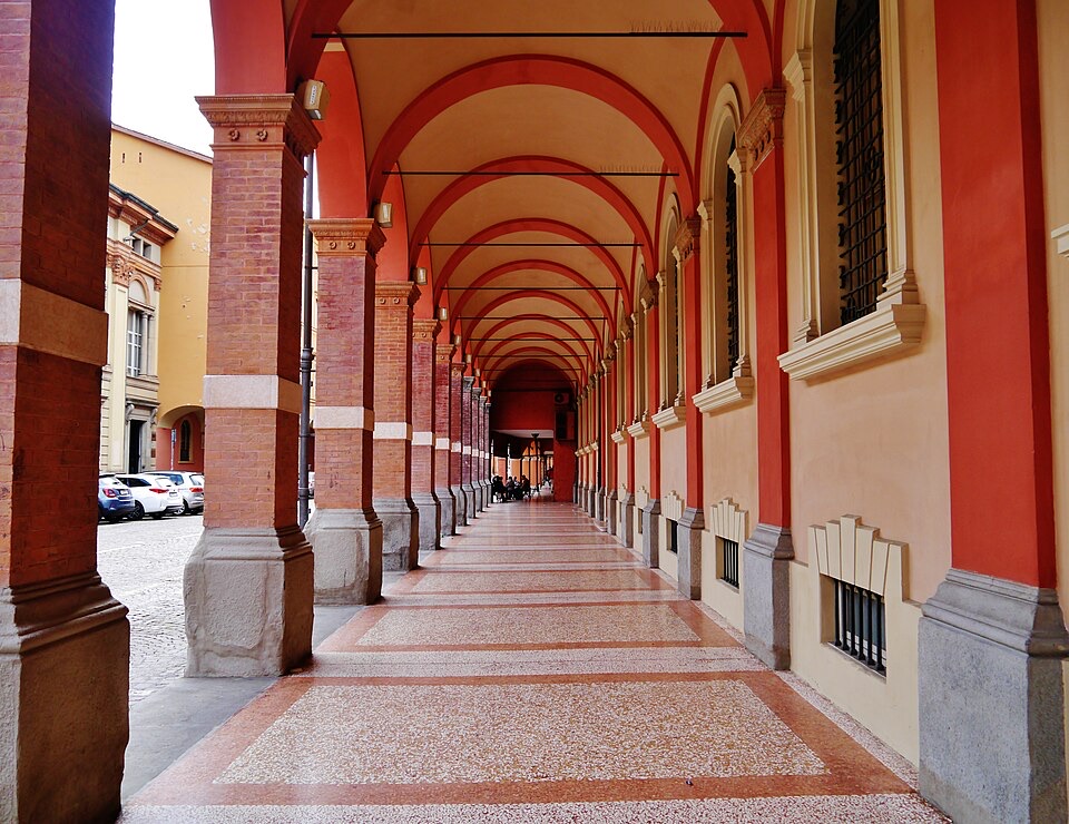
As the medieval population grew, property owners sought additional living space without surrendering valuable ground at street level. Upper floors were extended outward over the public road and supported initially by wooden beams. The arrangement left a sheltered passage underneath while creating more interior space above.
What began as a solution to overcrowding became regulated by the city. Porticoes had to be high and wide enough to permit normal movement beneath them, including the passage of people, goods and horses, and over time many wooden structures were replaced in brick or stone. Because the system continued for centuries, the portico ceased to be an architectural exception and became one of the basic forms through which Bologna’s streets were constructed.
Today shops, homes, churches and public buildings open onto continuous covered routes that provide shade during hot summers and protection from rain during winter. Selected groups of Bologna’s porticoes were added to the UNESCO World Heritage List in 2021.
One covered route continued beyond the dense city and climbed towards a sanctuary more than two hundred metres above it.
Porta Saragozza · Why Bologna Began Climbing to San Luca
Near Porta Saragozza, one of the gates in Bologna’s final medieval wall circuit, the porticoes lead west towards the hills and eventually to the Sanctuary of the Madonna di San Luca.
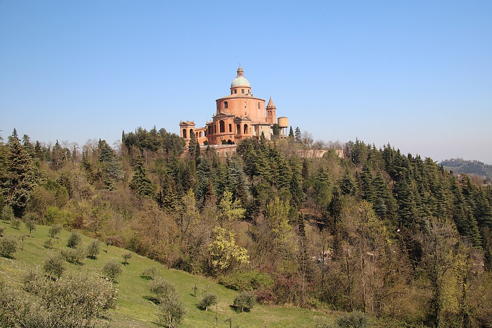
The sanctuary developed around a sacred image of the Virgin and Child. Tradition attributed the icon to Saint Luke the Evangelist, although modern art-historical study places its creation much later, probably within the medieval Byzantine cultural world. Whatever its historical origin, the image acquired enormous religious importance in Bologna.
That devotion became especially associated with an event in 1433, when persistent rain threatened crops around the city. The icon was carried down from the hill into Bologna in procession, after which the weather was said to improve. The ceremonial descent of the image became an annual tradition, reinforcing the connection between the city and the sanctuary above it.
Reaching San Luca still required several kilometres of walking and a climb of more than two hundred vertical metres, often in rain, summer heat or muddy conditions. During the 17th and 18th centuries, the route itself became one of Bologna’s most ambitious architectural projects.
-39 km · Arco del Meloncello and the Beginning of San Luca
With 39 kilometres remaining, the riders reach the Arco del Meloncello, the elegant 18th-century structure where the covered route crosses above the road and begins its steepest journey towards the sanctuary.
Construction of the Portico di San Luca had begun during the 17th century and continued into the following century. The complete covered route extends for almost four kilometres and is generally regarded as the longest continuous portico in the world. Pilgrims could now travel from Bologna towards the sanctuary while remaining protected from the weather for almost the entire journey.
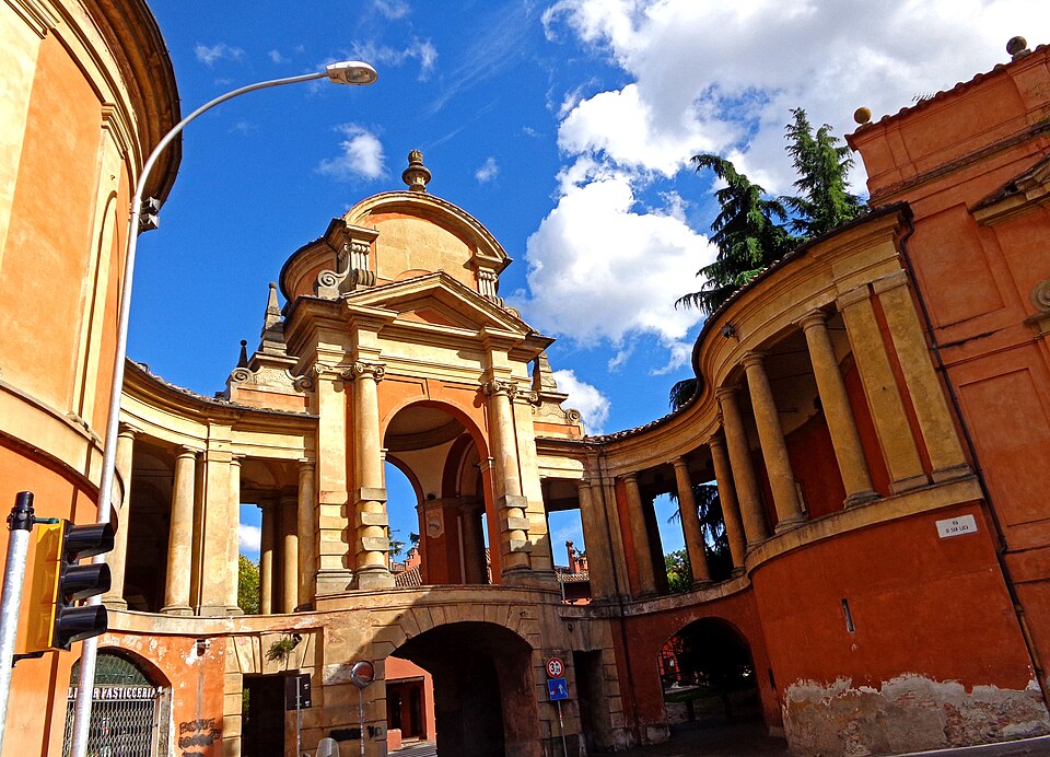
The lower part crosses relatively gentle urban terrain, but Meloncello marks the dramatic change in gradient. Architect Carlo Francesco Dotti, who also designed the present sanctuary, created the monumental crossing here during the 18th century so that the portico could pass above an existing road before turning towards the hill.
From this point, the architecture continually adjusts to the slope. Arches rise beside steep ramps and stairways, columns change their relationship with the ground, and the covered passage follows the road upwards for more than two kilometres.
The complete portico is traditionally counted as having 666 arches. Because 666 is identified in the Book of Revelation as the “number of the beast,” a popular interpretation imagines the long winding portico as a serpent whose head is crushed by the Virgin at the sanctuary above. It is an evocative story, but there is no convincing evidence that the architects deliberately designed the structure around that symbolism. The number of arches belongs to the building; the serpent belongs to the tradition that grew around it.
Beside the portico, the road climbs for roughly two kilometres at an average gradient approaching ten percent. Its steepness is irregular, and at the famous Curva delle Orfanelle, named after an institution for orphaned girls once associated with this part of the hill, the gradient reaches approximately 20 percent.
The first ascent begins with almost forty kilometres still to race. At the sanctuary, the riders will turn back towards Bologna and repeat the climb four more times.
-36.8 km · First Passage at San Luca
The first passage beside the sanctuary comes with approximately 36.8 kilometres remaining. Four complete laps of the traditional 9.2-kilometre circuit now separate the riders from the finish.
The Sanctuary of the Madonna di San Luca occupies Colle della Guardia above Bologna, its warm orange-red walls and large dome visible from the city and from parts of the surrounding plain. Religious buildings had existed on the hill for centuries, but the present sanctuary was constructed largely during the 18th century to designs by Dotti.
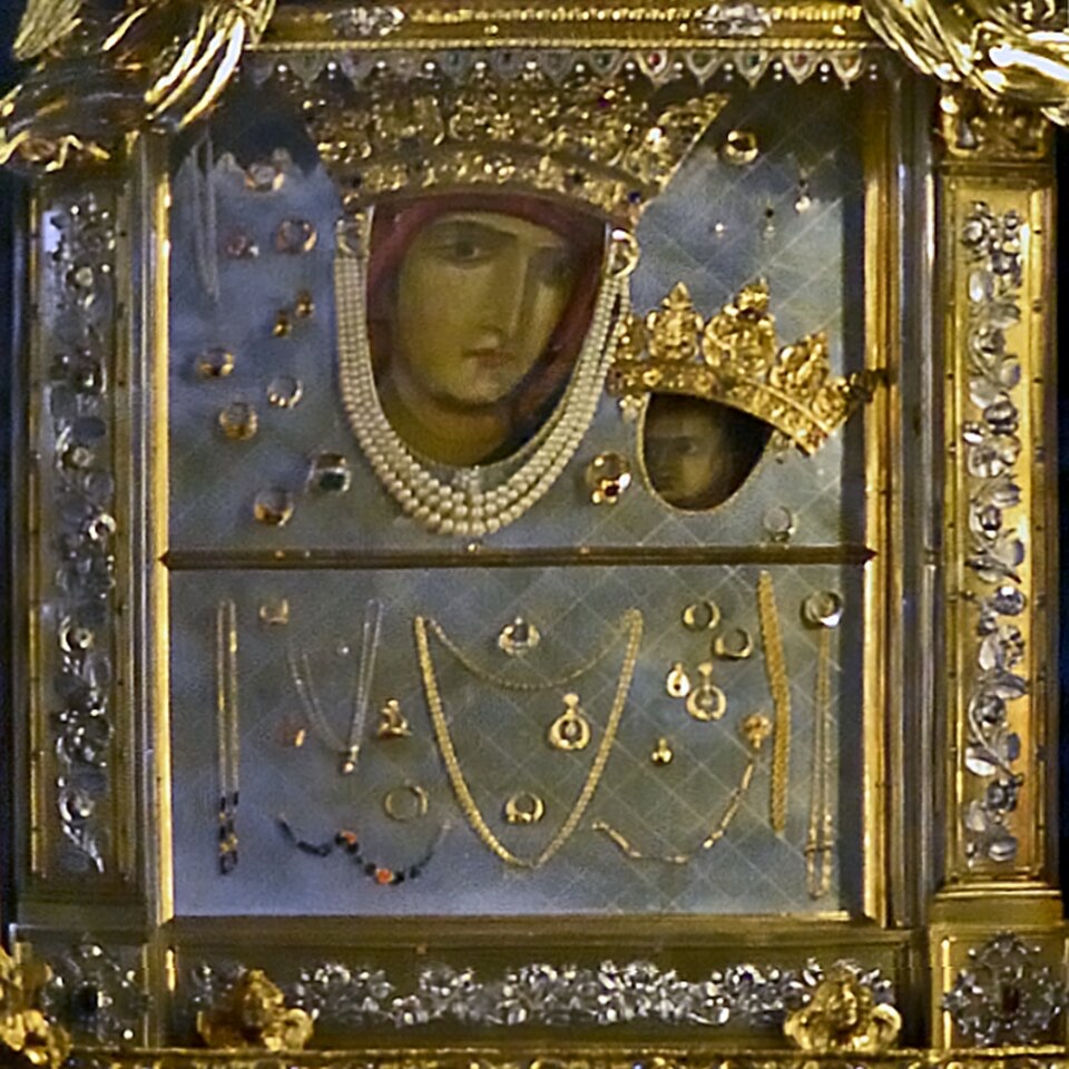
The icon kept inside remains the centre of the sanctuary’s religious life. During the annual observance, it is still carried down into Bologna and later returned uphill, preserving a physical connection between city and hill that has lasted for centuries and that eventually produced the extraordinary covered route beside the race.
The Giro dell’Emilia uses repetition for a very different purpose. A climb lasting only a few minutes becomes progressively more selective as recovery diminishes, the group contracts and riders return to the steepest ramps already carrying the effort of the previous passages.
San Luca and the Giro dell’Emilia · From Pilgrimage Road to Cycling Finish
The Giro dell’Emilia predates its modern San Luca finale. The first edition was held in 1909 and won by Eberardo Pavesi after a race of roughly 340 kilometres, a distance belonging to an era when professional cycling routinely demanded extraordinary endurance on primitive roads and heavy bicycles.
Over more than a century, the course changed repeatedly while the race established itself as one of the principal autumn classics of Italian cycling. Its official UCI 1.Pro classification places it below the WorldTour, but its place in the Italian autumn calendar, demanding terrain and San Luca finish regularly attract riders who contest the world’s largest stage races and one-day events.
The winners span several eras of the sport. Fausto Coppi won in 1947 and Gino Bartali in 1952, placing two of Italian cycling’s defining rivals on the roll of honour. Among the race’s earlier winners was Ugo Agostoni, the Lissone rider whose name would later be given to the Coppa Agostoni, winner here in 1912. Later generations brought victories for riders such as Eddy Merckx, Francesco Moser and Marco Pantani, while the modern race has been won by climbers and Grand Tour contenders including Nairo Quintana, Primož Roglič and Tadej Pogačar. Isaac del Toro won the 2025 edition.
The repeated San Luca circuit suits riders capable of managing something more complicated than a single explosive effort. Positioning matters before Meloncello, the gradient repeatedly breaks rhythm, the Orfanelle section can force riders beyond a sustainable pace, and the descent provides only limited time to reorganise before the road begins climbing again.
The same arches, bends and gradients return with each lap, while the group passing beneath them becomes progressively smaller.
-27.6 km · Second Passage at San Luca
The second arrival at the sanctuary leaves approximately 27.6 kilometres to race. Riders have already felt where the gradient changes and how long the hardest section lasts, while teams have seen which rivals can respond comfortably and which are beginning to struggle. The circuit descends rapidly through Bologna’s western hills before turning back towards Meloncello.
From the upper road, the city spreads northwards into the Po Valley, with the flat country crossed from Ferrara occupying the distant horizon. Behind and to the south rise the Apennine ridges around Loiano and Pianoro. The entire course has moved between those two landscapes, and from San Luca both are visible at once.
-18.4 km · Third Passage at San Luca
At the third passage, approximately 18.4 kilometres remain. San Luca is still the same short climb, but the accumulated effort changes how it is ridden. The Curva delle Orfanelle is particularly severe because a gradient approaching twenty percent forces high power at low speed, often while riders are also fighting to maintain position in a shrinking group. The road eases beyond the bend without immediately reaching the sanctuary, making an attack on the steepest ramp difficult to judge against the remaining distance to the top.
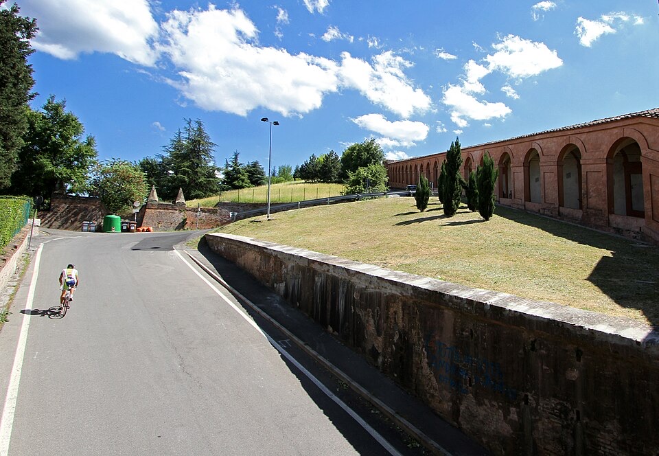
The short circuit also changes the experience beside the road. Spectators gathered along the portico see the race repeatedly instead of watching the peloton pass once and disappear into the mountains. By the later laps, the same stretch of hillside has witnessed the field change from a large peloton into a much smaller collection of contenders.
-9.2 km · Bell Lap at San Luca
The penultimate passage comes with 9.2 kilometres remaining. Only one circuit remains, and the descent offers the last opportunity for attacks, regrouping or tactical hesitation before the road returns to Meloncello.
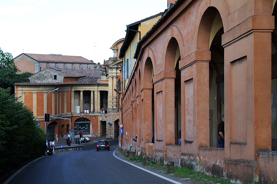
The portico has by now accompanied every decisive passage of the race, although it was built for movement at an entirely different pace. For centuries, pilgrims have climbed beneath its roof towards the image kept at San Luca. The riders remain on the road beside it, approaching the same sanctuary after nearly two hundred kilometres and four previous ascents.
On the final return to Meloncello, there is no passage through the sanctuary waiting on the other side. The fifth climb ends there.
FINISH · Madonna di San Luca
The final ascent begins beneath the Arco del Meloncello and follows the portico towards Colle della Guardia. The road pitches upwards again, tightens at the Orfanelle and continues beside the arches until the sanctuary appears above the final part of the climb.
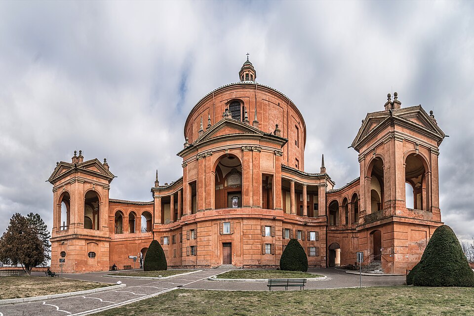
For most of the day San Luca has been far beyond the riders’ view. Ferrara began almost two hundred kilometres away in a landscape where rivers, drainage and reclamation shaped the ground on which the city and its agriculture developed. The road crossed that plain, entered the Apennines and eventually returned to Bologna, where the geography of the race contracted around a single hill.
The sanctuary had already been connected to Bologna for centuries before cycling arrived. Devotion to an icon brought pilgrims onto the hill, their journeys encouraged the construction of the portico, and the portico created a permanent architectural route between the city and San Luca. The Giro dell’Emilia later placed its finish on the road running beside it.
On race day both routes still exist together. People can walk uphill beneath the covered arches while the riders climb on the open road only metres away, each heading towards the same sanctuary through a landscape whose meaning was established long before anyone thought of racing a bicycle up it.



