


8 November 2026 | UCI Asia Tour 1.2 | Men’s Champion Road Race | 200 km
Okinawa is an island where a cycling race can travel through several different histories without ever leaving the same stretch of coastline. Its northern roads pass through the former territory of a medieval kingdom, climb into subtropical forests inhabited by animals found nowhere else on Earth, and connect villages whose traditions survived the destruction of the Second World War. The sea is rarely far away, yet the mountains make even short journeys between neighbouring communities unexpectedly demanding.
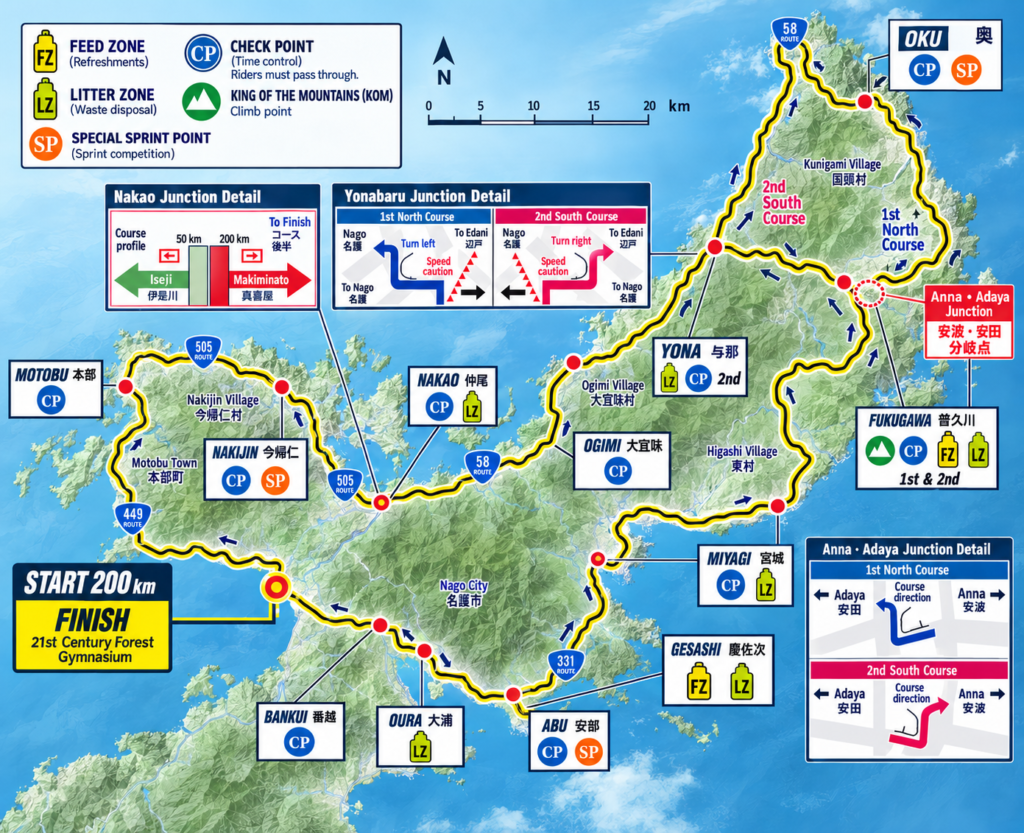
The Tour de Okinawa follows this geography for 200 kilometres, beginning and ending in Nago, the principal urban centre of northern Okinawa. From the city, the route heads northwest around the Motobu Peninsula before turning toward the western coast of Yanbaru, the forested region occupying the island’s northern end. It then enters a demanding sequence of mountain crossings and eastern coastal roads before returning south toward Nago.
Although Okinawa belongs to Japan, its history developed along a different trajectory from that of the Japanese mainland. For centuries, the Ryukyu Islands formed a maritime kingdom whose rulers maintained diplomatic and commercial relationships with China, Japan, Korea and Southeast Asia. The kingdom was incorporated into Japan in 1879, and the twentieth century brought a devastating battle, prolonged American administration and a complicated return to Japanese sovereignty.
The roads of the Tour de Okinawa connect these histories through the landscape itself. The first kilometres reveal the political geography of the old Ryukyu Kingdom; the northern coast introduces communities shaped by isolation and maritime exchange; and the forested interior opens a much older story, one measured not in centuries but in millions of years of island evolution.
The route also offers a distinctive sporting challenge. Rather than relying on a single major mountain, it accumulates difficulty through repeated climbs, technical descents and changes between the island’s western and eastern sides. Its two northern passages are not simply repetitions of the same terrain: they expose different relationships between the coastline, the mountains and the settlements that occupy the narrow spaces between them.
200 km | START — Nago and the Gateway to Yanbaru
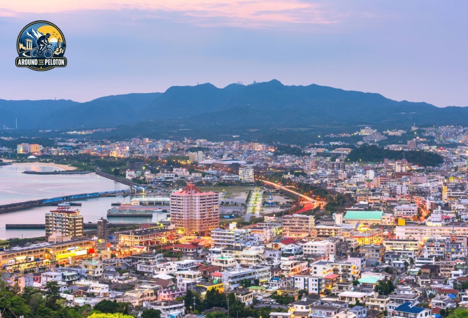
The race begins at the 21st Century Forest Gymnasium in Nago, a city situated between the developed southern half of Okinawa’s main island and the mountainous north. Its position has long made it an important point of connection. Roads and coastal settlements converge here before separating toward the Motobu Peninsula, the western coast of Yanbaru and the island’s Pacific-facing eastern side.
Nago occupies a broad coastal setting, with the East China Sea to the west and wooded hills rising inland. The surrounding valleys support agriculture, while the coastline has historically provided opportunities for fishing, transport and exchange. In northern Okinawa, where mountain ridges frequently interrupt overland communication, maritime connections were often as important as the roads that exist today.
The modern city belongs to a region that was once governed from much farther south. During the Ryukyu Kingdom, political authority was concentrated at Shuri, near present-day Naha, but northern Okinawa retained its own local institutions and distinctive cultural traditions. Before unification, the political landscape had been even more fragmented.
The opening kilometres carry the riders away from Nago toward the Motobu Peninsula, where that earlier history becomes particularly significant.
–176.4 km | Route 505 — The Motobu Peninsula and the Northern Kingdom
The Motobu Peninsula extends into the East China Sea northwest of Nago. Its coastline is deeply indented, with bays, small settlements and agricultural land enclosed by wooded limestone hills. The terrain is noticeably different from the broad urban corridors farther south, and the road must follow the natural openings between the peninsula’s ridges.
Route 505 provides one of the principal connections through this part of northern Okinawa. As the race continues toward Nakijin, it enters the territory once associated with Hokuzan, the northernmost of three rival kingdoms that divided Okinawa before the fifteenth century.
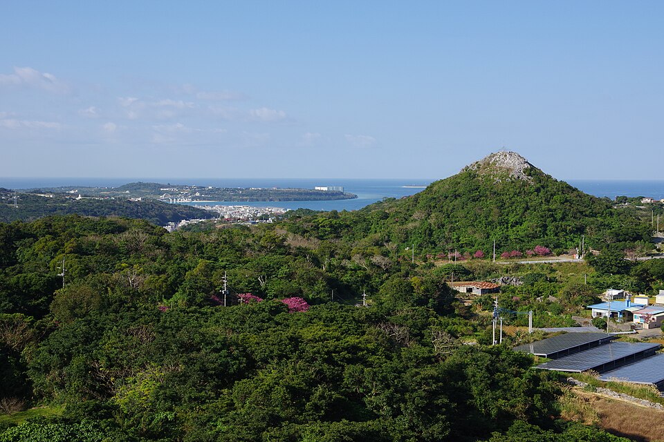
The period is known as Sanzan, meaning Three Kingdoms. Hokuzan occupied the north, Chūzan controlled the central region, and Nanzan governed territories in the south. These were not isolated communities competing only for agricultural land. Their rulers also sought recognition and commercial opportunities through relationships with Ming-dynasty China, whose maritime networks were central to the political and economic life of the Ryukyu Islands.
Hokuzan’s principal stronghold stood at Nakijin Castle, on a hill overlooking the northern side of the Motobu Peninsula. The castle is not a roadside monument on the race itinerary, but it provides the historical key to understanding the surrounding territory.
Nakijin Castle | The Walls of a Lost Kingdom
Nakijin Castle is one of Okinawa’s most remarkable surviving medieval sites. Its extensive limestone walls follow the contours of a hilltop, enclosing a complex of fortified and ceremonial spaces that once served the rulers of Hokuzan.
Archaeological evidence places its development between the late thirteenth and early fifteenth centuries, although the history of settlement and political authority in the area extends beyond any single construction phase. The walls, which stretch for approximately 1.5 kilometres, are particularly distinctive for their sweeping curves and adaptation to the natural terrain.
Nakijin belongs to the Ryukyuan tradition of the gusuku, fortified complexes that combined defensive, political and religious functions. Their architecture developed independently of the later stone castles familiar from Japanese feudal history. Many gusuku incorporated sacred spaces connected to indigenous Ryukyuan beliefs, and their construction reflected the availability of local limestone and the demands of the island’s topography.
Excavations at Nakijin have revealed imported ceramics and other objects associated with maritime trade. These discoveries help explain why a kingdom occupying the relatively remote northern end of Okinawa maintained connections far beyond the island.
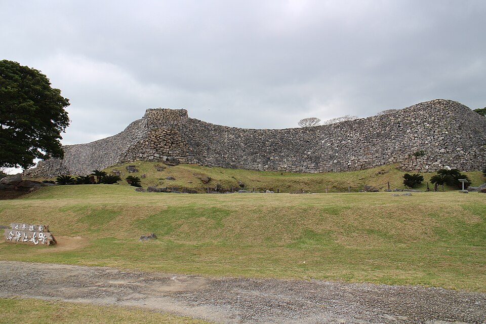
Hokuzan’s independence ended in 1416, when forces led by Shō Hashi of Chūzan conquered the northern kingdom. Thirteen years later, the conquest of Nanzan completed the political unification of Okinawa in 1429. Nakijin continued to function as an administrative centre under the new ruling authority, even after its royal court had disappeared.
Today, the ruins form part of the UNESCO World Heritage property known as the Gusuku Sites and Related Properties of the Kingdom of Ryukyu. Their survival makes the Motobu Peninsula more than an attractive coastal landscape: it is the setting of a political history that preceded the creation of a unified Okinawa.
The race’s opening passage through the peninsula therefore follows roads belonging to the former heartland of a lost kingdom, even where its principal monuments stand beyond the immediate course.
The Same Peninsula, Five Centuries Later
In April 1945, the Motobu Peninsula became the scene of another struggle shaped by its difficult terrain.
After American forces landed on Okinawa on 1 April, units advancing north encountered Japanese defensive positions around the peninsula’s mountains. Fighting around Mount Yae was particularly difficult, as Japanese troops used the wooded slopes and ridgelines to resist the advance.
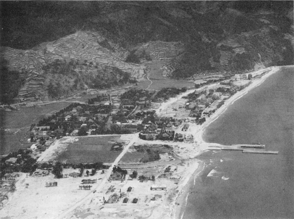
Across the water, Ie Island was attacked by American forces beginning on 16 April. The island’s isolated summit, Mount Gusuku, dominates its otherwise relatively low landscape. On 18 April, the American war correspondent Ernie Pyle was killed there while accompanying American troops.
The fighting in northern Okinawa formed only one part of the much larger Battle of Okinawa, whose most destructive and prolonged engagements occurred farther south. Nevertheless, the Motobu Peninsula demonstrates that the northern landscape was not untouched by the conflict.
The island’s civilian population experienced enormous disruption, including the destruction of homes, agricultural land and cultural property. For many communities, reconstruction after the war required rebuilding not only physical settlements but the social and economic traditions that had sustained them. That experience becomes especially important farther north, where one village’s textile industry would emerge as an unexpected symbol of cultural survival.
–158.4 km | National Route 58 — The Western Coast of Yanbaru
At approximately 43 kilometres into the mapped course, the itinerary reaches National Route 58, the principal road running along much of Okinawa’s western coast.
Here the character of the journey changes. The Motobu Peninsula’s irregular network of settlements gives way to a more continuous northbound passage between the East China Sea and the forested mountains of Yanbaru.
The name Yanbaru is associated with the wooded northern part of Okinawa, particularly the municipalities of Kunigami, Ōgimi and Higashi. Its mountains are relatively modest in absolute elevation, but their steep slopes and narrow valleys create a landscape very different from the more densely populated central and southern portions of the island.
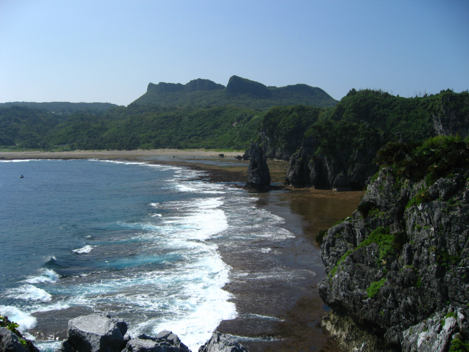
Settlements occupy the limited space available along the coast and at the mouths of rivers descending from the interior. The sea historically provided food and transport, while the surrounding hills supplied timber, agricultural resources and freshwater. Communities adapted to this combination of coastal accessibility and inland isolation.
The road passes through a region whose economy was traditionally based on agriculture, fishing, forestry and small-scale craft production. These activities were not separate from Okinawa’s wider history. They supplied materials and goods to the Ryukyu Kingdom, responded to changing trade relationships and eventually faced the pressures of industrialisation and modernisation.
One of the most distinctive surviving examples is found in Ōgimi, where the history of a woven cloth connects the medieval kingdom to the destruction and reconstruction of the twentieth century.
Ōgimi and Kijoka | The Survival of Bashōfu
In Kijoka, a district of Ōgimi, craftspeople developed and preserved bashōfu, a traditional textile made from fibres extracted from the banana plant known locally as ito-bashō.
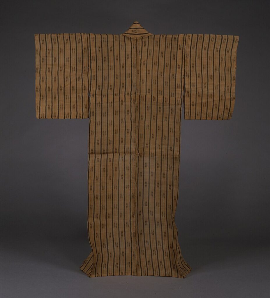
Unlike the varieties cultivated primarily for edible fruit, this plant is grown for its strong fibres. Producing the cloth requires a lengthy sequence of harvesting, stripping, preparing and joining fibres before they can be woven into fabric. The finished material is light, breathable and particularly suitable for Okinawa’s humid subtropical climate.
Bashōfu was once produced across parts of the Ryukyu Islands. It served everyday needs but also circulated within the political and economic networks of the kingdom. The cloth connected agricultural cultivation, household labour, specialist knowledge and wider systems of exchange.
Its survival became increasingly uncertain during the modern period. Industrial textiles reduced demand for traditional production, while the destruction caused by the Second World War threatened the remaining communities of skilled weavers.
The central figure in its postwar revival was Toshiko Taira, born in Kijoka in 1921. After the war, she devoted herself to restoring the craft and organising its production, helping women in the community develop weaving as a source of income while preserving techniques inherited from earlier generations.
Her work was particularly important because the knowledge involved could not simply be reconstructed from written instructions. Preparing fibres, producing thread and weaving cloth depended on practical skills transmitted through experience.
In 1974, Kijoka bashōfu was designated an Important Intangible Cultural Property of Japan. Taira was recognised as a Living National Treasure in 2000 and remained associated with the tradition until her death in 2022.
The history of Kijoka offers a different perspective on Okinawa’s postwar reconstruction. It is not primarily a story of political institutions or military occupation, but of a community preserving knowledge rooted in the plants, climate and working practices of its own landscape.
Beyond the inhabited western coast, the race begins to encounter the mountain roads that define Yanbaru’s interior.
–131.3 km | Prefectural Route 2 — Into the Forested Interior
Approximately 70 kilometres into the mapped route, the itinerary identifies a transition onto Prefectural Route 2, a mountain road connecting the western and eastern sides of northern Okinawa. This is one of the clearest geographical turning points in the race. The coastal settlements begin to recede, and the road enters a landscape increasingly dominated by forest.
The mountains of Yanbaru do not resemble the high ranges of continental Asia. Their significance lies instead in the density of their vegetation, the steepness of their valleys and the remarkable biodiversity preserved within them.
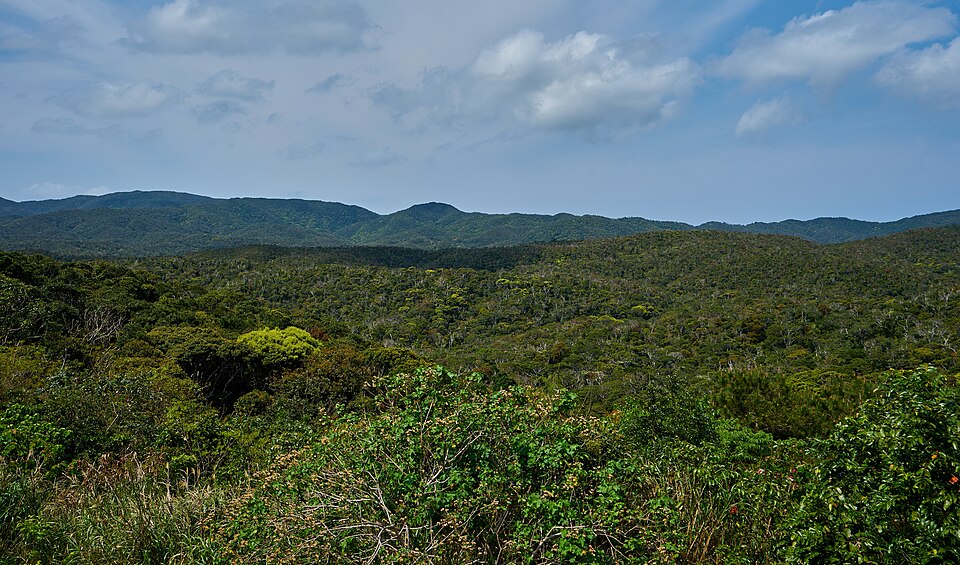
The Ryukyu Islands occupy a chain of landmasses extending between Japan and Taiwan. Over geological time, changes in sea level and the separation of island populations created conditions in which plants and animals could evolve independently. Northern Okinawa retains important habitats associated with that long history of isolation.
In 2021, its forests became part of the UNESCO World Heritage property Amami-Oshima Island, Tokunoshima Island, Northern Part of Okinawa Island, and Iriomote Island. The inscription recognises the exceptional biodiversity of these islands, particularly their concentration of endemic and threatened species.
One of the most recognisable is the Okinawa rail, known locally as the Yanbaru kuina. This largely flightless bird, scientifically described in 1981, inhabits the forests of northern Okinawa and occurs nowhere else in the world.
Its restricted distribution makes it vulnerable to habitat loss, road traffic and introduced predators. Conservation efforts therefore involve not only protecting forest habitat but managing the relationship between wildlife and the human infrastructure crossing it.
The Okinawa woodpecker provides another example of the region’s evolutionary distinctiveness. It is associated with mature forests in northern Okinawa, where the availability of suitable woodland is essential to its survival.
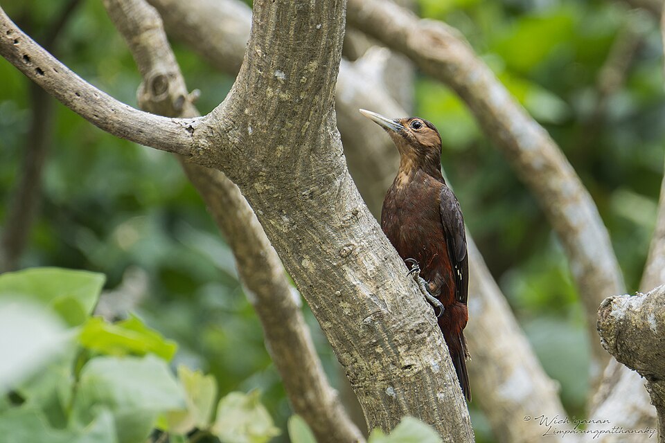
These species are not incidental curiosities. They illustrate why the forests of Yanbaru have international ecological importance despite occupying a comparatively small geographical area.
For the riders, the same terrain presents a more immediate challenge. Roads must climb from valleys onto ridges, descend through wooded slopes and change direction repeatedly as they negotiate the mountains. The course’s difficulty is cumulative rather than dependent on a single enormous ascent.
The forest also transforms the experience of the island. On the western coast, the sea provides a continuous geographical reference. Inland, the road becomes enclosed by vegetation, and the surrounding mountains conceal the coastline even when it is only a relatively short distance away.
–119.3 km | The Northern Mountain Roads — A Landscape of Isolation
The mapped itinerary records another important road transition after approximately 82 kilometres, continuing the race’s passage through the mountainous north.
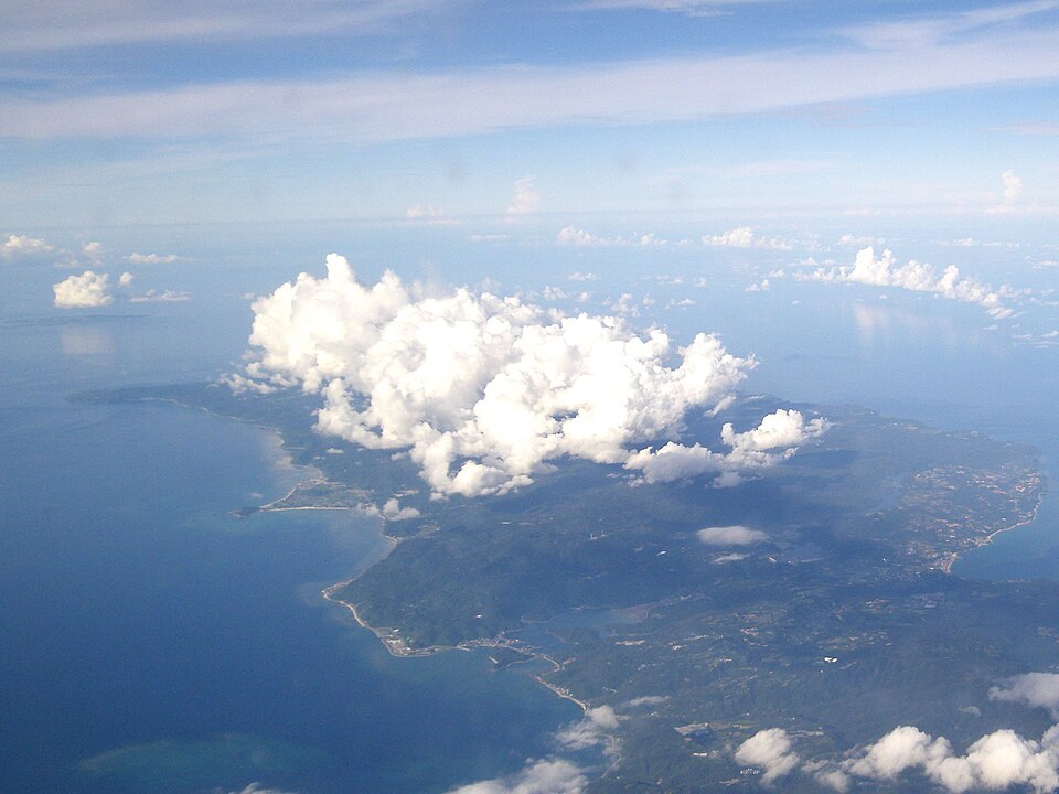
This part of the journey belongs to the wider region of Kunigami, the municipality occupying the northern end of Okinawa’s main island. Its settlements are distributed along the coast and within the relatively few valleys where agriculture and habitation are practical.
Historically, travelling between these communities could be difficult. Mountain ridges separated neighbouring settlements, while heavy rainfall and steep terrain complicated the construction and maintenance of overland routes.
The sea often provided an alternative connection, but it was not always reliable. Coastal travel depended on weather and local maritime conditions, while the forested interior remained a significant geographical barrier.
These constraints helped preserve distinctive local customs and forms of community organisation. They also contributed to the linguistic diversity of the Ryukyu Islands.
Okinawan and other Ryukyuan languages belong to the Japonic language family but are not simply dialects of standard Japanese in the ordinary linguistic sense. They developed through their own historical processes and contain vocabulary, grammatical features and sound systems reflecting the islands’ separate cultural history.
The spread of standard Japanese through education, administration and mass communication has placed many traditional Ryukyuan varieties under severe pressure. Their decline represents another form of cultural change affecting communities whose identities were once closely associated with particular islands and districts.
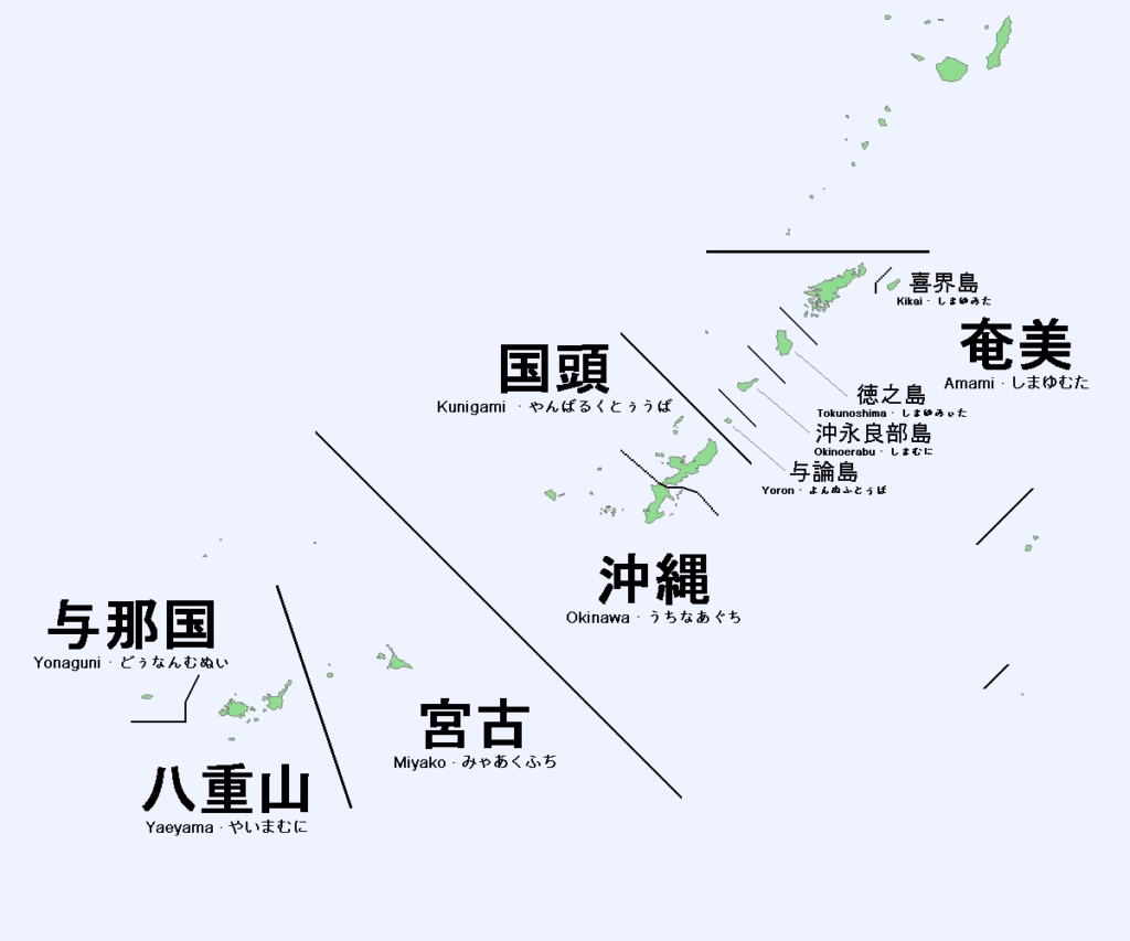
In Yanbaru, this linguistic history belongs to the same landscape as the forests and villages. The mountains did not prevent communication with the outside world, but they influenced how communities developed and maintained their local traditions.
The Northern Roads and the Geography of Water
Rainfall is one of the principal forces shaping Yanbaru. Moist air reaching the mountains produces substantial precipitation, which feeds streams descending through narrow valleys toward the coast.
These waterways help sustain the region’s forests and provide freshwater for human settlements. They also shape the roads, which frequently follow valleys or cross ridges where direct passage is impossible.
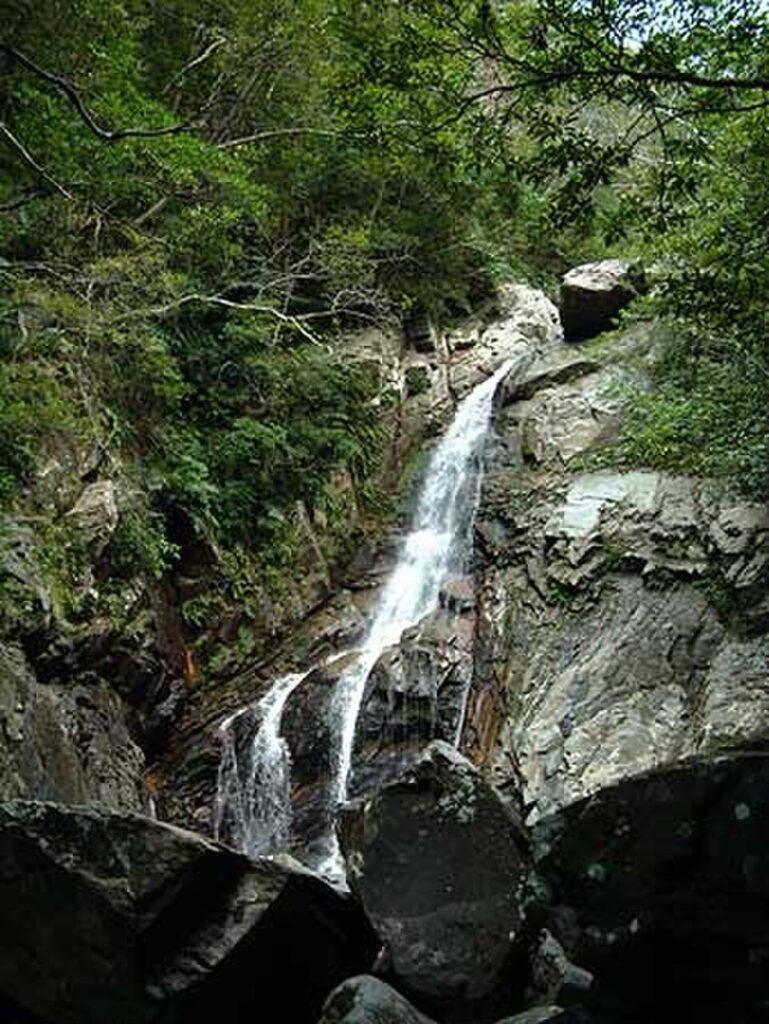
The relationship between vegetation and water is especially important on steep slopes. Forest cover helps protect soils and regulate runoff, while disturbances can increase erosion and alter the conditions of downstream habitats.
This creates a direct connection between the ecological importance of Yanbaru and the practical difficulties encountered by anyone travelling through it. The forest, the drainage network and the mountain roads are all parts of the same geographical system.
The course’s repeated climbing and descending reflects that structure. Each ridge represents another crossing between valleys whose streams eventually reach one side of the island or the other.
–81.2 km | Back Toward Route 58 — The Second Northern Passage
After approximately 120 kilometres, the mapped itinerary returns to National Route 58, marking another transition in the northern part of the course.
By this point, the race has already travelled through the Motobu Peninsula, the western coastal corridor and the forested mountain roads. The second northern passage should therefore be understood differently from the first.
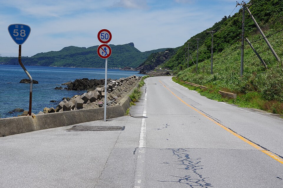
The opening journey introduced the relationship between settlements and the sea. The mountain crossing revealed the ecological and geographical character of the interior. Returning toward the northern road network now makes it possible to understand how closely those environments are connected.
Northern Okinawa’s communities depend on resources produced or regulated by the surrounding mountains. Forested catchments supply water, while narrow valleys determine where cultivation is possible. Roads link coastal settlements to the interior, but their alignments remain constrained by the same ridges that shaped earlier patterns of communication.
The landscape has also changed substantially during the modern period. Forestry, agriculture, road construction and military land use have all affected northern Okinawa. At the same time, conservation has become increasingly important as the exceptional biodiversity of Yanbaru has gained national and international recognition.
The establishment of Yanbaru National Park in 2016 and the UNESCO World Heritage inscription in 2021 represent major developments in this process. They also reflect an ongoing challenge: protecting rare habitats while allowing local communities to maintain livelihoods and access to the surrounding countryside.
The road therefore passes through a landscape that is neither untouched wilderness nor simply a rural area awaiting development. It is a region where environmental protection, local economic needs and historical land use must coexist.
–67.4 km | Across the Northern Ridges Again
At approximately 134 kilometres, the itinerary identifies another transition onto the northern mountain road network. The return crossing adds a new dimension to the race. The riders are no longer entering Yanbaru for the first time; they are confronting its topography after more than half the course has already been completed.
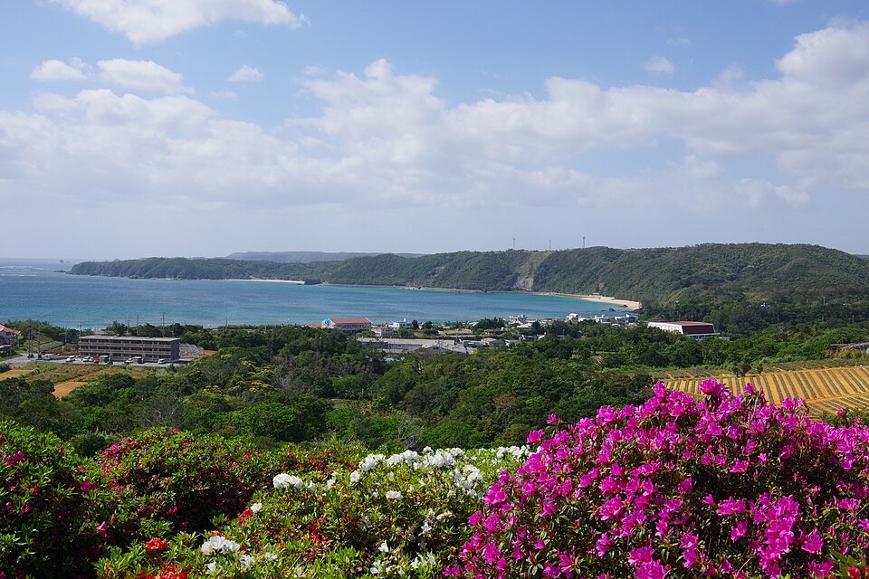
The repeated ridges and valleys become increasingly important as fatigue accumulates. Climbs that might be manageable early in the race can become decisive when encountered after several hours of competition, particularly on roads where changes of gradient make it difficult to maintain a consistent rhythm.
This is one reason the Tour de Okinawa differs from races organised around a single famous summit. Its difficulty is distributed across the route, and the repeated crossings of the northern mountains create opportunities for the field to fragment long before the finish.
The geography also explains the contrast between the island’s two coastlines. To the west lies the East China Sea, the maritime space through which the Ryukyu Kingdom maintained many of its historical relationships with the Asian mainland. To the east, the coastline faces the Pacific, with forested hills descending toward bays, rivers and smaller coastal settlements.
The distinction is not merely one of direction. The available land, road connections and settlement patterns vary as the course moves between the two sides of the island.
–35.2 km | National Route 331 — The Eastern Coast and the Road South
With approximately 35 kilometres remaining on the mapped route, the itinerary reaches National Route 331, which follows sections of Okinawa’s eastern coastline. The character of the landscape begins to change again. After the northern mountain roads, the race moves into the southern approach toward Nago, where the coastline becomes increasingly connected to larger settlements and modern transport infrastructure.
The eastern side of Yanbaru is associated with communities such as those in Higashi, where agriculture, forestry and coastal resources have historically shaped local livelihoods.
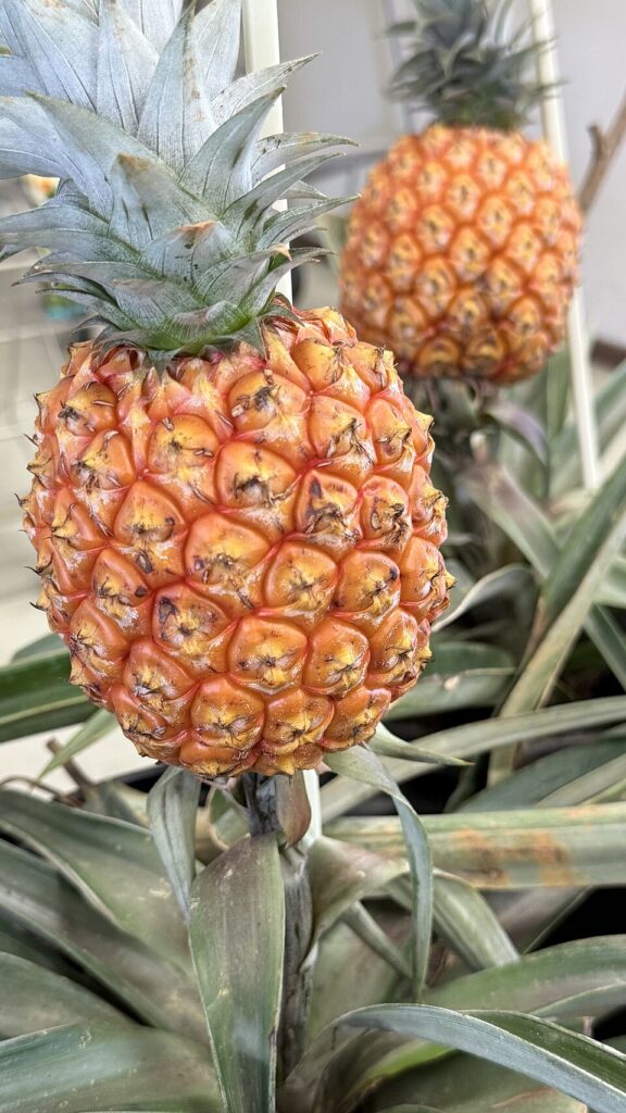
Pineapple cultivation became one of the characteristic agricultural activities of northern Okinawa during the twentieth century. The crop benefited from the island’s warm climate and suitable growing conditions, although changes in markets, labour and competition have transformed the industry over time.
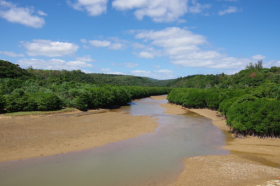
The region also contains important river and estuarine environments, including the mangroves of the Gesashi River. These habitats illustrate the ecological diversity of eastern Yanbaru, where water descending from forested mountains reaches the sea through sheltered coastal systems.
Unlike the upland forests, mangroves are adapted to tidal environments where freshwater and saltwater meet. Their roots stabilise sediment and provide habitat for fish, crustaceans and other organisms.
Together, the mountain forests and coastal wetlands demonstrate how different ecological communities occupy closely connected parts of northern Okinawa. Water links them physically, travelling from the ridges through streams and rivers before entering the sea.
As the riders continue south, however, the historical focus begins to shift from the natural landscape toward the modern island.
Okinawa After 1945
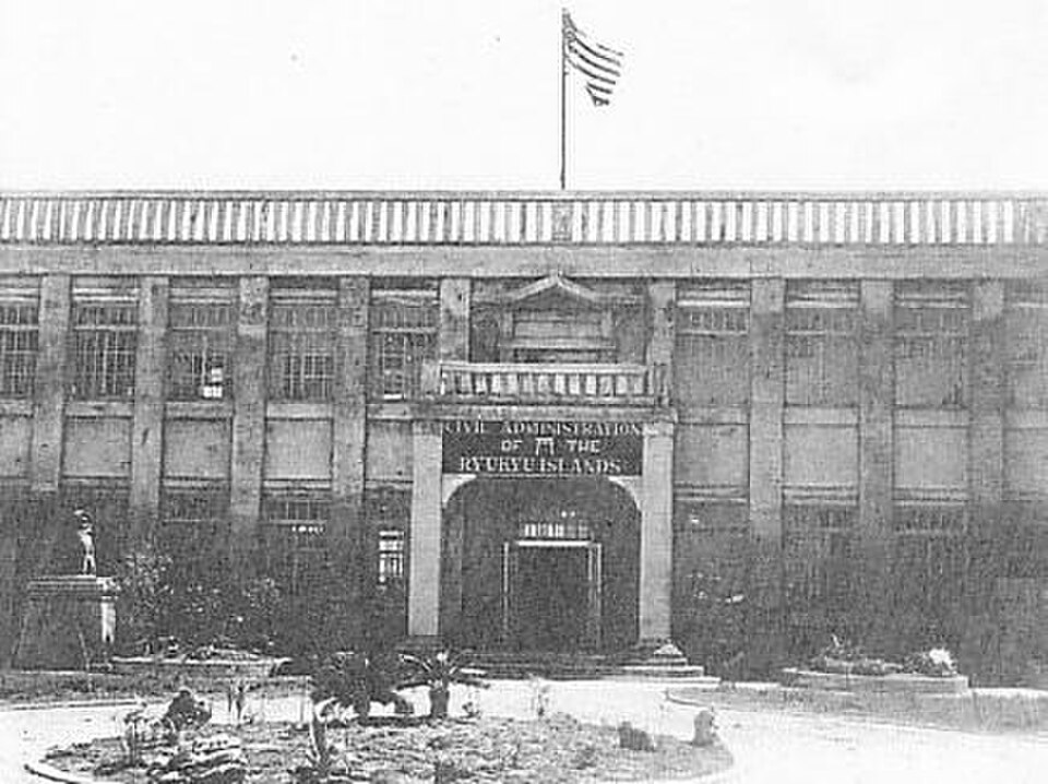
The Battle of Okinawa left an enormous human and material legacy. Civilian deaths, displacement and the destruction of settlements affected communities across the island, while the postwar political settlement placed Okinawa under American administration.
That period lasted until 15 May 1972, when the islands were returned to Japanese administration. Reversion did not end the American military presence, and questions concerning military facilities, land use and local autonomy remain important in Okinawan public life.
Northern Okinawa has experienced these issues in a particularly complex way. Parts of Yanbaru were used for military training, while other areas became increasingly important for environmental conservation. The return of some former military land and the expansion of protected areas have contributed to changes in how the northern landscape is managed.
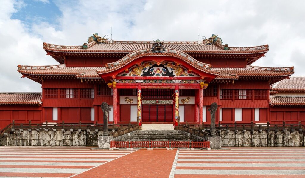
These developments form part of a longer pattern. Hokuzan’s rulers once sought influence through maritime diplomacy; the unified Ryukyu Kingdom later governed the north from Shuri; Japanese annexation brought Okinawa into a different political system; and the twentieth century introduced war, occupation and reversion.
Yet the continuity of local communities is equally important. The villages, agricultural traditions and cultural practices encountered along the course demonstrate that northern Okinawa’s history cannot be reduced to the succession of governments that controlled it.
–10.7 km | Prefectural Route 18 — The Final Climb Toward Nago
With just over ten kilometres remaining on the mapped course, the riders turn onto Prefectural Route 18. This late transition is significant because it brings the race back onto a road crossing the hills near Nago. After nearly 190 kilometres, the final approach is not simply a flat procession along the coast.
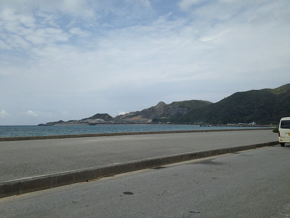
The hills surrounding the city form part of the same topographical system encountered throughout northern Okinawa, although the landscape becomes more inhabited as the route approaches the urban area. For the riders, the preceding distance now becomes decisive. The repeated climbs through Yanbaru, the changes between coastal and mountain roads, and the accumulated fatigue of a long race all influence what remains possible in the final kilometres.
The road’s geographical role is also clear. It reconnects the eastern side of the island with Nago’s western coastal corridor, completing the series of crossings that has defined much of the route. Beyond the hills lies the city where the race began, but the return carries a different perspective. The opening kilometres introduced northern Okinawa as a landscape of historical settlements and former kingdoms. The closing roads bring the riders back from the forests and coastal communities that have given the journey its broader meaning.
–1.3 km | National Route 58 — The Last Road Into the City
The mapped itinerary returns to National Route 58 with approximately 1.3 kilometres remaining. The final approach brings the peloton back into Nago, close to the coastal setting from which the race departed. After the difficult terrain of the north, the city provides a comparatively open and developed environment, with broader roads and more continuous settlement.
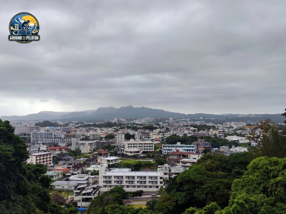
The contrast is striking. Within a single race, the riders have travelled from an urban sports complex into the territory of a medieval kingdom, crossed subtropical forests of international ecological importance, followed roads linking isolated coastal villages and returned through the modern infrastructure of northern Okinawa.
The route’s physical demands have been inseparable from that geographical journey. The mountains that once complicated communication between communities are the same mountains that make the Tour de Okinawa a demanding race.
FINISH — Nago, 21st Century Forest Gymnasium
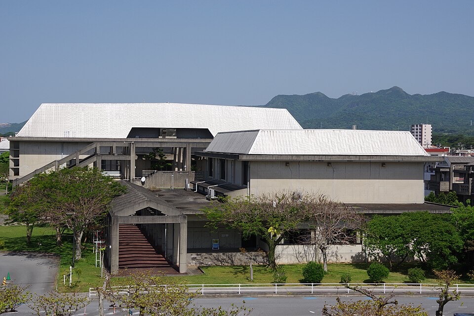
The Tour de Okinawa finishes where it began, at Nago’s 21st Century Forest Gymnasium, completing a circuit through the northern half of Okinawa’s main island.
The course has revealed an island whose history developed through both separation and connection. The mountains divided communities and helped preserve distinctive traditions, while the surrounding seas linked Okinawa to the political and commercial networks of East Asia.
Nakijin Castle recalls the period when northern Okinawa belonged to a separate kingdom. Kijoka’s bashōfu preserves knowledge passed between generations despite the disruptions of war and modernisation. The forests of Yanbaru shelter species whose evolution belongs to a timescale far older than either kingdom or nation.
The modern roads bring these histories together. They connect places that were once difficult to reach, crossing the same ridges and valleys that shaped the island’s settlement, culture and ecology.
By the time the riders return to Nago, the race has travelled through much more than 200 kilometres of Okinawan countryside. It has followed the geography of a region where the sea opened routes to the wider world, the mountains preserved a remarkable degree of difference, and communities learned to live between the two.



