
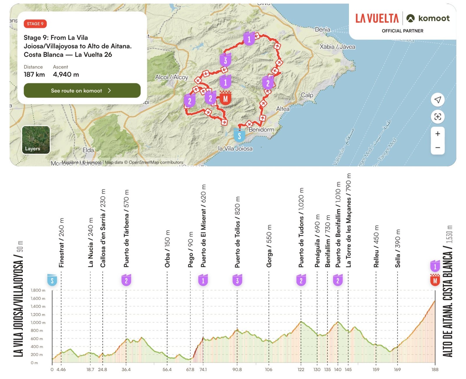

There are stages in which the geography seems to have been designed with little sympathy for cyclists. Stage 9 of the 2026 Vuelta a España is one of them. From the Mediterranean at Villajoyosa, the road turns almost immediately towards the mountains and spends much of the next 187.4 kilometres searching for another one to climb. More than 5,000 metres of accumulated ascent and six categorised climbs make this one of the defining days of the first week, ending at 1,543 metres on the Alto de Aitana after a final ascent twenty-two kilometres long.
Yet the severity of the route conceals another landscape, one whose isolation has preserved stories as effectively as it has produced difficult roads. Beyond the crowded Costa Blanca lies an interior of narrow valleys and limestone mountains where Muslim commanders once resisted Christian kings, villages were emptied by royal decree and repopulated by families arriving from Mallorca, ingenious systems of channels and terraces made agriculture possible on unforgiving slopes, and communities developed identities that can still change noticeably from one valley to the next.
Today the peloton will cross this world in an afternoon. Around it lies the history of people who spent centuries learning how to live among these mountains.
START · Villajoyosa, a Town Built Between the Sea and Chocolate
Stage 9 begins almost at the water’s edge in Villajoyosa, or La Vila Joiosa, where rows of brightly painted houses rise behind the beach and give the old maritime quarter one of the most recognisable waterfronts on the Costa Blanca. The colours are often associated with the town’s seafaring past, when fishermen returning from the Mediterranean needed to recognise their homes from offshore, but the picturesque façade is only the most visible part of a settlement whose relationship with the sea stretches through fishing, trade, defence and industry.
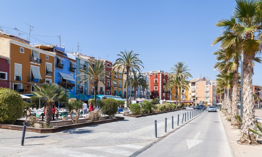
Villajoyosa was already an important settlement long before the modern town took shape. Iberian and Roman remains testify to more than two millennia of occupation, while the historic centre developed within fortifications whose surviving Renaissance walls recall the insecurity of life along a Mediterranean coast exposed to raids. The sea brought danger, but it also brought prosperity, and one of the commodities eventually arriving through Villajoyosa’s maritime connections would transform the town in a completely unexpected way: cacao.
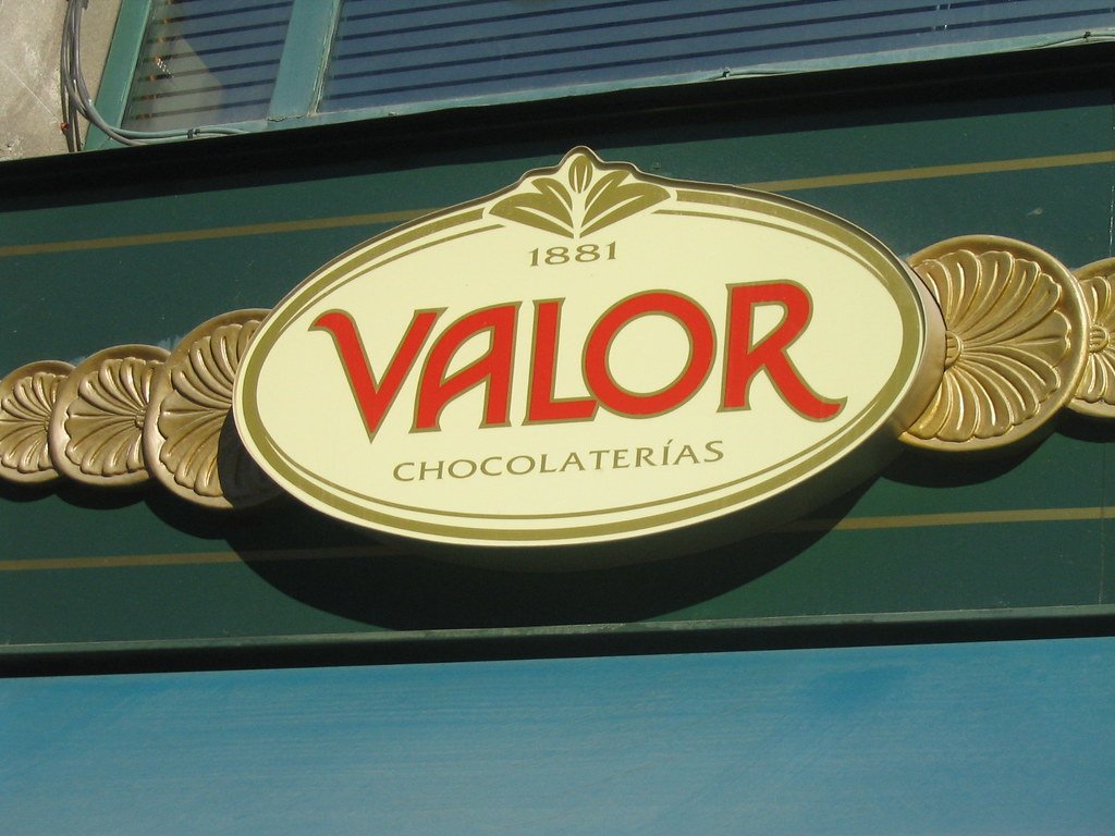
During the 18th and 19th centuries, ships left Villajoyosa carrying products such as textiles and cigarette paper and returned from the Americas with cacao in their holds. Chocolate production developed initially in small workshops behind family houses before becoming one of the town’s characteristic industries; over time, more than seventy local chocolate brands are recorded as having existed. Among them was the business begun by Valeriano López Lloret in 1881, which grew through five generations into Chocolates Valor. The company’s old family factory now forms part of the Valencian Chocolate Museum, where machinery preserves the technological evolution from stone grinding to modern production.
It is an unusual beginning to a mountain stage. Before the riders have climbed a metre of the official route, the place around them has already connected Mediterranean fishermen, transatlantic commerce, industrial history and something as apparently ordinary as a bar of chocolate.
-184 km · Puig Campana, Finestrat
Barely three kilometres into the race, Finestrat brings the peloton beneath one of the great geographical landmarks of the Costa Blanca. Puig Campana rises to 1,410 metres only a short distance from the Mediterranean, its enormous limestone mass appearing almost unnaturally abrupt beside the densely populated coastal plain. For anyone approaching from the sea, it is difficult to mistake, particularly because of the rectangular cleft near its summit known locally as the Portell, which gives the mountain its unmistakable silhouette.
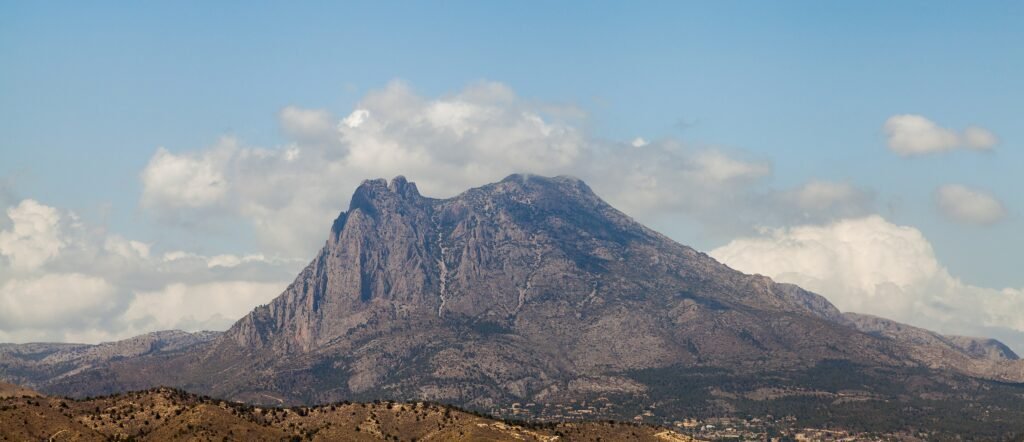
As often happens with mountains whose shape seems too strange to be accidental, people created stories to explain it. Several legends surround the Portell, including traditions connecting the great cut in the ridge with the giant or hero Rotllà, the Valencian form of Roland, the legendary Frankish warrior whose medieval afterlife spread across European folklore. Geography that could be explained by geology instead became something made by an extraordinary human hand, a familiar way in which communities transformed dramatic natural features into stories they could pass from one generation to another.
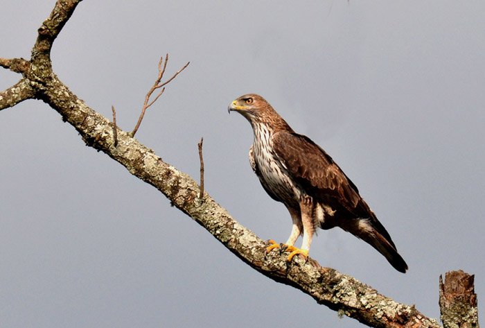
The mountain is equally significant as a natural environment. Its rapid rise from the Mediterranean creates a range of habitats across its slopes, supporting characteristic Mediterranean vegetation and wildlife that includes the Bonelli’s eagle, one of Europe’s threatened birds of prey. The peloton does not climb Puig Campana today, but for the opening kilometres its immense profile dominates the country through which the race is beginning its journey inland.
-151 km · Tàrbena, the Valencian Village That Still Speaks Like Mallorca
After the first substantial climbing of the day, the race reaches Tàrbena, and here the history of the mountains can still be heard in ordinary conversation. Some inhabitants preserve features of a distinctive local speech known as parlar salat, whose origins lie not on the Valencian mainland but across the Mediterranean in Mallorca.
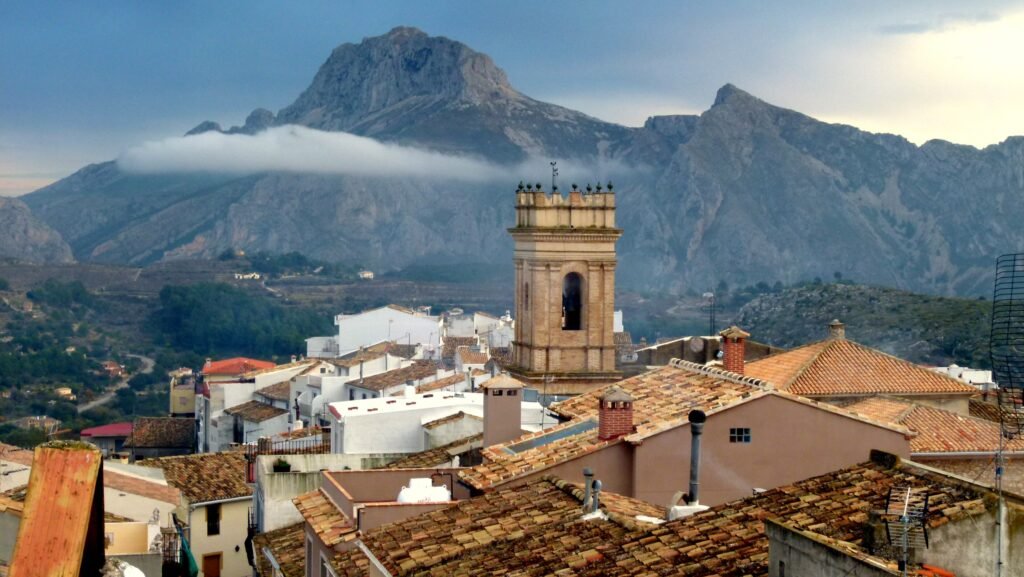
The explanation begins with one of the great ruptures in early modern Spanish history. For centuries these mountain valleys had supported substantial Muslim communities which remained after the Christian conquest and later, following compulsory conversion, became known as Moriscos. In 1609, Philip III ordered the expulsion of the Moriscos from Spain. The consequences were particularly severe in the Kingdom of Valencia, where many rural communities depended heavily upon Morisco farmers and entire settlements were suddenly stripped of much of their population.
Tàrbena was one of them. Attempts to rebuild its population followed in 1612 and 1616, when settlers were brought from Mallorca to occupy the abandoned land. They did not arrive empty-handed: they carried their vocabulary, pronunciation, customs and family traditions across the sea, and elements of that Mallorcan identity survived for centuries in their new mountain home. More than four hundred years later, the linguistic inheritance of those settlers remains one of Tàrbena’s defining characteristics.
The road therefore carries the peloton through something more subtle than a monument or ruin. Here history survived in the way people speak, preserving the memory of a forced departure and a migration that reshaped the human geography of these mountains.
-114 to -100 km · Vall de Gallinera and the Mountains of al-Azraq
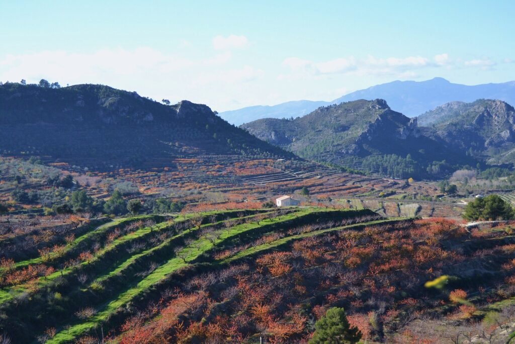
The race eventually enters La Vall de Gallinera, a long mountain corridor enclosed by the Serra de l’Almirall and the Serra Foradada. Olive trees, carob trees and cherry orchards cover the cultivated slopes, while a chain of small settlements follows the valley floor so closely that travelling through Gallinera can feel less like moving between separate villages than passing through different rooms of the same landscape.
People have occupied this valley since deep prehistory. Archaeological evidence reaches back to the Upper Palaeolithic, while prehistoric rock shelters, Iberian sites and later settlements reveal repeated human attempts to make use of the protected corridor between the coast and the interior. Under Islamic rule the valley developed into a network of small agricultural communities organised around farmsteads, irrigation systems and fortified centres. Archaeological and documentary evidence records numerous alquerías, rural settlements whose very name derives from the Arabic qarya.
During the 13th century these mountains became part of one of the most persistent struggles against the Christian expansion of Jaume I of Aragon. The central figure was Muhammad Abu Abdallah Ben Hudzail al-Sahuir, remembered simply as al-Azraq, “the Blue-Eyed”, a Muslim commander whose authority extended across several castles in the Alicante mountains. In 1245 he negotiated the Pacte del Pouet with Jaume I, temporarily retaining control of castles including Alcalà and Gallinera, but armed rebellion followed two years later. For roughly another decade, al-Azraq used these mountains as the centre of resistance against the expanding Christian kingdom.
The geography helps explain why. Gallinera is not an open plain where a larger army could easily impose itself; it is a sequence of narrow approaches, steep slopes, ridges and defensible heights. The remains of Muslim fortifications still occupy commanding positions above the valley, physical traces of a political landscape in which controlling a castle meant controlling the communities, routes and agricultural territory beneath it.
Al-Azraq’s first revolt was eventually defeated, but his story did not end there. He returned from exile in 1276 to lead another uprising and died in battle near Alcoi before he could return to Gallinera. A few months later Jaume I also died, leaving the final suppression of the revolt to his successor. Today the peloton crosses these valleys because their roads provide exactly what a mountain stage requires, but seven centuries earlier the same terrain mattered because its difficulty made it a formidable place to resist an invading power.
-97 km · La Foradà and the Villages of Vall de Gallinera
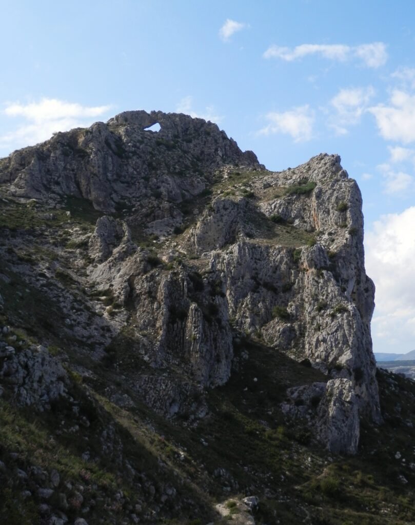
One natural feature dominates the identity of Gallinera: La Foradà, the pierced mountain whose great stone arch rises above the valley. Twice each year, around March and October, the setting sun passes through the opening and illuminates the area associated with the former Franciscan convent at Benitaia, producing a solar alignment that has become one of the valley’s best-known natural phenomena.
Below it lies a landscape that tells another chapter of the Morisco expulsion. The valley once contained a larger network of Muslim settlements, some of which disappeared after 1609 and were never permanently recovered. As in Tàrbena, new settlers arrived from Mallorca to repopulate the territory, creating another layer in the cultural history of these isolated valleys. Today’s villages of Benirrama, Benialí, Benissivà, Benitaia, la Carroja, Alpatró, Llombai and Benissili are the surviving communities within a landscape where abandoned settlements, castles, mills and irrigation works preserve evidence of those who lived here before them.
The agricultural landscape is equally distinctive. Gallinera is particularly known for its cherries, whose early ripening is favoured by the valley’s microclimate, while olive and carob cultivation has shaped its slopes for generations. The terraces visible from the road are not simply picturesque patterns cut into the mountainside; they are the cumulative result of centuries spent converting steep and difficult terrain into land capable of supporting human communities.
-58 km · Penàguila and the Jardí de Santos
By the time the race reaches Penàguila, the peloton has spent much of the day among medieval castles, agricultural terraces and villages whose forms were shaped by the Islamic and Christian societies of the mountains. Hidden just outside Penàguila is something entirely different: a private garden created in the 19th century according to the ideals of Romanticism.
The Jardí de Santos was begun in 1841 by Joaquín Rico y Soler, who transformed a mountain property into an intimate world of cypress trees, water, carefully arranged vegetation and architectural surprises. A cypress-lined approach leads towards a neoclassical house painted in Valencian indigo; beyond it lie a large pond, a hedge maze, an old aviary, groves of tall yews and cypresses, statues and viewpoints, while a small artificial grotto introduces the deliberately mysterious atmosphere prized by Romantic garden design.
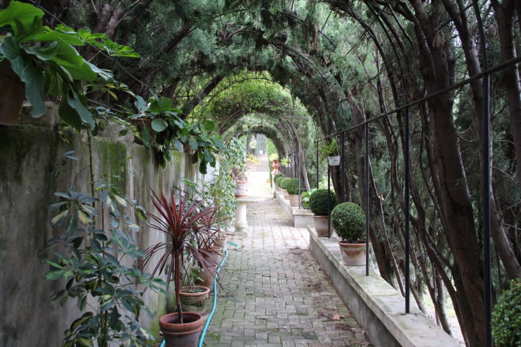
Its presence here is surprising precisely because of its scale and setting. This is not one of the monumental gardens created for a royal palace or aristocratic capital, but a personal landscape concealed beside a small Alicante mountain village. It represents the 19th-century desire to turn nature into an emotional experience, arranging trees, water, paths and hidden spaces so that walking through a garden became a succession of moods and discoveries.
Above Penàguila, meanwhile, stand the remains of a much older Almohad castle, a reminder that even here the layers of history refuse to remain separate. Within the same landscape the peloton passes a medieval Islamic fortress and a Romantic garden created six centuries later.
-47 km · Puerto de Benifallim and the Alicante Mountain Interior
At the Puerto de Benifallim, the race crosses its fifth categorised climb and rises once again above one thousand metres. By now the cumulative character of the stage becomes important not only to the riders but to understanding the landscape itself. The Costa Blanca is commonly imagined through beaches, resorts and the intensely developed Mediterranean strip, yet only a short distance inland the province fractures into a complicated system of limestone ranges, narrow valleys and elevated settlements.
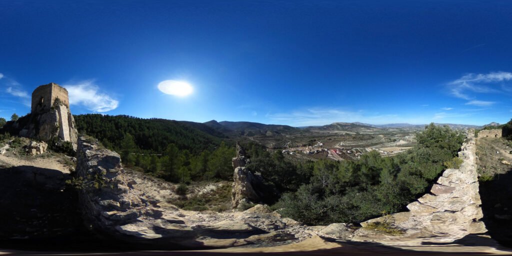
This geography helped preserve the cultural differences encountered throughout the stage because travelling between neighbouring valleys was historically far more difficult than their proximity on a modern map suggests. Communities developed around their own water sources and cultivable land, while ridges that today provide spectacular roads for cycling once imposed genuine limits on communication. The relentless succession of climbs in Stage 9 is therefore not an artificial sporting invention imposed upon the region; it is the natural consequence of attempting to travel across a country in which almost every valley is separated from the next by another mountain.
-18 km · Sella and the Landscape Built Around Water
The final ascent has already begun when the race reaches Sella, a compact mountain village occupying a slope beneath the enormous limestone wall of the Serra d’Aitana. Human presence in the surrounding territory reaches back thousands of years, with prehistoric paintings at the Font de l’Arc, but the landscape visible today owes much to the communities that lived here during the Islamic period.
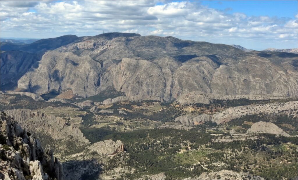
Water was the essential problem. Mediterranean rainfall is irregular, summers are dry and cultivable land is limited, so farming successfully beneath Aitana required careful control of every available source. Islamic communities developed networks of séquies, assuts, reservoirs and mills, capturing and directing water through the landscape and creating irrigated gardens around the settlement. The physical form of Sella itself retains traces of this history, with narrow streets adapted to the hillside and cultivated terraces descending into the valleys below.
The expulsion of the Moriscos in 1609 emptied Sella almost completely, after which Christian settlers repopulated the village. The agricultural pressure of later centuries produced another transformation as families constructed terraces ever higher on the surrounding slopes, building stone walls to hold tiny pieces of soil in place. What can appear from a distance to be a naturally stepped mountain is therefore partly a human artefact, created by generations who could not afford to waste usable ground.
For the riders, Sella is simply a marker on the final twenty-two-kilometre ascent. For the people who lived beneath Aitana, climbing these slopes was never sport; it was the geography within which food, water and survival had to be negotiated.
FINISH · Alto de Aitana and the Roof of Alicante
The Serra d’Aitana has been present throughout the stage even when hidden beyond nearer ridges, but during the final kilometres it becomes unavoidable. Rising to 1,558 metres, Aitana is the highest mountain in the province of Alicante, a vast limestone barrier standing surprisingly close to the Mediterranean and dominating much of the geography through which the race has travelled.
Altitude changes the natural world as the road climbs. The warmer Mediterranean vegetation of the lower slopes gradually gives way to environments adapted to colder temperatures, stronger winds and exposed limestone terrain. Cracks, cliffs and rocky slopes create small ecological refuges in which specialised plants survive, while the mountain’s height makes Aitana an important landmark visible across a large part of the province. From its upper slopes, on clear days, the contrast that has defined the entire stage becomes apparent at once: mountains filling the foreground while the Mediterranean stretches beyond them.
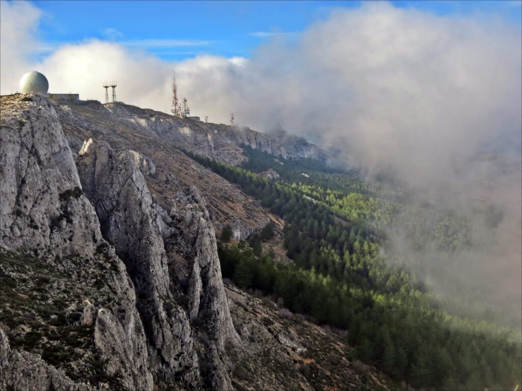
The Vuelta does not finish on the absolute summit. The upper mountain contains the Aitana military installation, and the race reaches its finish at approximately 1,543 metres after twenty-two kilometres of climbing at an average gradient of 5.8 percent. Access to this upper road gives the finish an unusual sense of isolation, as though the race has continued climbing beyond the ordinary limits of the inhabited landscape.
Aitana also carries its own Vuelta history. The race first finished here in 2001, when Claus Michael Møller won, and returned for victories by Leonardo Piepoli in 2004 and Damiano Cunego in 2009. Its most famous modern appearance came in 2016, when Pierre Latour won the stage while the mountain provided the setting for the final confrontation between Nairo Quintana and Chris Froome for the red jersey. Quintana survived Froome’s challenge and effectively secured his Vuelta victory on these slopes.
Now, in 2026, Aitana returns after a decade away, exactly twenty-five years after its first Vuelta finish. The peloton will arrive having climbed more than 5,000 vertical metres through a landscape where mountains have dictated settlement, agriculture, warfare, language and movement for centuries. For the riders those mountains will be reduced, brutally and necessarily, to gradients and remaining kilometres; around them, however, they tell the much longer story of the people who learned to make a home in one of the most complicated landscapes beside the Mediterranean.



