


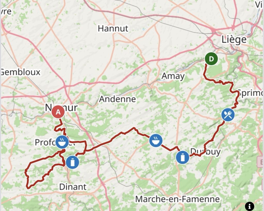
The Grand Prix de Wallonie crosses one of Belgium’s three federal regions, but Wallonia is far more than an administrative label. It forms the predominantly French-speaking southern half of the country, stretching from the former industrial basins of Liège and Charleroi through the agricultural plateaus of the Condroz, the wooded valleys farther south and the river landscapes of the Meuse and Sambre. For more than a century, parts of Wallonia belonged to the industrial heart of continental Europe. Coal, steel, glass, engineering and heavy manufacturing transformed the major valleys, while only a short distance away farms, monasteries, limestone villages and old estates preserved a much older rural structure.
That contrast suits the Grand Prix de Wallonie particularly well because the race itself is not tied to one immutable route. Towns and climbs move in and out, the opening kilometres change from year to year, and different editions explore different corners of the region. What has become much more stable is the destination. However the route is assembled, the race eventually turns towards Namur, follows the Meuse into the city and climbs to the Citadel above the confluence with the Sambre.
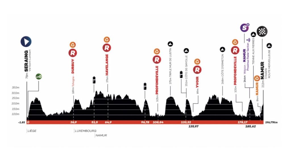
The 66th edition, on 16 September 2026, covers 196.77 kilometres and begins for the first time at Val Saint-Lambert in Seraing. From the industrial Meuse, the course moves into the Condroz and then through a succession of smaller river valleys and plateaus before returning to the Meuse farther south. Two new climbs enter the race this year, the Triple Mur des Monty at Lustin and the Côte de la Gayolle near Évrehailles, both appearing with a little under seventy kilometres remaining. From there, the route continues through the Molignée country towards the more familiar late difficulties of the Côte d’Ermeton, Tienne aux Pierres and finally the Citadel itself.
The course therefore moves through several versions of Wallonia in a single afternoon. Seraing belongs to the world of furnaces, crystal and steel. The Condroz replaces factory walls with limestone villages, agricultural ridges and rolling roads. The Molignée introduces mills, railways and older ironworking traditions. Near the end, the race reaches the Meuse again and follows it towards Namur, where geography has been shaping settlement, commerce and warfare for centuries.
The Grand Prix itself dates to 1935, but its modern identity is inseparable from that last ascent to the Citadel. Philippe Gilbert won twice, Nick Nuyens three times, and more recent editions have gone to riders as different as Tim Wellens, Jasper Stuyven, Christophe Laporte, Mathieu van der Poel, Gonzalo Serrano, Roger Adrià and Arnaud De Lie. The finish does not belong to one type of cyclist. It rewards whoever can absorb almost two hundred kilometres of repeated Walloon climbing and still accelerate once the road turns upward through Namur.
In 2026, however, the first significant story comes before the race has even started.
START · Val Saint-Lambert, Two Hundred Years of Crystal
The peloton assembles at Val Saint-Lambert, on the western edge of Seraing, in a place where medieval monastic history and industrial Wallonia still occupy the same ground.
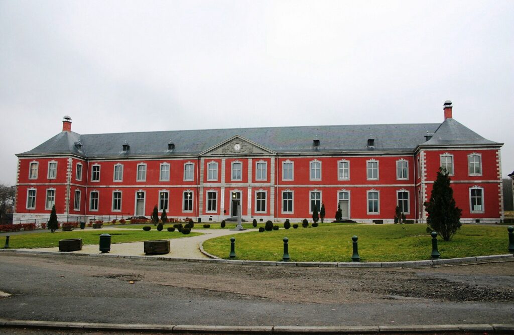
Long before glassworkers arrived, a Cistercian abbey stood here beside the Meuse. The complex developed over centuries, was damaged and rebuilt more than once and retained substantial architectural remains even after the religious community disappeared. When the upheavals of the French Revolutionary period ended monastic life, the site entered another phase of its history rather than falling completely out of use.
In 1826, chemist François Kemlin and engineer Auguste Lelièvre established a glassworks on the former abbey site. Their choice reflected the economic transformation already under way along the Meuse. Fuel, labour and transport were concentrated nearby, while Liège and the towns around it were becoming one of the most important industrial regions in continental Europe.
The transition from abbey to factory changed the purpose of the site without erasing its past. Furnaces replaced monastic workshops, glassblowers and cutters moved into a landscape once organised around religious life, and Val Saint-Lambert gradually developed into one of the great names of European crystal. By the late 19th century, its coloured glass, cutting and engraving had established an international reputation, and around 1900 the works had become the largest crystal factory in the world.
Its scale did not eliminate craftsmanship. The most prestigious objects still depended on highly specialised manual work, with glass blown, cooled, cut and engraved through processes requiring extraordinary precision. Industrial organisation and individual skill existed side by side, which helps explain why Val Saint-Lambert became both a major employer and a luxury name.
The 2026 start arrives at a particularly appropriate moment because the crystal works celebrate their bicentenary, exactly two hundred years after production began. The race leaves from a site where the history of Wallonia can be read almost in layers: abbey, industrial complex, heritage site, and now the starting point of a professional bicycle race.
Seraing · John Cockerill and the Industrial Meuse
Val Saint-Lambert belongs to Seraing, and Seraing belongs to the industrial history of Europe.
The Meuse valley south of Liège offered the conditions needed for large-scale industrial development during the 19th century. Coal lay nearby, the river provided transport and water, and the region already possessed deep traditions of metalworking. The arrival of the Cockerill family accelerated those advantages dramatically.
The English-born industrialist John Cockerill established his works at Seraing in the early 19th century, building an increasingly integrated complex around machinery, iron and eventually steel. The enterprise became one of the largest and most technologically advanced industrial organisations in continental Europe, producing equipment and materials that entered railways, bridges, factories and infrastructure far beyond Belgium.
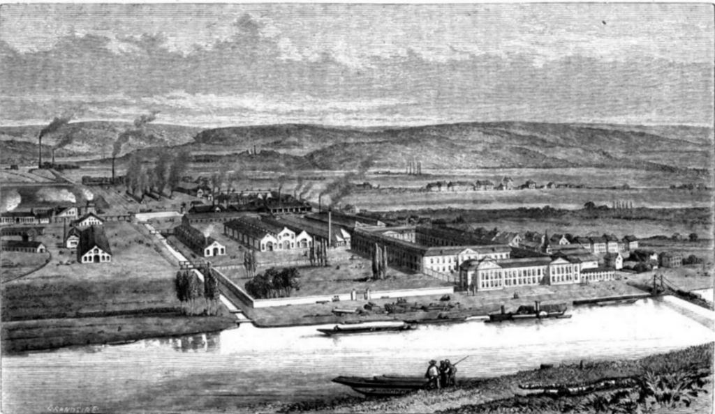
Seraing expanded around those works. Furnaces, mines, workshops, railways and workers’ housing transformed the valley, while the rhythms of employment and production began shaping daily life as completely as the river itself had once done. Steelworks occupied land where agricultural or riverside landscapes had stood only a few generations earlier, and the visual identity of the Meuse became inseparable from smoke, industrial buildings and transport infrastructure.
The later decline of heavy industry created another transformation. Some works closed, others were reorganised, and structures once regarded purely as productive assets became questions of heritage, redevelopment and memory. Seraing now contains the remains of an industrial system that once seemed permanent.
The Grand Prix begins amid that inheritance, but the route soon loosens its connection with the valley floor. Factory walls become less continuous, the road rises and the peloton moves towards a Wallonia shaped by a different combination of geology, agriculture and settlement.
The Meuse · The River That Organised Wallonia
The Meuse provides one of the clearest geographical threads between the beginning and end of the race.
Rising in France before passing through Belgium and the Netherlands, the river cuts a long corridor through Wallonia and repeatedly attracted settlement because movement along water was easier than movement across the ridges surrounding it. Medieval towns used the Meuse for trade. Fortresses controlled crossings. Quarries moved stone downstream. Later, coal and iron travelled through the same corridor as factories crowded the banks.
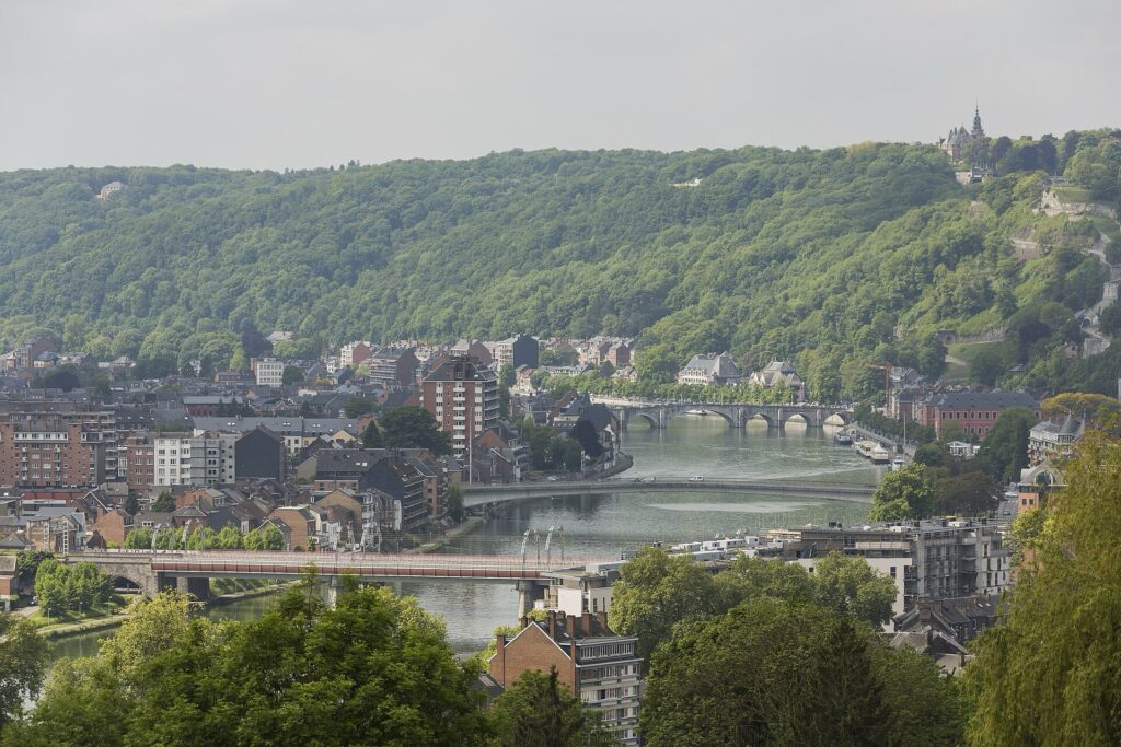
Seraing represents the industrial extreme of that relationship. Namur, almost two hundred kilometres later, represents an older form of dependence on the same river. There, the Meuse meets the Sambre beneath a rocky spur, and the convenience of transport becomes a question of military control.
The Grand Prix spends much of the day moving away from the Meuse and then seeking it again. That rhythm explains much of the character of Walloon road racing. The region does not need enormous mountains to create difficulty. Rivers have already cut deep corridors through an uplifted landscape, so any road crossing from one valley to another must repeatedly climb the ground between them.
The race leaves Seraing with that pattern ahead.
The Condroz · A Landscape Built from Ridges
Beyond the industrial valley, the route enters the Condroz, where the topography becomes more regular but not easier.
The landscape is organised by alternating bands of harder and softer rock, producing long ridges separated by lower depressions. Resistant sandstone tends to stand higher, while limestone and other formations occupy lower ground. From a distance, the country appears gently rolling. On a bicycle, the repetition becomes more obvious.
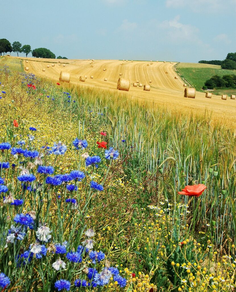
Villages developed according to the same structure. Settlements often occupied sheltered valleys or positions close to water, while farms spread across plateaus and gentler slopes. Locally quarried stone became part of the architecture, giving many villages the grey limestone character associated with southern Belgium.
Crossing the Condroz means repeatedly moving across the grain of that geology. Roads rise over one ridge, descend towards another settlement and then begin climbing again. None of the ascents needs to be particularly long for the accumulated effort to matter.
This is where the Grand Prix begins to acquire its familiar Walloon rhythm, one in which the road almost never settles for long enough for the race to become completely predictable.
Lustin · Where the Plateau Falls Towards the Meuse
Near Lustin, the open structure of the Condroz begins to break sharply towards the Meuse.
The village stands above a river that has cut deeply into the surrounding plateau, so the landscape changes from broad agricultural country to wooded slopes descending towards a narrow corridor occupied by water, railway and road. The difference in height becomes tangible because connections between plateau and valley have to negotiate that drop in relatively little distance.
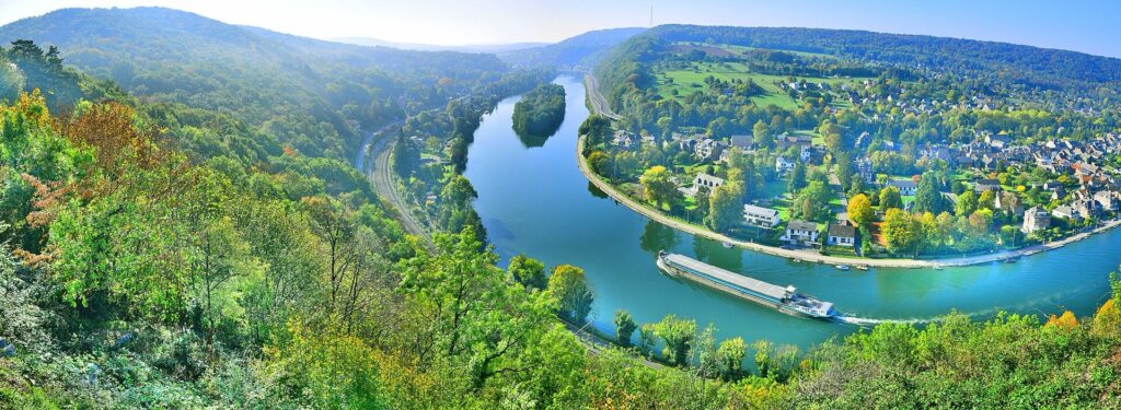
During the 19th century, railway development altered communities along this stretch of the Meuse. Villages that had depended heavily on river transport or difficult local roads gained faster links with Namur, Dinant and the industrial cities to the north. Improved access also encouraged tourism, particularly as the upper Meuse acquired a reputation for dramatic scenery.
Lustin still sits inside that relationship between plateau and river. In 2026, the race uses it more aggressively than before by introducing one of the new climbs of the edition.
~ -67 km · Triple Mur des Monty, a New Professional Climb with an Older Local Life
With roughly 67 kilometres remaining, the peloton reaches the Triple Mur des Monty.
Its inclusion in the GP de Wallonie is new, but the road already has a local cycling identity. The climb rises in several steep sections rather than through one uniform gradient, which gives the ascent the succession of walls suggested by its name.
Lustin has developed an unusual relationship with cycling through the Vieille Boucle Lustinoise, an event celebrating older racing culture with steel bicycles, vintage clothing and equipment from the era before carbon frames, aerodynamic integration and electronic shifting. The Triple Mur has also been used for a separate local hill-climb event.
The contrast is striking but natural. A road used to celebrate cycling’s material past now enters an international professional race ridden on some of the most technologically advanced bicycles in the sport.
On its own, the climb arrives too far from Namur to dictate the entire result. Its importance comes from what follows almost immediately, because the road does not return to an easy plateau before the next ascent begins.
~ -65 km · Côte de la Gayolle and the Broken Ground Above the Meuse
The Côte de la Gayolle, near Évrehailles, follows the Triple Mur and continues the transition between the Condroz and the deeply incised Meuse landscape.
The wider Yvoir area is built around that change in relief. Villages occupy higher ground above the river, while roads continually climb and descend through terrain in which limestone appears both in the geology and in the architecture.
Quarrying has long been part of the regional economy. Stone extracted from the Meuse valley and Condroz did not remain local, because river transport and later railways made it possible to move building material to larger markets. The same geological formations shaping the race therefore also shaped work and settlement.
Évrehailles sits above the river rather than beside it, and the climb towards the Gayolle expresses that position directly. The road is narrower and more irregular than the approach to Lustin, so positioning becomes more difficult at precisely the moment when the race is beginning to tighten.
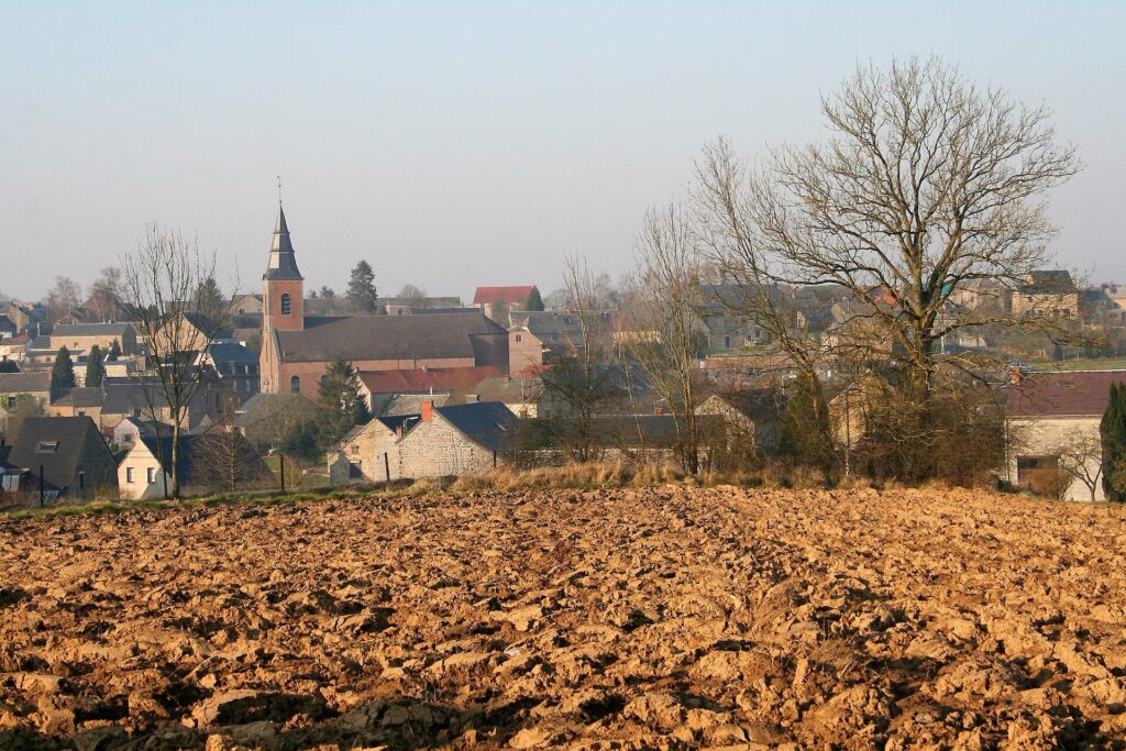
Together, the Monty and the Gayolle create a continuous sequence rather than two isolated climbs. By the time the second ascent is crossed, the peloton has begun to leave the open Condroz behind and move towards the smaller valleys feeding the Meuse.
The Molignée · Water, Iron and a Railway Through the Valley
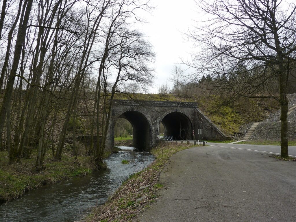
The Molignée is a tributary of the Meuse, but its narrow valley contains a concentrated history of older Walloon industry.
Long before Seraing became synonymous with steel, the region already possessed a network of smaller furnaces and forges using local ores, charcoal from surrounding forests and water power. Ironworking generated wealth on a much smaller scale than the 19th-century factories, but it altered land ownership, social status and settlement patterns throughout the countryside.
The Molignée itself helped sustain that economy. Water powered mills and workshops, while the valley provided a natural route through terrain that would otherwise have been more difficult to cross.
Railway construction added another layer in the 19th century. A line was threaded through the valley to connect local communities and industries with the national network, following a narrow corridor between river and hillside. Commercial rail use later disappeared, but the infrastructure did not vanish entirely.
Today, sections of the former railway support the Draisines de la Molignée, where visitors pedal small rail vehicles along the old tracks. The transformation is unusually literal: infrastructure once built for industrial transport now survives through a form of recreational human-powered movement.
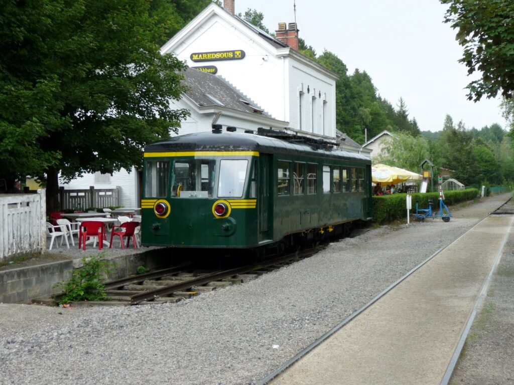
The professional race passes through that landscape quickly before climbing again towards Ermeton-sur-Biert, where the history of Walloon iron reappears in the ownership of an estate rather than the machinery of a factory.
Côte d’Ermeton · From Medieval Lordship to an Ironmaster’s Estate
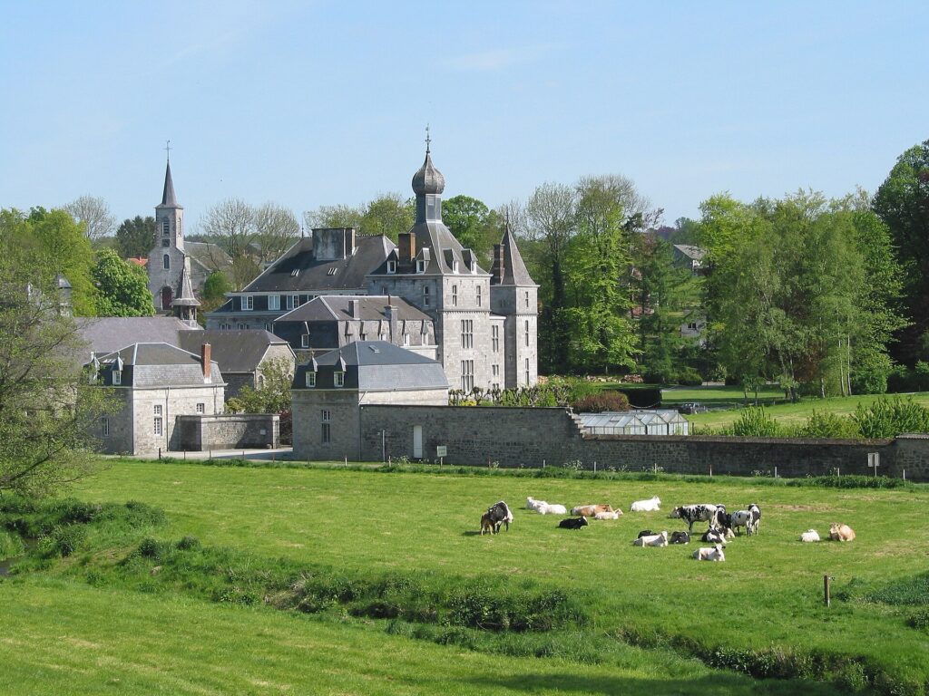
The Côte d’Ermeton brings the race through Ermeton-sur-Biert, where the local castle records the way industrial wealth began reshaping rural society long before the great steel age.
A medieval lordship existed here under the Counts of Namur, and the estate later passed through several aristocratic families. In 1612, it was purchased by Richard Godart, a master of forges.
That profession places Ermeton within the region’s older iron economy. Masters of forges could accumulate enough wealth to purchase land and enter social circles traditionally associated with nobility, and the rebuilding of the castle during the 17th century reflects that transition.
Later owners modified the property further, and in the 20th century it became associated with a Benedictine community. The same site therefore moved through several social worlds: medieval lordship, industrial wealth and religious occupation.
The village around it remained connected with the agricultural country above the Molignée, while the road through Ermeton continues the repeated climbing that defines the middle of the race. By the time the peloton leaves, the route has crossed another ridge and is beginning to descend towards a place where iron wealth was converted into something entirely different.
Annevoie · Iron Wealth Turned into Water
At Annevoie, the legacy of Walloon industry becomes landscape architecture.
The Jardins d’Annevoie began taking their recognisable form around 1758 under Charles-Alexis de Montpellier, whose family had prospered through ironworking. That wealth allowed him to enlarge the château and construct an elaborate garden organised around the movement of water.
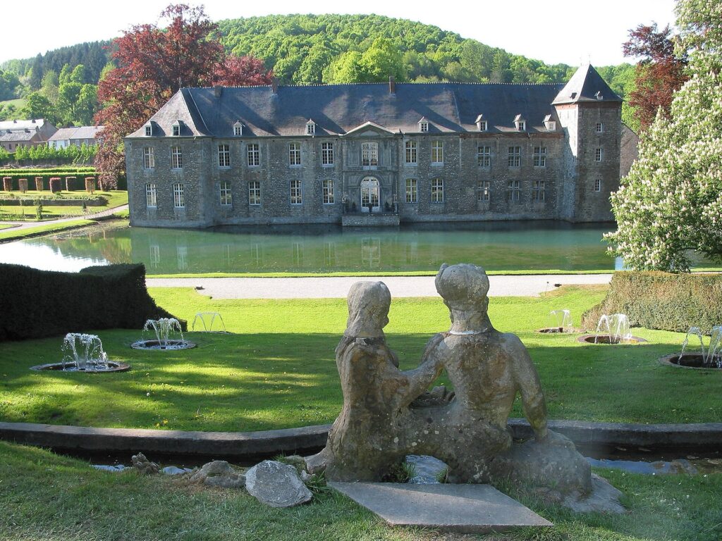
The system relies heavily on gravity and carefully controlled differences in elevation. Water flows through fountains, ponds, canals and cascades without depending primarily on mechanical pumping. French formal geometry appears beside Italian ideas about slope and hydraulic display, while later English influences softened parts of the layout.
The gardens are therefore as much engineering as decoration.
Their existence is inseparable from the region through which the race has already travelled. Iron generated the wealth, the valley supplied water, the terrain provided height differences, and technical knowledge transformed those resources into an estate designed for pleasure rather than production.
The Grand Prix began among industrial furnaces at Seraing. At Annevoie, the economic world of iron has been translated into a landscape of controlled water, trees and stone.
Profondeville · Returning to the Meuse
Around Profondeville, the race reaches the Meuse again.
The river looks very different here from the industrial corridor beside Seraing. Wooded slopes descend towards the water, villas and houses line sections of the bank, and the valley became increasingly associated with residential life and recreation as transport improved.
The continuity lies beneath that visual change. It is still the same river that organised settlement and movement at the start of the race, but the uses around it have shifted. Industry dominated one section, while scenery, agriculture and suburban life became more prominent farther south.
The return also clarifies the geography of the route. The peloton began beside the Meuse, climbed away from it into the Condroz, crossed the smaller valleys of the interior and now descends back towards the same river on the approach to Namur.
For a few kilometres, following the valley allows the road to settle. The relief has not disappeared, however, and Wépion still lies ahead before the final rise towards the city.
Wépion · Strawberries Beside the River
The southern approaches to Namur pass through Wépion, a village whose identity became closely associated with strawberries.
Commercial cultivation expanded particularly during the late 19th and early 20th centuries, when the slopes above the Meuse, local soils and favourable conditions supported production and improved transport made it possible to send delicate fruit quickly towards urban markets.
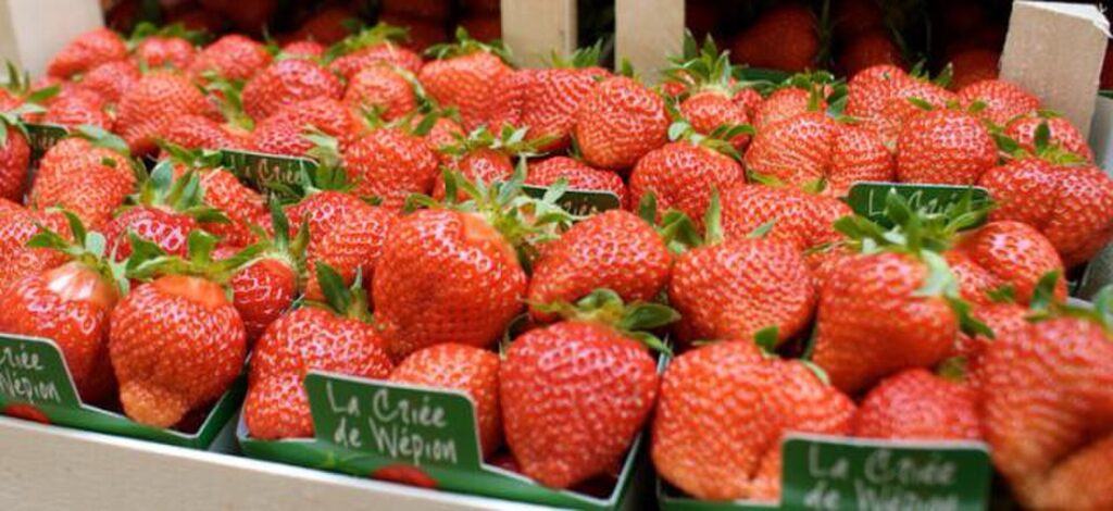
The fraise de Wépion became more than an agricultural product. The name itself acquired a reputation for quality, while specialised sales and producer traditions turned the fruit into part of the cultural identity of the village.
Production methods and scale have changed, but the association remains strong enough to survive through growers, seasonal sales and museum interpretation.
By this point the race is already entering the suburban approaches to Namur. The river still accompanies the course, but the calm of the valley is temporary because the final climbing terrain is close.
Tienne aux Pierres · The Last Rise Before Namur
The Tienne aux Pierres is one of the familiar late difficulties of the Grand Prix de Wallonie.
Its importance comes largely from timing. After almost two hundred kilometres, even a relatively modest climb becomes tactically important because teams have fewer riders left to control moves and because anyone losing contact has little time to recover before the Citadel.
The name itself belongs to the language of the landscape. In Walloon usage, tienne commonly refers to rising ground or a hill, while the reference to stones reflects the rocky terrain.
The climb forces another selection before the peloton reaches the city, but it does not settle the race by itself. Instead, it determines how riders arrive at Namur: some with teammates and position intact, others already forced to chase or respond.
As the road descends again, the geography ahead becomes increasingly obvious. The Meuse continues towards the city, the Sambre approaches from the west, and above their meeting point rises the fortified spur of Namur.
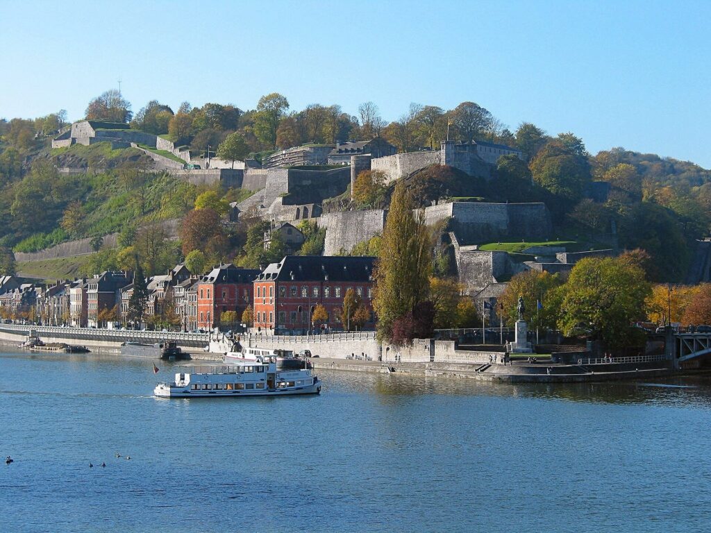
Namur · A City Built at a Confluence
Namur exists because of the meeting of the Sambre and Meuse.
Before modern roads, rivers were among the most efficient transport routes available, and the confluence naturally concentrated movement. The Sambre carried traffic from the west into the much larger north-south corridor of the Meuse, so goods, travellers and armies repeatedly converged here.
Above that meeting point rises a rocky spur. Occupation in the wider area extends back into antiquity, and the defensive value of the height was recognised early. By the Middle Ages, the spur had become the fortified residence of the Counts of Namur.
Their castle was not merely defensive architecture. It included residences, chapels, workshops, storage, wells and administrative spaces, making the hill both military centre and seat of political power.
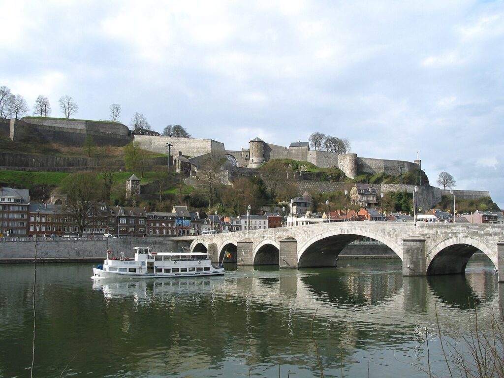
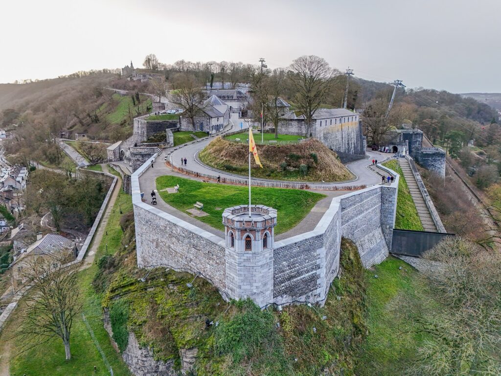
As artillery changed warfare, the fortress had to change with it. Medieval walls designed for arrows and siege engines became increasingly vulnerable to cannon, so later engineers introduced lower, thicker defences, bastions and protected approaches. The Citadel consequently accumulated successive generations of military architecture rather than preserving one fixed medieval form.
That long process culminated dramatically in the late 17th century, when the fortress became a major objective in wars involving some of Europe’s most powerful states.
Namur 1692 and 1695 · Vauban, Coehoorn and the War for the Fortress
In 1692, during the wars of Louis XIV, French forces besieged Namur as part of a broader struggle for control of the Spanish Netherlands. Louis XIV personally accompanied the campaign, while Sébastien Le Prestre de Vauban directed the siege operations.
The defenders relied on works influenced by Menno van Coehoorn, another of the great military engineers of the period. The confrontation therefore placed two different traditions of European fortification engineering around the same rocky spur.
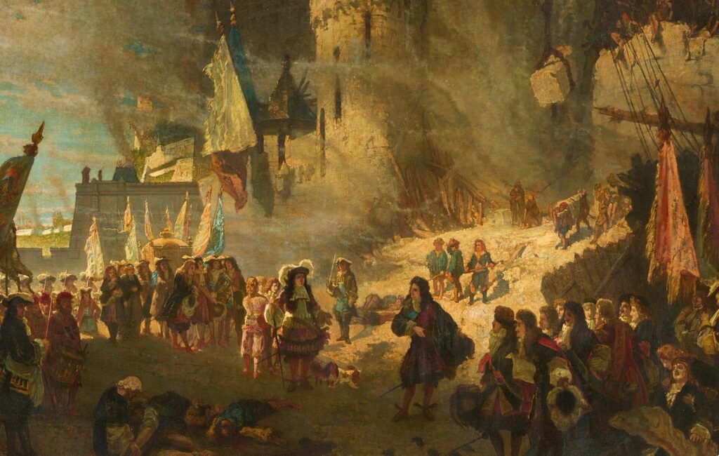
After a determined siege, the French took Namur and Vauban began strengthening the defences of the position he had just helped conquer. French control lasted only three years.
In 1695, an allied army under William III and Maximilian II Emanuel of Bavaria returned. The second siege was costly and destructive, and this time the allies retook the city and fortress.
These campaigns explain why Namur mattered well beyond its immediate region. Control of the confluence influenced movement through one of the strategic corridors of the southern Netherlands, so a fortress above the rivers became an objective in wars fought on a continental scale.
Much of what visitors recognise today as the Citadel belongs to a later reconstruction. After Napoleon’s defeat, the Congress of Vienna created the United Kingdom of the Netherlands partly as a barrier against renewed French expansion. Between 1815 and 1830, Dutch engineers rebuilt the fortress extensively, and most of the surviving military architecture dates from that phase.
The Grand Prix therefore finishes not at one fortress but at the accumulated result of centuries of adaptation.
FINAL CLIMB · Citadelle de Namur, From Military Road to Race Finish
The defining climb begins when the race leaves the lower city and turns towards the Citadel of Namur.
It is not long enough to become a mountain in the conventional cycling sense, and its gradients are varied enough that different types of riders can remain competitive. That ambiguity is precisely what has made the finish so successful.
A climber can attack on the steeper sections, a Classics specialist can absorb the changes in gradient and a powerful sprinter who handles hills well can remain close enough to use speed higher up the road. The preceding two hundred kilometres shape who is still capable of doing any of those things.
The road rises through a landscape where elevation once had a military purpose. Slopes affected how attackers could approach, where artillery could be placed and how walls could be defended. The same gradients that now separate riders from a finish line once separated soldiers from bastions and fortified entrances.
By the late 19th century, the Citadel’s strategic importance was fading as a new ring of forts around Namur made the old hilltop stronghold increasingly obsolete. Parts of the site were gradually opened to recreation, and roads, paths, sports facilities and cultural spaces occupied ground that had once been almost entirely military.
The modern race finish belongs to that transformation. A fortress hill became a civic landscape, and the roads created through it eventually became suitable for cycling.
The line on Avenue du Milieu du Monde comes only after the peloton has climbed through centuries of military engineering.
CYCLING HISTORY · Why Namur Produces Different Kinds of Winners
The Grand Prix de Wallonie dates to 1935, but its identity has always been flexible because the route itself has changed repeatedly.
The Citadel gave the race a more recognisable modern finish without narrowing the contest to one category of rider. The winners make that clear.
Nick Nuyens won three editions. Philippe Gilbert, perhaps the rider most naturally associated with Walloon climbing roads in the modern era, won twice. Tony Gallopin, Tim Wellens, Jasper Stuyven, Krists Neilands, Christophe Laporte and Mathieu van der Poel all succeeded despite having quite different strengths.
The pattern has continued recently. Gonzalo Serrano won in 2023, Roger Adrià in 2024 and Arnaud De Lie in 2025, when the powerful Walloon sprinter survived the late climbing and still had enough speed at the Citadel.
That variety reflects the design of the race. The route needs to create fatigue and selection without making the result inevitable before Namur.
The 2026 additions at Lustin and the Gayolle fit that principle well. They make the final third harder, force teams to work and reduce the number of riders arriving fresh, but they come early enough for the race to reorganise. Ermeton and Tienne aux Pierres continue the pressure before the Citadel finally asks for a short, concentrated effort after almost two hundred kilometres.
By the time the race reaches Namur, the field has been shaped repeatedly without being completely sorted.
FINAL 10 KM · Following the Meuse Towards Namur
The closing kilometres return the race to the river that organised so much of the day.
The Meuse leads the peloton towards Namur as the landscape becomes increasingly urban. Above the roofs, the Citadel begins to dominate the approach, while farther west the Sambre is drawing towards the same confluence.
At Seraing, the Meuse belonged to crystal, steel and industrial transport. Around Profondeville and Wépion, it became a valley of residential landscapes, agriculture and recreation. At Namur, the same river becomes the reason a fortress exists above the city.
For most of the final approach, the road follows the easiest natural corridor, staying close to the water rather than fighting the ridges crossed earlier in the race. That logic holds until the very end, when the course finally leaves the valley floor and turns upward.
The river remains below as the road begins climbing through the Citadel.
FINISH · Citadelle de Namur, Above the Meeting of Two Rivers
The Grand Prix de Wallonie finishes after 196.77 kilometres at the Citadel of Namur, above the point where the Sambre joins the Meuse.
The road behind the riders has crossed several different Wallonias without ever leaving the same region. At Val Saint-Lambert, a medieval abbey became a crystal works that celebrates two hundred years of production in 2026. Seraing shows the immense transformation brought by John Cockerill and the steel economy of the Meuse. The Condroz replaces factories with ridges, farmland and limestone villages, while Lustin and Évrehailles mark the point where the plateau begins breaking sharply towards the river.
The Molignée narrows the scale again. Water powered mills and workshops, forests supplied charcoal and the valley eventually carried a railway before the old tracks acquired a second life through recreation. At Ermeton, wealth from ironworking entered the ownership of an estate. At Annevoie, another industrial fortune was transformed into a garden whose fountains still depend on careful control of gravity and water. Profondeville and Wépion then return the race to the Meuse in a landscape where scenery, agriculture and settlement have replaced the heavy industrial character seen at the start.
Namur brings those different landscapes together because the city exists for the same geographical reason the race ends here. The Sambre and Meuse meet beneath a defensible height, and that combination of movement and elevation repeatedly attracted political power. Medieval counts built their residence on the spur. Later engineers adapted it to cannon. French and allied armies fought for control of it in the 1690s. Vauban strengthened it, and Dutch engineers rebuilt most of the surviving Citadel after Napoleon.
Eventually the fortress ceased to be essential to the defence of the city, and the hill entered a different phase of public life. Roads and paths replaced some of the military functions, visitors arrived for views rather than war, and professional cycling eventually made the climb part of the sporting identity of Namur.
For the riders, none of that matters during the final acceleration. The Citadel becomes gradient, fatigue, positioning and the rapidly diminishing distance to the line. Yet the reason the finish works so well is inseparable from the older geography. The road rises because the rock rises, and the fortress stands there because two rivers meet below.
The Grand Prix de Wallonie can change almost everything else. Future editions can begin in another town, cross another plateau or introduce another sequence of climbs. That variability is part of a race designed to move through a region whose landscapes change quickly between industrial valleys, agricultural ridges and old river towns.
Namur remains the place where those roads eventually converge, and the peloton leaves the Meuse for the final time to climb towards the Citadel.



