
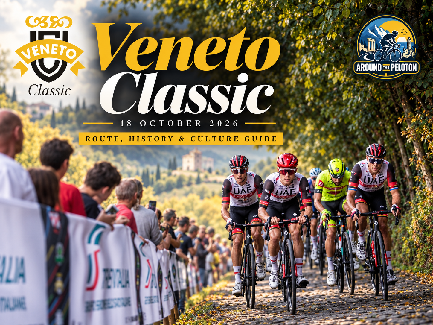

The Veneto Classic does not possess the accumulated mythology of the Italian races that have survived for a century. It was first held only in 2021. Yet in a remarkably short time it has acquired something many older races struggle to create: a landscape and a vocabulary recognisably its own.
There is the cobbled wall of La Tisa and the longer climb of La Rosina through the hills above Marostica. Near the end, the rough road through Diesel Farm leads almost immediately towards the violent ramp of Contrà Soarda. Between them lie vineyards, walled towns, foothill villages and the first folds of the Venetian Prealps, while Monte Grappa waits above the finish at Bassano as a geographical presence larger than the race itself.
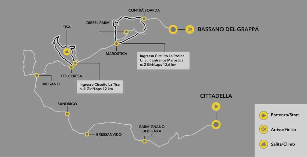
The 2026 edition intensifies that identity. Over 161 kilometres from Cittadella to Bassano del Grappa, the race begins on the Venetian plain before gradually folding itself into the hills. The opening thirty kilometres are almost completely flat, after which the road begins to rise around Breganze and Colceresa. La Tisa introduces the first real violence, La Rosina is crossed twice on a 12.6-kilometre circuit, and the race then enters a second circuit in which La Tisa returns repeatedly.

Only after that accumulation does the course finally escape towards Bassano. Diesel Farm and Contrà Soarda form the last pair of obstacles before the descent into the city. The result is a remarkably compressed route in which difficulty comes not from a great mountain pass but from repetition, abrupt changes of gradient and increasingly narrow roads along the seam between the Venetian plain and the Prealps.

A young race has found its terrain in very old ground.
–161 km | Cittadella
Few cycling races begin inside a piece of medieval urban planning preserved as completely as Cittadella.
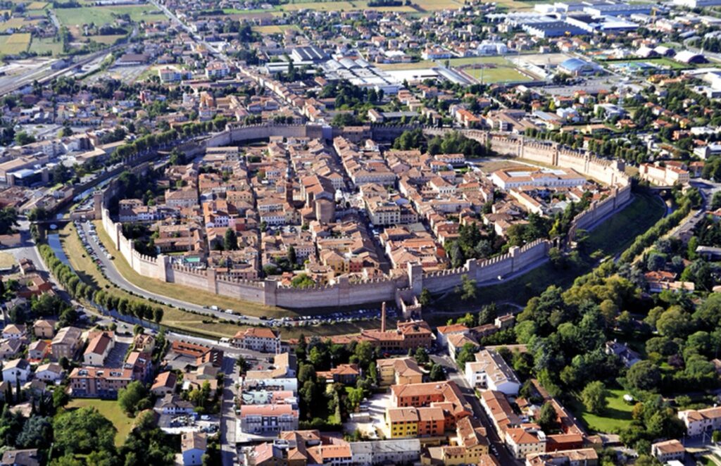
The town stands on the Venetian plain north of Padua, enclosed by an almost intact ring of walls constructed from 1220. They extend for roughly a kilometre and a half around the historic centre, punctuated by towers and four principal gates corresponding to the roads leading towards Padua, Vicenza, Bassano and Treviso.
Cittadella was not a settlement that gradually acquired fortifications as it expanded. It was deliberately founded and fortified by the commune of Padua during the political struggles of medieval northern Italy, when cities competed for control of roads, rivers, markets and surrounding territory. Its geometry still reveals that origin. Streets cross within an enclosed oval, while the walls define the town with unusual clarity against the flat landscape around it.
That landscape mattered. The Veneto plain was one of the great corridors between the Adriatic world and the Alps. Roads moving north from Padua and Venice eventually reached the Brenta valley, where passage became possible through the mountains towards Trentino and the German-speaking lands beyond.
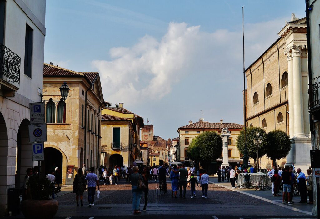
The race begins in Piazza Pierobon before leaving the walls behind and moving west across country that initially offers almost no indication of what will come later. For the opening kilometres the horizon remains broad, the profile almost entirely flat and the mountains still distant ahead.
–150 km | Carmignano di Brenta and the River Plain
Around Carmignano di Brenta, the race enters the agricultural landscape associated with the Brenta.
The river begins high in Trentino, flowing from the lakes of Caldonazzo and Levico before cutting south through the Valsugana. At Bassano del Grappa it emerges from the mountains onto the Venetian plain, where its course historically divided into channels and gravel beds before continuing towards the Adriatic.
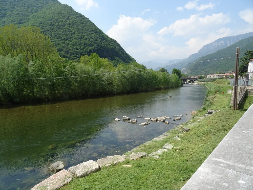
Water from the Brenta and its associated irrigation systems helped shape agriculture across this part of Veneto. Fields, canals, villages and roads developed together on an alluvial plain built partly from material carried out of the Alps over immense spans of geological time.
That relationship between mountain and plain will become increasingly visible as the race moves northwest. For now, however, the road remains low.
Carmignano is followed by Bressanvido and Sandrigo, settlements belonging to the dense network of small towns that characterises the countryside north of Vicenza. This is productive land rather than monumental landscape, intensively cultivated and crossed by roads linking communities only a few kilometres apart.
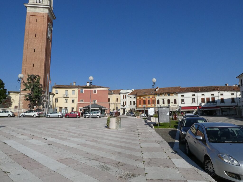
The Veneto Classic uses these opening kilometres to travel towards the hills rather than manufacture difficulty where none exists. The profile remains almost level until the race approaches Breganze, where the first folds begin to disturb the plain.
–131 km | Breganze and the Edge of the Hills
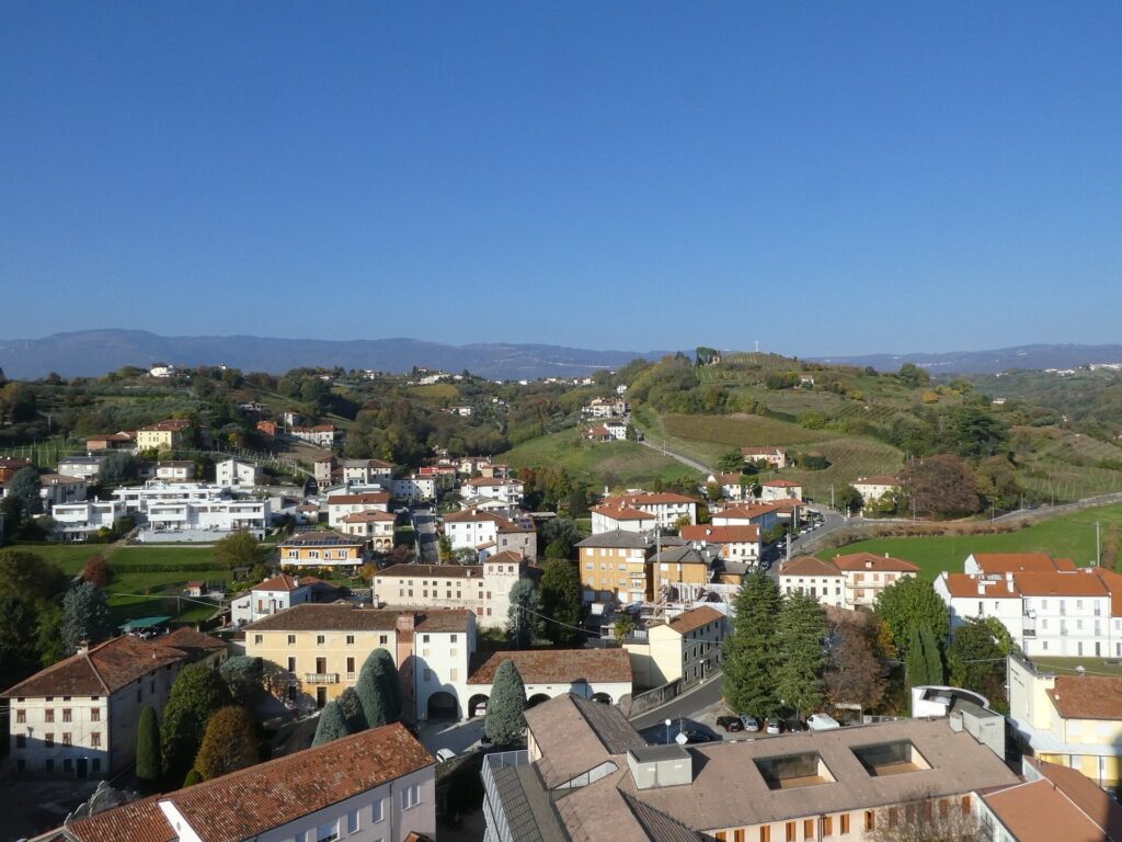
Breganze sits where the flat Veneto begins to wrinkle. To the south, the plain extends towards Vicenza and Padua. Immediately north, the land rises towards the Asiago plateau and the Venetian Prealps. This transitional belt, the Pedemontana, has long produced a distinctive combination of agriculture, settlement and trade because it sits between two geographical systems.
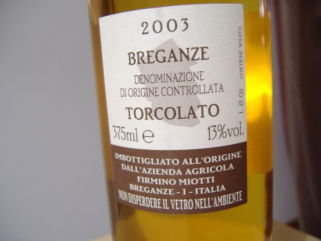
It is also wine country. The hills around Breganze form one of Veneto’s smaller but historically distinctive viticultural areas. The Breganze DOC includes red and white wines produced from several grape varieties, but its most unusual association is with Vespaiola, a white grape closely linked with the sweet wine Torcolato.
Traditionally, selected bunches of Vespaiola are dried after harvest before pressing, concentrating their sugars and flavours. The name Torcolato derives from the practice of twisting or hanging bunches during the drying process. The resulting wine belongs to an older agricultural world in which preservation, seasonality and patient cellar work shaped what could be produced from each harvest.
The surrounding landscape reflects the same transition visible in the race profile. Vineyards appear more frequently, roads begin to rise and fall, and the uninterrupted horizontal line of the first thirty kilometres disappears.
The Veneto Classic has reached the foothills.
–116 km | Colceresa and the Pedemontana
Beyond Breganze, the race crosses Colceresa, a municipality formed from the former communes of Mason Vicentino and Molvena. The administrative name is recent, but the landscape around it is not.
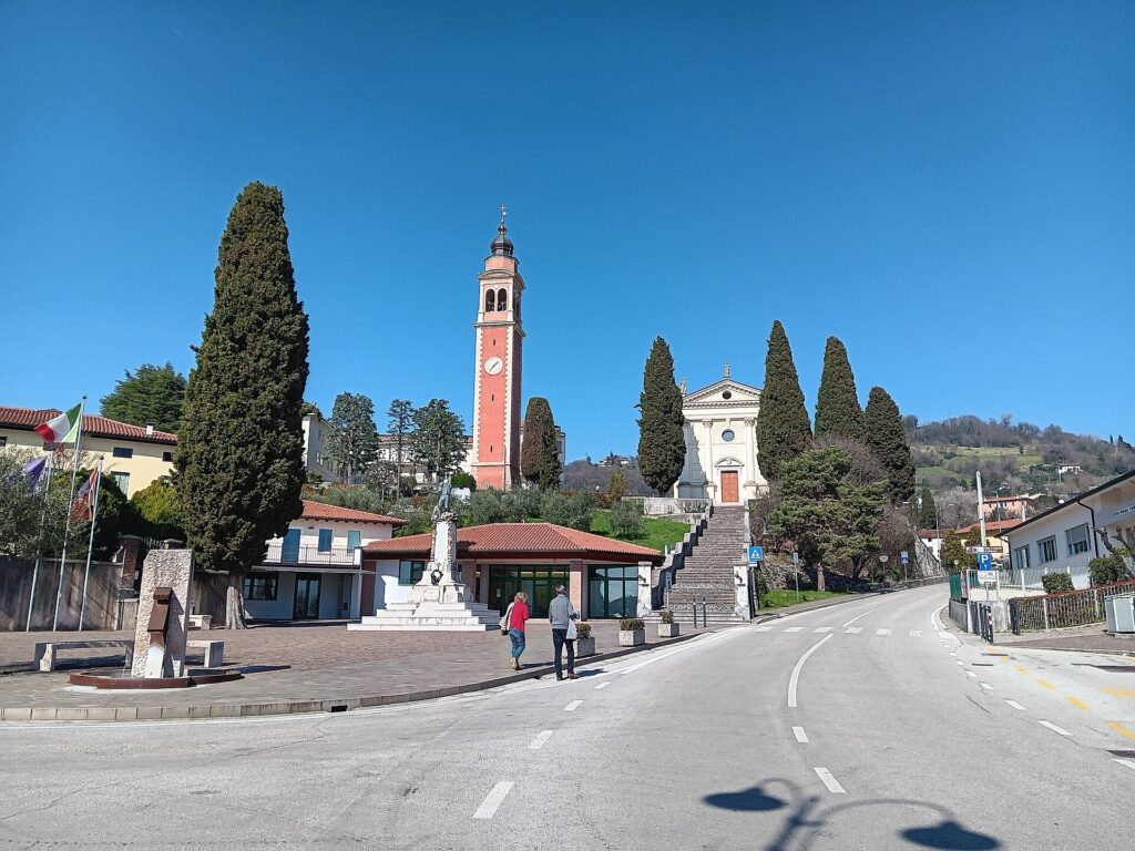
These are the lower hills between Vicenza’s plain and the Asiago plateau, where vineyards, orchards, woodland and settlements occupy a tightly folded landscape. The altitude remains modest, yet the roads can change character quickly. A broad valley road can become a narrow ramp within a few turns.
This is one reason the Pedemontana has produced such fertile terrain for cycling. It does not require enormous mountain passes to create difficulty. Short climbs can be connected repeatedly, descents are technical without being alpine, and the dense road network allows organisers to return to the same hills from different directions.
The Veneto Classic exploits precisely those qualities. Near Colceresa, the course approaches the territory of Marostica and the first appearance of the road that has become the race’s signature.
–106 km | La Tisa
The Muro della Tisa is short enough to appear almost insignificant on a map, but its dimensions describe a very different road once a bicycle reaches it.
The climb measures roughly 330 metres and averages around 15 percent, with pavé beneath the riders. It is not a mountain ascent designed to reward sustained climbing. Instead, the road pitches upwards abruptly, the cobbled surface disturbs traction and rhythm, and the summit arrives before a rider has much opportunity to settle into a controlled effort.
That distinction becomes important because La Tisa is not crossed once and forgotten. The route folds repeatedly through these hills, bringing the peloton back to the same wall as fatigue accumulates and the field becomes progressively smaller.
Its first appearance introduces the physical language of the race: short gradients, irregular surfaces and roads whose importance comes from how often they return. Before La Tisa becomes the centre of the later circuit, however, the course turns towards Marostica and a longer ascent through the hills above the town.
–101 km | Marostica and the La Rosina Circuit
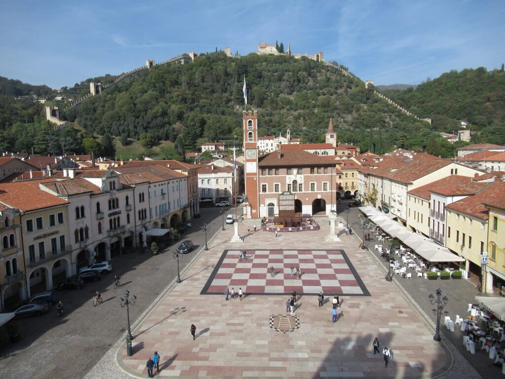
Marostica is one of the most visually distinctive towns of the Veneto foothills.
Its Lower Castle stands at the edge of the historic centre, facing Piazza Castello. From there, walls climb dramatically up the hillside towards the Upper Castle, enclosing the slope behind the town in a long fortified triangle.
The system developed principally under the Scaligeri, the ruling dynasty of medieval Verona, after their expansion into the Vicenza area during the fourteenth century. What survives is not simply a castle but a defensive landscape in which town, walls, hillside and fortress were arranged as parts of the same system.
Marostica is also internationally associated with a very different spectacle. The central square contains a giant chessboard used for the town’s celebrated living chess performance, in which costumed participants recreate a legendary match connected with the fifteenth century.
The story tells of two noblemen competing for the hand of Lionora, daughter of the local lord, with a chess game replacing the duel that might otherwise have decided the dispute. The historical basis of the legend is uncertain, and the modern spectacle developed much later, but it has become inseparable from Marostica’s public identity.
The Veneto Classic approaches this fortified town before turning upwards again onto the 12.6-kilometre La Rosina circuit, completed twice.
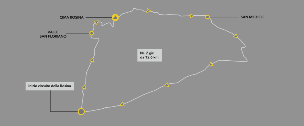
The central climb is La Rosina itself, approximately 2.1 kilometres at an average gradient around 6.5 percent. It demands a completely different effort from La Tisa. The gradient allows riders to establish a rhythm, but the climb lasts long enough to expose weakness as the race begins accumulating elevation.
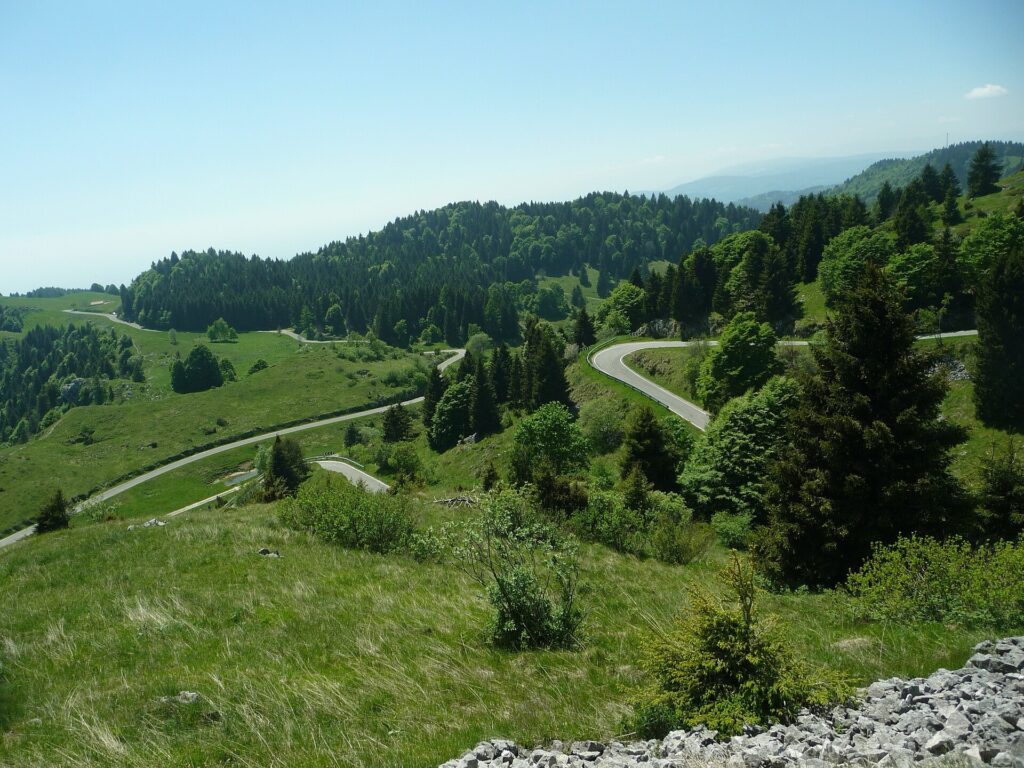
The road rises through the green foothills above Marostica towards Valle San Floriano and the crest at Cima Rosina before looping through San Michele and descending back towards the town.
From these slopes, the geography of the race becomes legible. The Venetian plain opens below while the Asiago plateau rises behind. Bassano lies farther east beneath Monte Grappa. The Veneto Classic is travelling along the seam between them.
La Rosina also carries a connection with Italian cycling beyond the race itself. The small church of the Madonna del Ciclista became associated with cyclists and with figures including Alfredo Martini, the long-serving coach of the Italian national road team. It gives these hills a cycling identity that predates the Veneto Classic by decades.
The peloton completes the circuit twice, but the landscape needs to be encountered only once. On the second passage, the roads remain the same while their effect changes: the climb costs more, positioning becomes harder to recover and the field returns to Marostica carrying another circuit in its legs.
After the second passage, the course leaves Rosina and turns back towards the road that will dominate the middle of the race.
–70 km to –18 km | The La Tisa Circuit
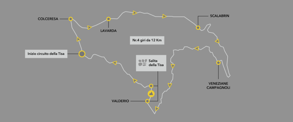
The second major circuit transforms La Tisa from an obstacle into a recurring pressure point.
The loop runs through the hills around Colceresa, Lavarda, Scalabrin and the surrounding rural roads, repeatedly returning the riders to the cobbled wall before sending them around the circuit again. Four complete laps follow after the circuit is entered, placing repeated steep accelerations inside more than fifty kilometres of already broken terrain.
The surrounding country is characteristic of the Vicentine foothills. Small roads connect scattered houses, cultivated slopes and woodland. There is no single monumental summit around which the race can organise itself. Difficulty instead comes from compression: short climbs arrive before riders have completely recovered from the previous effort, descents lead rapidly into turns and valley roads, and La Tisa repeatedly interrupts whatever rhythm the peloton manages to establish.
Repeated climbs occupy a peculiar place in road racing because their physical dimensions remain constant while their meaning changes. Three hundred metres at fifteen percent when the field is relatively fresh can be absorbed through positioning and power. The same road after several circuits, with accumulated climbing already in the legs, becomes capable of separating groups that had remained together earlier.
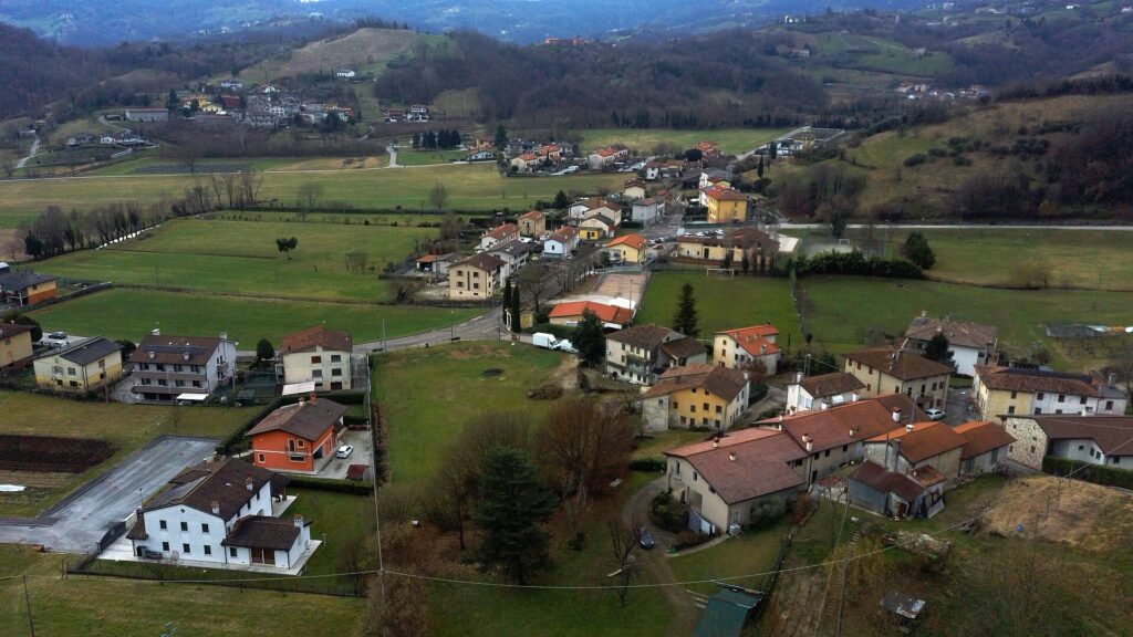
The wider landscape reinforces that transition. Immediately north rises the Asiago plateau, a high pre-Alpine territory historically shaped by forestry, pasture and communities that preserved a distinctive local culture, including traces of the Germanic Cimbrian language. The race remains below the plateau, but its wooded escarpment forms the northern boundary of the country through which these circuits turn.
The Veneto Classic therefore creates its principal difficulty without entering the high mountains visible around it. Rosina and Tisa provide a sequence of smaller roads whose repeated gradients gradually replace the large peloton with increasingly fragmented groups.
That terrain has already become closely associated with a race whose history remains remarkably short. The Veneto Classic was first held in 2021, when Samuele Battistella won the inaugural edition after attacking alone late in the race. Marc Hirschi followed in 2022, Davide Formolo in 2023, Magnus Cort in 2024 and Sakarias Koller Løland in 2025.
Five editions produced five different winners, but the continuity has come from the roads rather than the names. La Rosina and especially La Tisa have returned often enough for their appearance to begin identifying the race visually, giving the Veneto Classic a geographical identity before it has had time to accumulate the century of history possessed by older Italian events.
Eventually the repetitions stop. The final passage through the circuit sends the riders east towards Bassano rather than back around the loop.
After more than fifty kilometres shaped by Rosina and Tisa, the course becomes linear again, but the final road to Bassano contains two more obstacles.
–10 km | Diesel Farm
After the repetitions of La Tisa, the race moves towards one of its most unusual pieces of road.
Diesel Farm lies among the hills near Bassano, an agricultural estate associated with Renzo Rosso, founder of the Diesel fashion brand. Rosso was born in the Veneto and built Diesel into an international company while maintaining substantial connections with the Bassano area.
Here the race leaves conventional asphalt again. The Diesel Farm climb measures approximately 1.3 kilometres at an average gradient close to 10.9 percent and includes an unpaved section, requiring riders to manage both the steepness of the road and the reduced traction of a loose surface after the repeated paved and cobbled efforts of the previous hour.
The setting also captures something characteristic about this corner of Veneto. Agriculture and global industry are not separate worlds here. The wider region around Vicenza and Bassano became one of Italy’s important territories of small and medium-sized manufacturing businesses during the twentieth century, producing everything from textiles and machinery to ceramics, furniture and fashion.
The economic landscape is dispersed rather than concentrated into a single metropolis. Factories, workshops, vineyards, farms and historic towns occupy the same densely settled territory. A rough agricultural road through an estate connected with the founder of an international fashion company belongs naturally to that mixture of local land and global enterprise.
Beyond Diesel Farm there is little opportunity to settle back into a rhythm before the road rises again.
–5 km | Contrà Soarda
Contrà Soarda is the final serious interruption before Bassano.
The climb is only around 400 metres long but averages approximately 13 percent, cresting with roughly four kilometres remaining. Its dimensions would be modest in isolation; after the Rosina circuits, repeated passages of La Tisa and the rough climb through Diesel Farm, the same gradient becomes capable of deciding which riders reach Bassano together.
The road rises through another wine-growing landscape above the city. Contrà Soarda is associated with vineyards planted in the Bassano hills, part of the mosaic of cultivated slopes that has accompanied the race since Breganze.
From the higher ground, the geography changes once more. The hills begin falling towards the Brenta, Bassano opens below, and beyond the city stands the isolated mass of Monte Grappa.
No feature of the surrounding landscape carries greater historical weight.
Monte Grappa | The Mountain Above the Race
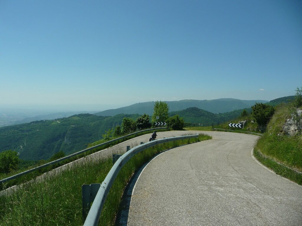
Monte Grappa rises to 1,775 metres immediately northeast of Bassano del Grappa, occupying an isolated massif between the Brenta and Piave valleys. Its scale and position make it impossible to treat merely as background to the final kilometres.
During the First World War, Grappa became one of the principal defensive positions of the Italian army after the catastrophe of Caporetto in 1917. Italian forces retreated across northeastern Italy, abandoning large territories before establishing a new defensive system along the Piave and across Monte Grappa.
Trenches, artillery positions, roads, tunnels and supply systems spread across terrain that had previously been dominated by grazing, forestry and small mountain communities. Fighting during 1917 and 1918 transformed the massif into one of the crucial landscapes of the Italian front.
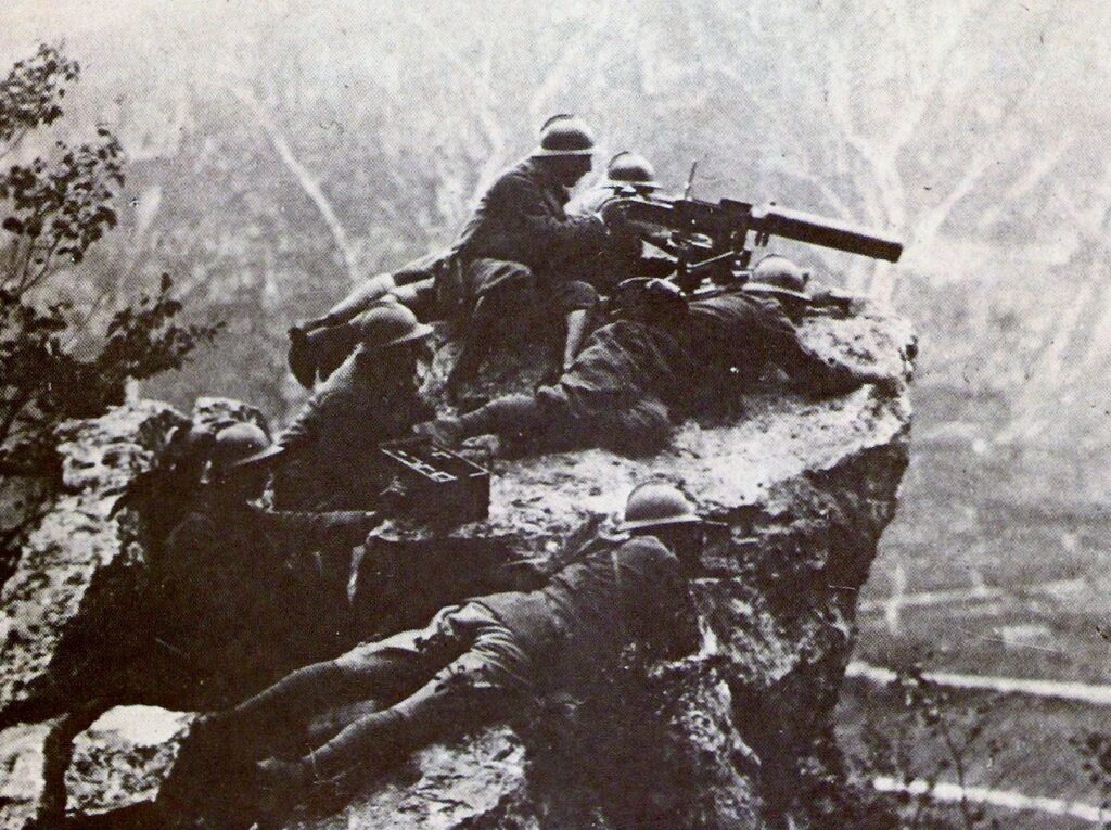
Its strategic importance came directly from geography. A decisive Austro-Hungarian breakthrough across Grappa could have opened access towards the Venetian plain and threatened the Italian defensive system along the Piave from the west. Italian forces instead held the massif through repeated battles, and the mountain subsequently became deeply embedded in the national memory of the war.
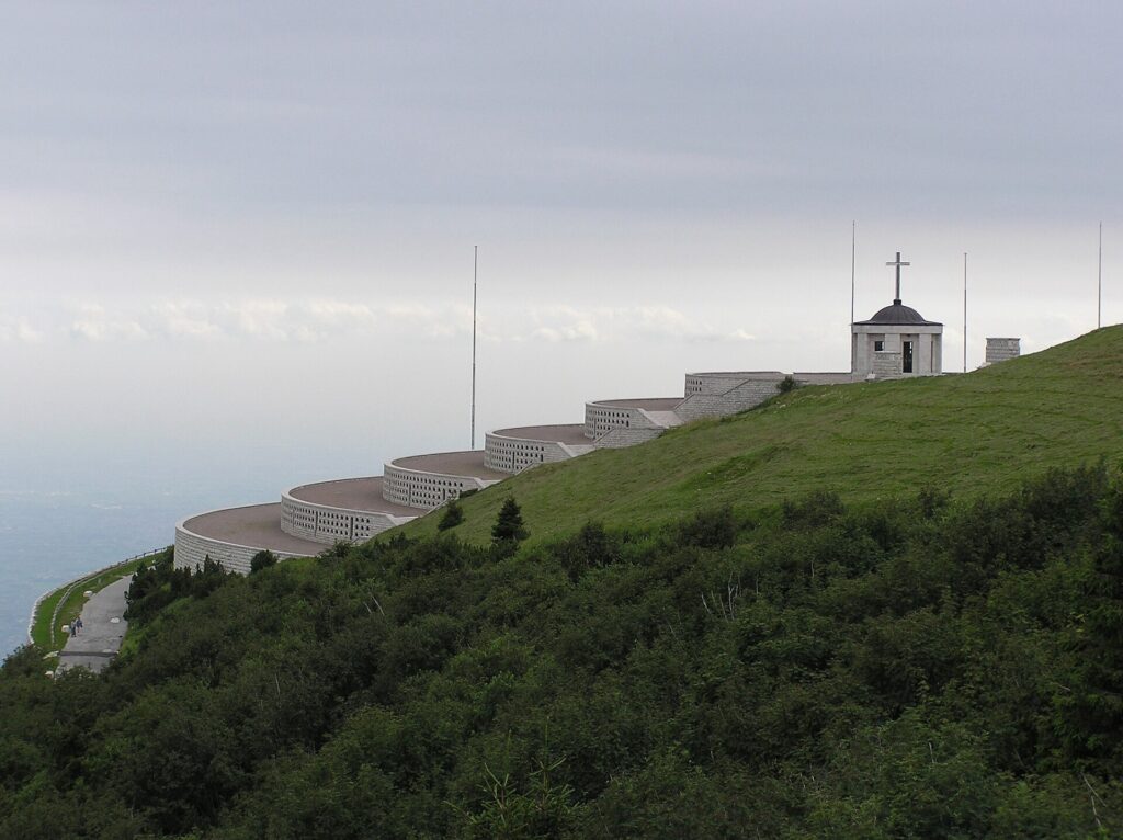
Near its summit stands the enormous military ossuary constructed during the Fascist period, containing the remains of thousands of Italian and Austro-Hungarian soldiers. The monument turned an already symbolic battlefield into a permanent landscape of commemoration visible high above the plain.
Bassano itself incorporated the mountain into its official name in 1928, becoming Bassano del Grappa.
Cycling later added another history to the massif. Its long roads and multiple approaches have appeared repeatedly in the Giro d’Italia, where Grappa has become one of northeastern Italy’s great cycling mountains. The Veneto Classic remains in the foothills below, but the massif dominates the final approach and places the race within a much larger landscape than its short walls might suggest.
–4 km | The Descent to Bassano
Contrà Soarda crests and the climbing is effectively finished.
The final kilometres descend from the foothills towards the Brenta. After a race defined by repeated circuits and sudden changes of gradient, the course finally acquires a destination that can be read directly in the landscape: Bassano lies below, where the mountains release the river onto the Venetian plain.
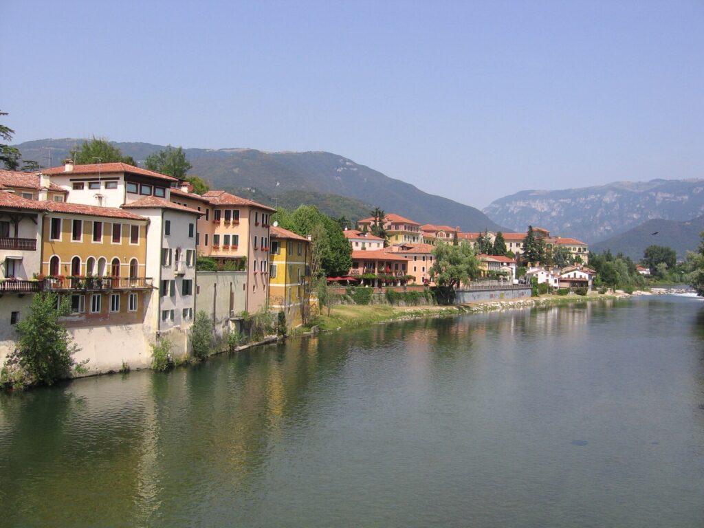
The riders are returning to the same river system encountered near the beginning at Carmignano di Brenta, but in a completely different setting. Here the Brenta has only just escaped the mountains. The valley narrows immediately north of the city before opening dramatically towards the south, making Bassano a natural meeting point between Alpine routes and lowland roads.
For centuries that position brought movement through the city. Timber descended from the mountains, agricultural goods moved across the plain, merchants travelled between the Venetian world and central Europe, and armies repeatedly used the same geographical corridor.
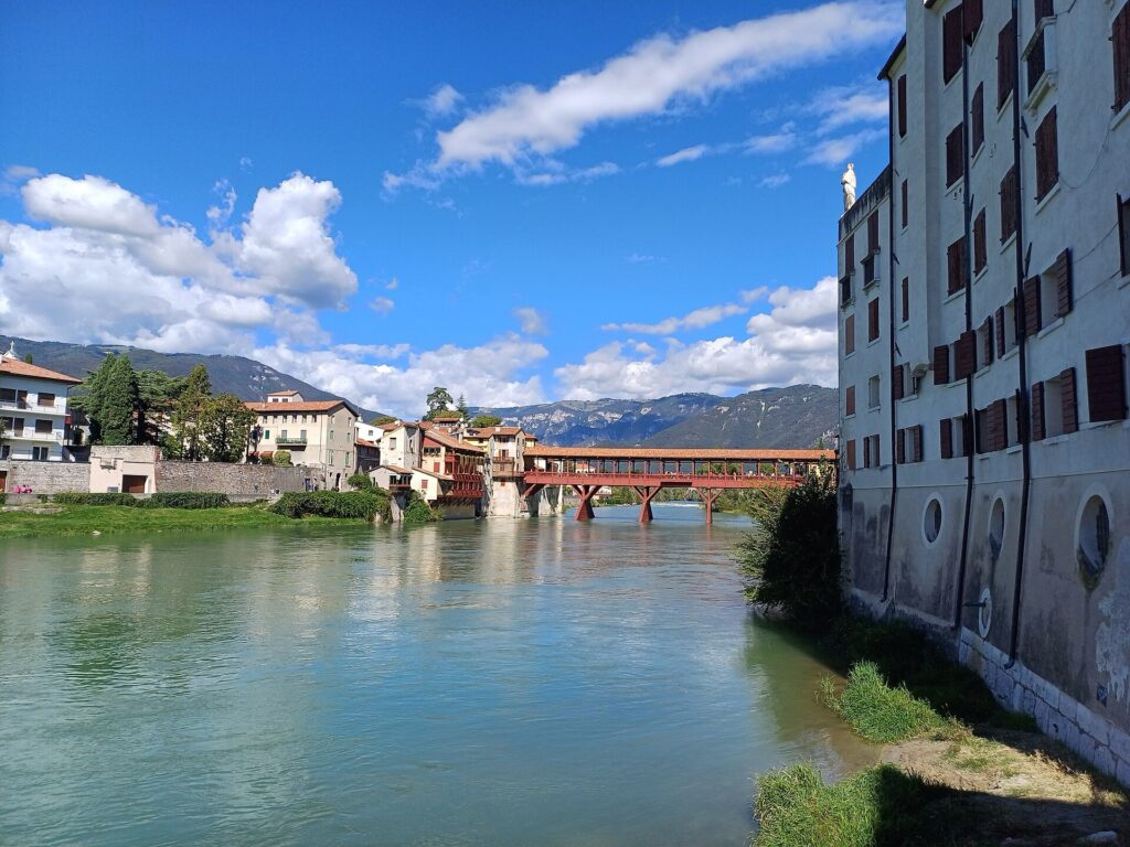
The bridge across the Brenta became the city’s enduring symbol.
The race descends towards the river and the historic centre beyond it.
FINISH · Bassano del Grappa
Bassano grew at the point where the Brenta emerges from the Valsugana and enters the Venetian plain. Its position made it commercially useful, strategically important and eventually inseparable from the bridge spanning the river beneath its historic centre.
The Ponte Vecchio, also known as the Ponte degli Alpini, is one of the most distinctive bridges in Italy.
A bridge existed at this crossing during the Middle Ages, but repeated floods and destruction forced numerous reconstructions. In the sixteenth century, after another collapse, the architect Andrea Palladio designed a replacement using timber rather than the monumental stone associated with many of his villas and public buildings.
The choice was practical. A wooden structure could better respond to the powerful Brenta, while its covered form and sequence of piers created the silhouette that still defines the crossing.
The bridge seen today has been rebuilt more than once, including after destruction during the Second World War, but it preserves the Palladian concept. Its association with the Alpini, Italy’s mountain infantry, deepened after the First World War, when Bassano and the road towards Monte Grappa became inseparable from the experience of soldiers moving to and from the front.
The city contains other histories less immediately visible from the race. The Bassano name travelled across Europe through the work of the Dal Ponte family of Renaissance painters, particularly Jacopo Bassano, whose workshop developed a distinctive combination of religious subjects, rural scenes and observations of everyday life.
Later, the Remondini family turned Bassano into one of Europe’s important centres of popular print production. From the seventeenth century onwards, their presses produced religious images, decorative prints, books and inexpensive pictures distributed through extensive commercial networks. Images created beside the Brenta could end up in homes and markets far beyond the Veneto.
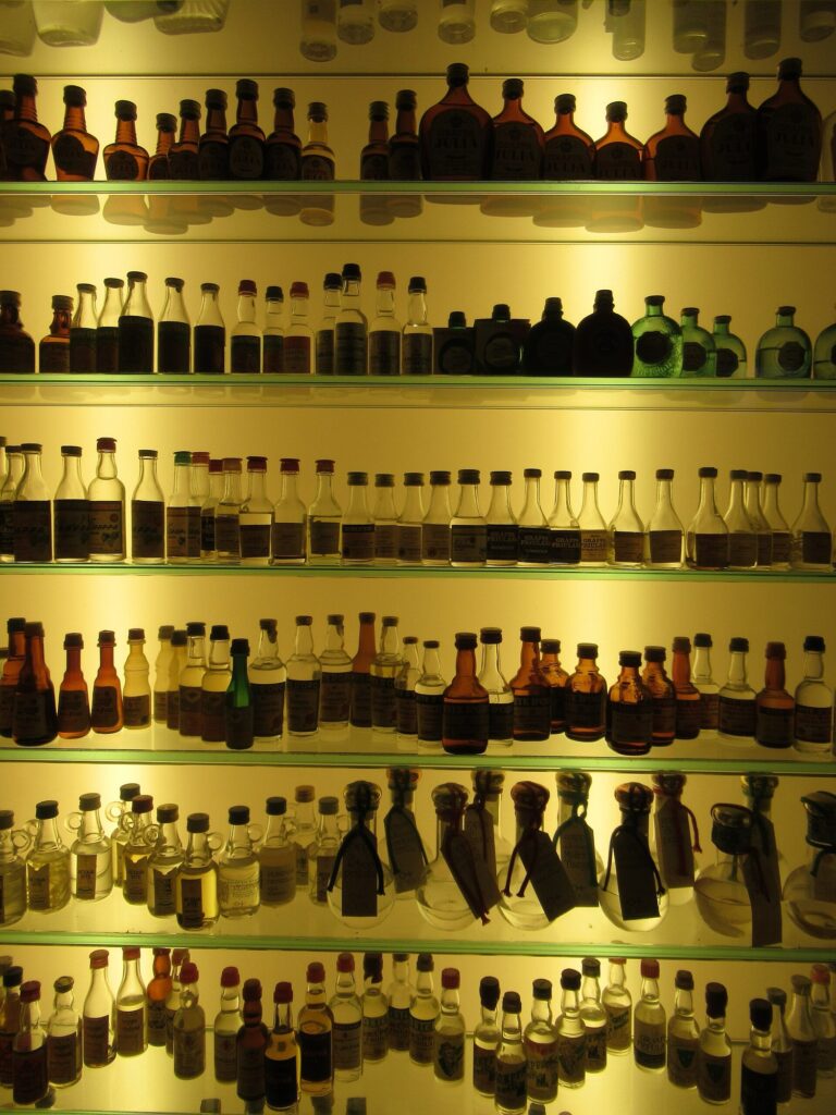
And then there is grappa. Despite the coincidence of names, the spirit is not simply named after the city. Grappa is an Italian pomace brandy distilled from the skins, seeds and stems remaining after grapes have been pressed for wine. Bassano nevertheless became deeply associated with its production and consumption, particularly through historic distilling families and the culture of the surrounding Veneto wine country.
The riders arrive in Piazza della Libertà with Monte Grappa still rising beyond the city and the Brenta flowing out of the mountains nearby. The landscape has tightened steadily since the open plain outside Cittadella: first into vineyards and low hills, then into repeated walls and narrow circuits, and finally into the small roads descending towards a river crossing used for centuries by travellers moving between the Alps and the Veneto.
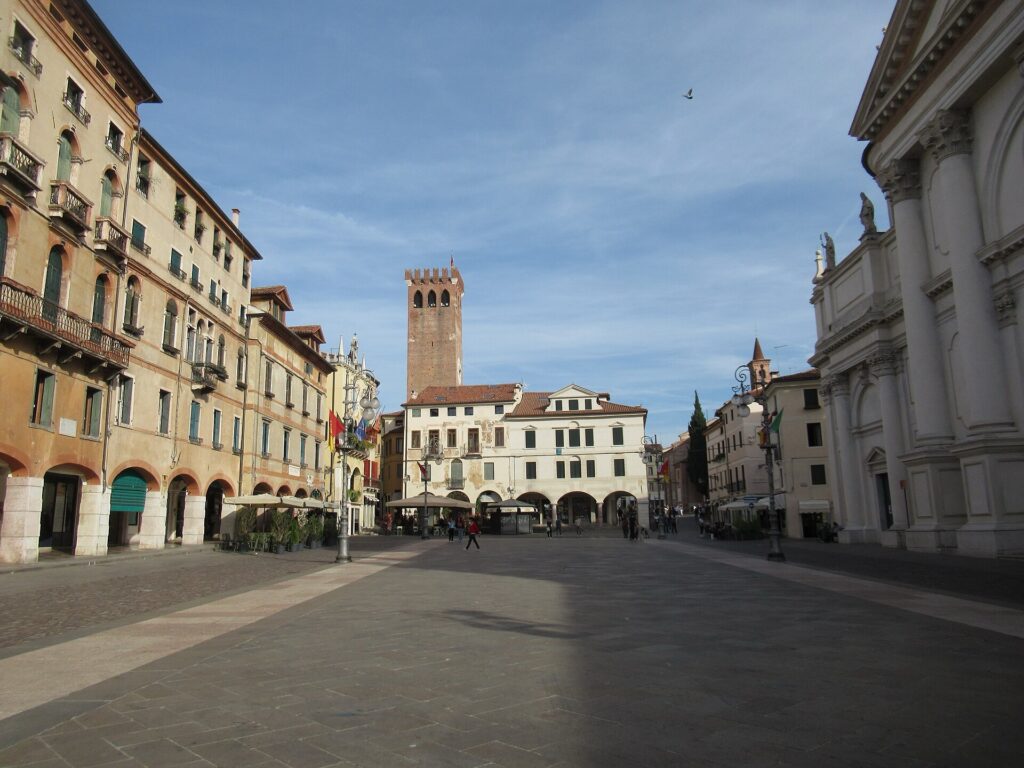
That progression suits a race still establishing its place in professional cycling. The Veneto Classic has no need to imitate the historical weight of Lombardia or the century-old mythology of Italy’s older autumn races. Its character comes from something more immediate: a compact group of roads whose surfaces, gradients and surroundings are already beginning to belong specifically to this event.
Above them, Monte Grappa provides a scale that the race itself does not yet possess. Below it, the Brenta passes beneath Palladio’s wooden bridge and opens onto the same plain from which the peloton began 161 kilometres earlier.
The Veneto Classic finishes where those two landscapes meet.



