

Paris-Tours has spent more than a century travelling south through the centre of France, but the landscape that defines the race today is concentrated into its final hour. The opening country is broad and agricultural, shaped by grain fields, small towns and river valleys stretching between Chartres and the Loire. Then, beyond Amboise, the road changes character. Vineyards climb onto limestone slopes, narrow lanes thread between stone walls and cellars, and strips of unpaved track cut directly through the vines before the race drops towards Tours.
That contrast has become the modern identity of one of France’s oldest classics. First held in 1896, Paris-Tours was traditionally associated with enormous gears, high speeds and the long finishing straight in Tours, a race in which sprinters could survive more than 250 kilometres and still settle the result in the final metres. Since 2018, the introduction of vineyard tracks and short climbs through the Vouvray wine country has transformed the finale without severing the race from its past. The long approach remains. What waits at its end is different.
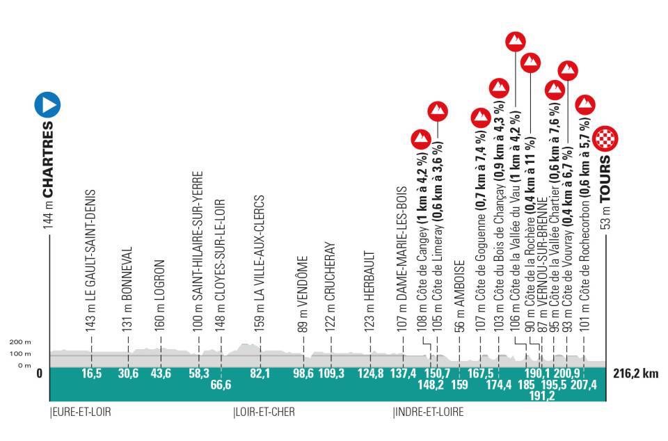
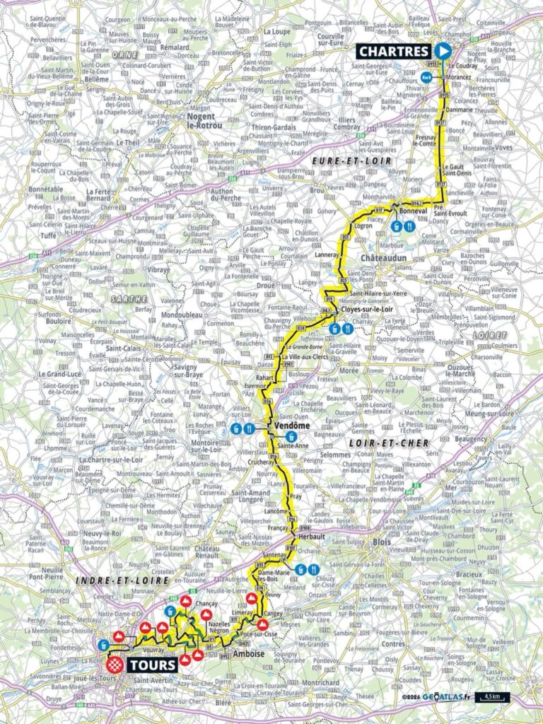
On 11 October 2026, the peloton will travel 216.2 kilometres from Chartres to Tours. The first two thirds cross Eure-et-Loir and Loir-et-Cher through Bonneval, Cloyes-sur-le-Loir and Vendôme before entering Indre-et-Loire and turning towards the Loire. The race reaches the first of ten vineyard tracks at Limeray with 65.2 kilometres remaining. From there, 10.5 kilometres of unpaved roads and a succession of short climbs are distributed through the vineyards around Amboise, Chançay, Vernou-sur-Brenne, Vouvray and Rochecorbon.
The result is a race divided almost perfectly between two landscapes. For roughly 150 kilometres, Paris-Tours crosses the open country of central France. In the final sixty-five, Touraine closes around it.
–216.2 km | Chartres
Chartres rises from the Beauce plain with extraordinary clarity. For kilometres around the city, the twin spires of Notre-Dame de Chartres dominate an agricultural landscape so open that the cathedral appears almost detached from the city beneath it.
The Beauce is one of France’s great cereal-growing regions. Wheat, barley, maize and oilseed fields extend across a limestone plateau southwest of Paris, producing the broad horizons that characterise the beginning of Paris-Tours. There are few major natural obstacles here, and settlement historically developed around water sources and market towns scattered across an intensely cultivated landscape.
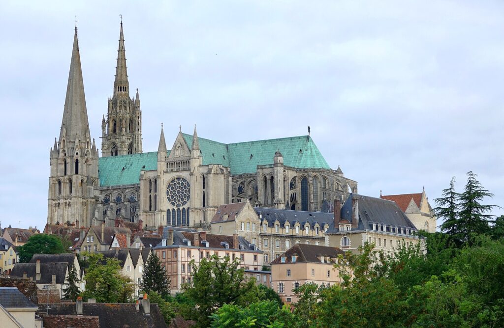
Chartres became the most important of them. A settlement existed here before the Roman conquest, when the area belonged to the Carnutes, a Gallic people whose territory occupied part of the central Loire basin. Under Rome, Autricum developed on the Eure, but the building that eventually defined Chartres emerged from medieval Christianity.
Notre-Dame de Chartres is one of the great surviving monuments of Gothic Europe. Much of the present cathedral was constructed rapidly after a fire in 1194 damaged an earlier church. Its architecture belongs to the formative period of High Gothic, when pointed arches, ribbed vaults and flying buttresses allowed builders to raise walls higher while opening enormous areas for stained glass.
Much of that medieval glass survives. Deep blues, reds and greens fill windows created principally during the twelfth and thirteenth centuries, producing one of the world’s most complete ensembles of medieval stained glass. Among them is the celebrated blue associated so closely with the cathedral that it is commonly called bleu de Chartres.
Chartres was also one of medieval Western Europe’s major pilgrimage destinations. The cathedral preserved a relic traditionally identified as the veil worn by the Virgin Mary, drawing pilgrims towards the city for centuries. Roads converging on Chartres therefore carried merchants and armies, but also generations of people travelling for religious reasons.
The peloton leaves beneath the silhouette created by that history and immediately enters the Beauce. The cathedral remains visible long after individual buildings have disappeared. Ahead lies nearly two hundred kilometres of road to Tours.
–199.7 km | Le Gault-Saint-Denis and the Beauce
By Le Gault-Saint-Denis, the urban edge of Chartres has been replaced completely by the Beauce. Villages appear as compact islands within enormous fields, often announced by a church tower or a line of trees before houses themselves become visible.
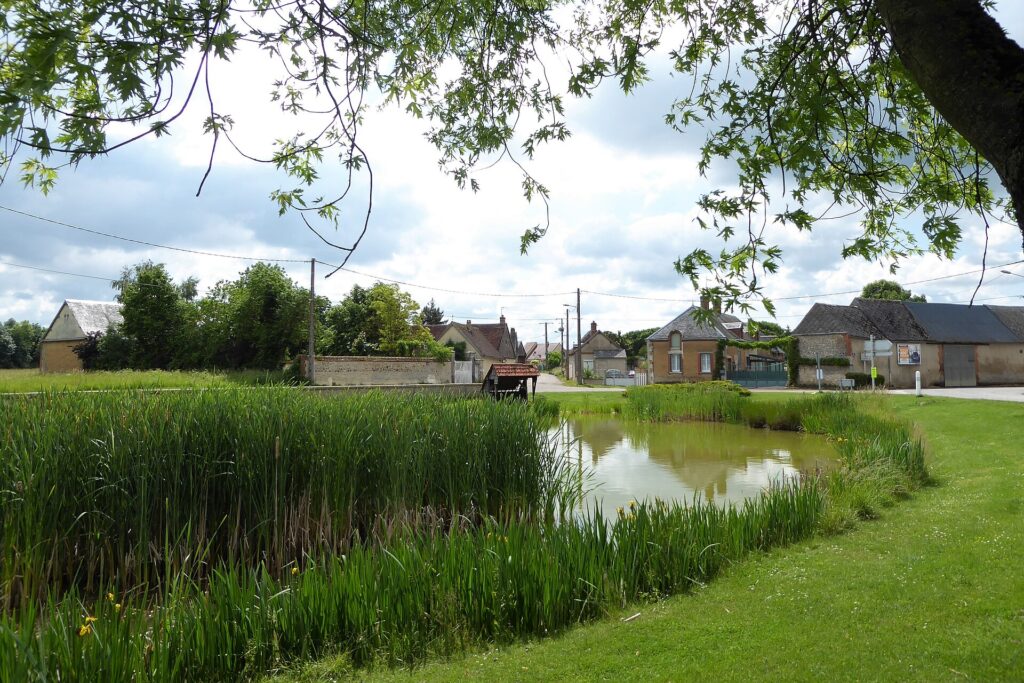
This apparent simplicity is deceptive. The landscape has been intensively worked for centuries, and its modern openness is partly the product of agricultural consolidation, mechanisation and the removal of many older field boundaries. Fertile soils and relatively level terrain made the Beauce exceptionally suitable for large-scale cereal cultivation, earning it the traditional description of the “granary of France.”
For Paris-Tours, the same geography produces speed. Roads run straight across exposed country with little climbing to disrupt the rhythm. Wind can matter far more than gradient, particularly when it crosses the road obliquely and forces riders to fight for shelter within the peloton.
The race continues south towards Bonneval, where the flat agricultural plateau is interrupted by water.
–185.6 km | Bonneval and the Loir
Bonneval sits beside the Loir, a river that should not be confused with the much larger Loire encountered near the end of the race. The names differ by only one letter, but the rivers are distinct. The Loir rises in the Beauce and flows west through Vendôme and La Flèche before eventually joining the Sarthe; the Loire is France’s longest river and follows an entirely different course farther south.
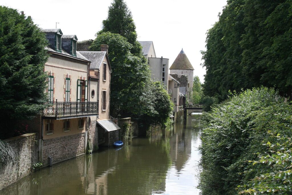
Bonneval grew around an abbey founded in the ninth century. The settlement developed within loops and channels of the Loir, and its waterways still wrap around parts of the old centre. Bridges, former mills and waterside houses give the town a character very different from the exposed agricultural country surrounding it.
The medieval abbey of Saint-Florentin became the nucleus around which Bonneval developed. Like many religious institutions in France, it accumulated land and economic influence before suffering through wars, political upheaval and the secularisation of the revolutionary period. Its surviving buildings later found other uses, while the river remained the constant feature around which the town was organised.
Paris-Tours crosses the Loir landscape and continues south. The road soon returns to open fields, but the river will reappear repeatedly during the next hundred kilometres, guiding the race towards Cloyes and Vendôme.
–172.6 km | Logron and the Road South
Around Logron, the race is again immersed in agricultural country. This is not the France of monumental destinations but of communes, farms and departmental roads connecting settlements that rarely appear on international itineraries.
That ordinariness is important to the geography of Paris-Tours. Unlike races built around a mountain chain or a famous sequence of climbs, much of this classic gains its scale from distance itself. The peloton moves for hours through landscapes where changes are gradual: the Beauce becomes the Loir valley, cereal country gives way to more varied farming, and the architecture slowly shifts as the race approaches the Loire.
For generations of riders, these roads formed the long prelude to a much simpler finale in Tours. In 2026 they still perform that role, accumulating kilometres before the race reaches the terrain on which positioning and handling become as important as endurance.
–149.6 km | Cloyes-sur-le-Loir
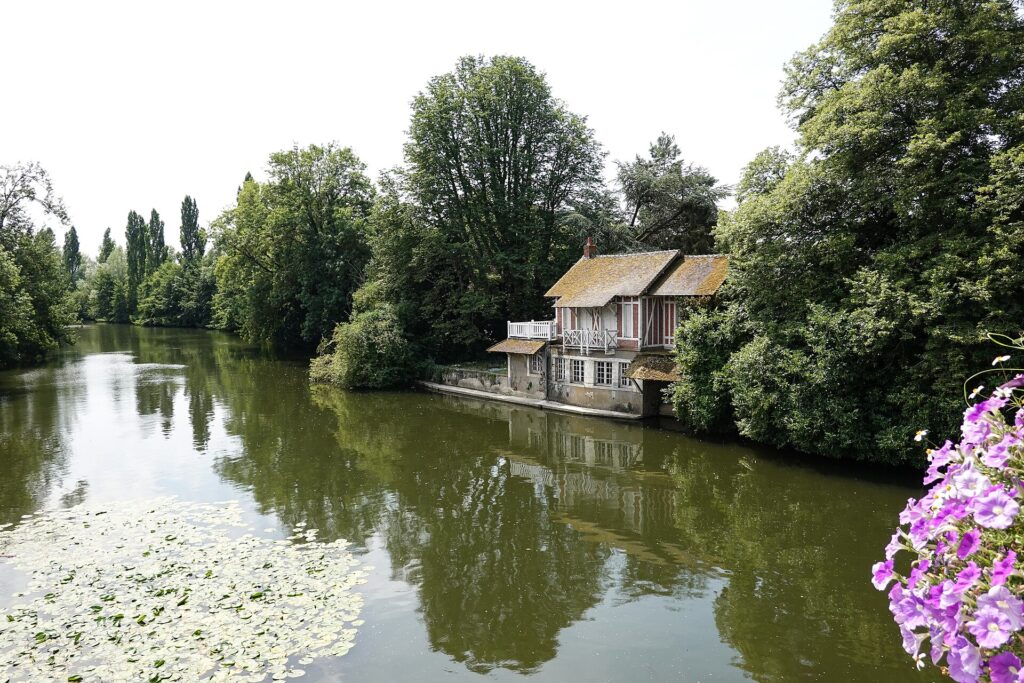
Cloyes-sur-le-Loir occupies another crossing of the Loir, where the river winds between wooded banks and low agricultural ground. The settlement is today part of the larger commune of Cloyes-les-Trois-Rivières, but its position beside the water gave it significance long before modern administrative boundaries existed.
Cloyes is associated, somewhat uncertainly, with one of the strangest episodes of medieval religious enthusiasm: the so-called Children’s Crusade of 1212. Later accounts describe a young shepherd named Stephen of Cloyes gathering followers after claiming to have received a divine message connected with the recovery of Jerusalem.
The event is difficult to reconstruct. Medieval sources are fragmentary, later writers embellished the story, and historians continue to debate who actually participated and how organised the movement really was. The familiar image of thousands of small children marching alone towards the Mediterranean is almost certainly too simple. What survives more securely is evidence of a popular religious movement involving young and poor participants at a time when crusading ideas had spread far beyond armies and aristocratic elites.
The modern race passes quickly through a place attached to that uncertain medieval memory. Beyond Cloyes, the Loir continues southwest while the road moves through increasingly wooded country towards Vendôme.
–117.6 km | Vendôme
Vendôme rises above another bend of the Loir, dominated by the ruins of a castle on the hillside and by the tower of the former Abbey of the Trinity below. Compared with the small towns crossed since Chartres, it presents a more substantial concentration of political and religious history.
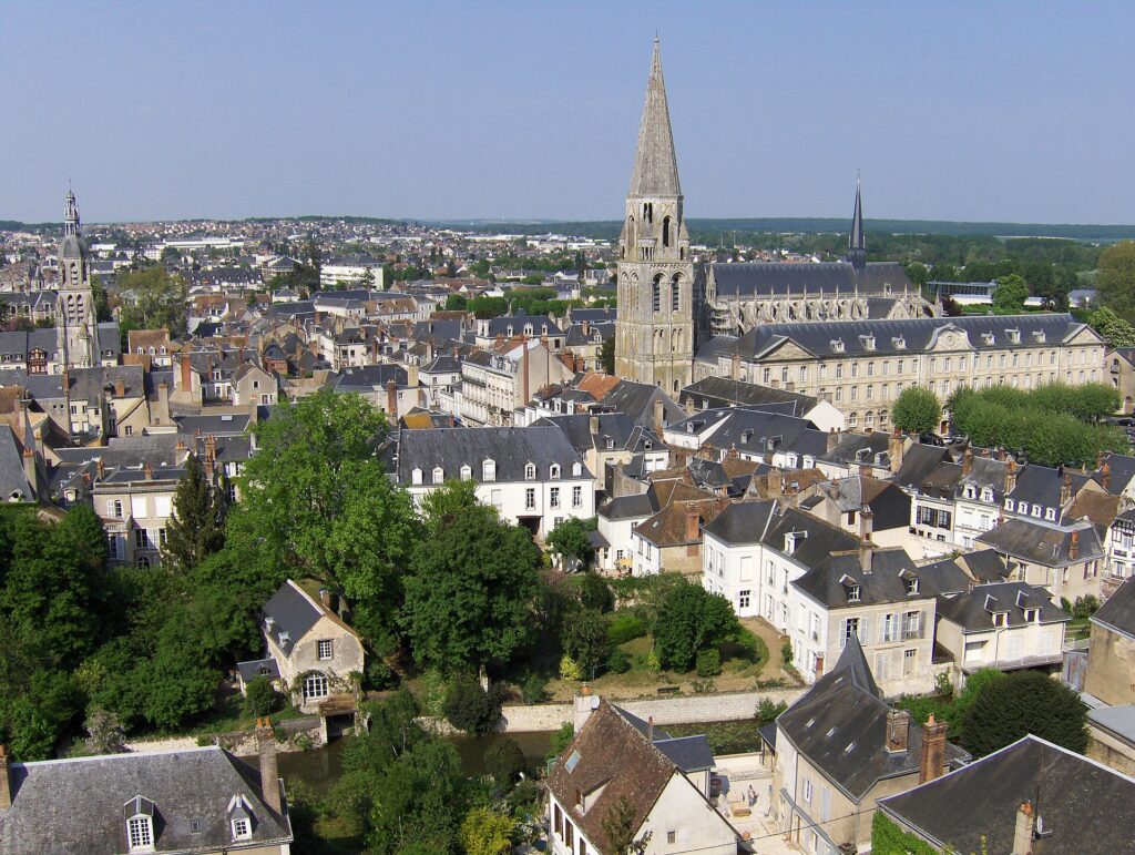
The abbey was founded in the eleventh century and became an important Benedictine house. Its church developed over several architectural periods, leaving a façade in which late Gothic stonework surrounds an elaborate central entrance. The tall Romanesque bell tower remains one of the most recognisable structures in the town.
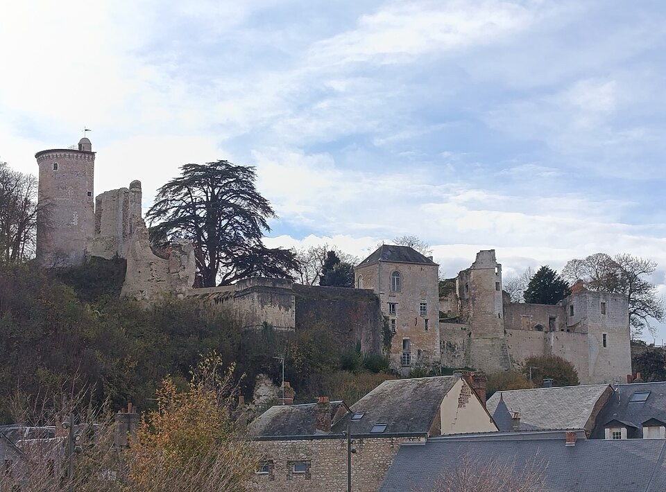
Above it stand the remains of the Château de Vendôme. The fortress belonged to a lineage that would eventually acquire importance far beyond the Loir valley. The counts, and later dukes, of Vendôme became connected with the Bourbon dynasty, and Antoine de Bourbon, Duke of Vendôme, was the father of Henry of Navarre.
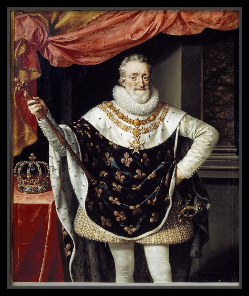
When Henry inherited the French crown as Henri IV in 1589, France had already endured decades of the Wars of Religion, a succession of conflicts in which dynastic rivalry became entangled with the violent division between Catholics and Protestants. Henry was Protestant, while Paris and much of the kingdom remained hostile to accepting a Protestant king. His succession therefore gave him a title before it gave him secure possession of the country.
Years of warfare followed. Henry eventually converted to Catholicism in 1593, entered Paris the following year and gradually consolidated his authority. In 1598, the Edict of Nantes granted substantial protections to French Protestants while preserving Catholicism as the kingdom’s dominant religion, helping bring the principal phase of the religious wars to an end.
The former Duke of Vendôme had become the first Bourbon king of France. The dynasty descending from him would dominate French monarchy for the next two centuries and extend into several other European royal houses.
That connection gives the ruined fortress above Vendôme a significance difficult to read from its quiet setting today. Below it, the Loir divides around islands and channels, gardens reach towards the water, and the town remains enclosed by a landscape far removed from the religious and dynastic struggles in which its ruling family became entangled.
The peloton continues south. For the moment, the road remains forgiving.
–91.4 km | Herbault and the Approach to Touraine
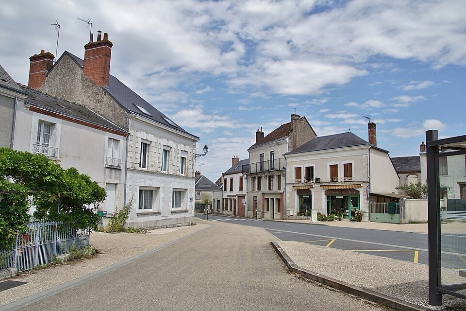
At Herbault, Paris-Tours begins approaching the cultural landscape of Touraine. The Loire itself is still some distance away, but the broad geographical transition has started. Fields become increasingly mixed with woodland, villages cluster more closely along valleys, and the stone architecture begins to anticipate the limestone country around Amboise and Vouvray.
Touraine is the historical territory centred on Tours and the middle Loire. Its reputation today is inseparable from Renaissance châteaux, vineyards and the river landscape, but its importance developed because this part of France occupied a corridor between northern and southwestern regions. Kings travelled through it, noble families established residences along the Loire and its tributaries, and fertile valleys supported both agriculture and growing towns.
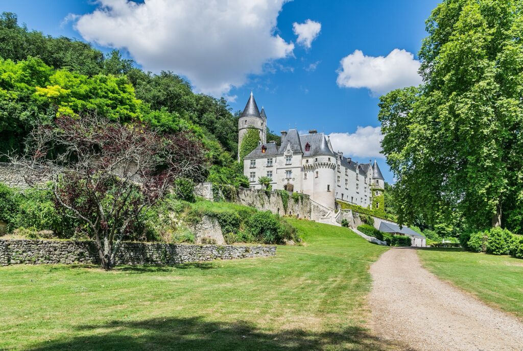
Paris-Tours is now moving towards that world from the north. The transformation will become unmistakable after the race crosses into Indre-et-Loire.
–78.8 km | Dame-Marie-les-Bois
Dame-Marie-les-Bois lies within gently rolling countryside north of the Loire. The long flat rhythm of the Beauce has finally begun to break apart, although the decisive difficulties are still ahead.
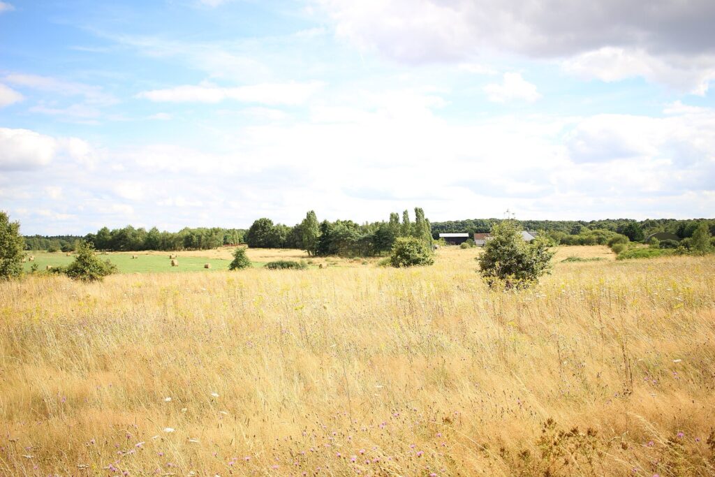
Forests become more prominent here. The race approaches the historic woodland associated with Amboise, part of a landscape once valued by French kings and aristocrats for hunting as much as for agriculture. The royal residences of the Loire did not exist in isolation: they belonged to estates of forests, farms, rivers and roads that supplied courts and provided spaces for hunting and recreation.
The road begins descending towards the Loire valley. Then, almost abruptly, one of the great architectural landscapes of France appears.
–57.2 km | Amboise and the Loire
Amboise occupies a commanding position above the Loire. The river spreads broadly beneath the town, divided by islands and crossed by bridges, while the Château Royal rises directly from a rocky spur above the northern bank.
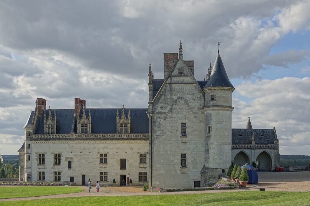
The location explains its importance. Whoever controlled this height controlled an important Loire crossing, and a fortress existed here long before the château acquired its Renaissance appearance. During the fifteenth and sixteenth centuries, however, Amboise became closely associated with the French monarchy.
Charles VIII grew up at Amboise and transformed the medieval fortress after returning from his campaigns in Italy. French exposure to Italian art and architecture during the Italian Wars helped accelerate the arrival of Renaissance ideas north of the Alps, and Amboise became one of the places where those influences entered French court culture.
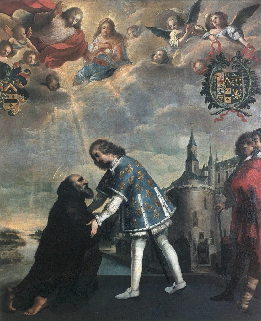
The château is also tied to the strange death of Charles VIII. In 1498, the twenty-seven-year-old king struck his head on a stone lintel while walking through the castle and died hours later. With no surviving male heir, the crown passed to Louis XII.
A generation later, Amboise acquired another extraordinary resident.
Leonardo da Vinci arrived in France in 1516 at the invitation of François I. Already in his sixties, Leonardo crossed the Alps carrying manuscripts and works from the final period of his life. The king installed him at the Château du Clos Lucé, a manor a short distance from the royal château.
Leonardo spent his final three years there, working on engineering, architecture and artistic projects while enjoying the patronage of François I. He died at Clos Lucé in 1519 and was eventually buried in the Chapel of Saint-Hubert within the Château d’Amboise.
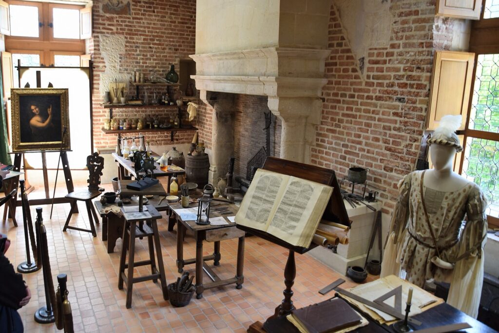
The association gives this small Loire town an exceptional place in European cultural history: an Italian artist whose work helped define the Renaissance ended his life within a French royal landscape that was itself being transformed by Renaissance ideas.
Paris-Tours does not linger beneath the château. Beyond Amboise, the character of the race changes almost immediately.
The vineyards are waiting.
–68 km to –48 km | Limeray, Cangey and the First Vineyard Roads
The first short climb arrives before Amboise itself, at the Côte de Cangey with approximately 68 kilometres remaining, followed by the Côte de Limeray. These are not major climbs in isolation. Their importance comes from what begins around them.
At race kilometre 151, with 65.2 kilometres remaining, the peloton enters the first vineyard track at Limeray.
The asphalt disappears. For 0.9 kilometres, Paris-Tours enters the agricultural roads running directly between the vines. The surface can vary with weather and maintenance, but these are not the engineered cobbles of northern France. They are working tracks belonging to a wine landscape, narrow and exposed to dust in dry conditions or loose, dirty surfaces when autumn weather turns wet.
A second sector at Pocé-sur-Cisse follows 5.5 kilometres later and extends for 1.5 kilometres. Then comes La Grosse Pierre, another 1.5 kilometres, as the course approaches the country around Amboise and the vineyards north of the Loire.
These tracks changed Paris-Tours when they were introduced in 2018. For much of the race’s modern history, the classic had been associated with speed and sprinting. The long approach to Tours encouraged enormous gears and tactical patience, while the famous Avenue de Grammont provided one of professional cycling’s most imposing finishing straights.
The vineyard roads disrupted that logic. Punctures, positioning, repeated accelerations and reduced traction introduced uncertainty into the final hour. A rider capable of winning Paris-Tours now needed more than speed after two hundred kilometres. The race began demanding qualities associated with the northern classics, but transplanted into an entirely different landscape.
And unlike cobbles laid centuries ago for transport, these roads exist because of wine.
The Vineyards of Touraine
The middle Loire is one of France’s great wine regions, but its vineyards are fragmented into distinct appellations shaped by grape variety, soil and local geography. Around Amboise, Chançay, Vouvray and Rochecorbon, the race enters a world dominated increasingly by Chenin Blanc.
Chenin is unusually expressive of both place and winemaking. Depending on harvest conditions and decisions in the cellar, it can produce dry, sweet and sparkling wines while retaining high natural acidity. In Vouvray, this flexibility became fundamental to the identity of the appellation.
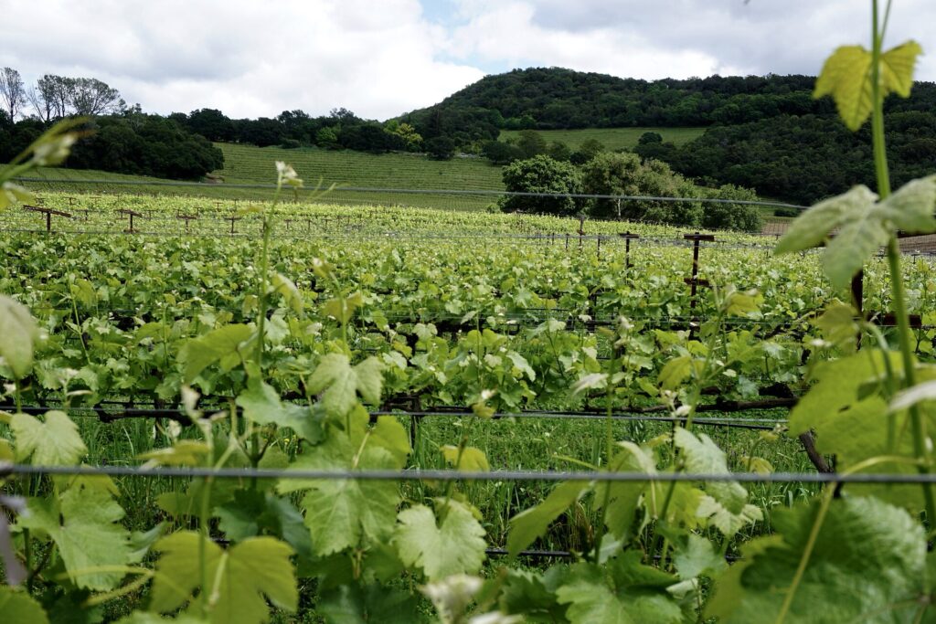
Beneath the vines lies another defining material: tuffeau.
This pale, soft limestone formed from marine sediments during the Cretaceous period. It could be quarried relatively easily and became one of the characteristic building stones of the Loire Valley. Châteaux, churches, houses and walls across Touraine glow with its light colour.
Quarrying also left enormous underground spaces.
Across the Loire region, abandoned tuffeau quarries were converted into cellars, storage spaces and troglodytic dwellings. Wine producers found the underground galleries particularly useful because their temperature and humidity remain relatively stable throughout the year. In places, kilometres of cellars extend into the slopes behind villages that appear modest from the road.
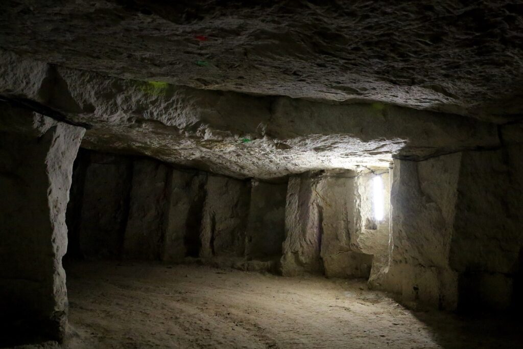
Paris-Tours therefore races across the surface of a landscape that continues underground. Vines occupy the plateau and slopes, houses line the valleys, and cellars penetrate the limestone beneath them.
The next thirty kilometres repeatedly move between those levels.
–44.4 km | Château de Valmer and Chançay
The fourth vineyard sector passes Château de Valmer with roughly 44 kilometres remaining. The château itself was largely destroyed by fire in 1948, but its estate preserves an exceptional sequence of terraced gardens descending through the hillside towards the Brenne valley.
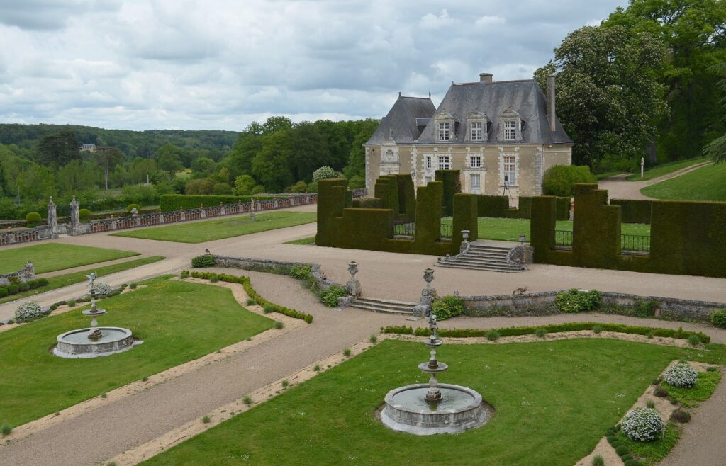
Valmer illustrates the relationship between aristocratic residence, ornamental landscape and viticulture that appears repeatedly in the Loire. Gardens were arranged formally around the château, while vines occupied the surrounding estate. The result was neither purely decorative nor purely agricultural: architecture, controlled views, productive land and social status were integrated into a single designed landscape.
The race moves quickly onwards to the Chançay-Reugny track, 0.9 kilometres of unpaved road beginning at kilometre 175. The Côte du Bois de Chançay follows nearby, one of the short climbs that repeatedly forces riders out of the rhythm they might otherwise establish between sectors.
By now the vineyard tracks are arriving too frequently for the race to reset completely after each one. Groups stretch on the climbs, compress on faster roads and fracture again when the surface changes.
That accumulation, rather than any individual sector, defines modern Paris-Tours.
–31.2 km | The Vouvray Country
With just over thirty kilometres remaining, the race reaches the Côte de la Vallée du Vau and enters the heart of the Vouvray landscape.
Vouvray lies east of Tours on the northern side of the Loire, where small tributary valleys cut into a limestone plateau above the river. Vineyards occupy slopes and higher ground while villages sit below, often backed directly against cliffs of pale tuffeau.
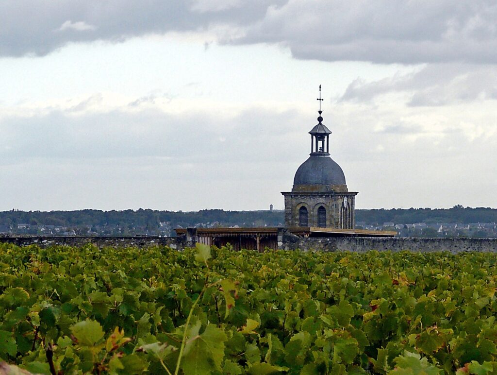
The Vouvray appellation is devoted overwhelmingly to Chenin Blanc, locally known historically as Pineau de la Loire. Wines range from dry to intensely sweet depending on vintage and harvest, while sparkling Vouvray has a long history of its own. The grape’s acidity allows wines to age for remarkable periods, particularly when balanced by residual sugar.
The physical landscape is as distinctive as the wine. Cellar entrances open directly from roads beneath the vineyards. Some lead into former quarries extending far into the limestone, creating an underground architecture invisible from the race route above.
The peloton now encounters sectors at Noizay, Les Épinettes and Vernou in rapid succession. None exceeds 1.3 kilometres, but recovery becomes increasingly difficult as the paved intervals shrink.
At Vernou-sur-Brenne, another short climb arrives.
The race is approaching the Loire again.
–20.7 km | Côte de Vouvray
The Côte de Vouvray comes with approximately twenty-one kilometres remaining. It is only 0.4 kilometres long, but averages 6.7 percent and arrives after repeated vineyard sectors and climbs have already reduced the race.
Below lies Vouvray itself, a village whose international reputation vastly exceeds its size because its name travels on bottles around the world. Above it, vineyards spread across the plateau. Between them, narrow roads climb through limestone cuttings and past entrances leading into the subterranean cellars.
This is where Paris-Tours most completely belongs to its modern landscape. The race is no longer simply passing vineyards on the way to Tours. The structure of the vineyards determines the roads, the geology determines the cellars and slopes, and those roads and slopes determine the race.
At kilometre 195.6, with 20.6 kilometres remaining, the 1.6-kilometre Peu Morier sector begins. It is the longest vineyard track of the 2026 route.
There is now almost no neutral terrain left.
–12 km | Rochecorbon
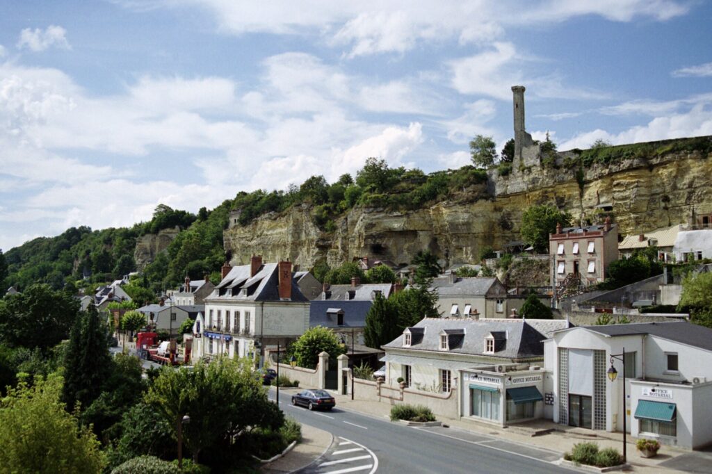
Rochecorbon stands where the limestone plateau meets the Loire immediately east of Tours. Cliffs rise behind the settlement, pierced by cellars and dwellings, while vineyards occupy the higher slopes above the river.
The final vineyard sector begins with exactly 12 kilometres remaining. At 0.8 kilometres it is not the longest, but its position makes every mechanical problem, hesitation or gap potentially decisive.
Soon afterwards comes the Côte de Rochecorbon.
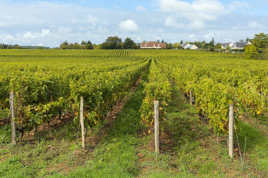
Only 0.6 kilometres long, the climb averages 5.7 percent. On paper it appears insignificant beside the great ascents of professional cycling. After more than two hundred kilometres, ten vineyard sectors and the repeated short climbs of the final hour, it has a different meaning.
There is no mountain summit here from which a rider can measure the remaining race. Instead, the difficulties simply stop.
The Loire appears again below. Tours is immediately ahead.
Paris-Tours | From the Falling Leaves to the Vineyard Tracks
Few surviving professional races reach as far back as Paris-Tours. The first edition was held in 1896, when Eugène Prévost won a race belonging to a cycling world that still preceded the Tour de France by seven years.
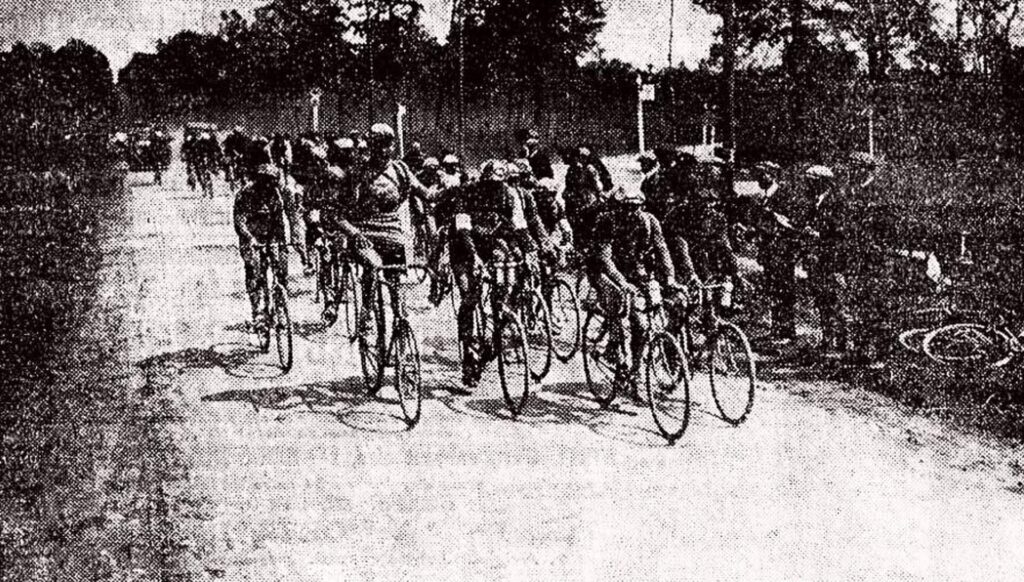
Its history subsequently accumulated many of the defining names of road racing. Lucien Petit-Breton, François Faber, Octave Lapize, Henri Pélissier, Eugène Christophe and Briek Schotte appear among the early and mid-century winners. Later came Rik Van Looy, Joop Zoetemelk, Freddy Maertens, Francesco Moser, Sean Kelly, Johan Museeuw, Erik Zabel, Philippe Gilbert and Greg Van Avermaet.
Gustave Danneels, Paul Maye, Guido Reybrouck and Erik Zabel each won three editions, but no rider has dominated Paris-Tours sufficiently to separate himself completely from the race’s changing eras. Its winners instead trace the evolution of the classic itself: early road pioneers, powerful Belgian specialists, rouleurs, sprinters and, increasingly, riders capable of surviving broken terrain late in a long race.
Its autumn date gave Paris-Tours one of its enduring identities. The Classique des feuilles mortes, the Classic of the Falling Leaves, arrives when the European road season is close to exhaustion. Spring ambitions are months old, the Grand Tours have finished and even the World Championships are usually already decided. Riders arrive in Touraine carrying an entire season in their legs.
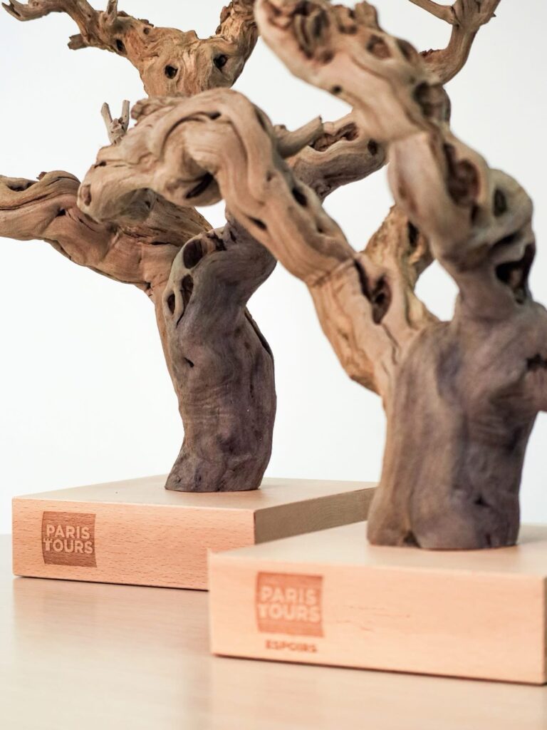
For decades, the race’s visual signature came at the very end. The Avenue de Grammont in Tours offered an exceptionally long, straight approach to the finish and became synonymous with enormous sprint trains and tactical waiting. Riders could see the road stretching towards the line while still kilometres away.
The modern transformation began in 2018. Vineyard tracks were deliberately incorporated into the route, pushing Paris-Tours away from its reputation as a sprinters’ classic. The change was controversial precisely because the old identity had been so strong, but it gave the race a landscape unmistakably its own.
Cobbles belong naturally to Flanders and northern France. Gravel strade have become inseparable from Tuscany. Paris-Tours found its equivalent among the vines of Touraine.
In 2025 another piece of the old geography changed when the finish moved from the Avenue de Grammont to Boulevard Béranger, closer to the final difficulties and still beside the centre of Tours.
The race arriving in 2026 is therefore neither the Paris-Tours of the twentieth century nor a newly invented gravel classic. It carries both identities.
Two centuries of cycling do not meet here. But two very different ideas of what Paris-Tours should be certainly do.
–8.8 km | The Road into Tours
The Côte de Rochecorbon is behind the riders. For the first time since Limeray, the race has escaped the repeated sequence of vineyard tracks and climbs.
The change is immediate. The roads broaden as the course leaves the limestone slopes and enters the urban approaches to Tours. After nearly sixty kilometres of constant interruption, speed rises again. A lone rider must now hold an advantage without another climb or gravel sector to disrupt the chase. A small group must decide whether cooperation is worth more than positioning for the finish.
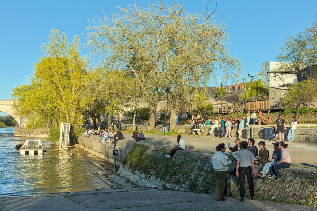
The Loire accompanies the final approach. This is the river that shaped Touraine on a scale far greater than any individual château or vineyard. Rising in the Massif Central, it travels more than a thousand kilometres before reaching the Atlantic, making it the longest river entirely within France.
Its middle valley became particularly associated with the French monarchy during the late Middle Ages and Renaissance. Royal residences and aristocratic estates multiplied along the river and its tributaries, producing the extraordinary concentration of châteaux for which the Loire Valley is known today.
Paris-Tours has spent the afternoon approaching that river system indirectly: first through the Beauce, then beside the Loir, then through the vineyard country north of the Loire itself.
Now the peloton reaches the city carrying the river’s name into the final kilometres.
FINISH · Tours
Tours developed between the Loire and Cher rivers at one of the principal crossroads of central France. The Roman city of Caesarodunum grew here during the first century AD, but the figure who gave Tours its greatest early importance arrived later.
Martin of Tours was a fourth-century Roman soldier who became a Christian bishop. According to the famous tradition, before becoming bishop he encountered a poorly clothed beggar at Amiens and cut his military cloak in two to share it with him. The story became one of medieval Christianity’s most recognisable images of charity.
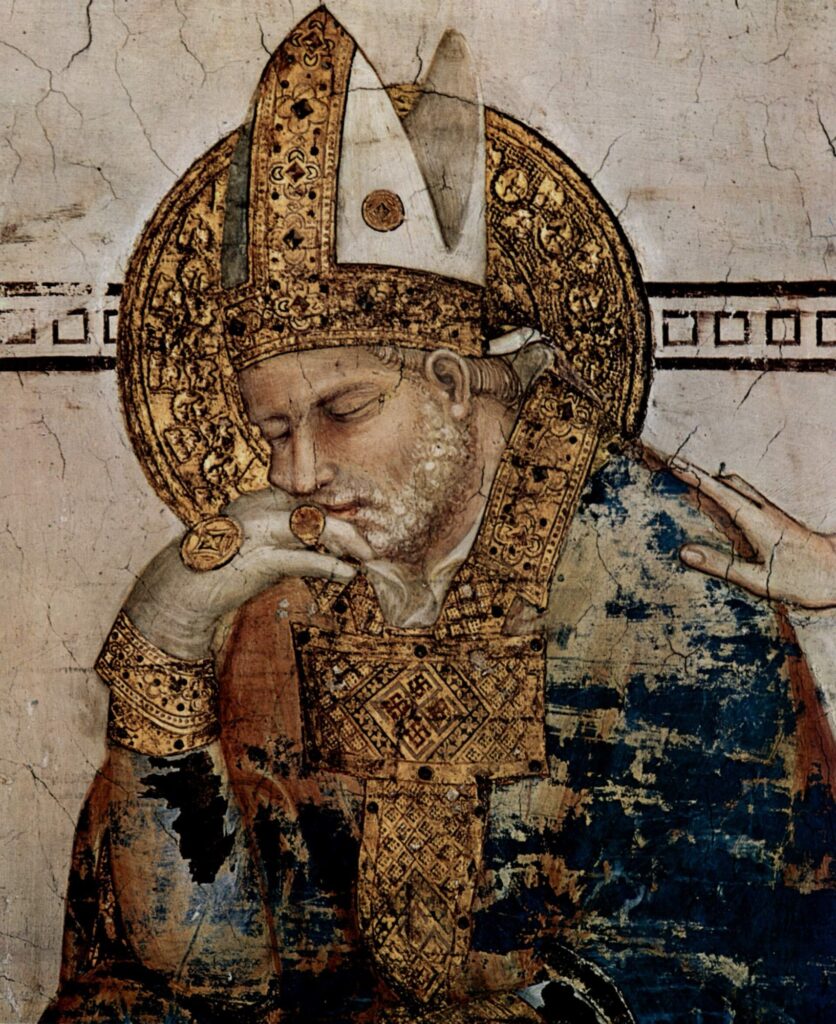
After Martin’s death in 397, his tomb at Tours developed into one of Western Europe’s major pilgrimage destinations. A vast basilica eventually rose over it, drawing travellers from across the Christian world and helping make Tours an important religious centre.
The medieval and Renaissance city expanded around that inherited importance. Timber-framed houses still survive around Place Plumereau, while the Cathedral of Saint-Gatien preserves architecture accumulated over several centuries. The Loire runs immediately north of the historic centre, broad and shallow between islands and sandbanks.
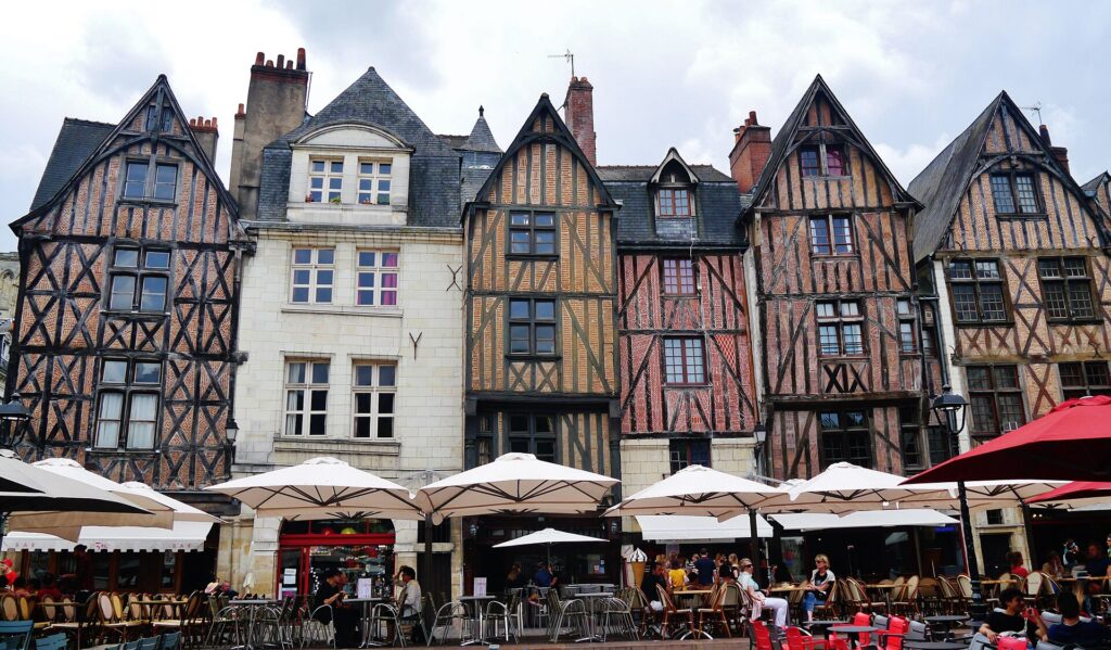
Place Plumereau in the historic centre of Tours, a square surrounded by preserved half-timbered houses that recall the city’s medieval urban landscape. (Photo: Parsifall / CC BY-SA 3.0 / Source: https://commons.wikimedia.org/wiki/File:Tours_Place_Plumereau_1.jpg)
Yet Paris-Tours reaches the city carrying a landscape that feels very different from the monumental Loire normally presented to visitors. There has been no procession of Chambord, Chenonceau and grand royal façades. Instead, the race has approached Tours through working France: grain fields beyond Chartres, Loir valley towns, forests north of Amboise, vineyard tracks, cellar villages and short roads cut through limestone.
By the time the riders arrive, the great cathedral of Chartres belongs to another horizon. The Beauce has narrowed into river valleys, the open fields into woodland and vines, and the smooth roads into pale tracks running between rows of Chenin Blanc. What began beneath Gothic spires ends after dust, limestone and the last descent from Rochecorbon.
That transformation also tells the story of Paris-Tours itself.
A race born in 1896 survived because it changed without abandoning the journey that gave it its name. Paris has disappeared from the start, the Avenue de Grammont has disappeared from the finish, and vineyard tracks now interrupt roads once associated with relentless speed. Yet the essential movement remains southward, through the centre of France towards Tours at the end of the European season.
The leaves are still falling. Now the road reaches the vines before it reaches the line.



