

25 October 2026 | Kisumu, Kenya | Men’s Elite & U23 Road Race | 175.1 km racing distance | 1,834 m elevation gain

In December 1901, a railway that had taken more than five years to build finally reached the shores of Lake Victoria. At the end of the line, Florence Preston, wife of railway engineer Ronald Preston, drove the ceremonial final fastening into the track, marking the completion of a journey that had begun hundreds of kilometres away on the Indian Ocean coast. Beyond the terminus stretched an immense freshwater lake, whose ports and trading communities were about to become connected to a new colonial transport network.
The settlement at the terminus was briefly known as Port Florence. Today it is Kisumu, one of western Kenya’s most important cities and the setting for the men’s Elite and Under-23 road race at the 2026 African Road Cycling Championships on Sunday, 25 October. More than a century after the railway’s arrival, Kisumu remains a place where different routes converge, connecting the shores of Lake Victoria with agricultural communities, expanding residential districts and the higher country beyond the city.
The championship course covers 175.1 kilometres of racing, preceded by a 2.6-kilometre neutralised section, and accumulates approximately 1,834 metres of climbing. Its start and finish are in Kisumu, but the most demanding terrain lies beyond the city’s northern neighbourhoods, where roads climb toward Kiboswa and the surrounding hills. Two significant ascents appear in the final third of the published elevation profile, with summit markers near kilometres 121 and 154 of the complete 177.7-kilometre course.
The lake encouraged trade long before the railway arrived, while the railway transformed regional connections under colonial rule. Today, the roads linking Kisumu with its surrounding settlements form part of the same long history of movement and exchange, providing the setting for a continental championship that begins and ends beside Lake Victoria.
Kisumu: The Railway’s Last Stop
175.1 km to go | START — Kisumu
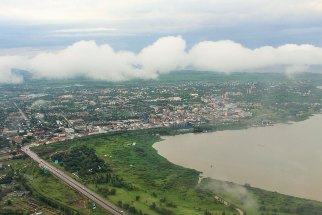
Kisumu stands on the northeastern shore of Lake Victoria, near the head of Winam Gulf, a long inlet extending eastward from the lake’s main body. Its position made the area an important meeting place long before the arrival of European colonial administrators, as communities from the surrounding region came to exchange agricultural produce, fish and other goods.
The name Kisumu is commonly associated with the Dholuo word sumo, referring to exchange or barter, preserving something of the place’s older commercial identity. When the railway arrived at the beginning of the twentieth century, it redirected and expanded commercial networks that had already developed around the lake and its hinterland.
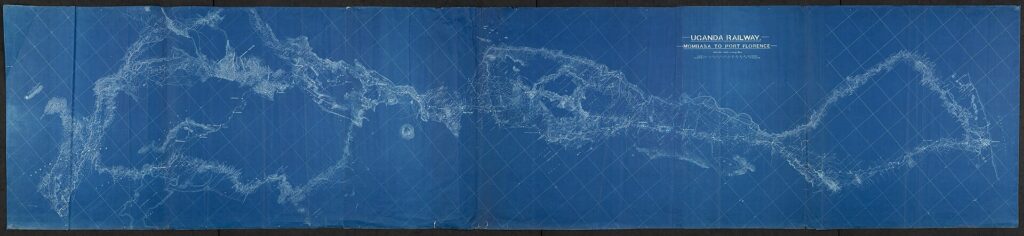
Construction of the Uganda Railway began at Mombasa in 1896. Despite its name, the original line was built across what is now Kenya, with the intention of connecting the Indian Ocean coast to Lake Victoria and, through the lake, the British-controlled territories around Uganda. The project required workers to cross difficult terrain, construct bridges and cut a railway through regions where colonial authority was still being established, turning an ambitious engineering undertaking into one of the principal instruments of British expansion in East Africa.

Thousands of labourers were recruited from British India, alongside African workers employed in construction and associated activities. Disease, accidents, harsh conditions and violence contributed to a heavy human cost, with Kenya Railways recording approximately 2,500 deaths during construction. The railway subsequently facilitated military movement, settler expansion and the reorganisation of trade under British rule, making its legacy inseparable from the political and economic consequences of colonial administration.
When the final rails reached Lake Victoria in December 1901, the ceremony involving Florence Preston marked the completion of the line’s first great objective. A railway from the coast now terminated beside an inland lake large enough to connect territories across eastern Africa, creating a junction between two different transport systems.
The name Port Florence did not endure, and the settlement returned to a form of its older local name, Kisumu, while the railway terminus and port became the foundations of a growing colonial town. Its modern layout still reflects this history, with the railway station, port installations and older commercial districts belonging to an urban landscape developed around the movement of people and goods between rail, road and water.

Theodore Roosevelt aboard the Uganda Railway in 1909, on the line linking Mombasa with Port Florence, present-day Kisumu. (Photo: Unknown photographer / Public Domain / Source: Wikimedia Commons, File: Uganda Railways – Theodore Roosevelt.jpg)
The championship begins within that inherited geography, following roads that connect the modern urban centre with communities beyond it and continuing a much older pattern of movement between the shoreline and the interior.
From the Railway to the Lake
The railway’s arrival did not complete the transport journey for passengers and cargo travelling beyond Kisumu. Destinations farther west and south still required a crossing by water, making steamships an essential extension of the railway network. Lake vessels linked Kisumu with ports in present-day Uganda and Tanzania, creating a combined rail-and-water system that connected the Indian Ocean with much of the Victoria basin.
Some of these vessels had extraordinary journeys before entering service. Ships built in Britain could be transported in sections to East Africa and assembled beside the lake, requiring considerable logistical effort to establish mechanised transport across an inland body of water far from the sea. The SS William Mackinnon, an early vessel associated with the lake’s developing steamship network, illustrates the ambition involved in creating these connections.
The lake was already part of an older commercial world, however, and fishing communities, traders and farmers had long used boats and shoreline markets to move goods between settlements. The steamship network introduced larger-scale scheduled transport into these existing relationships, while the railway placed the system increasingly under colonial economic control.
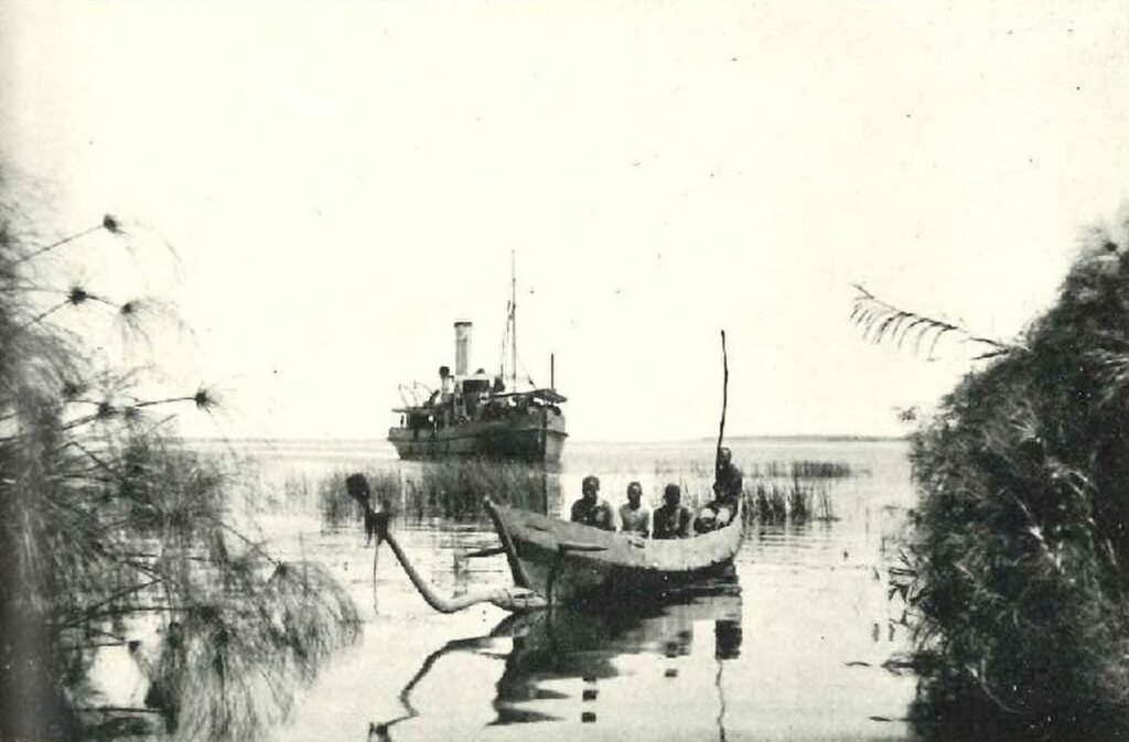
Kisumu grew because it occupied the junction between them. Its harbour became a place where goods and travellers transferred from one transport system to another, while roads radiating inland carried agricultural produce and connected surrounding communities with the markets and shipping services concentrated beside the lake.
Lake Victoria: The Water Behind the City
The Opening Kilometres | The Winam Gulf and Kisumu’s Urban Landscape
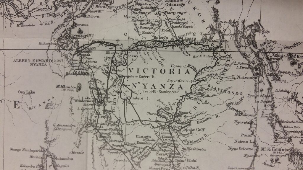
Lake Victoria covers approximately 68,800 square kilometres, making it Africa’s largest lake by surface area. Shared by Kenya, Uganda and Tanzania, it supports fisheries, transport routes, wetlands and communities whose livelihoods depend on its waters. Kisumu lies near the head of Winam Gulf, where the lake extends eastward into the Kenyan interior, creating a sheltered waterfront within a relatively confined part of the much larger basin.
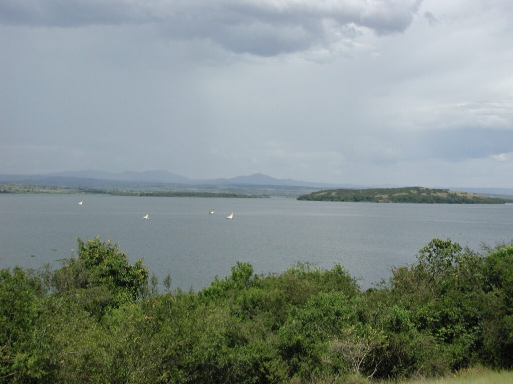
The gulf has long supported fishing and settlement, although its ecological conditions have been transformed by population growth, pollution and changes in the wider lake ecosystem. One of the most consequential developments followed the introduction of Nile perch, a large predatory fish that expanded dramatically during the twentieth century and became the foundation of an economically important commercial fishery.
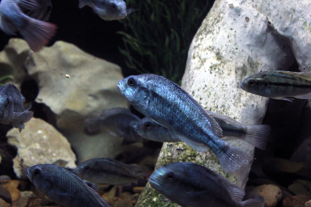
The growth of that industry brought opportunities, particularly through export markets, but it was also associated with severe disruption to native fish communities. Lake Victoria was once celebrated for its extraordinary diversity of cichlids, many of which had evolved within the lake itself, and predation, environmental change and other pressures contributed to the decline or disappearance of numerous species. The transformation became one of the most striking examples of rapid ecological change in a major freshwater ecosystem.
Water hyacinth introduced another challenge. The floating plant can spread across sheltered waters, obstructing boat movements, interfering with fishing and limiting access to landing sites. Its expansion has periodically created serious difficulties for communities around the lake, adding to pressures caused by pollution, wetland degradation and changing land use throughout the catchment.
These environmental changes matter directly to Kisumu because the city remains dependent on the waters that supported its growth. Fishing, commerce, tourism and public health are all connected to the condition of the lake, while the pressures affecting Victoria cross national borders and require cooperation between the three countries sharing its shores.
Through the Luo Heartland
The Early and Middle Kilometres | Communities Beyond the City
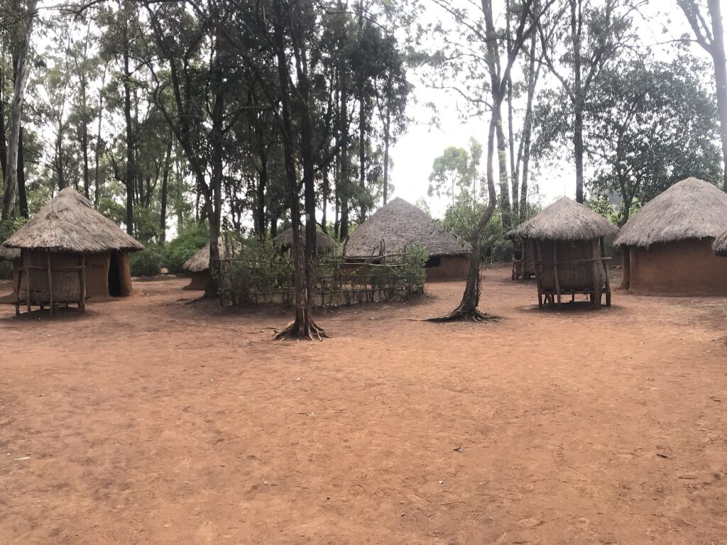
The region surrounding Kisumu is closely associated with the Luo people, one of Kenya’s major ethnic communities. Luo-speaking groups settled around the eastern Lake Victoria basin over several centuries, developing communities whose lives were shaped by fishing, agriculture, livestock keeping and exchange. Dholuo remains widely spoken throughout Kisumu County, alongside Swahili and English, and belongs to the Nilotic language family, reflecting historical connections between populations across parts of eastern Africa.
The cultural geography of the region is inseparable from the lake. Fishing settlements developed along its shores, while agricultural communities occupied land farther inland, and movement between these environments helped sustain markets and social relationships long before the modern road network emerged. The name Kisumu itself preserves something of this commercial history, linking the modern city to an older tradition of exchange even though the railway and subsequent urban development transformed its scale.
One of the region’s distinctive musical traditions centres on the nyatiti, an eight-stringed lyre associated with Luo storytelling and praise singing. Traditionally played by specialist musicians, the instrument accompanies songs that can preserve family histories, celebrate individuals and communicate social commentary. Its significance extends beyond its sound, belonging to an oral tradition in which music carries memory and connects generations through performance rather than written records alone.
These traditions remain part of a changing cultural landscape. Kisumu has become a major urban centre, while the surrounding districts have experienced population growth, changing agricultural practices and the spread of residential development. The roads used by the championship belong to this contemporary region, where older settlement patterns coexist with expanding neighbourhoods and commercial activity.
The Hills Above Kisumu
The Middle Kilometres | From the Lake Basin to Rising Ground
Kisumu’s relationship with altitude is unusual. The city stands beside a vast freshwater lake, yet its waterfront is already more than 1,100 metres above sea level, while the surrounding hills rise several hundred metres higher. The published race profile records an altitude range of approximately 1,150 to 1,528 metres, revealing the elevated setting of a course that might otherwise appear, from its lakeside location, to belong to a lowland landscape.
The region forms part of East Africa’s elevated interior, where tectonic activity, long-term erosion and the development of large lake basins have produced a complex arrangement of highlands and lower ground. North of Kisumu, this terrain has also influenced the city’s modern expansion, as residential development has spread toward previously less densely settled slopes.
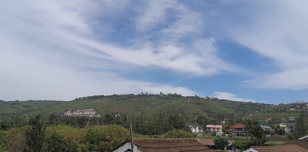
The Riat Hills provide a particularly visible example. Once characterised by rocky terrain, grazing land and scattered homes, parts of the area have been transformed by residential construction and rising land values. Land previously regarded as peripheral to the city has attracted developers and residents seeking larger properties and views across Kisumu and Lake Victoria.
The transformation reflects the geographical constraints on the city’s expansion. Kisumu cannot grow into the lake, while wetlands, transport infrastructure and established land uses limit development in other directions. The higher ground to the north has consequently become an increasingly important area of urban growth, changing the relationship between the city and settlements that were once more distinctly rural.
For much of the championship, the elevation profile shows relatively modest changes in height, allowing the riders to accumulate distance through the wider Kisumu area before the final third introduces more substantial climbing. The late ascents follow roads that connect the city with this changing northern landscape, where natural topography and urban development have become closely intertwined.
The First Late Climb: Toward Kiboswa
Approximately 57 km to go | Kisumu–Kiboswa Road
The first major late-race summit is identified at kilometre 120.8 on the organiser’s interactive map, leaving approximately 57 kilometres of the complete 177.7-kilometre course. The marker lies on Kisumu–Kiboswa Road, north of Kisumu, where the route climbs toward the higher ground around Kiboswa before descending again toward lower terrain.
Kibosh belongs to the northern landscape where Kisumu’s expanding suburbs meet older agricultural and residential communities. The surrounding slopes form part of the transition between the city beside Lake Victoria and the elevated land beyond it, with roads that have long connected hillside settlements to the markets and services of Kisumu.
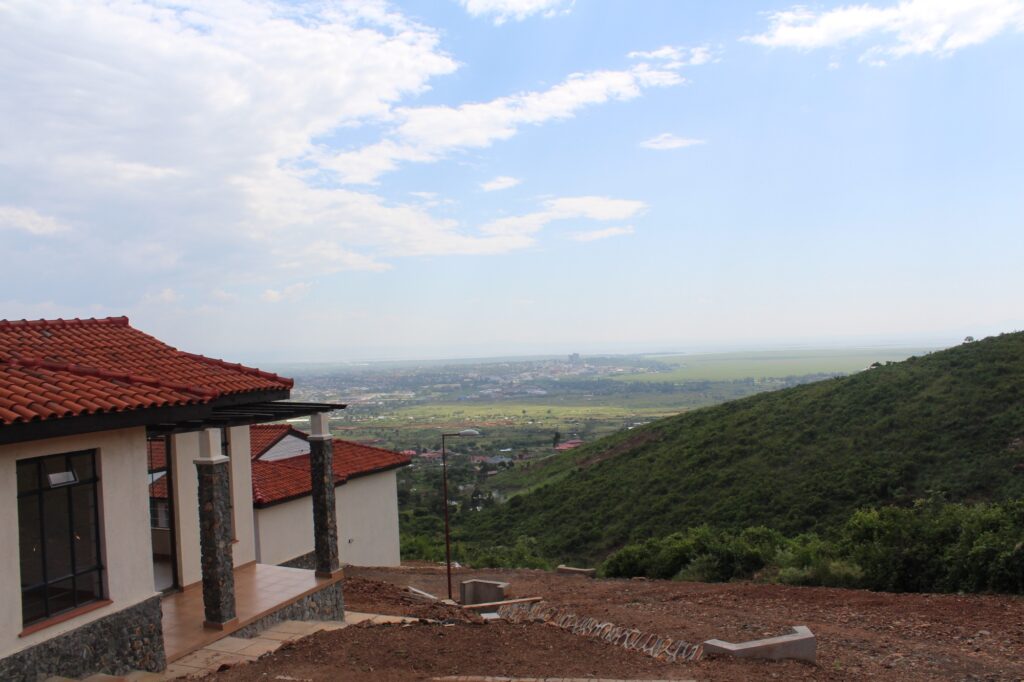
The area’s history is not limited to recent development. Communities have used the higher ground for settlement, grazing and cultivation over generations, but the rapid expansion of the city has changed the economic and residential character of parts of the surrounding hills. Nearby Riat has become increasingly associated with new housing and investment, illustrating how the landscape north of Kisumu is being incorporated into the growing urban area.
For the riders, the road’s significance lies in both its gradient and its position within the race. The summit arrives with approximately 57 kilometres remaining, when accumulated fatigue makes sustained climbing more difficult but enough distance remains for the race to change substantially before the finish.
The course includes a turning movement near Kiboswa before returning toward lower ground, creating a distinct ascent-and-return sequence within the final third. The riders are not climbing an isolated mountain pass but following a road built to connect Kisumu with settlements on higher land, where the gradient reflects the physical terrain that has influenced the city’s growth.
The Second Ascent: A Different Approach to the Highlands
Approximately 24 km to go | The Final Major Summit
The elevation profile identifies another significant summit at approximately kilometre 153.7 of the complete course, leaving about 24 kilometres to the finish. This second ascent follows a different road from the Kisumu–Kiboswa climb, although the available route material does not establish its exact road name.
The two climbs are separated by approximately 33 kilometres, creating a final phase in which the riders ascend toward the northern hills, return to lower terrain and then confront another substantial rise. The interval allows the race to develop between the climbs, but the second ascent arrives close enough to the finish that any separation created there may prove difficult to reverse.
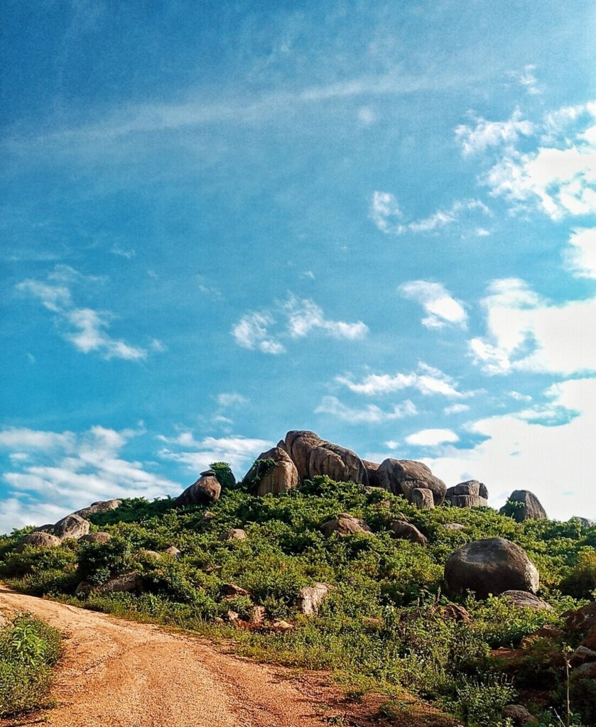
The higher ground north of Kisumu is reached by multiple roads serving different settlements and neighbourhoods, each negotiating the transition between the lake basin and the surrounding hills. Rather than relying on one long mountain ascent, the championship uses this road network to create repeated changes in altitude, contributing to its accumulated climbing total of approximately 1,834 metres.
By the time the riders approach the second summit, several hours of competition have already passed, and the remaining distance is short enough that the final climb could become an important selection point before the return to Kisumu. The final descent and approach bring the race back toward the urban basin, completing the geographical movement that has shaped the latter part of the course.
Back to the Lake: The Finish in Kisumu
0 km | FINISH — Kisumu
The race returns to Kisumu after 175.1 kilometres of competition, completing a course that has moved between the Lake Victoria basin and the hills immediately to its north. The finish brings the riders back to a city whose modern history began with another journey reaching its endpoint, when the Uganda Railway finally arrived at the lakeshore in December 1901.
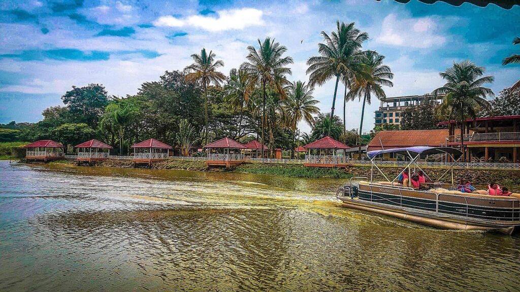
The ceremony involving Florence Preston marked the completion of a line stretching from the Indian Ocean to Lake Victoria, an engineering achievement that also helped consolidate British colonial control across East Africa. Yet the railway’s arrival did not end movement at Kisumu; it changed its direction, as passengers and goods continued across the lake by boat while roads and trading routes connected the new terminus with communities farther inland.
More than a century later, Kisumu remains a place defined by these connections. Its port and railway recall the city’s colonial development, its markets reflect older traditions of exchange, and its expanding roads link the waterfront with settlements on the surrounding hills. The championship uses those same relationships in a different way, temporarily transforming roads normally used by commuters, traders and agricultural communities into the course of a continental race.

There is a final contrast between the two journeys. The railway builders of 1901 were trying to reach the lake, while the cyclists of 2026 begin beside it, climb away into the hills and return to the same city. Both journeys reveal why Kisumu occupies such an important position in western Kenya: Lake Victoria is not an isolated endpoint, but the centre of a network of routes extending outward through the region.
On 25 October, that network becomes a championship course, and the riders return to the place where East Africa’s railway once met the water.