

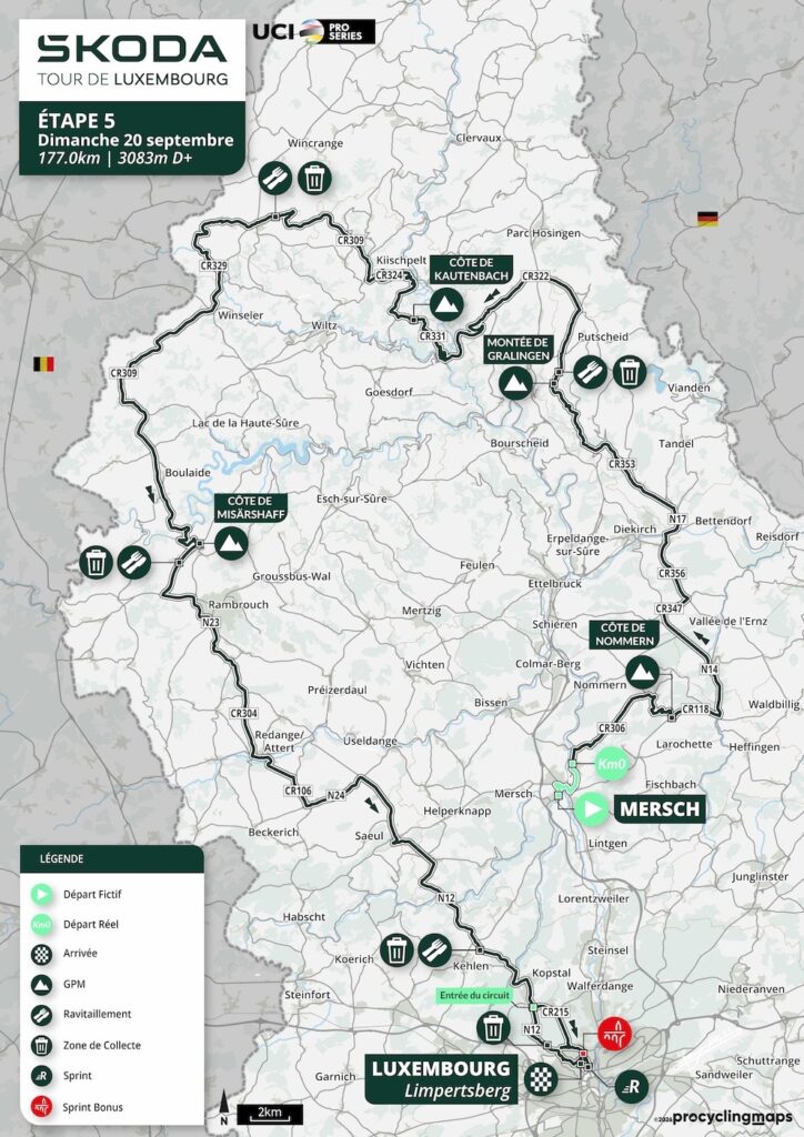
The final stage of the 2026 Tour de Luxembourg begins in the centre of the country and finishes in the capital, but the road between them takes almost the longest possible way around. From Mersch, the race climbs immediately into the sandstone country around Nommern and Larochette, turns north through Brandenbourg, Gralingen and Kautenbach, then crosses the high western plateau towards Boulaide, Rambrouch and the Attert valley. Only after more than 140 kilometres does the route begin to close on Luxembourg City, where the final urban circuit approaches the finish on Avenue Victor Hugo in Limpertsberg.
At 177 kilometres and 3,083 metres of climbing, Stage 5 is far from ceremonial. Four categorised ascents appear before the run towards the capital: Côte de Nommern at -168.1 km, Montée de Gralingen at -140.1 km, Côte de Kautenbach at -118.6 km and Côte de Misärshaff at -72.2 km. Much of the northern and western portion remains above 450 metres, and the final circuit still asks the riders to cross rolling ground between Bridel, Rollingergrund and Limpertsberg before the Tour can finally settle.

The route also closes several stories opened earlier in the week. Mersch appeared near the end of Stage 1, when the race used the Alzette valley on its return towards Luxembourg City. Larochette was introduced through the castle above the White Ernz. The final stage passes both places again, but with no need to repeat the earlier material. Mersch now opens onto its Roman past, while Larochette becomes a textile town rather than a castle town.
Beyond them, Stage 5 reaches new ground. Nommern carries the sandstone geology of the Mëllerdall into a landscape of Roman refuge sites and ancient charcoal platforms. Brandenbourg watches an old route between the Sûre and the Ardennes from a ruin that has never been heavily reconstructed. Kautenbach grew where railway engineers had to work with some of the most difficult valley terrain in the country. Farther west, the stage approaches Luxembourg’s slate country before entering the former railway landscape around Redange and Noerdange.
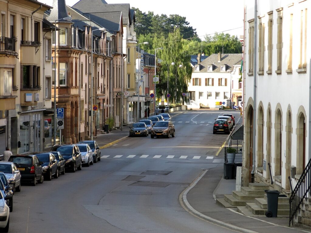
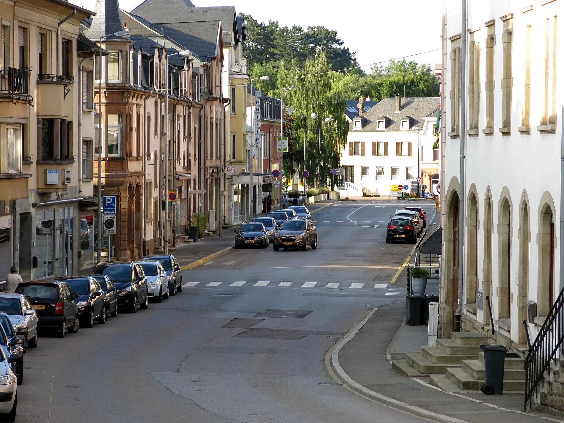
The heart of Mersch, looking north along Rue Grande-Duchesse Charlotte through the town centre. Photo by Jwh, licensed under CC BY-SA 3.0 Luxembourg, via Wikimedia Commons
The Tour then returns to Luxembourg City, but not to the fortress plateau or Fëschmaart explored on Stage 1. The final kilometres belong to a different city: the former industrial valley of Rollingergrund, the Boch family’s ceramics and the post-fortress district of Limpertsberg, where rose nurseries once exported millions of plants around Europe.
Five stages after the race left the capital, it comes back through a part of Luxembourg that only fully emerged after the old fortress began to disappear.
START · Mersch, Beneath the Modern Town Lies a Roman Estate
The neutral start leaves Place Saint-Michel in Mersch, with the official race beginning 2.8 kilometres later at Beringen.
Mersch already appeared on Stage 1, so there is little reason to return to the castle or repeat its role near the geographical centre of the Grand Duchy. The final stage begins instead with a much older layer.
A substantial Roman villa once occupied the site known as Mies on the edge of town. Excavations revealed a residence of remarkable scale, approximately 200 metres long and 60 metres wide, with a preserved hypocaust heating system and a rectangular water basin around 75 metres in length.
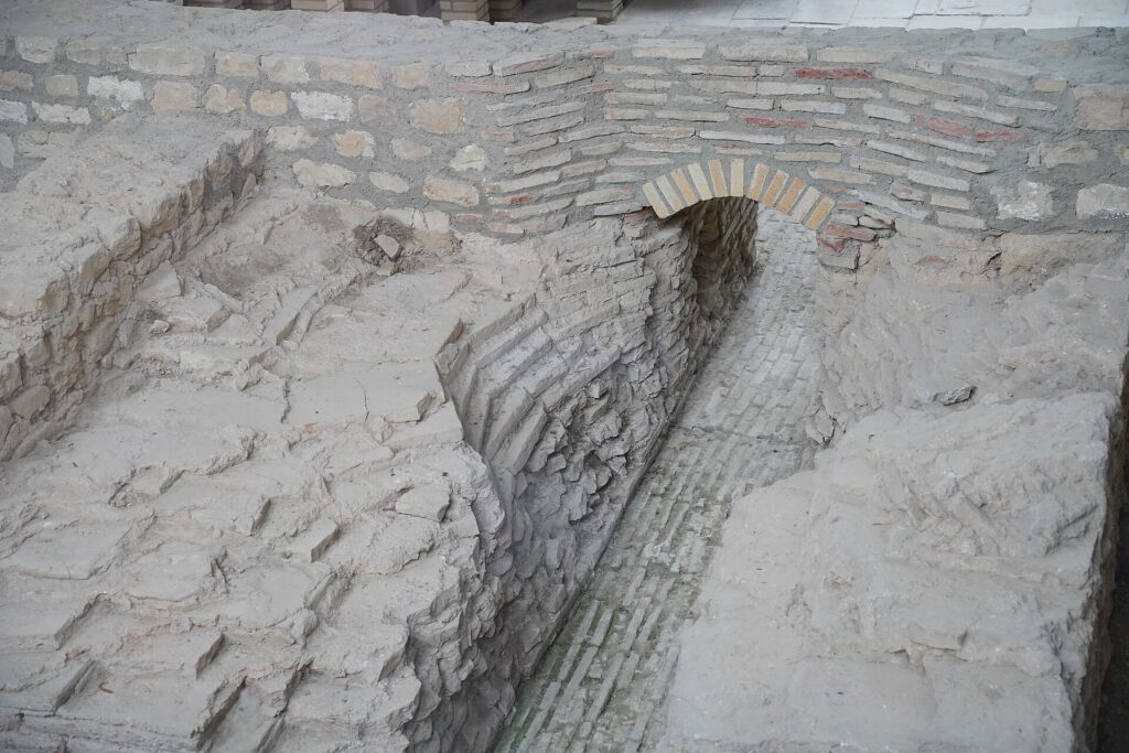
The excavated remains of Mersch’s Roman villa, part of a vast Gallo-Roman estate that once extended across the surrounding area. Photo by TimeTravelRome, licensed under CC BY 2.0, via Wikimedia Commons
The size of the complex suggests an estate far beyond a modest farmhouse. Roman villas combined elite residence with agriculture, storage and land management, tying the countryside to broader commercial and administrative networks. Mersch’s position near several valleys would have made movement across the surrounding territory comparatively easy.
The town’s name appears much later in early medieval sources as Marisca, generally associated with marshy ground. That description fits a settlement formed around low country where rivers and drainage shaped the usable land.
The race leaves that landscape almost immediately. Beringen marks kilometre zero, and within nine kilometres the first categorised climb has carried the peloton almost two hundred metres higher.
-168.1 km · Côte de Nommern and the Edge of the Sandstone Country
The Côte de Nommern reaches its summit with 168.1 kilometres remaining, at just over 417 metres.
The climb enters terrain closely related to the Mëllerdall explored on Stage 2, but this is its northwestern edge rather than the deeper sandstone world around Berdorf and Echternach. Around Nommern, Luxembourg sandstone appears in isolated blocks, narrow clefts and abrupt escarpments above softer surrounding ground.
The Noumerleeën form one of the most concentrated examples. Erosion has exposed contrasting layers of sandstone, narrow fissures and shallow caves, while some surfaces show honeycomb weathering resembling the cells of a beehive.
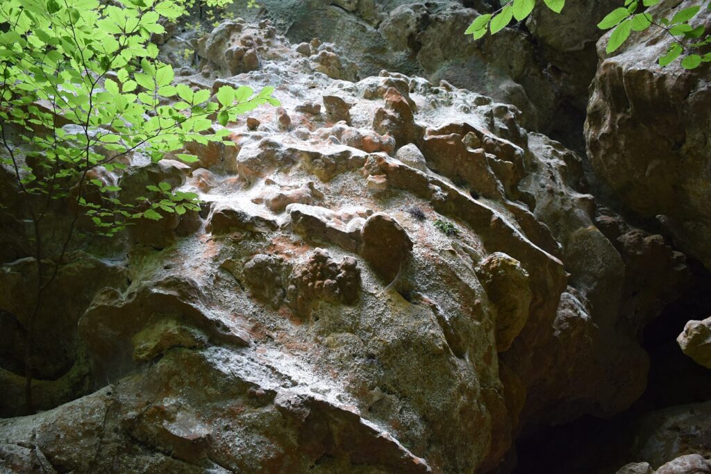
The weathered sandstone formations of Noumerleeën near Nommern, a striking miniature of the rocky landscape found across Luxembourg’s Little Switzerland. Photo by Zinneke, licensed under CC BY-SA 3.0, via Wikimedia Commons
Human use sits directly within that geology. On a rocky height are traces of the Alebuerg, a refuge site associated with the Roman period. Nearby level platforms preserve evidence of former charcoal burning, where wood was slowly converted into fuel for metalworking and other industries.
Another local formation, known as the Champignon, survives as an isolated block whose harder upper layers resisted erosion longer than the softer rock below, producing the shape of a vast stone mushroom.
Stage 2 showed the Mëllerdall from inside its ravines. Here the route meets the same geological system at its outer edge, where sandstone rises suddenly from a gentler agricultural landscape.
Only a couple of kilometres later, the race returns to Larochette.
-166.1 km · Larochette Returns, This Time Through Its Textile History
With 166.1 kilometres remaining, the peloton enters Larochette for the second time in this Tour.
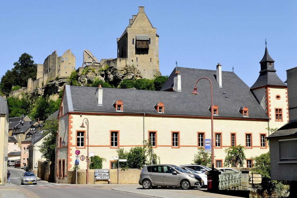
De Roebé Castle in Larochette, with the ruins of medieval Larochette Castle rising on the rocky ridge behind it. Photo by LBM1948, licensed under CC BY-SA 4.0, via Wikimedia Commons
Stage 1 used the castle above the White Ernz to explain the medieval structure of Luxembourg’s feudal landscape. The final stage can leave the castle on its rock and turn to the town beneath it.
Larochette developed a substantial textile industry, drawing on weaving traditions that reached back into the medieval period. Local accounts preserve privileges granted to its weavers under John the Blind, King of Bohemia and Count of Luxembourg, allowing them to operate more looms than craftsmen in many surrounding settlements.
Early production was domestic. Wool from Luxembourg, the Éislek and neighbouring regions was washed, treated, combed and woven in family workshops. Cleaning could involve substances almost unimaginable in modern textile production, including ammonia derived from urine, while finished cloth had to be washed again and stretched on frames to dry.
Over time, the industry moved from craft towards mechanised production. Water from the White Ernz and Scheerbach powered machinery, factories appeared along the streams and imported wool increasingly supplemented local supplies. Steam power and mechanical looms expanded output during the 19th century.
Larochette’s textile industry reached one of its strongest periods between roughly 1870 and 1895, aided by access to the markets of the German Zollverein. Factories became part of the townscape for generations before changing markets and the wider decline of European textile manufacturing gradually brought production to an end.
The final factories closed during the later 20th century, and a textile museum now preserves looms, sewing machines and equipment from that industrial period.
The Tour therefore passes Larochette again without repeating its earlier story. Above the road remains the medieval fortress of Stage 1; beside the river lies the manufacturing town that developed centuries later.
-146.7 km · Brandenbourg, A Castle Above an Old Crossroads
With 146.7 kilometres remaining, the route reaches Brandenbourg, where the ruins of a medieval castle rise above the valley of the Blees.
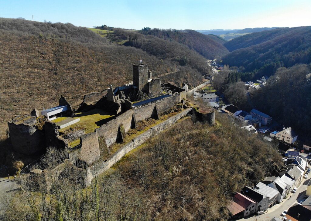
An aerial view of the ruins of medieval Brandenbourg Castle, standing above the village and wooded valleys of northern Luxembourg. Photo by Wikitestaccountlogin, licensed under CC BY-SA 4.0, via Wikimedia Commons
The site is less monumental than Vianden or Bourscheid, but the logic of its position is especially clear. The castle occupies a rocky spur around 329 metres above sea level, while the valley below lies close to 260 metres. More important than the absolute height is the junction beneath it.
Roads here linked the Sûre valley with the Ardennes and connected routes towards the Bourscheid and Vianden regions. Whoever controlled the high ground could observe movement through terrain where valleys offered the most practical corridors between settlements.
Archaeological work suggests a wooden fortification may already have existed during the 9th or 10th century. Stone construction followed in the early 13th century, with expansion during the 14th century and stronger defences added as artillery changed the requirements of warfare.
The castle remained partly inhabited until the middle of the 18th century before falling into ruin.
Its preservation today is particularly valuable because the site has not been comprehensively reconstructed. Stabilisation has focused largely on protecting the surviving medieval fabric, leaving Brandenbourg rougher and more fragmentary than heavily restored castles elsewhere in Luxembourg.
Walls end where collapse left them, towers expose their interiors and the relationship between ruin and rock remains easy to read.
The road leaves the Blees valley and climbs towards Gralingen.
-140.1 km · Montée de Gralingen and the High Ground Above the Valleys
The Montée de Gralingen reaches its summit at -140.1 kilometres, just below 490 metres.
Only 37 kilometres have passed, but the stage has already moved repeatedly between lower river country and elevated plateau. From Gralingen, the route continues through Merscheid, Wuelessen, Holzthum and Consthum, remaining close to or above 500 metres for long stretches.
There is no single famous summit here. The character of the terrain lies in accumulation. The Tour is crossing the upper surface of the Ardennes, where the road can remain open and rolling for kilometres before dropping suddenly into one of the deep valleys that cut through the plateau.
That drop comes at Kautenbach.
-123.5 km · Kautenbach, Where the Railway Had to Follow the River
With 123.5 kilometres remaining, the riders descend to Kautenbach, losing more than two hundred metres from the plateau.
The village lies in a constricted valley where the Wiltz meets the Clerve, surrounded by wooded slopes that leave little level ground for roads, buildings or railways. That geography became decisive during the railway age.
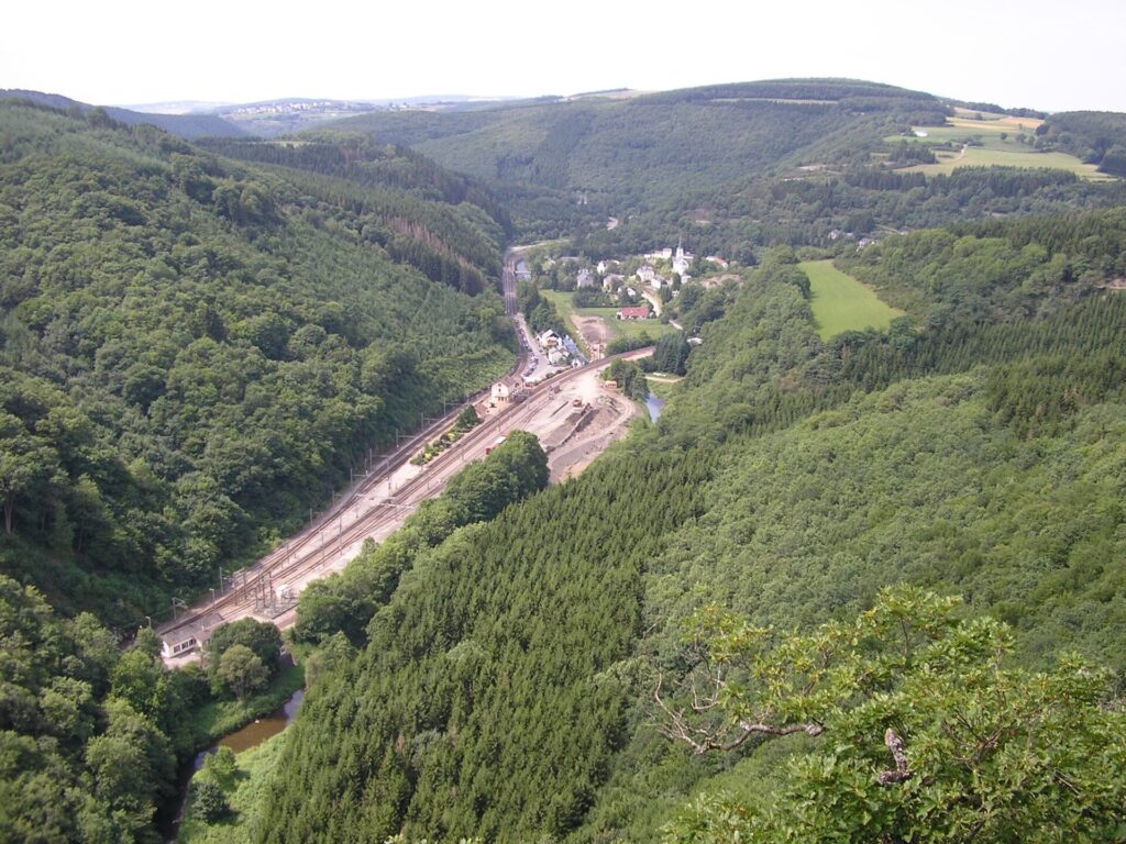
Kautenbach nestled in the wooded Wiltz valley, viewed from the Hockslee lookout above the village and railway station. Photo by Webwalking, licensed under CC BY-SA 3.0, via Wikimedia Commons
Kautenbach developed into an important junction on the main line running north from Luxembourg City. A branch towards Wiltz separated here, using the valley system to reach a town that would have been difficult to serve by a more direct route.
Railways make the shape of a landscape particularly visible because trains tolerate steep gradients poorly. Engineers had to follow river corridors, bend around hills and gain elevation gradually. Kautenbach mattered because the valleys themselves supplied a workable route through the northern Ardennes.
The settlement also acquired a curious viewpoint above the tracks. In 1913, the Bomm was created high above Kautenbach, originally involving a spherical structure mounted above the trees. It was destroyed during both world wars, rebuilt afterward, disappeared again through deterioration and was reconstructed once more in 2014.
The viewpoint’s repeated disappearance and return is a modest local story, but it fits a village whose entire development depended on adapting to difficult terrain.
The peloton has no option to follow the valley for long. The road climbs directly away from it.
-118.6 km · Côte de Kautenbach, Back Onto the Plateau
The Côte de Kautenbach reaches its summit with 118.6 kilometres remaining.
Only a few kilometres separate the valley floor from an altitude above 460 metres. Stage 3 already established the basic river-to-plateau rhythm of the Éislek, so there is little need to explain it again. On the final day, the interest lies in where the climb leads.
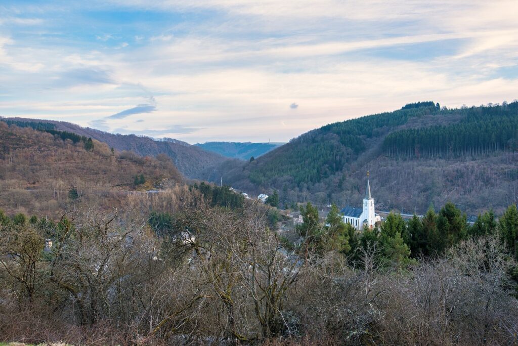
Kautenbach nestled in the wooded Wiltz valley, with the road of the Côte de Kautenbach visible climbing steeply away from the village. Photo by Tristan Schmurr, licensed under CC BY-SA 2.0, via Wikimedia Commons
Once the summit is reached, the route passes Wilwerwiltz and begins a long progression west across the high country.
The deep railway valley closes behind the race and the landscape gradually opens.
-97 km to -72.2 km · Across the Western Plateau
The middle of the stage crosses Oberwampach, Niederwampach, Doncols, Sonlez, Tarchamps, Watrange, Harlange and Boulaide, moving through open plateau country close to the Belgian border.
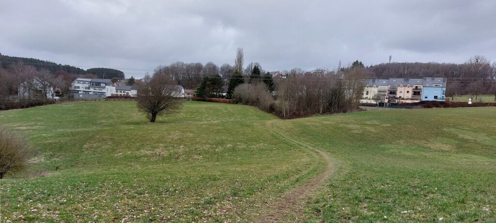
The southeastern side of Doncols, a rural village in Luxembourg’s Éislek region, seen from behind Duerfstrooss. Photo by Hejnjahns, licensed under CC BY-SA 4.0, via Wikimedia Commons
The road remains high, frequently above 450 metres, while forests alternate with pasture and agricultural land. The terrain is quieter than Kautenbach, but there is still little truly level riding because the route continues to cross small drainage systems and shallow valleys.
Around Boulaide, the Tour reaches the broader Upper Sûre country encountered on Stage 3. There is no reason to repeat the reservoir or dam. A different feature stands above this side of the valley: the Houfëls, a rocky viewpoint around 457 metres above sea level overlooking the Sûre landscape.
A pavilion was built there in 1934, and the site later acquired two pieces of military hardware, a German anti-tank gun and an American 155 mm artillery piece, reminders that this western edge of Luxembourg also belonged to the landscape of the Battle of the Bulge.
The race itself remains largely on the plateau before dropping briefly towards Misärsbréck and climbing once more.
-72.2 km · Côte de Misärshaff and Luxembourg’s Slate Country
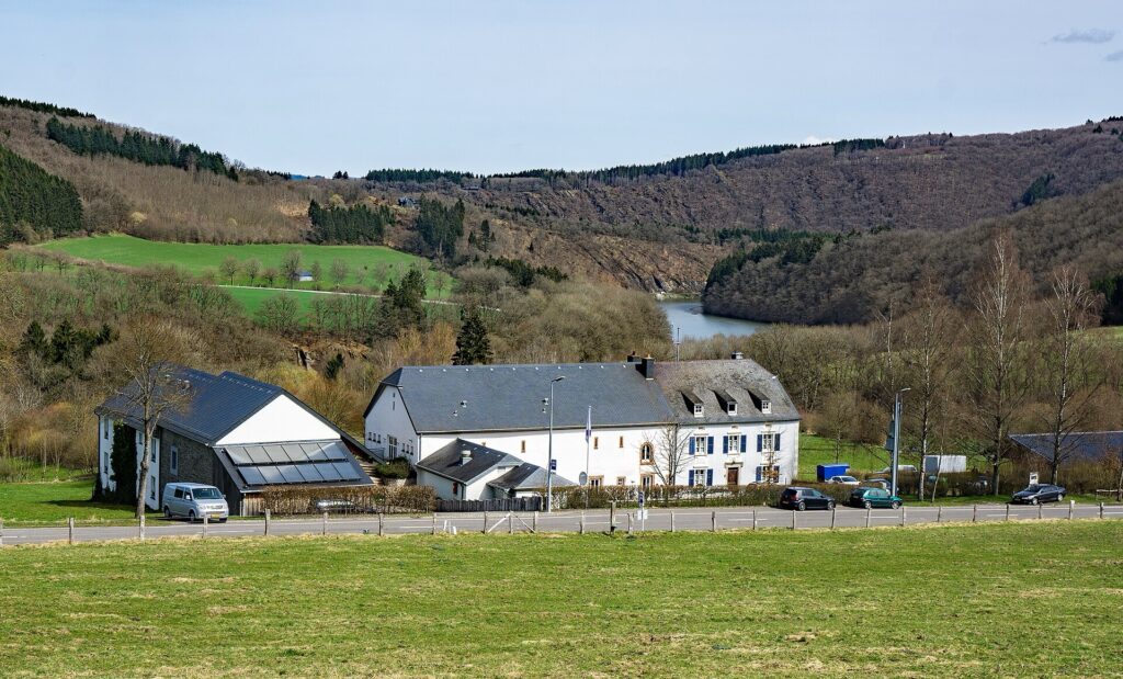
Misärshaff, a traditional Luxembourgish farm complex near Arsdorf now used as a Scout camp and youth training centre. Photo by MMFE, licensed under CC BY-SA 4.0, via Wikimedia Commons
The fourth and final categorised climb, the Côte de Misärshaff, reaches its summit with 72.2 kilometres remaining, at roughly 462 metres.
From there the route continues through Koetschette and Rambrouch, remaining above 500 metres on parts of the approach.
This is the western edge of Luxembourg’s old slate country.
The most important surviving industrial site lies at Haut-Martelange, within the Rambrouch area, where slate was quarried and mined from around 1790 until 1986. The stone was used primarily for roofing and other building purposes, and generations of workers spent their lives cutting, splitting and transporting it.
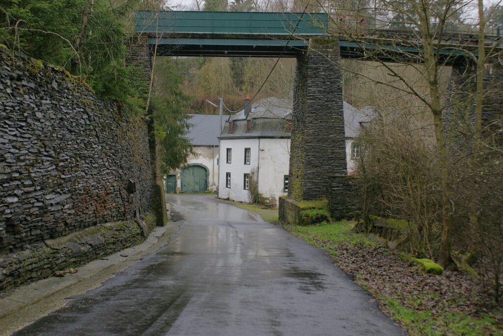
A view across Haut-Martelange and its old industrial quarter, shaped by the village’s historic slate-mining industry. Photo by ThiDo73, licensed under CC BY-SA 3.0, via Wikimedia Commons
Unlike the open iron workings of the Minett, slate extraction could lead deep underground. Galleries descended into cold, damp rock where blocks had to be separated along natural cleavage planes before being hauled to the surface and split into thin sheets by skilled workers.
The surviving industrial landscape includes workshops, machinery, rails and underground workings extending tens of metres below ground. Former employees have played an important role in preserving the knowledge of how the material was extracted and worked.
The Tour does not pass through the mine complex itself, and there is no need to pretend that it does. The road crosses the wider Rambrouch landscape to which the slate industry belonged, close enough for the history to explain another economic layer of western Luxembourg without turning it into a roadside attraction.
Beyond Rambrouch, the road begins losing altitude more consistently.
-56.9 km · Redange-sur-Attert and the Administrative West
With 56.9 kilometres remaining, the race reaches Redange-sur-Attert.
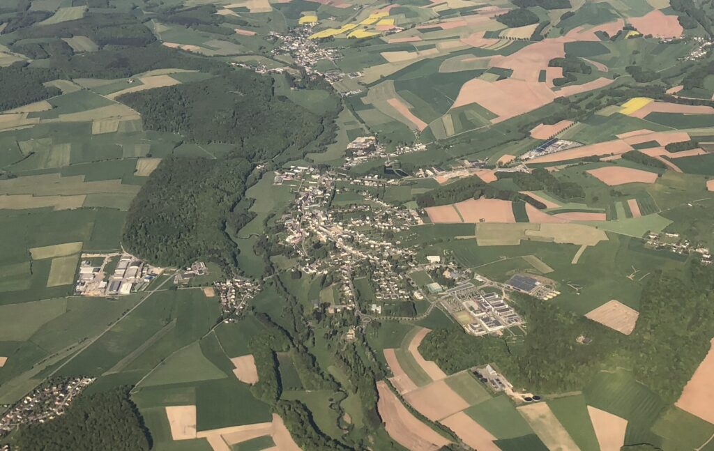
An aerial view of Redange-sur-Attert, known as Réiden in Luxembourgish, surrounded by the rolling fields of western Luxembourg. Photo by Bdx, licensed under CC BY-SA 4.0, via Wikimedia Commons
The town became an administrative centre relatively late. Under French rule after 1795, the territory was reorganised repeatedly within the Département des Forêts, and the regional seat initially lay elsewhere. In 1841, Redange replaced Ospern as the seat of the canton.
Its development therefore belongs less to dramatic fortifications than to the gradual construction of modern administration and transport across western Luxembourg.
The Attert valley also became important during the railway age. The Prince Henri or Attert line once connected Pétange with Ettelbruck, serving communities across the west and linking agricultural districts with the country’s mining and industrial regions.
The stage now enters terrain strongly associated with those former railways.
-53.9 km to -49.6 km · Niederpallen and Noerdange, Railways After the Trains
At 53.9 kilometres remaining, the peloton reaches Niederpallen, followed soon afterward by Noerdange.
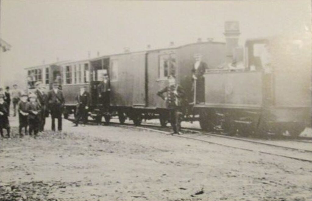
A historic view of the Jhangeli narrow-gauge railway on the Noerdange–Martelange line through Redange Canton in the 1910s. Photographer unknown, public domain, via Wikimedia Commons
Together they preserve an unusually concentrated memory of Luxembourg’s regional railway network.
The standard-gauge Attert line served Noerdange for more than seventy years, connecting Pétange in the south with Ettelbruck in the north. It carried passengers and freight through country that otherwise depended heavily on roads and provided western communities with access to the industrial south. The final train ran in 1969.
Noerdange also became the starting point of a narrower local railway towards Martelange, remembered as the Jhangeli. That line penetrated farther into the western countryside and served communities connected with the slate region before closing in 1953.
The former railway buildings now preserve both histories. The old station at Noerdange has become a museum devoted to regional rail transport, while Niederpallen retains exhibits associated with the Jhangeli.
Sections of the disused railway corridor have since been adapted for cycling.
That reuse gives the landscape a particularly neat continuity. Infrastructure once created to move people and goods efficiently through western Luxembourg survives partly because it remains useful for another form of movement.
The Tour crosses that old railway country before continuing through Saeul and Tuntange towards the capital.
-42.8 km · Tuntange and the Edge of the Seven Castles Country
With 42.8 kilometres remaining, the race reaches Tuntange.
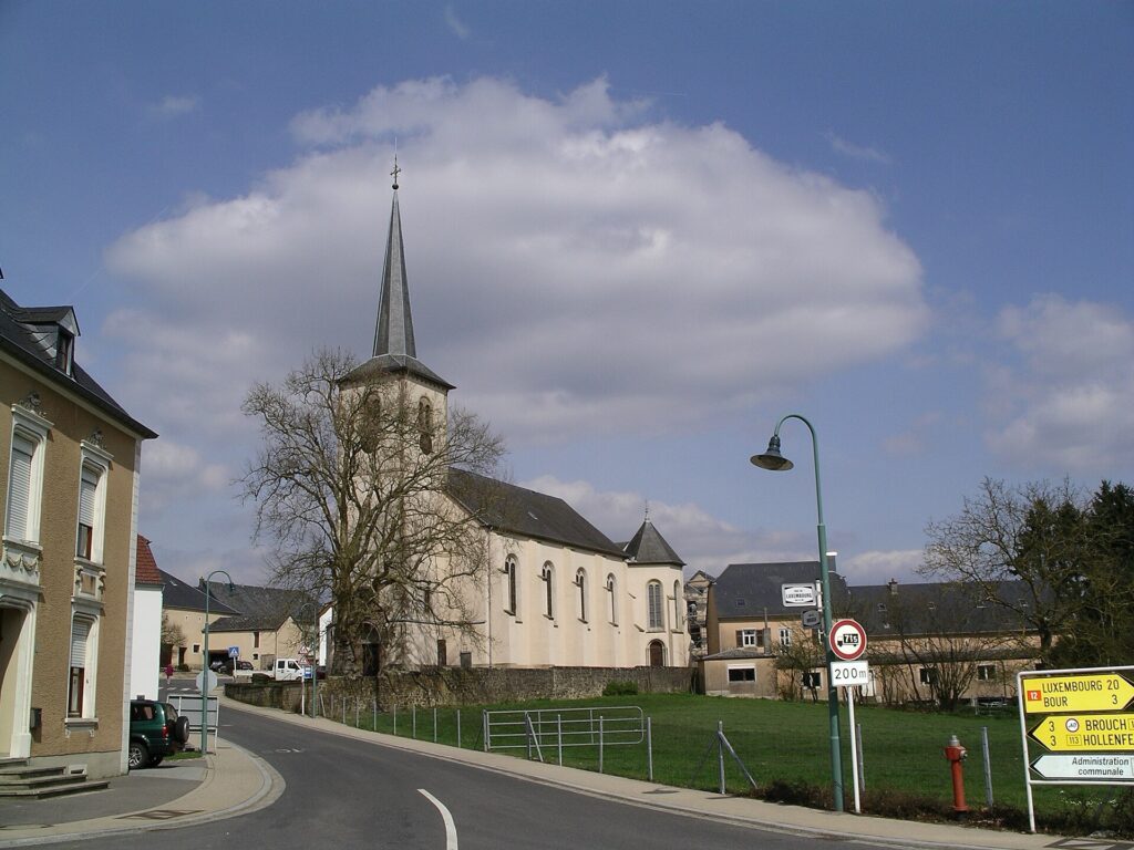
The Church of Saints Peter and Paul and its remarkable plane tree in Tuntange, now part of Luxembourg’s Helperknapp commune. Photo by Meffo, licensed under CC BY-SA 3.0, via Wikimedia Commons
Stage 1 already introduced nearby Hollenfels and the Valley of the Seven Castles, so there is little value in repeating the castles themselves. Tuntange belonged historically to the same network of lordships and later became the administrative centre of a commune that included Hollenfels, Ansembourg and Marienthal.
Its more recent history lies in the changing structure of local government. In 2018, the former communes of Tuntange and Boevange-sur-Attert merged to form Helperknapp, part of a broader pattern of municipal consolidation in a country where population growth has placed increasing demands on small local administrations.
The race does not enter the castle valley this time. It continues through Bour, Dondel and Quatre-Vents towards Kopstal, and the rural landscape begins gradually giving way to the outer edge of Luxembourg City.
-33.2 km · Kopstal, Water and Basketry in the Mamer Valley
With 33.2 kilometres remaining, the riders pass Kopstal, set in the valley of the Mamer.
The surrounding terrain is deeply wooded, with alluvial forest and rock formations squeezed around the river. It feels surprisingly enclosed for a place so close to the capital.
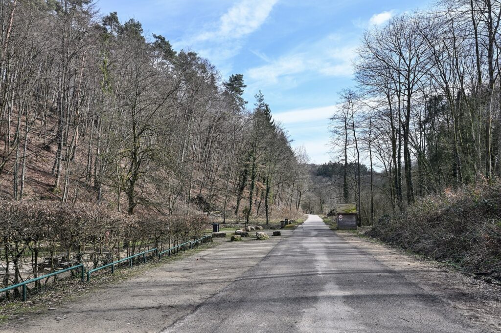
A quiet country road winding through the valley in the commune of Mamer, Luxembourg. Photo by Cayambe, licensed under CC BY-SA 4.0, via Wikimedia Commons
Water shaped the village in practical ways. Numerous springs within the commune contribute to the drinking-water supply of Luxembourg City, while the damp valley also supported an important tradition of basket weaving.
Willow grew well in the local conditions, and osier beds supplied the flexible rods used by basket makers. By the early 20th century, the craft had become sufficiently important to remain preserved in the symbolism and memory of the commune.
The Tour therefore approaches the modern capital through a valley that once supplied it with both water and everyday manufactured goods.
From Kopstal, the road rises towards Bridel, and with 29.9 kilometres remaining the race enters the finishing circuit.
FINAL 30 KM · Luxembourg Returns Through a Different City
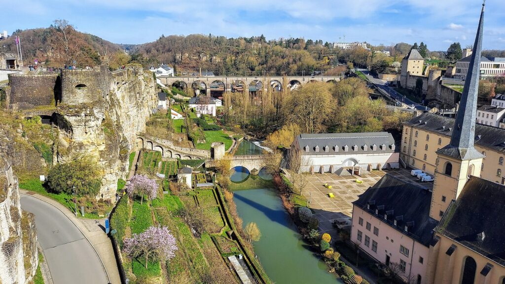
A panoramic view from Luxembourg City’s historic upper fortifications across the Grund, the picturesque lower city nestled in the Alzette Valley. Photo by P. Hughes, licensed under CC BY-SA 4.0, via Wikimedia Commons
The race re-enters Luxembourg City from the northwest.
Stage 1 began at Knuedler and finished at Fëschmaart, using the Bock, the fortress and the old city to explain the origins of Luxembourg itself. Five days later, the route reaches the capital from an entirely different direction and through a different urban history.
The road enters Rollingergrund, a lower valley shaped less by fortifications than by water, gardens and manufacturing. Springs, washhouses and workshops occupied ground outside the old military core, while the valley offered enough space for industries that would have been difficult to accommodate on the crowded fortress plateau.
The riders descend into that landscape before climbing towards Limpertsberg.
-26 km · Rollingergrund, Washerwomen and the Boch Ceramics Factory
Around 26 kilometres remaining, the race enters the Rollingergrund area.
Long before the district became part of modern Luxembourg City, it was known for market gardens, springs and small-scale agriculture. The seven springs of Septfontaines supported one of the most ordinary forms of urban labour.
In 1707, Luxembourg City constructed covered washing basins here, and generations of washerwomen brought clothes from the capital to be cleaned beside the springs.
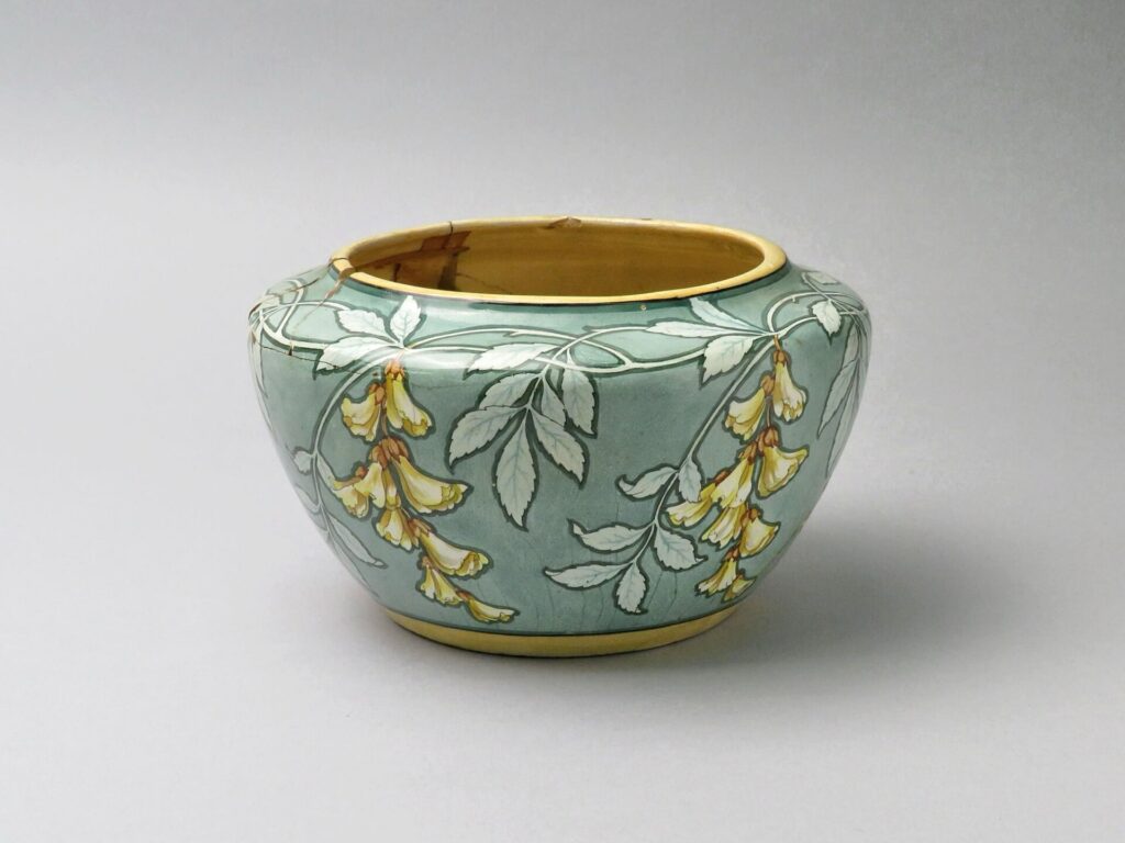
An Art Nouveau ceramic vase produced by Villeroy & Boch between 1895 and 1925, featuring floral decoration by Luxembourgish artist Antoine Jans. Photograph by Noémie Montignie, released under CC0 1.0, via Wikimedia Commons
In 1766, the Boch family received permission from the Austrian authorities to establish a ceramic manufactory nearby. The arrangement included an important condition: local residents were still to retain access to the water for washing and drying laundry.
Production began soon afterward, and the factory became an important stage in the history of the company later known as Villeroy & Boch. In 1767, Empress Maria Theresa granted it the status of an Imperial and Royal Manufactory.
The family’s success also produced Septfontaines Castle, completed nearby during the 1780s. Manufacturing, aristocratic residence and public washhouses therefore developed within the same small valley, all dependent in different ways on water.
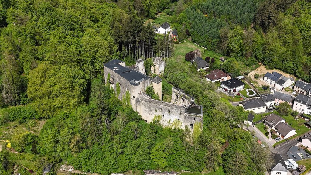
An aerial view of Septfontaines Castle in Habscht. Photo by GilPe, licensed under CC BY-SA 4.0, via Wikimedia Commons
The ceramic works survived revolutions, wars and technological change for more than two centuries. Manufacturing at the Luxembourg site finally ended in 2010.
The race climbs out of Rollingergrund towards a district whose development only became possible after Luxembourg ceased to function as a fortress city.
-24.7 km · Pabeierbierg and the Climb Toward Limpertsberg
The bonus sprint at Pabeierbierg comes with 24.7 kilometres remaining, shortly before the first passage across the finish line on Avenue Victor Hugo at -23.5 kilometres.
The road is climbing away from the Rollingergrund valley towards the higher residential districts of the capital. The elevation gain is modest compared with Kautenbach or Misärshaff, but late in a 177-kilometre stage it forms part of a circuit that repeatedly moves between lower valleys and the plateau around Limpertsberg and Bridel.
The wider area preserves several local industrial and topographical names from the period before modern urban growth absorbed many smaller districts into the city.
At the top, the race reaches a neighbourhood that developed because the military logic of Luxembourg changed completely in the 19th century.
-23.5 km · Limpertsberg, the District Built After the Fortress
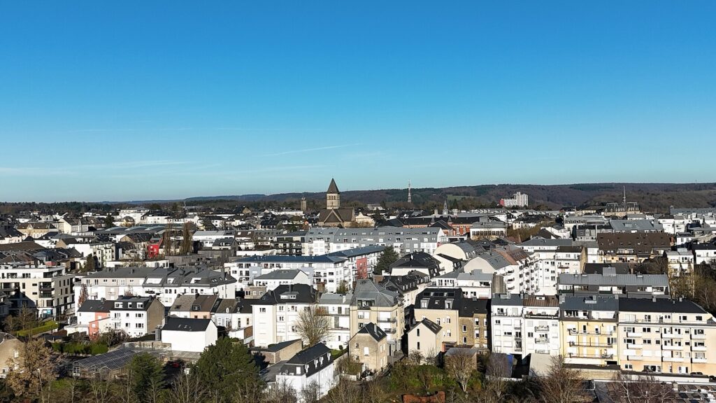
An aerial view across Limpertsberg, one of Luxembourg City’s historic residential districts. Photo by GilPe, licensed under CC BY-SA 4.0, via Wikimedia Commons
At 23.5 kilometres remaining, the riders cross Avenue Victor Hugo in Limpertsberg for the first time.
For much of Luxembourg City’s military history, this area could not develop as a normal suburb. The land lay close to the fortress and formed part of the glacis, where military engineers valued open fields of fire more than houses, workshops or gardens.
Everything changed after the Treaty of London in 1867, when Luxembourg’s neutrality was guaranteed and the fortress was ordered to be dismantled.
Land previously restricted for strategic reasons became available for civilian development. Streets, schools, residences and gardens gradually spread across the former military fringe, and Limpertsberg became one of the city’s principal new districts.
Its history therefore begins at the point where the fortress story from Stage 1 starts to end.
One activity became particularly successful on the newly available ground.
Limpertsberg · When Luxembourg Became a Country of Roses
In 1855, gardeners Jean Soupert and Pierre Notting established a rose nursery in Limpertsberg.
The district offered the space needed for nurseries to expand close to the city. Soupert and Notting developed new varieties, won international prizes and attracted customers far beyond Luxembourg.
Other breeders followed, including the Ketten brothers and Charles Gemen. Limpertsberg became one of Europe’s notable centres of rose cultivation and breeding.
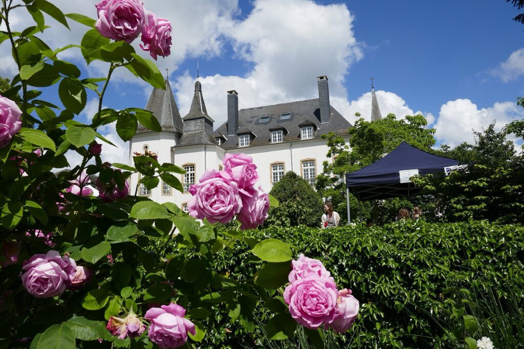
‘La Noblesse’, a historic Luxembourg rose created by Soupert & Notting in 1856, flowering in the rose garden of Munsbach Castle. Photo by Wilrooij, licensed under CC BY-SA 4.0, via Wikimedia Commons
By the beginning of the 20th century, Luxembourgish growers had created more than 260 new varieties, while exports reached remarkable levels. At the industry’s height, around ten million rose plants a year were being shipped internationally to private gardens, estates and royal courts.
The First World War disrupted the business, while urban development gradually consumed the nursery land. Houses and streets replaced growing fields as Limpertsberg became increasingly residential.
The roses nevertheless remained part of the district’s identity. Street names, gardens and local memory still preserve the breeders who once made Luxembourg internationally known for rose cultivation.
The finish of the Tour now sits inside that post-fortress landscape.
-17.2 km · Biergerkräiz and the High Road Above the Capital
After the first passage across the finish line, the course leaves Limpertsberg and returns towards the higher roads around Biergerkräiz, reached with 17.2 kilometres remaining.
The circuit does not remain inside the dense city. It moves back towards Bridel before descending again towards Luxembourg.
That repeated change of elevation is enough to keep the finale selective. The riders are no longer crossing the high western plateau or escaping from deep Ardennes valleys, but the capital itself is still built across distinct levels.
The return through Rollingergrund brings the race lower again before the road climbs back towards Limpertsberg.
FINAL LAP · Back Through Rollingergrund and Toward Limpertsberg
The final circuit repeats the northwestern edge of Luxembourg City.
This time the meaning of the road is already established. Rollingergrund lies below as the former valley of springs, washhouses and ceramic production. Limpertsberg rises above as the district that developed once the military restrictions around the fortress disappeared.
At -5.4 kilometres, Biergerkräiz is reached for the final time. From there, the course turns back towards Luxembourg City, drops into the lower ground and begins the last rise towards Avenue Victor Hugo.
After more than 170 kilometres and over 3,000 metres of climbing, the final difficulty is no longer historical or geographical in the abstract. It is simply the road the riders still have to climb before the Tour ends.
FINISH · Luxembourg-Limpertsberg, Beyond the Old Fortress
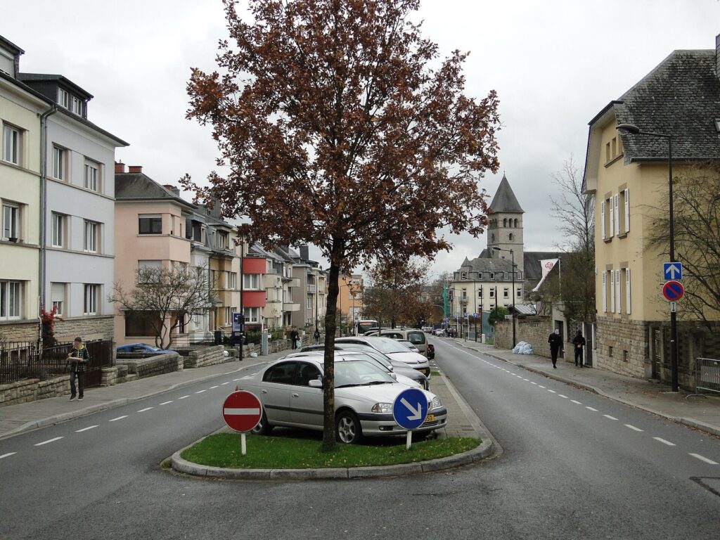
Avenue Victor Hugo running south through Luxembourg City’s Limpertsberg district. Photo by GilPe, licensed under CC BY-SA 4.0, via Wikimedia Commons
The 2026 Tour de Luxembourg finishes on Avenue Victor Hugo in Limpertsberg after 177 kilometres on the final day.
Stage 5 began at Mersch, a place already visited earlier in the Tour but now seen through the remains of a large Roman estate rather than its medieval castle. Nommern carried the race into sandstone country, where geology preserved both a Roman refuge site and evidence of former charcoal production. Larochette returned for a second passage and revealed the textile industry that once filled the town beneath the castle introduced on Stage 1.
Farther north, Brandenbourg watched an old crossroads from its ruined fortress, while Kautenbach showed how railway engineers had to work with the narrow valleys of the Ardennes rather than against them. The western plateau led the race towards Boulaide and the slate country around Rambrouch before the road descended into the former railway landscape of Redange and Noerdange.
The final thirty kilometres returned the Tour to Luxembourg City without repeating the old-city narrative with which the race began.
Instead of the Bock and medieval fortress, the approach used Rollingergrund, where washerwomen worked beside the seven springs and the Boch family established the ceramic manufactory that eventually became part of Villeroy & Boch. From that valley, the road climbed towards a district whose growth depended on the disappearance of the military restrictions that had shaped Luxembourg for centuries.
Limpertsberg spread across former strategic ground after 1867. Rose breeders filled parts of that newly available land with nurseries, created hundreds of varieties and exported millions of plants across Europe and beyond before urban development eventually replaced the growing fields.
The Tour began five days earlier inside the old fortress city. It ends in a neighbourhood that developed because the fortress no longer controlled the city’s future.
The final riders reach Avenue Victor Hugo in Limpertsberg, on ground once kept open for military reasons and later transformed by streets, gardens and rose nurseries.
That is where the 2026 Tour de Luxembourg finishes.



