

The Giro del Veneto crosses a region whose prosperity has always depended on movement. Rivers descend from the Alps towards the Adriatic, Roman roads established corridors that remained important for centuries, medieval cities grew around trade and agriculture, and the Venetian Republic later extended its influence westward across a mainland territory very different from the lagoon with which Venice is usually associated. Between Verona and Vicenza, much of that history survives not in isolated monuments but in the organisation of the landscape itself: old centres surrounded by cultivated plains, waterways engineered across generations, villas standing among former agricultural estates and hills rising abruptly from otherwise level country.
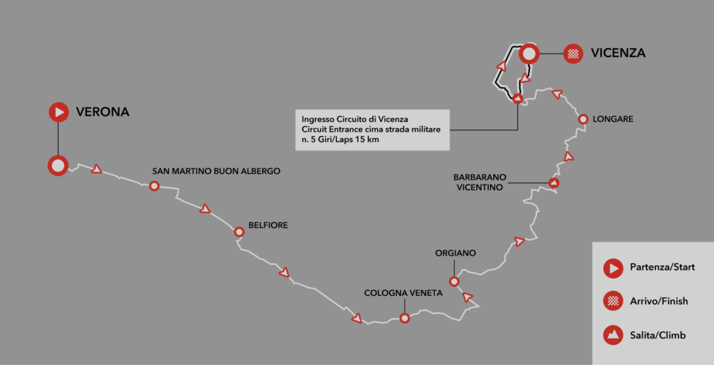
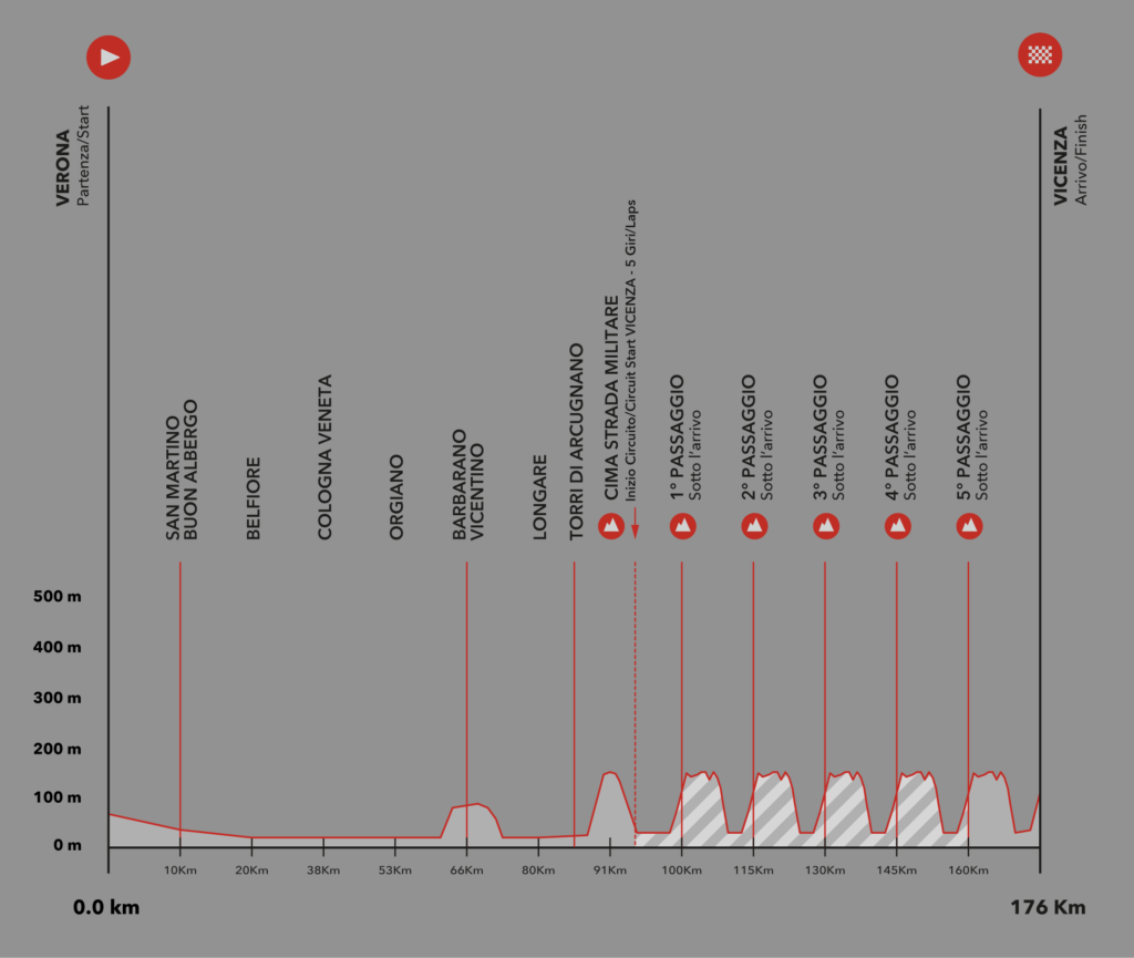
On 14 October 2026, the Giro del Veneto will travel 176 kilometres through this landscape from Verona to Vicenza. The opening sixty kilometres are almost completely flat, carrying the peloton east through San Martino Buon Albergo, Belfiore, Cologna Veneta and Orgiano before the terrain changes at Barbarano Vicentino. Beyond Longare, the race reaches the Colli Berici and eventually enters a 15-kilometre circuit around Vicenza to be completed five times, with the climb towards Monte Berico providing the principal difficulty of the finale.
The race itself is almost as old as the Giro d’Italia. First organised in 1909, the Giro del Veneto has survived wars, interruptions, changing organisers and a nine-year absence before returning in 2021. Costante Girardengo, Alfredo Binda, Fausto Coppi, Fiorenzo Magni, Roger De Vlaeminck, Francesco Moser and Giuseppe Saronni all appear in its history, placing a modern UCI ProSeries event within a lineage extending back to the formative decades of Italian professional cycling.
In 2026 that history begins in Verona and ends beneath Monte Berico, linking two cities whose architecture and political history reveal different chapters in the development of the Veneto.
–176 km | Verona
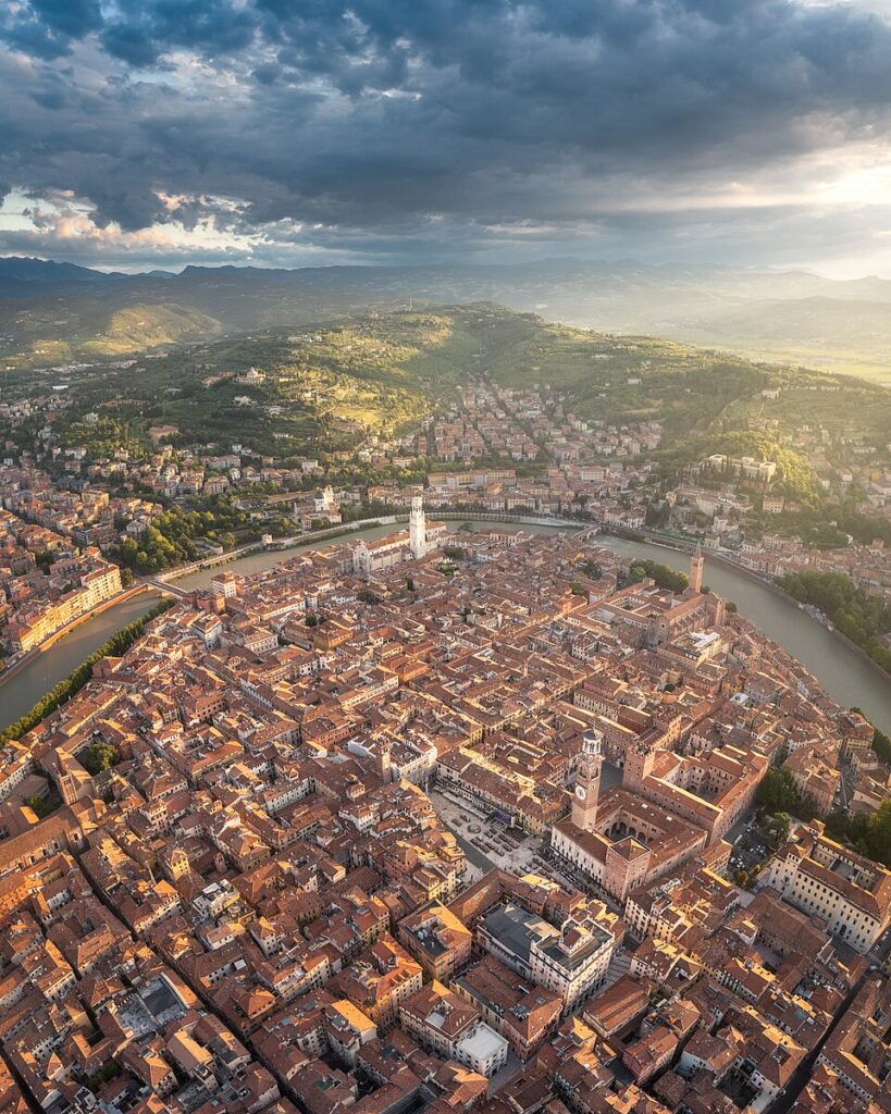
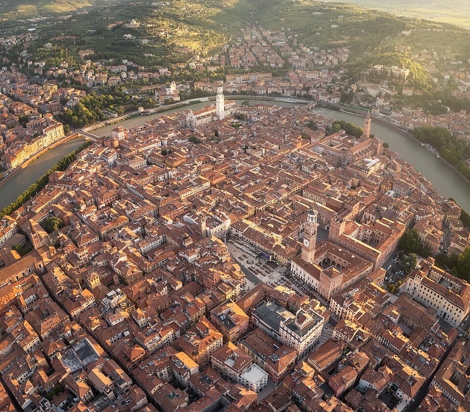
Verona stands on both banks of the Adige, where the river emerges from the Alpine world and bends through a city whose strategic importance was understood long before its association with Romeo and Juliet became its most internationally recognisable story. The Romans called it Verona and developed it at the meeting point of important routes across northern Italy, including the Via Postumia, the great road constructed in 148 BC to connect Genoa with Aquileia across the breadth of the Po Valley.
The Arena remains the most monumental survival from Roman Verona. Built in the first century AD, the elliptical amphitheatre once stood beyond the Roman city walls and could accommodate enormous crowds for public spectacles. Much of its external ring was damaged by earthquakes, particularly the destructive earthquake of 1117, but the inner structure survived sufficiently intact to become one of the best-preserved Roman amphitheatres in the world. Its modern use for large-scale opera has given an ancient building an unusual second life, particularly during the summer festival that has filled the Arena with music since the early twentieth century.
Yet Verona is not a Roman city preserved intact beneath later architecture. The medieval Scaligeri transformed it into one of the major political centres of northern Italy during the thirteenth and fourteenth centuries. Under the della Scala dynasty, Verona controlled territories extending across much of the Veneto, and the family’s presence survives in Castelvecchio, the fortified bridge across the Adige and the extraordinary Scaliger Tombs beside the church of Santa Maria Antica.
The balance of power eventually shifted east. Venice took Verona in 1405, incorporating the city into the Stato da Tera, the mainland territories through which the maritime republic expanded across northeastern Italy. With the exception of periods of war and occupation, Venetian rule continued until Napoleon dismantled the Republic in 1797. The winged lion of Saint Mark subsequently appeared throughout the region as a political emblem, far beyond the canals and islands normally associated with Venice.
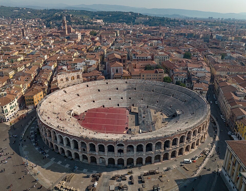
The Giro del Veneto leaves this accumulated city behind almost immediately. The Adige remains nearby, but the dense architecture gives way to the agricultural plain east of Verona, where the first hour of racing follows terrain that has been cultivated, drained and reorganised for centuries.
–166 km | San Martino Buon Albergo
Around ten kilometres into the race, the peloton reaches San Martino Buon Albergo on Verona’s eastern fringe. Today the town lies within the industrial and residential expansion surrounding the provincial capital, but its position historically belonged to the routes leading east from Verona towards Vicenza and Venice.
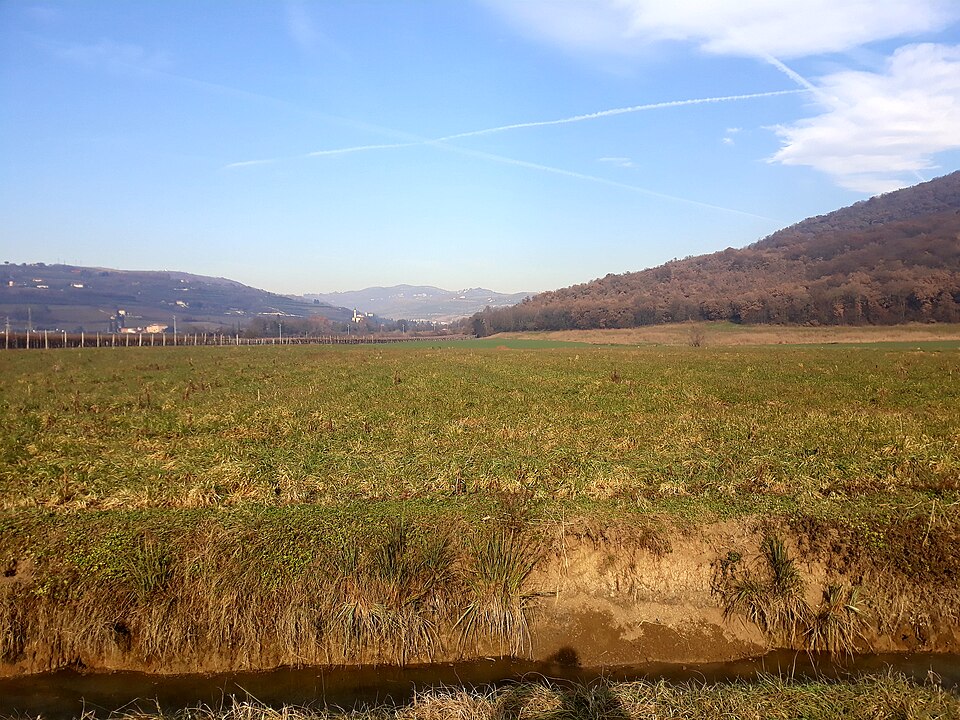
The landscape here sits close to the Adige and beneath the first hills of the Lessini Mountains to the north. Vineyards begin rising onto those slopes towards the wine country of Valpolicella and Soave, while the race itself remains on the lower plain. The contrast between hills and flat agricultural ground will accompany the peloton eastward, although the route initially avoids the elevations that define much of the Veneto’s celebrated wine landscape.
San Martino also marks the gradual disappearance of metropolitan Verona. Warehouses, roads and modern development become interspersed with cultivated fields as the race enters a countryside shaped by a dense network of settlements rather than by large empty distances.
–156 km | Belfiore and the Adige Plain
Belfiore lies around twenty kilometres into the race, within the broad agricultural corridor formed by the Adige and the waterways crossing the eastern Veronese plain. At racing speed the terrain appears almost featureless, yet its flatness conceals centuries of intervention. Rivers in the Veneto have repeatedly changed course, flooded settlements and deposited sediment across the plain, forcing communities to construct embankments, drainage channels and reclamation systems to make the land reliably productive.
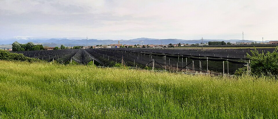
Agriculture remains the dominant visual language around Belfiore. Orchards and cultivated fields spread across terrain where differences of only a few metres in elevation once mattered greatly to drainage and settlement. The area is particularly associated with fruit production, including apples, while the wider plain supports maize, cereals and other crops characteristic of the lowlands between the Adige and the Euganean and Berici hills farther east.
For the peloton, these are the fastest kilometres of the race. There is almost no topographical resistance, and the long roads provide little assistance to a breakaway attempting to establish a decisive advantage. The profile remains close to sea-level flat as the race continues towards one of the historic small towns of the eastern Veronese.
–138 km | Cologna Veneta
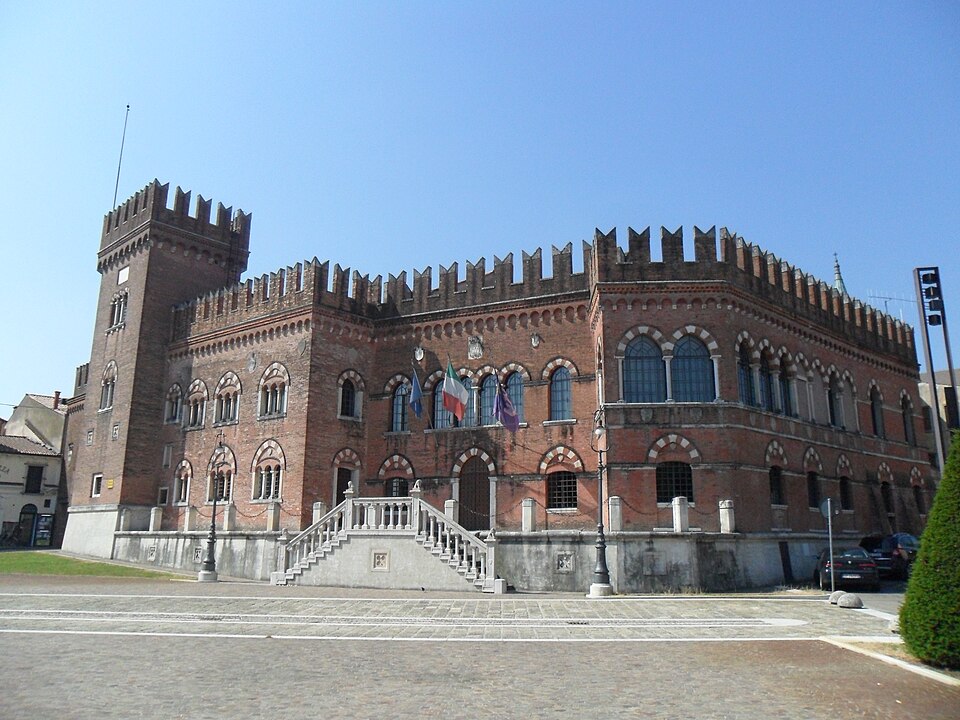
At approximately kilometre 38, Cologna Veneta introduces a more concentrated urban landscape. The town developed close to the Guà river and occupies a strategic position between the Veronese and Vicentine territories, an area repeatedly contested during the medieval struggles that divided northern Italy.
Its political history reflects the complicated geography of the Veneto before Venetian unification. Cologna passed through the influence of Verona, Padua and other regional powers before eventually entering the Venetian mainland state. The Republic administered it for centuries, and the architecture of its centre still belongs to the world of arcaded streets, civic buildings and compact settlements characteristic of the Veneto plain.
Cologna is also associated with something far removed from military and political history: mandorlato. This hard confection of honey, sugar, egg white and almonds became the town’s best-known speciality, particularly around Christmas, when local production traditionally intensifies. Its exact origins are debated, as happens with many regional foods whose recipes developed gradually rather than through a single documented invention, but Cologna Veneta has become one of the places most strongly identified with the confection.
Beyond the town, the road remains flat. The horizon ahead, however, begins to change. The Colli Berici, an isolated group of hills south of Vicenza, gradually become more important in the landscape and will eventually provide the terrain on which the character of the race changes completely.
–123 km | Orgiano
Orgiano sits near the southern edge of the Berici landscape, around 53 kilometres after the start. The settlement occupies the transition between open plain and rising ground, where agriculture begins to share the landscape with wooded slopes and the villas that became characteristic of the Venetian mainland.
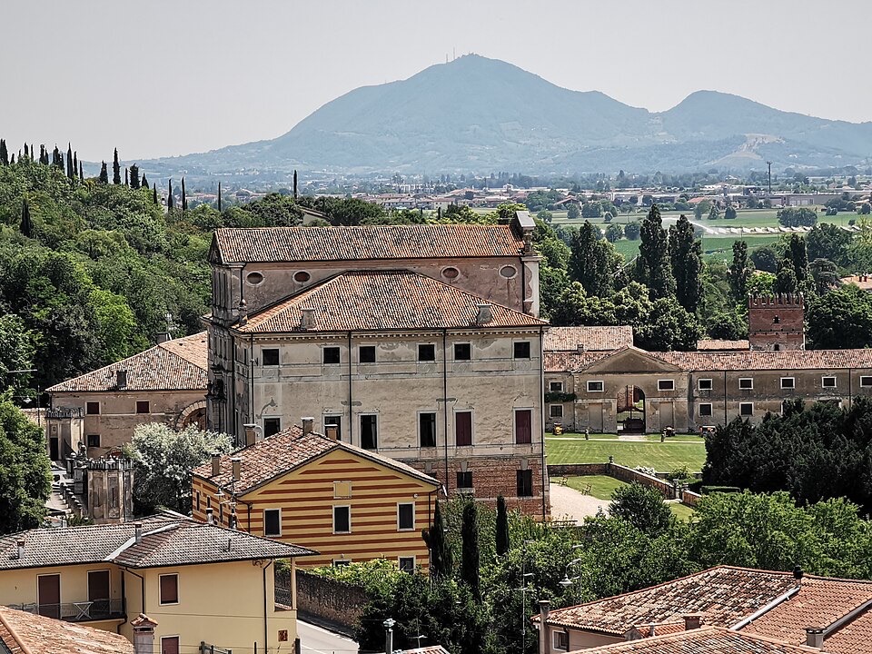
Among the most important buildings nearby is Villa Fracanzan Piovene, an eighteenth-century villa attributed to Francesco Muttoni. Its long façade, agricultural buildings and surrounding estate belong to a tradition that transformed parts of the Veneto countryside from the sixteenth century onward. Wealthy Venetian and mainland families invested in agricultural estates, building villas that functioned simultaneously as residences, administrative centres and symbols of social position.
These structures are frequently described simply as Venetian villas, but the term covers a much wider world than elegant country houses. Many stood at the centre of working agricultural systems, linking aristocratic architecture with the cultivation and management of the surrounding land. Their distribution across the Veneto became one of the most distinctive physical consequences of Venice’s expansion onto the mainland.
Orgiano lies within this landscape, but the race does not remain among the plains and estates for much longer. Ahead, the profile finally begins to rise.
–110 km | Barbarano Vicentino and the Colli Berici
At approximately kilometre 66, Barbarano Vicentino brings the first substantial change in elevation. The road rises from the plain towards the Colli Berici, the compact hill group occupying the countryside south of Vicenza. Unlike the Alpine and pre-Alpine chains visible farther north, the Berici stand as an isolated relief surrounded by lower land, creating a distinct geographical island above the Veneto plain.
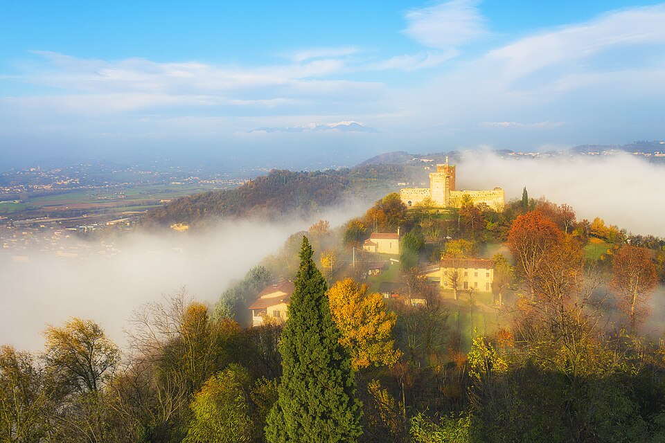
Their geology helps explain their appearance. Much of the range is composed of limestone formed from marine sediments when this part of northern Italy lay beneath warm seas, while volcanic activity also left traces across the area. Water dissolving the limestone created karst features, caves and underground drainage, giving the hills a physical character different from the sediment-filled plain surrounding them.
The human landscape adapted closely to this terrain. Vineyards occupy favourable slopes, woodland survives on steeper ground and settlements developed along ridges and at the foot of the hills. The Colli Berici are particularly associated with Tai Rosso, a red grape genetically related to Grenache but cultivated here as a local speciality, alongside other varieties suited to the warm exposures of the hills.
Barbarano itself sits at the southern foot of the range and has long acted as one of its agricultural centres. The Giro del Veneto climbs to around 90 metres above sea level here, modest in absolute terms but enough to interrupt more than sixty kilometres of almost uninterrupted flat racing. The road then descends again, but the Berici remain close to the peloton all the way to Vicenza.
–96 km | Longare
Longare lies east of the main Berici ridge, around kilometre 80, where the Bacchiglione river system and the low ground south of Vicenza create another corridor between hills and plain. The landscape is greener and more enclosed than the opening kilometres from Verona, with the slopes of the Berici rising immediately to the west.
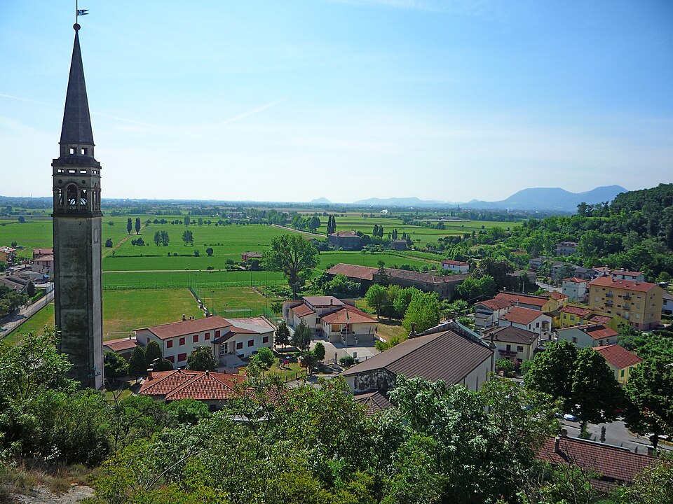
The area belongs to a network of waterways that shaped Vicenza and its countryside for centuries. The Bacchiglione flows through the city before continuing towards Padua, while tributaries and canals historically provided irrigation, transport and hydraulic power. As elsewhere in the Veneto, control of water was inseparable from agriculture and settlement, particularly across terrain where rivers could be both economic resources and sources of destructive flooding.
From Longare, the race turns north towards Arcugnano. Vicenza is now close, but the riders approach it through the hills rather than directly across the plain.
–91 km | Torri di Arcugnano
Torri di Arcugnano lies among the northern folds of the Colli Berici, where the route begins its final approach towards Vicenza. The municipality of Arcugnano extends across a landscape of low wooded ridges, valleys, villas and cultivated slopes immediately south of the city, creating a rural belt within only a few kilometres of Vicenza’s historic centre.
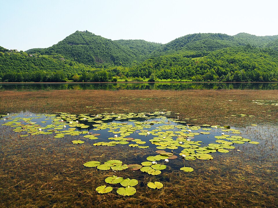
Nearby Lago di Fimon carries the story much farther back than the villas and villages visible from the modern roads. Archaeological discoveries around the shallow lake have revealed prehistoric communities living beside its wetlands during the Neolithic and Bronze Age, leaving evidence of settlement thousands of years before Roman Vicetia developed on the plain to the north. The sheltered basin around Fimon therefore preserves one of the deepest human histories in the Vicentine landscape.
The race does not reach the lakeshore, but Torri di Arcugnano places the peloton within the same northern Berici territory. Beyond these hills, the course approaches the decisive terrain on the southern edge of Vicenza, where the long linear journey from Verona gives way to a compact finishing circuit.
–85 km | Into the Vicenza Circuit
The Giro del Veneto now enters a 15-kilometre circuit to be completed five times. Sant’Agostino and Nogarazza occupy the lower roads before the course climbs towards the Strada Militare, crosses the upper Berici slopes around Villa Margherita and Villa Guiccioli and approaches the Sanctuary of Monte Berico before returning for another lap. Five passages through the same hills will transform this small landscape into the decisive final 75 kilometres of the race.
The southern edge of Vicenza concentrates religious history, Renaissance architecture and nineteenth-century warfare within a remarkably small area. The climb from the lower ground towards the Strada Militare reaches gradients of up to 12 percent, short enough to encourage repeated attacks but severe enough for the accumulated passages to reduce the field before the final lap.
The name Strada Militare preserves another layer of the landscape. Vicenza and the Berici became strategically important during the conflicts of the nineteenth century, particularly during the First Italian War of Independence in 1848. Austrian forces under Field Marshal Josef Radetzky moved against revolutionary and Italian nationalist forces across the Veneto, and the hills south of Vicenza became part of a battlefield extending towards Monte Berico.
Among the places connected with those events is Villa Guiccioli, standing on the slope below the sanctuary. The villa and surrounding area were involved in the fighting of 10 June 1848, when Austrian forces attacked positions defended by Italian volunteers. The battle ended with Austrian control re-established over Vicenza, one episode in the much larger and ultimately unsuccessful revolutionary campaigns of 1848.
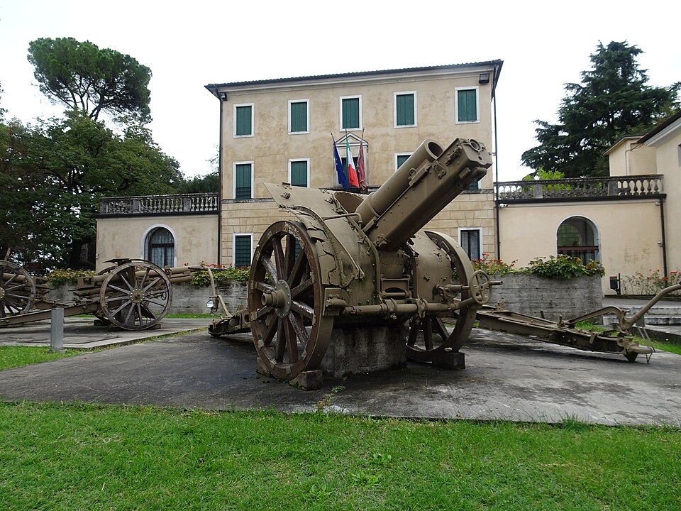
Today Villa Guiccioli houses the Museo del Risorgimento e della Resistenza, connecting the nineteenth-century movement for Italian national unification with the resistance to Fascism and German occupation during the Second World War. Its position is particularly appropriate: the peaceful wooded hill surrounding the museum was itself part of the terrain over which the struggle for Vicenza unfolded.
Higher on the circuit, Villa Margherita belongs to another characteristic feature of the Berici slopes. Villas appear repeatedly around Vicenza because the city became the centre of one of the most influential architectural traditions in European history.
Palladio and the Landscape of Vicenza
Andrea Palladio was born in Padua in 1508 but developed his career principally in Vicenza and its surrounding countryside. Drawing heavily on the architecture of ancient Greece and Rome, he developed a language based on proportion, symmetry and classical forms that transformed the appearance of villas, palaces and churches during the Renaissance.
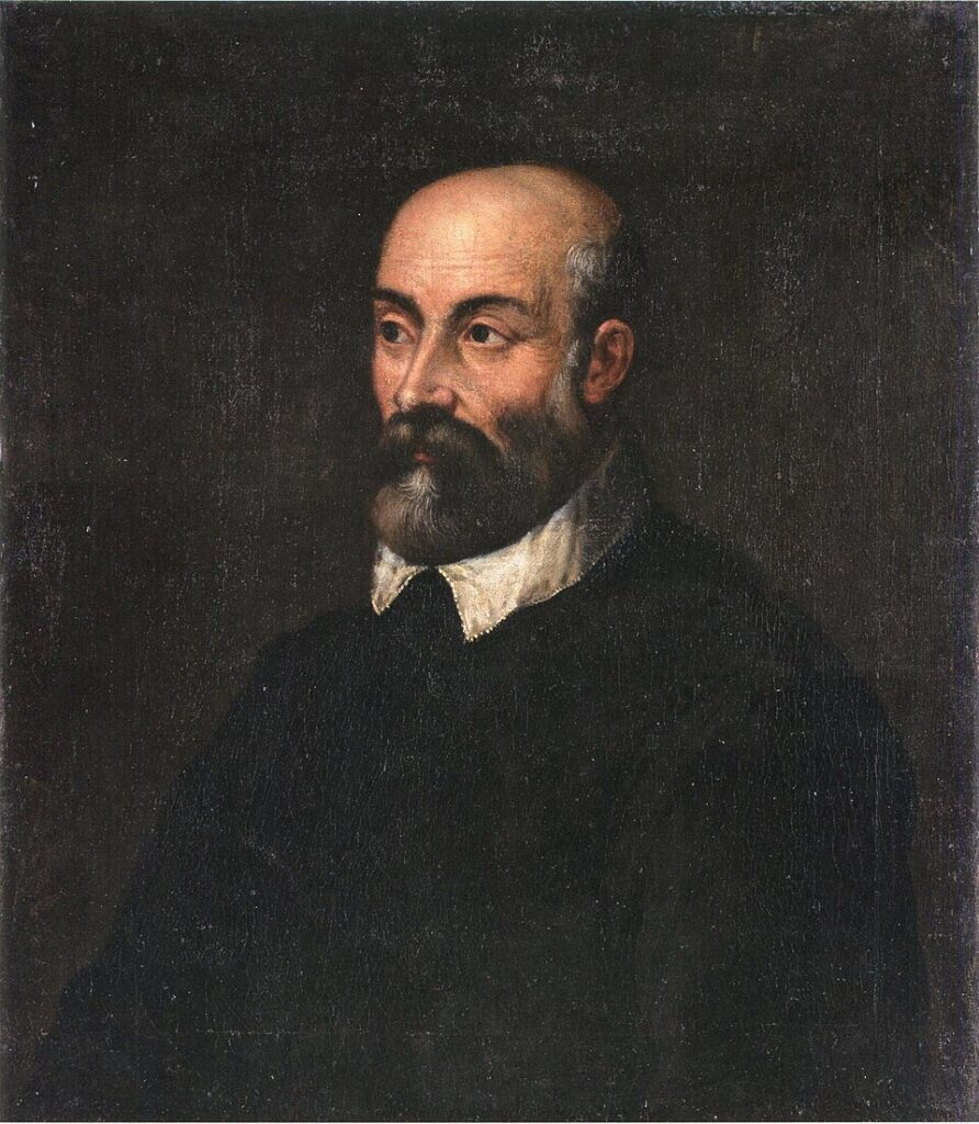
His influence extended far beyond the Veneto. Palladian architecture travelled across Europe and later across the Atlantic, shaping British country houses and eventually important buildings in the United States. Thomas Jefferson was among those deeply influenced by Palladio’s published designs, making the architectural ideas developed around Vicenza part of a global tradition extending well beyond Italy.
The concentration of Palladian buildings in and around Vicenza is so exceptional that the city and the Palladian villas of the Veneto are recognised together as a UNESCO World Heritage Site. Within central Vicenza stand buildings such as the Basilica Palladiana and Teatro Olimpico, while the surrounding countryside contains villas designed to combine aristocratic residence, agricultural administration and carefully controlled views across the landscape.
The most famous lies only a short distance from the race circuit. Villa Almerico Capra, universally known as La Rotonda, stands on a low hill outside Vicenza with four identical temple-fronted façades oriented towards the surrounding countryside. Palladio designed the building so that architecture and landscape operate together, each portico framing a different view. The design became one of the most copied houses in architectural history.
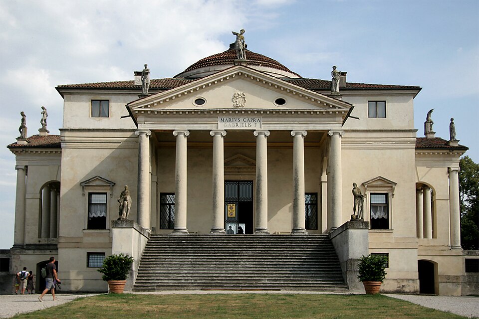
The riders will not pass directly through La Rotonda, but they are racing through the same southern hills that shaped Palladio’s understanding of landscape. The approach towards Monte Berico therefore carries the peloton through a territory where architecture was deliberately designed to look outward, across the plains and hills now occupied by the race.
Monte Berico
The defining landmark of the circuit rises immediately south of Vicenza. Monte Berico is a low hill rather than a mountain in the conventional sense, but its position above the city has given it religious, military and civic importance far beyond its altitude.
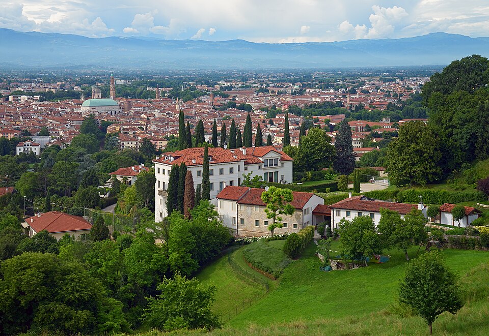
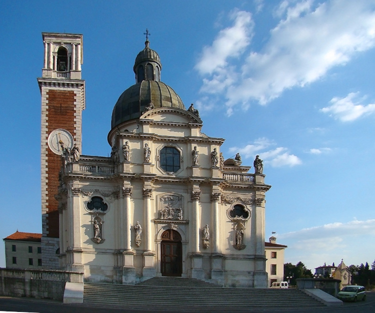
At the summit stands the Basilica Santuario della Madonna di Monte Berico. According to Catholic tradition, the Virgin Mary appeared here in 1426 and again in 1428 to Vincenza Pasini, during a period when Vicenza was suffering from plague. A sanctuary developed on the site and was expanded repeatedly over subsequent centuries, eventually producing the prominent Baroque building visible today.
The approach from Vicenza is marked by the long arcaded walkway connecting the city with the sanctuary, constructed during the eighteenth century to shelter pilgrims climbing towards Monte Berico. The sequence of arches has become one of Vicenza’s characteristic urban features, turning the physical ascent into a ceremonial route between the city below and the religious complex above.
From the terraces around the sanctuary, Vicenza spreads across the plain to the north. Beyond the rooftops, the landscape rises again towards the Lessini Mountains and, in clear conditions, the distant Alpine chain. The view makes visible much of the geography crossed by the Giro del Veneto: a broad plain punctuated by cities and waterways, enclosed by hills and mountains that are never entirely absent from the horizon.
Cycling has added another identity to Monte Berico. Since the revival of the Giro del Veneto in 2021, the hill has repeatedly featured in the modern race, and from 2022 the Vicenza finale became closely associated with its slopes. Matteo Trentin won the first of those modern Monte Berico finishes, followed by Dorian Godon in 2023 and Corbin Strong in 2024. The race itself had returned after a long absence between 2013 and 2020 and entered the UCI ProSeries in 2023, restoring an old Italian name within the contemporary international calendar.
The history behind that name extends much further. The inaugural Giro del Veneto was held in 1909, the same year as the first Giro d’Italia, and was initially a stage race rather than the one-day classic known today. Costante Girardengo established the first great dynasty with four consecutive victories from 1923 to 1926, still the record, while Alfredo Binda succeeded him in 1928. Fausto Coppi later won three editions, in 1941, 1947 and 1949, a sequence interrupted by war and resumed during the reconstruction of Italian cycling. Coppi’s extraordinary record in Il Lombardia, which he won five times, made him equally central to the history of another great race of the Italian autumn.
The later roll of honour charts changing generations of Italian racing: Fiorenzo Magni, Franco Bitossi, Francesco Moser, Giuseppe Saronni, Moreno Argentin, Gianni Bugno, Michele Bartoli, Davide Rebellin and Filippo Pozzato all appear among the winners. For much of its history the Giro del Veneto was overwhelmingly an Italian race in its results as well as its geography.
Across the modern circuit, that century of racing is compressed into five passages through the same southern hills. The peloton repeatedly climbs from the outskirts towards the Berici ridge, passes through the landscape of villas and the memory of 1848, approaches Monte Berico and descends towards the lower roads. On the fifth passage, the pattern finally leads towards the finish.
–15 km | The Final Circuit
The last lap begins with the accumulated cost of four previous passages already present in the legs. The opening plain from Verona has long disappeared from the character of the race, and the broad roads through Belfiore and Cologna Veneta have been replaced by a compact sequence of climbing, descending and repeated changes of direction around the southern edge of Vicenza.
Sant’Agostino and Nogarazza lead towards the final ascent of the Strada Militare. The gradients are short enough to encourage aggressive racing but steep enough for hesitation to create separation, particularly after the circuit has already been repeated four times. A rider attacking here must still negotiate the remaining roads around the ridge, while those behind have progressively less terrain available to organise a chase.
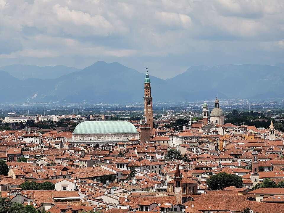
Villa Margherita and Villa Guiccioli pass for the final time as the route turns back towards Monte Berico. The sanctuary rises above the city, and the landscape begins to open northwards across Vicenza. What began 176 kilometres earlier among the Roman, medieval and Venetian layers of Verona is now ending in a city whose identity was transformed by Renaissance architecture and whose southern hills carry memories of pilgrimage, warfare and Italian unification.
The final descent returns the race towards the lower streets, where the five-lap pattern is finally broken and the finish approaches.
FINISH · Vicenza
Vicenza lies at the northern foot of the Colli Berici, between the hills crossed by the race and the pre-Alpine landscape rising farther north. Roman Vicetia existed here long before the city became internationally associated with Palladio, but it was the prosperity of the Venetian period that provided the setting for its extraordinary sixteenth-century architectural transformation.
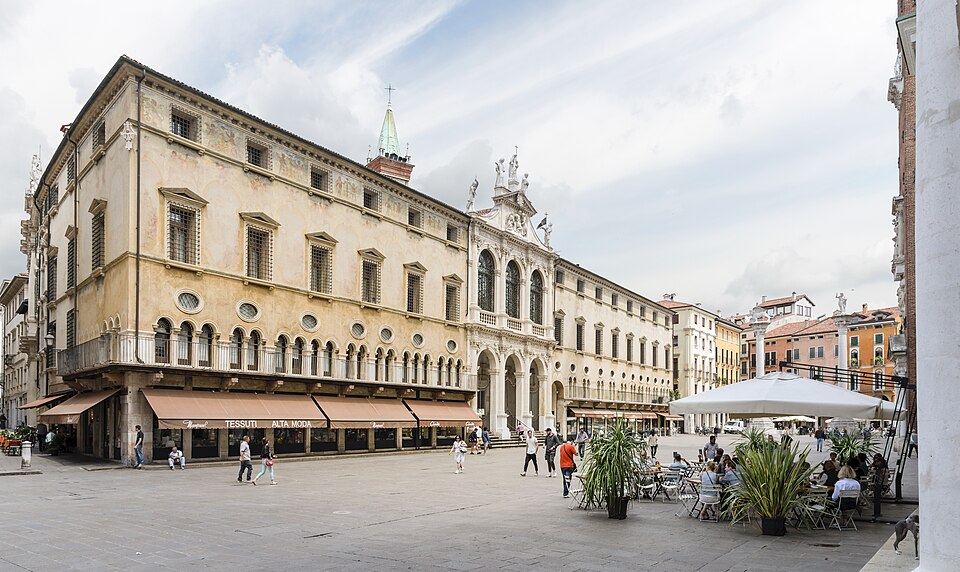
The historic centre still preserves that transformation with unusual coherence. The Basilica Palladiana dominates Piazza dei Signori behind its double loggia of white stone, while the nearby Teatro Olimpico, Palladio’s final work, contains a permanent Renaissance stage whose forced-perspective streets create the illusion of a much deeper classical city. Palaces designed by Palladio stand throughout the centre, making Vicenza one of the rare places where an individual architect influenced not merely a building or district but the visual identity of an entire city.
The Giro del Veneto arrives after crossing a region whose history has been similarly cumulative. Verona introduced the Roman and Scaliger worlds before the road moved across the agricultural plain shaped by rivers and centuries of reclamation. Cologna Veneta carried the race through the small urban centres of the Venetian mainland, Orgiano into the landscape of villas and estates, and Barbarano into the limestone hills of the Berici. Around Vicenza, those strands converged with Palladio, the Risorgimento and the sanctuary above Monte Berico.
The race itself belongs to that accumulation. Created in 1909, interrupted repeatedly by the upheavals of the twentieth century and absent again for much of the 2010s, the Giro del Veneto has nevertheless carried the names of Girardengo, Binda, Coppi, Magni, Moser, Saronni and generations that followed them into the twenty-first century. Its revival in 2021 did not recreate the race exactly as it had existed before; the modern event has found a new identity in the hills and cities of the region whose name it carries.
In 2026, Verona and Vicenza provide the two ends of that story. Between them lie 176 kilometres of plain, rivers, cultivated land and the first hills of the Berici, followed by five increasingly difficult passages through the landscape beneath Monte Berico. The Giro del Veneto begins in one of Italy’s great Roman cities and finishes in the city of Palladio, but the road between them reveals something broader: the Veneto beyond Venice, a mainland territory whose history was written across farms, fortified towns, villas, rivers and hills long before a bicycle race began travelling through them.



