

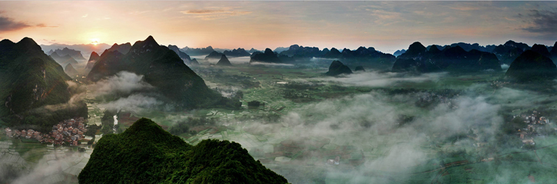
The Tour of Guangxi begins in a corner of China where the landscape already seems to belong partly to another world. Chongzuo lies in the far southwest of the country, close enough to Vietnam for the frontier to have shaped its history, languages and trade, and deep within the limestone country that extends across southern Guangxi into northern Vietnam. Beyond the city, isolated green hills rise abruptly from fields of sugar cane, rivers disappear between cliffs, and villages occupy the narrow spaces left between stone and water.
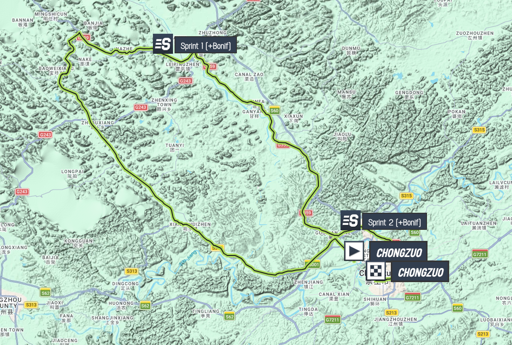
Stage 1 makes a 149-kilometre loop through this country before returning to Chongzuo. There are no classified climbs and nothing on the profile likely to prevent the fastest riders from expecting a sprint, but the apparent simplicity of the race conceals a much richer geography. The road passes through one of the principal homelands of the Zhuang people, crosses the agricultural landscape at the centre of China’s sugar industry and travels within the basin of the Zuo River, where limestone cliffs preserve evidence of communities that lived here more than two thousand years ago.

For a race that will spend six days travelling west and north through Guangxi, Chongzuo is more than a convenient starting point. It introduces the landscape from which much of the week’s character will emerge.
–149 km | Chongzuo
I
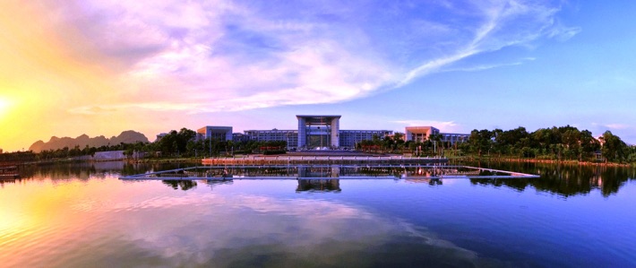
Chongzuo stands beside the Zuo River in southwestern Guangxi, but the modern city represents only a small centre within an enormous prefecture stretching towards the Vietnamese border. The administrative map is relatively new: Chongzuo became a prefecture-level city only in 2002. The human geography surrounding it is considerably older.
This is one of the heartlands of the Zhuang, China’s largest officially recognised ethnic minority and the people whose name appears in the formal designation Guangxi Zhuang Autonomous Region. Zhuang languages belong to the Tai branch of the Kra-Dai language family, which also contains Thai and Lao. For an international visitor accustomed to thinking of China primarily through Mandarin-speaking eastern cities, the linguistic map of Guangxi therefore points unexpectedly south, towards mainland Southeast Asia.
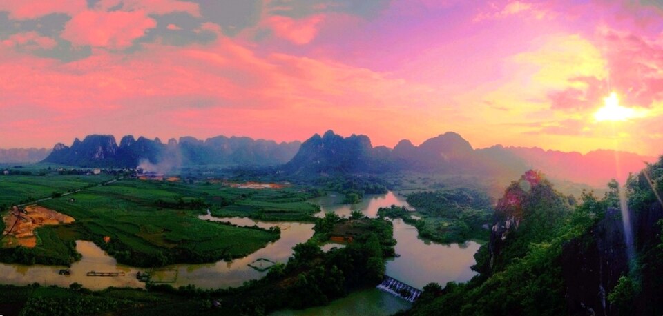
That relationship is written into the geography. The modern Chinese-Vietnamese frontier cuts across a region where rivers, valleys and communities existed long before national borders acquired their present form. Peoples historically grouped under names such as the Baiyue inhabited large areas of southern China, and among them were the Luoyue of the Zuojiang basin, whose descendants and cultural relationships remain subjects of archaeological and historical study.
Their most extraordinary surviving traces are found on limestone cliffs farther downstream, where red-painted human figures, drums, boats and animals overlook the river. The race will not pass the principal Huashan panels today, but it begins within the landscape that produced them, following the same combination of rivers, fertile valleys and limestone corridors that made settlement possible here for centuries.
Once the peloton leaves Chongzuo, that geography quickly becomes visible. The broad urban roads give way to Jiangzhou District, buildings begin to thin and cultivated land takes over. Behind the fields, the first limestone formations rise almost vertically from otherwise gentle terrain.
–120 km | Xiangshuizhen
Xiangshuizhen appears after 29 kilometres at approximately 148 metres above sea level, by which point the race has entered rural Guangxi. Here the countryside is not merely a green backdrop between towns. Agriculture determines the appearance of the valleys, and one plant in particular has transformed the economy and scenery of southwestern Guangxi.
Sugar cane thrives in the region’s warm, humid subtropical climate. Guangxi produces the majority of China’s sugar, and Chongzuo is one of the industry’s major centres, surrounded by fields that can extend right to the roadside. When mature, the cane forms dense walls of narrow leaves and tall stalks; during harvest, the same country opens abruptly as fields are cut and the crop begins its journey towards local mills.

The limestone behind those fields belongs to one of the world’s great karst regions. Rainwater, made weakly acidic as it absorbs carbon dioxide from the atmosphere and soil, penetrates fractures in the rock and slowly dissolves the calcium carbonate. Given enough time, fissures widen into caves, underground drainage systems develop, valleys deepen and the remaining rock is isolated into towers and cones.
Guangxi’s most internationally familiar expression of this geology lies around Guilin, but the formations around Chongzuo belong to the same immense limestone world. Here, however, the scenery is less associated with the famous tourist images of the Li River and more closely tied to the frontier country of the Zuojiang basin.
The geology has also dictated where people could live. Steep limestone towers offer little usable agricultural ground, so villages, roads and fields occupy the lower corridors between them. Water follows the same openings, producing a landscape in which settlements seem threaded through the gaps left by the rock.
From Xiangshuizhen the profile begins a long, gentle rise. It never becomes a true climb, but over the next forty kilometres the road gains enough height to reach the highest named point of the stage.
–81 km | Baizhao
Baizhao stands at race kilometre 68, approximately 251 metres above sea level. There is no categorised ascent and no summit banner waiting for the riders, only the culmination of the gradual rise that has carried the road away from Chongzuo.
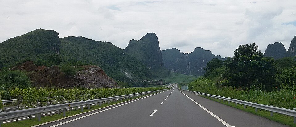
From here the scale of the karst landscape becomes easier to understand. What appears from a distance to be mountainous country is often something stranger: comparatively level agricultural land punctured by isolated masses of limestone. Fields reach towards the base of cliffs that can become too steep for cultivation almost immediately, while roads twist around formations rather than climbing across them.
Water provides the second organising force. Streams and tributaries feed the Zuojiang, or Zuo River, which eventually joins the Youjiang farther east before the combined waters continue towards the Pearl River system and the South China Sea. Long before asphalt roads crossed Guangxi, these waterways offered natural routes through country in which limestone could make overland movement difficult.
Along those rivers, the Luoyue left one of the most remarkable archaeological landscapes in China.
Across 38 sites in the wider Zuojiang valley, ancient painters placed enormous red compositions directly onto exposed limestone cliffs. The surviving images date broadly from the fifth century BCE to the second century CE. Human figures appear with arms raised or extended, sometimes surrounding much larger central figures, while boats, weapons, animals and bronze drums occur throughout the compositions.
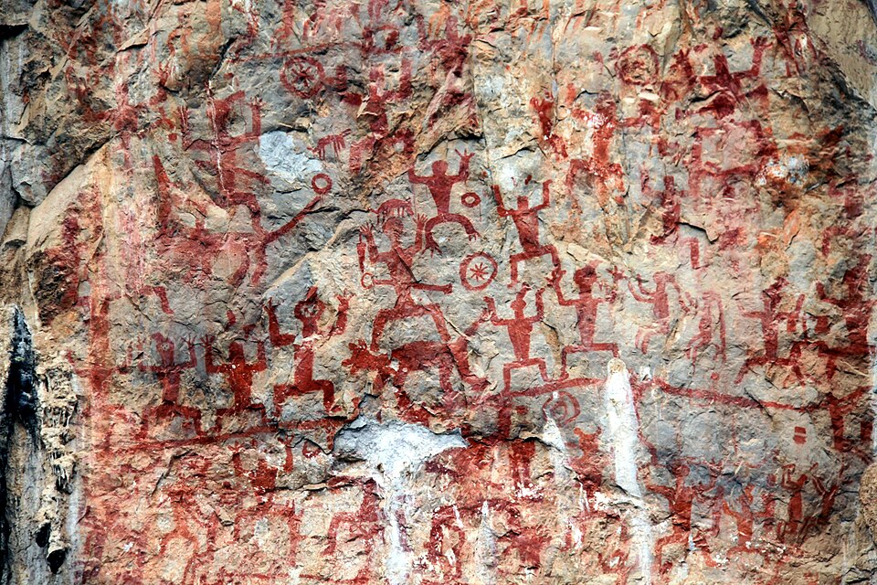
Their position is as striking as their subject matter. Many panels were painted high above the water rather than inside protected caves, meaning that producing them required considerable organisation and some means of reaching exposed rock faces. Their exact ceremonial significance has been lost, but the repetition of human figures and bronze drums suggests a ritual world shared by communities living along the river.
The drums are particularly revealing. Bronze drum traditions spread widely through southern China and mainland Southeast Asia, another reminder that the cultural history of this region cannot be understood neatly within modern borders.
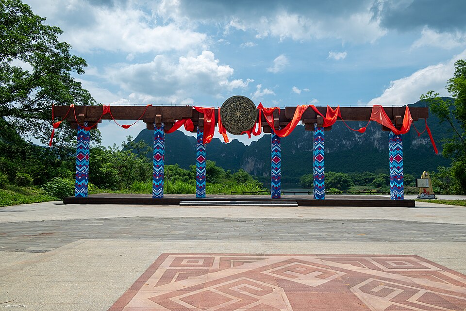
In 2016, UNESCO inscribed the Zuojiang Huashan Rock Art Cultural Landscape on the World Heritage List. The best-known cliffs lie outside today’s race route, particularly around Ningming, but Baizhao and the roads surrounding it belong to the same river-and-limestone country. The stage does not need to pass directly beneath the paintings for their world to be present in the landscape.
Beyond Baizhao, the profile begins to fall, and the race turns into the second half of its loop.
–62 km | Through the Zuojiang Border Country
The first intermediate sprint comes after 87 kilometres, with 62 kilometres remaining, but the road around it is more interesting than the points available there. The long gradual rise of the first half has ended and the course begins descending through a sequence of shallow valleys, short climbs and enclosed corridors towards Xinhe.
This is also where the wider geography of Chongzuo begins to pull the story southwards.
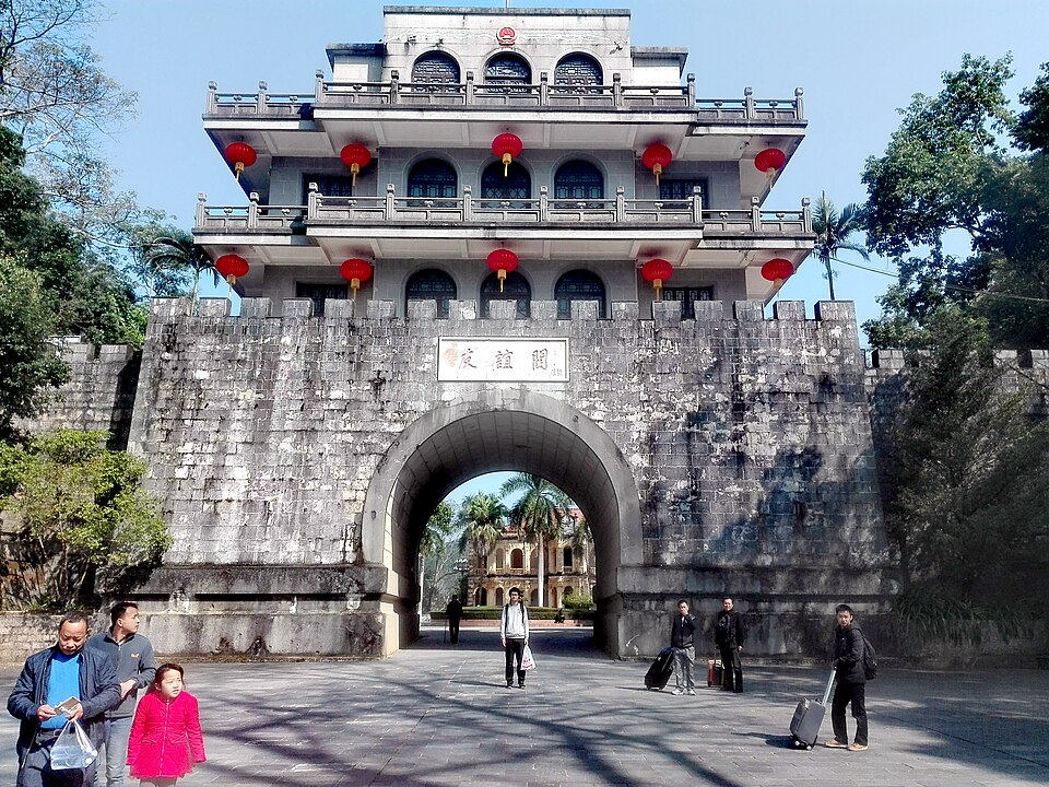
The Vietnamese frontier does not cross today’s stage, yet Chongzuo is inseparable from it. Several counties within the prefecture meet Vietnam, and routes through this region have connected the Guangxi interior with northern Vietnam for centuries. Commerce passed through them, but so did armies, refugees and political authority, producing a frontier that repeatedly shifted in importance even when the mountains themselves did not move.
During the nineteenth century, this borderland became entangled with French colonial expansion in Indochina. France’s growing control over Vietnam brought it into conflict with Qing China, and the Sino-French War of 1884-85 spread fighting through northern Vietnam and towards the Guangxi frontier.
One of the conflict’s decisive episodes occurred at Zhennan Pass, today’s Friendship Pass, southwest of Chongzuo. In March 1885, Chinese forces commanded in part by the veteran general Feng Zicai defeated a French offensive there, forcing the French back towards Lạng Sơn. The battle became one of the most celebrated Chinese victories of the war, even though diplomatic negotiations soon produced a settlement recognising the French position in Vietnam.
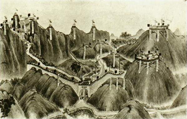
Those events took place well away from today’s road, and later stages will approach the frontier more closely. Yet their setting belongs to the same geography now surrounding the race: limestone ridges broken by narrow corridors through which movement between China and Vietnam has always had to pass.
The peloton continues through that landscape towards Xinhe, where the loop begins to turn decisively back towards Chongzuo.
–38.5 km | Xinhezhen
At kilometre 110.5, Xinhezhen sits at approximately 147 metres above sea level. After more than a hundred kilometres of predominantly rural roads, the town provides the clearest geographical hinge of the stage. The race has travelled west through Jiangzhou District; from here the remaining road begins drawing it home.
Xinhe has increasingly been promoted as part of Chongzuo’s rural tourism landscape, but what makes the area interesting is not a single monument. Its villages occupy the spaces between karst hills, waterways and cultivated ground, producing a pattern repeated across southwestern Guangxi in which human settlement and geology are difficult to separate.
That relationship has existed for generations, although the economy around it has changed dramatically. Traditional Zhuang communities relied heavily on wet-rice agriculture and local river systems, while markets connected villages across the region. Today those same valleys carry modern roads, commercial agriculture and tourism, and Chongzuo’s position near Vietnam has made cross-border trade increasingly important.
The countryside therefore resists an easy division between an “old” Guangxi and a modern one. A village may sit beneath a limestone tower shaped over millions of years while trucks carry sugar cane along a paved highway nearby; Zhuang remains spoken in communities connected by smartphones and high-speed transport to cities far beyond the region.
Xinhe is perhaps more revealing because it is ordinary. The Tour is not passing a preserved historical set but through a living rural landscape that has absorbed successive changes without losing the physical geography that determined where its roads and settlements could exist in the first place.
With less than forty kilometres remaining, those roads begin bending eastwards. The hills remain close, but the Zuo River valley and Chongzuo are gradually pulling the route back towards its starting point.
–30 km | The Heishui River Country
The return towards Chongzuo crosses another element of the local water system: the Heishui River, whose name translates literally as the “Black Water River.”
Its dark-looking water has become part of the scenic identity of the countryside west of Chongzuo, winding beneath limestone hills and through vegetation before feeding into the larger Zuojiang system. Like many rivers in karst country, its course is inseparable from the geology surrounding it. Limestone controls the valleys, underground drainage and springs, while the river occupies the lower passages through the terrain.
This part of the stage gives the final thirty kilometres something the profile alone does not reveal. The riders are not simply returning across the same anonymous rolling country. They are moving downstream through a connected water landscape, leaving the smaller river valleys and approaching the broader corridor of the Zuojiang.
The road continues to rise and fall in short steps. None is important enough to earn a classified climb, but the accumulated changes in gradient prevent the run back to Chongzuo from becoming completely flat. For teams expecting a sprint, the terrain requires attention rather than alarm: enough undulation to stretch a tired group, but little that should fundamentally alter the character of the stage.
Beyond the roadside, cultivated fields begin to share more space with buildings and larger roads. The enclosed rural landscape of the middle kilometres is gradually loosening as the course approaches the prefectural capital again.
–14 km | The Zuo River Draws the Race Home
The second intermediate sprint comes at kilometre 135, leaving fourteen kilometres to the finish. By now the broad loop through Jiangzhou District is almost complete, and the geography that introduced the stage begins to reassemble around the riders.
The Zuojiang is again close. Its modern bridges and embankments belong to Chongzuo, but the river itself has been the continuous line beneath almost everything encountered during the day. Tributaries drain the limestone country towards it; agricultural settlements developed along its basin; ancient communities travelled its waters; and the painted cliffs farther downstream turned the river corridor itself into a ceremonial landscape.
Chongzuo grew beside that same route of movement. Roads and railways have changed the scale and speed of travel, but the basic geography remains recognisable: the city occupies a useful opening in country otherwise repeatedly divided by water and limestone.
The final approach therefore reverses the opening kilometres. Sugar-cane fields and villages become less frequent, junctions widen and urban buildings begin to interrupt the horizon. Karst hills remain visible beyond the city, refusing to disappear entirely behind the modern landscape.
For the peloton, the transformation happens at increasing speed. Teams interested in the finish begin taking control of the wider roads, and the loose shape of a WorldTour bunch gradually becomes organised into competing lines. The geological and historical scale of the afternoon contracts into the immediate problem of arriving at the final corner in the right position.
The Tour began here several hours earlier, but Chongzuo looks different on the return. The road has supplied the context that the start line could not.
FINISH · Chongzuo
The first stage ends where it began, but the loop has revealed why Chongzuo is an appropriate place for this edition of the Tour of Guangxi to start.
The city faces inland towards China and south towards Vietnam at the same time. The Zuo River runs through it towards a wider network of waterways, while beyond the urban edge the limestone landscape fragments the countryside into valleys where Zhuang communities, agricultural fields and roads have developed in the spaces between the rock.
If the expected sprint arrives, it will occupy only the final seconds of a journey whose scale has been much larger than the sporting result. Behind the riders lie the quiet rise towards Baizhao, the river country around Xinhe and the limestone corridors through which people have moved for centuries. Somewhere farther along the same Zuojiang basin, red Luoyue figures still stand with their arms raised on cliffs above the water, looking out over a landscape whose essential shapes would have been familiar long before Chongzuo existed as a city.
Tomorrow the race leaves that circle behind. The road from Chongzuo will continue west towards Jingxi, closer to Vietnam and deeper into a frontier where the karst becomes more dramatic, the history of the border more immediate and the distinction between southern China and mainland Southeast Asia increasingly difficult to draw with a simple line on a map.
Stage 1 has introduced that country from the river valley. Stage 2 will enter it.



