
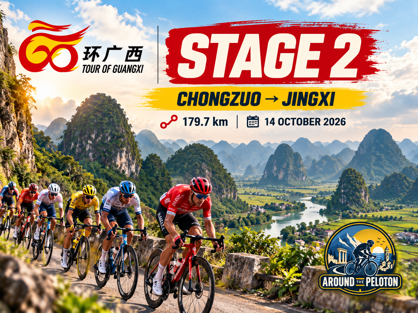

Stage 1 returned to Chongzuo after making a broad circle through the low karst country of the Zuo River. Stage 2 leaves that circle behind and points west, towards a landscape increasingly shaped by altitude, limestone and the proximity of Vietnam.
Over 179.7 kilometres, the Tour of Guangxi travels from Chongzuo to Jingxi, exchanging the lower agricultural valleys of the Zuojiang for a high limestone basin close to the international frontier. The transformation takes most of the day to reveal itself. For more than 130 kilometres the road rises almost imperceptibly through sugar-cane country and karst valleys, before the terrain finally steepens beyond Baisu and carries the race towards a plateau between 600 and 750 metres above sea level.

There is only one classified climb, but the profile tells a more interesting story than that statistic suggests. The ascent does not take the riders over an isolated mountain before returning them to the lowlands. It lifts them into another geographical world, and once they have reached it, the road remains high all the way to Jingxi.
Stage 2 is therefore less about crossing a mountain than about watching southern Guangxi change around the race.
–179.7 km | Chongzuo
The second stage begins beside the Zuo River in surroundings already familiar from yesterday, although the direction of travel immediately changes their meaning. Chongzuo is no longer both departure and destination; this morning it becomes the eastern gateway to a journey that will continue towards Daxin, Jingxi and the Vietnamese frontier.
The peloton leaves through Jiangzhou District and crosses the Zuojiang before joining the westward road. For a while, the landscape retains the character established on Stage 1. Sugar cane occupies the lower ground, limestone formations rise abruptly beyond the fields, and villages settle into the available spaces between rock and water. The difference is that none of it now needs an introduction. The race has already learned the visual language of Chongzuo and can begin moving beyond it.
West of the city, the valleys form part of a network that has carried people and goods towards the frontier for centuries. Vietnam remains out of sight, but the geography increasingly points in that direction. Rivers, roads and settlements occupy natural corridors through terrain where limestone repeatedly interrupts the most direct line across the map.
The profile begins rising almost without announcing it. Chongzuo stands only a little above 100 metres, while Jingxi lies close to 750 metres, yet there is no great mountain separating the two cities. The elevation accumulates gradually across the day, hidden within rolling roads and long stretches that barely resemble climbing.
Twenty-seven kilometres after the start, the race reaches Gena.
–152.7 km | Gena
Gena appears on the profile at approximately 182 metres above sea level, still unmistakably part of the lower country surrounding Chongzuo. The road rolls between cultivated valleys and limestone formations, occasionally rising towards a ridge before returning to the agricultural floor.
This is a landscape in which geology has always influenced movement. The steepest limestone towers offer little useful ground for roads or cultivation, so both tend to occupy the same valleys and openings. Villages developed where water and cultivable soil were available, while routes between them followed corridors that could be negotiated without crossing the most difficult formations.
For generations, Zhuang communities adapted their agriculture to those conditions. Wet-rice cultivation flourished where water could be controlled, while other crops occupied the drier ground. Sugar cane later transformed much of the lower country economically and visually, particularly around Chongzuo and Daxin, but it was added to an agricultural landscape already shaped by centuries of human use.
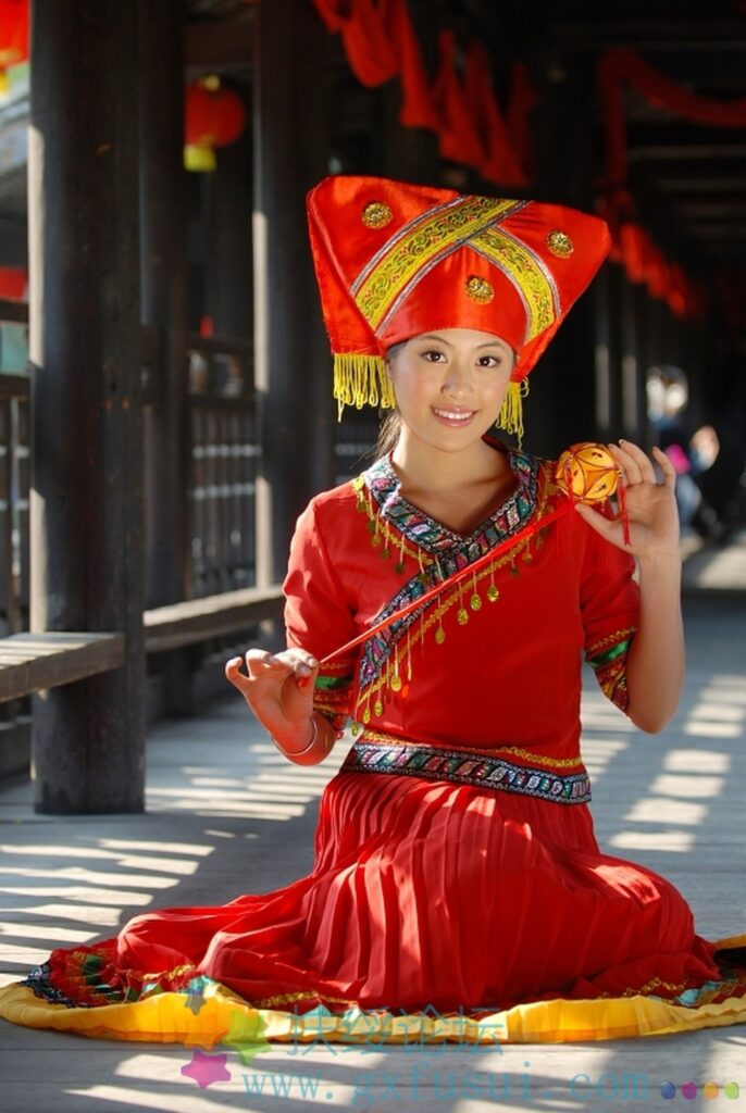
A Zhuang woman in Fusui County, Chongzuo, representing the indigenous Zhuang culture that has shaped the communities of southwestern Guangxi for generations. (Photo: Parper / CC BY-SA 3.0 / Source: Wikimedia Commons, File: Zhuang’s beautiful maiden in Chongzuo Fusui.jpg)
The Tour passes through these valleys rapidly, yet the pattern remains visible from the road. Fields occupy almost every practical opening; settlements gather where the land widens; hills rise immediately behind them. The countryside can appear spacious from one angle and enclosed from another, depending on how the road turns between the limestone.
Nothing here yet suggests the altitude waiting near Jingxi. The peloton continues west through terrain that remains warm, green and comparatively low, while the Vietnamese frontier gradually approaches from the south.
–115.2 km | Lubangcun
At kilometre 64.5, Lubangcun sits around 200 metres above sea level. More than one hundred kilometres remain, and the profile continues to conceal the transformation that will define the end of the stage.
The race is now travelling through the wider Daxin landscape, where the karst country of southwestern Guangxi begins to merge geographically with that of northern Vietnam. Political maps divide the two states with a precise line, but the limestone does not change character when it crosses the frontier. The same geological formations continue into Cao Bằng Province, carrying rivers, valleys and communities through a landscape that existed long before the boundary.
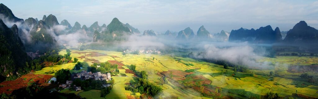
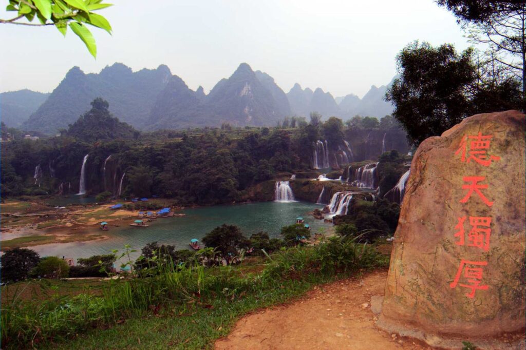
The wider Daxin region contains the most spectacular demonstration of that continuity. Southwest of today’s route, the Guichun River reaches the international frontier and falls across a broad limestone escarpment at Detian, facing Bản Giốc on the Vietnamese side. Water and rock create one landscape while the border divides it into two national names.
The race does not pass Detian Waterfall, and there is no reason to pretend otherwise. Its relevance is geographical rather than visual: it belongs to the same frontier country through which Stage 2 is moving and shows how closely the natural systems of Guangxi and northern Vietnam remain connected.
The same applies to the celebrated countryside around Mingshi, where rivers and rice fields lie beneath isolated limestone towers. Today’s road has its own quieter versions of that scenery. Peaks emerge beyond cultivated ground, villages occupy narrow valleys and the route continues west through a landscape whose dramatic features are not concentrated into a single viewpoint.
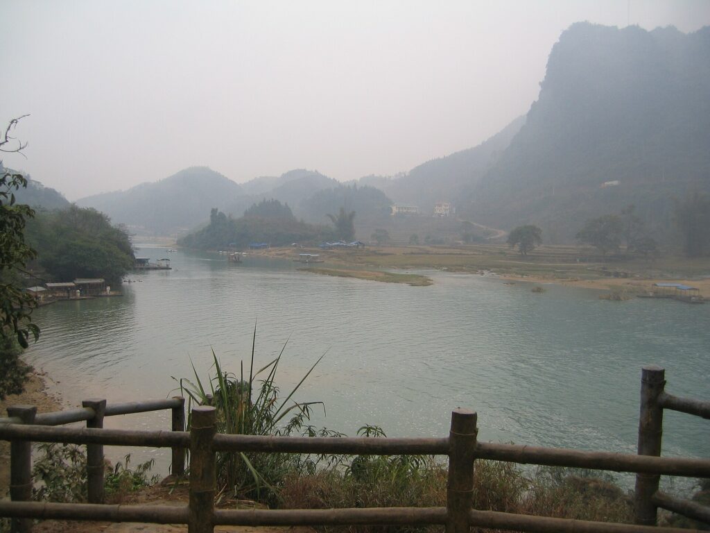
For much of the opening hundred kilometres, this cumulative quality defines the stage. There is no monument comparable with the painted cliffs of the Zuojiang on Stage 1, nor a single place around which the entire story can turn. Instead, the border landscape gradually becomes more coherent as Chongzuo recedes behind the riders.
Near Nongming, that geography begins to acquire a deeper political history.
–85.7 km | Nongming · A Frontier Governed from Afar
The first intermediate sprint comes at kilometre 94 near Nongming, around 220 metres above sea level. The race is more than halfway to Jingxi, although the elevation has changed remarkably little since Lubangcun.
The importance of this part of the route lies less in the profile than in the world through which it is travelling. For centuries, the remote districts of southwestern China posed a recurring problem for governments based far to the north and east: how could distant communities, separated by difficult terrain and possessing their own languages and political traditions, be incorporated into an imperial state?
One answer was the tusi system. Across parts of southwestern China, hereditary local rulers were recognised by imperial governments and allowed to exercise authority over their own communities in return for political allegiance. The arrangement took many forms and changed over time, but it provided a practical method of governing regions where replacing local structures with a conventional bureaucracy would have been difficult.
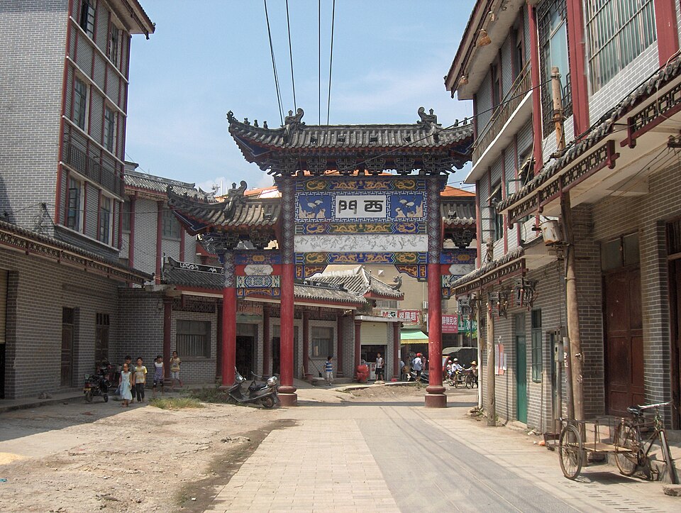
Guangxi became one of the important areas in which these native chieftaincies operated, particularly among Zhuang populations in the west. Their authority belonged simultaneously to local society and to the wider imperial system, creating a frontier administration very different from that of China’s central provinces.
Over the centuries, successive governments attempted to replace hereditary native rule with officials appointed directly by the state. The process strengthened central administration but did not remove the geographical conditions that had made indirect rule practical in the first place. Limestone basins, mountain corridors and difficult communications continued to divide neighbouring communities even when administrative structures changed around them.
Jingxi grew within this world. Its basin offered water and cultivable ground close to the Vietnamese frontier, while surrounding mountains provided both connections and barriers depending on which valley or pass a traveller followed.
As the peloton leaves Nongming, the terrain begins slowly to reflect that history. The valleys tighten, higher ground becomes more persistent and the broad agricultural landscapes around Chongzuo feel increasingly distant.
The decisive change waits beyond Baisu.
–46.5 km | Baisu · Where the Low Country Ends
Baisu arrives after 132.5 kilometres at approximately 319 metres above sea level. For most of the stage, the race has gained height so gradually that elevation has barely registered as part of the experience. From here, the landscape finally begins to rise with purpose.
Within the next sixteen kilometres, the road climbs towards more than 600 metres. The shallow undulations that have carried the peloton west begin to gather into a sustained ascent, and the limestone formations that previously stood above relatively broad valleys become part of higher, more enclosed terrain.
This is the transition the entire stage has been approaching.
The change is not abrupt enough to resemble the entrance to the Alps or Pyrenees, where a valley may suddenly close beneath enormous mountains. Guangxi works differently. The karst remains fragmented, irregular and intensely green, but the floor beneath it rises. Valleys narrow, cultivated land appears in smaller pockets, and the road searches for a manageable line towards the Jingxi basin.
The higher country also changes the relationship between settlement and terrain. Around Chongzuo, broad lowland valleys allowed agriculture to spread across substantial areas between the limestone. Towards Jingxi, usable land becomes more concentrated within basins and corridors, producing settlements that appear enclosed by the surrounding formations.
Ahead, the road begins the only classified climb of the day.
–30.5 km | The Climb into the Jingxi Highlands
The Category 2 ascent measures 8.5 kilometres at an average gradient of approximately 3.4 percent, reaching its summit around kilometre 148.5 with 30.5 kilometres remaining.
Those numbers make it sound gentler than its geographical importance warrants. For WorldTour riders, 3.4 percent is not an intimidating gradient, and a strong sprinter can reasonably hope to remain in contention. Yet the ascent is the point at which Stage 2 finally completes the transition it has been preparing since Chongzuo.
The road rises towards approximately 623 metres, lifting the peloton above the lower valleys of western Guangxi and onto the high country surrounding Jingxi. There is no corresponding descent back towards 300 metres because this is not simply a ridge crossed on the way to somewhere lower. The race has reached a new level and will remain there.
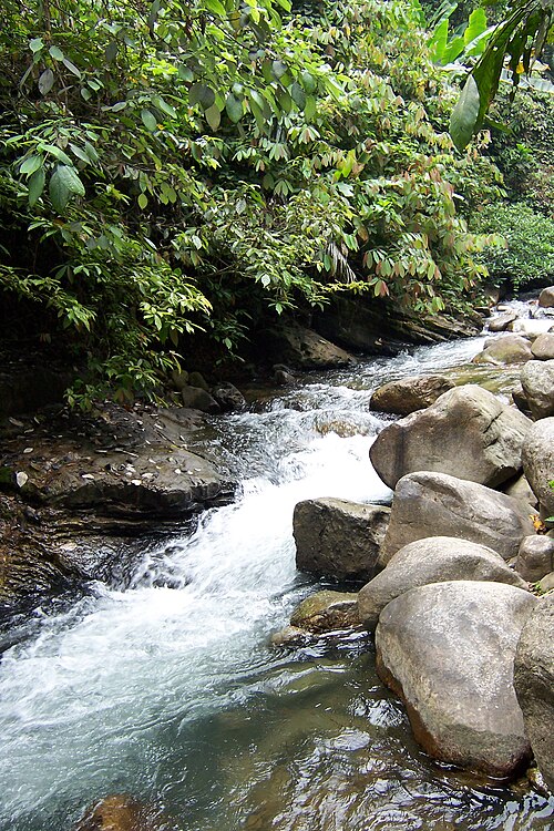
The scenery changes with it. Limestone peaks rise from higher valley floors, settlements occupy enclosed basins and the road repeatedly disappears between green formations before emerging into another pocket of cultivated land. The karst is no longer something standing above a broad agricultural plain; it increasingly defines the boundaries of the visible world.
This is also where Jingxi’s reputation as a landscape of mountains and water begins to make sense. Rainfall entering the limestone feeds springs and streams throughout the region, while valleys collect enough soil and water to support rice fields and settlements between the peaks. The geological processes are the same ones encountered around Chongzuo, but the higher basin gives them a different scale and appearance.
For the riders, the sporting question is whether the climb is difficult enough to reduce the group substantially. Its average gradient suggests survival is possible for many fast finishers, but the ascent comes after almost 150 kilometres and offers few opportunities for anyone struggling to hide. A rider losing contact here cannot rely on a long descent to erase the damage.
At the summit, thirty kilometres remain, and the road ahead continues across the highlands rather than falling away from them.
–25 km | On the Edge of Two Countries
From the high country west of the summit, northern Vietnam lies increasingly close beyond the limestone.
Across the frontier, Cao Bằng Province continues through essentially the same physical landscape. Karst peaks, enclosed valleys and rivers extend south without regard for the political boundary, while communities on either side share cultural relationships that are older than the modern states surrounding them.
The Zhuang languages of Guangxi belong to the same wider Tai linguistic world as languages spoken across mainland Southeast Asia. In northern Vietnam, the Tày and Nùng peoples are particularly close linguistic and cultural relatives of communities north of the border. Centuries of trade, migration and marriage created connections across valleys that governments later divided between separate national territories.
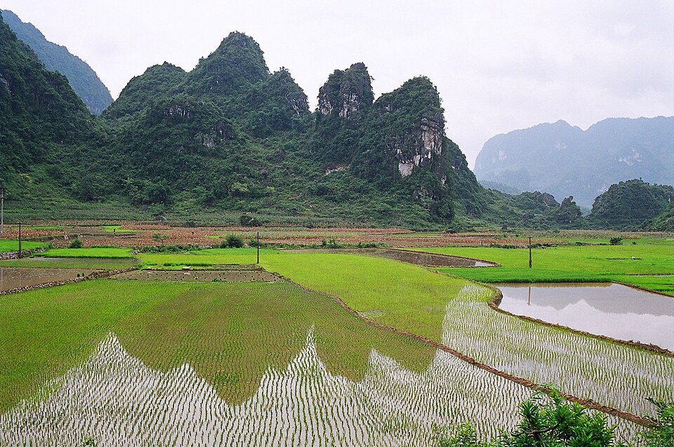
The frontier could also become a place of conflict. Chinese and Vietnamese states contested influence across these mountains at different moments, while the arrival of French colonial power in Vietnam during the nineteenth century introduced another political force into an already complicated borderland. Routes that carried traders in peaceful years could become military corridors during periods of war.
From the road, however, there is no obvious natural line separating one country from the other. The mountains continue. Rivers continue. Villages occupy the same kinds of valleys on both sides.
That continuity gives the final part of Stage 2 a character very different from the approach to most European finish towns. Jingxi is not simply a city at the end of a road; it belongs to a high frontier landscape shared geographically with the country immediately beyond it. The race is now inside that landscape.
–13.2 km | Huadong
Huadong comes at kilometre 166.5, where the second intermediate sprint is positioned at roughly 700 metres above sea level. The figure makes the day’s transformation unmistakable. At Baisu, barely thirty-four kilometres earlier, the race stood at approximately 319 metres.

The riders have not merely crossed a climb. They have arrived on the Jingxi plateau. Huadong belongs to Jingxi’s territory, and the final kilometres now travel through a landscape that feels markedly different from the low country left behind in the morning. Limestone formations gather more densely around the valleys, cultivated land occupies the flatter ground between them and settlements appear repeatedly at the foot of steep green slopes.
The race itself may nevertheless be coming back together. The classified ascent is long enough to remove riders already under pressure but gentle enough for a well-supported sprinter to survive, particularly if teams can control the pace. The high road after the summit provides no major descent, although its rolling terrain allows groups behind to organise a pursuit if the gaps remain small.
As Jingxi approaches, buildings become more frequent without ever fully obscuring the limestone. The city does not announce itself through a long belt of featureless suburbs. Peaks remain visible beyond streets and between neighbourhoods, sometimes appearing unexpectedly at the end of an urban road.
That relationship between city and stone is what makes Jingxi a destination worth more than a finish-line paragraph.
Jingxi · The City in the High Basin
Jingxi lies at roughly 750 metres above sea level in a broad karst basin near the Vietnamese frontier. Mountains surround it without completely enclosing it, while rivers and springs emerge through the limestone country around the city and feed the agricultural valleys between the peaks.
Its setting explains much of its history. For centuries, this was distant frontier territory from the perspective of China’s imperial capitals, but it was not isolated in the local sense. Routes connected neighbouring valleys, Zhuang communities occupied the surrounding countryside, and the proximity of Vietnam placed Jingxi within a cross-border world of trade and movement.
The city’s political history developed accordingly. Hereditary Zhuang rulers governed the area within the broader tusi system, exercising local authority while recognising successive Chinese dynasties. Such arrangements allowed imperial governments to incorporate frontier territories without immediately dismantling political structures that were already embedded in local society.
Jingxi’s strategic importance came partly from its position. To the south and west lay routes towards Vietnam; to the east were the valleys leading back towards Daxin and Chongzuo; to the north, roads continued deeper into western Guangxi. The basin therefore functioned not simply as an isolated pocket between mountains but as a junction within a difficult landscape.
The modern city has expanded across that basin, yet the physical setting remains unusually visible. Limestone hills stand close to built-up districts, agricultural land survives around the urban edge and water emerges repeatedly from the karst surrounding the city. Jingxi’s growth has occupied the available openings rather than erasing the landscape around them.
That geography extends to some of the wider area’s most celebrated scenery. Rivers flow beneath and between limestone formations, springs emerge from underground systems and rural valleys preserve the combination of water, rice fields and steep green peaks characteristic of western Guangxi. Unlike the lower country around Chongzuo, however, everything here occurs at the altitude the race has spent the afternoon reaching.
The city is therefore not simply where Stage 2 happens to stop. It is the geographical explanation for the stage’s unusual profile. The road had to climb because Jingxi itself is high.
FINISH · Jingxi
After 179.7 kilometres, the Tour reaches Jingxi almost six hundred metres higher than the roads on which the morning began.
There has been no monumental pass and no summit from which the peloton could look back across an enormous mountain range. Instead, the transformation has taken place gradually enough to be missed if the stage is reduced to its classified climbs. Chongzuo disappeared first, then the broad agricultural valleys began to narrow, the frontier drew closer, and finally the road rose through Baisu into a high basin where limestone once again surrounded the race, but in a different form from the country left behind.
Jingxi completes that transition rather than merely providing its finish line. The city occupies one of the openings in the high karst, with streets, fields and water gathered between formations that continue south towards Vietnam. The political border is close, yet the landscape on either side belongs to the same geological and cultural continuum that has shaped movement through this region for centuries.
A sprint here would not contradict the character of the stage. The classified climb is gentle enough for fast riders to survive, and the plateau beyond offers time for groups to reorganise. What matters is that whoever contests the finish does so in a landscape fundamentally different from the one through which the race rolled during the morning.
The Tour of Guangxi began yesterday beside the Zuo River. By the end of its second day, it has climbed into the high frontier country of western Guangxi, where cities occupy limestone basins and the mountains continue almost uninterrupted across the boundary with Vietnam.
There is no descent waiting beyond the finish to return the race to the lowlands. Jingxi is where the road has been heading all day, and when the peloton stops here, the change of altitude finally becomes a change of place.



