
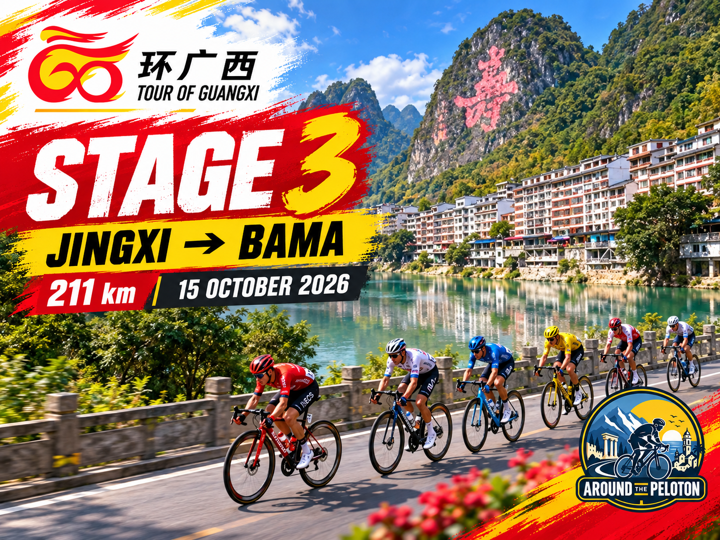

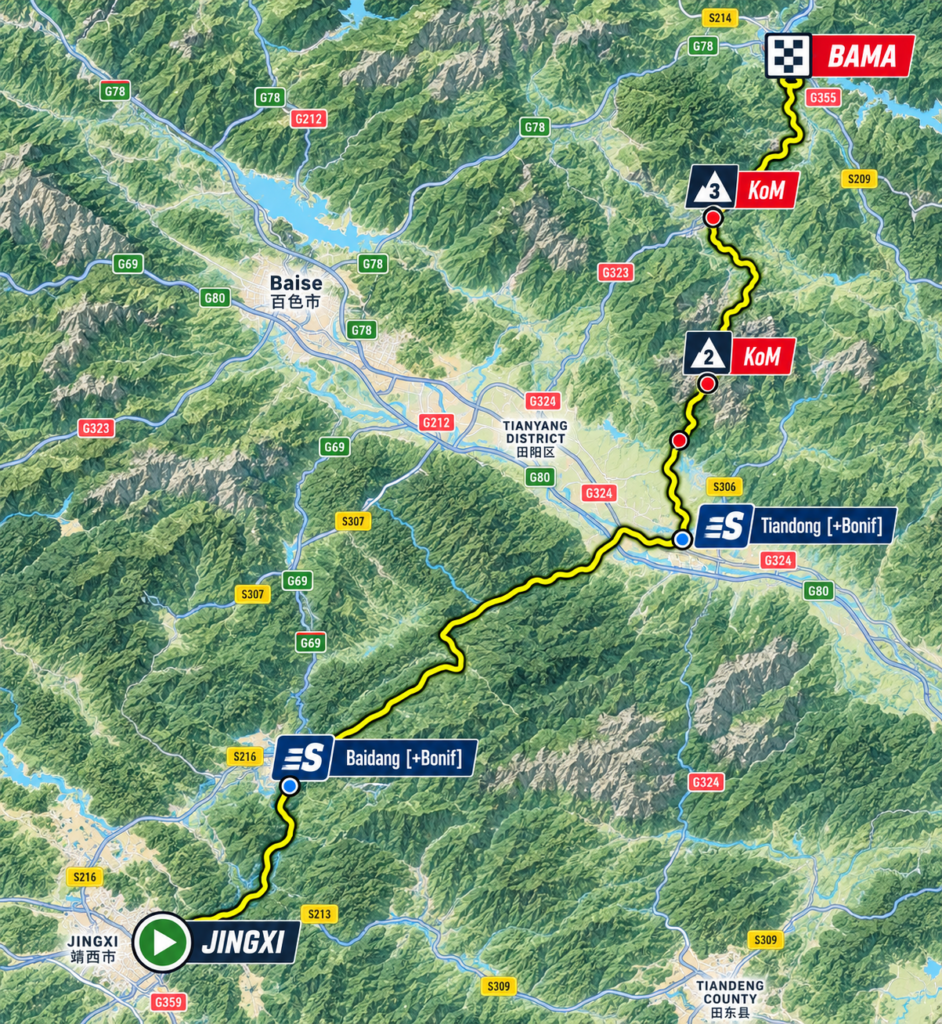
Stage 2 spent its final kilometres climbing into Jingxi, reaching a high karst basin close to the Vietnamese frontier after an afternoon in which the landscape seemed steadily to rise around the race. Stage 3 begins at 748 metres above sea level and heads in the opposite direction, leaving Jingxi for a 211-kilometre journey towards Bama that will carry the peloton down from the border highlands, across the broad corridor of the Youjiang and eventually back into the mountains of northwestern Guangxi.
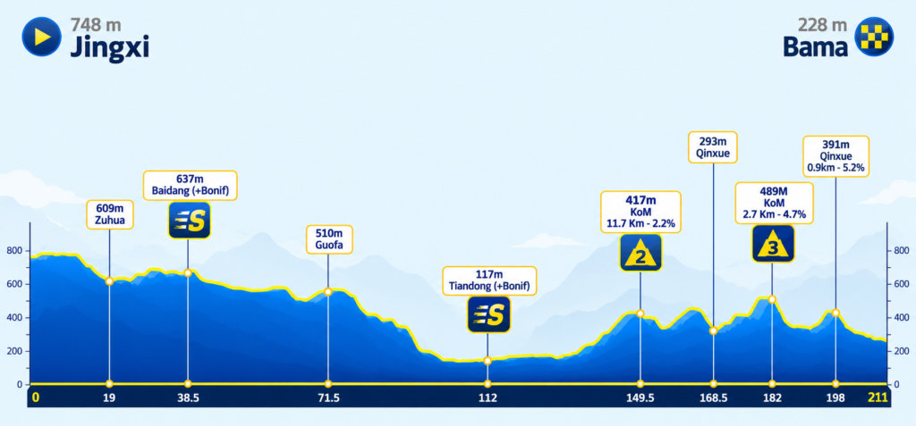
The profile tells the geographical story unusually clearly. For almost half the stage the road loses altitude, gradually at first and then more decisively as the limestone highlands give way to the warmer country surrounding Tiandong, where the race reaches barely 117 metres above sea level. From there the direction of travel remains northeast, but the landscape changes again as the valley closes, the road begins climbing and the final sixty kilometres unfold through a succession of wooded ridges before descending towards Bama.
It is a journey between two very different forms of isolation. Jingxi developed within high country pushed against an international frontier; Bama lies among the mountains of the interior, where difficult communications preserved small rural communities long after Guangxi’s larger river valleys had become important corridors of movement and trade. That remoteness once contributed to Bama’s poverty. During the late twentieth and early twenty-first centuries, however, it was reimagined as something desirable, helping turn the county into one of China’s most unusual destinations for people searching for health and longevity.
Before the race reaches that world, it must descend from another.
–211 km | Jingxi · Leaving the High Basin
Jingxi requires little reintroduction after yesterday’s finish. The city occupies an elevated basin among the limestone formations of southwestern Guangxi, close enough to Vietnam for the border to have shaped its trade, history and cultural geography for centuries. What matters this morning is the perspective created by leaving it, because the first half of Stage 3 reveals just how high the race climbed to reach Jingxi the previous afternoon.
The opening road remains among the same limestone country, where cultivated basins appear between steep formations and villages occupy the limited level ground beneath them. There is no immediate plunge towards the lowlands. Instead, the route spends its first kilometres crossing an elevated landscape around 700 metres, allowing altitude to disappear so gradually that the transformation is initially easier to understand from the profile than from the roadside.
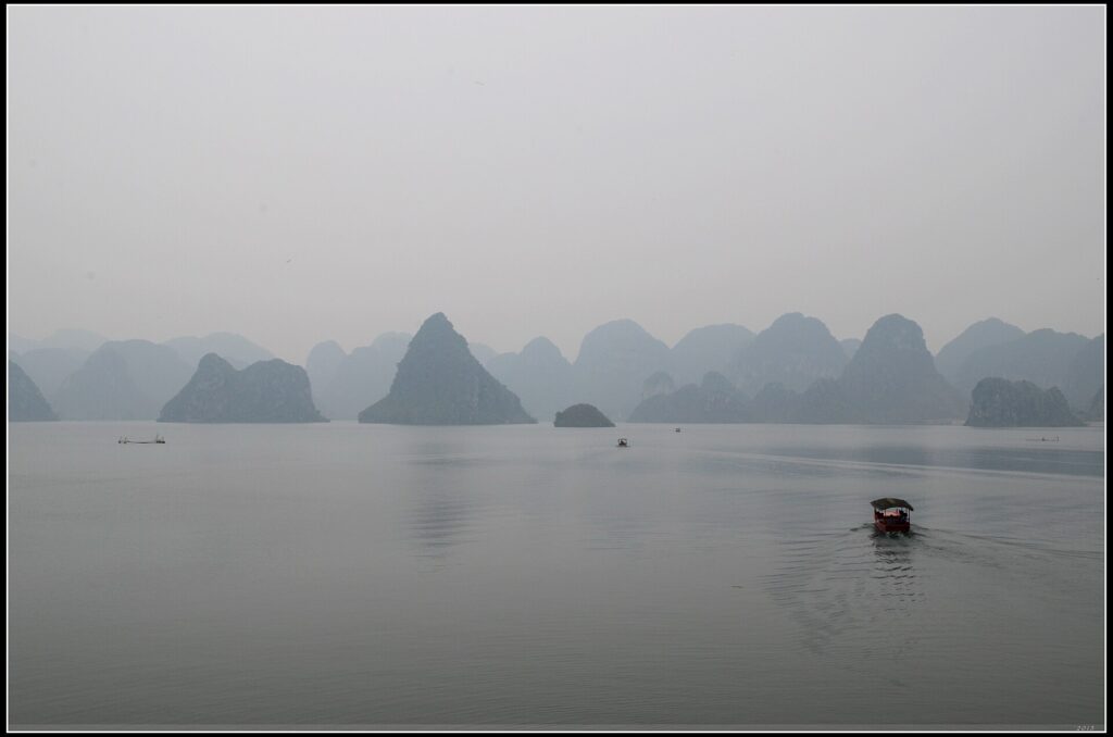
Quyang Lake and the Bameng Reservoir in Jingxi, where water, cultivated valleys and steep limestone karst peaks define the landscape of western Guangxi. (Photo: jaysonh / CC BY 3.0 / Source: Wikimedia Commons, File: 渠洋湖–岜蒙水库,靖西,广西 Guangxi 05-10-13 – panoramio.jpg)
Behind the race lies the frontier country explored during the opening two stages. Ahead lies the basin of the Youjiang, one of western Guangxi’s great natural corridors and the counterpart of the Zuojiang encountered around Chongzuo on Stage 1. The two rivers belong to the same wider system, but the country separating them is anything but simple, and the road towards Tiandong must first find its way out of the high limestone interior.
–192 km | Zuhua · Across the Plateau
At Zuhua, nineteen kilometres into the stage, the race remains at approximately 609 metres. The high plateau has begun to descend, although the road still passes through a sequence of shallow basins, low ridges and agricultural pockets rather than following any single dramatic valley.
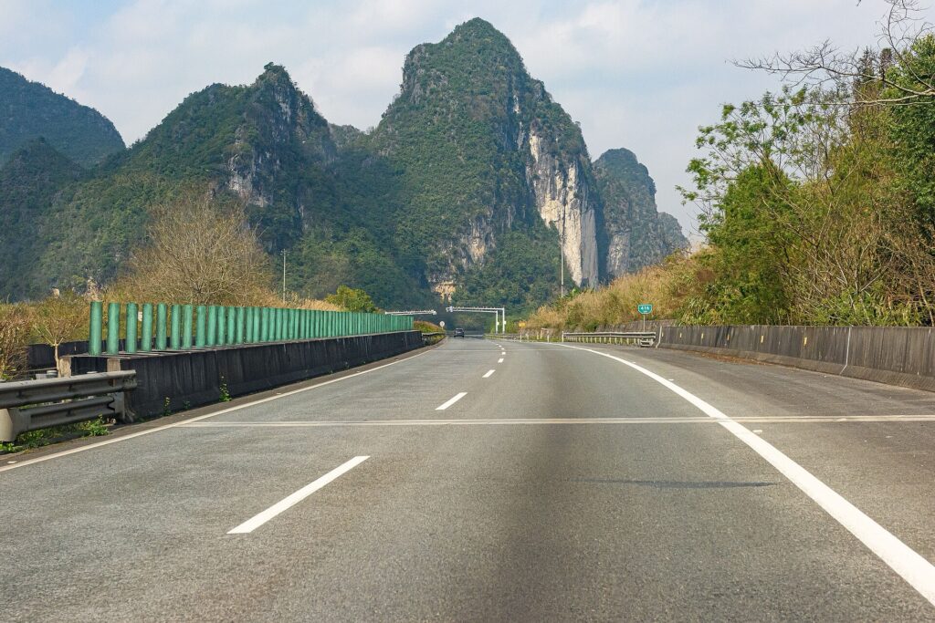
The S60 Hena Expressway near Jiuzhou in Jingxi, crossing the elevated karst landscape of western Guangxi as the road descends from the plateau. (Photo: N509FZ / CC BY-SA 4.0 / Source: Wikimedia Commons, File: K416 point of GX-S60 westbound (20240221112301).jpg)
This is rural Guangxi on a scale that can be difficult to appreciate from the map. Limestone has divided the landscape into countless small compartments, leaving settlements to develop wherever water, soil and sufficiently level ground coincide. Fields spread across the bottoms of depressions before stopping abruptly at the foot of wooded hills, while roads thread through the gaps that connect one inhabited basin with the next. The resulting geography has historically allowed communities to exist surprisingly close to major valleys while remaining relatively isolated from them.
As the route turns farther into the interior, the influence of the Vietnamese frontier begins to recede. The road is now approaching a different geographical system, organised not around a political boundary but around the Youjiang and the broad east-west corridor carved through western Guangxi by its waters.
The change will eventually be dramatic, although there is still a long descent before the river country appears.
–172.5 km | Baidang · The Last of the High Country
The first intermediate sprint comes at Baidang after 38.5 kilometres, with the race still at approximately 637 metres. The surrounding terrain remains elevated, but beyond this point the profile begins its sustained fall towards Tiandong, and the enclosed highland character of the opening gradually loosens as the valleys become wider and the road finds longer passages between the hills.
The transition unfolds over dozens of kilometres rather than at a single pass. Altitude is surrendered almost imperceptibly as cultivated ground expands, vegetation becomes heavier in the warmer lower country and settlements appear more frequently along the road. What initially seemed like another variation of the Jingxi landscape slowly becomes something else, with the limestone formations no longer controlling every horizon and the valleys beginning to connect into a broader corridor.
Beneath that geographical change lies one of the great river systems of southern China. The Youjiang flows eastward through western Guangxi before eventually meeting the Zuojiang near Nanning. Their Chinese names preserve their relationship: Youjiang is the Right River and Zuojiang the Left River, two major branches that combine to form the Yongjiang before their waters continue through the Pearl River system towards the South China Sea.
Stage 1 travelled through the cultural landscape of the Left River. Two days later, the Tour is descending towards its western counterpart.
–139.5 km | Guofa · The Long Descent
Guofa lies at kilometre 71.5, approximately 510 metres above sea level, and from here the loss of altitude becomes the dominant geographical movement of the stage. Over the following forty kilometres the road drops by almost four hundred metres, carrying the race out of the mountain basins and towards the broad agricultural country surrounding the Youjiang.
There is no Alpine descent and no spectacular sequence of hairpins. The terrain simply opens over time, as valleys that had been enclosed between limestone formations begin to merge, cultivated areas stretch farther from the road and the horizon becomes less crowded by immediate walls of rock. The transformation is gradual enough to feel natural, yet by the time the race approaches Tiandong the landscape bears little resemblance to the high country left behind that morning.
Such transitions have always mattered in Guangxi. Mountain communities could remain culturally and economically distinct even when major river corridors lay relatively close by, because moving between them required negotiating terrain that imposed its own routes. Rivers such as the Youjiang therefore became lines of communication through a region repeatedly divided by mountains, providing space for agriculture and settlements while also guiding trade, military movement and political influence.
Modern highways have shortened those distances without eliminating the underlying geography. In a few hours the Tour crosses a sequence of environments that historically shaped where communities could grow and how easily they could communicate with the rest of the region.
By the time the road reaches Tiandong, the race has descended almost to the floor of the Youjiang valley.
–99 km | Tiandong · The Youjiang Valley
At kilometre 112, Tiandong stands at approximately 117 metres above sea level, more than six hundred metres below the start in Jingxi. The mountains have withdrawn sufficiently for the valley to spread across the landscape, producing one of the clearest visual transitions anywhere on this year’s Tour of Guangxi.
The Youjiang rises far to the west, with its wider drainage system reaching towards Yunnan, and crosses Guangxi before joining the Zuojiang farther east. Along its course, broad alluvial land provided conditions fundamentally different from those of the surrounding mountains: agriculture could occupy larger continuous areas, settlements could expand and movement along the valley was considerably easier than movement across the ridges enclosing it.
Those advantages also made the Youjiang a political corridor. During the upheavals of the late 1920s, when the alliance between the Chinese Nationalist Party and Communist movement had collapsed into violent confrontation, the wider valley became the setting for revolutionary organisation among rural communities in western Guangxi. In December 1929 the Baise Uprising began farther upstream, associated particularly with the young Deng Xiaoping and Communist forces attempting to establish revolutionary bases in the region.
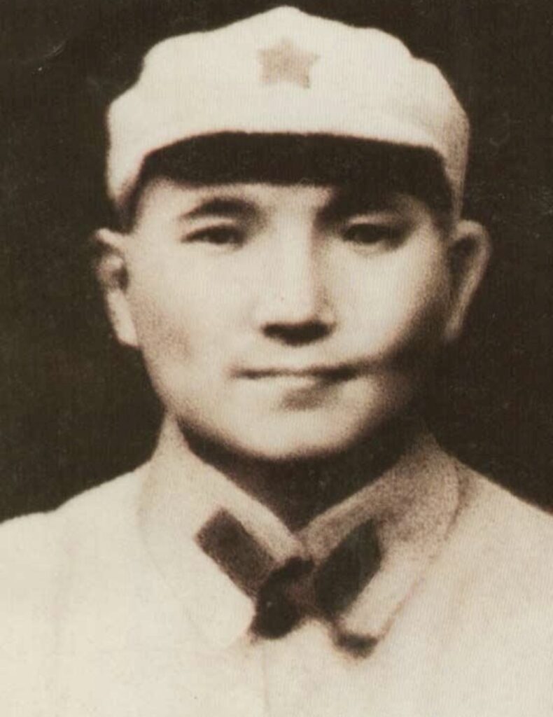
Deng Xiaoping in 1929, the year in which he became closely associated with the Baise Uprising and the establishment of the Communist revolutionary base in the Youjiang region of western Guangxi. (Photo: Unknown author / Public Domain / Source: Wikimedia Commons, File: 1929 Deng Xiaoping.jpg)
Baise itself lies west of today’s route and should not be confused with Tiandong, but the uprising belonged to a broader Youjiang landscape in which revolutionary activity extended beyond a single city. Deng, only twenty-five years old at the time, was operating in a region far removed from the political centres with which his later career would become associated. Decades before he became the dominant figure behind China’s post-Mao economic transformation, he was involved in revolutionary organisation among rural communities in this remote southwestern river basin.
The Communist base created around the Youjiang proved short-lived as military pressure and wider strategic changes forced its forces to disperse, yet the episode became an important part of the revolutionary history later constructed around Guangxi. Today the valley presents a different face, dominated by intensive agriculture, modern roads and expanding settlements, although the geography that made it important remains immediately legible from the race route.
For more than one hundred kilometres Stage 3 has been descending towards this point. Once Tiandong is behind, the direction of the profile reverses and the mountains begin to gather around the road again.
–85 km | Leaving the Youjiang
North of Tiandong, the broad valley gradually contracts as the route turns towards the mountain country separating the Youjiang from Bama. The first gradients are gentle enough to pass almost unnoticed, but the character of the road changes steadily as cultivated plains narrow into smaller valleys and wooded ridges once again begin controlling the horizon.
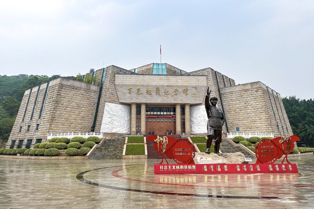
The race is entering country where isolation survived much longer than it did along the river below. Bama, now less than one hundred kilometres away, developed among mountains that made travel difficult and restricted the amount of land available for large-scale agriculture. For much of its modern history, remoteness was not a romantic quality but an economic disadvantage, contributing to poverty and limiting access to markets and services.
That history is important because the same characteristics would later be given an almost opposite meaning. As China’s cities expanded and concerns about pollution, chronic illness and the pressures of urban life became increasingly prominent, Bama’s distance from industrial development could be presented as evidence of environmental purity. Mountain water, rural diets, clean air and the apparent simplicity of village life became components of a new image, strengthened above all by the remarkable ages attributed to some of the county’s inhabitants.
The road towards Bama therefore enters a landscape whose meaning has changed almost as dramatically as its elevation. What was once remoteness would eventually be marketed as refuge.
–61.5 km | Climbing Back into the Mountains
The Category 2 summit comes at kilometre 149.5 after an ascent of 11.7 kilometres averaging 2.2 percent. Its statistics are modest, but the climb performs an important geographical function, raising the race towards approximately 417 metres and carrying it decisively away from the low river country crossed around Tiandong.
The gradient follows the land rather than attacking it, rising through a sequence of shallow ramps as the valley narrows around the road. For the riders, the ascent is unlikely to produce the violent selection associated with a major mountain pass, yet after 150 kilometres its persistent drag begins a final hour in which genuinely flat road becomes increasingly difficult to find.
The broken terrain reflects the geography approaching Bama. Valleys become shorter, ridges separate neighbouring settlements and roads repeatedly climb away from streams before dropping towards another pocket of inhabited land. Where the Youjiang offered a continuous corridor across western Guangxi, this country divides movement into smaller compartments, and it was within those compartments that many of Bama’s rural communities remained comparatively isolated.
After the summit, the road descends towards Qinxue before rising again. By then, the river valley has disappeared completely from the shape of the stage.
–42.5 km | Qinxue · Mountain Communities
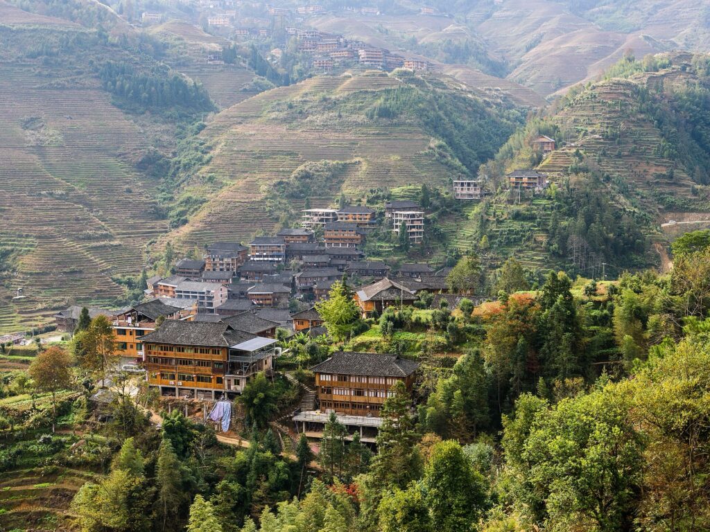
Qinxue appears at kilometre 168.5, approximately 293 metres above sea level, with another classified climb and a final substantial rise still separating the race from Bama. The surrounding landscape is once again one of narrow valleys and wooded ridges, but culturally the route is entering a part of Guangxi with its own distinct identity.
The destination is formally the Bama Yao Autonomous County, reflecting the presence of the Yao among a population that also includes substantial Zhuang and Han communities. The Yao themselves are not a single culturally uniform population: communities carrying the designation are distributed across the mountains of southern China and into mainland Southeast Asia, with considerable differences in language, dress, customs and historical experience.
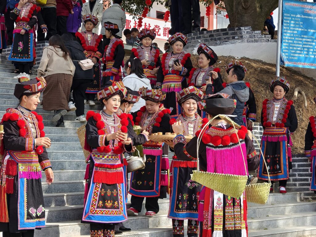
Mountain geography helped preserve that diversity. In places such as northwestern Guangxi, settlements separated by ridges could maintain distinctive traditions even while participating in wider networks of trade and migration. Agriculture adapted to the limited land available within the valleys, while everyday movement demanded an intimate knowledge of routes through terrain that outsiders often perceived simply as inaccessible.
Modern roads have transformed those relationships, yet the mountains remain central to how Bama presents itself. They provide the physical setting for Yao communities, the scenery encountered by visitors and the sense of separation from urban China that has become inseparable from the county’s modern reputation.
With twenty-nine kilometres remaining, the race reaches the sharpest classified climb of the afternoon.
–29 km | The Final Classified Climb
The Category 3 ascent measures only 2.7 kilometres but averages 4.7 percent, making it considerably steeper than the long climb out of the Youjiang. Its summit reaches approximately 489 metres, the highest point since the race left the Jingxi highlands during the morning, and after more than 180 kilometres the increase in gradient provides the most obvious opportunity for the final group to fracture.
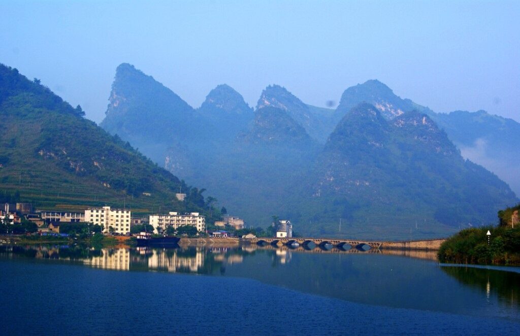
Around the road, overlapping ridges and enclosed valleys make Bama’s historical isolation increasingly easy to understand. Settlements occupy small pockets of usable land between slopes, and the route repeatedly changes direction as it searches for passages through terrain that offers few straightforward lines of travel. There is little in this mountain landscape to suggest that the county ahead has become nationally famous, yet the contrast between physical remoteness and modern reputation is central to Bama’s story.
Its reputation began with something measurable. Researchers had identified an unusual concentration of very old residents in Bama long before the county developed the wellness industry that surrounds longevity today. What followed was a gradual transformation in which demographic interest, local environment and tourism became increasingly difficult to separate, until the mountains themselves seemed to offer an explanation for the people who lived among them.
The distinction is important: Bama’s exceptional longevity population has been the subject of legitimate scientific study, while many claims that later attributed longevity directly to particular properties of its water, air, caves or geomagnetism remain unproven. Between those two facts lies the story of modern Bama.
The road now begins to reveal it.
–13 km | The Last Ridge Before Bama
The final significant rise reaches approximately 391 metres at kilometre 198, leaving thirteen kilometres before the finish. Beyond it the road begins descending towards Bama, and the county’s famous longevity landscape moves from an idea associated with the destination into the world immediately surrounding the race.
As stories of local centenarians spread across China, visitors began arriving not merely to observe the phenomenon but to place themselves inside the environment associated with it. Some came for short holidays, while others stayed for weeks or months, particularly older people and those dealing with chronic illnesses who hoped that prolonged exposure to the local climate and rural surroundings might improve their health. Seasonal long-term residents became sufficiently characteristic of Bama’s tourism economy to be compared with migratory birds, arriving and departing according to climate and personal circumstances.
The Panyang River valley became one of the principal centres of this migration, and accommodation, health services and businesses developed around the growing population of visitors. Bama’s natural landscape consequently acquired a second identity. Rivers and springs were no longer simply parts of the hydrology, while caves and mountains increasingly appeared within a narrative connecting environmental purity with exceptional human lifespan.
The appeal of that story is understandable, particularly in a rapidly urbanised society where clean air, quiet landscapes and distance from industrial life can themselves feel restorative. Its scientific limits are equally important. The existence of long-lived residents does not demonstrate that longevity can be transferred through a particular spring, mineral, cave atmosphere or other environmental property, and research into Bama has never reduced exceptional ageing to such a mechanism.
The final descent therefore enters a landscape in which genuine demographic interest and a much larger mythology of health now exist side by side.
Bama · Where Longevity Became a Landscape
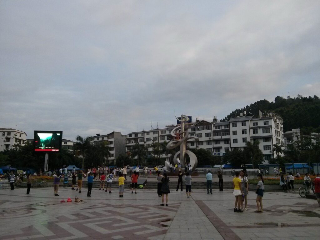
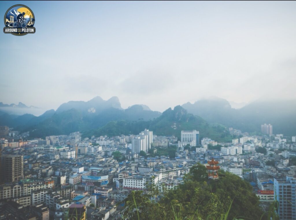
Bama lies among the mountains of northwestern Guangxi at approximately 228 metres above sea level. The county seat is modest in scale, yet the name has travelled across China through stories of centenarians and through the possibility that something about this isolated landscape might help explain their survival.
Researchers have examined Bama’s elderly population from several directions, reconstructing family histories and studying diet, physical activity, social conditions, environment and genetic factors. The resulting picture is interesting precisely because it refuses the simple explanation on which much of the county’s commercial mythology depends. Traditional lifestyles among older generations combined considerable physical activity with diets rich in plant foods, while family histories suggest that inherited factors may also contribute to exceptional survival. Social relationships, living conditions and the wider environment form additional parts of a problem in which no single variable can easily be isolated from the others.
This does not require choosing between the extremes of treating Bama as either a miraculous landscape or an elaborate fraud. The concentration of very old residents is a legitimate subject of demographic and medical research; what remains unsupported is the claim that a single unusual property of the local environment explains it or can reproduce the same longevity in visitors.
That distinction became harder to maintain as Bama’s reputation expanded. Visitors did not travel only to meet centenarians but to experience the environment around them, and gradually the county itself became part of the explanation. Mountains represented clean air and isolation, rivers became associated with special water, while caves were incorporated into an increasingly elaborate landscape of health.
The geology underlying those attractions is already familiar from the Tour’s journey across Guangxi. Bama belongs to the same immense limestone world encountered around Chongzuo and Jingxi, where soluble rock has been shaped by water into towers, enclosed valleys, underground drainage systems and caves. Here the subterranean landscape includes Baimo Cave and the formations promoted as Crystal Palace, where limestone dissolved and redeposited over geological time has created extensive chambers and mineral formations.
After two stages in which karst itself dominated the geographical story, there is little need to explain the process again. What changes in Bama is the meaning attached to it. Caves that are remarkable geological structures in their own right have also entered the county’s wellness narrative, promoted alongside water, air and rural surroundings as elements of an environment associated with long life.
That association helped transform the local economy. A county historically marked by remoteness and poverty gained visitors, accommodation, infrastructure and new commercial opportunities, but success also introduced an obvious contradiction. Bama became desirable because it appeared isolated from the pressures of modern urban China, and the resulting influx of people inevitably began altering the place whose relative isolation had attracted them.
The transformation is therefore more revealing than any supposed secret of longevity. An elderly rural population drew scientific attention; scientific attention contributed to reputation; reputation encouraged tourism; and tourism taught visitors to interpret almost every element of the landscape through the idea of health. Bama’s mountains and rivers remained physically where they had always been, but what outsiders believed they represented changed profoundly.
The Tour arrives inside the landscape produced by that transformation.
FINISH · Bama
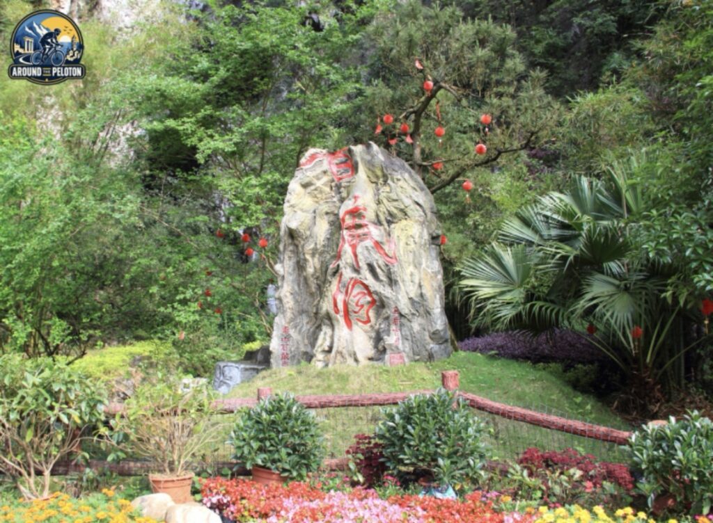
The finish in Bama completes a 211-kilometre crossing of western Guangxi shaped less by a single decisive climb than by the enormous vertical transition between its landscapes. Jingxi stood at 748 metres when the peloton departed in the morning, enclosed by the high limestone country close to Vietnam; more than one hundred kilometres later, Tiandong lay almost six hundred metres lower beside the Youjiang, where the mountains opened around one of the region’s historic corridors of agriculture and movement. The second half then reversed that descent, carrying the race away from the river and back through the ridges that once made Bama difficult to reach.
Those mountains help explain why the finish feels so different from the start, but they also explain something of Bama’s modern history. Isolation restricted the county for generations before a changing China learned to assign new value to remoteness, clean landscapes and traditional rural life. Once exceptional longevity became attached to the same geography, Bama could be transformed from a poor mountain district into a destination for people searching for something that modern medicine, polluted cities and accelerated urban life seemed unable to guarantee.
The people who reached extraordinary ages here remain more interesting than the mythology constructed around them precisely because their lives resist a convenient answer. Longevity emerged across families and generations shaped simultaneously by inheritance, diet, labour, community and environment, while the desire to reduce those lives to a miraculous property of water or rock says as much about the visitors arriving in Bama as it does about the county itself.
Late in the afternoon, after descending from Jingxi, crossing the Youjiang and climbing back through the mountains, the Tour reaches a place whose modern identity has been built around the possibility of having more time. For the riders arriving beneath the finish banner, Bama will measure that time in seconds; beyond the barriers, almost everything that made the county famous begins with the much more difficult question of years.



