
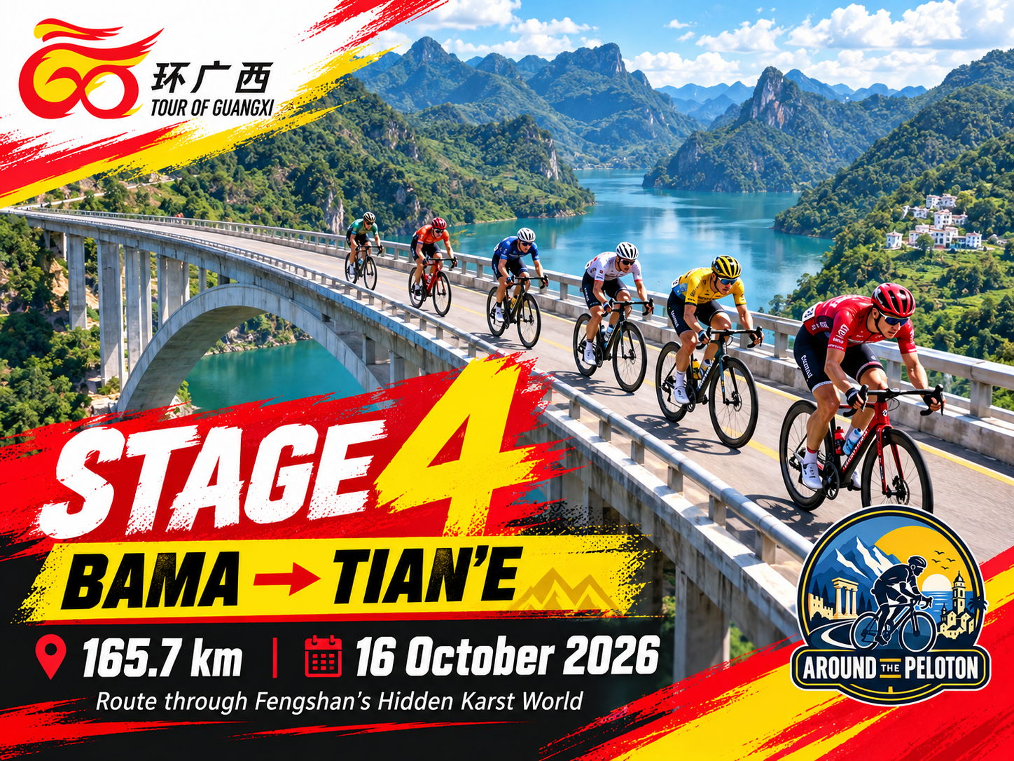

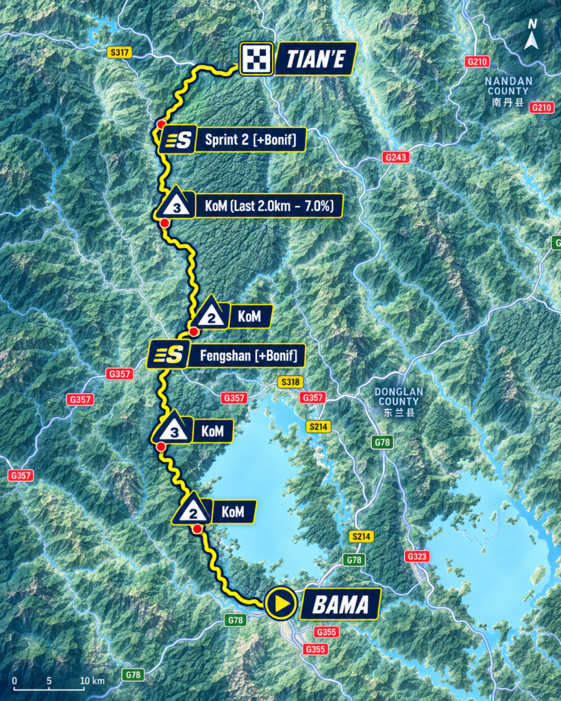
Stage 3 reached Bama after crossing one of the great geographical transitions of western Guangxi, descending from the high basin of Jingxi to the Youjiang before climbing back into the mountains. Stage 4 begins among those mountains and never truly escapes them. Over 165.7 kilometres from Bama to Tian’e, the road turns north through Fengshan and into increasingly elevated country, accumulating climb after climb until the race reaches 1,084 metres before beginning its eventual descent towards the upper Hongshui River.
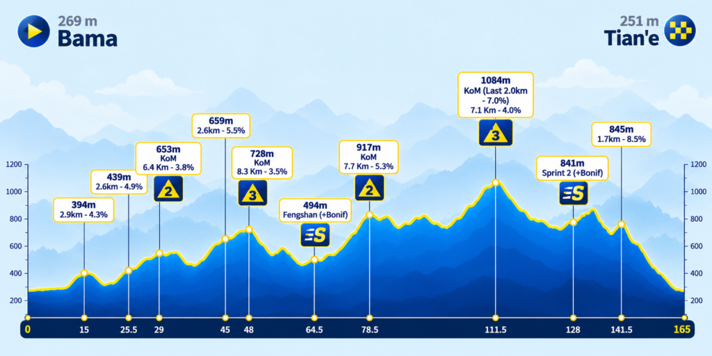
There is no single ascent large enough to dominate the profile. Instead, the difficulty is cumulative, with the road repeatedly gaining and surrendering altitude through a landscape in which valleys are narrow, ridges overlap and level ground is scarce. The opening fifty kilometres already carry the peloton well above Bama, another Category 2 ascent takes the race beyond 900 metres after 78.5 kilometres, and the highest point arrives at kilometre 111.5, where the final two kilometres of the climb average seven percent. Even beyond that summit, the mountains have one more steep rise to offer before the long descent towards Tian’e.
Yet the most revealing feature of the route cannot be seen on the elevation profile. Beneath the mountains crossed during the first half of the stage lies another landscape entirely, formed by water moving through hundreds of metres of carbonate rock. Around Fengshan, rivers disappear underground, caves open beneath the hills and enormous voids interrupt the surface in a region recognised internationally as part of the Leye–Fengshan UNESCO Global Geopark. Stage 3 explored what a mountain landscape could come to mean to the people living within it; Stage 4 follows the water north and discovers how much of that landscape exists underneath.
–165.7 km | Bama · Following the Water North
The peloton leaves Bama at approximately 269 metres above sea level, departing the county whose centenarians, mountain environment and longevity tourism provided the closing story of Stage 3. There is no need to retell that story this morning because the road north provides a more interesting continuation: some of the water associated with Bama’s inhabited valleys originates in the karst country towards which the race is now travelling.
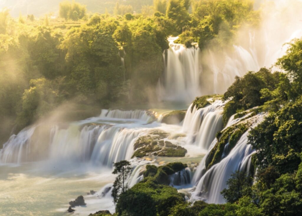
A waterfall in Bama, Guangxi, part of the water-rich karst landscape surrounding Bama Yao Autonomous County. (© sihuo0860371 via Canva.com)
The Panyang River, closely associated with Bama and the villages that became central to its longevity reputation, has its headwaters around Sanmenhai in neighbouring Fengshan County. There, water carried through an immense underground system returns to daylight before continuing through the mountains towards Bama. Stage 4 therefore begins by travelling against part of yesterday’s hydrological journey, leaving the lower valleys and climbing towards the country from which their water emerges.
The transition begins almost immediately. During the first twenty-five kilometres, the road rises through a succession of wooded folds, climbing above 390 metres, descending briefly and then climbing again beyond 430. None of these early ascents is individually imposing, but there is little sustained level ground between them, and Bama gradually disappears behind overlapping ridges rather than through one decisive mountain pass.
–136.7 km | Into the Karst Highlands
At kilometre 29 the first Category 2 ascent reaches 553 metres after 6.4 kilometres at 3.8 percent. Another ridge follows before the road has properly settled, eventually carrying the race towards the second classified summit at kilometre 48, but by this point the more important change is visible in the landscape itself. The peloton is entering an elevated labyrinth in which ridges, enclosed depressions and river valleys overlap without providing an obvious route north.
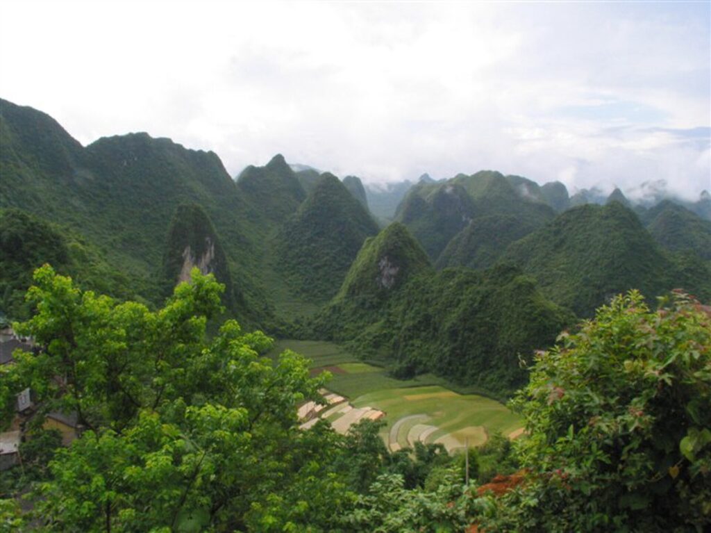
This is part of the great limestone country of southwestern China, where immense thicknesses of carbonate rock accumulated in ancient seas before tectonic uplift exposed them to erosion. Rainwater, made mildly acidic as it passes through the atmosphere and soil, penetrates fractures in the limestone and slowly enlarges them. Across geological time, those fractures can become passages, chambers and underground rivers, while the surface above develops its own architecture of peaks, depressions and abrupt rock walls.
The result is a landscape whose drainage cannot always be understood simply by looking at the valleys. Water that would elsewhere gather into visible streams can disappear through openings in the rock and continue beneath entire mountains, sometimes emerging kilometres away in a different basin. Two places separated at the surface may therefore belong to the same subterranean river system, while neighbouring valleys may drain in completely different directions.
As the road continues upward, another succession of slopes carries the riders towards approximately 659 metres before the second classified ascent reaches its summit at kilometre 48. By then the peloton is 728 metres above sea level, and the hidden geography beneath the road has become as important to understanding Fengshan as the mountains visible around it.
–117.7 km | Fengshan’s Underground Country
The second classified ascent is 8.3 kilometres long at an average of 3.5 percent, but its summit marks more than another entry in the mountains classification. The race is now deep inside Fengshan County, part of a karst region whose geological importance extends far beyond Guangxi.
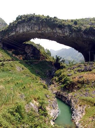
Jiangzhou Natural Bridge in Fengshan County, a monumental natural arch formed within the limestone karst landscape of northwestern Guangxi. (Photo: Rosysea / CC BY-SA 3.0 / Source: Wikimedia Commons, File: Jiangzhou Natural Bridge.jpg)
Together with neighbouring Leye County to the west, Fengshan forms the Leye–Fengshan UNESCO Global Geopark, an area where extraordinarily thick sequences of carbonate rock preserve hundreds of millions of years of geological history. Uplift, fracturing and prolonged dissolution subsequently created an exceptional concentration of caves, underground rivers, natural bridges, peak clusters and giant depressions. Among the most spectacular are tiankeng, immense steep-sided sinkholes whose dimensions can be measured in hundreds of metres and which represent some of the most dramatic expressions of mature karst anywhere in the world.
Much of this scale is difficult to perceive from the road because the landscape continues beneath it. Cave chambers occupy spaces inside mountains that appear solid from outside, while underground rivers connect areas separated by ridges at the surface. What the peloton sees is therefore only the upper boundary of a considerably larger geographical system.
One of its most remarkable expressions is Sanmenhai, in Fengshan County, where the Poxin underground river passes through a sequence of enormous karst windows. Sections of the cave roof have collapsed, allowing daylight to reach the river and creating blue-green pools enclosed by limestone walls. From water level they can resemble isolated lakes, although they are fragments of a single subterranean system continuing through the rock beyond the accessible passages.
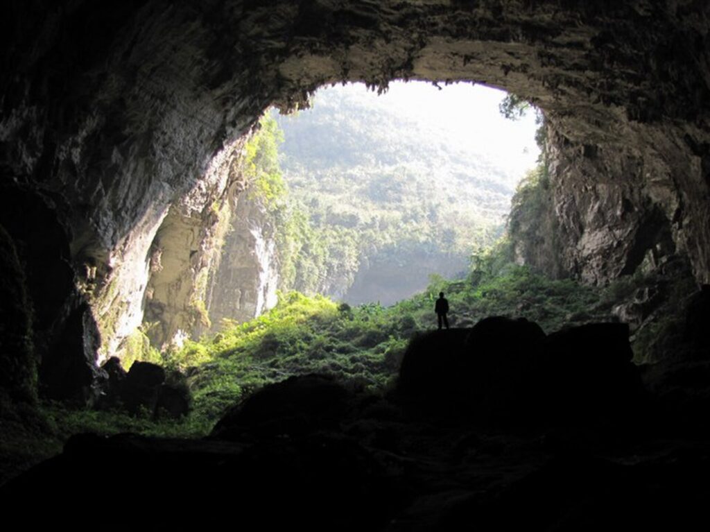
The name Sanmenhai, commonly understood as the “three gates of the sea,” refers to the great openings traditionally visible along the navigable part of the system. Yet more karst windows exist beyond them, revealing how incomplete the surface impression can be. The visible pools are moments when an underground river briefly allows itself to be seen.
For the Tour, Sanmenhai provides an unusually precise connection between consecutive stages. Its waters form part of the headstream system of the Panyang River, linking the underground geography of Fengshan with the Bama valleys where Stage 3 ended. The race has spent the morning travelling towards the source country of a river whose lower reaches became intertwined with Bama’s modern identity, discovering that its journey begins not on an exposed mountainside but within the limestone itself.
–101.2 km | Fengshan · A Town Inside the Mountains
The first intermediate sprint comes after 64.5 kilometres in Fengshan, at approximately 494 metres above sea level. After the repeated climbing of the opening hour, the county seat occupies one of the relatively generous pockets of land among the surrounding limestone ranges, its streets and buildings gathered in a basin that feels almost provisional when viewed against the mountains enclosing it.
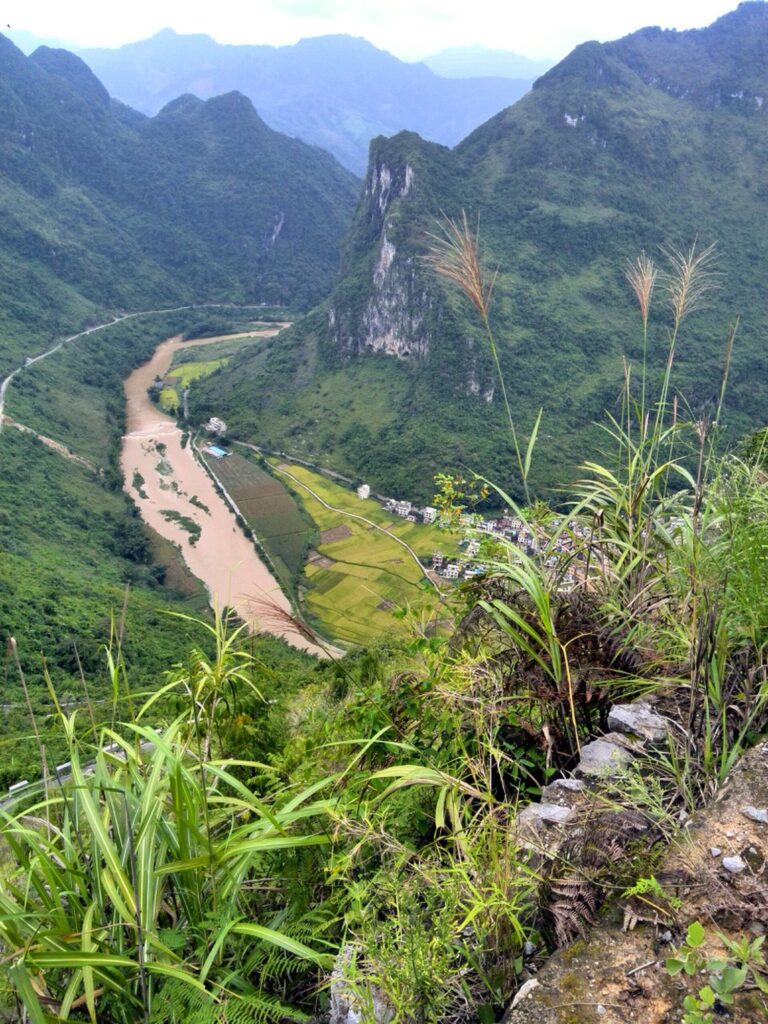
Fengshan is a small county centre rather than one of Guangxi’s great historic cities, and that scale is important to understanding it. For generations this was an interior mountain district where journeys measured on a map could become considerably longer on the ground, with ridges, caves and disappearing rivers complicating movement between communities. Agriculture occupied whatever flatter land the terrain permitted, while settlements developed in valleys and basins where water and cultivable ground could be found together. Zhuang, Yao and Han communities share this mountain region, and several parts of the county retain specifically Yao administrative and cultural identities.
Modern roads have altered the relationship between Fengshan and the outside world, while the extraordinary karst surrounding the town has itself become an economic resource through tourism. Sanmenhai, the cave systems and the wider geopark now attract visitors precisely because of geological conditions that once contributed to the county’s isolation. The transformation is characteristic of several parts of inland Guangxi: remoteness has not disappeared, but some of the physical features that produced it have acquired a new value.
For the Tour, Fengshan provides only a brief opening in the terrain. Beyond the sprint the buildings begin to thin, the enclosing slopes return and the road turns upwards again, climbing towards the highest country encountered anywhere on the route between Bama and Tian’e.
–87.2 km | Above 900 Metres
At kilometre 78.5, the second Category 2 climb reaches approximately 917 metres after 7.3 kilometres averaging 5.3 percent. Unlike the gentler ascents of the opening fifty kilometres, this is substantial enough to alter the race as well as the scenery, particularly after the succession of climbing already accumulated since Bama.
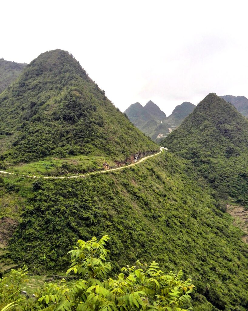
The ascent carries the peloton into a different vertical layer of the landscape. Valleys become deeper relative to the road, settlements appear farther below and the dense folds of the mountains begin to dominate every direction. The subtropical image often associated with Guangxi’s lowland karst gives way to something more austere, with long forested ridges, narrow cultivated pockets and roads suspended between valleys whose water may eventually disappear beneath the limestone.
For much of the following thirty kilometres the race remains high. The profile rolls between roughly 800 and 950 metres rather than returning to the low country, so every descent is incomplete and every new rise begins before much altitude has been surrendered. The difficulty lies not simply in the gradients but in the absence of a genuine release from them, as the riders carry the accumulated work of one ascent across the uplands and directly into the next.
The road is gradually approaching the roof of Stage 4, where the highest point of the entire journey between Bama and Tian’e waits above 1,000 metres.
–54.2 km | 1,084 Metres · The Roof of Stage 4
The road reaches its highest point at kilometre 111.5 after a 7.1-kilometre climb averaging four percent. The overall figure disguises the character of its upper slopes, where the final two kilometres rise at seven percent and carry the peloton to 1,084 metres above sea level.
By now the race has climbed more than eight hundred vertical metres above its starting elevation in Bama, although never through a single continuous ascent. The altitude has been accumulated through the repeated folding of the terrain, each ridge lifting the route farther into the mountains until the landscape that surrounded Bama in the morning lies far below and behind.
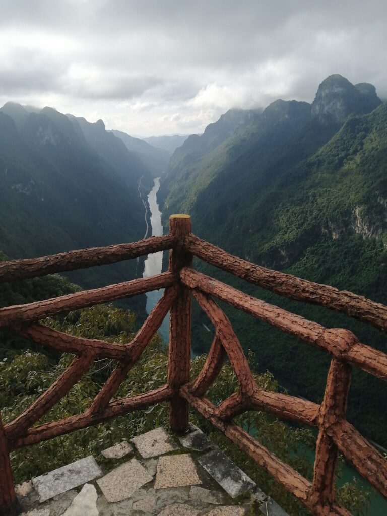
The summit also marks a geographical threshold. The road is approaching the northern reaches of Guangxi, close to the frontier with Guizhou, and beyond these mountains lies the upper Hongshui River. The water story that began with underground streams around Fengshan is about to change scale completely.
The Hongshui, whose name means “Red Water River,” belongs to the great Pearl River system and carries water eastward from the highlands of southwestern China. Its course through northwestern Guangxi is constrained by mountain ranges and deep valleys, a combination that historically made sections of the river difficult to navigate while creating substantial differences in elevation over relatively short distances. Those same characteristics would eventually make the Hongshui one of China’s important hydropower corridors, where the force of water descending from the Yunnan–Guizhou highlands could be captured on an industrial scale.
Tian’e lies within that transformed river landscape, but more than fifty kilometres of difficult mountain road still separate the peloton from it.
–37.7 km | Across the High Country
The second intermediate sprint comes at kilometre 128, with the road still approximately 841 metres above sea level. Although the race has descended from its highest point, it remains deep within the uplands, and the profile refuses to provide the sustained descent that might normally follow a summit above one thousand metres.
Instead, the route continues across heavily dissected country where roads cling to slopes or search for narrow passages between mountains before turning towards another valley. From this altitude, the relationship between settlement and terrain becomes particularly visible. Houses and cultivated land gather where gradients ease, while steeper slopes remain overwhelmingly forested, creating a pattern of human occupation dictated less by straight-line distance than by the limited spaces in which everyday life can be accommodated.
A larger transition is also taking place. The subterranean drainage systems that defined Fengshan are giving way to the catchment of a great surface river. Water still determines the geography, but its expression is changing from hidden channels and cave resurgences to the immense valley of the Hongshui and, beyond it, the reservoir landscape created around Tian’e.
Before the race can reach that valley, the mountains impose one final obstruction.
–24.2 km | The Last Wall
At kilometre 141.5 the road reaches approximately 845 metres after a climb of only 1.7 kilometres. Its average gradient of 8.5 percent makes it the steepest named ascent of the stage, and its position after more than 140 kilometres of relentless climbing gives those numbers considerably more importance than its length might suggest.
By this point the terrain itself carries the story. The peloton has crossed the Fengshan karst, climbed beyond 900 metres, reached the 1,084-metre roof of the stage and remained high for much of the afternoon. The final wall is the last obstruction before the structure of the route changes completely, and from its crest almost everything that follows points downward.
Over little more than twenty kilometres the road loses roughly six hundred metres, dropping from the mountain interior towards Tian’e and the Hongshui. Forested slopes enclose a descent that compresses much of the vertical journey of the afternoon into its final chapter, carrying the riders away from the high karst country and towards one of the largest engineered water landscapes in southern China. The mountains do not disappear as the elevation falls; instead, the water contained between them becomes dramatically larger.
Tian’e · Where the Hongshui Was Remade
Tian’e County occupies the upper Hongshui River in northwestern Guangxi, close to the provincial boundary with Guizhou. Its county seat, Liupai, lies among steep mountains beside a river system whose modern appearance has been profoundly altered by one of the largest hydroelectric projects in southern China.
The Longtan Dam stands on the Hongshui downstream from the county seat. Rising more than 200 metres, the immense roller-compacted concrete gravity structure was conceived not simply as a power station but as an intervention in an entire river system, combining electricity generation with flood regulation and improved navigation. Construction began in the early twenty-first century, the river was progressively impounded and the generating complex became one of the major components of the hydropower network developed along the Hongshui.
Building a project on this scale required the movement of materials, workers and machinery through terrain whose steep valleys had historically restricted transport. Roads and supporting infrastructure had to penetrate the mountains, construction activity reshaped sections of the river corridor, and the creation of the reservoir transformed communities upstream as rising water occupied former riverbanks, farmland and settlement areas. Resettlement therefore became part of the human geography of Longtan, as it has around many of China’s major dams, with electricity distributed far beyond Tian’e accompanied locally by a permanent rearrangement of where people could live, cultivate land and move through the valley.
The resulting reservoir changed the visual scale of the Hongshui. Instead of a river confined to the bottom of a steep valley, long reaches became deep expanses of comparatively still water extending between mountain walls, with branches penetrating tributary valleys. A river corridor once defined by current, shoals and difficult navigation became simultaneously a store of water, a source of electricity and a new geographical barrier requiring another generation of infrastructure to cross.
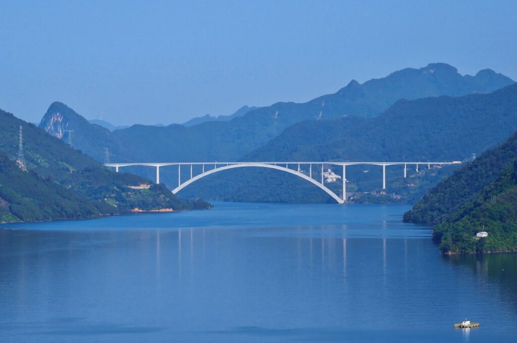
The Tian’e Longtan Bridge belongs to that second transformation. Opened in 2024, it carries an expressway across the reservoir on a concrete arch whose main span reaches 600 metres. Its dimensions are remarkable, but its location explains them: the depth of the reservoir and the steepness of the surrounding slopes severely constrain conventional approaches to crossing the valley. The bridge therefore represents more than another engineering landmark. It demonstrates how one enormous intervention in the landscape produced new geographical problems that subsequent engineering was required to solve.
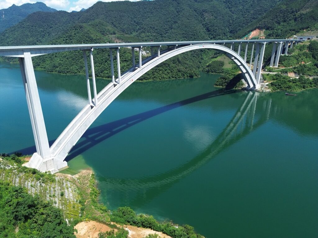
For Tian’e, these projects have progressively altered the meaning of isolation. A county once defined by the difficulty of moving through its mountains has become connected to national systems of electricity generation and modern road transport, even though the underlying topography remains as severe as ever. Hydropower, reservoir construction, roads and bridges have brought stronger connections and new economic possibilities while simultaneously altering valleys and communities whose relationship with the Hongshui long predates the dam.
The contrast with Fengshan is revealing. Around Fengshan, communities historically adapted themselves to the places where limestone, water and cultivable ground allowed settlement to exist. Around Tian’e, modern engineering has reached the scale at which people can alter the river itself.
FINISH · Tian’e
The final kilometres complete one of the most geographically coherent journeys of the Tour of Guangxi. The race began in Bama beside a landscape famous for the relationship people have imagined between water, environment and human longevity, then travelled north towards Fengshan, where that water can disappear beneath limestone mountains and return through immense cave systems. From there the road climbed beyond 900 metres, reached 1,084 metres in the high country and finally descended towards Tian’e, where the Hongshui has been transformed into an enormous reservoir and source of hydroelectric power.
The connection between those places is not an idea imposed upon the route. Water genuinely changes character throughout the stage. Around Bama it belongs to inhabited valleys and the modern mythology of longevity; in Fengshan it becomes subterranean, carving chambers and rivers through ancient carbonate rock; around Tian’e it gathers into the Hongshui, where the scale of the landscape allowed modern China to turn falling water into infrastructure measured in dams, reservoirs, bridges and electricity.
For the riders, none of that geography has been abstract. The same mountains that determine where rivers disappear, where villages can exist and where reservoirs fill valleys have forced the road repeatedly upward for more than 140 kilometres. Only after the final steep rise does the landscape finally release the race, sending it down from the high country towards a river valley that human intervention has changed almost as profoundly as water once changed the limestone around Fengshan.
Stage 3 ended in Bama with the question of how a landscape can acquire a reputation. Stage 4 ends beside a river that has been physically remade. Between them, beneath ridges the peloton could cross but never see through, the water has made a journey of its own.



